
Why Wälder um Greiz und Werdau stands out
The area is best known as one of the largest consolidated woodland landscapes in the Saxony-Thuringia border region, defined by extensive conifer forest, deeply incised valleys, and historic ponds once used for timber rafting. It also stands out for its cross-border protected-area structure, in which the Thuringian Landschaftsschutzgebiet Wälder um Greiz und Werdau pairs directly with the Saxon Werdauer Wald to form a single continuous forest.
Wälder um Greiz und Werdau history and protected-area timeline
The protection status of the area has two separate origins reflecting the post-war division of Germany. In 1961, the East German district administration of Gera established the Landschaftsschutzgebiet Wälder um Greiz und Werdau on the Thuringian side of the forest. The matching Saxon protection area, the Werdauer Wald, was designated seven years later in 1968 by the district administration of Karl-Marx-Stadt, formalizing the cross-border forest as two cooperating landscape protection areas rather than a single designation.
Human use of the forest, however, is far older. Written records from the late fourteenth century document timber privileges and forest taxes paid in kind by local peasants, suggesting that the woodland was already an important local economic resource in the medieval period. From the second half of the sixteenth century, the forest became the starting point for organized timber rafting along the Pleiße toward Leipzig, where a dedicated Holzhof was set up in 1579 to receive the floated wood. To support this trade, local streams such as the Meiselbach and the Leubnitzer Bach were converted into raft canals, and existing ponds in the forest were deepened, including the Schlötenteich near the former Schlötenmühle on the Weiße Elster side. Rafting down the Pleiße was disrupted after 1600, briefly resumed in 1689 to supply towns as far as Münsa near Altenburg, and finally ceased on that river in 1733.
After 1945, parts of the forest in the eastern sections near Werdau and the Leubnitzer Waldsiedlung were cleared as part of reparations deliveries to the Soviet Union. The cleared land was converted to fields and partly distributed to settler families for new farmsteads, with the Leubnitzer Waldsiedlung developing on what had once been the former State Forest District of Trünzig. A separate weekend settlement, the Werdauer Waldsiedlung, also emerged on similar former forest ground. Reforestation of these cleared areas has been carried out gradually in recent decades, slowly returning parts of the landscape to woodland.
Wälder um Greiz und Werdau landscape and geographic character
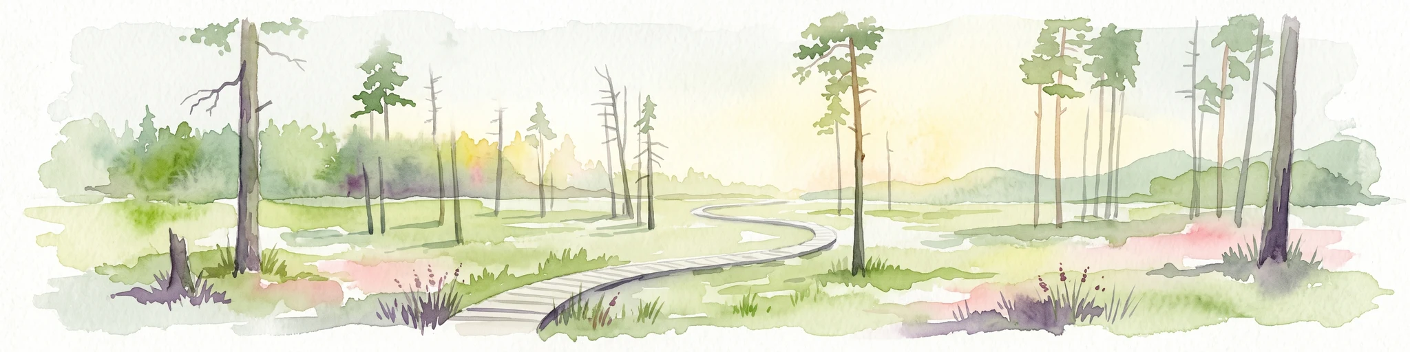
Wälder um Greiz und Werdau occupies a ridge of wooded upland pressed between two deeply cut river valleys, the Pleiße to the northeast and the Weiße Elster to the southwest. The forest is not flat plateau but a rolling series of hills and saddles, with the Brand at about 447 meters marking the high point on the Thuringian side, followed in descending order by the Sauberg, the Tischberg, the Teufelskanzel, and the Silberberg.
The visible character of the landscape is shaped above all by the contrast between wide, uniform conifer stands on the heights and the sharper relief of the valleys and side valleys that break into the forest. Among these valley forms, the Schlötengrund and the Krebsgrund stand out as particularly scenic incisions into the wooded ridge, while the Quirlbach somewhere west of Greiz marks part of the protected area's outer boundary. Streams and old raft canals, including the Meiselbach and the Leubnitzer Bach, trace the historic drainage of the forest, and water has long been stored in small ponds such as the Schlötenteich, the Seerosenteich, and the Elferteich, giving parts of the forest a soft, lake-studded feel.
Human influence is woven into the natural form. Narrow clearings for roads and forest villages, the small isolated settlement of Waldhaus, and the straight lines of former railway and timber-rafting corridors break up the forest canopy in places. On a clear day, views from the higher summits open over the Elster valley toward Greiz and across the state border toward Saxon settlements around Werdau, framing the forest as a green island between two regional townscapes.
Wälder um Greiz und Werdau ecosystems, habitats, and plant life
The landscape protection area is overwhelmingly forested, with roughly eighty percent of its surface under tree cover. The productive forest is dominated by spruce, pine, and larch, reflecting the long history of timber management in the region. Scattered through this conifer matrix are smaller areas of older deciduous woodland, including residual beech and oak mixed forest as well as stands of birch and maple that have expanded into former open ground. These deciduous remnants are ecologically important because they preserve something of the natural mixed-forest character that once covered the hill country between the two major river valleys.
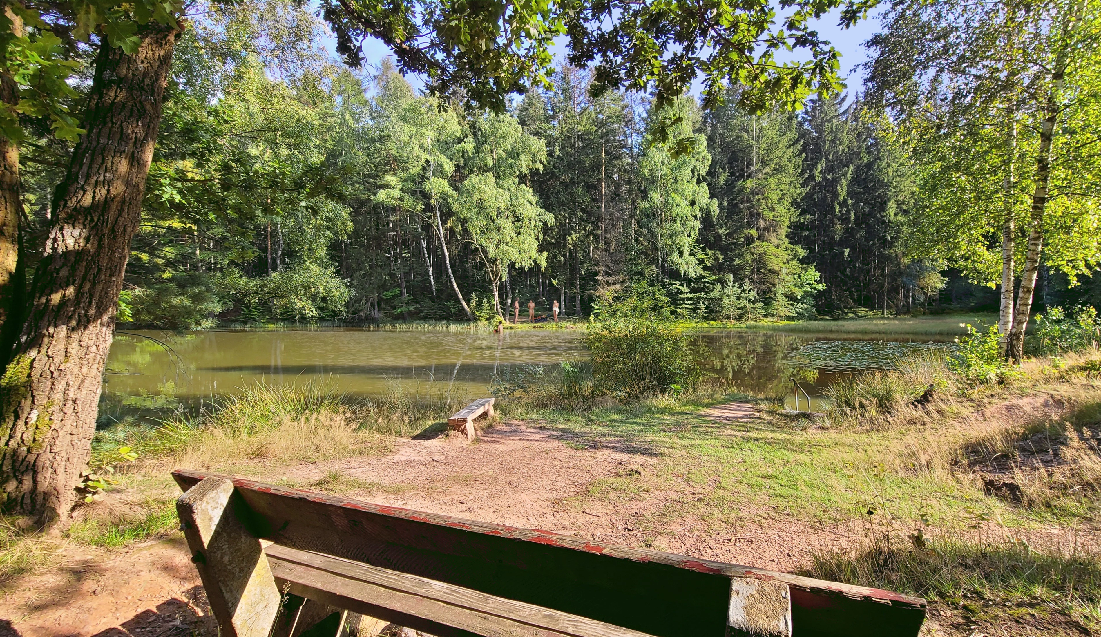
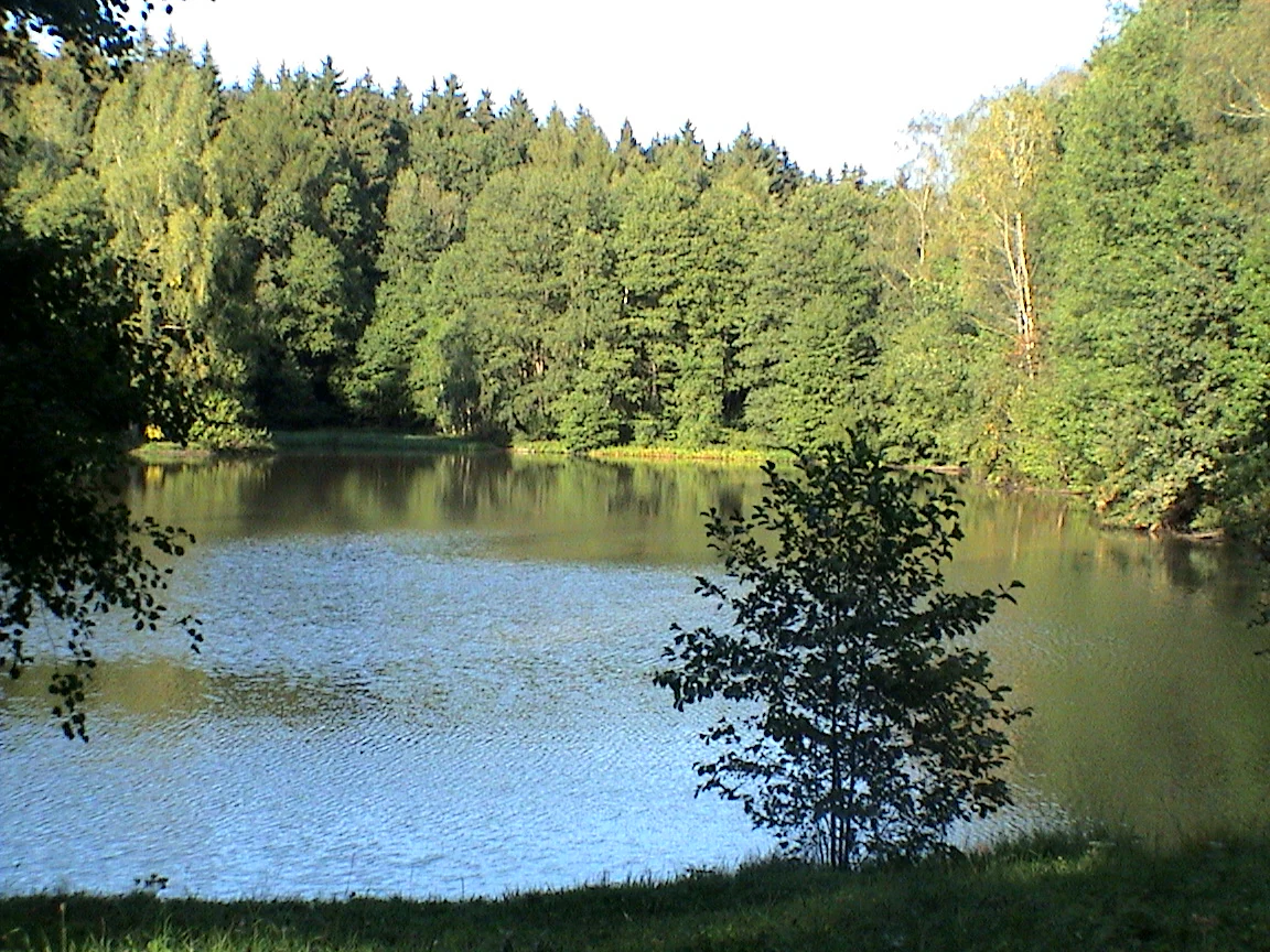
Moisture-loving habitats are concentrated around the forest's many small standing waters. Ponds such as the Seerosenteich, the Schlötenteich, the Stauweiher, and the Elferteich support characteristic aquatic and waterside vegetation, including the water-lily growth that gives the Seerosenteich its name. These small water bodies also provide breeding and feeding habitat for amphibians and water birds, and they break up the otherwise continuous forest cover with reflective open surfaces that are important for landscape-level biodiversity.
The protected area also contains formally designated natural monuments and protected landscape components, reflecting recognition of individual trees, small habitat patches, and geomorphological features that deserve specific protection beyond the general landscape-level designation. The historic trails and depth of woodland mean that the forest functions as a refuge for typical central European forest species as well as for less common woodland birds that depend on mature trees and old wood for nesting.
Wälder um Greiz und Werdau wildlife and species highlights
The forest supports a community of animals typical of large, well-connected central European mixed woodlands. Larger mammals such as red deer and red fox roam the closed forest stands, while smaller woodland creatures, including forest ants, occupy the forest floor. Birdlife is rich for a managed forest landscape of this size, with common woodland species such as great tits and great spotted woodpeckers present throughout the year.
Of greater ecological interest are the less common breeding birds that depend on the forest's older trees and quieter interior. Black woodpeckers drum in the mature timber and excavate nesting cavities that are later used by other species. Hobbies and sparrowhawks hunt along the forest edges and over the clearings, taking smaller birds and insects on the wing. The combination of mature woodland, ponds, and small clearings gives the protected area value as a breeding and feeding area well beyond what its working-forest character might initially suggest.
Because most of the area is forested and the ponds are relatively small, the wildlife profile is one of typical woodland fauna rather than open-landscape species. Nonetheless, the size and continuity of the forest, and its direct linkage to the Saxon Werdauer Wald across the state border, give the broader mammal and bird community enough space to maintain stable populations over the long term.
Wälder um Greiz und Werdau conservation status and protection priorities
The principal conservation value of Wälder um Greiz und Werdau lies in safeguarding one of the largest consolidated forest areas in the Saxony-Thuringia border region. By carrying the Thuringian half of the protective designation that continues directly into the Saxon Werdauer Wald, the area forms a continuous, cross-border conservation corridor of roughly 62 square kilometers, allowing forest species to move between protected forest blocks without crossing intensively used farmland or settlement zones.
At the local level, the protection framework combines broad landscape conservation with finer-grained measures. Within the general Landschaftsschutzgebiet status, individual features are singled out as Flächennaturdenkmale, or area natural monuments, while particularly important habitat elements receive the additional status of Geschützte Landschaftsbestandteile, protected landscape components. This layered approach helps protect specific trees, small wetland patches, and habitat complexes that contribute disproportionately to the overall biodiversity of the forest.
The protected area also records a shift in land-use priorities since the mid-twentieth century. Where parts of the eastern sections were cleared for fields and new farmsteads after 1945, ongoing reforestation in recent decades has gradually returned former agricultural ground to woodland, restoring forest continuity and reducing fragmentation in the long term. In combination, the formal designations and the gradual restoration of former cleared areas give the area durable conservation significance well beyond a single protected-site boundary.
Wälder um Greiz und Werdau cultural meaning and human context
The forest is deeply woven into the everyday life of the surrounding villages and small towns. The hamlets of Teichwolframsdorf, Reudnitz, Daßlitz, Langenbernsdorf, and the isolated settlement of Waldhaus sit at the forest edge or in clearings within it, and their residents have long used the woodland for timber, grazing rights, hunting, mushroom gathering, and recreation. Walking, cycling, mushroom picking, inline skating, and horse riding are all common weekend activities, and the forest's quiet lanes and small swimming ponds, including the Stauweiher and the Elferteich, function as informal social spaces for the region.
A particularly strong cultural thread is the area's timber-rafting history. Rafting along the Pleiße from the late sixteenth century onward, and the conversion of streams such as the Meiselbach and the Leubnitzer Bach into raft canals, left physical traces that are still visible in the landscape. These are actively interpreted today through the Flößergraben nature trail, which follows the vanished timber-rafting infrastructure through the forest. On the Saxon side, the heritage railway project Werdauer Waldeisenbahn, operated by an association on a short section of the former Werdau–Mehltheuer line between Teichwolframsdorf and Langenbernsdorf, layers a second strand of industrial heritage onto the same forest.
Recurring events such as the twice-yearly Werdauer Waldlauf and the winter cross-country skiing circuits reinforce the forest's role as a venue for communal activity. Altogether, the area is less a remote wilderness than a working cultural landscape that happens also to be protected, with the everyday rhythms of the surrounding villages and small Thuringian and Saxon towns still legible in its ponds, lanes, and old tracks.
Top sights and standout views in Wälder um Greiz und Werdau
One standout feature is the sheer spatial scale of the protected forest, which forms part of one of the largest contiguous woodland areas in the Saxony-Thuringia border region, with the Thuringian and Saxon protection areas functioning as a single living forest despite their administrative separation.
Equally distinctive is the layered forest landscape itself: a productive conifer-dominated canopy over eighty percent of the area, broken by deeply cut valleys such as the Schlötengrund and Krebsgrund, by old timber-rafting ponds like the Seerosenteich and the Schlötenteich, and by small hilltop summits including the Brand, Sauberg, and Teufelskanzel.
Finally, the area combines conservation, recreation, and heritage in unusually direct ways. Marked hiking routes, the Werdauer Waldeisenbahn heritage railway, the Flößergraben nature trail interpreting the vanished rafting industry, and seasonal events such as the Werdauer Waldlauf and winter cross-country skiing make the protected landscape an active, well-used resource for the surrounding region rather than a passive reserve.
Best time to visit Wälder um Greiz und Werdau
The forest has a year-round character and changes considerably with the seasons. Late spring and early summer are the most pleasant months for walking and cycling, when the canopy is fully leafed out, the forest ponds are visually active with water-lily growth, and the marked trail network is at its most inviting for casual day visitors.
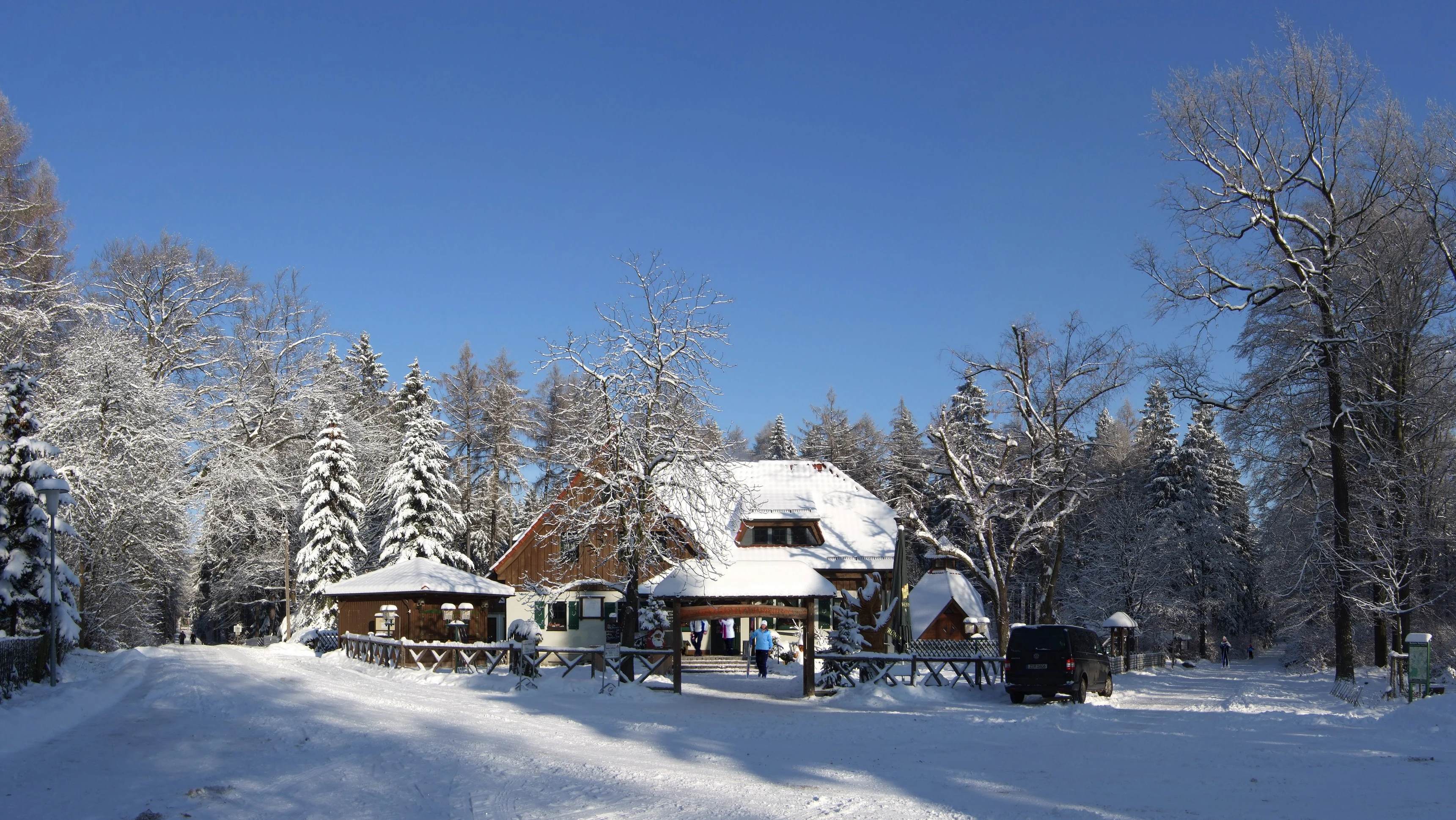
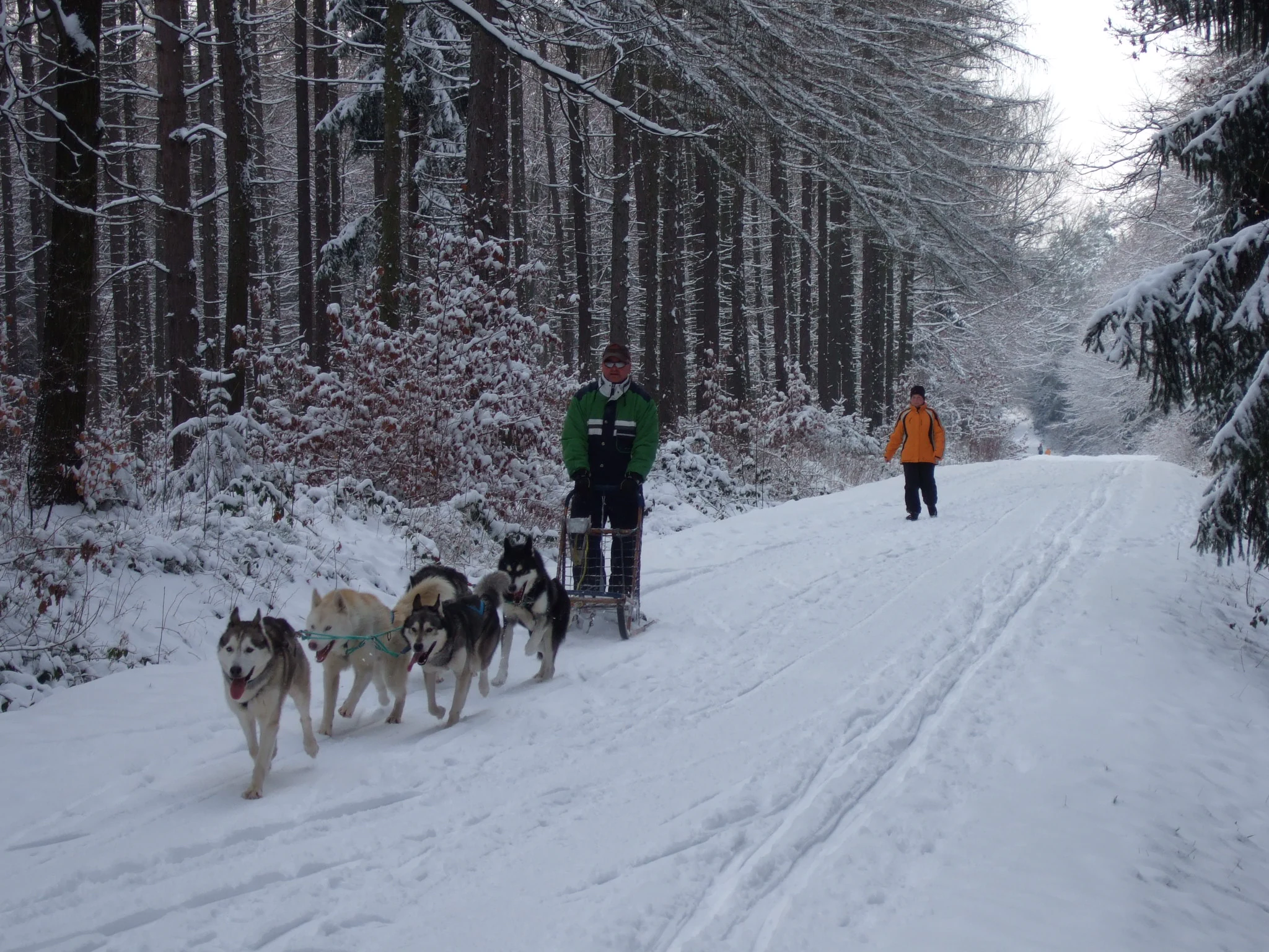
Autumn is widely considered the classic season for visiting any large central European forest, and Wälder um Greiz und Werdau is no exception. Mushroom gathering is a long-standing local tradition in these woods, and the cooler air and softer light make the larger ridge sections particularly atmospheric. In winter, the protected area supports a network of cross-country ski trails, and the ponds and clearings often take on a quiet, frost-bound character that contrasts with the busier summer atmosphere.
Because the forest is largely working woodland rather than open high-mountain terrain, it remains accessible at any time of year when conditions are safe, and visitors should generally expect a calm, low-key experience rather than dramatic seasonal swings in accessibility.