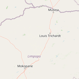
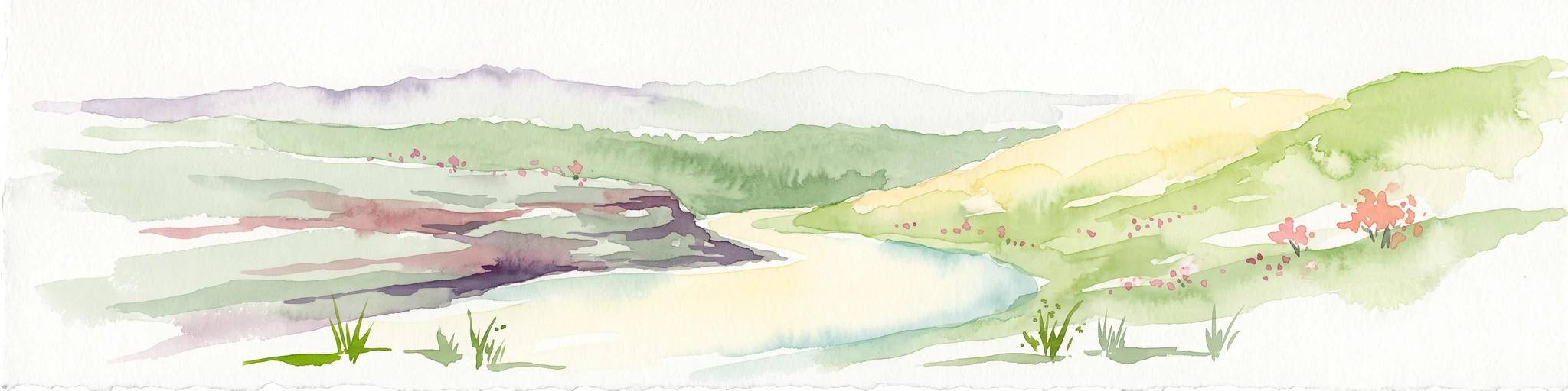
Why Waterberg Biosphere stands out
The Waterberg Biosphere is particularly known for its dramatic sandstone landforms: mesas, buttes, bluffs, and isolated kopjes carved out by ancient river erosion. These formations create sheer cliffs that rise up to around 550 meters above the surrounding plains, providing both scenic character and sheltered cliff habitats. It is also recognized for its layered ecological zones, which combine high plateau savanna, specialized shaded cliff vegetation, and riverine corridors. Combined with deep archaeological and early human history, the Waterberg stands out as a landscape where geological time, ecological diversity, and human antiquity intersect in a single contiguous region.
Waterberg Biosphere history and protected-area timeline
The history of the Waterberg stretches back many hundreds of thousands of years. Its sandstone formations retain groundwater and contain cliff overhangs that provided natural shelters for early human ancestors. Evidence from nearby Makapansgat suggests that early hominins such as Homo erectus may have moved seasonally into the higher elevations of the Waterberg in search of game.
Around two thousand years ago, Bushmen moved into the Waterberg, producing distinctive rock paintings that survive in protected areas like Lapalala. Their depictions of rhinoceros, antelope, and other wildlife provide a vivid record of the region's fauna at the time. Later Iron Age settlers from Bantu-speaking groups brought cattle into the region, eventually triggering ecological change as cattle grazing reduced grassland cover, encouraged brush invasion, and enabled the spread of the tsetse fly. The resulting sleeping sickness epidemic devastated populations on the lower plains, while people at higher elevations, above the fly's range, persisted.
From roughly 1300 AD onward, Nguni settlers introduced new technologies, including dry-stone wall building, which was applied to Iron Age forts whose defensive structures still stand today. European contact began in 1808 with the arrival of the first white settlers, followed by traveling Afrikaner groups in the mid-19th century. As the 19th and early 20th centuries progressed, increasing cattle grazing and land occupation placed heavy pressure on native wildlife populations, prompting a gradual shift toward conservation-oriented land management in the 20th century. The UNESCO Biosphere designation in 2001 marked a formal consolidation of the region's ecological and cultural value.
Waterberg Biosphere landscape and geographic character
The Waterberg is defined by its ancient sandstone massif, a deeply rugged upland whose formation extends back to the Neoarchean and early Paleoproterozoic eras. The bedrock derives from the Kaapvaal craton, with later igneous intrusions from the Bushveld Igneous Complex adding vanadium- and platinum-bearing rock to the geological fabric. Over hundreds of millions of years, riverine erosion sculpted this solid foundation into a dramatic suite of landforms.
The massif is dominated by mesas, buttes, and isolated kopje outcrops that rise sharply from the surrounding plains. Exposed multi-colored sandstone layers, often coarse-grained and yellow in tone, form steep cliff faces, with some bluffs reaching up to around 550 meters above the plain. The Sandrivier range near Vaalwater offers a textbook example of cross-bedded sandstone escarpment.
Coarse-grained sandstones appear across the range, particularly visible in formations like the Sandrivier escarpment. The geological base, drawn from the Kaapvaal craton with Bushveld Igneous Complex intrusions, has given rise to long, layered cliff faces that catch the South African light. The massif's combination of horizontal layering and differential erosion gives the Waterberg its signature profile of flat-topped massifs separated by deep river gorges.
Waterberg Biosphere ecosystems, habitats, and plant life
Ecologically, the Waterberg Biosphere is best understood as a dry deciduous forest system within the broader Bushveld biome. Its character emerges from a layered combination of sub-habitats rather than any single dominant ecosystem. According to ecological descriptions of the reserve, these sub-habitats include high plateau savanna, specialized shaded cliff vegetation systems, and riparian zone habitats with associated marshes.
The savanna consists of rolling grasslands interspersed with semi-deciduous woodland. Characteristic trees include mountain syringa, silver cluster-leaf, and the lavender tree, with the canopy often leafless through the dry winter months. Native grasses such as signal grass, goose grass, and heather-topped grass provide forage, and small isolated kopje formations host rare Pachypodium habitats.
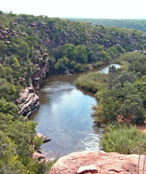
Vegetative cliff habitats are abundant because of the Waterberg's extensive historic river erosion. These cliffs shelter trees such as the paperbark false-thorn, with its flaking bark hanging from thick trunks, and the fever tree, which holds cultural significance in Bushman tradition and grows above the Palala River near prehistoric ceremonial sites and intact rock paintings. Riparian corridors along the region's rivers ultimately drain into the Limpopo River and from there into the Indian Ocean, supporting river bushwillow and other water-dependent flora. Together these sub-habitats produce a mosaic of ecosystems within a single contiguous landscape.
Waterberg Biosphere wildlife and species highlights
The Waterberg's combined grassland, cliff, and riparian habitats support a rich and varied mammal community. Indigenous antelope species include impala, kudu, klipspringer, and blue wildebeest, which thrive in the savanna mosaic. Other notable mammals include South African giraffe, southern white rhinoceros, warthog, hippopotamus in the riverine zones, and apex predators such as the African leopard, hyena, and lion. The Nile crocodile inhabits the river systems of the Waterberg as a top predator.
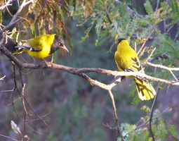
The biosphere also hosts a notable snake fauna, including the black mamba and the spitting cobra. The Waterberg's snakes attracted early scientific study, most famously by Eugene Marais in 1905. The African porcupine finds shelter in cliffside caves, while birds such as the black-headed oriole and white-backed vulture occupy the riparian zones and escarpment edges. Because the wet habitats support relatively few water-living insects, the region is considered an almost malaria-free environment, an unusual feature for a South African landscape of this scale.
Waterberg Biosphere conservation status and protection priorities
As a UNESCO Biosphere Reserve designated in 2001, the Waterberg represents one of the most ambitious integrated conservation landscapes in northern South Africa. Its designation as the first biosphere reserve in northern South Africa reflects both its ecological richness and its deep cultural heritage. The biosphere framework combines formal protected areas with privately managed land committed to conservation-compatible use.
Key protected nodes include Marakele National Park on the western edge of the reserve, the Welgevonden Game Reserve covering 37,500 hectares of plateau, the smaller Kololo Game Reserve of 3,000 hectares, and the Lapalala Wilderness Nature Reserve, which at roughly 48,000 hectares is the largest private game reserve in both the Waterberg and Limpopo Province.
Modern conservation efforts in the Waterberg focus on restoration rather than only preservation. Where 20th-century cattle grazing destroyed native grass cover and reduced wildlife populations, landowners have increasingly reverted to restoring original grass species and reducing fences to allow large mammal migration. The added ecological value of restored habitat has stimulated ecotourism growth, creating an economic incentive that supports ongoing soil conservation and wildlife recovery. Larger consolidated farms and open-space corridors also improve genetic connectivity among mammal populations, making conservation both an ecological and an economic strategy in the biosphere.
Waterberg Biosphere cultural meaning and human context
The Waterberg carries an unusually layered human story. Stone Age occupation extending back potentially millions of years links the landscape to broader questions about the origin of humans in southern Africa. Bushman rock art at sites like Lapalala provides a vivid visual record of life and fauna in the region, depicting rhinoceros and antelope among other subjects.
Iron Age Bantu-speaking settlers shaped the ecological history of the plateau through cattle introduction, with cascading effects on grassland cover and disease patterns. Later Nguni arrivals contributed distinctive dry-stone architecture, examples of which still stand. Colonial-era encounters added further layers, including the striking account of mid-19th-century Afrikaner travelers who reached the Waterberg believing they had arrived in Egypt. The fever tree, used by Bushmen as a spiritual conduit to communicate with the dead, remains a living symbol of the region's intertwined natural and cultural heritage.
Top sights and standout views in Waterberg Biosphere
Standout features of the Waterberg Biosphere include its iconic sandstone cliff and mesa scenery, formed over more than a billion years; its status as South Africa's first northern UNESCO Biosphere Reserve; and its mosaic of dry deciduous forest, savanna, cliff vegetation, and riparian habitats, all linked into a single contiguous system.
Equally distinctive is the concentration of major protected areas within the biosphere, from Marakele National Park across to the Lapalala Wilderness, each contributing to wildlife recovery, ecological restoration, and ecotourism. The combination of prehistoric rock art, ancient stone fortifications, and large-mammal conservation defines a landscape where geological time and human time meet visibly.
Best time to visit Waterberg Biosphere
The Waterberg's climate supports a dry winter and a wetter summer season, which strongly shapes both scenery and wildlife activity. During the dry winter months, the canopy of the dry deciduous forest thins out, opening up visibility across the plateau and making wildlife easier to observe at water sources. Summers bring greening grasslands, fuller canopies, and more active birdlife, along with occasional thunderstorms that reshape the atmosphere of the bush.
For visitors interested in mammal viewing, the dry months tend to concentrate animals around remaining water sources and improve general visibility. Those interested in lush vegetation and active birdlife, including seasonal migrants, may prefer the summer months. Because wet habitats in the region support few water-living insects, the Waterberg is considered an almost malaria-free environment much of the year, an unusual advantage for a South African landscape.