
Mori Atlas logo
Protected landscapeWeikersheim

A deep look into the Tauberland natural region, cultural-landscape textures, and protected valley habitats.

Weikersheim Protected Landscape in Baden-Württemberg: Geography, Mapped Boundaries, and Terrain Context

(Landschaftsschutzgebiet „Weikersheim“)

The Weikersheim Protected Landscape spans nearly 2,718 hectares across the Tauberland region, preserving a distinctive mosaic of sloping terrain, traditional orchards, and near-natural stream corridors. This area is defined by its historic Steinriegel stone ridges and deep wooded Klingen valleys, which create a unique ecological and cultural texture within the Main-Tauber-Kreis district. Explore the mapped boundaries and geographic features of this protected area to understand its role in maintaining regional habitat connectivity.

protected landscapeBaden-WürttembergMain-Tauber-KreisTauberlandSteinriegeldry-stone ridges
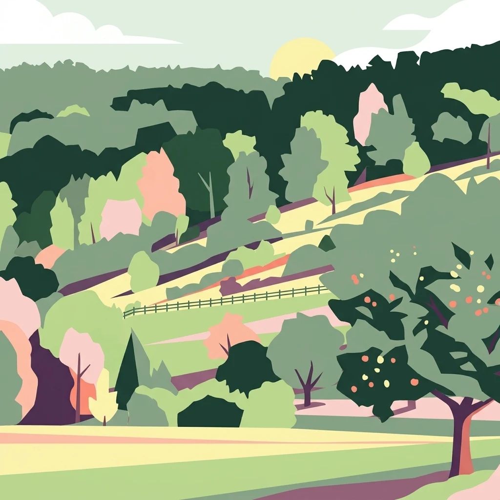
A graphic illustration of a hilly, verdant landscape featuring rolling fields, fruit trees, and dense woodland under a pale sky.

Weikersheim

Protected landscape

Park overview

Structured park overview, official facts, and landscape profile for Weikersheim Protected Landscape

Weikersheim Protected Landscape park facts, protected area profile, and essential visitor context

Review the core facts for Weikersheim Protected Landscape, including designation, size, terrain, visitor scale, habitats, and operating context in one park-focused overview.

About Weikersheim Protected Landscape

The Weikersheim Protected Landscape, designated under that name on 19 May 1993, is one of the larger landscape protection areas in the Main-Tauber-Kreis district of Baden-Württemberg. It occupies a substantial part of the Tauberland, the natural region that follows the River Tauber through the eastern foothills of Baden-Württemberg into neighbouring Bavaria. By protecting nearly 2,720 hectares of countryside across four municipalities, the designation aims to maintain the landscape character that has developed over centuries of mixed agricultural and forest use.

A defining element of the area is the presence of Steinriegel, ridges of stones gathered and stacked by farmers over generations as fields were cleared for cultivation. These structures remain embedded in the modern landscape, providing both a visible cultural signature and important refuges for plants, insects, reptiles, and small mammals. The protected landscape also encompasses numerous small streams and Klingen, the narrow wooded side valleys typical of the Tauberland, which together with meadows, orchards, scrub, and forest create a richly varied habitat pattern.

Because the surrounding region is heavily used for agriculture, the protected landscape plays a particularly important role in maintaining ecological connectivity and in preserving near-natural features within a working countryside. The designation also recognises the landscape's value for local recreation, ensuring that the scenic quality and accessibility of the area are retained alongside its conservation function.

Quick facts and research context for Weikersheim Protected Landscape

The Weikersheim Protected Landscape lies in the Main-Tauber-Kreis district of Baden-Württemberg, in south-central Germany within the Tauberland natural region. It is a Category V protected landscape under the IUCN system, managed by the Regierungspräsidium Stuttgart and formally designated on 19 May 1993.

The area originally covered around 2,770 hectares when first designated, but was reduced to approximately 2,718 hectares after a 1994 ordinance carved out the Steinriegellandschaft zwischen Weikersheim und Elpersheim as a separate nature reserve. It is identified in the federal protected-area database under WDPA record 320257 and carries the local LSG designation number 1.28.013.

Protection and recognition

Terrestrial protected area records and international recognition history

Weikersheim Protection Status and Documented Conservation Scope

Terrestrial conservation records for Weikersheim outline official designation details, management frameworks, and documented protection parameters. Structured data brings together verified administrative boundaries and international recognition metrics for comprehensive environmental analysis.

Protection details

Protection scope
Terrestrial
Transboundary protection
No
WDPA ID
320257
Park context

Deeper park guide and search-rich context for Weikersheim Protected Landscape

Weikersheim Protected Landscape history, landscape, wildlife, and travel context

Explore Weikersheim Protected Landscape through its history, landscape character, ecosystems, wildlife, conservation priorities, cultural context, and seasonal travel timing in a structured park guide built for atlas discovery and search intent.

Why Weikersheim Protected Landscape stands out

The protected landscape is best known for its Steinriegel, the traditional dry-stone ridge formations that line parts of the rolling Tauberland countryside between Weikersheim and Elpersheim. These old field-clearance structures create a distinctive cultural-landscape texture that is rare in this part of Germany and contributes strongly to the area's identity. Equally characteristic are the near-natural streams, forested Klingen valleys, and ecologically rich slopes. Together they form a varied habitat mosaic that supports diverse plant and animal communities while preserving the visual and cultural character of the historic Tauberland farming landscape.
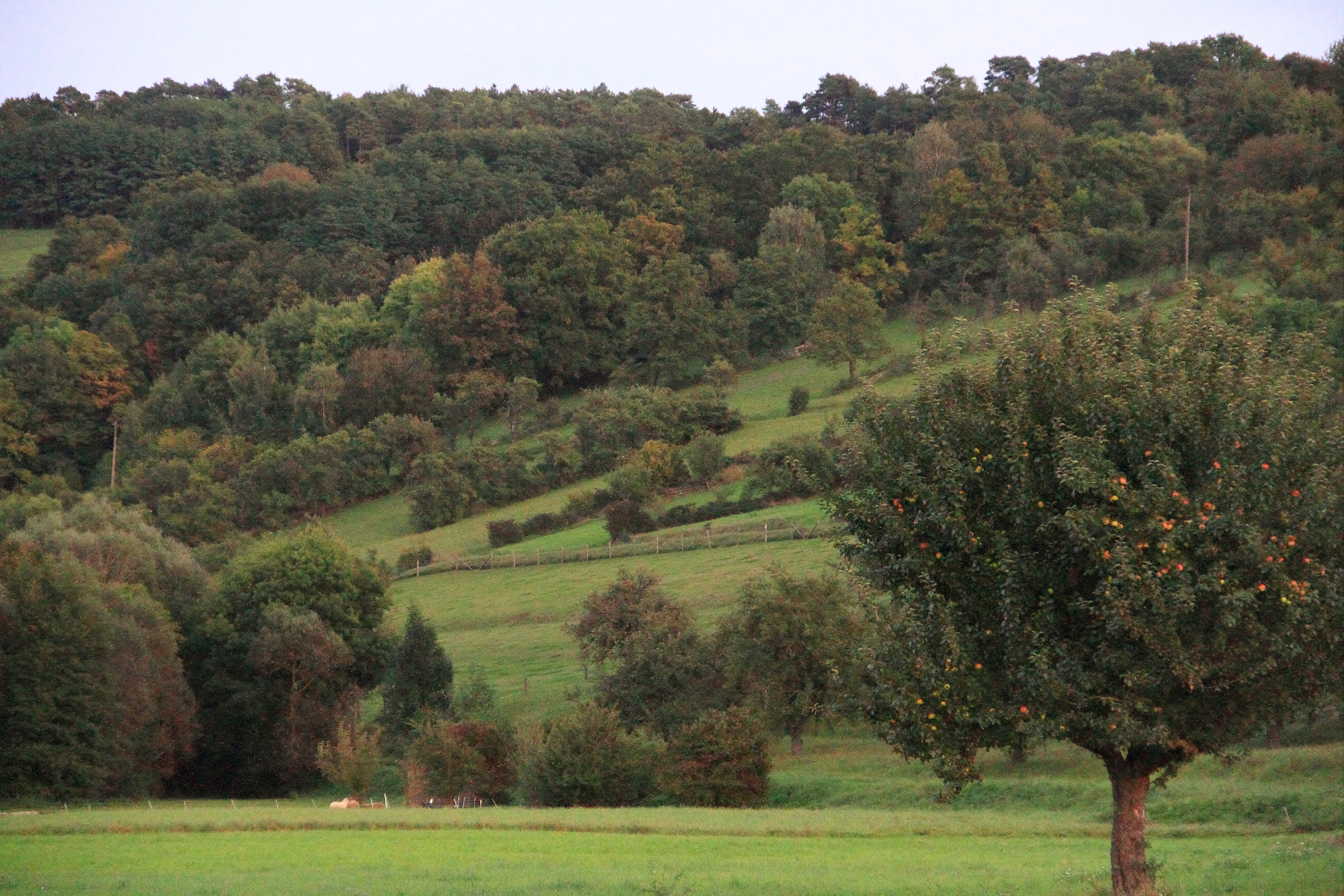
A landscape view of rolling hills in Weikersheim with grassy slopes, scattered trees, and dense forested areas in the background.
Rolling hills and traditional orchard landscape near Weikersheim, Germany.

Weikersheim Protected Landscape history and protected-area timeline

The Weikersheim Protected Landscape was formally established by ordinance on 19 May 1993, when the regional authorities of Baden-Württemberg set aside approximately 2,770 hectares around the town of Weikersheim and its neighbouring municipalities for landscape conservation. The designation came under the responsibility of the Regierungspräsidium Stuttgart and gave the area the local identification number 1.28.013.

A second ordinance, issued on 23 September 1994, refined the boundaries and reduced the overall protected landscape by 77 hectares. This adjustment was linked to the creation of the separate nature reserve Steinriegellandschaft zwischen Weikersheim und Elpersheim, which recognised the exceptional ecological and cultural value of the Steinriegel formations by giving them a higher level of protection under nature reserve status. Since then, the two designations have worked in tandem to protect the broader landscape while safeguarding its most distinctive features more strictly.

Weikersheim Protected Landscape landscape and geographic character

The protected landscape sits within the Tauberland, a gently undulating natural region shaped by the River Tauber and its tributaries. The terrain consists of rolling slopes, broad valley sides, and the deeper incisions of side valleys. The skyline is broken by occasional ridges and hilltops, while between them the land descends into a patchwork of fields, meadows, hedges, orchards, and woodland.

A particularly distinctive surface feature is the Steinriegel, low linear ridges of stacked stones that run across fields and along slopes. These are remnants of centuries of manual land clearance and lend the countryside a textured, historic quality. The area also contains numerous Klingen, narrow steep-sided wooded valleys that feed into the main drainage system, giving the landscape a sharper, more dramatic local relief than the broader plateau.

Weikersheim Protected Landscape ecosystems, habitats, and plant life

Ecologically, the Weikersheim Protected Landscape functions as a large buffer and refuge within an otherwise intensively used agricultural region. Its habitats include near-natural streams shaded by gallery woodland, species-rich meadows, traditional orchards, scrub, and deciduous forest, alongside the specialised micro-habitats created by the Steinriegel themselves.

The slopes are especially important for biodiversity. Their mosaic of different uses produces a high diversity of small biotopes within short distances, which supports a wide range of plants, insects, and other wildlife. The streams and Klingen contribute additional ecological value by connecting habitat patches and providing cooler, moister conditions than the open fields above.

Weikersheim Protected Landscape wildlife and species highlights

The combination of open slopes, near-natural streams, and traditional land-use elements gives the protected landscape a wildlife profile that is richer than the surrounding farmland. The Steinriegel are particularly valuable as refuges for warmth-loving invertebrates, reptiles, and small mammals, while the wooded Klingen support typical forest species including a variety of breeding birds.

Streamside corridors, meadows, and hedgerows add to the variety, providing habitat for amphibians, pollinators, and ground-nesting birds. Although the area is not primarily managed as a wildlife reserve, its habitat diversity means it functions as an important refuge and stepping stone for species across the wider Tauberland.

Weikersheim Protected Landscape conservation status and protection priorities

The conservation value of the Weikersheim Protected Landscape lies in its scale and its role within a heavily farmed region. By protecting nearly 2,720 hectares of connected countryside, it preserves ecological features that would otherwise be vulnerable to agricultural intensification, including near-natural streams, traditional slope management, and the Steinriegel formations.

The 1994 separation of the Steinriegellandschaft as a nature reserve inside the broader protected landscape demonstrates a layered conservation approach, where general landscape protection is combined with stricter protection for the most ecologically and culturally significant sites. Together the two designations help maintain ecological connectivity, protect soil, water, and habitat diversity, and safeguard a piece of the historic Tauberland landscape.

Weikersheim Protected Landscape cultural meaning and human context

The cultural character of the protected landscape is closely tied to centuries of farming in the Tauberland. The Steinriegel are a direct expression of the labour invested by past generations in clearing stones from fields and stacking them into field boundaries, ridge lines, and structural features that today are valued as both cultural heritage and ecological assets.

The wider landscape also reflects the regional building traditions of the Tauberland, with the protected area encompassing parts of the countryside around the historic town of Weikersheim itself, known for its castle and Baroque gardens. Traditional orchards, hedgerows, and the patterns of small settlements and farmsteads all contribute to a sense of place rooted in long-standing rural land use.

Top sights and standout views in Weikersheim Protected Landscape

The scale of the protected landscape, nearly 2,720 hectares across four municipalities, makes it one of the larger landscape protection areas in the Main-Tauber-Kreis. Its size is key to its role in maintaining ecological connectivity in the Tauberland.

Internationally it is registered in the World Database on Protected Areas under record 320257 and classified as IUCN Category V, placing it within the global framework of protected landscapes. It combines general landscape protection with the stricter protection of the embedded Steinriegellandschaft nature reserve, offering both broad conservation and focused safeguarding of distinctive cultural-landscape features.

Best time to visit Weikersheim Protected Landscape

The Weikersheim Protected Landscape is accessible year-round and changes character meaningfully with the seasons. Spring brings fresh green growth to the meadows and orchards, along with active birdlife along the streams and Klingen. Summer highlights the dense vegetation of the valleys and the bright colours of flowering meadows on the slopes.

Autumn is particularly rewarding visually, when the deciduous forests of the Klingen turn colour and the harvested fields open up longer views across the Steinriegel landscape. Winter offers quieter conditions and clearer visibility of the terrain structure, from the broader slopes to the dry-stone ridges, making it a useful period for those interested in the geology and traditional land use of the area.


Monthly climate preview

Track representative annual temperature ranges and precipitation rhythm for Weikersheim

Weikersheim Climate Normals and Long-Term Temperature Patterns

Long-term representative coordinate measurements outline the baseline temperature and precipitation rhythm across twelve months at Weikersheim. Reviewing the complete monthly climate profile reveals deeper baseline shifts in average thermal maximums and daily precipitation rates.
Annual mean9 °C
-1 °C19 °C
Jan-1°
Feb
Mar
Apr
May13°
Jun17°
Jul19°
Aug19°
Sep14°
Oct
Nov
Dec
Warmest month
July

19.4 °C

Coolest month
January

-0.7 °C

Wettest month
July

2.4 mm/day

Driest month
April

1.4 mm/day

Park location guide

Geography guide, regional context, and park location map for Weikersheim Protected Landscape

Weikersheim Protected Landscape park geography, regions, and map view in Germany

Understand where Weikersheim Protected Landscape sits in Germany through a broader geographic reading of the surrounding landscape, nearby location context, and its mapped position within the national park landscape.

How Weikersheim Protected Landscape fits into Germany

Germany is a federal republic in Western and Central Europe with a population of over 83 million across sixteen constituent states. It is Europe's largest economy by nominal GDP and a major global exporter and importer. The capital is Berlin, and the country borders Denmark, Poland, Czech Republic, Austria, Switzerland, France, Luxembourg, Belgium, and the Netherlands.

Wider geography shaping Weikersheim Protected Landscape in Germany

Germany is located in Western and Central Europe, spanning 357,022 km². It borders Denmark to the north, Poland and the Czech Republic to the east, Austria and Switzerland to the south, and France, Luxembourg, Belgium, and the Netherlands to the west. The country has coastlines on the Baltic Sea and North Sea to the north, with the Alps located in the southern region.

Map view of Weikersheim Protected Landscape

Use this park location map to pinpoint Weikersheim Protected Landscape in Germany, understand its exact geographic position, and read its mapped placement within the surrounding landscape more clearly.

Pigeon | © OpenStreetMap contributors

Location context for Weikersheim Protected Landscape

Baden-Württemberg

Explore photographic evidence of dry stone ridges, wooded valleys, and Tauberland terrain.

Weikersheim Photos and Scenery: Visualizing the Protected Landscape

Visual documentation of Weikersheim captures the distinctive rolling slopes, traditional stone ridge formations, and wooded valley habitats defining the protected landscape. Examining these field photographs reveals the varied terrain, near natural streams, and cultural geography shaping the broader Tauberland region.

A landscape view of rolling hills in Weikersheim with grassy slopes, scattered trees, and dense forested areas in the background.

Park atlas

Compare regional Tauberland terrain and nearby conservation areas

Explore Other Parks Near Weikersheim and Surrounding Protected Landscapes

Browsing other protected areas near Weikersheim reveals broader regional geography across the Tauberland natural region. Expanding the map comparison helps trace connected valley terrain and adjacent conservation zones.
A wide watercolor illustration showing a landscape of rolling green hills and trees under a pastel pink and yellow sky.
Protected landscapeGermany
About 11 km away#1 closest

South

Niederstetten (Landschaftsschutzgebiet) Protected Landscape Map and Regional Terrain Data

Protected landscape and topographic features in Baden-Württemberg

Covering 1,786 hectares, the Niederstetten (Landschaftsschutzgebiet) serves as a vital protected landscape within the Hohenlohe region. It is recognized for its deeply incised side valleys, stream-fed corridors, and traditional dry-stone wall boundaries that define this portion of the German countryside.

Area
17.86 km²
Established
1992
Relief
Upland
Climate
Temperate
A soft watercolor illustration of rolling hills and gentle terrain in shades of pale green and muted earth tones against a white background.
Protected landscapeMittelfranken
About 12 km away#2 closest

East

Naturpark Frankenhöhe Protected Landscape: Geography, Map, and Regional Conservation Context

Explore the diverse natural terrain of the Mittelfranken region in Bavaria.

Naturpark Frankenhöhe serves as a significant protected landscape in western Mittelfranken, encompassing a unique mosaic of forests, vineyards, and agricultural valleys. This geographic entity is shaped by the European Main Watershed, where rivers divide between the Rhine and Danube systems. Its terrain provides a study in transitions, from higher forested crests to open orchard meadows that define the local Bavarian countryside.

Area
1,104.06 km²
Established
1974
Relief
Mixed relief
Climate
Temperate
A watercolor illustration of rolling hills in shades of purple and green against a white background.
Nature reserveBaden-Württemberg
About 17 km away#3 closest

Southwest

Jagsttal Dörzbach-Krautheim Protected Area: Landscape Geography and Atlas Map Context

Nature reserve featuring karst features and riparian corridors

Spanning the Jagst river valley in Baden-Württemberg, Jagsttal Dörzbach-Krautheim showcases a sophisticated mosaic of dry calcareous grasslands and wet floodplain woodlands. This atlas entry focuses on the park boundary geography, identifying the intersection of limestone scree slopes, plateau forests, and karst caves that create its distinct ecological profile. Gain a comprehensive view of how these features form a vital conservation link within the regional river network.

Area
17.502 km²
Established
2005
Relief
Mixed relief
Climate
Temperate
Watercolor painting of a river winding through a gentle green valley with distant hills.
Nature reserveBaden-Württemberg
About 26 km away#4 closest

South

Jagst bei Kirchberg und Brettach Nature Reserve: Protected River Landscapes of Baden-Württemberg

River valleys, calcareous grasslands, and limestone terrain in Southwestern Germany.

The Jagst bei Kirchberg und Brettach nature reserve preserves a diverse corridor of natural river meanders, floodplain meadows, and beech forests. Situated in the Baden-Württemberg region, this protected area spans nearly 900 hectares, offering a rich study in limestone geology and riparian ecology within the Kocher-Jagst plains.

Area
8.93 km²
Established
2019
Relief
Upland
Climate
Temperate
Nature reserveBaden-Württemberg
About 31 km away#5 closest

Southwest

Jagsttal bei Schöntal und Klosterwald: Protected Nature Reserve Landscape Overview

Geographic profile of the Jagst-Kocher plateau in Baden-Württemberg

Spanning the high plateau between the Jagst and Kocher rivers, this protected area features a unique vertical transition from continuous beech forest canopy to steep ravines and calcareous valley slopes. The landscape encompasses a complex mix of traditional orchard meadows, dry grasslands, and specialized freshwater tufa springs, serving as a representative example of the regional ecological heritage in southwest Germany.

Area
12.605 km²
Established
2019
Relief
Upland
Climate
Temperate
A soft watercolor painting of a river valley with green fields, distant hills, and a prominent tree in the foreground on the right.
Protected areaBaden-Württemberg
About 35 km away#6 closest

South

Bühlertal Vellberg-Geislingen: Protected River Valley and Karst Geography

A concentrated habitat corridor in Baden-Württemberg

This protected area follows the Bühler river through a series of tight meanders and dramatic limestone formations. The landscape is characterized by a transition from wet floodplain woods and tall-herb fringes to dry calcareous grasslands and hillside forests. Covering over 800 hectares, the site serves as a vital ecological link across the Kocher-Jagst plains and the forested ridges of the Schwäbisch-Fränkische Waldberge.

Area
8.474 km²
Established
2019
Relief
Upland
Climate
Temperate
A horizontal watercolor illustration depicting a soft, pastel landscape with rolling hills in the background, a small pond, and several green and light pink flowering trees.
Nature reserveBaden-Württemberg
About 35 km away#7 closest

South

Crailsheimer Hart und Reusenberg: Protected Nature Reserve and Karst Landscape Geography

Jagst valley protected habitat in Baden-Württemberg

Crailsheimer Hart und Reusenberg represents a key conservation unit in southwest Germany. This nature reserve is recognized for its distinctive gypsum keuper geology, which creates a network of dolines, semi-dry grasslands, and near-natural floodplain forests. Understanding its boundaries provides insight into habitat connectivity within the broader Baden-Württemberg protected-area network.

Area
7.14 km²
Established
2019
A watercolor illustration depicting a soft, rolling landscape of green hills, distant mountain silhouettes, and a winding stream.
Protected areaBavaria
About 38 km away#8 closest

Northeast

Naturwald Speckfeld: Protected Forest Reserve and Steigerwald Geographic Detail

Broadleaf woodland and gypsum ridge landscapes in Bavaria

Naturwald Speckfeld offers a look into unharvested forest dynamics within the Steigerwald mountains. This protected area stands out for its steep topography, historical castle ruins, and rare broadleaf woodland transitions, providing a critical reference point for natural forest conservation in the Lower Franconia region of Bavaria.

Area
0.195 km²
Established
1978
Relief
Upland
Climate
Temperate

Common questions about visiting, size, designation, and location context for Weikersheim Protected Landscape

Weikersheim Protected Landscape FAQs for park facts, access, geography, and protected area context

Find quick answers about Weikersheim Protected Landscape, including protected-area facts, park geography, trail and visitor context, and how the park fits into its surrounding country and regional landscape.
MoriAtlas Explorer

Continue Your Protected Areas Search Across the Global Atlas

Deepen your exploration by continuing the structured search for national parks and protected areas worldwide. Utilize the comprehensive filtering capabilities to compare different conservation landscapes and refine your understanding of global park geography. Discover more about the distribution and characteristics of protected natural areas.

Global natural geography