

Mori Atlas logo
Wildlife reserveWelgevonden Game Reserve

Discover the rugged terrain, mountain bushveld, and varied high-altitude habitats of this South African reserve

Welgevonden Game Reserve: An Authorized Atlas of Protected Landscapes in the Waterberg Mountains

Welgevonden Game Reserve represents a significant protected area within the Waterberg Biosphere of Limpopo, South Africa. This atlas entry examines the reserve's unique geography, which encompasses a dramatic range of rocky ridges, forested kloofs, and expansive high-altitude grassland plateaus. By mapping the interaction between these distinct elevations and habitats, observers can better understand the ecological foundation of one of the region's most important private conservation areas.

Mountain BushveldBig FivePrivate Game ReserveWaterbergUNESCO BiosphereWhite Rhino

Welgevonden Game Reserve

Wildlife reserve

Park overview

Structured park overview, official facts, and landscape profile for Welgevonden Game Reserve

Welgevonden Game Reserve park facts, protected area profile, and essential visitor context

Review the core facts for Welgevonden Game Reserve, including designation, size, terrain, visitor scale, habitats, and operating context in one park-focused overview.

About Welgevonden Game Reserve

Welgevonden Game Reserve is one of the largest and most ecologically significant privately managed conservation areas in South Africa's Waterberg region. Situated in Limpopo province, the reserve sits within a UNESCO Biosphere Reserve whose broader landscape stretches across more than 650,000 hectares, linking Welgevonden to a network of neighbouring protected areas that collectively preserve the character of the Waterberg.

The defining quality of Welgevonden is the sheer diversity of its terrain. Sandstone ridges give way to deeply cut valleys and kloofs, and these steep, wooded landscapes transition suddenly into broad, grassy plateaus that crown many of the higher elevations. As elevation climbs from around 1,080 metres in the north to roughly 1,800 metres in the south, vegetation shifts between dry bushveld, riverine thicket, mountain grasslands, and afro-temperate scrub, producing a mosaic of habitats within a relatively compact reserve.

This habitat variety underpins the reserve's exceptional wildlife richness. Welgevonden supports more than 50 mammal species, a figure that reflects the overlap between lowveld and highveld ecological zones typical of the Waterberg. The reserve is home to the Big Five, but it is equally valued for rarer and more secretive species, including brown hyena, aardwolf, pangolin, and aardvark, animals that often remain invisible in busier, more heavily visited reserves. Its white rhino population is among the strongest of any private African reserve, an indicator of both habitat quality and long-term conservation investment.

Welgevonden's appeal extends beyond large mammals. Over 300 bird species have been recorded on the reserve, including blue cranes that breed in the open southern grasslands during early summer. For visitors, the reserve offers a malaria-free safari experience set against the dramatic backdrop of Waterberg mountains, while for conservationists it serves as a working example of how ecologically rich private land can function as a long-term vital refuge within a broader biosphere network.

Quick facts and research context for Welgevonden Game Reserve

Welgevonden Game Reserve lies in the Waterberg District of Limpopo province in northern South Africa, with the small town of Vaalwater serving as the nearest gateway. The reserve covers roughly 36,000 to 38,200 hectares of continuous wilderness, depending on how boundary extensions are counted, and forms part of the Waterberg Biosphere Reserve declared by UNESCO in 2001.

The terrain is dominated by Waterberg sandstone mountain ranges, dissected valleys, and elevated grassy plateaus, with elevation increasing from around 1,080 metres in the north to roughly 1,800 metres in the south. The reserve supports more than 50 mammal species and over 300 recorded bird species, including both Big Five game and a set of rare nocturnal species.

Protection and recognition

Documented terrestrial conservation scope and official establishment timeline

Welgevonden Game Reserve Protection Status and Designation History

Welgevonden Game Reserve holds documented terrestrial protection status established in 2001. Official management records and designation timelines provide clear context for ongoing conservation efforts.

Protection details

Protection scope
Terrestrial
Designated year
2001
Transboundary protection
No
Park context

Deeper park guide and search-rich context for Welgevonden Game Reserve

Welgevonden Game Reserve history, landscape, wildlife, and travel context

Explore Welgevonden Game Reserve through its history, landscape character, ecosystems, wildlife, conservation priorities, cultural context, and seasonal travel timing in a structured park guide built for atlas discovery and search intent.

Why Welgevonden Game Reserve stands out

Welgevonden is best known for combining Big Five game viewing with a strikingly varied Waterberg landscape that ranges from forested kloofs to open high-altitude grasslands. The reserve carries one of the largest populations of white rhino of any private reserve in Africa, and it offers reliable sightings of lion, leopard, elephant, buffalo, and rhino within a single, ecologically connected ecosystem. Equally distinctive is the presence of rarer nocturnal species such as brown hyena, aardwolf, pangolin, and aardvark, which thrive in the reserve's less disturbed habitats. Blue cranes, one of South Africa's most threatened breeding birds, also nest in the southern grasslands early in the year, adding a rare avifaunal highlight to the broader safari experience.
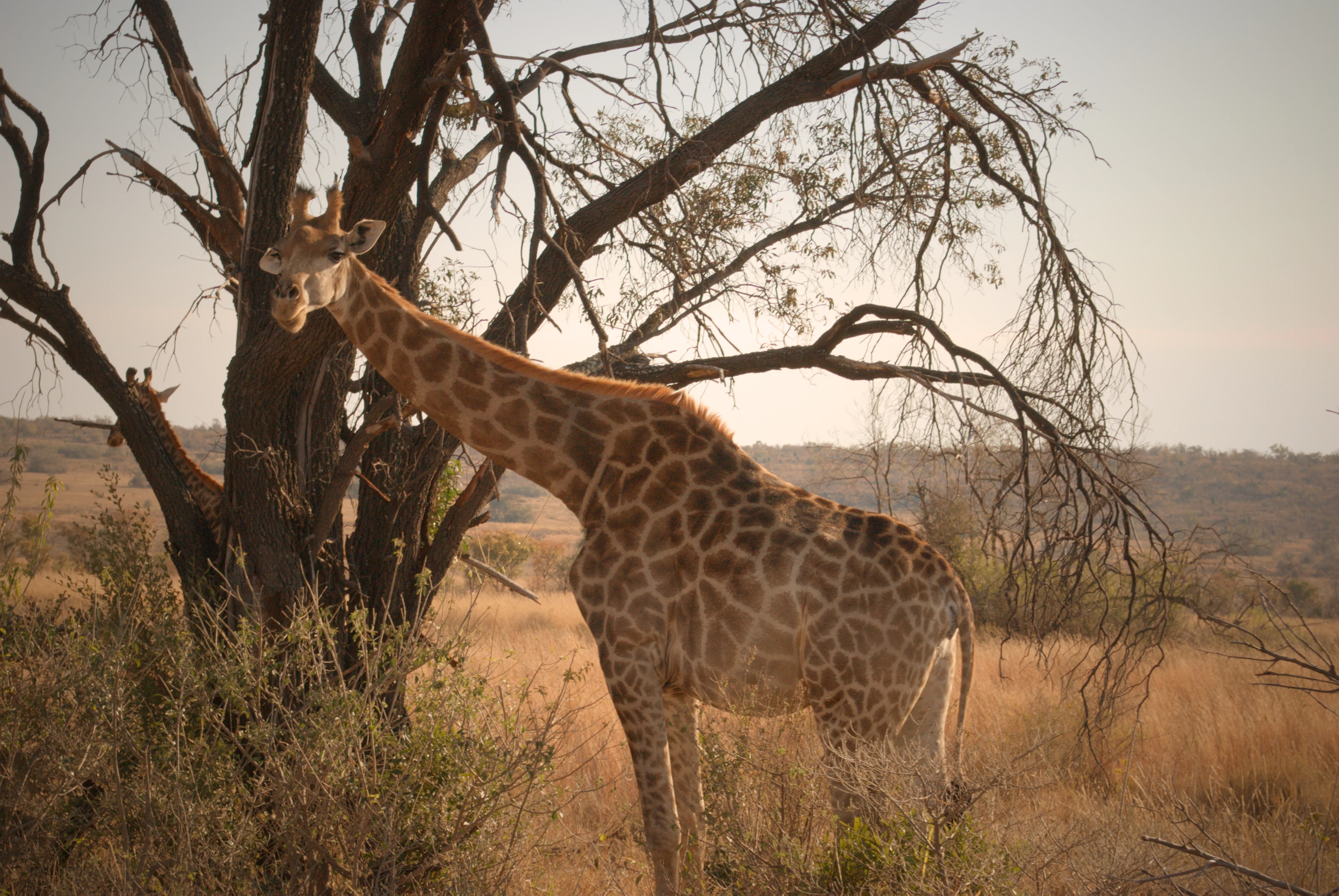
A side profile of a giraffe standing next to a large tree in a dry, grassy savannah field.
A giraffe standing in the dry savannah landscape of Welgevonden Game Reserve.

Welgevonden Game Reserve history and protected-area timeline

Welgevonden's identity as a modern game reserve is tied closely to the development of the Waterberg Biosphere Reserve, which was officially declared by UNESCO in 2001. This broader designation framed the region as a landscape of international conservation significance, and Welgevonden sits within the heart of that declared area, linking private conservation land to a wider set of biosphere goals.

The reserve itself was developed by consolidating former livestock and farming land into a single continuous protected block, restoring wildlife populations across habitats that had been reduced by decades of agricultural use. As part of this transition, species historically lost from the Waterberg, including lion, elephant, and white rhino, were reintroduced and given space to rebuild viable breeding populations. The reserve's name, derived from Dutch and meaning roughly "well found," reflects the early sense of discovery attached to this remote and rugged stretch of bushveld.

Over time, Welgevonden has grown into one of South Africa's leading examples of private, low-density conservation tourism. Its expansion coincided with a broader shift in the Waterberg away from large-scale ranching and toward ecologically informed land use, helping anchor the region as a destination that combines biodiversity protection with sustainable visitor experiences.

Welgevonden Game Reserve landscape and geographic character

The Waterberg mountains that define Welgevonden consist of ancient sandstone formations weathered into a striking mix of ridges, cliffs, and rounded summits. These geological foundations have been sculpted by millions of years of erosion into a landscape of dramatic relief, with steep kloofs cutting down through vegetated slopes and open plateaus crowning the higher elevations.

Elevation varies significantly across the reserve, beginning at around 1,080 metres in the northern low-lying sections and rising to approximately 1,800 metres in the southern uplands. This vertical range creates layered scenery in which forested valleys sit beneath exposed rocky ridges and grassy crowns, producing strong contrasts in vegetation and light across short distances.

The flatter upland areas support extensive grasslands that give the reserve a highveld character at its higher southern reaches, while the lower slopes and valleys remain unmistakably bushveld. Rivers and seasonal drainage lines thread through the kloofs, adding corridors of denser greenery, and the shifting textures of rock, grass, and woodland give the reserve an unusually varied visual identity for an area of its size.

Welgevonden Game Reserve ecosystems, habitats, and plant life

Welgevonden spans an ecological transition zone where Waterberg mountain habitat meets classic bushveld, producing a layered biological character that is unusual within South African private reserves. The overlap between lower-lying dry woodland and higher-altitude grassland creates conditions in which species typical of both ecosystems can coexist within a single protected landscape.

Vegetation on the reserve ranges from open grassland plateaus and afro-temperate scrub on the upper slopes to denser bushveld and riverine woodland in the sheltered valleys. This mosaic enables both grazers and browsers to find suitable habitat throughout the year, while also providing cover and foraging variety for predators and smaller carnivores.

Wetland areas and seasonal watercourses further increase the reserve's habitat complexity, sustaining amphibian populations and supporting birdlife during breeding seasons. The grasslands in the southern portion of the reserve have particular importance as breeding habitat for blue cranes, a species dependent on undisturbed open landscapes and a useful indicator of habitat health in the higher Waterberg elevations.

Welgevonden Game Reserve wildlife and species highlights

Welgevonden supports more than 50 mammal species, anchored by the presence of the Big Five and a strong population of white rhino that ranks among the largest of any private reserve in Africa. The reserve's mix of open plains and broken woodland supports healthy populations of antelope ranging from large eland to small duiker, providing a prey base that sustains healthy predator numbers.

Lion, leopard, and cheetah are regularly sighted on the reserve, and the rugged kloof structure of the Waterberg gives leopards in particular an unusually wide range of cover and denning habitat. Elephant, buffalo, and rhino move through both valley and plateau landscapes, demonstrating the functional connectivity of the reserve's habitat mosaic.

A distinctive feature of Welgevonden's wildlife profile is the presence of rarer and more secretive species. Brown hyena, aardwolf, pangolin, and aardvark all occur within the reserve, where they are most often encountered on nocturnal drives. Their continued presence is a strong indicator of low disturbance and intact ecological processes. Giraffe, warthog, bush pig, and sable antelope further broaden the mammalian character, while over 300 bird species, including seasonally nesting blue cranes in the south, add a significant avian dimension to the reserve's wildlife value.

Welgevonden Game Reserve conservation status and protection priorities

Welgevonden's conservation significance is rooted in its place within the UNESCO-designated Waterberg Biosphere Reserve, a framework that recognises the broader region's value as a connected landscape of high biodiversity and ecological importance. As a substantial private reserve embedded in this biosphere, Welgevonden contributes habitat and species recovery capacity to a regional conservation network stretching across more than 650,000 hectares.

The reserve is notable for the recovery of large mammals that had been lost from much of the Waterberg during the ranching era. White rhino in particular have thrived here, building one of the strongest private population strongholds in Africa, while lion, elephant, and buffalo populations reflect similar efforts to restore ecological completeness to the landscape. The reserve's varied terrain has provided resilient habitat against pressures that affect more uniform environments, supporting both grazers and predators in numbers that reflect functioning ecosystem processes.

Its private, low-density tourism model is itself part of the conservation approach. By keeping visitor numbers low and concentrating on small lodges, the reserve limits disturbance to wildlife, particularly the nocturnal and shy species that depend on quiet, intact habitat. This balance between protection, ecological restoration, and low-impact tourism is increasingly regarded as a key feature of successful private conservation in the Waterberg.

Welgevonden Game Reserve cultural meaning and human context

The Waterberg region carries a layered human history, with earlier indigenous communities and later European settler ranching both shaping the landscape that Welgevonden now protects. Many of the reserve's properties evolved from working farms, and the transition from livestock land to wildlife reserve represents a significant shift in how the land is valued and used.

The Dutch-derived name of the reserve itself reflects the linguistic inheritance of early European settlement in the region, while broader South African context frames Welgevonden within a national story of land reform, conservation expansion, and the rise of private game reserves as a major land-use category over recent decades.

Top sights and standout views in Welgevonden Game Reserve

Welgevonden's highlights centre on the combination of a strong Big Five presence with an unusually varied Waterberg landscape, ranging from forested kloofs to open high-altitude grasslands. The reserve's white rhino population, one of the largest of any private African reserve, is a defining conservation feature, while the regular presence of brown hyena, aardwolf, pangolin, and aardvark offers rare insight into the reserve's quieter ecological character.

Birdwatching is a strong secondary highlight, particularly in the southern grasslands where blue cranes breed early in the year, and across the broader reserve where more than 300 bird species have been recorded. Its malaria-free setting within a UNESCO Biosphere Reserve adds both practical and ecological significance to the experience.

Best time to visit Welgevonden Game Reserve

Welgevonden is open to visitors year-round, and its malaria-free status removes one of the seasonal considerations that affect many other northern South African reserves.

The dry winter months, typically from May through August, are often considered the most comfortable period for game viewing, when vegetation thins, animals concentrate around remaining water sources, and cooler temperatures make longer drives more pleasant. The wetter summer months, roughly November through March, bring greener landscapes and long grass that can make some sightings more challenging, but this is also the period when migratory bird species are present and blue cranes breed in the southern grasslands. Both seasons offer a distinctly different character of visit shaped by seasonal conditions in the Waterberg.
Monthly climate preview

Long-term monthly temperature and precipitation patterns recorded at representative park coordinates

Welgevonden Game Reserve Climate Normals and Annual Temperature Rhythm

Representative coordinate records show significant annual temperature variations and distinct precipitation shifts across the twelve-month cycle at Welgevonden Game Reserve. Examining the complete monthly climate normals provides deeper insight into long-term thermal averages and precipitation totals.
Annual mean20 °C
13 °C24 °C
Jan24°
Feb24°
Mar23°
Apr20°
May17°
Jun14°
Jul13°
Aug16°
Sep20°
Oct23°
Nov24°
Dec24°
Warmest month
January

24.4 °C

Coolest month
July

13.4 °C

Wettest month
January

2.8 mm/day

Driest month
August

0 mm/day

Park location guide

Geography guide, regional context, and park location map for Welgevonden Game Reserve

Welgevonden Game Reserve park geography, regions, and map view in South Africa

Understand where Welgevonden Game Reserve sits in South Africa through a broader geographic reading of the surrounding landscape, nearby location context, and its mapped position within the national park landscape.

How Welgevonden Game Reserve fits into South Africa

South Africa is the southernmost country in Africa, spanning 1.22 million km² with a population of over 63 million. The country operates with three capital cities, Pretoria (executive), Cape Town (legislative), and Bloemfontein (judicial), and is renowned for its biodiversity, national parks, and multicultural society.

Wider geography shaping Welgevonden Game Reserve in South Africa

South Africa occupies the southernmost region of Africa, with coastline along both the Atlantic Ocean to the west and the Indian Ocean to the east. The interior features elevated plateaus including the Highveld, with the Drakensberg escarpment marking the eastern highlands. The country shares borders with Namibia, Botswana, Zimbabwe, Mozambique, Eswatini, and Lesotho.

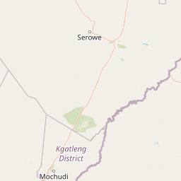
Map view of Welgevonden Game Reserve

Use this park location map to pinpoint Welgevonden Game Reserve in South Africa, understand its exact geographic position, and read its mapped placement within the surrounding landscape more clearly.

Pigeon | © OpenStreetMap contributors

Location context for Welgevonden Game Reserve

Limpopo

Explore protected area terrain, rugged kloof habitats, and Waterberg mountain views

Welgevonden Game Reserve Photos and Landscape Scenery Visual Guide

Visual records capture the distinctive topography, rocky ridges, and high-altitude grasslands defining Welgevonden Game Reserve. Examining these protected area landscapes reveals the diverse habitats and rugged terrain shaping the southern African bushveld ecosystem.

A side profile of a giraffe standing next to a large tree in a dry, grassy savannah field.

Park atlas

Compare adjacent mountain bushveld habitats and regional wildlife reserves.

Parks Near Welgevonden Game Reserve and Surrounding Protected Areas

Browsing other protected areas near Welgevonden Game Reserve reveals the ecological diversity of the wider Waterberg region. Comparing these nearby conservation landscapes provides valuable geographical context for southern African safari terrain.
Biosphere reserveLimpopo
Mapped location lies within the park boundary#1 closest

Northeast

Waterberg Biosphere: A Protected Sandstone Massif in Limpopo Province South Africa

Geology, mapping, and ecological zones of the Waterberg range

The Waterberg Biosphere stands as a major protected region in South Africa, formed by ancient sandstone layers sculpted into mesas and deep gorges. This massif bridges ecological zones from highland savanna to riverine habitats, anchoring a network of game reserves and wilderness areas through its distinctive geological and historical landscape identity.

Area
6,540.33 km²
Established
2001
Relief
Mountain
Climate
Subtropical
National parkLimpopo Province
About 19 km away#2 closest

Southwest

Marakele National Park: National Park Protected Landscape and Geographic Context

Explore its Limpopo Province regional setting and mapped boundaries.

Marakele National Park represents a vital protected national park within the diverse geography of Limpopo Province, South Africa. This entry provides detailed atlas-style information on its protected landscape, focusing on mapped geographic boundaries and its context within the regional natural terrain. It serves as a key resource for understanding the park's specific role as a conservation area and its place within the broader atlas of South African protected lands.

Area
670 km²
Established
1994
Relief
Mountain
Climate
Subtropical
Wildlife reserveLimpopo
About 59 km away#3 closest

South

Mabula Game Reserve: Protected Bushveld and Geographic Landscape Profile

Exploration of the Limpopo bushveld and wildlife habitat boundaries

Mabula Game Reserve provides a detailed look at the bushveld ecosystems of South Africa. Spanning 12,000 hectares in Limpopo, the reserve features a unique blend of rocky ridges, open savanna, and riverine woodlands. Its structural diversity creates a distinct natural corridor that serves as a focal point for understanding regional wildlife distribution and the transition zone between the Waterberg and the northern plains.

Area
120 km²
Scope
Terrestrial
A soft watercolor painting of a river flowing through a hilly, green valley with distant ridgelines under a pale sky.
Nature reserveLimpopo
About 62 km away#4 closest

Northeast

Lapalala Wilderness Nature Reserve: Geographic Atlas and Park Landscape Mapping

Protected bushveld terrain in the Limpopo province of South Africa

Lapalala Wilderness represents an influential private conservation landscape featuring over forty-eight thousand hectares of bushveld habitat. Gain insight into the reserve's structural diversity, including its sixty kilometers of priority river systems and distinct land types that define this protected territory in Limpopo.

Area
480 km²
Established
1981
Relief
Upland
Climate
Subtropical
Nature reserveLimpopo
About 71 km away#5 closest

South

Mabalingwe Nature Reserve: Protected Bushveld Geography and Terrain Analysis

Mapping the Limpopo reserve landscape and habitat features

Examine the 8,800-hectare landscape of Mabalingwe Nature Reserve. From its malaria-free bushveld habitat to its network of seasonal dams and mixed woodland terrain, this entry provides a clear look at the environmental context of this private Limpopo protected area.

Area
88 km²
Established
1989
Relief
Upland
Climate
Subtropical
Nature reserveLimpopo Province
About 90 km away#6 closest

Southeast

Nylsvley Nature Reserve: A Geographical Overview of Limpopo Province's Wetland Landscapes

Protected floodplain ecosystems and seasonal riverine terrain

Nylsvley Nature Reserve protects a vast, shallow floodplain and surrounding open woodland, creating a high-density conservation zone in the Limpopo Province. Its terrain is defined by the seasonal interaction of the Nyl River, extensive reedbeds, and unique botanical communities. This profile examines the reserve as a significant reference point for understanding the interplay between floodplain geography, savanna bushveld, and inland wetland habitats.

Area
40 km²
Established
1998
Relief
Lowland
Access
Access unknown
Wildlife reserveNorth West Province
About 107 km away#7 closest

South

Borakalalo Game Reserve: Protected Bushveld and Aquatic Landscapes in North West Province

Mapping a diverse South African wildlife reserve

Borakalalo Game Reserve features a distinct ecological setting within South Africa, combining woodland bushveld with the aquatic ecosystems of Klipvoor Dam. This protected area provides a habitat for varied mammal species and an extensive bird list, set against the backdrop of the interior plateau landscape in North West Province.

Area
130 km²
Relief
Upland
Access
Access unknown
Scope
Terrestrial
Nature reserveLimpopo
About 121 km away#8 closest

West

Atherstone Nature Reserve: Mapping the Savannah and Bushveld of Limpopo, South Africa

A collaborative conservation landscape of plains and grasslands

Atherstone Nature Reserve features a distinctive blend of classic bushveld thickets and open Kalahari-influenced grasslands. Situated in Limpopo, the 23,500 hectare protected area serves as a primary hub for large mammal conservation and savannah ecology, offering researchers and atlas enthusiasts a focused look at South Africa’s northern provincial wilderness.

Area
235 km²
Established
1994
Relief
Upland
Climate
Subtropical

Common questions about visiting, size, designation, and location context for Welgevonden Game Reserve

Welgevonden Game Reserve FAQs for park facts, access, geography, and protected area context

Find quick answers about Welgevonden Game Reserve, including protected-area facts, park geography, trail and visitor context, and how the park fits into its surrounding country and regional landscape.
MoriAtlas Explorer

Continue Your Protected Areas Search Across the Global Atlas

Deepen your exploration by continuing the structured search for national parks and protected areas worldwide. Utilize the comprehensive filtering capabilities to compare different conservation landscapes and refine your understanding of global park geography. Discover more about the distribution and characteristics of protected natural areas.

Global natural geography