
Why Whitireia Park stands out
Whitireia Park is best known for Whitireia maunga itself, a sacred mountain for Ngāti Toa Rangatira that is named in the iwi's pepeha and recognised as one of two sacred names in the Māori world said to have come from the gods. The reserve is also distinguished by the dramatic coastal headland above Porirua Harbour, where open grasslands, remnant kohekohe forest, dune plantings, and restored wetlands all meet within a compact, easily walkable landscape. Its layered identity sets the park apart from purely scenic reserves. The headland combines deep Kāti Toa cultural significance, the material traces of pre-European Māori fishing settlements, an almost two-million-year earthquake uplift history, a continuously operating national AM radio transmission site, and an evolving restoration program following the destructive 2010 wildfire. Few New Zealand reserves carry such a dense overlap of natural, broadcasting, and iwi history within walking distance of a major urban centre.
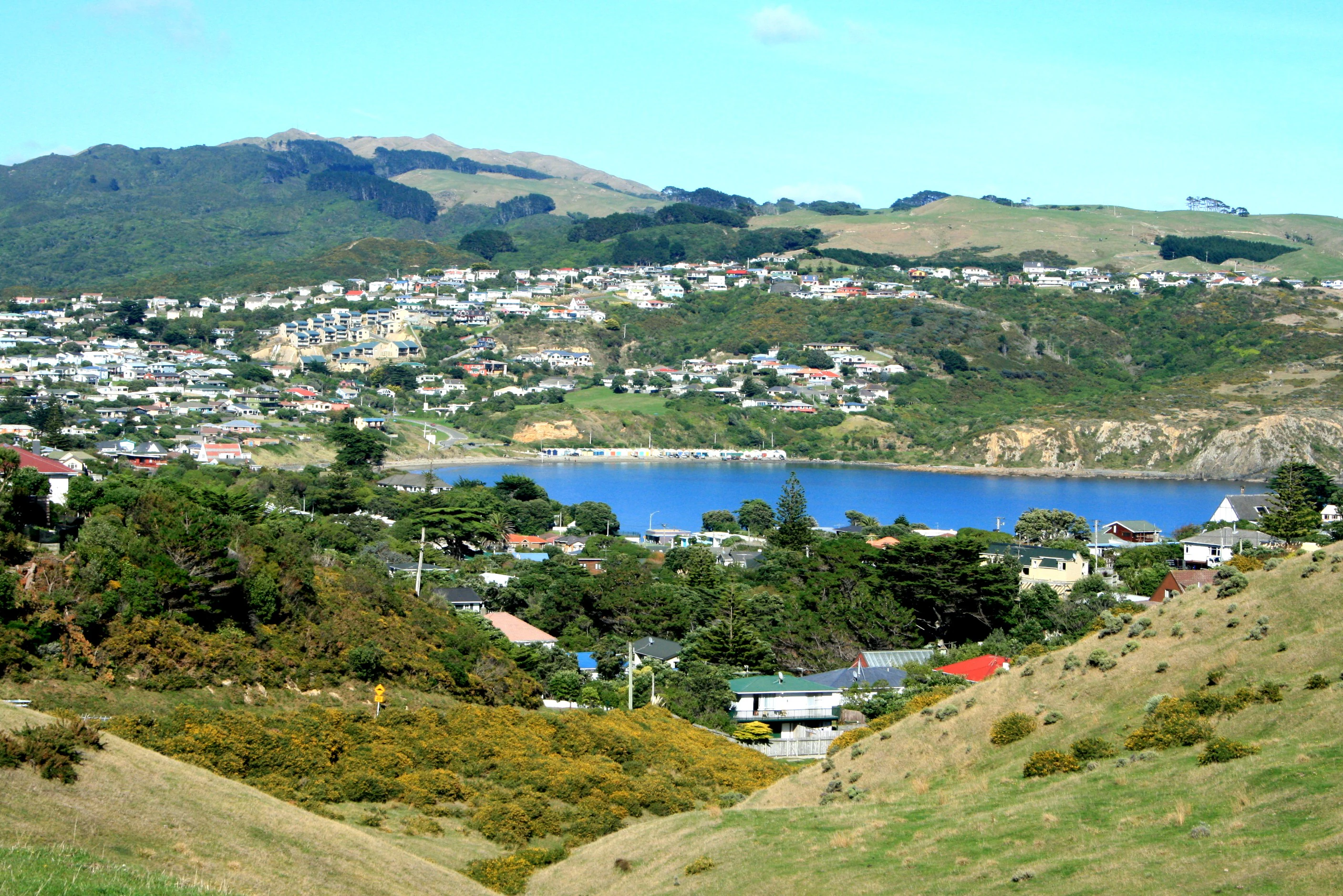
Whitireia Park history and protected-area timeline
Whitireia Park holds one of the most layered histories of any small coastal reserve in the Wellington Region. Long before formal protection, the headland was a place of continuous Māori occupation. The Polynesian explorer Kupe is believed to have landed just south of Tītahi Bay at Komangarautawhiri, and the anchor stone of his canoe was long respected by local iwi before being taken to Te Papa Tongarewa. In the early nineteenth century, Ngāti Toa took the area under Te Rauparaha, drawn by its strategic position near the early European trading ports around Cook Strait.
A decisive moment in the park's story came in 1847 and 1848, when Ngāti Toa arranged the gift of approximately 200 hectares at Whitireia to Bishop George Selwyn, with the expectation that an Anglican college would be established for Māori children. Because Māori land could not be transferred directly to the church at the time, the land was first vested in the Governor and then passed to the Bishop under the Porirua Trust. When the promised college did not materialise, the gift became the subject of Wi Parata v Bishop of Wellington, an 1877 Supreme Court case in which Chief Justice James Prendergast described the Treaty of Waitangi as a "simple nullity," setting a foundation for Treaty jurisprudence that would shape New Zealand law for decades.
The land's modern reserve character emerged in 1935, when the New Zealand Broadcasting Service purchased about 40 hectares for the Titahi Bay Transmitter. The new AM station, launched by Prime Minister Michael Joseph Savage in 1937, became New Zealand's national emergency broadcaster. A 212 metre antenna erected in 1979 was briefly the tallest man-made structure in the country. The reserve itself was formally established in 1976 by the Porirua College Trust Board and the Broadcasting Corporation of New Zealand, with Ngāti Toa support and a management plan finalised in 1978.
The history of Whitireia closed a major chapter in 2014 with the Ngāti Toa Rangatira Claims Settlement Act. The settlement recognised the iwi's longstanding relationship with the headland and vested key sites including the Whitireia Urupā, Te Onepoto Bay, and Onehunga Bay back in Ngāti Toa Rangatira, while establishing the joint Whitireia Park Board. In October 2025, Ngāti Toa purchased the remaining 53 hectares from Radio New Zealand, completing the reunification of Whitireia maunga under iwi ownership for the first time since 1848.
Whitireia Park landscape and geographic character
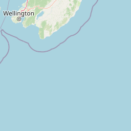
Whitireia Park occupies a strong, hilly headland that pushes north into Te Awarua-o-Porirua Harbour, defining the boundary between Tītahi Bay and the broader inlet. The terrain is shaped by long-term earthquake uplift, which has raised successive coastal terraces out of the sea over the past one or two million years. The most recent major rupture, the 1855 Wairarapa earthquake, was directly responsible for the marshlands at Te Onepoto Bay, the elevated western coastline beaches, and the shallowing of the harbour that ended its use by large sailing ships.
The surface of the headland is dominated by open coastal grasslands, with grazing long used as a fire management tool across much of the reserve. Scattered through this open landscape are patches of remnant coastal kohekohe forest, including a roughly two hectare stand that contains rare Streblus banksii trees and Doodia australis fern. The wetland behind the Onehunga Bay carpark is dominated by toetoe and flax, while the bay's dune fringe is being actively planted with spinifex, pingao, shore spurge, sand tussock, sand daphne, and native iris.
The park's highest point is Whitireia or Mount Couper, at 104 metres, named jointly for the mountain's long Māori identity and for William Couper, a Scottish-descended settler who ran a sawmill and shipyard on the harbour in the nineteenth century. From this elevated spine, walkers look west to Mana Island and the South Island, east to Te Awarua-o-Porirua Harbour, and south over Tītahi Bay itself, making the headland both a defining landmark and a vantage point for the surrounding harbour landscape.
Whitireia Park ecosystems, habitats, and plant life
The ecological character of Whitireia Park is defined by the meeting of several contrasting habitats within a small area. Earthquake uplift has exposed older coastal landforms and created shallow wetland basins, while prolonged grazing and a major 2010 wildfire have shaped the regenerating plant communities visible today. The result is a coastal reserve where open grassland, low forest remnants, dune margins, and freshwater wetland sit within a few hundred metres of each other.
Vegetation spans coastal forest remnants, regenerating dune flora, and wetland margins. The remnant kohekohe forest is unusual for its coastal Wellington setting and includes rare trees and ferns of regional interest. Flax and toetoe dominate the Onehunga Bay wetland, while the dune plantings deliberately pair hardy native sand-binding species like spinifex and pingao with sand daphne, shore spurge, and native iris to rebuild habitat for native insects and lizards. Replanting programs continue across the headland following the 2010 fire, gradually restoring a more continuous native plant cover.
Wildlife patterns reflect this mosaic habitat structure. Te Onepoto Bay supports waterbirds across its calm marsh margins, while the wetland inland hosts wetland species adapted to denser flax and toetoe cover. The dune plantings provide refuge for small native fauna, and the broader harbour views position the reserve as a useful vantage point for observing seabirds moving through Te Awarua-o-Porirua Harbour.
Whitireia Park wildlife and species highlights
Whitireia Park's wildlife is concentrated around its wetland margins and dune restorations rather than in the open grazed grasslands of the headland. Te Onepoto Bay is the reserve's most visible bird habitat, regularly hosting kingfishers, white-faced herons, little shags, black shags, royal spoonbills, black-backed gulls, and shore plover, which use the shallow marsh created by the 1855 earthquake uplift.
The wetland behind the Onehunga Bay carpark supports a different bird community shaped by flax and toetoe cover. Pūkeko and paradise ducks are common here, alongside other wetland species that move between the bay, the inland valley, and the broader harbour. Restored dunes around Onehunga Bay are intentionally replanted with sand-binding natives to rebuild habitat for native insects and lizards, gradually re-establishing the small fauna that once occupied the headland's coastal margins.
Across the reserve, regeneration work, dog-leash management at Onehunga Bay, and active replanting after the 2010 wildfire continue to influence how wildlife re-establishes across the headland, making the park an ongoing example of coastal restoration rather than a static habitat.
Whitireia Park conservation status and protection priorities
Whitireia Park's conservation role centres on protecting a rare coastal habitat mosaic close to one of New Zealand's most urbanised regions. Remnant kohekohe forest, including rare Streblus banksii trees and Doodia australis fern, gives the reserve a particular botanical value that would be difficult to replace if lost. The dune and wetland complexes at Onehunga Bay and Te Onepoto Bay, both originating from earthquake uplift, are protected under the park's joint iwi and regional council governance.
Wildfire has been one of the defining conservation pressures on Whitireia Park. A major February 2010 fire destroyed much of the headland's vegetation, prompting ongoing replanting programs organised through working bees and supported by the Department of Conservation, Greater Wellington, and Ngāti Toa. Earlier conservation thinking also used grazing as a fire-risk reduction tool across much of the park.
The 2014 Ngāti Toa Rangatira Claims Settlement Act gave the conservation framework a stronger cultural foundation. Several culturally sensitive sites, including the Whitireia Urupā, Te Onepoto Bay, and Onehunga Bay, were vested in Ngāti Toa Rangatira, while the Whitireia Park Board was established to oversee the recreation reserve as a joint iwi and regional council entity. The 2025 repurchase of the former Radio New Zealand land closed a long-running gap in this framework, returning all of Whitireia maunga to iwi ownership for the first time in 177 years.
Whitireia Park cultural meaning and human context
Whitireia Park carries an unusually rich cultural weight for a small urban-edge reserve. Whitireia maunga is one of the most important identity markers for Ngāti Toa Rangatira, named in the iwi's pepeha alongside Raukawa (Cook Strait), Tainui (the ancestral waka), and Te Rauparaha (the paramount chief). According to kaumātua Ihakara Arthur, Whitireia is one of only two names in Māoridom believed to have come directly from the gods, brought from Hawaiki by the ancestors.
Pre-European occupation of the headland is reflected in surviving kumara-growing terraces visible above the cliffs and in oral traditions about Kupe's landing near Komangarautawhiri and the anchor stone later held at Te Papa. After Ngāti Toa took the area in the 1820s under Te Rauparaha, the headland became a strategic foothold near the early European trading ports around Cook Strait and continued to support a fishing and gardening economy well into the 1840s.
The 1847 to 1848 gift of land to Bishop Selwyn, intended to fund a Māori college, became a landmark moment in New Zealand legal history through the Wi Parata case of 1877 and Chief Justice Prendergast's controversial characterisation of the Treaty of Waitangi. That history still resonates across the park today, and the Ngāti Toa Rangatira Claims Settlement Act 2014 explicitly recognised the headland's enduring cultural importance, restoring key cultural sites to iwi ownership and embedding Ngāti Toa in the ongoing governance of the reserve.
Top sights and standout views in Whitireia Park
Whitireia Park's strongest distinguishing features are concentrated within a small, walkable coastal landscape. The Whitireia maunga itself, named in the Ngāti Toa pepeha and recognised as one of the sacred names from the gods, anchors the reserve's identity. The active tectonics of the Wellington region are unusually legible here, with earthquake-shifted beaches, wetlands, and terraces offering a compact record of long-term uplift that is rarely visible so close to a major city.
The reserve also stands out for its layered modern history. A continuous AM radio transmission site, including a once nationally tallest antenna, occupied part of the park for nearly ninety years, while the 1847 to 1848 land gift that shaped Wi Parata v Bishop of Wellington remains a touchstone for understanding Treaty of Waitangi jurisprudence. The 2014 settlement and the 2025 repurchase of the remaining Radio New Zealand land close a long arc of return. Layered on top of all this is an active restoration story, with the 2010 wildfire and its replanting program still visibly reshaping the headland's vegetation.
Best time to visit Whitireia Park
The character of a visit to Whitireia Park shifts noticeably with the seasons, though the reserve is accessible year-round on foot. Summer and early autumn tend to bring the longest opening hours for the vehicle gates, calmer sea conditions for swimming and diving at Tītahi Bay, and the warmest conditions for completing the exposed Onepoto loop track. Spring often offers milder walking weather and active bird life around Te Onepoto Bay and the Onehunga Bay wetland as waterbird numbers fluctuate.
Winter brings brisk sea winds across the headland and shorter daylight, but also quieter tracks and sharper visibility over Mana Island and the South Island. Because much of the park's appeal depends on coastal views and the condition of the wetland and dune plantings, clear weather after wind or rain tends to be especially rewarding. Visitors should be aware that fire risk shapes access: the park can be closed at short notice during dry periods, and fire and fireworks are banned throughout the reserve.