

Why Wiestetal stands out
Its naturally meandering lowland stream, the Wieste, which forms the spine of a connected system of alder-ash gallery forest, wet grassland, sedge mires, and former sand quarry ponds, providing habitat for rare stream fish, dragonflies, the Eurasian otter, and foraging black storks.
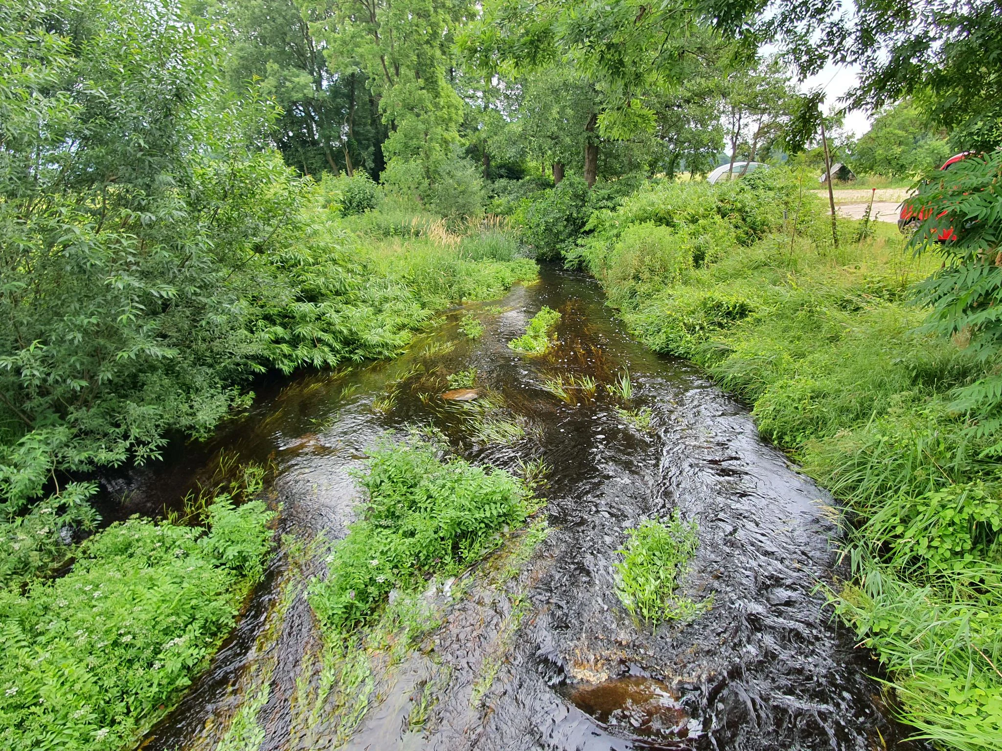
Wiestetal landscape and geographic character
The Wiestetal landscape is shaped by the low, gently undulating terrain of the North German geest. Between Mulmshorn and Ottersberg, the Wieste has carved a shallow valley through sandy glacial deposits, leaving small ridges of dry geest on either side and a broad, flat valley floor.
The stream itself is the dominant scenic feature. It flows in tight, naturally formed meanders with undercut banks, gravel and sand bars, and pools. Around Clüversborstel and further upstream, the open water alternates with shading alders, reed fringes, and emergent water plants that fill the channel during the growing season. This gives even a short stretch of the valley a strongly varied, almost intimate visual character.
Surrounding the stream, the valley floor carries a layered mosaic of habitats. Closest to the water sit the alder-ash galleries, reed beds, and tall herb fringes. Beyond them lie wet grassland mosaics, with sedge mires, swamp patches, and small areas of bog woodland scattered across the slightly more elevated floodplain margins. Further out, on the dry geest slopes, oak-dominated mixed woodland takes over, sometimes giving way to open farmland at the reserve boundary.
A distinctive secondary element of the landscape is found southwest of Schleeßel, where former sand quarry pits have been flooded to create a chain of small ponds. These ponds, managed extensively, add open water, soft banks, and wet fringe vegetation to the otherwise stream-dominated scenery, and visually mark a transition zone between the natural valley and the agricultural landscape to the south.
Wiestetal ecosystems, habitats, and plant life
The reserve protects a coherent lowland stream valley ecosystem rather than a single habitat type. Its nature is fundamentally defined by the interaction between the meandering Wieste, its floodplain, and the surrounding geest.
Streamside and aquatic habitats are central. The water itself supports submerged vegetation and serves as habitat for rare fish such as the spined loach and brook and river lampreys. Dragonflies, including the Green Clubtail, reproduce along the slow and moderately flowing stretches, while the Eurasian otter uses the Wieste as a movement corridor through the wider agricultural landscape.
Vegetation forms a clear zonation. Closest to the stream grows a near-continuous gallery of alder and ash forest, regularly flooded and rich in decomposing leaf litter. Landward of this, reed beds and tall herb fringes give way to wet meadows maintained through low-intensity grassland use. Further into the floodplain, large and small sedge communities, swamp pockets, and isolated bog woodland patches create small-scale structural diversity. On the slightly raised and drier margins, oak-mixed forests replace the wet communities, providing a transition to the surrounding geest.
The ponds in the former sand quarry area southwest of Schleeßel add another habitat layer, combining open water, shallow banks, and fringing marsh communities that complement the stream-based habitats elsewhere in the reserve. The overall effect is a valley in which water, soil moisture, woodland, and grassland form a tightly linked ecological gradient.
Wiestetal wildlife and species highlights
The Wiestetal's fauna is closely tied to the structure of the stream and its wet surrounding habitats. Fish are a key focus of the reserve's conservation role: the Wieste hosts the spined loach (Steinbeißer), the river lamprey (Flussneunauge), and the brook lamprey (Bachneunauge), all of which depend on clean, well-oxygenated gravelly stretches of running water.
Invertebrate life is similarly stream-centered. Dragonflies are prominent along the river, with the Green Clubtail (Grüne Flussjungfer) among the species recorded in the valley. Reed beds, sedge mires, and meadows provide additional breeding and feeding habitat for a broader community of wetland insects.
Among mammals, the Eurasian otter (Fischotter) is one of the most ecologically significant species. The Wieste functions not only as habitat but also as a migration corridor, allowing otters to move between larger river systems and to access suitable foraging areas further along the valley.
The reserve's woodlands and wet grasslands also support larger birdlife. The black stork (Schwarzstorch) uses the valley as a feeding habitat, taking advantage of the stream, wet meadows, and damp woodland edges. Other species typical of mixed lowland forests, reed beds, and wet meadows are likely to be present within the mosaic, reinforcing the valley's role as an integrated wildlife corridor in an otherwise agricultural region.
Wiestetal conservation status and protection priorities
Wiestetal carries one of the more layered conservation statuses of any small reserve in Lower Saxony. It is a national nature reserve (Naturschutzgebiet) under the designation NSG LÜ 295, placed under protection on 15 January 2013. Its IUCN category is IV, designating it as a Habitat/Species Management Area, a framework that emphasizes targeted habitat management alongside protection.
A defining feature of the reserve is its relationship with the European Habitats Directive. About 340 hectares of the 382-hectare reserve overlap with the larger FFH site "Wiestetal, Glindbusch, Borchelsmoor", designated in 2004. The 2013 national designation was made specifically to allow the two districts, Rotenburg (Wümme) and Verden, to meet their obligation to also secure this FFH area at the national level. This means that even though the reserve is small and locally grounded, its protection logic is closely tied to the EU Natura 2000 network.
From an ecological standpoint, the reserve matters because it preserves a near-natural meandering stream and its connected gallery forest within an intensively used agricultural region. Wet meadows, reed beds, sedge mires, and bog woodland remnants maintain habitat continuity that supports species dependent on running water and on seasonally wet conditions. The carefully managed ponds in the former sand quarry southwest of Schleeßel add a further element of habitat diversity and are kept under low-intensity management.
Management of the reserve falls under the responsible lower nature conservation authorities of the two districts, with the NLWKN, Lower Saxony's state agency for water management, coastal protection, and nature conservation, as the overarching authority. In several villages, portions of the reserve are additionally marked as nature experience areas, indicating a deliberate intent to combine strict protection with public environmental education.
