

Why Wilhelmsglücksbrunn Nature Reserve stands out
Wilhelmsglücksbrunn is best known for its combination of a near-natural stretch of the Werra river, traditionally grazed floodplain meadows, and small inland salt-influenced habitats fed by natural brine (Sole) springs. These saline seeps give the area a botanical character unusual for inland Thuringia, supporting halophytic vegetation alongside wet meadows, reed beds, and the wet "Nesselbusch" depression. The reserve is also recognized as a key refuge for meadow-breeding waders such as snipe, lapwing, and whinchat, and as an important staging area for migratory waterbirds moving along the Werra valley. Its position within the "Grünes Band" ecological corridor along the former inner-German border strengthens its role as a stepping stone for biodiversity conservation.
Wilhelmsglücksbrunn Nature Reserve history and protected-area timeline
The Wilhelmsglücksbrunn area has a long industrial and cultural history tied to its saline springs. Salt production at the site is first documented in a 1426 charter, in which Landgrave Frederick the Peaceful granted brine-boiling rights to four citizens of Creuzburg, on condition that they pay taxes and duties to the princely chamber. The rights were regranted in 1452 by Duke Wilhelm of Saxony, but the salt works were destroyed during the German Peasants' War of 1525 and remained idle for about two hundred years because the operation was not profitable.
In 1726, Duke Johann Wilhelm of Saxe-Eisenach rebuilt the saline and named it "Wilhelmsglücksbrunn." With new borings and more modern technology, the salt works operated successfully for more than a century before salt production was finally halted in 1843. After that, the brine was used unsuccessfully for therapeutic purposes; a spa association formed in 1874 in Creuzburg failed to attract lasting interest, and a later joint venture by the saline's owner Kommerzienrat Nikolaus von Dreyse, the city of Eisenach, and other shareholders piped the water from the main spring, now called the Karolinenquelle, to Eisenach's Kartausgarten for drinking and bathing cures. That spa venture collapsed during World War I and the global economic crisis, and the curative operation closed in 1938.
Ecological protection of the floodplain began much later. After provisional safeguarding between 1990 and 1995, the Werra floodplain at Wilhelmsglücksbrunn was formally designated as a nature reserve by the Thüringer Landesverwaltungsamt in September and October of 2000. The reserve was subsequently incorporated into the EU Birds Directive area covering the Werra floodplain between Breitungen and Creuzburg, which was reported to the European Commission in 2007.
Wilhelmsglücksbrunn Nature Reserve landscape and geographic character
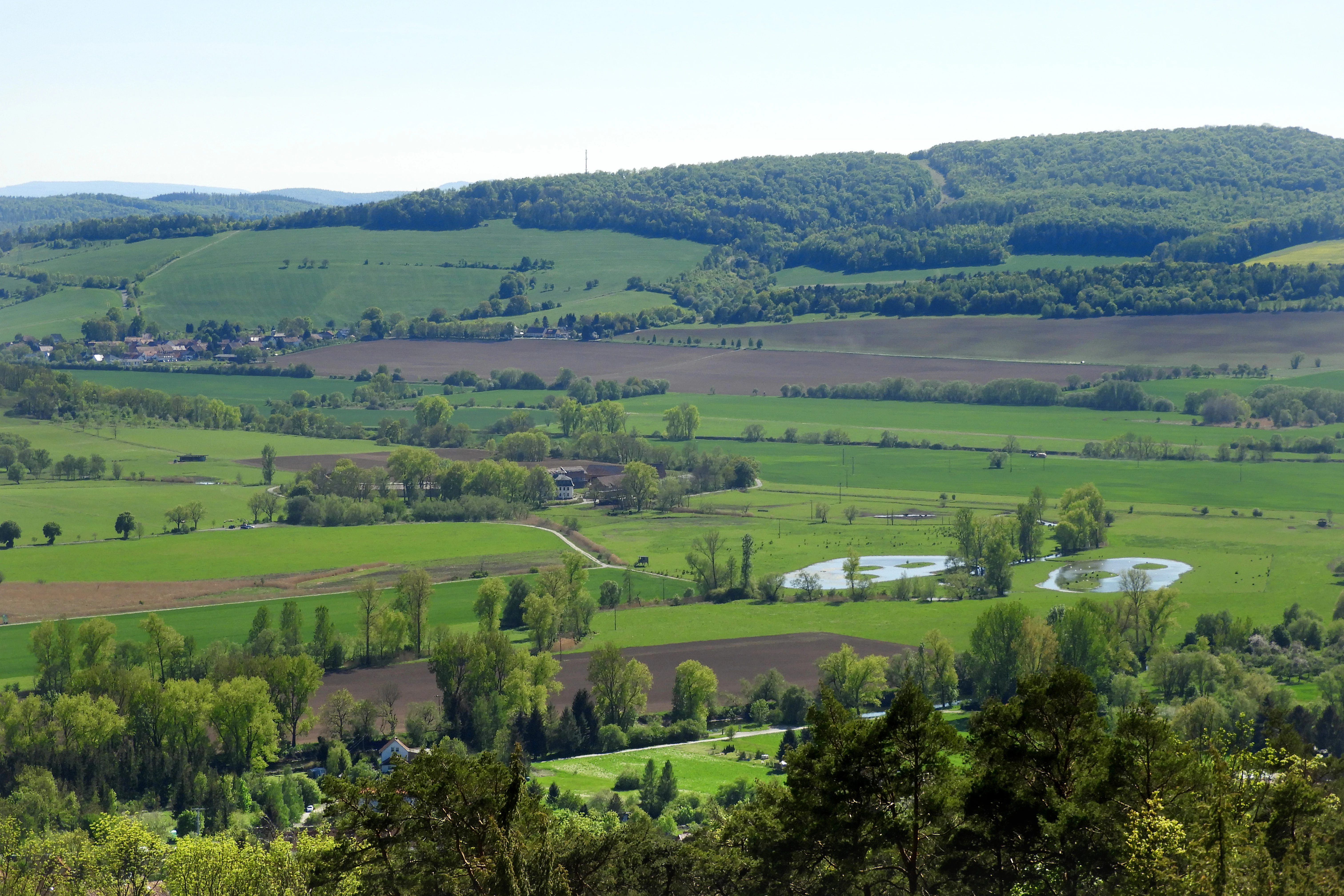
The protected landscape is a low-elevation, almost level floodplain segment of the Werra in western Thuringia, sitting between roughly 189 and 201 meters above sea level. The valley opens into a basin-like widening near the Creuzburger Werradurchbruch, where the Werra flows in a channel around thirty to thirty-five meters wide. Drainage ditches cross the reserve, designed both to drain the historically wet meadows and to convey excess floodwater.
To the west the area borders the Netra-Ifta valley and the southern Ringgau, while to the east it transitions into the Creuzburg-Eisenach graben zone. Geologically, the reserve sits above the Creuzburg graben fault system, through which saline groundwater rises from Upper Buntsandstein salt deposits; salt seeps give small areas of the floodplain a locally brackish, halophytic character that is unusual this far inland. The "Nesselbusch," a shallow wet depression at the southeastern edge of the Aue, adds a second, more enclosed landscape element of reed, sedge, and tall-herb communities.
Wilhelmsglücksbrunn Nature Reserve ecosystems, habitats, and plant life
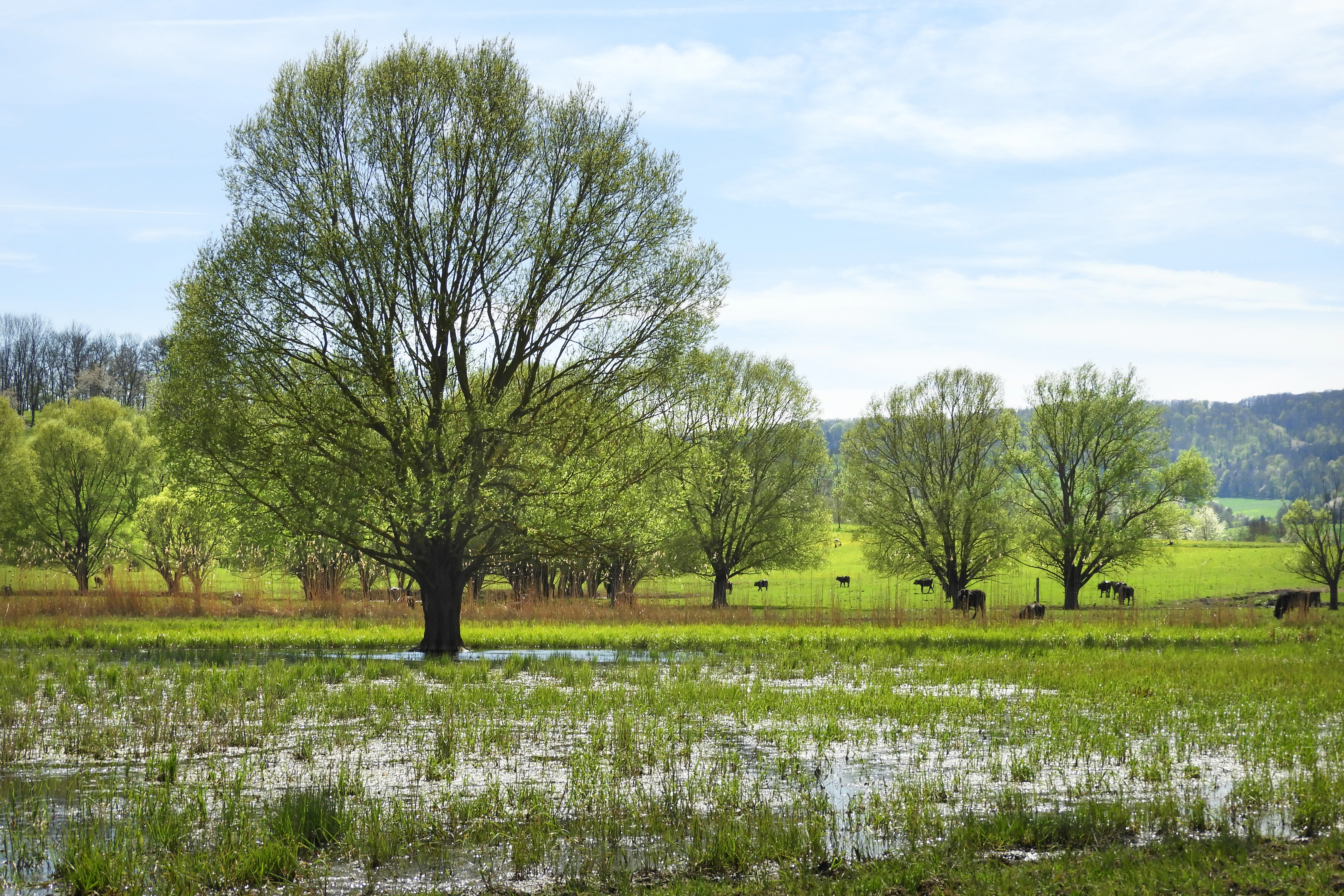
Ecologically, Wilhelmsglücksbrunn is shaped by the interplay of a near-natural river, regular flood pulses, artificial drainage, and small saline seeps. This combination has produced a varied floodplain vegetation complex, characterized by plant scientists of the FFH management plan as extensive strawberry-clover creeping bentgrass flood meadows, dotted with salt-bush communities and locally enriched by species such as the lesser centaury, sea aster, and various Chenopodium and Atriplex goosfoots.
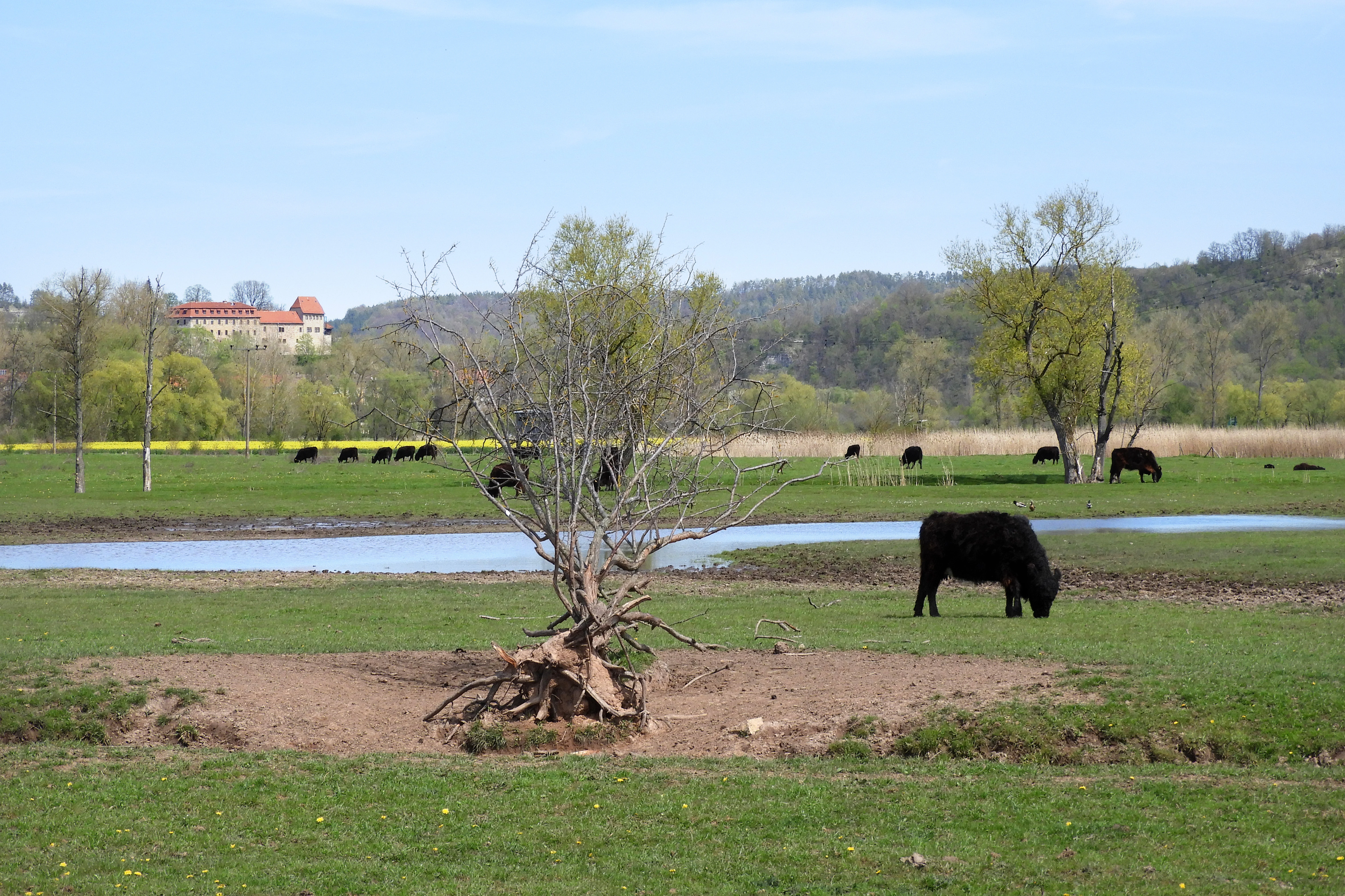
The wet depressions support knotted foxtail grasslands with slender centaury and fox sedge stands, while small salt-influenced patches carry Salzbinsen (salt rush) vegetation. The Nesselbusch sub-area is dominated by common reed stands, slender sedge communities, tall-herb vegetation, and grassland fallows. Mowing pastures dominate the wider grassland matrix, and grazing by Galloway cattle, horses, and water buffalo is used as the main tool to keep the open habitats suitable for ground-nesting birds and amphibians.
Wilhelmsglücksbrunn Nature Reserve wildlife and species highlights
The Werra floodplain at Wilhelmsglücksbrunn is recognized primarily as a key site for meadow-breeding birds and for migratory waterfowl. Field surveys have confirmed the presence of species such as common snipe, whinchat, northern lapwing, great grey shrike, black kite, and meadow pipit, while conservation assessments also highlight the area as important for bluethroat, common kingfisher, grey partridge, marsh harrier, red kite, yellow wagtail, river warbler, barn owl, white stork, and corncrake.
Bird inventory work in the surrounding Werra valley Birds Directive site additionally stresses the importance of the area for kingfisher, goosander, little ringed plover, greylag goose, garganey, water rail, little and common moorhens, little bittern, marsh harrier, black-headed gull, snipe, corncrake, lapwing, whinchat, meadow pipit, bluethroat, melodious warbler, river warbler, and black kite, and as a resting and wintering area for waders, ducks, bean and white-fronted geese, whooper swan, cormorant, spotted crake, little gull, black tern, black stork, grey and great egrets, osprey, and hen harrier.
Among other animal groups, the pool frog is considered a notable amphibian find. Grasshopper surveys recorded moisture-loving species such as the short-winged conehead and the large marsh grasshopper, butterfly surveys in the 1990s documented only a limited set of common day-flying species, and four stillwater dragonfly species have been recorded in the Nesselbusch area.
Wilhelmsglücksbrunn Nature Reserve conservation status and protection priorities
The formal conservation goal for Wilhelmsglücksbrunn is to preserve a relatively near-natural section of the Werra including its banks and the adjoining floodplain, and to protect the brackish and freshwater habitats on which the area's fauna depends. Specific objectives include safeguarding extensively used grasslands with their ditches and tall-herb communities, protecting the saline springs and their associated halophytic plant communities (some of which are considered threatened), and preserving the Nesselbusch sub-area's reed, sedge, and tall-herb vegetation against disruptive change.
Beyond its national designation, the reserve lies entirely within the EU Birds Directive site "Werra-Aue zwischen Breitungen und Creuzburg" (roughly 2500 hectares), and the river channel through the Aue also belongs to the Natura 2000 FFH site "Werra bis Treffurt mit Zuflüssen." The Werra-Aue here is the northernmost sub-area of the larger Birds Directive site and contributes stepping-stone habitat within the "Grünes Band" National Nature Monument, a corridor along the former inner-German border declared by the Thuringian state parliament in November 2018 to safeguard biodiversity across regional boundaries.
Wilhelmsglücksbrunn Nature Reserve cultural meaning and human context
The Wilhelmsglücksbrunn estate and its saline works have shaped local identity for centuries. The salt springs were first used industrially in the early fifteenth century, and the modern saline was built in 1726 and named for the founding duke of Saxe-Eisenach; salt production continued on the site for more than a century. After salt production ended in 1843, the brine was marketed for rheumatism, gout, and chronic skin conditions, and a piped cure enterprise linking the main spring, the Karolinenquelle, to a spa pavilion in Eisenach operated until 1938.
The historic manor house, which had fallen into disrepair, was extensively renovated in the early 2000s and now accommodates a certified organic hotel with a restaurant and the café "Saline." The same owners run ecological agriculture, a cheese-making operation, and an on-site farm shop, continuing a long tradition of using saline-influenced floodplain land for grazing and food production. The cultural layer is complemented by the presence of long-distance pilgrimage and hiking routes such as the Elisabethpfad, Lutherweg 1521, and Werra-Burgen-Steig, as well as the Werratal cycling route, all of which pass through or beside the reserve.
Top sights and standout views in Wilhelmsglücksbrunn Nature Reserve
Wilhelmsglücksbrunn stands out for its rare, in Thuringia, combination of near-natural river, traditionally grazed floodplain meadows, and active saline springs that create small inland halophytic patches. The reserve provides an important breeding and resting refuge for meadow waders and migratory waterfowl, including snipe, lapwing, whinchat, black kite, and white stork, and is a stepping-stone site within the larger Werra valley Birds Directive area and the Grünes Band National Nature Monument.
Visitors encounter a layered landscape shaped by centuries of human use, from medieval salt-boiling rights and the eighteenth-century Wilhelmsglücksbrunn saline to a renovated organic estate with café and farm shop, traversed by long-distance pilgrimage trails and the Werratal cycling route.
Best time to visit Wilhelmsglücksbrunn Nature Reserve
Because the reserve's value lies in its floodplain meadows, wetland habitats, and birdlife, the late spring and early summer months tend to bring the most active breeding-bird displays and lush meadow vegetation, while autumn and winter bring migratory and wintering waterfowl into the Werra valley. Wet conditions, seasonal flooding, and the saline seeps give the Aue a different atmosphere across the year, but visit timing should always be balanced against the sensitivity of meadow-nesting birds and the protection status of the site.
