Mori Atlas logo
Protected areaWolkberg Wilderness Area

Mapping the mist-belt forests and mountain terrain of South Africa's diverse wilderness reserve

Wolkberg Wilderness Area: Exploring the Rugged Quartzite Landscapes of the Limpopo Escarpment

Wolkberg Wilderness Area stands as a significant protected massif within South Africa's Limpopo Province, defined by its complex quartzite ridges and deep forested valleys. This wilderness reserve preserves a vital ecological transition between the highveld plateau and the eastern lowveld, supporting rare Afromontane forest patches and mountain streams. Through this detailed atlas, examine the boundaries, rocky topography, and unique plant communities that characterize this remote mountain range.

wilderness areaAfromontane forestmist-beltmountain reserveLimpopobirdwatching

Wolkberg Wilderness Area

Protected area

Park overview

Structured park overview, official facts, and landscape profile for Wolkberg Wilderness Area

Wolkberg Wilderness Area park facts, protected area profile, and essential visitor context

Review the core facts for Wolkberg Wilderness Area, including designation, size, terrain, visitor scale, habitats, and operating context in one park-focused overview.

About Wolkberg Wilderness Area

Wolkberg Wilderness Area is one of the quieter but ecologically significant protected areas in South Africa's north-eastern interior. It sits within the Wolkberg, a quartzite-laden range that forms a transitional bridge between the lowveld plains to the east and the highveld plateau to the west. Although far less famous than the dramatic peaks of the central Drakensberg, the Wolkberg hosts a richer and more humid forest flora because it catches moisture drifting in from the Indian Ocean.

Within the reserve, altitude, geology, and climate combine to produce a varied patchwork of habitats. Steep quartzite ridges, rocky boulder slopes, Afromontane forest patches, and open grassy crests are all present within a relatively compact area. The forest belts are concentrated along the drainage lines and the deeper valleys, where the Mohlapitse River and its tributaries maintain a continuous canopy of indigenous trees, ferns, and shrubs. Above these forested valleys, the terrain breaks into bare rock faces, grasslands, and low fynbos-like scrub on the higher crests.

The reserve is managed in a deliberately low-impact way. Visitor infrastructure is minimal, centered on the Klipdraai forest station, where the office, parking, and a simple camping ground are clustered in a forested setting. This emphasis on restraint reinforces the wilderness character of the landscape: the Wolkberg feels remote, undominated by roads, and governed by the rhythms of the mountain rather than by development. Birdwatching, forest walking, and quiet nature immersion are the principal forms of engagement, rather than a broad package of tourist attractions.

The area's broader importance lies in its role as a refuge for mist-belt species at the inland edge of their range and as one of the older designated wilderness areas in South Africa. By preserving a sizeable block of relatively undisturbed Afromontane habitat in a heavily modified province, the Wolkberg Wilderness Area anchors the long-term survival of its plant and bird communities, including species that depend on large patches of mature forest and rugged cliff terrain.

Quick facts and research context for Wolkberg Wilderness Area

Wolkberg Wilderness Area is a wilderness reserve in Limpopo Province, South Africa, situated in the Wolkberg mountains, a quartzite subrange of the Drakensberg. The area was proclaimed a Wilderness Area in October 1977 and covers roughly 22,000 hectares around the 2,127-metre peak of Ysterkroon, south-east of Haenertsburg and east of Polokwane.

The reserve is accessed from the Klipdraai forest station, which houses the park office, parking area, and a basic camping site. The Mohlapitse River, a tributary of the Limpopo Olifants River, runs through it, draining the mountains and supporting a corridor of indigenous forest along its banks.

Protection and recognition

Examine terrestrial protection details and documented recognition records for Wolkberg Wilderness Area.

Wolkberg Wilderness Area Protection Status and Formal Conservation Scope

Wolkberg Wilderness Area maintains a defined terrestrial protection scope within its designated conservation boundaries. Documented records provide verified administrative context regarding management status and formal recognition without external speculation.

Protection details

Protection scope
Terrestrial
Transboundary protection
No
Park context

Deeper park guide and search-rich context for Wolkberg Wilderness Area

Wolkberg Wilderness Area history, landscape, wildlife, and travel context

Explore Wolkberg Wilderness Area through its history, landscape character, ecosystems, wildlife, conservation priorities, cultural context, and seasonal travel timing in a structured park guide built for atlas discovery and search intent.

Why Wolkberg Wilderness Area stands out

Wolkberg Wilderness Area is best known for protecting a scenic and ecologically important reach of the Wolkberg, a quartzite mountain block that rises sharply above the surrounding Limpopo lowveld. Its moist, mist-influenced Afromontane forests, rocky cliff lines, and clear mountain streams support rare plants such as Burchellia bubalina and an unusually high concentration of forest-loving bird species. The reserve is also notable among South Africa's wilderness areas for the rarity of some of its raptors, including bat hawk, black eagle, and crowned eagle, which depend on the closed canopy and cliff habitats the park preserves.

Wolkberg Wilderness Area history and protected-area timeline

The Wolkberg Wilderness Area was formally proclaimed a Wilderness Area on 28 October 1977, after a period in which the Wolkberg region was increasingly recognized for its ecological and scenic significance. The proclamation brought roughly 22,000 hectares around the high peak of Ysterkroon under formal protection, placing the area among the earlier designated wilderness reserves in South Africa.

Since then, the reserve has remained a low-development protected area, with management focused on maintaining its wilderness character rather than expanding visitor infrastructure. Klipdraai forest station has long served as the administrative heart of the reserve, combining office, parking, and a modest camping site in a single forest-anchored node. The continuity of this hands-off approach is part of what distinguishes the Wolkberg from more heavily developed parks in the national network.

Wolkberg Wilderness Area landscape and geographic character

The landscape of Wolkberg Wilderness Area is defined by the rugged quartzite massif of the Wolkberg, a lesser subrange of the greater Drakensberg system. The terrain rises from the surrounding lowveld into sharply defined ridges, deep forested valleys, and open grassy crests, with the highest point, Ysterkroon, reaching 2,127 metres above sea level. The area feels distinctly mountainous, with rocky koppies, sheer cliff bands, and broken boulder slopes that contrast strongly with the gentler lowlands to the east.

Geologically, the dominant substrate is hard quartzite, which produces the resistant ridges, blocky outcrops, and shallow skeletal soils that shape much of the skyline. Between these rocky ridges, drainage lines cut down into the bedrock, allowing rivers and seeps to feed the forested valleys below. The Mohlapitse River, a tributary of the Olifants, is the main watercourse, threading the reserve and carving a continuous corridor of moist valley terrain through the otherwise dry surroundings.

The visual character of the area alternates between dense green forest along the streams, exposed rock and boulder slopes on the higher ground, and rolling grasslands on the highest crests. Cloud and mist are a frequent feature, lending the range its evocative name and softening the skyline with a layered, atmospheric quality typical of South African Afromontane ranges.

Wolkberg Wilderness Area ecosystems, habitats, and plant life

The ecosystems of Wolkberg Wilderness Area span the transition between dry lowveld woodland, Afromontane forest, mist-belt grassland, and rocky highland scrub. This compact intersection of very different ecological zones gives the reserve an unusually high habitat diversity for its size and produces the ecological conditions that underpin its botanical richness.

The Afromontane forests are among the most distinctive features of the reserve. Lying mostly along drainage lines and the deeper valleys, they are dominated by a layered canopy of indigenous trees, with a moist understorey of ferns, creepers, and shade-loving shrubs. The presence of species such as Burchellia bubalina signals the relatively undisturbed, species-rich character of these forest belts. Outside the valleys, grasslands and low woody scrub on the higher quartzite ridges add a very different vegetation type that benefits from periodic fires and the cooler, wetter conditions of the high ground.

Moisture plays a defining role in the park's ecological identity. The Wolkberg intercepts moisture-bearing air moving in from the east, supporting closed-canopy forest and a range of moisture-dependent plants at unusually high latitudes for South Africa. This combination of altitude, exposure, and humidity sustains wetland seeps, mossy rock faces, and small but ecologically important patches of montane vegetation that would not survive in the surrounding dry lowveld.

Wolkberg Wilderness Area wildlife and species highlights

Wolkberg Wilderness Area is best known among naturalists for its birdlife, which is exceptionally rich for a wilderness reserve of its size. The combination of mature Afromontane forest, open cliff faces, and grassland supports a wide spectrum of resident and visiting species across very different habitat types.

Large forest raptors are a particular feature. The reserve is known for populations of crowned eagle, a specialist hunter of forest-dwelling mammals and large birds, as well as bat hawk, which preys on bats emerging from roosting caves and hollow trees at dusk. Black eagle also occur in the cliffs and rocky ridges, while hamerkop and pearl-breasted swallow reflect the variety of water-associated and aerial insectivores that forage along the rivers and forest edges.

Beyond birds, the closed-canopy forest along the Mohlapitse River supports the usual complement of small forest mammals and reptiles typical of South African Afromontane habitats, while the rocky ridges and grasslands host a different set of species adapted to more exposed terrain. The reserve's quiet, lightly visited nature and its large blocks of relatively undisturbed habitat help maintain the conditions these species require.

Wolkberg Wilderness Area conservation status and protection priorities

The Wolkberg Wilderness Area is a conservation anchor for Afromontane and mist-belt ecosystems in Limpopo Province, an area otherwise dominated by drier lowveld and extensive land use pressure. By formally protecting around 22,000 hectares of forests, clifffaces, and grasslands since 1977, the reserve maintains a sizeable island of natural habitat in a province where transformation of land outside protected areas has been substantial.

The area's conservation value rests on several reinforcing factors. It protects a representative sample of Wolkberg quartzite terrain, including its characteristic Afromontane forests, which act as refugia for moisture-dependent species near the inland edge of their range. It also preserves continuous forested corridors along the Mohlapitse River that connect higher elevation forest patches to lower valley habitats, supporting wider landscape-level ecological processes.

Its status as a designated wilderness area further restricts infrastructure development, road-building, and resource extraction, allowing natural processes like fire regimes and river flow to operate with minimal intervention. This combination of long-standing formal protection and a deliberately restrained management approach has kept the Wolkberg Wilderness Area ecologically intact in ways that distinguish it from nearby unprotected landscapes.

Top sights and standout views in Wolkberg Wilderness Area

Wolkberg Wilderness Area stands out for the contrast between its rugged quartzite ridges and its surprisingly lush Afromontane forest patches. The presence of rare plants such as Burchellia bubalina and a high concentration of large forest raptors, including crowned eagle and bat hawk, give the reserve a strong identity among South African wilderness areas for naturalists and birdwatchers.

Its long-standing wilderness designation since 1977 and minimal visitor infrastructure also keep it distinct from more developed reserves, preserving a sense of remoteness and ecological integrity that is increasingly rare in the region.

Best time to visit Wolkberg Wilderness Area

Conditions in the Wolkberg Wilderness Area change with the southern African seasons, and these changes strongly shape the feel of a visit. The warmer, wetter months bring heavier rain to the range, swelling the Mohlapitse River, intensifying the green of the forest belts, and producing frequent cloud and mist around the higher ridges. This is also a productive time for bird activity, when forest understorey species are most active and migrant or breeding birds are present.

The cooler, drier months offer clearer skies, easier walking conditions, and better panoramic views from the high crests and ridges, though nights can be cold at higher elevation and the forest streams run lower. Birdwatching remains rewarding year-round because the reserve's forest raptors and resident species are largely permanent. Visitors who prefer quieter, cooler conditions and crisp viewpoints may favor the dry season, while those drawn to lush forest, flowing rivers, and atmospheric mist tend to favor the wetter months.
Monthly climate preview

Long-term representative temperature ranges and monthly precipitation patterns for Limpopo

Wolkberg Wilderness Area Climate Normals and Annual Temperature Rhythm

Representative coordinates record measured multiyear temperature shifts alongside shifting monthly precipitation volumes across the protected terrain. Analyzing twelve-month climatological normals clarifies long-term environmental patterns for Wolkberg Wilderness Area.
Annual mean19 °C
14 °C23 °C
Jan23°
Feb23°
Mar22°
Apr19°
May17°
Jun14°
Jul14°
Aug16°
Sep20°
Oct21°
Nov22°
Dec23°
Warmest month
December

22.9 °C

Coolest month
July

13.6 °C

Wettest month
February

3.9 mm/day

Driest month
July

0.2 mm/day

Park location guide

Geography guide, regional context, and park location map for Wolkberg Wilderness Area

Wolkberg Wilderness Area park geography, regions, and map view in South Africa

Understand where Wolkberg Wilderness Area sits in South Africa through a broader geographic reading of the surrounding landscape, nearby location context, and its mapped position within the national park landscape.

How Wolkberg Wilderness Area fits into South Africa

South Africa is the southernmost country in Africa, spanning 1.22 million km² with a population of over 63 million. The country operates with three capital cities, Pretoria (executive), Cape Town (legislative), and Bloemfontein (judicial), and is renowned for its biodiversity, national parks, and multicultural society.

Wider geography shaping Wolkberg Wilderness Area in South Africa

South Africa occupies the southernmost region of Africa, with coastline along both the Atlantic Ocean to the west and the Indian Ocean to the east. The interior features elevated plateaus including the Highveld, with the Drakensberg escarpment marking the eastern highlands. The country shares borders with Namibia, Botswana, Zimbabwe, Mozambique, Eswatini, and Lesotho.

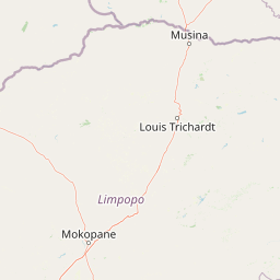
Map view of Wolkberg Wilderness Area

Use this park location map to pinpoint Wolkberg Wilderness Area in South Africa, understand its exact geographic position, and read its mapped placement within the surrounding landscape more clearly.

Pigeon | © OpenStreetMap contributors

Location context for Wolkberg Wilderness Area

Limpopo
Park atlas

Compare nearby mountain reserves, mist belt forests, and regional protected areas in South Africa.

Other Parks Near Wolkberg Wilderness Area and Connected Protected Landscapes

Browse protected areas and regional reserves situated near the rugged quartzite ridges and Afromontane forests of Wolkberg Wilderness Area. Comparing adjacent conservation landscapes reveals broader regional topography, climate transitions, and varied mountain terrain across the escarpment.
Wildlife reserveLimpopo
About 65 km away#1 closest

West

Polokwane Game Reserve: A Comprehensive Geographic Profile of a Limpopo Wildlife Reserve

Mapped boundaries and natural habitat in northern South Africa

Spanning 2,800 hectares of grassy plains and bushveld, Polokwane Game Reserve serves as a critical municipal protected area near the urban core of Polokwane. This geographic overview highlights the reserve's unique eastern ridge flora, its chain of riverine waterholes, and the spatial distribution of its protected landscape within the Limpopo province.

Area
28 km²
Established
1977
Relief
Upland
Climate
Subtropical
Nature reserveLimpopo
About 90 km away#2 closest

East

Balule Nature Reserve: Mapping the Protected Lowveld Savannah and Olifants River Corridor

An open-system wilderness integral to the Greater Kruger ecological network.

Explore the geographic identity of Balule Nature Reserve, a vast protected area in South Africa characterized by its integration with the Greater Kruger wilderness. The terrain encompasses a rich mix of mopane-dominated woodland, riverine forest along the Olifants River, and open subtropical bushveld that supports significant wildlife migrations.

Area
400 km²
Relief
Lowland
Climate
Subtropical
Access
Moderate access
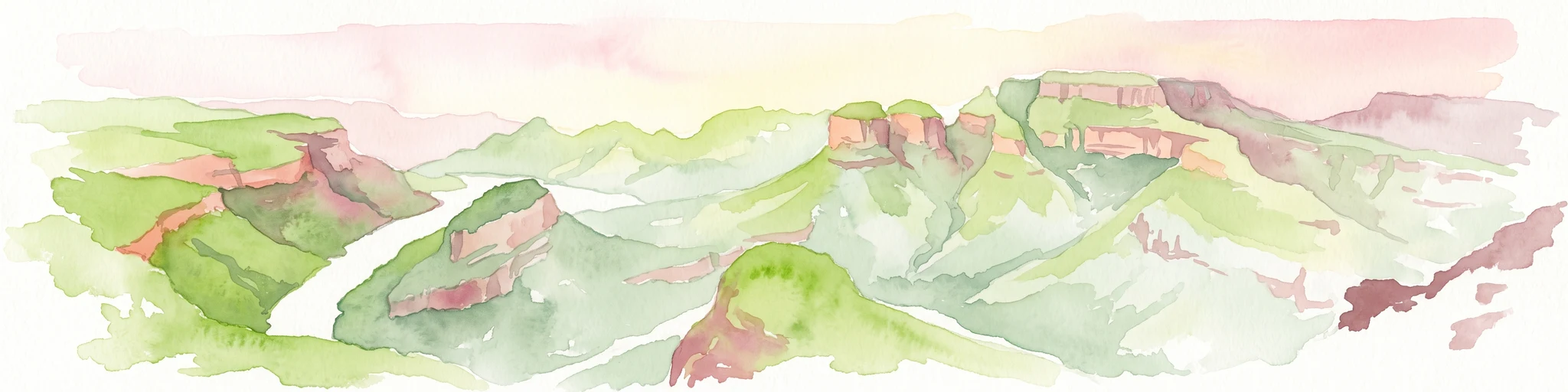
A horizontal watercolor painting depicting the Blyde River Canyon with green slopes, reddish cliff faces, and a winding river.
Nature reserveMpumalanga
About 96 km away#3 closest

Southeast

Blyde River Canyon Nature Reserve: Escarpment Geography and Protected Landscape Map

Mapping river-carved canyons and plateau ecosystems in Mpumalanga

Blyde River Canyon Nature Reserve protects a vast stretch of the Mpumalanga Drakensberg, characterized by vertical cliffs, rocky massifs, and deep river gorges. This atlas-focused resource highlights the reserve's geological landmarks, including the Three Rondavels and Bourke's Luck Potholes, offering a clear view of the complex terrain and protected natural boundaries defining this northeastern South African landscape.

Area
290 km²
Established
1965
Relief
Mountain
Climate
Subtropical
A soft watercolor illustration showing rolling green hills with sparse native vegetation, set against a pale, warm-toned horizon.
Biosphere reserveLimpopo
About 97 km away#4 closest

East

Kruger to Canyons Biosphere: An Atlas of Protected Lands and Geographic Diversity in Limpopo

Integrated conservation across savanna, canyon, and montane ecosystems

Covering the stretch between the Letaba and Sabie Rivers, this biosphere reserve serves as a vital conservation landscape in South Africa. Its unique geography captures the transition from rugged escarpment cliffs to open bushveld, showcasing a high density of protected land and biodiversity. Use this map-oriented resource to understand the structural role of the biosphere as a model for landscape-scale environmental management and its geographic placement within the Limpopo province.

Area
28,748.1 km²
Established
2001
Relief
Mixed relief
Access
Access unknown
Wildlife reserveLimpopo
About 105 km away#5 closest

Southeast

Kapama Game Reserve: Geographic Atlas and Protected Landscape Map of Limpopo

Explore the diverse terrain and riverine ecosystems of this South African wildlife reserve

Kapama Game Reserve sits within the Limpopo Lowveld, featuring a complex mix of open savanna, mixed bushveld, and dense riverine corridors shaped by the Blyde River. This record provides a detailed look at the reserve as a functional piece of the greater regional conservation landscape, highlighting its topography and its role in protecting South Africa's native habitat.

Area
130 km²
Established
1993
Scope
Terrestrial
National parkSouth Africa
About 109 km away#6 closest

East

Kruger National Park: South Africa's Iconic National Park for Geographic Discovery

Explore savanna landscapes and mapped protected area boundaries.

Kruger National Park serves as a paramount example of a protected landscape, offering a rich tapestry of savanna ecosystems and varied terrain across South Africa's Lowveld. This canonical entry details its vast geographic scope, approximately 19,623 square kilometres, and its status as the nation's first national park. Understand the park's environmental context, from the Lebombo Mountains to the Limpopo River, and its integral role within larger transfrontier conservation initiatives, providing critical insight for atlas-based geographic exploration.

Area
19,623 km²
Established
1926
IUCN
II
Visitors
1.7M annual
Wildlife reserveLimpopo
About 120 km away#7 closest

Southeast

Thornybush Game Reserve: A Protected Wildlife Landscape in Limpopo, South Africa

Mapped savanna corridors and riverine ecological zones

Located in the Limpopo province of South Africa, Thornybush Game Reserve is an essential private wildlife area known for its open savanna and rich riparian vegetation. By maintaining an unfenced boundary with the neighboring national park, it acts as a critical extension of the Greater Kruger wilderness. This entry details its geographical scope, terrain features, and its function as a managed, integrated component of the regional conservation landscape.

Area
140 km²
Water
Minor water
Nature reserveMpumalanga
About 130 km away#8 closest

East

Timbavati Private Nature Reserve: Protected Landscape and Regional Map Overview

Savanna bushveld geography in Mpumalanga, South Africa

Spanning over 534 square kilometres, Timbavati Private Nature Reserve provides a crucial habitat mosaic within the Mpumalanga region. The area is defined by its pioneering unfenced conservation model, linking private land with the Greater Kruger National Park to protect a broad spectrum of woodland habitats and diverse savanna ecosystems.

Area
534 km²
Established
1956
Relief
Upland
Climate
Subtropical

Common questions about visiting, size, designation, and location context for Wolkberg Wilderness Area

Wolkberg Wilderness Area FAQs for park facts, access, geography, and protected area context

Find quick answers about Wolkberg Wilderness Area, including protected-area facts, park geography, trail and visitor context, and how the park fits into its surrounding country and regional landscape.
MoriAtlas Explorer

Continue Your Protected Areas Search Across the Global Atlas

Deepen your exploration by continuing the structured search for national parks and protected areas worldwide. Utilize the comprehensive filtering capabilities to compare different conservation landscapes and refine your understanding of global park geography. Discover more about the distribution and characteristics of protected natural areas.

Global natural geography