

Mori Atlas logo
Nature reserveWraysbury Reservoir

Examining the intersection of utility infrastructure, sonar testing facilities, and international wetland conservation zones.

Wraysbury Reservoir Nature Reserve: A Distinctive Engineered Landscape and Protected Wetland Area in Northern Surrey

Wraysbury Reservoir represents a complex, multi-layered landscape situated in northern Surrey, defined by its massive earthen embankments and critical role in London's water supply. This protected area functions simultaneously as a high-security utility site, an open-water sonar test facility for the National Physical Laboratory, and a globally significant wetland habitat for wintering waterbirds. Through its SSSI and Ramsar-listed boundaries, the site provides essential shelter for various migratory species, creating an unusually technical and ecological geography alongside the busy M25 motorway and Heathrow flight paths.

reservoirwater supplythames waterSurreysite of special scientific interestramsar wetland
A flat-style digital illustration depicting a valley surrounded by steep cliffs, with a river flowing through the center, a waterfall on the right, and coniferous trees in the foreground.

Wraysbury Reservoir

Nature reserve

Park overview

Structured park overview, official facts, and landscape profile for Wraysbury Reservoir

Wraysbury Reservoir park facts, protected area profile, and essential visitor context

Review the core facts for Wraysbury Reservoir, including designation, size, terrain, visitor scale, habitats, and operating context in one park-focused overview.

About Wraysbury Reservoir

Wraysbury Reservoir sits in a transitional pocket of landscape between Surrey, Berkshire, and the western edge of Greater London, framed by major infrastructure on every side. It sits just west of the M25 and falls directly under the flight path of aircraft on approach to Heathrow Airport, with the neighbouring King George VI Reservoir, opened in 1947, lying close by. The broader site covers about 205 hectares of open water contained within engineered earthen banks, and the reservoir itself has a design capacity of around 34,000 million litres, with water pumped in daily from an inlet at Datchet on the River Thames.

The reservoir was constructed in the late 1960s as part of the post-war expansion of London's water supply network, with work beginning in 1967 and completed in 1970. The banks were built up to around 17 metres above surrounding ground level in places, enclosing a waterbody whose perimeter runs to roughly 5,700 metres. Maximum depth approaches 21 metres at top water level. As a working asset, Wraysbury is owned and operated by Thames Water, and the reservoir continues to function as a regulated supply component within a wider system that includes adjacent reservoirs drawing on different parts of the Thames catchment.

Although Wraysbury exists primarily as engineered infrastructure, its ecological profile is what has brought it formal conservation recognition. It was notified as a biological Site of Special Scientific Interest in 1999 and is included within the South West London Waterbodies Ramsar site and Special Protection Area, designations that highlight the collective importance of the cluster of reservoirs and gravel pits in this part of the Thames basin for wintering and migratory birds. The combination of open water, undisturbed banks, and managed grazing, which includes a flock of sheep kept on the embankments to keep vegetation short, produces habitat conditions that consistently attract large gatherings of waterfowl through the colder half of the year.

A further distinctive layer of Wraysbury's identity is its role as a controlled open-water testing site. The reservoir hosts the National Physical Laboratory's Open-Water Test Facility, used by the Ministry of Defence for calibration and testing of sonar systems and also serving civilian commercial customers. This places Wraysbury in an unusual position where water supply, ecological habitat, and defence and research activity all intersect within a single site.

Quick facts and research context for Wraysbury Reservoir

Wraysbury Reservoir is a managed water supply reservoir on the northern fringe of Surrey, close to the border with Berkshire and Greater London. It covers roughly 205 hectares (around 2 square kilometres) of open water and is fed by pumping from the River Thames at Datchet. The site carries multiple overlapping designations, functioning simultaneously as a working reservoir, a biological Site of Special Scientific Interest notified in 1999, and a component of a larger Ramsar wetland and Special Protection Area complex in south-west London.

Protection and recognition

Documented terrestrial protection history established in 1999

Wraysbury Reservoir Protection Status and Designated Area Records

Wraysbury Reservoir holds recorded terrestrial protection status established in 1999 for conservation management tracking. Official records outline the designation timeline and administrative history without international recognition sources.

Protection details

Protection scope
Terrestrial
Designated year
1999
Transboundary protection
No
Park context

Deeper park guide and search-rich context for Wraysbury Reservoir

Wraysbury Reservoir history, landscape, wildlife, and travel context

Explore Wraysbury Reservoir through its history, landscape character, ecosystems, wildlife, conservation priorities, cultural context, and seasonal travel timing in a structured park guide built for atlas discovery and search intent.

Why Wraysbury Reservoir stands out

Wraysbury Reservoir is best known for its combination of utility and ecological roles: it is an important Thames Water source for London's supply while also supporting nationally significant numbers of wintering waterbirds, especially cormorants, great crested grebes, and shovelers, with gadwalls also well represented. Its location directly beneath Heathrow's western approach and its use as an Open-Water Test Facility for sonar systems give it an unusually distinctive technological profile as well.
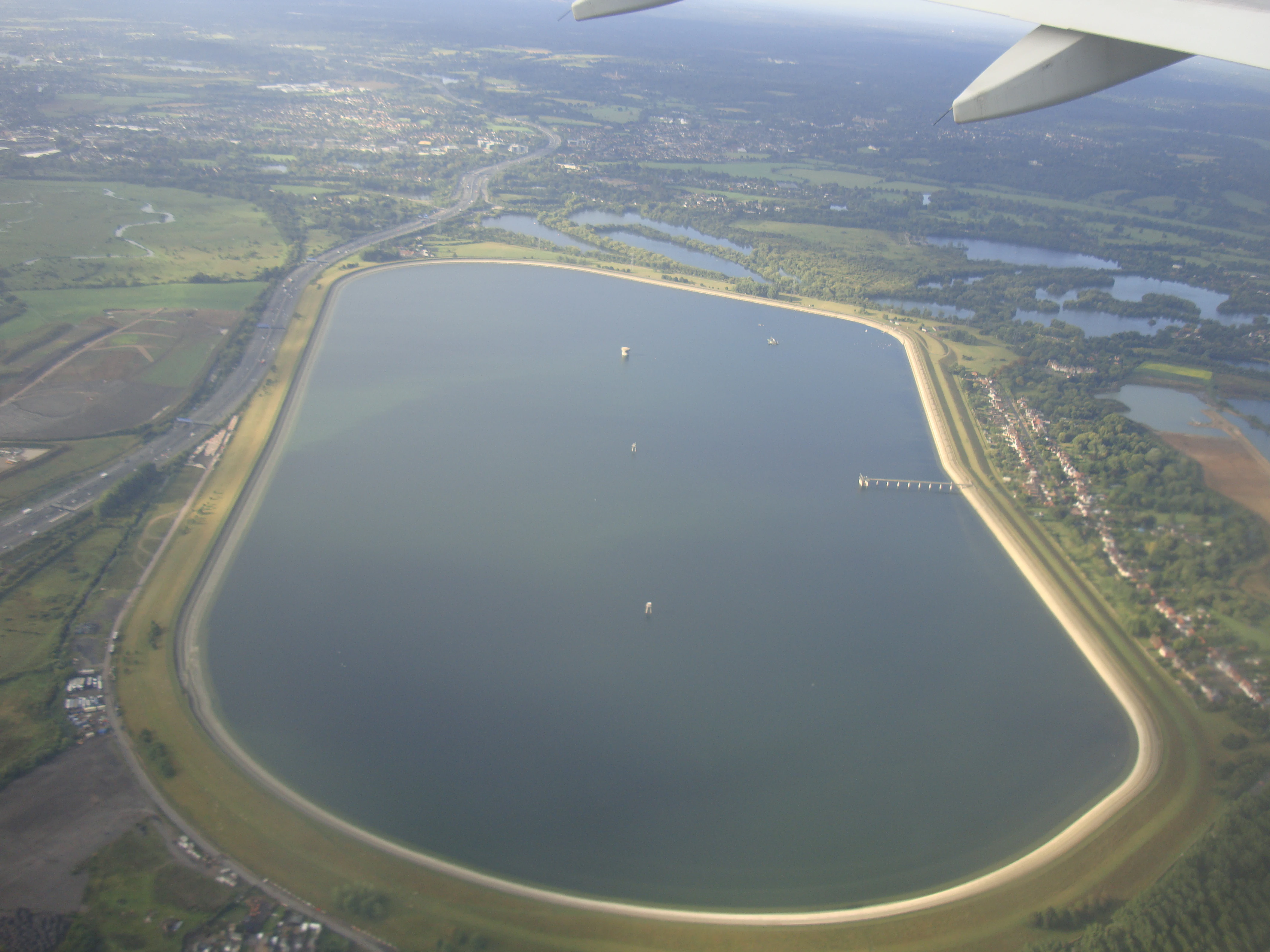
Aerial view looking down at the oval-shaped Wraysbury Reservoir, surrounded by green fields and nearby roads, with the wing of an aircraft visible in the top right corner.
Aerial view of Wraysbury Reservoir in Surrey, England.

Wraysbury Reservoir history and protected-area timeline

Wraysbury Reservoir was built during the late 1960s as part of the second wave of major reservoir construction that expanded potable water capacity for Greater London. Construction began in 1967 and was completed by 1970, with the contractor W. & C. French responsible for delivery. From the outset the reservoir was conceived as part of an integrated supply network rather than a standalone asset: pumped intake at Datchet on the River Thames connects it directly to the main river system, and the older King George VI Reservoir at Hythe End, opened in 1947, sits nearby as a complementary storage site.

The site's modern conservation history began in 1999, when Wraysbury was formally notified as a Site of Special Scientific Interest on biological grounds, recognising the importance of its wintering waterbird populations. It was subsequently included within the broader South West London Waterbodies Ramsar site and Special Protection Area, extending its recognition to international designations tied to the Ramsar Convention and the European Union's Birds Directive framework. The reservoir has therefore accumulated a layered history as operational water infrastructure that, over time, has come to be valued as much for what it supports ecologically as for what it delivers to the water network.

Wraysbury Reservoir landscape and geographic character

The landscape of Wraysbury Reservoir is essentially a created rather than natural one, shaped by late-twentieth-century civil engineering. The site is defined by long, gently curving earthen embankments that rise up to around 17 metres above the surrounding ground, enclosing a roughly oval expanse of open water with a perimeter close to 5.7 kilometres. Maximum water depth reaches approximately 21 metres at top water level, producing a deep, still reservoir rather than a shallow wetland.

Around the waterbody, the immediate setting is heavily influenced by infrastructure. The M25 runs along the eastern margin, aircraft descend towards Heathrow overhead, and the surrounding terrain carries a mix of motorway corridors, agricultural land, and the edges of nearby villages including Wraysbury. Vegetation on the banks themselves is kept deliberately short by a flock of grazing sheep maintained by Thames Water, which both eases inspection of the embankments and shapes the visual character of the perimeter. The reservoir is paired visually and functionally with the nearby King George VI Reservoir, and together they form a large, engineered water landscape within the otherwise low-lying Thames Valley.

Wraysbury Reservoir ecosystems, habitats, and plant life

Ecologically, Wraysbury Reservoir sits within the broader family of deep-water artificial waterbodies in the lower Thames basin that nevertheless support significant freshwater and waterbird communities. The combination of open water, undisturbed banks, and managed grazing creates a habitat mosaic that is unusually productive for birds, even though the water itself is deep and artificial. The reservoir's inclusion in the South West London Waterbodies Ramsar site and Special Protection Area reflects the way such man-made sites can, collectively, function as wetland habitat of recognised international importance.

Within this mosaic, the reservoir's conservation interest is concentrated rather than evenly distributed. Its recognised wildlife value is centred on wintering waterbirds drawn to the open water and shoreline, with the 205-hectare SSSI citation focused on biological rather than geological features. The site's protected status is therefore a function of habitat quality and species use rather than of any landscape or geological characteristic, and the natural interest of Wraysbury is best understood as an emergent property of a well-managed engineered site rather than as a remnant of an original habitat.

Wraysbury Reservoir wildlife and species highlights

The wildlife character of Wraysbury Reservoir is dominated by wintering waterfowl, for which the reservoir holds nationally important numbers under its SSSI citation. Cormorants, great crested grebes, and shovelers all occur in counts of recognised national importance during the winter months, while gadwalls are also well represented. These species reflect a typical pattern for large, deep reservoirs in lowland England, where open water and sheltered banks support diving fish-eaters such as cormorants and grebes, and dabbling ducks like shovelers and gadwalls.

The grazing regime on the banks, with sheep maintained by Thames Water to keep vegetation short, helps maintain open sward conditions along the shoreline that benefit feeding and loafing areas for waterfowl. While the source material does not provide detailed inventories of breeding birds, fish populations, or other taxa, the site's designation as a biological SSSI and its inclusion in a Ramsar site and Special Protection Area reflect the consistently high ornithological value that the reservoir has demonstrated over time.

Wraysbury Reservoir conservation status and protection priorities

Wraysbury Reservoir carries a layered set of conservation designations that, taken together, mark it as a site of regional, national, and international importance for waterbirds. It was notified as a biological Site of Special Scientific Interest in 1999, covering around 205.6 hectares, an area that aligns with the broader water surface of the reservoir and its immediate supporting habitat. The SSSI citation sets out the site's biological interest, anchored in the nationally important wintering populations of cormorants, great crested grebes, and shovelers that the reservoir supports.

Beyond the SSSI boundary, the reservoir forms part of the South West London Waterbodies Ramsar site and Special Protection Area, designations under the Ramsar Convention and the European Union Birds Directive framework respectively. These wider designations recognise that Wraysbury's ecological value cannot be considered in isolation: it is part of a cluster of reservoirs, gravel pits, and associated waterbodies in the south-west London reaches of the Thames that collectively support significant numbers of wintering and migratory birds. The conservation significance of Wraysbury thus lies both in what the site itself sustains and in the contribution it makes to a recognised wetland complex.

Wraysbury Reservoir cultural meaning and human context

Wraysbury Reservoir does not have a strong standalone cultural heritage narrative in the available sources, and its identity is shaped more by its role as working infrastructure and ecological habitat than by any long-established human history of the specific reservoir footprint. The surrounding area, however, has a longer human story: the village of Wraysbury and nearby settlements along the Thames sit in a landscape with deep historical roots, and the broader Thames Valley carries a rich heritage of water-based settlement, milling, and river commerce. The reservoir itself, as a product of post-war and late-1960s infrastructure planning, reflects the era of large-scale engineering responses to London's growing demand for reliable water supply.

Top sights and standout views in Wraysbury Reservoir

Wraysbury Reservoir combines three unusually distinct layers of identity. It is a major working component of London's water supply, with daily pumping from the Thames at Datchet and a capacity of tens of millions of cubic metres. It is a recognised wildlife site, with SSSI, Ramsar, and Special Protection Area status underpinned by nationally important wintering populations of cormorants, great crested grebes, and shovelers. And it hosts the National Physical Laboratory's Open-Water Test Facility, used for sonar calibration, giving it a notable role in defence and marine technology.

Best time to visit Wraysbury Reservoir

The most ecologically meaningful period for Wraysbury Reservoir is the winter months, when the nationally important gatherings of cormorants, great crested grebes, shovelers, and gadwalls are present on the water. For general interest, the wider landscape around the reservoir takes on a softer, quieter character outside the peak summer, while still allowing views across the open water and embankments. As a working reservoir, the site is tied to Thames Water management rather than to a public visitor calendar, and any access is subject to operational constraints.

Monthly climate preview

Measured monthly weather rhythms and representative point statistics for Surrey

Wraysbury Reservoir Climate Normals, Long Term Temperature and Precipitation Patterns

Long term climate data for Wraysbury Reservoir documents a measured annual progression of average temperatures and daily precipitation totals from representative coordinates. Exploring the complete monthly weather profile reveals detailed temperature ranges and precipitation trends across all twelve recorded months.
Annual mean10 °C
4 °C18 °C
Jan
Feb
Mar
Apr
May12°
Jun15°
Jul18°
Aug17°
Sep15°
Oct11°
Nov
Dec
Warmest month
July

17.6 °C

Coolest month
January

4 °C

Wettest month
November

2.6 mm/day

Driest month
March

1.6 mm/day

Park location guide

Geography guide, regional context, and park location map for Wraysbury Reservoir

Wraysbury Reservoir park geography, regions, and map view in United Kingdom

Understand where Wraysbury Reservoir sits in United Kingdom through a broader geographic reading of the surrounding landscape, nearby location context, and its mapped position within the national park landscape.

How Wraysbury Reservoir fits into United Kingdom

The United Kingdom is a parliamentary constitutional monarchy located in northwestern Europe, consisting of four constituent countries: England, Scotland, Wales, and Northern Ireland. As a major global power with over 69 million residents, it maintains significant international influence in politics, economics, and culture.

Wider geography shaping Wraysbury Reservoir in United Kingdom

The United Kingdom is an island nation located in northwestern Europe, surrounded by the Atlantic Ocean, North Sea, English Channel, Celtic Sea, and Irish Sea. It shares a land border with the Republic of Ireland to the west. The territory includes the island of Great Britain, the northeastern portion of Ireland, and most of the smaller British Isles islands.

Map view of Wraysbury Reservoir

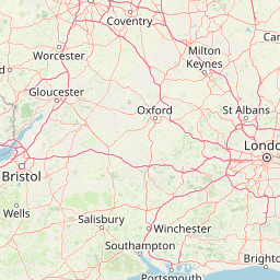
Use this park location map to pinpoint Wraysbury Reservoir in United Kingdom, understand its exact geographic position, and read its mapped placement within the surrounding landscape more clearly.

Pigeon | © OpenStreetMap contributors

Location context for Wraysbury Reservoir

Surrey

Visualizing the earthen embankments, open water expanse, and wetland habitats of Surrey

Wraysbury Reservoir Photos and Protected Landscape Scenery

Photographic records illustrate the engineered embankments and open water habitats defining Wraysbury Reservoir. Visual exploration reveals the distinctive intersection of industrial water infrastructure and protected wetland ecosystems.

Aerial view looking down at the oval-shaped Wraysbury Reservoir, surrounded by green fields and nearby roads, with the wing of an aircraft visible in the top right corner.

Park atlas

Compare connected waterbodies, wetland habitats, and engineered landscapes across the Thames Valley

Explore Other Parks Near Wraysbury Reservoir and Surrounding Regional Protected Areas

Browsing other parks near Wraysbury Reservoir reveals adjacent wetland habitats and engineered water bodies across the regional landscape. Extending your review beyond this Surrey reservoir provides deeper context on protected lowland ecosystems and water storage infrastructure.
Watercolor illustration of a coastal landscape featuring green hills, white cliffs, and a body of water
National parkSouth East England
About 37 km away#1 closest

South

South Downs National Park: A Distinctive Chalk Landscape in South East England's Atlas

Iconic chalk downland, coastal cliffs, and mapped terrain.

South Downs National Park is a premier protected landscape in South East England, celebrated for its unique chalk downland terrain and dramatic coastal formations. This page provides detailed geographic context for the park, highlighting its rolling hills, dry valleys, and ancient woodlands. Discover the park's mapped boundaries and its significance within England's protected areas, offering a structured atlas view for landscape exploration.

Area
1,627 km²
Established
2010
IUCN
V
Visitors
18M annual
Biosphere reserveSussex
About 74 km away#2 closest

Southeast

Brighton and Lewes Downs Biosphere Reserve: Geography and Protected Coastal Landscapes

Chalk downlands and marine ecosystems in Sussex

The Brighton and Lewes Downs Biosphere Reserve anchors a diverse range of protected habitats from the South Downs ridges to the English Channel seafloor. This mapped record details the terrestrial chalk grasslands, coastal cliffs, and rare offshore reef systems that characterize this notable biosphere reserve in Sussex. It serves as a comprehensive geographic reference for understanding the boundary between land-based conservation and marine habitat management.

Area
295.14 km²
Established
2014
Visitors
12M annual
Relief
Upland
Marine protected areaWest Sussex
About 83 km away#3 closest

South

Kingmere Marine Conservation Zone: Protected Marine Geography and Chalk Reef Landscapes

Submerged chalk cliff systems and rocky reefs in West Sussex

The Kingmere Marine Conservation Zone protects an unusual underwater landscape of chalk ridges and rocky outcrops within the English Channel. Stretching between Littlehampton and Worthing, this area serves as a vital spawning ground and exhibits some of the finest chalk reef features in European waters.

Area
47 km²
Established
2013
Relief
Lowland
Climate
Temperate
Marine protected areaEast Sussex
About 87 km away#4 closest

Southeast

Beachy Head West Marine Protected Area: Coastal Geography and Underwater Chalk Landscapes

Mapped protected seabed and marine geography in East Sussex

Investigate the marine landscape of Beachy Head West, a protected zone defined by its submerged chalk reefs and gullies extending from the East Sussex cliffs into the English Channel. This record highlights the site's distinct underwater topography, seabed mosaic, and its role as a core component of the regional marine conservation network across southeast England.

Area
24 km²
Established
2013
Relief
Lowland
Climate
Temperate
Nature reserveNorthamptonshire
About 90 km away#5 closest

North

Summer Leys Nature Reserve: Geographic Context and Mapped Wetland Boundaries in Northamptonshire

Wetland ecosystems and industrial land reclamation in the Upper Nene Valley

Summer Leys is an important nature reserve and protected wetland complex in Northamptonshire. Defined by its history as a gravel extraction site, the landscape now features open lagoons, reed-fringed pools, and vital grassland habitats. This site provides a critical study in how former industrial terrain is repurposed for ecological conservation and avian biodiversity within the regional landscape of the English East Midlands.

Area
0.5 km²
Relief
Lowland
Climate
Temperate
Access
Easy access
Watercolor painting showing a landscape with green and purple vegetation, a body of water, and distant hills.
National parkEngland
About 92 km away#6 closest

Southwest

New Forest National Park: Historic Protected Landscape and Regional Geography in England

Mapped heathland, ancient woodlands, and pastoral traditions.

Explore New Forest National Park, a nationally significant protected area in England renowned for its unique blend of ancient royal forest history, traditional pastoral practices, and biologically rich lowland habitats. This page provides an atlas-focused view of its mapped boundaries, distinctive terrain, and geographic context within England, highlighting its value as a living landscape shaped by centuries of common grazing rights and supporting rare wildlife.

Area
566 km²
Established
2005
IUCN
V
Visitors
14.8M annual
A soft watercolor illustration showing rolling green hills and wetlands against a light, pale sky.
Nature reserveEssex
About 100 km away#7 closest

Northeast

Abberton Reservoir: Mapped Landscape and Protected Area Context in Essex, England

Freshwater reservoir, wetland, and historic site

Abberton Reservoir stands as a landmark of regional geography in Essex. This entry maps the site's transition from an engineered water-supply facility to a mosaic of reedbeds, marshes, and open water, providing essential habitat for migratory wildfowl and wintering bird populations.

Area
7 km²
Established
1939
Relief
Lowland
Climate
Temperate
Nature reserveEssex
About 107 km away#8 closest

East

Colne Estuary Nature Reserve: Geography and Protected Landscapes of the Essex Coast

Coastal wetlands, saltmarsh zones, and geological formations

Colne Estuary represents a massive tidal landscape in Essex characterized by the interaction between fluvial and marine systems. Covering over 2,900 hectares, this site protects diverse habitats including intertidal mudflats, active saltmarshes, and transitional zones that support wintering waterbirds. The area remains a key reference for studying coastal accretion and Quaternary geology in the East of England.

Area
29.152 km²
Established
1989
Relief
Lowland
Climate
Temperate

Common questions about visiting, size, designation, and location context for Wraysbury Reservoir

Wraysbury Reservoir FAQs for park facts, access, geography, and protected area context

Find quick answers about Wraysbury Reservoir, including protected-area facts, park geography, trail and visitor context, and how the park fits into its surrounding country and regional landscape.
MoriAtlas Explorer

Continue Your Protected Areas Search Across the Global Atlas

Deepen your exploration by continuing the structured search for national parks and protected areas worldwide. Utilize the comprehensive filtering capabilities to compare different conservation landscapes and refine your understanding of global park geography. Discover more about the distribution and characteristics of protected natural areas.

Global natural geography