

Mori Atlas logo
Protected areaZacapu Lagoon

A perennial spring-fed aquatic landscape situated within the highland basin system of Western Mexico

Zacapu Lagoon: Mapping the Ecological Geography and Protected Wetland Boundaries in Central Michoacán

Zacapu Lagoon represents a critical protected wetland ecosystem in the state of Michoacán, sitting at an elevation of 1,980 meters within the broader Lerma River basin. This compact perennial water body is sustained by a network of local springs and serves as a vital habitat for a remarkable cluster of endemic aquatic species. The site is formally recognized for its hydrological significance and wetland biodiversity, offering an essential window into the unique natural terrain and conservation character of the Mexican highlands.

wetlandRamsar siteendemic speciesfreshwater lagoonMexican highlandsMichoacán

Zacapu Lagoon

Protected area

Park overview

Structured park overview, official facts, and landscape profile for Zacapu Lagoon

Zacapu Lagoon park facts, protected area profile, and essential visitor context

Review the core facts for Zacapu Lagoon, including designation, size, terrain, visitor scale, habitats, and operating context in one park-focused overview.

About Zacapu Lagoon

Zacapu Lagoon is a compact freshwater wetland on the central Mexican highlands, located within the town of Zacapu in the northern part of Michoacán. The lagoon occupies a surface of approximately 33 hectares at around 1,980 meters above sea level, making it a typical high-elevation wetland within the broader Lerma River basin. Its waters are derived from roughly 20 local springs and ultimately flow outward through the Angulo River, connecting the lagoon to one of Mexico's largest and most ecologically significant river systems.

Although small and surrounded by an urban environment, Zacapu Lagoon carries conservation importance well beyond its physical footprint. In 2003, the site received formal protection as a natural protected area, and on 5 June 2004, around 40 hectares were inscribed on the Ramsar list of wetlands of international importance. This double designation reflects both the lagoon's ecological value and its recognition as a globally significant wetland habitat.

The lagoon's character is shaped by a mix of open water, fringing wetlands, and shoreline vegetation. Stands of sabino (Montezuma cypress), weeping willows, reeds, cattails, bulrushes, and other aquatic plants frame the water body and provide habitat structure for a wide range of species. This vegetation supports both resident aquatic fauna and seasonal populations of waterbirds, reinforcing the lagoon's role as a living wetland within an otherwise heavily altered regional landscape.

In practical terms, Zacapu Lagoon represents a case where a small, locally embedded wetland has disproportionate biological and conservation value. Its combination of protected legal status, Ramsar recognition, and an unusually dense suite of endemic aquatic species makes it an important reference point for wetland conservation, freshwater biodiversity, and habitat protection strategies in central Mexico.

Quick facts and research context for Zacapu Lagoon

Zacapu Lagoon is a perennial freshwater wetland located in the municipality of Zacapu, Michoacán, in central Mexico. With a surface area of approximately 33 hectares and an elevation near 1,980 meters, it sits within the Lerma River basin and is linked to the Angulo River, while being fed by roughly 20 surrounding springs. It was designated a natural protected area in 2003 and inscribed as a Ramsar site of international importance on 5 June 2004, formalizing its role as a refuge for several endemic aquatic species.

Protection and recognition

Explore the documented terrestrial conservation scope and recognition history for Zacapu Lagoon.

Zacapu Lagoon Protection Status And Designated Area History

Zacapu Lagoon maintains a documented terrestrial protection status established in 2004 without transboundary territory. Records compile administrative designation history and management scope for environmental analysis.

Protection details

Protection scope
Terrestrial
Designated year
2004
Transboundary protection
No
Park context

Deeper park guide and search-rich context for Zacapu Lagoon

Zacapu Lagoon history, landscape, wildlife, and travel context

Explore Zacapu Lagoon through its history, landscape character, ecosystems, wildlife, conservation priorities, cultural context, and seasonal travel timing in a structured park guide built for atlas discovery and search intent.

Why Zacapu Lagoon stands out

Zacapu Lagoon is best known as the exclusive natural habitat of a remarkable cluster of endemic aquatic species. The small wetland is the only place where the Zacapu shiner, Zacapu allotoca, Zacapu dwarf crayfish, Anderson's salamander, and Girardinichthys ireneae are known to occur, along with a locally endemic subspecies of the Mexican garter snake. This unusually high concentration of narrowly endemic freshwater life within such a compact wetland defines the lagoon's scientific and conservation significance. Beyond its endemic fauna, the lagoon is also recognized internationally through its Ramsar designation, which acknowledges both its hydrological value and its importance for resident and migratory waterbirds. The interplay of rare endemic fish and salamanders, established aquatic vegetation, and seasonal bird use makes Zacapu Lagoon a benchmark site for understanding small-wetland biodiversity in the Mexican highlands.
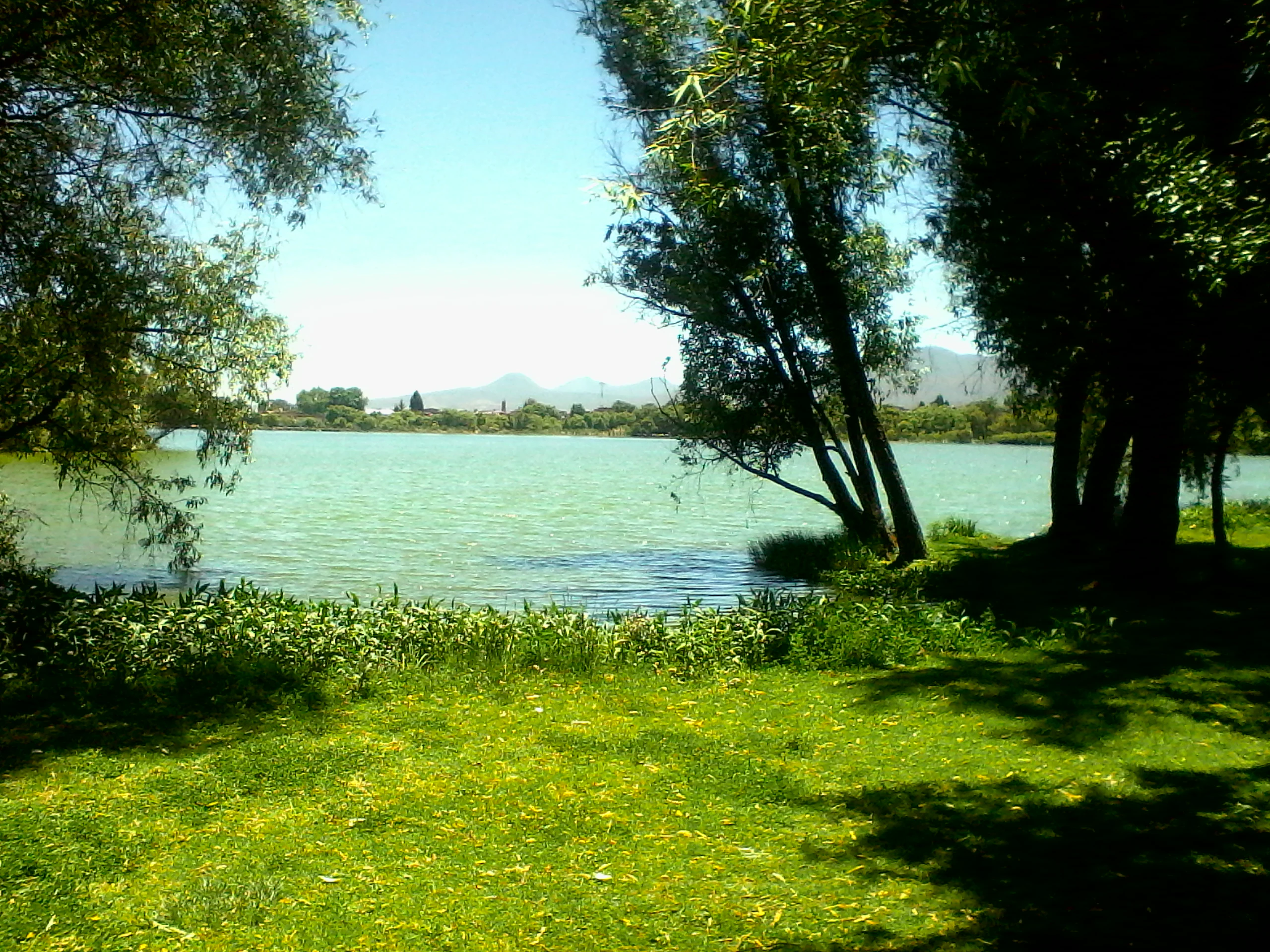
Zacapu Lagoon
Partial view of Zacapu Lagoon

Zacapu Lagoon history and protected-area timeline

Zacapu Lagoon's modern conservation history began in the early 2000s, when growing recognition of its ecological value led to formal protection. In 2003, the wetland was declared a natural protected area by Mexican authorities, establishing a legal framework for its management and conservation.

A little over a year later, on 5 June 2004, approximately 40 hectares of the lagoon and its surrounding wetlands were inscribed on the international Ramsar list of wetlands of importance. This designation reflected both the lagoon's ecological significance and its role as habitat for several endemic and restricted-range species. Together, these two milestones anchored the lagoon's identity as a protected site and laid the groundwork for ongoing efforts to safeguard its endemic aquatic fauna and associated wetland habitats.

Zacapu Lagoon landscape and geographic character

The landscape of Zacapu Lagoon is shaped by the high-elevation geography of central Michoacán, with the wetland sitting at roughly 1,980 meters above sea level. The lagoon itself is small, with a maximum length of around 635 meters and a maximum width near 414 meters, forming a compact but well-defined freshwater body.

Surrounding the open water, the terrain transitions into a band of wetland vegetation and riparian habitat. Sabino trees, weeping willows, reeds, cattails, bulrushes, and sedge-like plants create a soft, vegetated fringe along the margins of the lagoon. This mosaic of water, emergent plants, and shoreline trees gives the wetland its characteristic visual character and supports the diverse ecological roles the site plays for both aquatic and semi-aquatic species.

Although the immediate lagoon footprint is modest, its hydrological setting ties it into the much larger Lerma River basin via the Angulo River and a network of roughly 20 contributing springs. This connection places the small wetland within a broader landscape of highland streams and seasonal water systems, which influences water levels, nutrient flows, and the seasonal behavior of species using the site.

Zacapu Lagoon ecosystems, habitats, and plant life

Ecologically, Zacapu Lagoon functions as a freshwater wetland refuge within a highland basin landscape. Its waters are fed by about 20 springs, creating relatively stable perennial conditions that contrast with many of the more seasonal water bodies elsewhere in the region. The mix of open water and emergent vegetation supports a layered habitat structure that is unusual for such a small urban-adjacent wetland.

The vegetation around the lagoon includes sabino (Montezuma cypress), weeping willow, common reeds, cattails, soft bulrush, and other wetland plants, which stabilize the shoreline and provide cover, nesting substrates, and feeding areas for aquatic and semi-aquatic animals. This established plant structure has been central to the lagoon's ability to sustain its endemic fauna and important bird populations across seasons.

A defining feature of the lagoon's ecology is the disproportionate number of narrowly endemic species tied to its waters. The combination of spring-fed hydrology, stable water levels, vegetation cover, and isolation within the Lerma basin has allowed several aquatic lineages to persist here even as similar habitats in the broader region have deteriorated.

Zacapu Lagoon wildlife and species highlights

Zacapu Lagoon's wildlife profile is dominated by its extraordinary concentration of endemic and restricted-range aquatic species. The wetland is the only known natural habitat of the Zacapu shiner (Notropis grandis), the Zacapu allotoca (Allotoca zacapuensis), the Zacapu dwarf crayfish (Cambarellus zacapuensis), Anderson's salamander (Ambystoma andersoni), and Girardinichthys ireneae, along with a localized subspecies of the Mexican garter snake (Thamnophis eques insperatus). Several other goodeid and cyprinid fish, including Bulldog goodeid, Goodea atripinnis, Skiffia lermae, Xenotoca variata, Zoogoneticus quitzeoensis, mexcalpique michoacano, Notropis calientis, and Algansea lacustris, also occur in the lagoon.

The lagoon is likewise important for waterbirds, hosting species such as American wigeon, northern pintail, Mexican duck, northern shoveler, green-winged teal, ring-necked duck, lesser scaup, ruddy duck, greater white-fronted goose, American coot, great blue heron, gadwall, and cinnamon teal. These species reflect both resident use and seasonal migratory presence.

Terrestrial and semi-aquatic wildlife around the lagoon includes a range of passerine birds, such as the spotted wren, rufous-crowned sparrow, rusty-crowned ground-sparrow, common yellowthroat, striped sparrow, varied bunting, blue mockingbird, and happy wren, as well as the ring-necked snake and garter snakes. Altogether, the wildlife assemblage blends rare endemic aquatic fauna with a broader community of wetland-associated birds and reptiles, making the lagoon a small but unusually rich site for biodiversity.

Zacapu Lagoon conservation status and protection priorities

Zacapu Lagoon holds an unusually strong conservation profile for a wetland of its size. In 2003 it was officially declared a natural protected area, and on 5 June 2004 approximately 40 hectares were designated as a Ramsar site of international importance. These two overlapping protections anchor the lagoon within both Mexican national conservation policy and the international wetland conservation framework.

The significance of these designations rests largely on the lagoon's role as the sole known habitat of several endemic aquatic species, including fish, a crayfish, and a salamander. By protecting the spring-fed hydrology, water quality, and surrounding vegetation that sustain these species, the conservation status of Zacapu Lagoon directly supports the survival of lineages that exist nowhere else. This makes the site a high-priority reference area for freshwater biodiversity conservation in the Lerma River basin and more broadly in central Mexico.

Zacapu Lagoon cultural meaning and human context

Zacapu Lagoon is closely interwoven with the identity of the town of Zacapu, where the wetland sits within or at the edge of the urban area. Its long-term presence has shaped local perceptions of natural heritage, and its Ramsar recognition has strengthened municipal and regional pride in a small urban-adjacent wetland as a site of national and international ecological importance.

Top sights and standout views in Zacapu Lagoon

Among the defining qualities of Zacapu Lagoon are its Ramsar status, its designation as a Mexican natural protected area, and the exceptional concentration of endemic aquatic species that occur only within its waters. The lagoon also stands out for its hydrological setting within the Lerma River basin, its spring-fed perennial character at around 1,980 meters elevation, and its combination of established wetland vegetation with diverse waterbird and passerine bird communities.

Best time to visit Zacapu Lagoon

Seasonal conditions around Zacapu Lagoon are largely shaped by central Mexico's rainy and dry cycles. The rainy season tends to bring fuller water levels, greener fringing vegetation, and increased activity among breeding waterbirds, while the cooler dry months can bring concentrations of migratory waterfowl and clearer viewing conditions across the open water. Both periods can offer rewarding experiences, with the rainy season emphasizing lush wetland scenery and the dry season offering strong waterbird observation opportunities.

Monthly climate preview

Long term temperature and precipitation records across twelve months of observation

Zacapu Lagoon Climate Normals and Measured Monthly Temperature Patterns

Zacapu Lagoon records long term temperature measurements ranging from mean lows near thirteen degrees to daytime maximums exceeding thirty degrees celsius alongside distinct precipitation rhythms. Reviewing the complete monthly climate normals reveals detailed temperature variations and precipitation shifts across the representative coordinate.
Annual mean17 °C
13 °C21 °C
Jan13°
Feb15°
Mar17°
Apr20°
May21°
Jun20°
Jul18°
Aug18°
Sep17°
Oct16°
Nov15°
Dec14°
Warmest month
May

21 °C

Coolest month
January

13.2 °C

Wettest month
July

5.5 mm/day

Driest month
April

0.1 mm/day

Park location guide

Geography guide, regional context, and park location map for Zacapu Lagoon

Zacapu Lagoon park geography, regions, and map view in Mexico

Understand where Zacapu Lagoon sits in Mexico through a broader geographic reading of the surrounding landscape, nearby location context, and its mapped position within the national park landscape.

How Zacapu Lagoon fits into Mexico

Mexico, officially the United Mexican States, is a country in North America spanning the Sierra Madre mountain ranges, coastal plains, and tropical regions. It borders the United States to the north, Guatemala and Belize to the southeast, and has coastlines along the Pacific Ocean, Gulf of Mexico, and Caribbean Sea. With a population exceeding 130 million, Mexico is home to one of the world's most significant concentrations of Indigenous languages alongside Spanish.

Wider geography shaping Zacapu Lagoon in Mexico

Mexico occupies a land area of 1,972,550 km2, making it the thirteenth-largest country in the world. The terrain is highly diverse, featuring the Sierra Madre Occidental and Sierra Madre Oriental mountain ranges, the Mexican Plateau, coastal lowlands along the Pacific and Gulf/Caribbean margins, and the Yucatan Peninsula. The country spans multiple climate zones from desert in the north to tropical rainforest in the south.

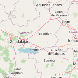
Map view of Zacapu Lagoon

Use this park location map to pinpoint Zacapu Lagoon in Mexico, understand its exact geographic position, and read its mapped placement within the surrounding landscape more clearly.

Pigeon | © OpenStreetMap contributors

Location context for Zacapu Lagoon

Michoacán

Explore protected area views, shoreline vegetation, and spring-fed aquatic habitats.

Zacapu Lagoon Photos and Scenery: Visualizing Highland Wetland Landscapes

Zacapu Lagoon photos reveal the unique topography and shoreline vegetation shaping this high-elevation wetland sanctuary. Visual research helps observers understand the rare aquatic habitats and freshwater scenery characterizing central Michoacán.

Zacapu Lagoon

Park atlas

Compare nearby national parks and connected highland wetland reserves.

Explore Parks Near Zacapu Lagoon and Surrounding Protected Areas

Browse protected areas and wetland reserves located near Zacapu Lagoon in the Mexican highlands. Expanding the geographic scope reveals broader regional biodiversity patterns and connected freshwater conservation landscapes.
Protected areaMichoacán
About 9.4 km away#1 closest

North

Alberca de los Espinos: Volcanic Crater and Protected Wetland Geography in Michoacán

Highland crater lake within the Trans-Mexican Volcanic Belt

The protected basin of Alberca de los Espinos forms a striking volcanic landform. Deep within its 2,100-meter crater rim, the lake exhibits complex thermal stratification and seasonal color changes. This site serves as a vital component of the regional geography in Michoacán, blending geological character with recognized wetland status.

Area
1.42 km²
Established
2003
Relief
Upland
Climate
Temperate
Protected areaMichoacán
About 27 km away#2 closest

Southeast

Lake Pátzcuaro Protected Area: A Geographic Exploration of the Michoacán Volcanic Basin

Highland volcanic geography and protected wetland ecosystems

Located in a unique endorheic basin at 2,000 metres elevation, Lake Pátzcuaro stands as a landmark of central Mexico. The protected area encompasses dramatic volcanic ridges, expansive marshland fringes, and islands that define the regional geography. Explore the mapped terrain of these highland waters, which serve as a critical ecological corridor and a focal point for understanding the physical and environmental heritage of the Michoacán highlands.

Area
126.4 km²
Relief
Highland
Climate
Temperate
Access
Easy access
National parkMichoacán
About 45 km away#3 closest

West

Lago de Camécuaro National Park: National Park Protected Landscape and Geographic Atlas

Mapped boundaries and regional natural landscape context for Michoacán.

Lago de Camécuaro National Park offers a focused exploration of a distinct protected area within Michoacán, Mexico. Understand its specific geographic identity through mapped boundaries and regional terrain context, suitable for atlas-based discovery of natural landscapes and conservation areas. This entry provides a factual overview of the park's protected status and its placement within the broader geography of the region.

Area
0.097 km²
Established
1941
IUCN
II
Relief
Upland
National parkMichoacán
About 55 km away#4 closest

Southwest

Barranca del Cupatitzio National Park: National Park, Michoacán Protected Area

Mapped boundaries and regional geographic context.

Barranca del Cupatitzio National Park stands as a designated national park, providing critical geographic information for atlas exploration. Understand its specific mapped protected area boundaries and discover its role within the regional geography of Michoacán. This profile highlights the park's landscape identity and its significance as a key protected natural site for detailed geographic study.

Area
4.582 km²
Established
1938
IUCN
II
Visitors
255.2K annual
Wildlife reserveMichoacán
About 71 km away#5 closest

Southwest

Área de protección de flora y fauna Pico de Tancítaro: Geographic and Landscape Overview

Protected volcanic highlands in the state of Michoacán

Trace the ridges and forested valleys of this federal wildlife reserve. The area integrates sustainable land use with the protection of native highland ecosystems, marking a core point of interest for those tracking the volcanic geography of Mexico's Trans-Mexican Volcanic Belt.

Area
234.06 km²
Established
2009
Relief
Mountain
Scope
Terrestrial
Protected areaGuanajuato
About 82 km away#6 closest

Northeast

Lake Yuriria: Exploring the Protected Landscape and Volcanic Terrain of Guanajuato

A historic artificial wetland and Ramsar-recognized migratory bird habitat.

Lake Yuriria serves as a benchmark for landscape conservation in the Bajio region. Spanning an extensive wetland area within a volcanic basin, this protected zone provides essential habitat for over 140 bird species and remains a cornerstone of the regional geography for its water regulation and agricultural impact.

Area
72 km²
Established
1548
Relief
Lowland
Climate
Subtropical
Natural monumentGuanajuato
About 88 km away#7 closest

Northeast

Siete Luminarias Natural Monument: Exploring Maar Volcanic Craters in Guanajuato

A protected volcanic landscape on the Mexican Plateau.

Siete Luminarias encompasses seven well-defined volcanic maars surrounding the town of Valle de Santiago. This natural monument illustrates a rare geological occurrence where ancient underground explosions created broad, flat-floored craters that remain as essential features of the local Bajio terrain and regional geologic identity.

Area
89.28 km²
Established
1997
Relief
Upland
Climate
Subtropical
National parkMichoacán
About 99 km away#8 closest

East

Cerro de Garnica National Park: Its Geography and Protected Landscape Identity

Explore mapped boundaries within Michoacán's natural terrain.

Cerro de Garnica National Park serves as a distinct protected area contributing to the geographic understanding of Michoacán. This page offers a focused view on its mapped boundaries and natural landscape characteristics, providing essential context for atlas exploration. Discover the park's specific identity as a national park and its place within the regional geography, highlighting its value for structured discovery.

Area
19.36 km²
Established
1936
IUCN
II
Relief
Mountain

Common questions about visiting, size, designation, and location context for Zacapu Lagoon

Zacapu Lagoon FAQs for park facts, access, geography, and protected area context

Find quick answers about Zacapu Lagoon, including protected-area facts, park geography, trail and visitor context, and how the park fits into its surrounding country and regional landscape.
MoriAtlas Explorer

Continue Your Protected Areas Search Across the Global Atlas

Deepen your exploration by continuing the structured search for national parks and protected areas worldwide. Utilize the comprehensive filtering capabilities to compare different conservation landscapes and refine your understanding of global park geography. Discover more about the distribution and characteristics of protected natural areas.

Global natural geography