
Mori Atlas logo
Nature reserveZbiornik Wody Stara Orunia

Mapping the historical brick architecture and vital ecological hibernation zones in northern Poland

Zbiornik Wody Stara Orunia: An Underground Industrial Reservoir and Protected Nature Reserve

Zbiornik Wody Stara Orunia represents an unusual convergence of 19th century Prussian engineering and modern ecological conservation within the city of Gdańsk. This protected nature reserve preserves an historic underground water reservoir, known for its eleven brick vaulted naves that now provide a critical winter roosting habitat for several bat species. Its location within the regional water trail highlights the intersection of industrial heritage, urban archaeology, and regional biodiversity in the Pomeranian landscape.

underground reservoirindustrial heritage19th-century architecturebrick vaultingNatura 2000bat conservation
A stylized, flat-design illustration of a mountain valley with waterfalls, pine trees, and soft-colored cliffs under a pale sky.

Zbiornik Wody Stara Orunia

Nature reserve

Park overview

Structured park overview, official facts, and landscape profile for Zbiornik Wody Stara Orunia

Zbiornik Wody Stara Orunia park facts, protected area profile, and essential visitor context

Review the core facts for Zbiornik Wody Stara Orunia, including designation, size, terrain, visitor scale, habitats, and operating context in one park-focused overview.

About Zbiornik Wody Stara Orunia

Zbiornik Wody Stara Orunia is a 19th-century hydrotechnical landmark in southern Gdansk, Poland, and one of the most distinctive surviving elements of the city's early municipal water supply system. The site belongs to a series of underground reservoirs constructed on the hills surrounding Gdansk in the second half of the 19th century. Unlike a traditional water tower, which raises water to create pressure, the Orunia reservoir was positioned on elevated ground and used gravity alone to move water in both directions. Water flowed in from a drainage intake at Pręgowo, above the city, and then descended from the reservoir into the urban distribution network below.

The reservoir was designed by Eduard Friedrich Wiebe, a Prussian architect and engineer known for his work on water supply systems. Its construction was part of a broader modernization program advanced by Gdansk's mayor Leopold von Winter, who sought to bring sanitary infrastructure to a rapidly growing industrial city. The brick structure covers an area of nearly 1,500 square meters and contains eleven parallel naves supported by arched arcades, forming a vaulted interior that is both structurally impressive and atmospherically unusual. The clay bricks used in its construction came from a local brickyard at Kolibki, rooting the building firmly in the regional building traditions of Pomerania.

The structure was decommissioned in 1978, when its relatively low elevation proved insufficient to maintain adequate pressure for the expanding modern water network. After decades of disuse, the site underwent a careful revitalization between 2016 and 2018, which included uncovering and conserving the original brick vaults and replacing the heavi earth cover above the reservoir with lighter expanded clay aggregate. This reduced the load on the historic structure while improving its thermal insulation. Since then, the reservoir has been opened to guided visitors as part of the Gdansk Water Trail, a heritage route highlighting the city's historic infrastructure.

Equally important to the site's modern identity is its ecological significance. Because the underground chambers remain dark, cool, and largely undisturbed, they have become a reliable winter refuge for bats. Since 2021, the reservoir has been formally recognized as part of the European Natura 2000 network through the site 'Zbiornik na Oruni,' with particular attention to the protection of hibernating greater mouse-eared bats. This combination of industrial heritage and contemporary biodiversity conservation gives the Orunia reservoir a layered identity: it is at once a monument to 19th-century engineering, a working piece of urban heritage tourism, and a living ecological site within the city.

Quick facts and research context for Zbiornik Wody Stara Orunia

Zbiornik Wody Stara Orunia is an underground, gravity-fed drinking water reservoir built in 1869 in the Orunia district of Gdansk, Poland. Designed by the Prussian engineer Eduard Friedrich Wiebe as part of a broader municipal water supply program led by mayor Leopold von Winter, it originally drew water from a drainage intake in Pręgowo and distributed it through Gdansk's urban network by gravity alone.

The brick structure has a roughly square footprint with sides about 40 meters long, enclosing eleven naves supported by arches and accommodating a total volume of around 5,700 cubic meters. The site is part of the Dolina Potoku Oruńskiego protected landscape complex, was entered into the municipal heritage register in 2019, and has been a Natura 2000 special area of conservation since 2021 due to its importance as a bat hibernation site.

Protection and recognition

Examine terrestrial protected area records and official recognition timelines.

Zbiornik Wody Stara Orunia Protection Status and Designation History

Terrestrial protection status for Zbiornik Wody Stara Orunia establishes a designated baseline dating from 2021 without imported international recognition sources. Official conservation records outline management scope and protected area designation details for structured geographical analysis.

Protection details

Protection scope
Terrestrial
Designated year
2021
Transboundary protection
No
Park context

Deeper park guide and search-rich context for Zbiornik Wody Stara Orunia

Zbiornik Wody Stara Orunia history, landscape, wildlife, and travel context

Explore Zbiornik Wody Stara Orunia through its history, landscape character, ecosystems, wildlife, conservation priorities, cultural context, and seasonal travel timing in a structured park guide built for atlas discovery and search intent.

Why Zbiornik Wody Stara Orunia stands out

Zbiornik Wody Stara Orunia is best known as a rare surviving example of a 19th-century Prussian underground water reservoir, combining industrial heritage with an active role in modern wildlife conservation. Its eleven brick-vaulted naves and its quiet, sheltered interior have made it one of the recognized winter roosts for bats in the Gdansk region, including a protected population of the greater mouse-eared bat. The site is also valued for its place within the Gdansk Water Trail, a network of accessible historic waterworks. Visitors and researchers alike recognize it as a place where technical history, urban renewal, and ecological preservation intersect in an unusually direct way.
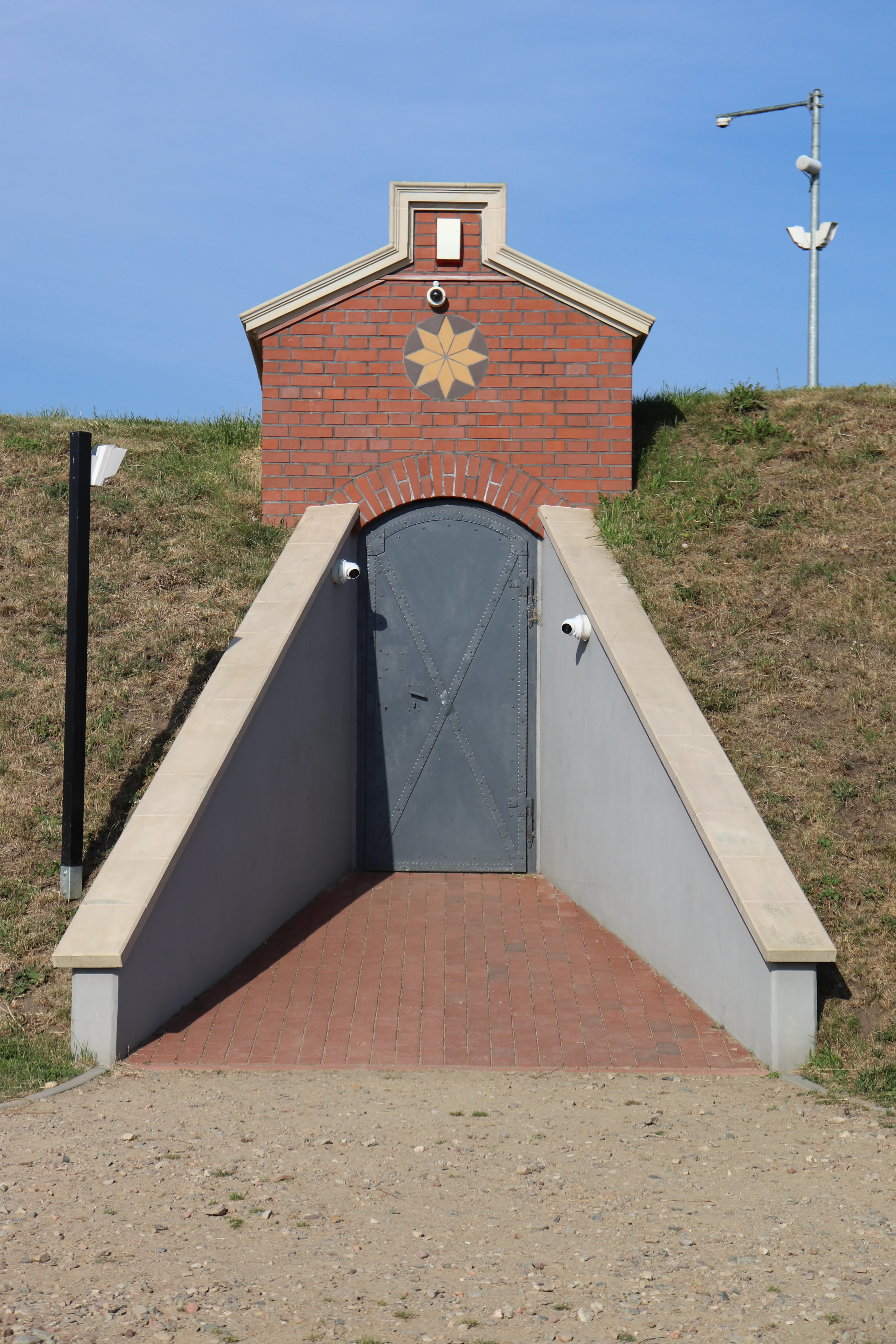
A red brick building entrance built into a grassy hill, featuring a gray arched metal door and a star-shaped ornament above the entrance.
The entrance to the Stara Orunia Water Reservoir in Gdańsk, Poland.

Zbiornik Wody Stara Orunia history and protected-area timeline

The history of Zbiornik Wody Stara Orunia begins in the mid-19th century, when Gdansk undertook a major modernization of its water and sewage systems under the leadership of mayor Leopold von Winter. The Prussian engineer Eduard Friedrich Wiebe designed both the overall water supply concept and the specific structure of the reservoir as part of this program. Construction was completed in 1869, and the reservoir entered service as a gravity-fed drinking water cistern serving the urban network.

Water reached the reservoir through a cast-iron pipeline from a drainage intake at Pręgowo, located above the city. From the reservoir, water descended under gravity into the lower parts of Gdansk, allowing the system to smooth out daily fluctuations in demand. Because the reservoir was built underground on a hillside rather than as an elevated tower, it functioned as a quieter, less conspicuous counterpart to a traditional water tower.

The reservoir belonged to the low-pressure category of Gdansk's network of several underground cisterns, owing to its modest elevation of approximately 40 meters above sea level. By the late 20th century this became a limitation, and the structure was taken out of active service in 1978. Although the reservoir itself was retired, the original Pręgowo water intake has continued in use, now feeding newer reservoirs near the historic site.

Between 2016 and 2018 the abandoned reservoir was revitalized for public access and heritage preservation. Works included uncovering and conserving the brick vault ceilings and replacing the original earth covering with lighter expanded clay aggregate to reduce structural load and improve insulation. In 2019 the site was entered into the municipal heritage register, and it has since been incorporated into the Gdansk Water Trail, a publicly accessible route connecting surviving historic water infrastructure across the city. Since 2021 the site has also been designated as a Natura 2000 special area of conservation for bats, marking a new chapter in which the historic reservoir is valued simultaneously as cultural heritage and as protected wildlife habitat.

Zbiornik Wody Stara Orunia landscape and geographic character

The reservoir sits within the elevated landscape of southern Gdansk, in the Orunia district, among the low hills that begin at Góra Pięciu Braci and extend along the upper Radunia Canal valley. This gently undulating terrain, shaped by the valleys of small streams such as the Orunia Potok, gives the area a softer, greener character compared with the dense urban core closer to the Motława River.

From the exterior, the reservoir presents as a low brick structure largely concealed beneath ground level. Only ventilation columns and modest entry portals reveal its presence. Internally, the landscape is architectural rather than natural: a long, ordered sequence of eleven parallel naves separated by eight arcades, each arcade spanning roughly four meters. The vaulted interior, rising to about five meters in height, creates a cathedral-like rhythm of brick arches and shadows, broken by still water covering the floor and by the soft, indirect lighting installed for visitors.

Adjacent to the reservoir, the surrounding Orunia Park and the broader Dolina Potoku Oruńskiego protected landscape zone add a layer of natural scenery. Walking paths, viewpoints, and wooded slopes along the nearby canal valley connect the industrial monument to a wider recreational landscape that includes observation points such as the hike-named Viewpoint XII 'Jerzy,' which honors the local historian Jerzy Samp.
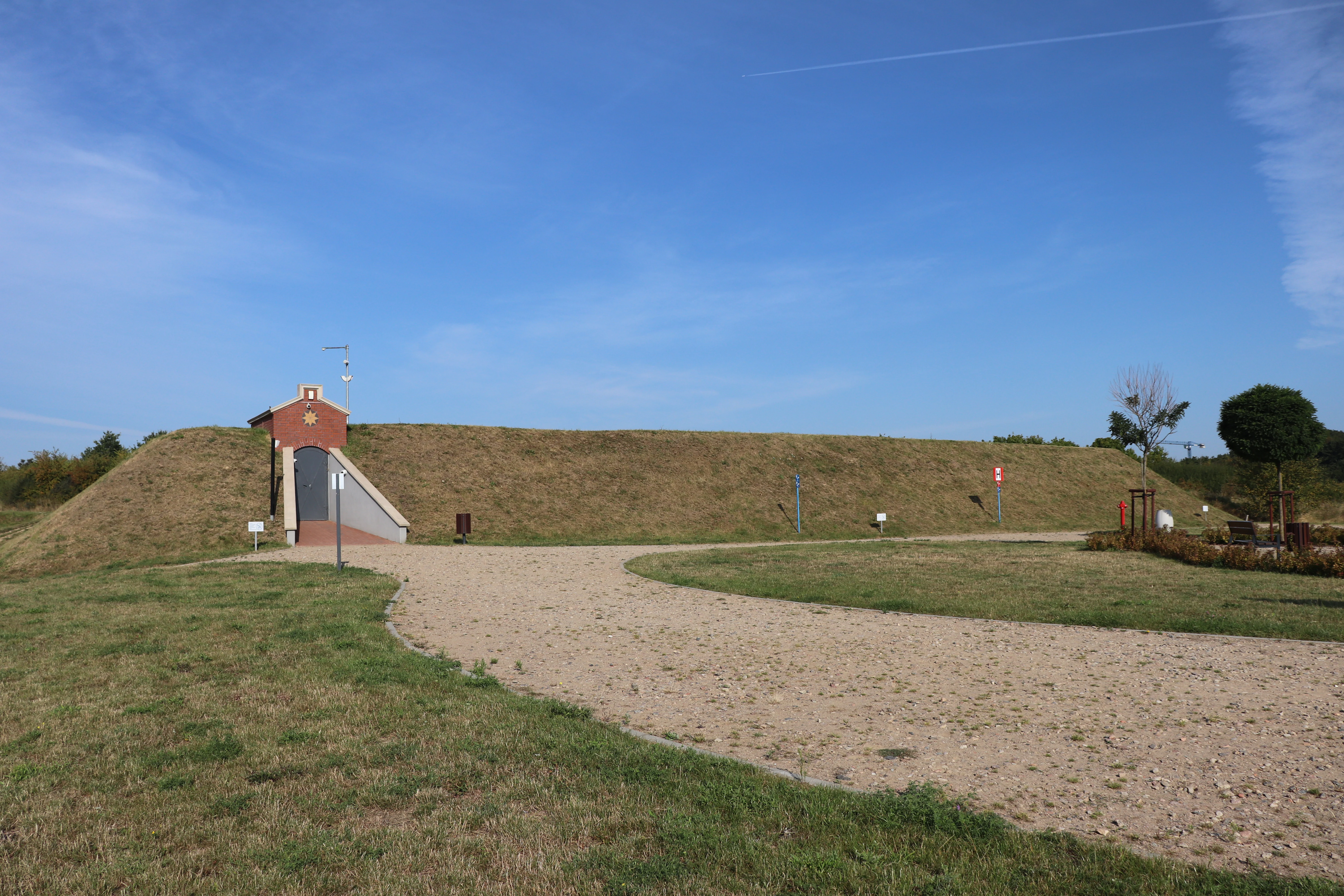
A red brick building entrance built into a grassy mound, serving as an access point for the Stara Orunia water reservoir, with a gravel path leading up to it under a clear blue sky.
The historic entrance to the Stara Orunia underground water reservoir in Gdansk.

Zbiornik Wody Stara Orunia ecosystems, habitats, and plant life

The natural environment of the Orunia reservoir is unusual because the most important ecological feature lies underground, inside the brick structure itself. The reservoir's enclosed chambers maintain a particularly stable microclimate: constant darkness, limited air exchange, mild and even temperatures, and very low disturbance from human activity once the hibernation season begins. These conditions closely resemble traditional cave environments, which are scarce in the lowlands of Pomerania, and they form the basis for the site's ecological significance.

The broader landscape around the reservoir belongs to the Dolina Potoku Oruńskiego protected landscape complex, a zone that protects the valley of the Orunia stream along with its associated habitats. This mosaic includes fragments of woodland, wet meadows, and small watercourses that connect the reservoir area with the nearby Radunia Canal. Together, these features support a network of habitats used by bats both for roosting and, in warmer seasons, for commuting and feeding.

While the reservoir itself is a built environment, its role in the local ecological system is essentially that of an artificial cave within an otherwise lowland urban matrix. For bats that require cool, quiet, and frost-free winter quarters, the difference between a natural limestone cave and a brick vault maintained at roughly stable temperatures is far less important than the absence of disturbance. The site's Natura 2000 status reflects precisely this recognition that even small, very localized shelters can be critical on a regional scale.

Zbiornik Wody Stara Orunia wildlife and species highlights

Bats are the dominant wildlife focus at Zbiornik Wody Stara Orunia, and the reservoir is now classified as a Natura 2000 special area of conservation specifically to protect its hibernating bat community. The primary species protected is the greater mouse-eared bat, whose winter roost in the reservoir is the formal object of conservation for the site.

In addition to the greater mouse-eared bat, the reservoir is regularly used by other bat species during the hibernation period. Surveys have recorded the presence of the whiskered bat and Natterer's bat, with occasional observation of the long-eared bat and the brown long-eared bat. Since the early years of monitoring, winter counts have varied considerably from year to year, with totals ranging from roughly 100 to about 800 individuals, reflecting natural fluctuations in bat populations and local conditions.

Visits to the reservoir are timed to avoid the hibernation period, so as not to disturb the bats. Because the underground chambers hold still water and quiet air throughout the cold season, and because access is tightly regulated, the reservoir has become one of the most reliable urban bat wintering sites in the Gdansk area. For visitors and local conservation organizations alike, the site illustrates how a piece of decommissioned industrial infrastructure can acquire significant ecological value once managed for wildlife.

Zbiornik Wody Stara Orunia conservation status and protection priorities

Conservation at Zbiornik Wody Stara Orunia operates on two interlocking levels: the protection of an industrial heritage structure and the protection of an important bat hibernation site. Since 2021, the underground reservoir has been recognized as the Natura 2000 site 'Zbiornik na Oruni,' a special area of conservation focused on the greater mouse-eared bat and its winter roost within the brick-vaulted chambers.

The most direct conservation measure is the strict limitation of human access during the bat hibernation season, when disturbance could be fatal to roosting animals. Public visits are only possible outside this period, and only with a guide, which limits the number of people entering the chamber at any one time and ensures that bat-friendly conditions are maintained. The 2016 to 2018 revitalization was carried out with conservation in mind: excavating and restoring the vaults improved their structural stability, while replacing the heavy earth cover above with lighter expanded clay aggregate reduced the structural load and improved thermal insulation, helping to stabilize conditions inside.

The reservoir is also part of the broader Dolina Potoku Oruńskiego protected landscape complex, which connects the site to surrounding natural areas. Recognition as a Natura 2000 area and inclusion in Gdansk's municipal heritage register in 2019 have together given the site a formal, long-term protective framework. In effect, the conservation story at the Orunia reservoir is one of reusing decommissioned infrastructure for biodiversity rather than removing or replacing it.

Zbiornik Wody Stara Orunia cultural meaning and human context

Zbiornik Wody Stara Orunia is closely tied to the identity of the Orunia district, one of Gdansk's older neighborhoods, with a long history of small-scale industry, market gardening, and freight along the Radunia Canal. The Orunia Park nearby, the nearby hills along the canal valley, and the legacy of local brickyards at Kolibki together shaped both the labor and the materials that made the reservoir possible.

The site also carries an explicitly educational and touristic cultural role. Since its revitalization, the reservoir has been integrated into the Gdańsk Water Trail, a route that opens up surviving pieces of the city's historic water supply for guided visits. Adjacent viewpoints, including Viewpoint XII 'Jerzy,' named for the historian Jerzy Samp, emphasize the reservoir's place in a wider narrative of local heritage, scholarship, and community memory. For residents and visitors alike, the reservoir represents a tangible link between 19th-century public health engineering and contemporary urban identity in Gdansk.

Top sights and standout views in Zbiornik Wody Stara Orunia

Zbiornik Wody Stara Orunia stands out as one of the rare underground water reservoirs from the Prussian era of Gdansk's history that remains physically accessible. Its defining features include the eleven parallel brick naves, the 19th-century cast-iron pipeline system that once brought water from Pręgowo, and the unusually calm, cathedral-like interior formed by brick arches over still water.

Equally notable is the site's layered identity. It functions simultaneously as a piece of preserved industrial heritage, a stop on the Gdańsk Water Trail, and a Natura 2000 protected area hosting one of the region's most important bat hibernation roosts. This combination of architectural, educational, and ecological value is uncommon even among European historic waterworks and gives the Orunia reservoir a distinctive cultural and natural profile.

Best time to visit Zbiornik Wody Stara Orunia

The most suitable period to visit the reservoir is outside the bat hibernation season, when guided tours are offered and disturbance to wildlife is avoided. Visiting during late spring, summer, or early autumn allows exploration of the underground chambers when bat activity is reduced and the surrounding Orunia Park and Dobra Potoku Oruńskiego valley are at their most attractive.

In winter, the site itself is closed to visitors to protect hibernating bats, but the surrounding landscape still offers viewpoints and walks. Weather in Gdansk is generally mildest and driest from late spring through early autumn, which is also when the wider Radunia Canal valley and adjacent parks are most accessible. Because tours are available only with a guide during a limited season, visitors should plan a trip within the open months rather than attempting a winter visit.
Monthly climate preview

Long-term representative point measurements tracking monthly temperature variations and precipitation distribution

Zbiornik Wody Stara Orunia Climate Normals, Annual Temperature and Precipitation Rhythm

Representative coordinate records show average temperatures ranging from negative values in winter months to peak warmth in July and August alongside steady year-round precipitation. Reviewing the complete twelve-month profile provides detailed meteorological data for tracking annual climate patterns.
Annual mean8 °C
0 °C18 °C
Jan
Feb
Mar
Apr
May11°
Jun15°
Jul18°
Aug18°
Sep14°
Oct
Nov
Dec
Warmest month
August

18.3 °C

Coolest month
January

-0.5 °C

Wettest month
July

2.5 mm/day

Driest month
April

1.3 mm/day

Park location guide

Geography guide, regional context, and park location map for Zbiornik Wody Stara Orunia

Zbiornik Wody Stara Orunia park geography, regions, and map view in Poland

Understand where Zbiornik Wody Stara Orunia sits in Poland through a broader geographic reading of the surrounding landscape, nearby location context, and its mapped position within the national park landscape.

How Zbiornik Wody Stara Orunia fits into Poland

Poland, officially the Republic of Poland, is a Central European country spanning from the Baltic Sea in the north to the Carpathian Mountains in the south. It borders Germany, Czech Republic, Slovakia, Ukraine, Belarus, Lithuania, and Kaliningrad Oblast. The country has a temperate climate, diverse landscapes, and is known for its rich history, cultural heritage, and strong economic position within the EU.

Wider geography shaping Zbiornik Wody Stara Orunia in Poland

Poland occupies 312,696 km2 in Central Europe, extending from the Baltic Sea coast in the north to the Sudetes and Carpathian Mountains in the south. It borders Germany to the west, Czech Republic and Slovakia to the south, Ukraine and Belarus to the east, and Lithuania and Kaliningrad Oblast to the northeast. The landscape includes lowland plains, uplands, and mountain ranges.

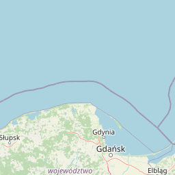
Map view of Zbiornik Wody Stara Orunia

Use this park location map to pinpoint Zbiornik Wody Stara Orunia in Poland, understand its exact geographic position, and read its mapped placement within the surrounding landscape more clearly.

Pigeon | © OpenStreetMap contributors

Visual exploration of the historic underground reservoir architecture and surrounding protected landscape

Zbiornik Wody Stara Orunia Photos, Landscape Scenery, and Protected Area Views

Visual documentation captures the vaulted brick architecture, industrial heritage, and sheltered wildlife habitats defining Zbiornik Wody Stara Orunia. Detailed photography reveals the subterranean terrain, structural geometry, and protected environmental character of the historic reservoir.

A red brick building entrance built into a grassy hill, featuring a gray arched metal door and a star-shaped ornament above the entrance.

A wide, low-angle shot inside the Stara Orunia water reservoir, showing multiple rows of dark, red-brick arches reflecting in a still pool of water, illuminated by warm artificial lights.

A red brick building entrance built into a grassy mound, serving as an access point for the Stara Orunia water reservoir, with a gravel path leading up to it under a clear blue sky.

Park atlas

Compare adjacent conservation landscapes and regional heritage sites

Parks Near Zbiornik Wody Stara Orunia and Surrounding Protected Areas

Browse other parks near Zbiornik Wody Stara Orunia to examine related protected landscapes and regional valley terrain. Expanding the geographic comparison reveals connected nature reserves and local architectural monuments across northern Poland.
Nature reservePomeranian Voivodeship
About 7.5 km away#1 closest

Northwest

Dolina Strzyży Nature Reserve Protected Forest and Stream Valley Geography

Natural riparian forest in Pomeranian Voivodeship

Explore the geographic profile of Dolina Strzyży Nature Reserve, a protected valley woodland in the Pomeranian Voivodeship of Poland. This reserve maintains dense oak-hornbeam habitats and stream-side ecosystems, functioning as a vital green connection between urban Gdańsk and the expansive Trójmiejski Park Krajobrazowy, preserving historic forest remnants.

Area
0.385 km²
Established
2007
Relief
Upland
Climate
Temperate
A wide panoramic watercolor illustration showing a pastoral landscape with green rolling hills, a winding river, scattered trees, and a soft sky with pink and yellow hues.
Protected areaPomeranian Voivodeship
About 9.3 km away#2 closest

Northeast

Twierdza Wisłoujście Protected Area: Coastal Geography and Historical Mapping in Gdańsk

A historic Baltic fortification and vital ecological site in Pomeranian Voivodeship.

Explore the layered masonry and water-influenced landscape of Twierdza Wisłoujście, a coastal fortress established on the delta of the Vistula River. This site bridges the history of maritime defense and modern ecological conservation as a designated Natura 2000 area. Examine how shifting river channels and centuries of construction define the current defensive perimeters and moated surroundings within the Pomeranian Voivodeship.

Established
1482
Relief
Lowland
Climate
Temperate
Access
Easy access
Protected landscapePomeranian Voivodeship
About 15 km away#3 closest

Northwest

Trójmiejski Park Krajobrazowy: Protected Landscape and Glacial Geography in Pomerania

Exploring the forested moraine upland near the Baltic coast

Covering nearly 20,000 hectares, Trójmiejski Park Krajobrazowy forms an essential green belt along the Kashubian moraine. Its terrain is defined by dramatic erosion, including 80-meter deep ravines and extensive pine-beech forests that host rare relic plant species and protected peatland habitats.

Area
199.3 km²
Established
1979
Relief
Upland
Climate
Temperate
Nature reservePomeranian Voivodeship
About 16 km away#4 closest

South

Dolina Kłodawy Nature Reserve: Geography and Botanical Protected Areas in Pomeranian Voivodeship

Glacial river gorge landscapes in Northern Poland

This protected area centers on a 1.6 kilometer section of the Kłodawa stream, showcasing complex forest ecosystems including ash-alder woodlands and oak-hornbeam slopes. The site remains a vital reference for regional botanical geography, highlighting how glacial moraine hills create unique habitats for rare plants within the Pomeranian Voivodeship landscape.

Area
0.104 km²
Established
1999
Relief
Lowland
Climate
Temperate
A horizontal watercolor illustration showing a gentle river landscape with soft green meadows, trees, and rolling hills in the background.
Nature reservePomeranian Voivodeship
About 21 km away#5 closest

Northwest

Kacze Łęgi Nature Reserve: Mapped Protected Woodland and River Valley Geography

Riparian floodplain forest in the Pomeranian Voivodeship of Poland

Kacze Łęgi functions as a crucial nature reserve that maintains an unusually well-preserved fragment of elm and alder floodplain forest. Nestled along the Kacza River valley in Gdynia, this site offers a concentrated look at the original vegetation of Baltic river valleys. It remains a key component of the regional protected landscape, providing a deep study of moisture-loving woodland within the larger context of the Pomeranian coastal lowlands.

Area
0.09 km²
Established
1983
Relief
Lowland
Scope
Terrestrial
A soft watercolor painting of a marshy coastal landscape with tall grasses, calm water, and distant dunes under a bright, clear sky.
Nature reservePomeranian Voivodeship
About 22 km away#6 closest

East

Rezerwat przyrody Mewia Łacha: Protected Coastal Geography and Vistula Estuary Map

Dynamic Baltic sandbars and migratory bird habitat in Pomerania

Rezerwat przyrody Mewia Łacha occupies a vital coastal strip where river discharge meets the Gulf of Gdańsk. This nature reserve serves as an essential site for migratory waterfowl and nesting terns, defined by its shifting sandbars, dune slacks, and brackish pools. It stands as a key example of the varied estuarine geography found within the Pomeranian Voivodeship.

Area
1.505 km²
Established
1991
Relief
Lowland
Climate
Temperate
Nature reservePomeranian Voivodeship
About 35 km away#7 closest

North

Mechelińskie Łąki Nature Reserve: Coastal Geography and Protected Baltic Wetland Atlas

Pomeranian Voivodeship coastal dune and marsh landscape exploration

Investigate the protected topography of Mechelińskie Łąki Nature Reserve, where saline meadows meet the Baltic shoreline of Puck Bay. This faunistic reserve preserves an essential mosaic of dunes, marshes, and reedbeds in northern Poland, serving as a significant habitat for nesting shorebirds and rare amphibian species within the Pomeranian Voivodeship.

Area
1.135 km²
Established
2000
Relief
Lowland
Climate
Temperate
Nature reservePomeranian Voivodeship
About 44 km away#8 closest

West

Rezerwat przyrody Jezioro Turzycowe: Wetland Protected Area in Pomeranian Voivodeship

Kashubian Lake District bog forest and dystrophic lake atlas

Rezerwat przyrody Jezioro Turzycowe protects a concentrated mosaic of post-glacial wetland environments, including a dystrophic lake and raised bog habitats. This nature reserve offers deep insight into the specific hydrological and botanical conditions defining northern Polish wilderness corridors.

Area
0.114 km²
Established
1959
Relief
Upland
Climate
Temperate

Common questions about visiting, size, designation, and location context for Zbiornik Wody Stara Orunia

Zbiornik Wody Stara Orunia FAQs for park facts, access, geography, and protected area context

Find quick answers about Zbiornik Wody Stara Orunia, including protected-area facts, park geography, trail and visitor context, and how the park fits into its surrounding country and regional landscape.
MoriAtlas Explorer

Continue Your Protected Areas Search Across the Global Atlas

Deepen your exploration by continuing the structured search for national parks and protected areas worldwide. Utilize the comprehensive filtering capabilities to compare different conservation landscapes and refine your understanding of global park geography. Discover more about the distribution and characteristics of protected natural areas.

Global natural geography