Mori Atlas logo
Protected areaZbocza Płutowskie

A vital ecological mosaic of riparian forest and dry slope habitats in Kuyavian-Pomeranian Voivodeship

Zbocza Płutowskie: Examining Protected Area Boundaries and Rare Xerothermic Grassland Landscapes

(Zbocza Płutowskie (PLH040040))

Zbocza Płutowskie represents a significant protected area within the Kuyavian-Pomeranian Voivodeship of northern Poland. This site safeguards a complex ecological gradient, ranging from rare xerothermic grasslands on sun-warmed slopes to extensive oak-hornbeam and alluvial floodplain forests. By mapping the transition between these distinct terrain types, the area provides a window into the conservation value of lowland Polish habitats and their preservation as part of the Natura 2000 network.

Natura 2000Special Area of Conservationxerothermic grasslandsbroadleaf forestoak-hornbeam forestfloodplain forest

Zbocza Płutowskie

Protected area

Park overview

Structured park overview, official facts, and landscape profile for Zbocza Płutowskie

Zbocza Płutowskie park facts, protected area profile, and essential visitor context

Review the core facts for Zbocza Płutowskie, including designation, size, terrain, visitor scale, habitats, and operating context in one park-focused overview.

About Zbocza Płutowskie

Zbocza Płutowskie is a habitat-focused protected area in the Natura 2000 ecological network, a European Union initiative that designates sites of community importance for the long-term preservation of natural habitats and selected species. The site carries the official Natura 2000 code PLH040040 and is classified as a Special Area of Conservation, which means it is primarily aimed at protecting habitats and animal species other than birds covered by the EU Habitats Directive.

Geographically, the area lies in the Kuyavian-Pomeranian Voivodeship, one of the historical-cultural regions of north-central Poland, and is associated with the administrative area around Kijewo Królewskie in Chełmno County. The site covers roughly 1,011 hectares, a moderate surface that nonetheless represents a wide range of habitat types in close proximity. This juxtaposition of dry, elevated terrain and lower-lying, more humid forest is a defining feature of the place and gives the site much of its ecological significance.

The natural value of the area is rooted in the preservation of habitat types that have become increasingly fragmented in the surrounding agricultural landscape. The dry slopes support a grassland community of calcareous or xerothermic character, a habitat type that in Poland is generally associated with steep, sun-exposed valley sides and river valleys. Adjacent to these slopes, the site includes meadows traditionally managed in an extensive way, a habitat that depends on long continuity of low-intensity mowing or grazing and that today is one of the most threatened semi-natural habitats in lowland Europe.

In parallel, the site also preserves representative examples of Central European deciduous forests: oak-hornbeam communities at slightly higher or more stable positions, and several types of alluvial and floodplain forests along the lower, seasonally wetter parts of the terrain. The combination of slope, meadow, and woodland habitats within a relatively small area is what makes Zbocza Płutowskie a meaningful component of the Natura 2000 network in this part of Poland.

Quick facts and research context for Zbocza Płutowskie

Zbocza Płutowskie (code PLH040040) is a Special Area of Conservation in the Natura 2000 network, covering roughly 1,011 hectares in the Kuyavian-Pomeranian Voivodeship in north-central Poland. The site is positioned near Kijewo Królewskie within Chełmno County and was established to protect specific Annex I habitat types and selected non-bird animal species targeted by the EU Habitats Directive. Its habitat portfolio includes xerothermic grasslands, extensively used lowland and upland meadows, Central European oak-hornbeam forests, willow-poplar-alder-ash floodplain forests, and alluvial oak-elm-ash forests.

Protection and recognition

Documented terrestrial protection scope and international recognition sources

Zbocza Płutowskie Protection Status and Natura 2000 Recognition

Zbocza Płutowskie holds documented terrestrial protection status supported by official Natura 2000 recognition records. Structured conservation data outlines the established management scope and international designation details for this protected area.

International recognition

Protection details

Protection scope
Terrestrial
Transboundary protection
No
Park context

Deeper park guide and search-rich context for Zbocza Płutowskie

Zbocza Płutowskie history, landscape, wildlife, and travel context

Explore Zbocza Płutowskie through its history, landscape character, ecosystems, wildlife, conservation priorities, cultural context, and seasonal travel timing in a structured park guide built for atlas discovery and search intent.

Why Zbocza Płutowskie stands out

The site is best known for combining xerothermic, sun-exposed slope grasslands with oak-elm-ash floodplain forest and Central European oak-hornbeam woodland. These habitat types, particularly the dry calcareous grasslands of the Festuco-Brometea class and the Ficario-Ulmetum riverine forests, are among the most characteristic and threatened lowland habitat complexes in the Polish Natura 2000 network.

Zbocza Płutowskie history and protected-area timeline

As a Natura 2000 site, Zbocza Płutowskie was formalized through the European Union's Habitats Directive framework, which requires member states to identify Special Areas of Conservation for habitat types and species listed in the directive's annexes. The site's designation reflects the recognition that the combination of dry slope grasslands, extensively managed meadows, and broadleaf alluvial forests present here is of European conservation importance. Historical land use, particularly the persistence of extensive meadow management on slopes that are less suitable for intensive agriculture, has played a central role in maintaining the habitat quality that justified the designation.

Zbocza Płutowskie landscape and geographic character

The landscape of Zbocza Płutowskie is defined by a transition between elevated, well-drained slopes and lower, more humid valley terrain typical of the northern Polish lowlands. The slopes themselves are the most visually distinctive element; they support xerothermic, dry grassland communities of the Festuco-Brometea type, vegetation that depends on sunny exposures and thin, often calcium-rich soils.

Around and below these slopes, the broader topography flattens into terrain occupied by semi-natural meadows and by several types of deciduous forest. The oak-hornbeam forests of the Galio-Carpinetum and Tilio-Carpinetum association occupy the more stable, mesic positions in the forest complex, while the riverine and floodplain stretches are dominated by willows, poplars, alders, and ash, with extensive oak-elm-ash stands of the Ficario-Ulmetum type along the wettest reaches.

The overall impression of the landscape is one of a mosaic rather than a single unified habitat type: grasslands on the slopes, meadows along gentler gradients, and a layered forest mosaic on the valley floor. This juxtaposition of habitats within a compact area is a defining visual and ecological feature of the site.

Zbocza Płutowskie ecosystems, habitats, and plant life

Ecologically, Zbocza Płutowskie captures a small but coherent cross-section of lowland Central European habitats. The most distinctive component is the xerothermic grassland habitat listed under code 6210, characterized by drought-adapted species and adapted to steep, sunny slopes. These dry grasslands are unusually well preserved in this region and provide a key reference for habitat conservation planning in the Kuyavian-Pomeranian area.

Meadow habitats of the Arrhenatherion and Polygono-Trisetion types add a second major ecological element to the site. These lowland and upland fresh meadows have been shaped over long periods by extensive, low-intensity management, and their botanical diversity depends on the continuation of that tradition. They form an important ecological bridge between the dry slopes and the forest communities.

The forest component of the site is unusually rich for a single Natura 2000 area. The Central European oak-hornbeam forest (9170) represents the mesic forest type, while three distinct classes of floodplain and alluvial woodland (91E0 and 91F0) represent the hydrologically dynamic habitats along the river system. Together, these habitats create a layered ecological structure from dry grassland through meadow and mesic woodland down to periodically flooded alluvial forest.

Zbocza Płutowskie wildlife and species highlights

The site's species protection focus is on non-bird animal species listed in the EU Habitats Directive. Eriogaster catax, the barred tree moth known in Polish as barczatka kataks, is one of the species for which the area was designated. Maculinea (Phengaris) nausithous, the dusky large blue butterfly, known in Polish as modraszek nausitous, is the other key species highlighted in the designation. The presence of these species underlines the role of the site in maintaining both dry-grassland and wet-meadow butterfly and moth populations that have declined across much of lowland Europe.

Zbocza Płutowskie conservation status and protection priorities

Zbocza Płutowskie is significant from a conservation perspective because it bundles several habitat types that are individually rare and increasingly fragmented in the surrounding agricultural landscape into a single protected area. Xerothermic slope grasslands of the Festuco-Brometea type, traditionally managed lowland and upland meadows, Central European oak-hornbeam forests, and several classes of alluvial and floodplain forests are all represented here. The site's inclusion in the Natura 2000 network gives these habitats formal protection status and connects them to a wider European network of similar sites. Designated species such as Eriogaster catax and Maculinea nausithous further reinforce the conservation priority of maintaining extensive, semi-natural habitat complexes in this part of Poland.

Top sights and standout views in Zbocza Płutowskie

The most distinctive feature of Zbocza Płutowskie is the coexistence, within a relatively compact territory, of dry xerothermic grasslands, traditionally managed meadows, and a broadleaf forest mosaic that includes both mesic oak-hornbeam woodland and multiple classes of alluvial floodplain forest. The site is also notable for being a dedicated habitat protection area rather than a landscape park, with formal Natura 2000 status reflecting the European significance of its habitat and species combinations, including the moths and butterflies for which the site was specifically designated.

Monthly climate preview

Track monthly temperature ranges and precipitation averages across the protected terrain

Zbocza Plutowskie Climate Normals and Long-Term Weather Patterns

Representative coordinates record measured monthly temperature swings and precipitation averages from 1991 to 2020 at ninety-four meters of elevation. Examining the complete twelve-month statistical baseline provides a detailed look at long-term climatic variations across the protected area.
Annual mean8 °C
-3 °C19 °C
Jan-3°
Feb-2°
Mar
Apr
May13°
Jun17°
Jul19°
Aug19°
Sep14°
Oct
Nov
Dec-1°
Warmest month
July

19.4 °C

Coolest month
January

-3 °C

Wettest month
July

2.6 mm/day

Driest month
April

1.2 mm/day

Park location guide

Geography guide, regional context, and park location map for Zbocza Płutowskie

Zbocza Płutowskie park geography, regions, and map view in Poland

Understand where Zbocza Płutowskie sits in Poland through a broader geographic reading of the surrounding landscape, nearby location context, and its mapped position within the national park landscape.

How Zbocza Płutowskie fits into Poland

Poland, officially the Republic of Poland, is a Central European country spanning from the Baltic Sea in the north to the Carpathian Mountains in the south. It borders Germany, Czech Republic, Slovakia, Ukraine, Belarus, Lithuania, and Kaliningrad Oblast. The country has a temperate climate, diverse landscapes, and is known for its rich history, cultural heritage, and strong economic position within the EU.

Wider geography shaping Zbocza Płutowskie in Poland

Poland occupies 312,696 km2 in Central Europe, extending from the Baltic Sea coast in the north to the Sudetes and Carpathian Mountains in the south. It borders Germany to the west, Czech Republic and Slovakia to the south, Ukraine and Belarus to the east, and Lithuania and Kaliningrad Oblast to the northeast. The landscape includes lowland plains, uplands, and mountain ranges.

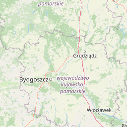
Map view of Zbocza Płutowskie

Use this park location map to pinpoint Zbocza Płutowskie in Poland, understand its exact geographic position, and read its mapped placement within the surrounding landscape more clearly.

Pigeon | © OpenStreetMap contributors

Location context for Zbocza Płutowskie

Kuyavian-Pomeranian Voivodeship
Park atlas

Compare surrounding lowland habitats and adjacent protected landscapes across the region

Parks Near Zbocza Płutowskie and Related Protected Areas in Regional Polish Lowlands

Browsing other protected areas near Zbocza Płutowskie reveals connected lowland habitats, riverine forests, and rare slope grasslands across the Kuyavian-Pomeranian Voivodeship. Extending the geographic comparison helps place local xerothermic ecosystems and floodplain terrain within a broader regional context.
Watercolor painting of a wide, soft-focus river valley landscape with gentle hills, green vegetation, and a winding waterway.
Protected landscapeKuyavian-Pomeranian Voivodeship
Park boundaries overlap#1 closest

Northeast

Chełmiński Park Krajobrazowy: Geographic Overview of Protected Lands in Kuyavian-Pomeranian

Glacial moraine terrain and Vistula valley protected landscapes

Chełmiński Park Krajobrazowy preserves a compact, high-contrast landscape where glacial moraine hills meet the active river corridors of the Lower Vistula. The area is defined by its five distinct nature reserves that safeguard unique slope habitats, island-like floodplain forests, and post-glacial lake basins, offering an essential reference for studying the geomorphology of the Polish lowlands.

Area
223.36 km²
Established
1998
Scope
Terrestrial
Water
Major water bodies
Protected areaKujawsko-Pomorskie Voivodeship
0.4 km away#2 closest

West

Solecka Dolina Wisły: Mapping the Middle Vistula River Valley Protected Landscapes

Protected riverine habitats in Kujawsko-Pomorskie Voivodeship

The Solecka Dolina Wisły protected area captures the ecological structure of the Vistula River valley. From active sandy bars in the river channel to oak-hornbeam woodlands on the upper valley slopes, the site offers a detailed look at lowland riverine geography, flood-plain dynamics, and xerothermic grassland habitats within the Polish landscape.

Area
70.301 km²
Established
2009
Relief
Lowland
Scope
Terrestrial
Protected landscapeKuyavian-Pomeranian Voivodeship
19 km away#3 closest

North

Wdecki Park Krajobrazowy: Protected Landscape Atlas and Regional Geography

Forest and river basin terrain in Poland

Examine the geographic foundation of Wdecki Park Krajobrazowy, a protected landscape characterized by the Wda River drainage, glacial erratics, and extensive pine forests. The area supports a rich variety of wetland flora, mires, and managed reservoirs such as the Żur, making it a significant conservation landmark within the wider Bory Tucholskie region of northern Poland.

Area
191.77 km²
Established
1993
Relief
Lowland
Climate
Temperate
A minimalist watercolor painting showing a calm lake or wetland surrounded by soft green trees and gentle hills under a light sky.
Protected areaKuyavian-Pomeranian Voivodeship
28 km away#4 closest

North

Sandr Wdy Protected Area: Glacial Geography and Wetland Habitats in Northern Poland

An essential reference area for Bory Tucholskie forest ecology.

Sandr Wdy is a distinctive Natura 2000 protected area shaped by post-glacial processes. The landscape features a flat outwash plain punctuated by lake basins, river valleys, and diverse mire systems. With multiple strict nature reserves integrated into its boundaries, the site provides a comprehensive view of how hydrological and soil conditions influence habitat distribution within the broader forest landscape of Poland.

Area
63.21 km²
Established
2011
Relief
Lowland
Climate
Temperate
A panoramic watercolor illustration showing a calm lake bordered by pine trees and patches of pink shrubs under a pale sky.
Nature reservePoland
About 33 km away#5 closest

North

Rezerwat przyrody Miedzno: Wetland and Peatland Protected Area in Northern Poland

Geographic atlas of the Miedzno nature reserve and its glacial valley.

Rezerwat przyrody Miedzno represents a vital ecological corridor in Poland, defined by its flow-through lake, alder-birch swamp forests, and rare marshland flora. This nature reserve, situated within the Wdecki Landscape Park, provides a detailed view into the post-glacial topography and avian conservation landscapes of the Bory Tucholskie mesoregion.

Area
0.885 km²
Established
1968
Relief
Lowland
Climate
Temperate
A watercolor painting showing a soft, atmospheric landscape with a winding body of water, green treelines, and patches of pinkish bog vegetation against a pale, warm sky.
Nature reserveKuyavian-Pomeranian Voivodeship
About 34 km away#6 closest

North

Dury Nature Reserve: Protected Wetland and Peatland Geography in Kuyavian-Pomeranian Voivodeship

Strictly protected dystrophic lake and bog habitats

Dury Nature Reserve is a specialized botanical and hydrological site in the Tuchola Forest. It preserves a distinct mosaic of four dystrophic lakes surrounded by peat bogs. The reserve is a core component of local wetland conservation, protecting rare bog species and maintaining the integrity of northern Polish forest ecosystems.

Area
0.13 km²
Established
1975
Relief
Lowland
Climate
Temperate
Protected landscapeKuyavian-Pomeranian Voivodeship
35 km away#7 closest

Northwest

Tuchola Landscape Park: Mapped Protected Area and Riverine Geography in Poland

Pine-covered outwash plains and the meandering Brda River corridor

Covering a significant portion of northern Poland, Tuchola Landscape Park protects a distinctive postglacial landscape of sandy plains and dense pine forests. The park geography is anchored by the Brda River, which flows through a series of rapids and breakthroughs before reaching deep into the surrounding pine-clad outwash plain. Detailed map data provides insight into the park's eight nature reserves, which preserve critical wetland, bog, and riverine habitats.

Area
369.83 km²
Established
1985
Relief
Lowland
Climate
Temperate
Watercolor painting of a green and pink wetland landscape with soft, abstract horizontal washes and tall grasses in the foreground.
Protected areaKuyavian-Pomeranian Voivodeship
36 km away#8 closest

Southwest

Równina Szubińsko-Łabiszyńska: Protected Area and Noteć River Valley Geography

Natura 2000 habitat mosaic in the Kuyavian-Pomeranian Voivodeship

Równina Szubińsko-Łabiszyńska functions as a crucial ecological corridor in Poland, protecting rare lowland habitats including floodplain meadows and oak-hornbeam woodlands. This site showcases the intricate relationship between the meandering Noteć river and nineteenth-century canal infrastructure, providing a unique lens into the protected wetland terrain of the region.

Area
28.259 km²
Established
2011
Relief
Lowland
Climate
Temperate

Common questions about visiting, size, designation, and location context for Zbocza Płutowskie

Zbocza Płutowskie FAQs for park facts, access, geography, and protected area context

Find quick answers about Zbocza Płutowskie, including protected-area facts, park geography, trail and visitor context, and how the park fits into its surrounding country and regional landscape.
MoriAtlas Explorer

Continue Your Protected Areas Search Across the Global Atlas

Deepen your exploration by continuing the structured search for national parks and protected areas worldwide. Utilize the comprehensive filtering capabilities to compare different conservation landscapes and refine your understanding of global park geography. Discover more about the distribution and characteristics of protected natural areas.

Global natural geography