Mori Atlas logo
National parkZion National Park

Discover the protected terrain and regional geography of this significant national park.

Zion National Park: Mapped Protected Landscape Boundaries and Geographic Context in Utah

Zion National Park stands as a distinct protected landscape within the state of Utah, offering a unique focal point for geographic discovery and atlas exploration. This page serves as the canonical entry for understanding the park's mapped boundaries and its role within the broader regional geography. Users can explore the inherent natural terrain and landscape context that defines Zion National Park, providing a foundation for structured geographic understanding.

National ParksUtahCanyon LandscapesRed Rock FormationsSlot CanyonsDesert Ecosystems

Zion National Park

National park

Park overview

Structured park overview, official facts, and landscape profile for Zion National Park

Zion National Park park facts, protected area profile, and essential visitor context

Review the core facts for Zion National Park, including designation, size, terrain, visitor scale, habitats, and operating context in one park-focused overview.

About Zion National Park

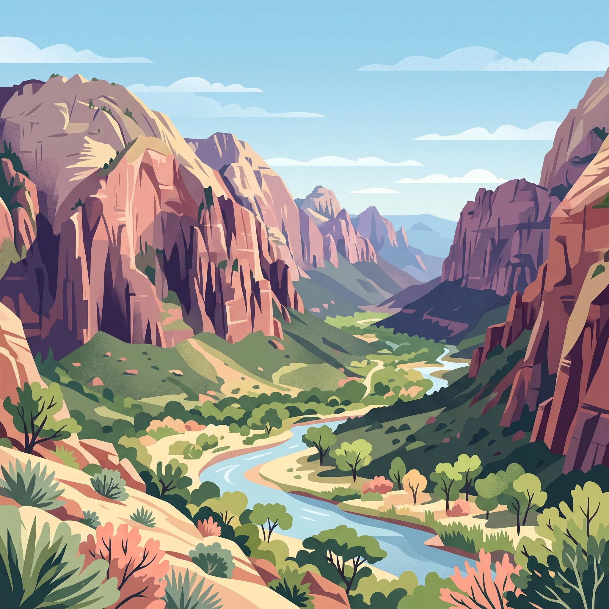
Zion National Park preserves one of the most spectacular canyon landscapes in North America. The park's defining feature is Zion Canyon, a dramatic gorge carved by the North Fork of the Virgin River through layered Navajo Sandstone. The canyon walls rise sharply from the river bottom, displaying warm reds, oranges, and creams that shift in hue throughout the day as sunlight plays across the rock faces. Beyond the main canyon, the park encompasses the Kolob Canyons section to the northwest, accessible from Cedar City, and the Kolob Terrace area featuring the famous slot canyon known as The Subway. The park's geography is remarkably varied, ranging from desert washes at lower elevations to forested mesas and plateaus exceeding 8,000 feet. This topographic complexity, combined with the meeting point of three major ecological regions, creates an extraordinary diversity of habitats and visual experiences within a single protected area. The park received 4.9 million visitors in 2024, making it one of the most visited national parks in the United States.

Quick facts and research context for Zion National Park

Zion National Park spans approximately 146,597 acres across Washington, Kane, and Iron counties in southwestern Utah. The centerpiece is Zion Canyon, a 15-mile-long canyon carved by the North Fork of the Virgin River to depths of up to 2,640 feet. The park's elevation ranges from 3,666 feet at Coalpits Wash to 8,726 feet at Horse Ranch Mountain, creating over 5,000 feet of topographic relief. The park protects significant biodiversity including 289 bird species, 75 mammals, 32 reptiles, and numerous plant species. Established as a national park in 1919, the park received wilderness designation for 85% of its area in 2009.

Protection and recognition

Tracing the terrestrial boundary history and official designation parameters established in 1919.

Zion National Park Protected Area Designation and Conservation Status

Documented geographic parameters define the terrestrial protection scope and historical designation history of Zion National Park. Researchers can analyze verified database records to trace official conservation boundaries and understand the framework securing regional canyon ecosystems.

Protection details

Protection scope
Terrestrial
Designated year
1919
Transboundary protection
No
Core area
503.45 km²
Park context

Deeper park guide and search-rich context for Zion National Park

Zion National Park history, landscape, wildlife, and travel context

Explore Zion National Park through its history, landscape character, ecosystems, wildlife, conservation priorities, cultural context, and seasonal travel timing in a structured park guide built for atlas discovery and search intent.

Why Zion National Park stands out

Zion is best known for its dramatic red sandstone canyon landscape, particularly the iconic Zion Canyon with its towering vertical walls of Navajo Sandstone. The park features the famous Angels Landing ridge, The Great White Throne, and The Narrows, a spectacular slot canyon only 20 feet wide but reaching heights of 2,000 feet. The Virgin River has carved this labyrinthine canyon system over millions of years, creating one of the most visually striking landscapes in the American West. The park's location at the convergence of the Colorado Plateau, Great Basin, and Mojave Desert creates unusual biological diversity within a relatively compact area.

Zion National Park history and protected-area timeline

Human habitation of the Zion area extends back approximately 8,000 years, beginning with small family groups of Native Americans. The Basketmaker Ancestral Puebloans arrived around 300 CE, followed by the Virgin Anasazi culture around 500 and the Parowan Fremont group. Both of these cultures had abandoned the area by approximately 1300, likely due to severe droughts. They were succeeded by Southern Paiute and Ute peoples who migrated seasonally through the region. Mormon settlers arrived in 1858, with the first permanent settlement in Zion Canyon established in 1863 by Isaac Behunin, who named the area Zion in reference to biblical places of peace. The area remained relatively isolated until the early 20th century. President William Howard Taft created Mukuntuweap National Monument in 1909 to protect the canyon. In 1918, National Park Service acting director Horace Albright proposed changing the name to Zion, arguing that the original Paiute-derived name would deter visitors who might find it difficult to pronounce. Congress redesignated the monument as Zion National Park on November 19, 1919, with President Woodrow Wilson signing the legislation. The Kolob Canyons section was added as a separate national monument in 1937 and incorporated into the park in 1956. In 2009, the Omnibus Public Land Management Act designated 124,406 acres, approximately 85% of the park, as the Zion Wilderness.

Zion National Park landscape and geographic character

The physical landscape of Zion National Park is defined by its spectacular canyon geology. Zion Canyon, the park's centerpiece, stretches 15 miles long and reaches depths of 2,640 feet, with walls of reddish Navajo Sandstone rising sharply above the Virgin River. The canyon narrows dramatically near the Temple of Sinawava, where the famous slot canyon The Narrows begins. This narrow gorge, only 20 feet wide but towering up to 2,000 feet tall, represents one of the park's most distinctive geological features. The Kolob Canyons section to the northwest features finger canyons cut into the Kolob Plateau, while the Kolob Terrace area offers the famous Subway slot canyon and panoramic views from Lava Point. The park's highest point is Horse Ranch Mountain at 8,726 feet, while the lowest point is Coalpits Wash at 3,666 feet. The Navajo Sandstone formations display striking cross-bedding patterns, particularly visible at Checkerboard Mesa, and create numerous notable features including Angels Landing, The Great White Throne, The Court of the Patriarchs, and the Towers of the Virgin. The park sits on the Markagunt and Kolob plateaus at the intersection of three geographic provinces: the Colorado Plateau, Great Basin, and Mojave Desert.

Zion National Park ecosystems, habitats, and plant life

Zion National Park occupies a remarkable ecological crossroads where the Great Basin, Mojave Desert, and Colorado Plateau converge. This biogeographical intersection, combined with dramatic elevation changes exceeding 5,000 feet, creates four distinct life zones within the park: desert, riparian, woodland, and coniferous forest. Desert conditions persist on canyon floors and rocky ledges, characterized by sagebrush, prickly pear cactus, rabbitbrush, and specialized plants like sacred datura and Utah penstemon. Riparian communities along the Virgin River and its tributaries support boxelder, Fremont cottonwood, maple, and willows, creating lush corridors of vegetation amid the arid surroundings. Mid-elevation slopes between 3,900 and 5,500 feet feature stunted forests of pinyon pine and juniper mixed with manzanita, cliffrose, serviceberry, and scrub oak. Above 6,000 feet, mesas and cliffs support ponderosa pine, Gambel oak, Douglas-fir, white fir, and aspen stands. The park's biodiversity includes 289 bird species, 79 mammals, 28 reptiles, 7 fish, and 6 amphibian species.

Zion National Park wildlife and species highlights

Zion National Park supports a diverse animal community across its four life zones. The desert habitat hosts mule deer, rock squirrels, pinyon jays, whiptail lizards, and collared lizards, with nocturnal species including desert cottontails, jackrabbits, and Merriam's kangaroo rats. Top predators such as cougars, bobcats, coyotes, badgers, gray foxes, and ring-tail cats roam the park. Desert bighorn sheep, reintroduced in 1973, are frequently visible near roadways. The avian community features golden eagles, red-tailed hawks, peregrine falcons, and white-throated swifts. California condors, reintroduced to the region, successfully bred in the park for the first time in 2014. Nineteen species of bats inhabit the area. Riparian zones support unique species including beavers, flannel-mouth suckers, gnatcatchers, dippers, canyon wrens, and the virgin spinedace fish.

Zion National Park conservation status and protection priorities

Zion National Park serves as a critical protected area at the intersection of three major North American ecosystems. The park's conservation significance was formalized in 2009 when 85% of its area was designated as wilderness under the National Wilderness Preservation System, protecting its wild character and scenic river values. The park preserves dramatic geology including the spectacular Zion Canyon and a labyrinth of deeply eroded Navajo sandstone canyons formed at the margin of the Colorado Plateau. The protection of the Virgin River corridor and its riparian habitats preserves critical water resources and wildlife corridors in this arid region. Reintroduction programs for desert bighorn sheep and California condors demonstrate active conservation management. The park also preserves evidence of human history spanning 8,000 years, maintaining cultural connections to the indigenous peoples who inhabited this landscape.

Zion National Park cultural meaning and human context

The Zion region holds deep cultural significance for multiple indigenous peoples. The Ancestral Puebloans, including the Basketmaker culture and later Virgin Anasazi, inhabited the area from approximately 300 CE until around 1300 CE. The Parowan Fremont also occupied the region before departing. These groups were succeeded by Southern Paiute and Ute peoples who maintained seasonal migration patterns throughout the area. Mormon pioneers arrived in 1858 and established permanent settlements, with Isaac Behunin naming the area Zion in 1863 after the biblical place of peace. The name reflected both religious significance and the canyon walls' resemblance to temple spires. The Mormon community had long used the term Zion to describe their desired place of refuge. The park's name was changed from the original Mukuntuweap National Monument to Zion in 1919, reflecting both the Mormon naming tradition and early 20th-century biases favoring more accessible names for tourist destinations.

Top sights and standout views in Zion National Park

Zion National Park offers world-class hiking through its signature landscapes. The Angels Landing trail provides a dramatic ridge hike with panoramic canyon views, while The Narrows allows hikers to wade through one of the most spectacular slot canyons in the world. The park's nine geological formations represent 150 million years of sedimentation, with the towering Navajo Sandstone cliffs being the most visually commanding feature. The free shuttle system provides access to Zion Canyon from early April through late October, allowing visitors to explore without private vehicles. The Kolob Canyons section offers more remote experiences including access to Kolob Arch, one of the world's longest natural arches. The Zion Traverse backpack route connects the park's northwest to southeast sections over 50 miles of trail.

Best time to visit Zion National Park

Spring and fall offer the most comfortable conditions for exploring Zion. Spring weather is unpredictable, with stormy wet days common mixed with occasional warm sunshine, while wildflowers bloom from April through June with peak flowering in May. Fall brings generally clear and mild days with cool nights, and autumn tree colors typically peak in late October in Zion Canyon. Summer days are hot, often reaching 95 to 110 degrees Fahrenheit, though overnight lows remain comfortable. Afternoon thunderstorms are common from mid-July through mid-September, occasionally producing dramatic waterfalls and flash floods. Winter in Zion Canyon is fairly mild, with clear days reaching 60 degrees Fahrenheit, though winter storms can bring rain to the canyon and heavier snow to higher elevations. The Zion Canyon Scenic Drive is served by free shuttle buses from early April to late October, with private vehicles allowed other months.
Monthly climate preview

Long term temperature and precipitation baselines measured at a high elevation coordinate

Zion National Park Climate Normals and Monthly Weather Averages

Long term climatology from 1991 to 2020 at the representative elevation of 2087 meters shows a transition from sub zero winter averages to high summer temperatures peaking above 34 degrees Celsius. Exploring the full twelve month profile reveals detailed monthly precipitation rates and temperature spreads across the yearly cycle.
Annual mean9 °C
-2 °C22 °C
Jan-2°
Feb-1°
Mar
Apr
May12°
Jun18°
Jul22°
Aug21°
Sep16°
Oct
Nov
Dec-2°
Warmest month
July

21.8 °C

Coolest month
December

-2.2 °C

Wettest month
February

1.5 mm/day

Driest month
June

0.4 mm/day

Park location guide

Geography guide, regional context, and park location map for Zion National Park

Zion National Park park geography, regions, and map view in United States of America

Understand where Zion National Park sits in United States of America through a broader geographic reading of the surrounding landscape, nearby location context, and its mapped position within the national park landscape.

How Zion National Park fits into United States of America

The United States of America is a federal presidential republic and one of the world's largest countries by area and population. It consists of 50 states across a vast territory spanning multiple time zones, with its capital in Washington, D.C. and largest city in New York City. The nation has a diverse economy, influential political system, and significant cultural and military presence globally.

Wider geography shaping Zion National Park in United States of America

The United States occupies a vast territory in North America, bordered by Canada to the north and Mexico to the south. The 48 contiguous states stretch from the Atlantic to the Pacific Ocean, while Alaska occupies the northwestern region and Hawaii is an archipelago in the Pacific. The country encompasses diverse terrain including the Rocky Mountains, Appalachian Mountains, Great Plains, and extensive river systems.

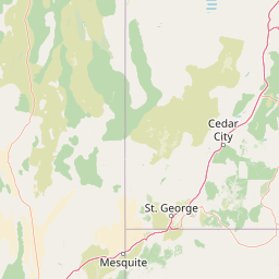
Map view of Zion National Park

Use this park location map to pinpoint Zion National Park in United States of America, understand its exact geographic position, and read its mapped placement within the surrounding landscape more clearly.

Pigeon | © OpenStreetMap contributors

Location context for Zion National Park

Utah
Natural feature types

Explore the Natural Features and Geological Landmarks of Zion National Park

Utilize the MoriAtlas structured database to examine the specific natural features and canyon landscapes of Zion National Park. This index offers a deep view into the geological formations and diverse natural terrain characterizing this protected landscape in Utah.
Recorded earthquake history

Examine the Recorded Earthquake History for Zion National Park

Access a detailed archive of historical seismic events associated with the geography of Zion National Park. This MoriAtlas catalogue provides transparent access to event dates, magnitudes, and epicentre distances to support your interest in regional seismic history.

Zion National Park Earthquake History

Catalogued events

76 events

Strongest magnitude

Magnitude 5.9

Most recent event

Aug 15, 2024

This history includes earthquakes recorded inside the park or within 50 km of its borders

Park atlas

Map adjacent protected areas, comparing the dramatic canyon geology and desert ecosystems across Utah and the Southwest US.

Discover Other National Parks and Protected Areas Near Zion National Park

Browse other national parks and protected areas near Zion National Park, discovering a wider array of canyon formations, red rock landscapes, and desert ecosystems across Utah and the Southwest US. Explore these adjacent protected landscapes for a deeper geographic comparison, tracing shared geological features and distinct conservation patterns within the Colorado Plateau region.
Wildlife reserveWashington County
About 0.8 km away#1 closest

Northwest

LaVerkin Creek Wilderness: Mapping Protected Landscapes in Southwestern Utah

Wildlife reserve and watershed protection in Washington County

This protected area unit serves as a critical buffer for the upper LaVerkin Creek corridor. Its terrain spans the transition from high-elevation forested plateaus to deeply carved sedimentary canyons. By maintaining an unroaded status, the wilderness preserves essential riparian habitats and geological features that define the character of the surrounding southwestern Utah plateau region.

Area
1.8 km²
Established
2009
IUCN
Ib
Relief
Highland
Protected landscapeArizona
38 km away#2 closest

Southeast

Kaibab National Forest: Protected Plateau Landscapes and Forested Geography in Arizona

High-elevation forest terrain bordering the Grand Canyon

Spanning over 1.6 million acres in Arizona, Kaibab National Forest is characterized by its split geographic configuration, with distinct sections flanking the North and South rims of the Grand Canyon. The terrain ranges from the high-altitude Kaibab Plateau to volcanic uplands near Williams, encompassing four designated wilderness areas and varied forest ecosystems that provide a critical buffer for the surrounding canyon country.

Area
6,500 km²
Established
1909
Relief
Mountain
Climate
Temperate
Wildlife reserveUtah
41 km away#3 closest

West

Red Mountain Wilderness: Mapped Sandstone Massif and Protected Landscape in Utah

Ecological transitions between the Mojave Desert and Great Basin

Red Mountain Wilderness is a distinct protected landscape in southwestern Utah characterized by its dramatic Navajo sandstone block. Positioned near the Gunlock Fault and Snow Canyon, the area features rugged desert terrain where Mojave and Great Basin ecosystems converge. This wilderness preserves significant archaeological history and diverse plant communities within its sandstone canyons and flats, offering a window into the varied natural environment of the region.

Area
75.8 km²
Established
2009
IUCN
Ib
Relief
Upland
Wildlife reserveArizona
56 km away#4 closest

Southeast

Kanab Creek Wilderness: Protected Canyon Landscapes and Geography of Northern Arizona

Extensive tributary canyon systems and plateau terrain

Kanab Creek Wilderness represents a vast protected area in northern Arizona, defined by deep gorges and vertical cliffs etched into the Kanab and Kaibab Plateaus. This geographic atlas entry provides insights into the canyon network that feeds the Colorado River, highlighting the extreme elevation gradients and archaeological significance of this rugged wilderness.

Area
305 km²
Established
1984
IUCN
Ib
Relief
Upland
National parkUtah
57 km away#5 closest

Northeast

Bryce Canyon National Park: Utah's Mapped Protected Landscape and Geographic Context

Explore the unique geology and protected boundaries of Bryce Canyon National Park.

Bryce Canyon National Park offers a distinct protected landscape within the geography of Utah, characterized by its unique geological formations. This entry provides essential context for understanding its mapped boundaries and natural terrain, serving as a vital component for atlas-based discovery of protected areas. Investigate the specific geographic setting and conservation significance of this iconic national park.

Area
145.02 km²
Established
1928
IUCN
II
Visitors
2.5M annual
National parkArizona
76 km away#6 closest

Southeast

Grand Canyon National Park: Arizona National Park Protected Landscape & Geography

Explore mapped boundaries and regional atlas context.

Grand Canyon National Park stands as a premier national park, showcasing a unique protected landscape within Arizona's diverse geography. This detailed entry focuses on the park's specific geographic identity, its mapped boundaries, and its significance within the regional atlas. Discover the contours of this protected area and its place in the natural terrain of the American Southwest.

Area
4,926.08 km²
Established
1919
IUCN
II
Visitors
4.9M annual
Wildlife reserveArizona
80 km away#7 closest

South

Mount Trumbull Wilderness: A Detailed Geographic Overview of Northern Arizona Volcanic Protected Lands

Mapping basalt mesas and cinder cone ecosystems on the Uinkaret Plateau

Mount Trumbull Wilderness represents a distinct volcanic protected area located on the Uinkaret Plateau of the Arizona Strip. This rugged wilderness encompasses a massive basalt-capped mesa, scattered cinder cones, and deep ecological gradients ranging from pinyon-juniper woodlands to ancient ponderosa forests, providing a vivid look at the complex geological history near the Colorado River.

Area
31 km²
Established
1984
IUCN
Ib
Relief
Mountain
Protected landscapeUnited States of America
109 km away#8 closest

East

Glen Canyon National Recreation Area: Protected Landscape and High Desert Geography Map

Colorado Plateau canyons, sandstone strata, and reservoir environments

Explore the geological architecture of Glen Canyon National Recreation Area, a vast federal protected landscape. The area showcases towering Navajo Sandstone cliffs, deep blue reservoir arms, and remote backcountry canyons that exemplify the distinct high desert terrain of the Colorado Plateau in the United States.

Area
5,075.23 km²
Established
1972
Visitors
5.2M annual
Relief
Upland

Common questions about visiting, size, designation, and location context for Zion National Park

Zion National Park FAQs for park facts, access, geography, and protected area context

Find quick answers about Zion National Park, including protected-area facts, park geography, trail and visitor context, and how the park fits into its surrounding country and regional landscape.
MoriAtlas Explorer

Continue Your Protected Areas Search Across the Global Atlas

Deepen your exploration by continuing the structured search for national parks and protected areas worldwide. Utilize the comprehensive filtering capabilities to compare different conservation landscapes and refine your understanding of global park geography. Discover more about the distribution and characteristics of protected natural areas.

Global natural geography