
Mori Atlas logo
Protected landscapeŻywiecki Park Krajobrazowy

Analyzing the protected terrain, high mountain ridges, and hydrological features of this unique Polish landscape.

Żywiecki Park Krajobrazowy: Mapped Boundaries and Geographic Context of a Beskid Mountain Landscape

The Żywiecki Park Krajobrazowy represents a significant protected area within the southern Silesian Voivodeship, defined by the rugged relief of the Beskid Żywiecki mountains. This landscape incorporates deep valleys, expansive mountain ridges, and high-altitude massifs such as the Pilsko. Through this detailed atlas record, users can examine the complex geomorphological structure of the range, ranging from forested Carpathian slopes to open mountain pastures and subalpine vegetation zones.

mountain landscape parkCarpathian mountainsBeskid Żywieckihigh-mountain terrainsubalpine vegetationdwarf mountain pine
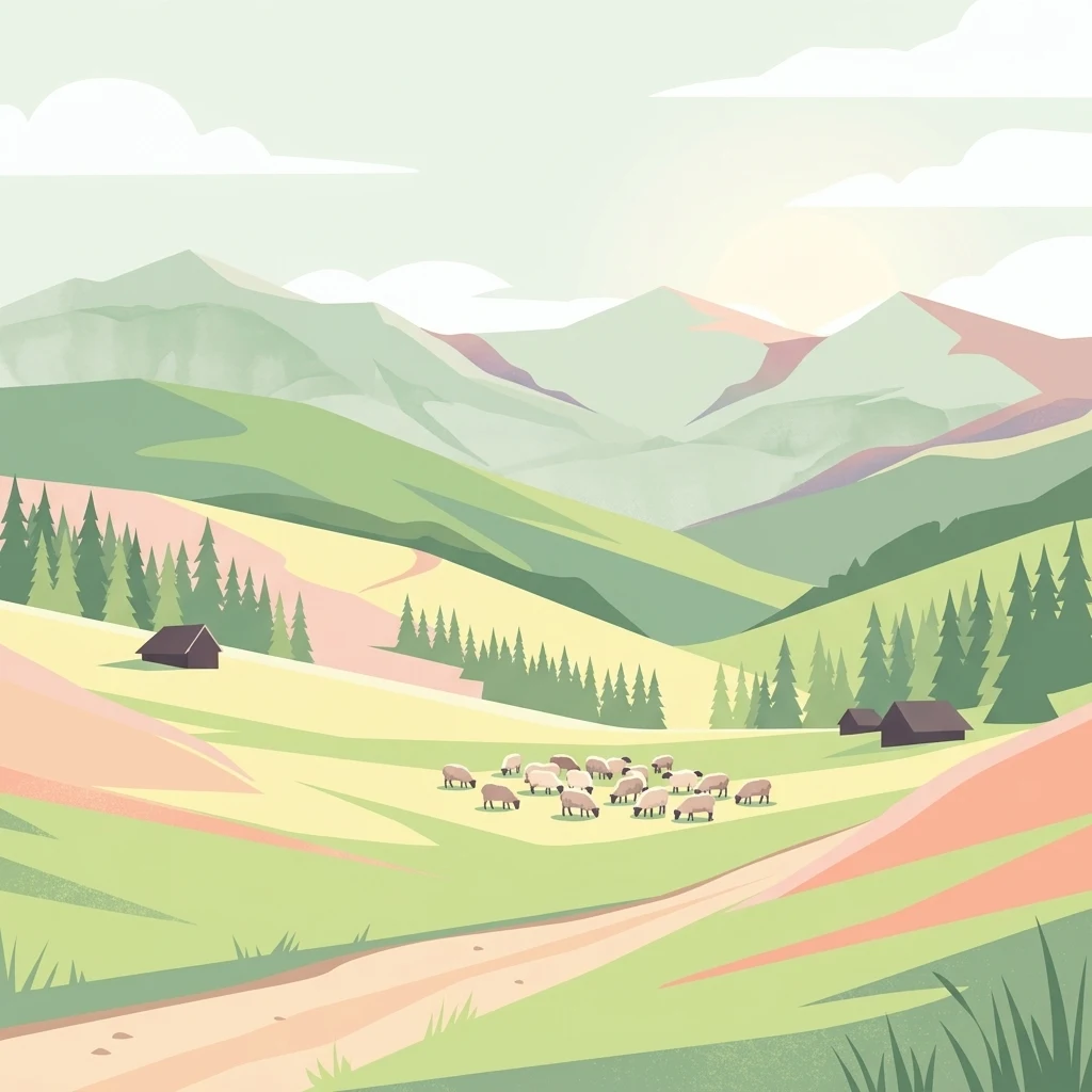
A flat-style digital illustration showing a mountainous landscape with grassy hills, patches of pine forest, small dark cabins, and a flock of white sheep grazing in the valley.

Żywiecki Park Krajobrazowy

Protected landscape

Park overview

Structured park overview, official facts, and landscape profile for Żywiec Landscape Park

Żywiec Landscape Park park facts, protected area profile, and essential visitor context

Review the core facts for Żywiec Landscape Park, including designation, size, terrain, visitor scale, habitats, and operating context in one park-focused overview.

About Żywiec Landscape Park

Żywiec Landscape Park is one of the largest and highest-elevation landscape parks of the Polish Carpathians, anchoring the Beskid Żywiecki as a protected area of regional and national importance. It lies in southern Poland, not far from the urban and industrial centers of Upper Silesia, Kraków, and Bielsko-Biała, yet its interior preserves a strongly forested alpine-style environment that feels far from the surrounding lowlands.

The park is built around the Pilsko rozróg, a central highland node from which several long mountain ridges radiate outward. North and west of this center stretches the Lipowski Wierch and Romanka group, with sharp prongs like Prusowa and Skała. To the south rises the Wielka Racza group, where peaks such as Wielka Racza, Wielka Rycerzowa, Muńcuł, and the Przegibek pass define a long section of the Polish-Slovak frontier. The contrast between deeply cut river valleys and towering, often pastured ridges gives the park a richly sculpted appearance.

What sets the park apart from many lower Polish landscape parks is the presence of true high-mountain features. Pilsko, the highest summit within the park, rises into a subalpine belt with dwarf mountain pine and krummholz rowan, while several peaks above 1,000 meters elsewhere in the park sustain an upper-mountain spruce forest that thins into stunted, sparse stands near the tree line. The terrain also includes notable geomorphological phenomena, including active or fossil landslides, river rock ledges, the 10-meter Sopotnia Wielka waterfall (the largest in the Beskids), and the longest cave in the park near the same village.

Ecologically, the park is a stronghold of natural Carpathian forest communities and of large carnivores associated with the wildest parts of the region. Its ten strict nature reserves collectively protect representative examples of the beech-fir-spruce forests of the lower montane belt, old-growth upper-mountain spruce forests, boggy alder communities, peatland complexes, and Carpathian beechwood remnants. The area's accessibility from three large urban regions, the network of mountain huts, the passage of the Main Beskid Trail, and ski centers at Korbielów and Pilsko combine to make it a heavily used yet still ecologically significant mountain landscape.

Quick facts and research context for Żywiec Landscape Park

Żywiec Landscape Park was established on 13 March 1986 by resolution of the provincial council in Bielsko-Biała, and since 1998 has been managed within the Complex of Landscape Parks of the Silesian Voivodeship. It covers roughly 358 square kilometers of the Beskid Żywiecki, with an additional buffer zone of about 218 square kilometers. The park spans parts of seven municipalities in southern Silesia and includes ten nature reserves protecting the best-preserved forest stands and habitat fragments in the western Beskids. It lies within a single major physical-geographical region, the Beskid Żywiecki, and represents one of the highest and most ecologically diverse protected areas in the Polish Carpathians.

Protection and recognition

Documented terrestrial protection facts and official designation records for Żywiecki Park Krajobrazowy.

Żywiecki Park Krajobrazowy Protection Status and Regional Conservation Scope

Terrestrial protection status records for Żywiecki Park Krajobrazowy outline the foundational management framework governing the landscape. Official designation details clarify the established conservation boundaries and international recognition sources associated with the terrain.

Protection details

Protection scope
Terrestrial
Buffer area
217.9 km²
Park context

Deeper park guide and search-rich context for Żywiec Landscape Park

Żywiec Landscape Park history, landscape, wildlife, and travel context

Explore Żywiec Landscape Park through its history, landscape character, ecosystems, wildlife, conservation priorities, cultural context, and seasonal travel timing in a structured park guide built for atlas discovery and search intent.

Why Żywiec Landscape Park stands out

The park is especially known for its concentration of high-mountain terrain in the Polish Beskids, particularly the Pilsko massif with its subalpine zone of dwarf mountain pine near Poland's border with Slovakia. It is also recognized for the striking Sopotnia Wielka waterfall, the longest cave within the park, extensive forests of Carpathian beech, fir, and spruce, and a rich fauna that includes brown bears, wolves, and lynx. The combination of traditional mountain pastures, tall ridge forests, and strict nature reserves gives the park a layered identity that is rare in the lower Western Carpathians.
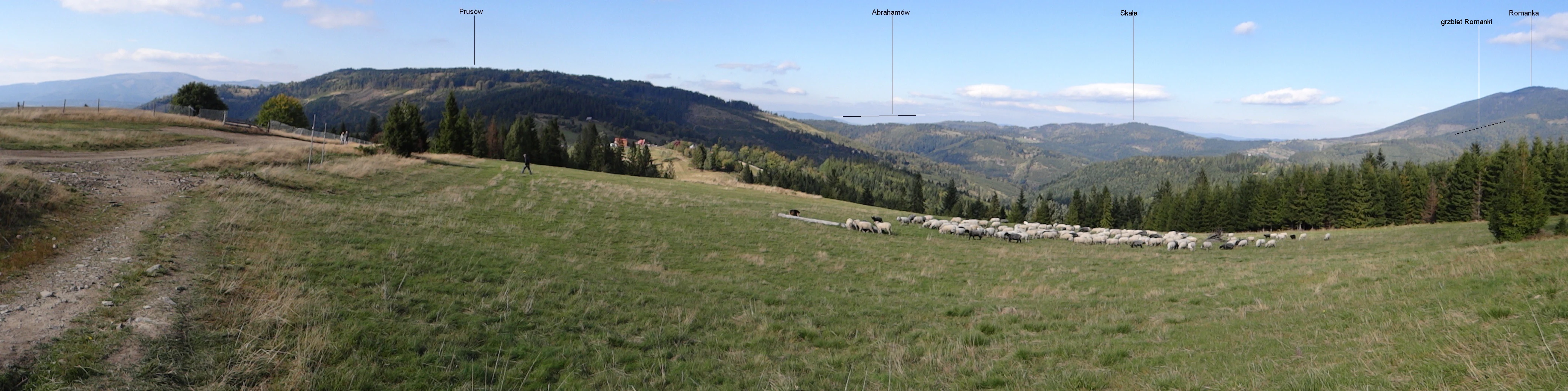
A panoramic photograph of a rolling mountain meadow in the Żywiec Landscape Park, with a flock of sheep grazing in the midground and forest-covered mountains in the background under a blue sky.
A wide view of the grassy slopes and forested ridgelines at Hala Boracza in the Zywiec Landscape Park.

Żywiec Landscape Park history and protected-area timeline

The protected area was created on 13 March 1986 through a resolution of the Wojewódzka Rada Narodowa, the regional council of the time based in Bielsko-Biała. It was established on already partly forested, partly pastured terrain that had long supported traditional mountain agriculture but was increasingly valued for its natural qualities and landscape character.

In 1998, the park was incorporated into the newly created Zespół Parków Krajobrazowych Województwa Śląskiego, the umbrella body managing landscape parks across the Silesian Voivodeship. This brought it into a coordinated administrative framework with neighboring parks and standardized its management approach. The oldest strict nature reserve within the park, Śrubita in the Wielka Racza group, predates the landscape park itself and illustrates how individual protection efforts had gradually built up before the broad landscape designation was made.

Żywiec Landscape Park landscape and geographic character

The landscape of Żywiec Landscape Park is shaped by long, parallel mountain ridges cut by deeply incised river valleys, with altitudes climbing from foothill levels near 600 meters to peaks that exceed 1,500 meters in the broader region. The central organizing feature is the Pilsko massif, from which major ridges radiate in several directions, giving the terrain a clearly dendritic structure.

West and north of Pilsko lie the steep ranges of the Lipowski Wierch and Romanka group, including the prominent Prusowa and Skała summits. To the south, the Wielka Racza group forms a chain of high, often broadly rounded summits along the Polish-Slovak border, while the eastern flanks of the park descend toward the Sola river basin. The highest parts of Pilsko display a genuinely high-mountain relief, transitioning into a subalpine zone with dwarf mountain pine.

The hydrological and geomorphological detail is striking. Active and relict landslides leave broad scarps and steps on many slopes, while the main rivers have carved rock ledges that produce rapids and waterfalls, most famously the 10-meter cascade in Sopotnia Wielka, described as the largest waterfall in the Beskid mountains. The Sopotnia Wielka cave, at roughly 100 meters in length, extends the park's surface character into the karst underground. Traditional mountain pastures, called hale, occupy many of the flatter ridge tops and shoulder slopes, opening up the otherwise densely forested terrain into broad grassy skylines.
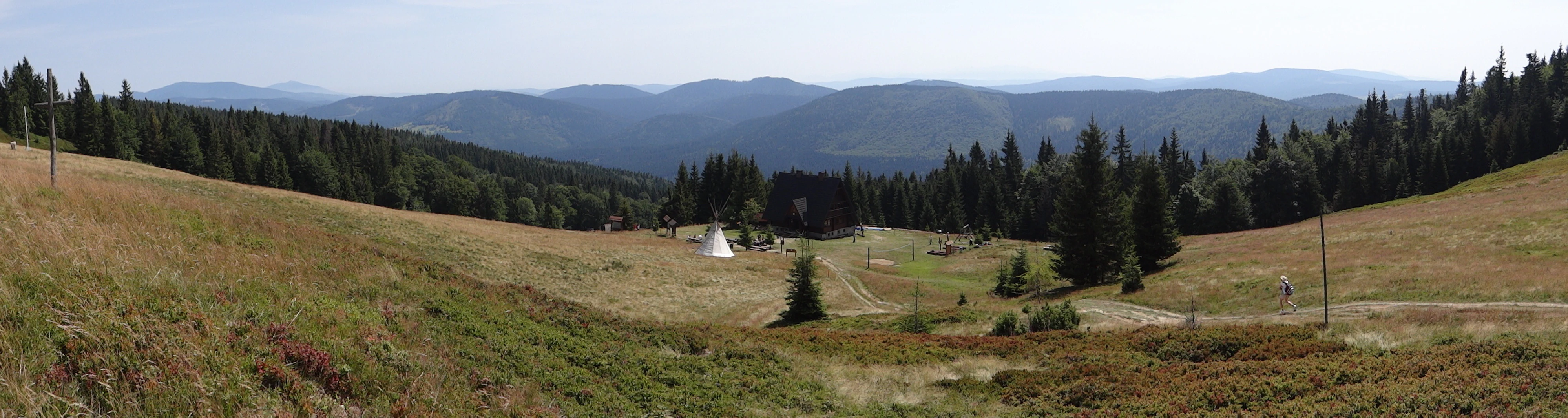
A wide panoramic landscape view of a grassy alpine pasture, Hala Rycerzowa, with coniferous forests and rolling mountain ridges in the background under a pale sky.
Panoramic view from Hala Rycerzowa in the Zywiec Beskids.

Żywiec Landscape Park ecosystems, habitats, and plant life

The park spans four distinct vegetation belts, from the lower foothills around 600 meters to the subalpine zone above 1,300 meters on Pilsko. The lowest belt is largely converted to agriculture and settlements, while the natural lower montane forests were once dominated by fertile Carpathian beechwood with abundant fir and admixed spruce and sycamore maple. Centuries of human activity have shifted much of this into fir-spruce forest, though small surviving patches of natural beech-fir forest remain in the Wielka Racza group.

The upper montane belt is more natural in character and consists largely of spruce with patches of rowan, grading near the ridgelines into sparse, stunted stands typical of the upper tree line. Only on the highest summit of the park, Pilsko, does a true subalpine belt develop, featuring dwarf mountain pine and shrubby forms of rowan, with associated subalpine plant communities that are rare at this latitude in the Polish mountains.

More than a thousand vascular plant species have been recorded in the park, including montane and high-mountain taxa concentrated in the dwarf pine zone and in spring-fed wetland areas. Protected plant species include stemless carline thistle, alpine clubmoss, Turk's cap lily, globe flower, Siberian garlic, serrated bellflower, and mountain false spikenard. Wetland and spring complexes support additional specialized flora that contributes to the park's botanical significance at the regional scale.

Żywiec Landscape Park wildlife and species highlights

The park supports a notably rich vertebrate fauna for a Polish mountain landscape. Large carnivores are among its signature species: the higher ridges and forests serve as refuges for the brown bear, gray wolf, Eurasian lynx, and European badger. Red deer and roe deer are commonly seen ungulates, while European beaver occurs in portions of the buffer zone where slower river reaches provide suitable habitat.

The birdlife is equally notable, with 106 recorded breeding species, most of which are protected. The park is one of the strongholds in the Silesian Beskids for both capercaillie and black grouse, while common buzzard, northern goshawk, Eurasian sparrowhawk, and various owls including the rare Eurasian eagle-owl are also present. The forest interior holds multiple woodpecker species, fitting the park's character as a mature woodland habitat.

Among reptiles, sand lizard, viviparous lizard, slow worm, and grass snake are typical, with the venomous common European adder also present. Amphibians are well represented by newts, toads, common frogs, the fire salamander, the European tree frog, and the yellow-bellied toad, which is particularly associated with higher-elevation spring and stream habitats in the Carpathians.

Żywiec Landscape Park conservation status and protection priorities

The conservation significance of Żywiec Landscape Park lies in how it bundles multiple layers of protection across a single high-quality mountain landscape. At the broader level, the landscape park designation protects roughly 358 square kilometers of terrain from incompatible land use, while the surrounding buffer zone of about 218 square kilometers softens the impact of nearby settlements and forestry.

Within the park, ten strict nature reserves concentrate protection on the best-preserved forest and habitat fragments. These include stands of old-growth upper-mountain spruce forest near the tree line, peatland and bog forests with open water pools, primeval fir-spruce-beech forests in the Wielka Racza group, and exceptionally preserved Carpathian beechwood sites such as Oszast and Gawroniec. The Pilsko reserve, which combines the former Pilsko and Pięć Kopców reserves and abuts a large Slovak counterpart, represents the most important subalpine protection unit in the park.

Functionally, the park forms a critical node in the broader network of Western Carpathian protected areas, helping connect forest and subalpine habitats across the Polish-Slovak border. The continuing presence of viable populations of brown bear, wolf, and lynx depends on this kind of large, relatively quiet mountain block, which also supports capercaillie, black grouse, eagle-owl, and a wide range of protected plants.

Żywiec Landscape Park cultural meaning and human context

The park sits within a region of long-standing highlander culture in the Polish Carpathians, where traditional pastoralism shaped both the economy and the open grassy skylines still visible today. Mountain pastures, locally known as hale, were maintained for seasonal cattle grazing and left a legacy of semi-open ridge landscapes that continue to influence the visual character of the park.

The surrounding municipalities of Ujsoły, Jeleśnia, Milówka, Radziechowy-Wieprz, Rajcza, Świnna, and Węgierska Górka, with Żywiec itself just outside the boundary, have a strong regional identity tied to the Beskid mountains, folk music traditions, and heritage associated with the historic city of Żywiec. Hiking and skiing have become integral parts of the modern regional culture, with a network of PTTK mountain huts supporting both recreation and the transmission of mountain traditions.

Top sights and standout views in Żywiec Landscape Park

Żywiec Landscape Park stands out for combining high-mountain terrain, richly layered forest communities, and a constellation of strict nature reserves within a single protected landscape. The Pilsko massif contributes the park's only subalpine vegetation and some of its oldest spruce forests, while the Wielka Racza group provides classic Carpathian beech-fir-spruce stands and the oldest reserve in the park at Śrubita. Geomorphological highlights include the Sopotnia Wielka waterfall, the longest cave within the park, and widespread landslide features that shape the valley profiles. Ecologically, the presence of reproducing populations of brown bear, wolf, and lynx, alongside capercaillie, black grouse, and eagle-owl, places the park among the most faunistically significant mountain areas in Poland.

Best time to visit Żywiec Landscape Park

The park is broadly accessible year-round, but each season offers a different experience. Late spring and early summer bring fresh greens to the forests and the most vivid wildflower displays on the meadows and in the subalpine zone of Pilsko. Summer is the classic time for long-distance hiking along the Main Beskid Trail and through the network of marked paths linking the PTTK huts. Autumn is widely considered one of the most atmospheric periods, with low-angle light over the ridge pastures and the lower forests turning color; it is also a productive season for observing rutting deer.

Winter transforms the park into a popular ski and snowshoe destination, particularly around Korbielów and Pilsko, though above 1,000 meters conditions can be demanding and weather changes quickly. Early spring is the quietest season for visitors, with snowmelt feeding the waterfalls and cave areas in full flow, including the Sopotnia Wielka cascade.


Monthly climate preview

Track long-term average temperature and monthly precipitation patterns across representative coordinates

Annual Climate Normals and Weather by Month for Żywiecki Park Krajobrazowy

Long-term data records reveal distinct seasonal temperature ranges and precipitation variations across representative park coordinates. Examining the complete twelve-month profile provides deeper insight into measured meteorological patterns at higher elevations.
Annual mean6 °C
-5 °C17 °C
Jan-5°
Feb-4°
Mar
Apr
May11°
Jun15°
Jul17°
Aug17°
Sep12°
Oct
Nov
Dec-3°
Warmest month
July

16.9 °C

Coolest month
January

-4.9 °C

Wettest month
July

4.3 mm/day

Driest month
December

1.9 mm/day

Park location guide

Geography guide, regional context, and park location map for Żywiec Landscape Park

Żywiec Landscape Park park geography, regions, and map view in Poland

Understand where Żywiec Landscape Park sits in Poland through a broader geographic reading of the surrounding landscape, nearby location context, and its mapped position within the national park landscape.

How Żywiec Landscape Park fits into Poland

Poland, officially the Republic of Poland, is a Central European country spanning from the Baltic Sea in the north to the Carpathian Mountains in the south. It borders Germany, Czech Republic, Slovakia, Ukraine, Belarus, Lithuania, and Kaliningrad Oblast. The country has a temperate climate, diverse landscapes, and is known for its rich history, cultural heritage, and strong economic position within the EU.

Wider geography shaping Żywiec Landscape Park in Poland

Poland occupies 312,696 km2 in Central Europe, extending from the Baltic Sea coast in the north to the Sudetes and Carpathian Mountains in the south. It borders Germany to the west, Czech Republic and Slovakia to the south, Ukraine and Belarus to the east, and Lithuania and Kaliningrad Oblast to the northeast. The landscape includes lowland plains, uplands, and mountain ranges.

Map view of Żywiec Landscape Park

Use this park location map to pinpoint Żywiec Landscape Park in Poland, understand its exact geographic position, and read its mapped placement within the surrounding landscape more clearly.

Pigeon | © OpenStreetMap contributors

Location context for Żywiec Landscape Park

Silesian Voivodeship
Natural feature types

View Geographic Landmarks and Natural Features in Żywiecki Park Krajobrazowy

Open this collection to browse the specific landforms and hydrological features that shape Żywiecki Park Krajobrazowy. MoriAtlas provides a structured approach to understanding the park's terrain, allowing you to isolate and examine the mountain ridges, valleys, and waterfalls that characterize this protected landscape.
Recorded earthquake history

Review the Recorded Seismic History of Żywiecki Park Krajobrazowy

Access the MoriAtlas seismic database to view a chronologically organized list of recorded earthquakes in the vicinity of Żywiecki Park Krajobrazowy. This catalogue provides transparent access to historical event data, including magnitude and location, to assist in studying the geographic context of the Beskid Żywiecki range.

Żywiecki Park Krajobrazowy Earthquake History

Catalogued events

39 events

Strongest magnitude

Magnitude 4.8

Most recent event

Jun 7, 2007

This history includes earthquakes recorded inside the park or within 50 km of its borders

Visual exploration of high mountain terrain, forests, and protected scenery

Żywiecki Park Krajobrazowy Photos and Mountain Landscapes

Visual records capture the high mountain relief, dense Carpathian beech forests, and deep river valleys that define the terrain across Żywiecki Park Krajobrazowy. Studying these protected landscapes reveals the dramatic ridge topography, subalpine vegetation zones, and remote natural habitats found along the southern Polish border.

A panoramic photograph of a rolling mountain meadow in the Żywiec Landscape Park, with a flock of sheep grazing in the midground and forest-covered mountains in the background under a blue sky.

Wide panoramic shot of a grassy mountain meadow with small wooden houses, surrounded by forested hills under a cloudy sky.

A wide panoramic landscape view of a grassy alpine pasture, Hala Rycerzowa, with coniferous forests and rolling mountain ridges in the background under a pale sky.

Park atlas

Compare adjacent mountain terrain and connected Carpathian protected areas.

Explore Other Parks Near Żywiecki Park Krajobrazowy and Surrounding Protected Landscapes

Browse other parks near Żywiecki Park Krajobrazowy to compare neighboring mountain terrain and high elevation forest zones. Reviewing adjacent protected landscapes provides broader regional context across the surrounding region.
Nature reserveWojewództwo śląskie
Mapped location lies within the park boundary#1 closest

Southwest

Rezerwat przyrody Muńcoł: Protected Beech Forest and Mountain Landscape in Poland

Floristic nature reserve in the Beskid Żywiecki region

Spanning over 45 hectares, Rezerwat przyrody Muńcoł protects a rare Carpathian beech forest community on the eastern slopes of the Kotarz massifs. This reserve acts as a core area for submontane botanical research and provides an essential look at the montane forest dynamics found across the Województwo śląskie province of Poland.

Area
0.452 km²
Established
1998
Relief
Mountain
Scope
Terrestrial
A horizontal watercolor painting depicting soft, layered green hills and purple-toned mountain ridges in the distance, with a foreground of stylized evergreen trees.
Protected landscapeSilesian Voivodeship
3.2 km away#2 closest

Northwest

Park Krajobrazowy Beskidu Śląskiego: Geographic Atlas of Protected Silesian Beskid Landscapes

Mapped mountain ridges, river headwaters, and protected forest reserves.

Gain insight into the ecological and structural character of Park Krajobrazowy Beskidu Śląskiego. This resource documents the park's flysch geological formations, rare cave systems, and the hydrological significance of the Vistula River headwaters within the Silesian Beskids.

Area
386.2 km²
Established
1998
Relief
Mountain
Climate
Alpine
Watercolor painting of rolling green hills and distant forested mountains under a light sky
National parkLesser Poland Voivodeship
7.7 km away#3 closest

East

Babia Góra National Park: Carpathian National Park with Mapped Terrain and Unique Flora

Explore protected landscapes and regional geography in Lesser Poland Voivodeship.

Babia Góra National Park, a significant protected area in Poland's Carpathian Mountains, offers a distinct atlas exploration experience. Its landscape is defined by the prominent Babia Góra massif, featuring complete altitudinal vegetation zones, rare endemic plant species, and notable terrain characteristics. As a UNESCO biosphere reserve, it provides valuable insights into Carpathian ecosystems and regional geographic context, making it a key destination for structured discovery of protected lands and natural landscapes.

Area
33.92 km²
Established
1954
IUCN
II
Visitors
81K annual
Watercolor painting of a green, rolling mountain range and hills set against a white background.
National parkLesser Poland Voivodeship
7.7 km away#4 closest

East

Babiogórski Park Narodowy: Geographic Overview and Protected Carpathian Mountain Terrain

Mapping alpine vegetation zones in the Lesser Poland Voivodeship

Babiogórski Park Narodowy encompasses the massif of Babia Góra, offering a complex mountain landscape that transitions from beech-fir forests to true alpine summit zones. Recognized for its clear vertical vegetation layering, this protected area holds significant ecological importance within the Western Carpathians and serves as a major landmark for studying high-altitude terrain in southern Poland.

Area
33.92 km²
Established
1954
Visitors
81K annual
Relief
Mountain
Watercolor painting showing layered mountains and green forests
National parkSlovakia
15 km away#5 closest

South

Malá Fatra National Park National Park: Geographic Context and Protected Area Mapping

Explore the mapped terrain and regional geography.

Malá Fatra National Park serves as a cornerstone for understanding Slovakia's protected landscapes. This dedicated park page provides crucial geographic context, detailing its national park designation and the extent of its protected area boundaries. Users can leverage MoriAtlas to visualize the park's location within the broader regional geography, facilitating a structured approach to discovering its natural landscape and terrain through map-based exploration.

Area
226.3 km²
Established
1988
IUCN
II
Relief
Mountain
A horizontal watercolor illustration depicting rolling, soft green mountains under a pale pink sky, with simple plant motifs in the foreground.
Protected landscapeSilesian Voivodeship
19 km away#6 closest

North

Park Krajobrazowy Beskidu Małego: Geographic Overview and Protected Mountain Landscape

Twin ridges and sandstone terrain in the western Carpathians

Trace the geography of Park Krajobrazowy Beskidu Małego, a protected landscape in southern Poland covering 257 square kilometers of the Little Beskids. This detailed atlas entry provides insights into the park's twin-ridged structure, sandstone bedrocks, and the ecological significance of its nature reserves and valley corridors located within the Silesian Voivodeship.

Area
257.7 km²
Established
1998
Relief
Mountain
Climate
Temperate
A watercolor painting showing a rolling landscape with distant mountains, soft green and pink trees, and gentle hills on a plain white background.
Protected landscapeBielsko-Biała
About 19 km away#7 closest

Northwest

Cygański Las Protected Landscape: Mapped Geography and Foothill Forest in Bielsko-Biała

An expansive 593-hectare woodland corridor in the Silesian Beskids.

Cygański Las functions as a formal protected landscape complex, preserving diverse forest communities from fertile beech stands to mountain sycamore on the slopes of Bielsko-Biała. This terrain serves as the essential southern trailhead for the Silesian Beskids, connecting the urban fabric of the city with the rugged elevations of Szyndzielnia, Klimczok, and Magurka Wilkowicka through a network of historic trails.

Area
5.93 km²
Established
1997
Relief
Mountain
Climate
Temperate
A horizontal watercolor painting depicting a soft green landscape with rolling hills, distant light purple mountain ridges, and a central water feature, rendered in a light, atmospheric style.
Protected landscapeSilesian Voivodeship
About 22 km away#8 closest

Northwest

Dolina Wapienicy: Protected Landscape and Carpathian Mountain Valley in Silesian Voivodeship

Mapped terrain, forest ecosystems, and ridge geography

Dolina Wapienicy acts as a protected landscape complex within the urban-adjacent geography of the northern Silesian Beskids. The area encompasses mature Carpathian beech forests and rare upper montane spruce stands, organized around the Wapienica River and the Mościcki Dam reservoir. It remains a focal point for understanding how mountain valley systems maintain biodiversity and near-natural wilderness characteristics in close proximity to major urban settlements.

Area
15.19 km²
Established
1993
Relief
Mountain
Climate
Temperate

Common questions about visiting, size, designation, and location context for Żywiec Landscape Park

Żywiec Landscape Park FAQs for park facts, access, geography, and protected area context

Find quick answers about Żywiec Landscape Park, including protected-area facts, park geography, trail and visitor context, and how the park fits into its surrounding country and regional landscape.
MoriAtlas Explorer

Continue Your Protected Areas Search Across the Global Atlas

Deepen your exploration by continuing the structured search for national parks and protected areas worldwide. Utilize the comprehensive filtering capabilities to compare different conservation landscapes and refine your understanding of global park geography. Discover more about the distribution and characteristics of protected natural areas.

Global natural geography