
Mori Atlas logo
Countries

Browse mapped protected landscapes and discover geographic patterns across the Maltese islands.

Malta National Parks and Protected Areas: A Geographic Atlas for Exploration

Malta, a small island nation in the heart of the Mediterranean, features a unique tapestry of protected areas and natural landscapes waiting to be explored. MoriAtlas provides a structured geographic platform to discover these vital conservation spaces, detailing their mapped boundaries and regional context. Navigate Malta's protected lands to understand their distribution and landscape significance, offering an atlas-like view of the nation's natural geography.

Malta National Parks and Protected Areas: A Geographic Atlas for Exploration
Park system

Analyzing the Malta Park System and Protected Area Distribution

Comparing scale, establishment history, and habitat classifications across island landscapes

Users can examine the environmental profile of Malta, focusing on urban gardens, coastal reserves, and recreational green spaces across the Mediterranean archipelago. Evaluating median park size, designation types, and habitat distributions using known records helps clarify conservation patterns on highly populated islands.

Known protected area

4.9 km²

Area data available for 8 of 11 parks.

Median park size

0.2 km²

Median across 8 parks with known area.

Oldest known park

Established in 1933.

Largest known park

Recorded area: 3.5 km².

Designation distribution

Nature reserve5
Protected area2
Marine protected area1
National park1
Natural monument1

1 more category represented

Habitat distribution

Coastal habitat7
Marine habitat4
Mediterranean forest4
Karst habitat3
Dune habitat1

2 more categories represented

Climate distribution

Mediterranean8
About

Uncover the mapped geography of Malta's protected areas, highlighting its unique island conservation efforts.

Exploring Malta's Protected Areas and National Park Geography on the Mediterranean Atlas

Malta, an island nation in the Mediterranean, offers a unique geographic lens for exploring protected areas and conservation landscapes. This atlas provides a comprehensive view of Malta's protected natural areas, detailing their distribution across the island's terrain and revealing regional conservation efforts.

Malta is a small island nation in the Mediterranean, located between Italy, Tunisia, and Libya. With a population of about 520,000 spread over 316 km², it is one of the world's most densely populated countries. The country has a long history of foreign rule and is known for its strategic position, historic sites, and membership in the EU, Commonwealth, and UN.

Malta is an island country in Southern Europe located in the Mediterranean Sea. Consisting of an archipelago, it lies about 80 km south of Italy, 284 km east of Tunisia, and 333 km north of Libya. The country has been inhabited since at least 6500 BC and has been ruled by various powers including Phoenicians, Carthaginians, Greeks, Romans, Arabs, Normans, Knights Hospitaller, French, and British. Malta gained independence from Britain in 1964 and became a republic in 1974. It joined the European Union in 2004 and the eurozone in 2008.

Currency code:EUR
ISO code:MT
Parks count
11
Capital
Valletta
Area
316 km²
Population
519,562 (2,021)

Coastal
Island
Mountainous
Landlocked
Park atlas11 parks

Explore the mapped geography and protected landscapes of Malta's natural heritage

Malta National Parks and Protected Areas: A Geographic Atlas Overview

Discover the protected areas and national parks within Malta, presented through a geography-first atlas structure. This view provides essential context for understanding the distribution and conservation landscapes across this Mediterranean island nation. Delve into the specific park details available from this country-level perspective, supporting focused exploration of Malta's natural and protected heritage.
A horizontal watercolor painting showing soft green hills, grassy marshland, and a calm water channel under a light, hazy sky.
Nature reserveGozo

Comino Nature Reserve: Geography, Protected Marine Areas, and Karst Terrain in Gozo

Island ecology and coastal landscape mapping

Examine the protected geography of Comino, an island nature reserve near Gozo defined by limestone plateaus and sheltered bays. This overview covers the ecological boundaries of the Natura 2000 marine area, the distribution of coastal sea caves, and the topographic patterns of this Important Bird Area.

Area
3.5 km²
Relief
Lowland
Climate
Mediterranean
Access
Moderate access
A pale, minimalist watercolor illustration showing soft, rolling green and yellow hills against a white background.
Nature reserveMalta

Filfla Nature Reserve: The Protected Limestone Plateau and Geography of Malta

Tracing the limestone cliffs and seabird sanctuary of the Maltese archipelago

Filfla is a small, uninhabited limestone islet lying 4.5 kilometres south of the main island of Malta. Defined by its 60-metre sea cliffs and flat plateau, this protected nature reserve functions as a crucial Important Bird Area and a landmark for regional Mediterranean biodiversity. Examine the mapped boundaries and geological profile of this site to understand its status as the southernmost extremity of the Maltese archipelago.

Area
0.06 km²
Established
1980
Relief
Upland
Climate
Mediterranean
Watercolor painting of a reddish limestone sea arch or islet surrounded by water and faint coastal hills.
Nature reserveGozo

Fungus Rock: A Protected Limestone Nature Reserve on the Western Coast of Gozo

Geographic landmark and protected coastal terrain

Fungus Rock represents a critical protected landscape at the entrance to Dwejra bay, offering a unique look at Mediterranean limestone geology. Known for its vertical cliff faces and historical botanical significance, this nature reserve remains a defining feature of the Gozitan coastline and the surrounding marine environment.

Area
0.007 km²
Relief
Upland
Climate
Mediterranean
Access
Easy access
A horizontal watercolor illustration showing soft, blended washes of green, yellow, and pale pink depicting an abstract rolling landscape or horizon line against a white background.
Natural monumentMalta

Għar Dalam Natural Monument: A Protected Maltese Cave and Paleontological Landmark

Geological and prehistoric landscape context in southeastern Malta

Għar Dalam is a protected natural monument in Malta that preserves a complex phreatic cave passage and essential fossil records of extinct dwarf species. This cave site acts as a major cornerstone for understanding the prehistoric Mediterranean, documenting the arrival of early Neolithic cultures and the long-term evolution of island-bound animal life through stratified sediment analysis.

Established
1933
Relief
Lowland
Climate
Mediterranean
Access
Easy access
A pale, minimalist watercolor painting depicting St Paul's Island in Malta, showing green rolling landforms and a hint of a structure against a light background.
Protected areaMalta

St Paul's Island Protected Landscape and Maltese Coastal Geography Overview

Uninhabited Mediterranean island and heritage landmark

St Paul's Island represents a unique Mediterranean limestone islet featuring maritime garigue habitat and historic ruins. Located near the Mellieħa coastline, this protected area provides a compact example of Maltese coastal geography, defined by exposed cliffs and an enduring connection to local maritime history.

Area
0.101 km²
Relief
Lowland
Scope
Mixed
Water
Water-dominated
A soft, pastel-toned watercolor painting of a rolling green landscape with a small body of water in the foreground and a silhouette of a building on a hill in the distance.
Wildlife reserveMalta

Buskett Gardens Wildlife Reserve: Geography and Protected Landscape Map of Malta

A rare sheltered woodland valley in the central Mediterranean

Buskett Gardens serves as a critical protected woodland in the heart of the Maltese islands. Nestled in the fertile Wied il-Luq valley, the site offers an unusually green, shaded environment of broadleaved trees and conifers. This reserve functions as an Important Bird Area and a historic cultural landscape, providing a lush contrast to the exposed limestone plateau of rural Malta.

Area
0.47 km²
Relief
Upland
Scope
Terrestrial
Water
Minor water
A flat-style vector illustration depicting a coastal beach scene with reddish sand, rolling green hills in the background, a blue ocean with gentle waves, and a few beach umbrellas in the foreground.
Protected areaGozo

Ramla Bay: Geographic Mapping and Protected Landscape Analysis of the Gozo Coast

Coastal terrain, red-sand geology, and Mediterranean rural landscapes.

Ramla Bay represents a significant protected coastal pocket on the island of Gozo. Beyond its well-known red-sand beach, the area encompasses a wider valley landscape defined by limestone headlands and agricultural plateaus. Use this mapped overview to understand the interaction between the Mediterranean coastline and the rugged rural hinterland of the Maltese islands.

Relief
Lowland
Climate
Mediterranean
Access
Easy access
Scope
Terrestrial
A horizontal watercolor painting depicting a soft-toned, abstract coastal landscape with gentle green hills, grassy foreground patches, and a calm, pale pool of water against a white background.
Marine protected areaMalta

Ras ir-Raħeb Marine Protected Area: Geographic Profile and Mapped Coastal Landscape

Coastal cliffs and protected marine zones in north western Malta.

Ras ir-Raħeb serves as a pivotal marine protected area along the Malta coastline, where high limestone cliffs meet complex underwater habitats. This site links historical archaeological remnants with modern ecological conservation, offering a unique geographic snapshot of the Rabat plateau edge. Its mapped boundaries encompass both the terrestrial promontory and the essential seagrass meadows beneath the surface, providing a critical reference point for Mediterranean coastal geography and protected land status.

Established
2005
Relief
Upland
Climate
Mediterranean
Access
Moderate access
National parkMalta

Ta' Qali National Park: Malta's Largest Urban Protected Landscape and Recreation Hub

Mapped Gardens, Event Venues, and Recreational Zones

Ta' Qali National Park serves as a vital green lung in central Malta, showcasing a landscape transformed from a wartime airfield into a modern urban protected area. This national park is recognized for its extensive recreational zones, meticulously designed formal gardens, and a prominent open-air concert venue that hosts major cultural events. Its relatively flat terrain and planned infrastructure offer a distinct map-based perspective on urban parkland, highlighting its significance as a major public amenity and a key feature of Malta's landscape.

Area
0.35 km²
IUCN
V
Relief
Lowland
Climate
Mediterranean
Nature reserveMarsaxlokk

Xrobb l-Għaġin Nature Park: Protected Coastal Landscape in Marsaxlokk, Malta

A compact peninsula of protected cliffs and historic archaeological sites

Xrobb l-Għaġin Nature Park spans a low-lying coastal peninsula near Marsaxlokk, combining rocky Mediterranean shoreline with significant prehistoric temple remains. This protected area serves as a focal point for environmental education and coastal terrain analysis, showcasing the integration of natural heritage and historical coastal defense within a compact geographic boundary.

Area
0.155 km²
Relief
Lowland
Scope
Terrestrial
Water
Minor water
A watercolor painting showing a soft landscape with green rolling hills, low vegetation, and a calm water surface against a pastel sky.
Nature reserveSouth Eastern Region

Il-Ballut ta' Marsaxlokk Nature Reserve: Geography and Protected Wetland Landscapes

Essential salt marsh habitat in Malta's South Eastern Region

Il-Ballut ta' Marsaxlokk serves as a critical protected area, preserving a rare salt marsh landscape within the coastal environment of Malta. This reserve features a compact mosaic of muddy canals, halophytic vegetation, and Mediterranean coastal terrain. Its inclusion in the Natura 2000 network highlights its regional importance as a refuge for migratory birds and a focal point for environmental conservation in the South Eastern Region.

Area
0.23 km²
Established
2018
IUCN
IV
Relief
Lowland
Landscape and environment

Understand how Town of Malta is shaped by terrain, ecosystems, and seasonal conditions

Town of Malta geography, nature, climate, and landscape context for park-focused travel research

Explore the physical geography, natural setting, and climate patterns of Town of Malta through a location-first overview built for travel research, national park discovery, and broader regional context. This section helps explain how landscapes, habitats, and environmental conditions shape what people search for, where they travel, and how they experience protected areas in Town of Malta.

Town of Malta geography and landscape

Malta is located in the Mediterranean Sea between Sicily and North Africa, approximately 80 km south of Italy, 284 km east of Tunisia, and 333 km north of Libya. The archipelago sits at coordinates 35°54′N 14°31′E.

Town of Malta nature and environment

As a small island nation, Malta has limited natural terrain, with a predominantly limestone terrain and coastal landscape.

Town of Malta climate and seasonal conditions

Malta has a Mediterranean climate with hot, dry summers and mild, wet winters.

Explore this place

Related topics and popular queries

Ways to explore Town of Malta

Useful phrases, related topics, and discovery prompts connected to Town of Malta.
where is malta locatedwhat is malta countrymediterranean island nation maltamalta capital vallettamalta eu membership historyislands between sicily and africamalta island countrymediterranean islandsvalletta capitalsouthern europe nationseu island statemaltese islandsmediterranean european countrymalta republic eu
Park map

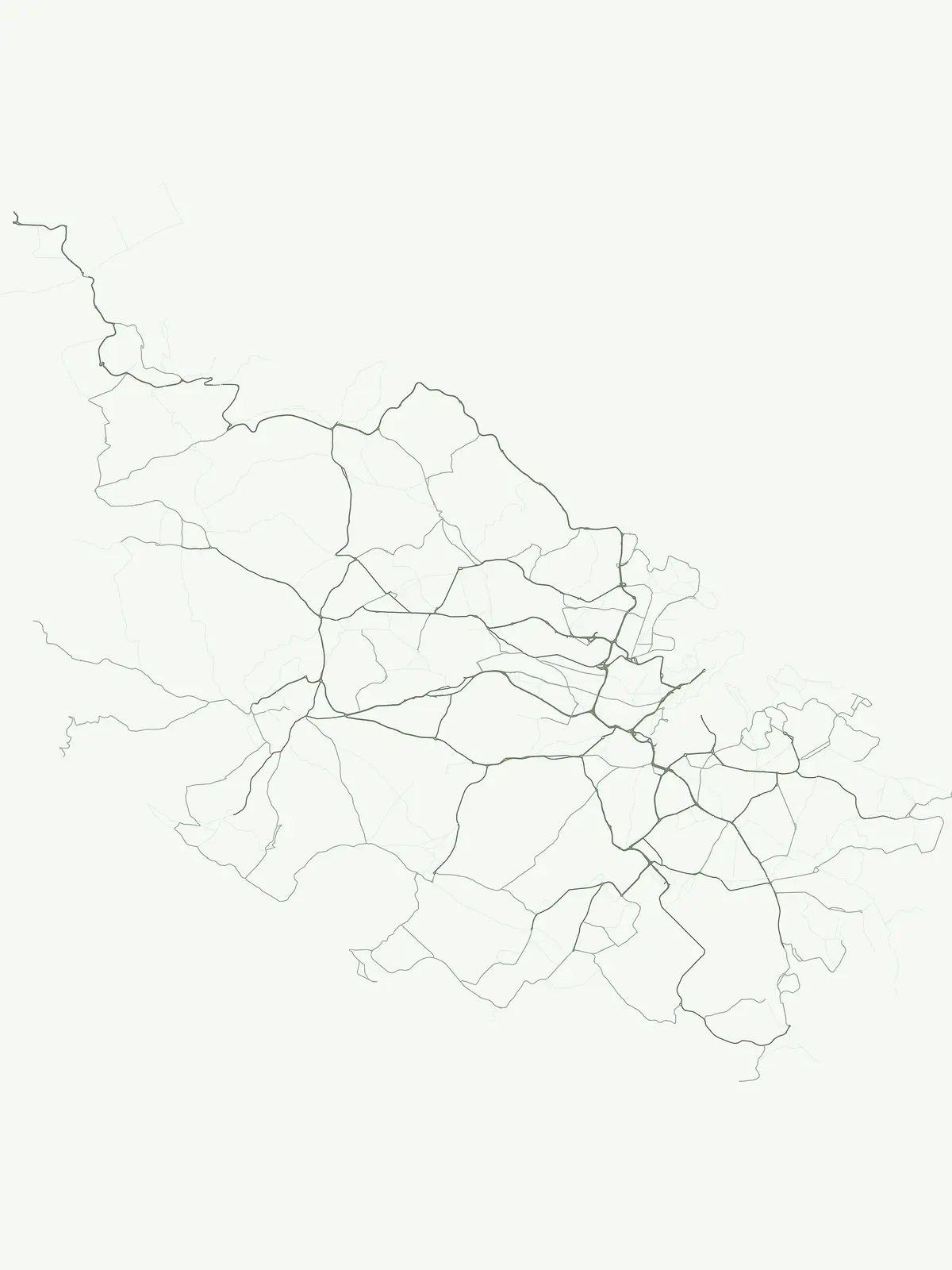
Visualize the spatial arrangement of Malta's protected natural areas and conservation landscapes across the island nation.

Geographic Map of Malta's National Parks and Protected Areas Distribution

Browse a geographic overview of Malta's national parks and protected areas, previewing their distribution across this Mediterranean island nation. The dedicated country map provides a comprehensive atlas view, ideal for understanding the regional context and spatial layout of Malta's conservation sites.

Exploring Malta's unique island geography, distribution of protected areas, and key conservation landscapes

Frequently Asked Questions About National Parks and Protected Areas in Malta

Discover common questions about Malta's national parks, marine protected areas, and other vital conservation zones across the Maltese archipelago. These insights offer a deeper understanding of the island nation's compact geography and the specific strategies safeguarding its natural and cultural heritage for atlas-based exploration.
Other countries

Compare Malta's protected landscapes with adjacent Mediterranean regions and a wider global park atlas

Explore National Parks and Protected Areas in Other Countries from Malta

Beyond Malta's unique island geography, discover national parks and protected areas across numerous other countries, exploring diverse conservation landscapes and mapped terrain. This broader country-level view helps users compare environmental protection strategies and geographic park distributions within the comprehensive MoriAtlas database.

Explore National Parks and Protected Areas Across the United States of America

Access a structured overview of the United States of America's protected natural areas, designed for geographic exploration. Browse national parks and other conservation landscapes, understanding their regional distribution and mapped boundaries. This resource serves as a foundational atlas entry point for discovering the country's diverse terrain and protected natural heritage.

430 parks

Bahamas National Parks and Protected Areas: Mapped Geographic Exploration

Access a structured overview of the Bahamas' national parks and protected natural areas. This atlas-focused exploration details the geographic distribution, landscape context, and mapped boundaries of conservation lands across the archipelago, facilitating deeper understanding of the island nation's natural heritage.

19 parks

Haiti National Parks and Protected Areas: Explore Mapped Landscapes and Regional Geography

Access a structured view of Haiti's national parks and protected areas, emphasizing their geographic distribution and landscape context. This entry point facilitates exploration of mapped terrain and understanding the regional spread of conservation efforts across the island nation. Understand the foundational geography of Haiti's natural reserves and navigate to detailed park information for a comprehensive atlas experience.

15 parks

Lebanon National Parks and Protected Areas: A Geographic Atlas Explorer

Delve into the geographic distribution of Lebanon's national parks and protected areas. This atlas interface highlights mapped boundaries, key natural terrain features, and the regional spread of conservation sites, offering a structured way to understand the country's protected lands and their landscape context.

12 parks

Georgia National Parks and Protected Areas: A Geographic Atlas Overview

This atlas entry for Georgia provides a geographic overview of its national parks and protected areas. Users can explore the mapped distribution of these conservation landscapes, understand their regional context within the Caucasus, and gain insights into the natural terrain. It serves as a structured gateway for navigating Georgia's protected territories and appreciating their geographic significance.

12 parks

Palestine National Parks and Protected Areas: A Geographic Atlas Entry Point

Explore the structured geography of Palestine through its national parks and protected areas. This atlas resource maps the distribution of nature reserves and historical protected sites, allowing for a focused examination of regional terrain and landscape conservation zones across the West Bank.

4 parks

Greenland National Parks and Protected Areas Atlas: Explore Mapped Landscapes

Delve into the structured geography of Greenland's national parks and protected areas via the MoriAtlas explorer. This resource details the mapped extent of protected regions and offers a framework for understanding their geographic context across the island. Discover the broad sweep of Greenland's conservation areas and their place within the larger Arctic landscape.

1 park

Pitcairn National Parks: Geographic Atlas and Protected Area Map

Trace the geographic extent of national parks and protected areas within the Pitcairn Islands. This atlas offers a detailed look at the island terrain, from raised coral cliffs to tangled scrub forests, allowing for structured study of these remote Pacific ecosystems and their conservation landscapes.

1 park

Protected area types

Continue Exploring Malta's Protected Area Designations and Park Geography

To deepen your understanding of Malta's natural heritage, continue exploring the specific classification categories represented within the country. This journey through its designation system reveals the geographic distribution and landscape context of its protected areas, offering clear pathways into more detailed atlas information for each type. Understand how Malta organizes its conservation efforts through these distinct park classifications.

Malta Park Designations
MoriAtlas Explorer

Continue Your Global Geographic Exploration with MoriAtlas Park Discovery

Dive deeper into the world's protected landscapes and national parks through MoriAtlas's structured atlas interface. Discover how continents and countries are organized, and how individual park geography fits into the broader map. Our platform is built for understanding the distribution and context of protected areas worldwide, facilitating your journey through global natural geography.

Global natural geography