Mori Atlas logo
Countries

Browse mapped protected landscapes and understand their regional geographic distribution across Nicaragua.

Nicaragua National Parks and Protected Areas: A Geographic Atlas Exploration

As a Central American country, Nicaragua offers a rich tapestry of protected lands for geographic discovery. This atlas provides a structured view of its national parks and conservation areas, detailing their mapped boundaries and regional context. Understand the distribution of Nicaragua's natural landscapes, from its Caribbean coast to its volcanic terrain, making it a valuable resource for exploring protected area geography.

Nicaragua National Parks and Protected Areas: A Geographic Atlas Exploration
About

Map Nicaragua's varied park geography, tracing its volcanic landscapes, tropical forests, and coastal protected areas.

Explore Nicaragua's National Parks and Protected Landscapes: A Central American Atlas
Browse a comprehensive atlas of national parks and protected areas across Nicaragua, showcasing its diverse conservation landscapes from active volcanoes to Caribbean coastlines. The country overview serves as an essential geographic entry point for understanding the regional distribution and unique features of protected land in Central America.

Nicaragua is a Central American country spanning 130,375 km² with a population of approximately 6.7 million. It borders Honduras, Costa Rica, the Caribbean Sea, and the Pacific Ocean. The official language is Spanish, and the currency is the Córdoba. Known for its agricultural productivity and cultural diversity, Nicaragua has a history dating back to indigenous civilizations before Spanish conquest in the 16th century.

Nicaragua is the largest country in Central America by area, located in the heart of the region. Originally inhabited by indigenous peoples, it was colonized by Spain in the 16th century and gained independence in 1821. The country features diverse geography including volcanic landscapes, lakes, and coastlines on both the Caribbean and Pacific. Managua serves as the political and economic center. The population is predominantly Mestizo, with significant White, Black, and Indigenous communities. Nicaragua has experienced significant political instability including dictatorship, foreign interventions, and revolutionary movements.

Largest city:Managua
Currency code:NIO
ISO code:NI
Parks count
2
Capital
Managua
Area
130,375 km²
Population
6,676,948 (2,024)

Coastal
Island
Landlocked
Park atlas2 parks

Trace Nicaragua's diverse protected landscapes, from Pacific coast volcanoes to Caribbean forest reserves, on a detailed geographic atlas.

Discover National Parks in Nicaragua: A Comprehensive List of Protected Areas
Browse a comprehensive list of Nicaragua's national parks and diverse protected areas, including volcanic landscapes and tropical forests along both Pacific and Caribbean coasts. Gain valuable geographic context for each park, comparing conservation efforts and regional spread across Central America's largest country for in-depth exploration.
National parkNicaragua

Masaya Volcano National Park: Nicaragua National Park Atlas & Landscape Context

Explore the mapped boundaries of this unique volcanic terrain.

Masaya Volcano National Park offers a distinct focus for atlas exploration within Nicaragua's broader geographic framework. This page details the park's identity as a protected landscape, highlighting its volcanic terrain and mapped features. Understand its significance within the national park system and its contribution to the mapped natural heritage of Central America.

IUCN
II
Relief
Mountain
Access
Access unknown
National parkNicaragua

Zapatera Archipelago National Park: Nicaragua National Park Atlas and Protected Landscape Explorer

Explore the mapped boundaries and regional geography.

Zapatera Archipelago National Park serves as a distinct national park within Nicaragua, offering a focused point for exploring protected landscapes and their geographic context. This entry details the park's mapped boundaries and its significance within the atlas of Central American natural areas. Users can understand its role as a protected entity and its contribution to the region's mapped geography, supporting structured discovery of its natural landscape identity.

IUCN
II
Climate
Tropical
Scope
Mixed
Water
Water-dominated
Landscape and environment

Understand how Nicaragua is shaped by terrain, ecosystems, and seasonal conditions

Nicaragua geography, nature, climate, and landscape context for park-focused travel research
Explore the physical geography, natural setting, and climate patterns of Nicaragua through a location-first overview built for travel research, national park discovery, and broader regional context. This section helps explain how landscapes, habitats, and environmental conditions shape what people search for, where they travel, and how they experience protected areas in Nicaragua.

Nicaragua geography and landscape

Nicaragua occupies a strategic position in Central America, bordered by Honduras to the north, the Caribbean Sea to the east, Costa Rica to the south, and the Pacific Ocean to the west. The country also shares maritime borders with El Salvador and Colombia. The terrain includes coastal plains, volcanic highlands, and interior valleys. Lake Managua and Lake Nicaragua are major freshwater bodies.

Nicaragua nature and environment

Nicaragua features diverse ecosystems across its Caribbean and Pacific coastal regions. The Caribbean lowlands include rainforests and wetlands, while the Pacific side has more cultivated landscapes. The country contains several protected areas and nature reserves supporting biodiversity.

Nicaragua climate and seasonal conditions

Nicaragua has a tropical climate with wet and dry seasons. The Pacific lowlands are generally warmer and drier, while the Caribbean coast receives higher rainfall.

Explore this place

Related topics and popular queries

Ways to explore Nicaragua
Useful phrases, related topics, and discovery prompts connected to Nicaragua.
where is Nicaragua locatedwhat is Nicaragua known forNicaragua capital cityNicaragua geography and borderspopulation of Nicaraguanicaragua countrycentral america largest countrymanagua capitalnicaragua geographynicaragua populationnicaragua culturecentral american travel
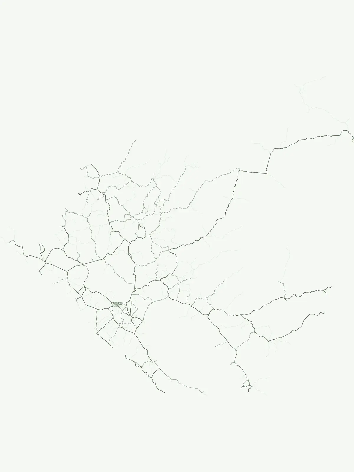
Park map

Visualize the spatial distribution of Nicaragua's protected areas, from volcanic landscapes to Caribbean coastal reserves.

Nicaragua National Parks Map: Trace Protected Area Distribution and Conservation Geography
Preview the mapped locations of Nicaragua's national parks and protected areas, observing their distribution across the country's diverse Central American geography. Open the dedicated country map to explore the full extent of Nicaragua's conservation landscapes, tracing park boundaries and regional environmental contexts in detail.

Explore the geographic spread and conservation efforts across Nicaragua's diverse natural landscapes.

Frequently Asked Questions About National Parks and Protected Areas in Nicaragua
Uncover essential information about the national parks and protected areas mapped across Nicaragua's Central American geography, including its Caribbean and Pacific coasts. These common questions offer a structured overview of park distribution, conservation landscapes, and key geographic contexts for exploring Nicaragua's natural heritage.
Other countries

Compare park geographies and conservation landscapes across Central America and the global atlas.

Discover Nearby Countries: National Parks and Protected Areas Beyond Nicaragua
Expand your national park discovery from Nicaragua into a broader regional context, exploring protected areas in neighboring countries and diverse geographic zones. Browse comprehensive country-level park lists to trace conservation efforts, compare distinct landscapes, and plan further explorations across the global atlas.

Costa Rica National Parks and Protected Areas: A Geographic Atlas

Access a structured atlas for exploring Costa Rica's national parks and protected natural areas. This platform offers detailed insights into the geographic scope of conservation efforts, highlighting park boundaries, regional terrain, and the distribution of diverse natural landscapes across the country. It serves as a vital tool for understanding the mapped protected geography of Central America.

30 parks

Bahamas National Parks and Protected Areas: Mapped Geographic Exploration

Access a structured overview of the Bahamas' national parks and protected natural areas. This atlas-focused exploration details the geographic distribution, landscape context, and mapped boundaries of conservation lands across the archipelago, facilitating deeper understanding of the island nation's natural heritage.

19 parks

Honduras National Parks and Protected Areas: Geographic Atlas and Mapped Landscapes

Navigate the atlas of Honduras's national parks and protected areas, gaining insights into their geographic spread and conservation significance. This resource highlights the distribution of protected landscapes across the country, offering a clear view of Honduras's natural terrain and facilitating systematic discovery of its diverse natural features. Understand the scope of protected areas and their placement within the broader Honduran geography.

18 parks

Panama National Parks and Protected Areas: Geographic Atlas and Map Explorer

Uncover the geographic richness of Panama through its national parks and protected areas. This atlas provides a structured way to view mapped protected landscapes, understand their regional context, and explore the natural terrain. Focus on the distribution and boundaries of conservation areas across the country, from watershed protection zones to tropical rainforests.

11 parks

Belize National Parks and Protected Areas: Mapped Geographic Discovery

Delve into the protected areas of Belize through a comprehensive geographic lens. This atlas helps you understand the distribution and mapped context of national parks and conservation landscapes within Belize. Examine the country's natural terrain and how protected areas are situated regionally, offering a unique perspective on its ecological geography and conservation efforts.

8 parks

El Salvador National Parks and Protected Areas: Mapped Geographic Explorer

Gain insight into the protected areas and national parks of El Salvador through a geography-first lens. This explorer helps visualize the spread of protected lands, including volcanic landscapes and tropical forests, across the country's diverse terrain. Understand how these areas contribute to regional geographic context and conservation.

4 parks

Armenia National Parks and Protected Areas: Geographic Browse

Delve into Armenia's protected natural areas with a focus on geographic structure and mapped park boundaries. MoriAtlas offers a comprehensive view of the nation's protected lands, highlighting their regional context within the Armenian Highlands and South Caucasus geography. Understand the distribution of these vital conservation zones.

4 parks

Guatemala National Parks and Protected Areas: Mapped Geographic Distribution

Delve into the structured geography of Guatemala's protected natural areas. This atlas provides a framework to explore the mapped extent and regional distribution of national parks and reserves. Understand how Guatemala's diverse landscapes, from volcanic highlands to coastal regions, are represented within its conservation network, offering a unique geographic perspective.

3 parks

Protected area types

Continue Exploring Nicaragua's Designation-Based Park Geography and Atlas Context

Deepen your understanding of Nicaragua's conservation network by continuing to explore its specific designation categories. This structured approach reveals the geographic spread and classification of protected lands, offering valuable insights into the nation's mapped park boundaries and regional landscape context. Discover how each represented designation type contributes to the overall atlas of protected areas in Central America.

Nicaragua Protected Area Designations
MoriAtlas Explorer

Continue Your Global Geographic Exploration with MoriAtlas Park Discovery

Dive deeper into the world's protected landscapes and national parks through MoriAtlas's structured atlas interface. Discover how continents and countries are organized, and how individual park geography fits into the broader map. Our platform is built for understanding the distribution and context of protected areas worldwide, facilitating your journey through global natural geography.

Global natural geography