Mori Atlas logo
National parkAlkhanay National Park

Explore the sacred geography and volcanic formations within Russia's Trans-Baikal region

Alkhanay National Park: Mapping Protected Mountain Terrain and Forest Steppe Landscapes

(National Park "Alkhanay")

Alkhanay National Park serves as a vital protected area in Zabaykalsky Krai, defined by its position in a transitional ecological zone between the East Siberian taiga and the Mongolian steppe. The park centers on Mount Alkhanai, an ancient volcanic remnant and sacred summit that rises above steep canyons and coniferous forests. This protected landscape reveals a complex geography of mineral springs, Jurassic-period rock structures, and undulating plains that support a diverse range of forest-steppe environments.

Buddhist pilgrimage siteSacred mountainTrans-Baikal regionDaurian forest steppeSubarctic climateProtected area management
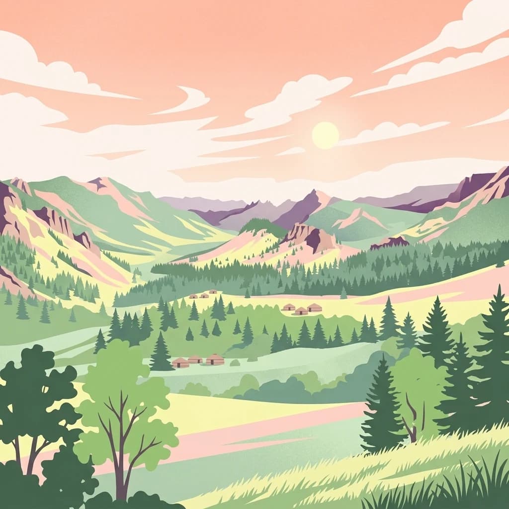
Illustration of a mountain landscape with green cliffs, rocky formations, and pine trees

Alkhanay National Park

National park

Park overview

Structured park overview, official facts, and landscape profile for Alkhanay National Park

Alkhanay National Park park facts, protected area profile, and essential visitor context

Review the core facts for Alkhanay National Park, including designation, size, terrain, visitor scale, habitats, and operating context in one park-focused overview.

About Alkhanay National Park

Alkhanay National Park represents a remarkable fusion of spiritual heritage and ecological significance in the heart of Siberia's Trans-Baikal region. The park's establishment in 1999 formalized protection for an area that has drawn Buddhist pilgrims for centuries to worship at Mount Alkhanai, a mountain embedded with deep religious meaning for the Buryat people, who are the largest indigenous group in Siberia, as well as for Mongols and Buddhist practitioners. The mountain's name derives from an ancient legend telling of a princess who fled pursuers to the summit and defiantly shouted "kill me!"—Alkhanai—in the local language, though today the site embodies peacefulness and healing rather than tragedy.

The park occupies 138,234 hectares in a geographically diverse landscape characterized by forested mountains, steep canyons with streams and waterfalls, mineral springs, and views across the vast undulating plains extending southward toward Mongolia. The terrain sits at medium elevations of 1,000 to 1,200 meters, with the Mount Alkhanai massif rising to 1,663 meters as a dominant presence in the southern reaches of the Mogotuyskogo Range. The underlying geological structure reflects ancient volcanic origins and Jurassic-period fault systems that shaped the distinctive rock formations visible throughout the area.

Managing this dual identity—supporting both religious pilgrimage and nature conservation—defines the park's approach to visitor management and resource protection. The park maintains distinct zoning that provides strictly protected nature reserves, areas of limited resource management, and recreational zones with developed trails suitable for visitors of various abilities. This balanced approach allows pilgrims to continue their traditional routes to sacred sites while ensuring the surrounding natural environment remains protected from degradation.

Quick facts and research context for Alkhanay National Park

Alkhanay National Park is situated in the Trans-Baikal region of southeastern Russia, in the Agin-Buryat Okrug administrative area. The park was established on May 15, 1999, covering 138,234 hectares of mountainous terrain. Its central feature is Mount Alkhanai, rising to 1,663 meters, which is considered one of the Five Sacred Peaks of Northern Buddhism. The park lies within the Daurian forest steppe ecoregion, characterized by a subarctic climate with extremely dry winters and short, cool summers. Thirty-seven streams within the park feed the Ilya River, a tributary of the Onon River, which eventually flows into the Amur River.

Protection and recognition

Examine documented terrestrial conservation frameworks and administrative scope.

Alkhanay National Park Protection Status and Designated Area Records

Alkhanay National Park maintains structured terrestrial protection status within national conservation registers. Systematic records compile management frameworks and administrative recognition details for the protected landscape.

Protection details

Protection scope
Terrestrial
Transboundary protection
No
Buffer area
104 km²
Park context

Deeper park guide and search-rich context for Alkhanay National Park

Alkhanay National Park history, landscape, wildlife, and travel context

Explore Alkhanay National Park through its history, landscape character, ecosystems, wildlife, conservation priorities, cultural context, and seasonal travel timing in a structured park guide built for atlas discovery and search intent.

Why Alkhanay National Park stands out

Alkhanay National Park is renowned primarily for its exceptional combination of religious and natural significance. Mount Alkhanai stands as one of the Five Sacred Peaks of Northern Buddhism, drawing pilgrims to its rock landforms, mineral springs, and meditation sites. The mountain features prominent sacred locations including Demchog Sume, the temple housing the guardian deity Alkhanov Demchog, and the "Temple Gate" rock formation through which pilgrims pass for healing. The Dalai Lama has made two unofficial visits to this sacred site, further cementing its prominence in the Buddhist world. Beyond its religious importance, the park protects a rare example of the Daurian forest steppe ecosystem, representing one of the last intact steppe environments in the Palearctic.

White Buddhist stupas with golden spires on a grassy hillside under blue sky
White Buddhist stupas with golden spires on a grassy hillside

Alkhanay National Park history and protected-area timeline

Alkhanay National Park was officially established on May 15, 1999, formalizing protection for an area that had long held spiritual significance for local communities. The establishment came as recognition of both the region's ecological importance within the Daurian forest steppe and its enduring role as a sacred Buddhist pilgrimage destination. Prior to national park status, the area existed within various protected designations, though the creation of the park provided a more comprehensive framework for balancing conservation with visitor access.

The park's creation coincided with growing recognition of the Daurian forest steppe as one of the last relatively undisturbed steppe ecosystems in the Palearctic. While the park was formally protected in 1999, the tradition of pilgrimage to Mount Alkhanai stretches back centuries, with Buddhist practitioners making the journey to the mountain's sacred sites long before any formal protection existed. The Dalai Lama's visits to the park in 1991 and subsequently further elevated the international profile of this sacred mountain, with one visit resulting in a Buddhist stupa marking the landing spot of the helicopter that carried him.

Today the park is managed by FGBU "Alkhanaya" and maintains infrastructure to support both pilgrims and recreational visitors, including accommodations at park-run and district-run hostels, cabin rentals, and campgrounds.

Alkhanay National Park landscape and geographic character

The physical landscape of Alkhanay National Park presents a compelling combination of mountainous terrain and rolling steppe that reflects its position in a transitional ecological zone. The park sits in the Mogotuyskogo Range, with Mount Alkhanai rising to 1,663 meters as the most prominent peak and visual anchor of the protected area. The mountain's upper reaches feature dome-shaped summits with exposed bare rock, while the lower slopes descend toward the vast undulating plains that extend southward toward Mongolia.

The terrain encompasses forested mountains characterized by steep canyons carved by streams and waterfalls, creating scenic corridors through the pine and cedar forests that dominate the middle elevations. Multiple springs emerge throughout the park, their cold waters carrying calcium carbonate deposits that have contributed to the mineral spring sites revered by pilgrims. The area contains few natural lakes but features extensive wetlands along stream corridors, providing important habitat diversity within the predominantly forested and steppe landscape.

Geologically, the landscape bears the marks of ancient volcanic activity, with Mount Alkhanai itself representing an ancient volcanic remnant. The underlying geological structure reflects Jurassic-period fault systems that concentrated volcanic and tectonic activity in this area, creating the distinctive rock formations that now serve as both scenic attractions and sacred pilgrimage sites.
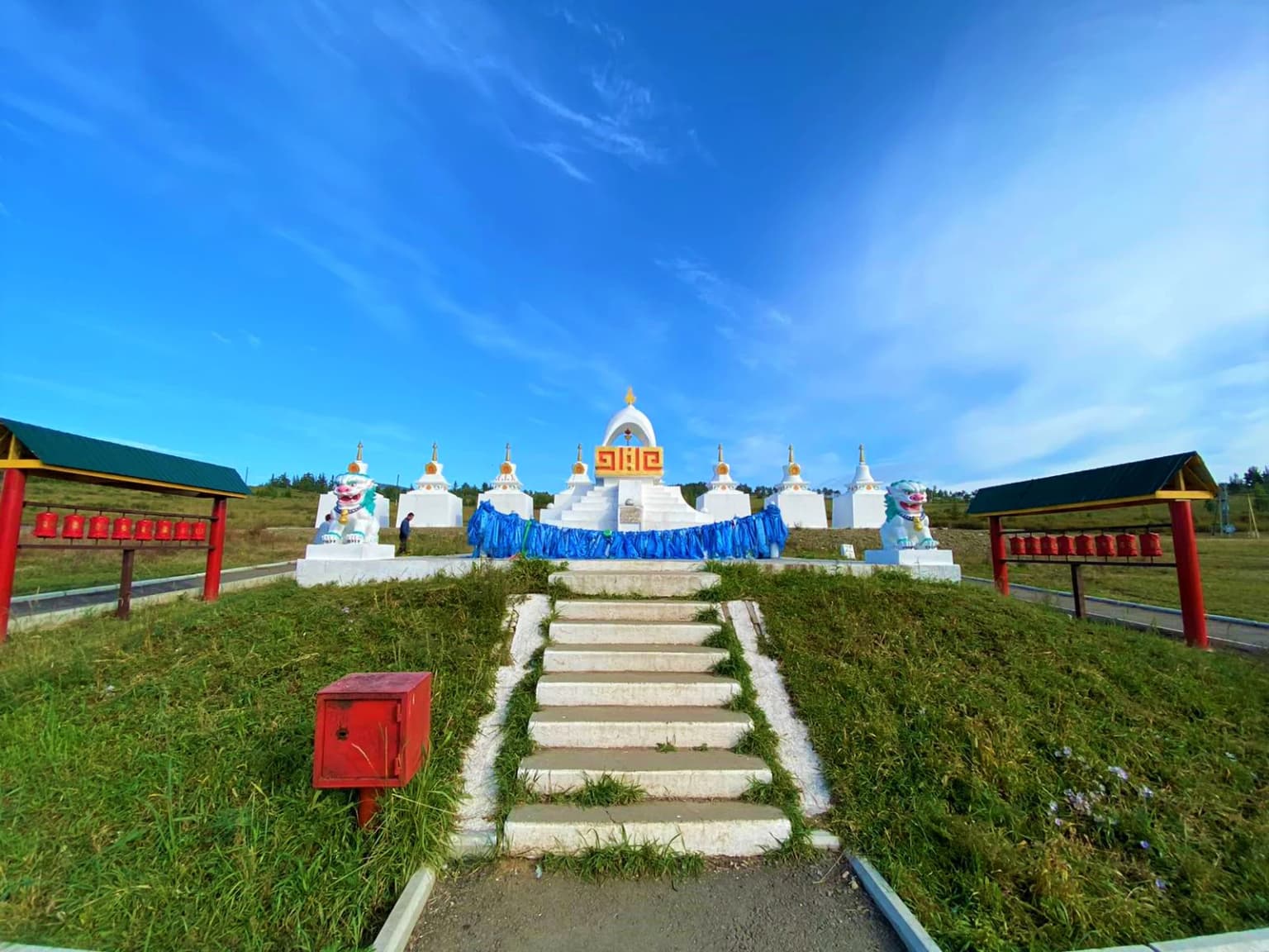
A wide angle shot of a row of white Buddhist stupas, or suburgans, centered at the top of a grassy hill. A stone staircase leads up to the structures, flanked by two covered prayer wheel stations. The sky is clear and blue.
A collection of suburgans, traditional Buddhist stupas, located within Alkhanay National Park.

Alkhanay National Park ecosystems, habitats, and plant life

Alkhanay National Park occupies a critical position within the Daurian forest steppe ecoregion, a landscape described as "a sea of grass that forms the best and most intact example of an undisturbed steppe ecosystem" and one of the last areas in the Palearctic supporting stable herds of larger vertebrates. This transitional zone between the East Siberian taiga to the north and the Mongolian Steppe to the south creates remarkable habitat diversity within the park's boundaries.

The park exhibits three distinct altitude zones of vegetation. The forest-steppe zone at the base of the mountains around 900 meters gives way to a forest belt dominated by cedar and pine with some spruce and fir, which transitions to a sub-alpine level featuring predominantly stunted Daurian larch near the peaks. At higher elevations, the larch typically reaches only about 2 meters in height, shaped by prevailing northwesterly winds, while creeping cedar, Sakhalin raspberry, Siberian mountain ash, and Siberian juniper represent other characteristic upper-elevation species.

The botanical diversity within the park is remarkable, with one study identifying 340 plant species, of which 180 have documented uses in local folk medicine practices. Notable species include rose root, astragalus membranous, and Baikal skullcap, each holding significance in traditional medicine. Botanists estimate the total plant species in the park may reach 700, indicating the area remains incompletely studied. The undergrowth of the forest belt features alder bush, willow, rhododendron, and blueberry, while ground pine forms common ground cover toward the forest boundaries.

A large green sign with the Russian text for Alkhanay National Park stands next to a wooden sculpture of a deer with large antlers.
The main entrance sign for Alkhanay National Park, featuring a stylized deer statue.

Alkhanay National Park wildlife and species highlights

Alkhanay National Park supports diverse wildlife populations across its range of habitats, from steppe grasslands through forested mountain slopes to wetland areas along stream corridors. The park is particularly notable for birdlife, with different species occupying distinct habitat zones—grouse in higher shrub areas, partridges in edge zones, woodpeckers and nutcrackers in middle forests, and finches in steppe habitats at lower elevations.

The abundance of small rodents throughout the park attracts numerous birds of prey, including nesting eagles, harriers, owls, and vultures that hunt across the open landscapes and forest edges. Wetland areas support substantial populations of wading birds, with demoiselle cranes particularly notable among the species found in these aquatic habitats. Ducks and shorebirds also populate the wetland areas, taking advantage of the 37 streams and associated marshland that traverse the park.

The mammalian community includes several significant species, with black bear, roe deer, elk, red deer, lynx, and sable representing the larger mammals that inhabit the park's forests and open areas. The park has also recorded the presence of musk deer at higher elevations. Additionally, the park provides protected zones for lizard species, contributing to the overall reptilian diversity of the protected area.

An aged paper page featuring a detailed, hand-colored illustration of a lady slipper orchid plant, including its flower, leaves, and root system, with handwritten Latin text at the top.
A historical botanical illustration of a lady slipper orchid from a 1720 publication.

Alkhanay National Park conservation status and protection priorities

Alkhanay National Park serves critical conservation functions within both the Russian protected area system and the broader Palearctic ecological landscape. The park protects one of the finest remaining examples of the Daurian forest steppe ecoregion, a habitat type that has faced significant reduction across its historical range. This ecosystem represents one of the last areas in the Palearctic still supporting stable populations of larger vertebrates, making the park's protected status particularly significant for maintaining ecological processes and species populations.

The freshwater systems within the park, comprising 37 streams feeding the Ilya River, contribute to the broader Shilka (Amur) Freshwater Ecoregion designated by the World Wildlife Fund. These temperate upland river systems support distinctive fish communities, including the bagrid catfish (Pseudobagrus herzensteini), an endemic species known reliably only from the hilly streams of the Onon and Shilka river systems. The park's 18 documented fish species in its lake systems further demonstrate the aquatic biodiversity values requiring protection.

Beyond ecological conservation, the park's protected status preserves important cultural heritage, with 16 natural cultic sites reflecting the diverse groups that have inhabited the area, from pre-Buddhist traditions through Buryat shamanistic practices to Buddhist pilgrimage infrastructure. The management approach of zoning—separating strict nature protection from recreational use—allows the park to fulfill both conservation mandates and support continued spiritual use of the landscape.

Alkhanay National Park cultural meaning and human context

The cultural landscape of Alkhanay National Park is profoundly shaped by the Buryat people, Siberia's largest indigenous group, for whom Mount Alkhanai holds sacred significance as a spiritual center. This sacred status was later adopted by Mongols and practitioners of Buddhism, establishing the mountain as one of the Five Sacred Peaks of Northern Buddhism. The synthesis of indigenous Buryat spiritual traditions with Buddhist practices has created a distinctive religious landscape where pilgrimage traditions continue to thrive.

The park contains 16 natural cultic sites reflecting this layered spiritual history, including ancient cave drawings, tiled graves dating to the 6th century BCE, shamanistic tradition sites, and Buddhist stupas. Prominent among these is Demchog Sume, the temple dedicated to the guardian deity Alkhanov Demchog (yidam Chakrasamvara), and the "Temple Gate" rock formation with its central opening through which pilgrims pass for healing. The meditation site of Naro Hazhod serves Buddhist clergy and lay practitioners alike.

The Dalai Lama's visits to Alkhanay, including an unofficial visit in 1991, have reinforced the mountain's significance within the global Buddhist community. A Buddhist stupa within the park marks the landing spot of the helicopter that carried the Dalai Lama during his visit, creating a tangible connection between this Siberian landscape and international Buddhist heritage.

Rocky outcrops in foreground with dense green forest and mountain slope in background
Scenic overlook from Mount Alkhanay summit showing forested valley below

Top sights and standout views in Alkhanay National Park

Alkhanay National Park stands as a distinctive protected area where natural and cultural preservation intersect around the sacred Mount Alkhanai. The mountain's status as one of Northern Buddhism's Five Sacred Peaks draws pilgrims to its mineral springs, rock landforms, and meditation sites throughout the year, with well-developed trails allowing access to sacred landmarks including the Temple Gate and Demchog Sume. The park protects an exceptional example of the Daurian forest steppe, one of the last relatively intact steppe ecosystems in the Palearctic. The transitional landscape between Siberian taiga and Mongolian steppe supports remarkable biodiversity across three distinct vegetation zones, from forest-steppe through coniferous forest to sub-alpine larch. The geological heritage of the area, including ancient volcanic formations and Jurassic-period fault structures, creates the dramatic rock landforms that serve as both scenic attractions and spiritual foci.

Narrow passage formed by large rocks with a light source visible at the far end
Narrow rock passage with light visible at the end

Best time to visit Alkhanay National Park

The subarctic climate of Alkhanay National Park shapes visitor experience significantly across seasons, with each period offering distinct advantages for different types of activities. The short summer season from June through August brings the most comfortable temperatures for hiking and pilgrimage, with average July temperatures around 17°C (63°F), though visitors should expect cool conditions even at the height of summer. This is the peak season for both pilgrims completing mountain circuits and recreational visitors exploring the park's trails.

Winter visits present a dramatically different character, reflecting the region's extreme continental climate. The Siberian High produces extremely dry winters with minimal precipitation, resulting in limited snow cover despite the cold—January temperatures average around -25°C (-12°F). The stark winter landscape offers a distinctive experience for those prepared for the cold, though access and facilities are more limited during this season. Spring and autumn provide transitional periods with changing scenery as the park's vegetation responds to seasonal shifts, though these shoulder seasons may have more variable weather conditions. The park's high elevation means that even summer evenings can be cool, and visitors should prepare for temperature variations regardless of when they visit.

Monthly climate preview

Long-term monthly temperature and precipitation rhythm for Alkhanay National Park

Alkhanay National Park Climate Normals and Annual Temperature Patterns

Alkhanay National Park records a wide annual temperature range alongside distinct monthly precipitation variations based on long-term representative coordinate data. Reviewing the complete monthly climate normals reveals detailed seasonal temperature swings and precipitation averages across the protected area.
Annual mean-1 °C
-21 °C18 °C
Jan-21°
Feb-17°
Mar-10°
Apr0°
May8°
Jun15°
Jul18°
Aug15°
Sep8°
Oct-1°
Nov-11°
Dec-18°
Warmest month
July18.1 °C
Coolest month
January-20.9 °C
Wettest month
July3.1 mm/day
Driest month
January0.2 mm/day
Park location guide

Geography guide, regional context, and park location map for Alkhanay National Park

Alkhanay National Park park geography, regions, and map view in Russia

Understand where Alkhanay National Park sits in Russia through a broader geographic reading of the surrounding landscape, nearby location context, and its mapped position within the national park landscape.

How Alkhanay National Park fits into Russia

Russia is a transcontinental nation spanning eleven time zones, bordered by fourteen countries. It is the world's largest country by area, covering 17,098,246 km². Moscow is the capital and largest city, while Saint Petersburg is the second-largest and a major cultural centre.

Wider geography shaping Alkhanay National Park in Russia

Russia spans Eastern Europe and North Asia, covering 17,098,246 km². It shares land borders with fourteen countries, more than any other nation, and spans eleven time zones. The landscape includes vast plains, mountain ranges such as the Urals and Caucasus, and extensive coastlines along the Arctic Ocean, Pacific Ocean, Baltic Sea, Black Sea, and Caspian Sea.

Map view of Alkhanay National Park

Use this park location map to pinpoint Alkhanay National Park in Russia, understand its exact geographic position, and read its mapped placement within the surrounding landscape more clearly.

Location context for Alkhanay National Park

Zabaykalsky Krai
Park atlas

Compare surrounding regional terrain, protected landscapes, and connected mountain reserves

Explore Protected Areas and Parks Near Alkhanay National Park in Eastern Siberia

Visitors exploring Alkhanay National Park can continue comparing nearby protected areas across the surrounding transitional forest steppe zone. Expanding regional park discovery reveals broader ecological patterns and related mountain geography throughout eastern Siberia.
Nature reserveDornod Province
About 174 km away#1 closest

Southeast

Mongol Daguur Nature Reserve: Steppe and Wetland Geography in Eastern Mongolia

Protected landscape boundaries within Dornod Province

An authoritative overview of the Mongol Daguur protected area, focusing on its role as a core element of the Daurian landscape. Discover the spatial distribution of its steppe habitats, wetland systems, and mountain-grassland terrain that define this eastern Mongolian region.

Area
156 km²
Established
1998
IUCN
Ib
Relief
Lowland
Watercolor painting of a river winding through hills with trees and vegetation
National parkZabaykalsky Krai
About 252 km away#2 closest

Southwest

Chikoy National Park: Protected National Park with Highland Landscape and River Basin Geography

Explore its protected boundaries and unique taiga-steppe transition in Zabaykalsky Krai.

Chikoy National Park, a protected area in Russia's Zabaykalsky Krai, showcases the rugged geography of the Khentei-Daur Highlands. As a national park, it preserves the upper Chikoy River basin and represents a significant ecological borderland, marking the transition from Siberian taiga to Mongolian steppe. This page facilitates a structured understanding of the park's mapped landscape, its prominent natural monument Bystrinsky Golets, and its role within the broader atlas of protected natural areas.

Area
6,665 km²
Established
2014
IUCN
II
Relief
Mountain
Watercolor illustration showing a mountainous landscape with green valleys and a river, rendered in soft pink and green hues
National parkKhentii Province
About 265 km away#3 closest

Southwest

Onon-Balj National Park: A Protected River Valley in Mongolia's Khentii Province

Explore unique geography and diverse ecosystems at a steppe-forest transition.

Onon-Balj National Park safeguards a critical river valley area in Khentii Province, Mongolia, marking an important ecological transition zone between Siberian forests and the Daurian steppe. Discover the park's mapped landscape, characterized by mid-sized mountains and riparian habitats along the Onon and Balj rivers. This protected area offers insights into regional geography, biodiversity, and the unique natural heritage of northern Mongolia.

Area
4,158 km²
Established
2000
IUCN
II
Relief
Mountain
Wildlife reserveKhentii Province
About 407 km away#4 closest

Southwest

Khan Khentii Strictly Protected Area: Geographic Overview and Protected Landscape Mapping

Eastern Mongolia wilderness and Khentii mountain terrain

Explore the expansive reaches of Khan Khentii Strictly Protected Area, a cornerstone of Mongolian conservation. This reserve shields intact taiga forests, river valley habitats, and the historic Burkhan Khaldun mountain from industrial activity, preserving one of the most significant mountain wilderness regions in the province of Khentii.

Area
12,270 km²
Established
1992
IUCN
Ib
Relief
Mountain
Watercolor painting depicting a lake with mountain ranges, green hills, and scattered trees.
National parkBuryatia
About 430 km away#5 closest

Northwest

Zaybaykalsky National Park: Geographic Atlas of Lake Baikal Protected Terrain

Mapping the Svyatoy Nos peninsula and Barguzin mountain landscapes

Spanning over 269,000 hectares, Zaybaykalsky National Park protects a dramatic transition from the shores of Lake Baikal to high-altitude mountain complexes. This atlas resource details the park's steep topography, characterized by ancient taiga forests and geological features like the Academician Ridge and marble-limestone islands, offering a structured view of this significant Siberian protected area.

Area
2,690 km²
Established
1986
IUCN
II
Relief
Mountain
Protected areaDornod Province
About 458 km away#6 closest

Southeast

Buir Lake Protected Area: Geographic Overview and Steppe Landscape Context

Mapping the transboundary freshwater wetlands of Dornod Province

Buir Lake occupies a expansive depression in the eastern Mongolian steppe, characterized by its shallow seasonal hydrology and fringing marshlands. This protected area serves as a primary geographic feature within Dornod Province, linking regional steppe systems and migratory bird corridors. The site offers a clear look at the interplay between water and grassland in a unique transboundary setting.

Established
2004
Relief
Lowland
Scope
Terrestrial
Water
Water-dominated
Watercolor illustration showing a lake, green vegetation, and mountains under a light sky
National parkIrkutsk Oblast
About 472 km away#7 closest

West

Pribaikalsky National Park: Geographic Context and Protected Landscape Boundaries

Coastal mountain terrain and the freshwater ecosystems of Irkutsk Oblast.

Located in Russia, Pribaikalsky National Park represents a primary protected area within the Lake Baikal basin. The region features dramatic topographical transitions from the Primorsky Range to the inland expanse of Olkhon Island. This record provides a detailed look at the park's physical geography, including its forest cover, coastal cliffs, and the significant role of the Angara River outflow in shaping the surrounding Siberian terrain.

Area
4,173 km²
Established
1986
IUCN
II
Visitors
400K annual
A stylized digital illustration of a mountainous valley landscape with scattered ger dwellings, evergreen forests, and a sunrise sky.
National parkTöv Province
About 518 km away#8 closest

Southwest

Gorkhi-Terelj National Park: Mapped Protected Landscape in Töv Province

Explore the geographic context and park boundaries.

Gorkhi-Terelj National Park is a designated national park offering rich opportunities for geographic exploration and protected landscape discovery. This entity page provides detailed insights into its mapped boundaries and its position within the regional geography of Töv Province. Understand the specific landform and terrain characteristics that define this protected natural area, central to understanding Mongolia's conservation landscapes.

Area
2,920 km²
Established
1993
IUCN
II
Relief
Mountain

Common questions about visiting, size, designation, and location context for Alkhanay National Park

Alkhanay National Park FAQs for park facts, access, geography, and protected area context

Find quick answers about Alkhanay National Park, including protected-area facts, park geography, trail and visitor context, and how the park fits into its surrounding country and regional landscape.
MoriAtlas Explorer

Search national parks and protected areas

Narrow your park search by location, environment, and protection category.

Global natural geography