
Streams
Park geography
Detailed analysis of mountain topography, elevation spans, and recorded landscape features.
Comprehensive Geographic Profile and Mapped Terrain of Alvão Natural Park in Vila Real, Portugal
Discover the physical characteristics and administrative geography of Alvão Natural Park, a 72.03 square kilometer protected area located in the Vila Real region of Portugal. This profile details the elevation gradient ranging from 260 to 1339 meters, alongside mapped natural landmarks including the Fisgas de Ermelo waterfalls, the Olo river, and various mountain peaks and viewpoints.
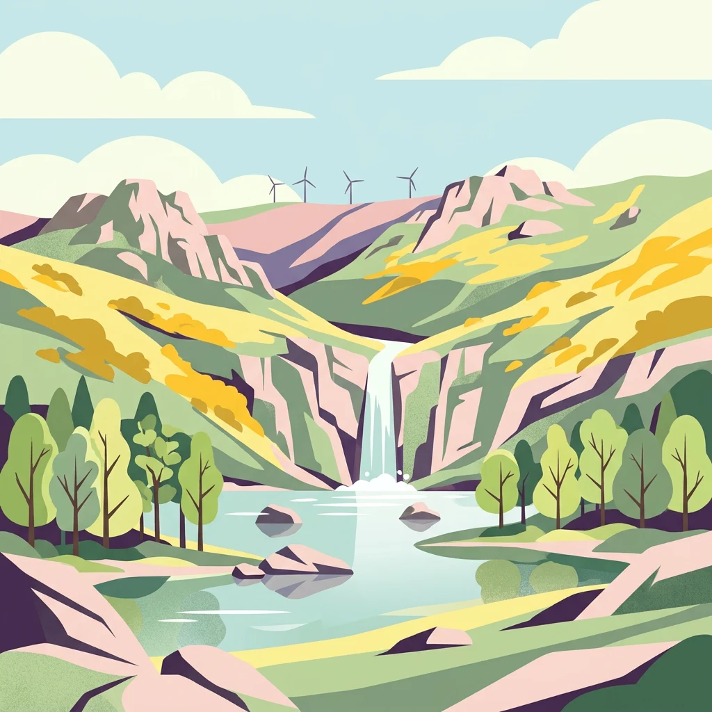
Portugal's smallest natural park protecting rugged mountain landscapes, cascading waterfalls, and traditional agro-silvopastoral heritage in the heart of Trás-os-Montes
Alvão Natural Park
Alvão Natural Park is a protected landscape in northern Portugal, established on June 8, 1983 under decree-law 237/83. Located in the Vila Real district across the municipalities of Mondim de Basto and Vila Real, the park occupies approximately 72 square kilometres of mountainous terrain in the Tâmega and Douro subregions of the Norte Region. It is the smallest of Portugal's natural parks, yet it preserves a remarkable diversity of landscapes, ecosystems, and cultural traditions within its compact footprint. The park spans an altitudinal range of over 1,000 metres, from the summit of Caravelas at 1,339 metres down to the Rio Olo valley at roughly 260 metres. This dramatic elevation gradient, combined with the contrast between granite highlands and schist lowlands, creates a distinctive mosaic of habitats and scenery. The park is also integrated into the European Union's Natura 2000 network as the Alvão-Marão site, reflecting its importance for conserving European biodiversity and threatened species.
- Location
- Portugal
- Park type
- Protected area
- Established
- 1983
- Area
- 72 km²
- Highest point
- 1,339 m
Location overview
Regional positioning and political boundaries within Vila Real
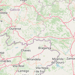
Geographic Location of Alvão Natural Park in Portugal
Alvão Natural Park is located in Portugal, positioned within the regional boundaries of Vila Real. The inland terrestrial protected area operates under a single country jurisdiction without transboundary or coastal status.
- Countries
- Portugal
- Regions
- Vila Real
- Primary location
- Portugal
- Geographic setting
- Inland
Boundary and coordinates
Mapping the spatial extent and 72.03 square kilometer area of the park
Geographic Boundary Map and Spatial Limits of Alvão Natural Park
Interactive geographic outlines provide spatial context for Alvão Natural Park by tracing its physical perimeter. Accompanying spatial metrics define the estimated area, central coordinates, and lateral spans of the protected territory.
- Boundary area
- 72.4 km²
- Boundary perimeter
- 46 km
- Northernmost point
- 41.4125° N
- Southernmost point
- 41.3237° N
- Easternmost point
- 7.7412° W
- Westernmost point
- 7.9225° W
- Geographic centre
- 41.3693° N, 7.8175° W
- North–south span
- 9.9 km
- East–west span
- 15.2 km
Elevation and terrain
Mountain relief metrics and recorded natural features across protected terrain
Alvão Natural Park Terrain and Elevation Range Geography
Recorded elevation metrics outline the vertical range of the protected mountain landscape from two hundred sixty to one thousand three hundred thirty-nine meters. Associated feature cards document specific streams, peaks, viewpoints, and water bodies located within the park boundary.
- Minimum elevation
- 260 m
- Maximum elevation
- 1,339 m
- Highest point
- 1,339 m
Selected named natural features
Streams
Ribeiro das Fisgas
Peaks
Caravelas
1,330 m
Reservoirs
Albufeira Fundeira do Alvão
Viewpoints
Canhão das Fisgas
Viewpoints
Miradouro de Lamas de Olo
Environmental setting
Temperate climate zones, mountain relief, and forest cover classifications
Environmental Classifications and Terrain Settings in Alvão Natural Park
Recorded classifications group mountainous terrain, forest cover, and habitat types into complementary categories for physical setting analysis. Stored records link individual environmental attributes directly to related protected area destinations across the region.
- Relief
- Mountain
- Climate
- Temperate
- Water
- Minor water
- Forest cover
- Mostly forested
- Seasonality
- Year-round
Landscape features
Mountains · Valleys · Plateau · Rivers · Waterfalls · Cliffs
Habitat types
Temperate broadleaf forest · Montane forest · Grassland · Riverine habitat · Wetland
Park atlas
Trace nearby national parks and protected landscapes, comparing their mapped geography and conservation footprint across Portugal's Norte Region.
Discover Other Protected Areas and National Parks Near Alvão Natural Park, Portugal
Browse a curated selection of protected areas and national parks located near Alvão Natural Park, extending your geographic discovery across Portugal's Norte Region. This comparative view provides valuable context for understanding the regional spread of conservation landscapes, allowing deeper atlas-style analysis of adjacent mountain parks and diverse natural reserves.
National parkPortugal
36 km away#1 closest
Northwest

Peneda-Gerês National Park: A Distinct Protected Landscape in Northern Portugal
Granite peaks, glacial valleys, and cultural heritage mapped.
Peneda-Gerês National Park represents a cornerstone of protected landscapes in Portugal, celebrated for its rugged granite mountains and deep glacial valleys sculpted over millennia. This national park showcases a rare ecological transition zone with unique endemic species and features dramatic waterfalls and pristine river systems. The park's rich cultural tapestry, interwoven with its natural environment, offers a compelling subject for atlas-based geographic discovery and landscape exploration.
- Area
- 695.93 km²
- Established
- 1971
- IUCN
- II
- Visitors
- 92.8K annual

Protected landscapeBragança District
67 km away#2 closest
Northeast
Montesinho Natural Park: Protected Landscape in Bragança District, Portugal
Explore mapped boundaries and regional landscape context.
Montesinho Natural Park is designated as a protected landscape in northeastern Portugal, located within the administrative region of Bragança District. This page serves as an entry point to understanding the park's protected area characteristics, its mapped geographic footprint, and its role in the broader natural landscape of the Trás-os-Montes region. Discover the atlas value of this significant protected territory and its relation to surrounding geography.
- Area
- 742.25 km²
- Established
- 1979
- IUCN
- V
- Relief
- Mountain
Biosphere reserveGalicia
69 km away#3 closest
North

Área de Allariz Biosphere Reserve: Mapping the Protected Landscapes of Inland Galicia
Exploring the river basins, granitic massifs, and ecological frontiers
The Área de Allariz biosphere reserve serves as a vital transition zone in northwestern Spain, characterized by its flat-floored tectonic basin, the River Limia, and varied highland terrain. This protected area offers an instructive look at the integration of traditional rural land management with large-scale ecological recovery and conservation across its core, buffer, and transition zones.
- Area
- 214.82 km²
- Established
- 2005
- Relief
- Mixed relief
- Scope
- Terrestrial
Protected landscapeEsposende
71 km away#4 closest
West
Northern Littoral Natural Park Protected Landscape: Geographic Discovery and Atlas Context
Mapped protected areas and regional landscape discovery near Esposende.
Uncover the geographic identity of Northern Littoral Natural Park, a key protected landscape situated near Esposende. This MoriAtlas entry focuses on its mapped boundaries and regional significance, providing a factual basis for understanding its role within Portugal's network of protected areas. Explore the park's natural terrain and its context within the broader geography of the Norte region for comprehensive atlas-based discovery.
- Area
- 87.62 km²
- Established
- 1987
- IUCN
- V
- Relief
- Lowland
Nature reservePortugal
85 km away#5 closest
South
Serra da Estrela Natural Park: Glacial Terrain and Highest Peaks in Portugal
Explore the dramatic geography of this nature reserve.
Serra da Estrela Natural Park is a significant protected landscape in Portugal, celebrated for containing the nation's highest peak and exceptional Quaternary glacial formations. The park's terrain includes dramatic valleys carved by ice, numerous glacial lakes, and a stark alpine plateau around Torre. This nature reserve preserves a unique environment shaped by both geological history and traditional pastoralism, offering rich mapped context for understanding Portugal's mountainous geography and protected areas.
- Area
- 891.32 km²
- Established
- 1976
- IUCN
- V
- Visitors
- 7.6K annual
National parkGalicia
121 km away#6 closest
Northwest
Atlantic Islands of Galicia National Park: Protected Archipelagos & Galician Coastline Geography
Explore mapped island ecosystems and protected marine areas.
Uncover the protected landscape of the Atlantic Islands of Galicia National Park, Spain's only national park in Pontevedra province. This atlas entry details the four distinct archipelagos, Cíes, Ons, Sálvora, and Cortegada, across the Rías Baixas. Discover the unique sea-land protected area, its rare bay laurel forests, significant seabird colonies, and the broader regional geography of Galicia.
- Area
- 84.8 km²
- Established
- 2002
- IUCN
- II
- Visitors
- 472.3K annual
Biosphere reserveProvincia de León
152 km away#7 closest
Northeast
Reserva de la biosfera de los Ancares Leoneses: Protected Mountain Terrain and Atlas
Mapping the Sierra de Ancares river valleys in Provincia de León
Examine the geographic layout and protected boundaries of the Reserva de la biosfera de los Ancares Leoneses. This biosphere reserve serves as a critical mountain corridor, featuring complex river basins and diverse forest cover that highlight the region's environmental and cultural history across the Spanish highlands.
- Area
- 567.86 km²
- Established
- 2006
- Relief
- Mountain
- Scope
- Terrestrial
Biosphere reserveGalicia
154 km away#8 closest
North
Reserva de la biosfera de las Tierras del Miño: Mapped Landscapes and Geographic Overview
Extensive riverine forests and wetland networks in northwestern Spain
Explore the expansive territory of Reserva de la biosfera de las Tierras del Miño, spanning a large portion of the Galician interior. This protected area features a mosaic of wetlands, riparian corridors, and mountainous terrain, offering a deep look into the ecological and cultural geography of the upper Miño river basin.
- Area
- 3,636.69 km²
- Established
- 2002
- Relief
- Lowland
- Scope
- Terrestrial
MoriAtlas Explorer
Continue Exploring Alvão Natural Park's Unique Mapped Geography and Landscape Context
Delve deeper into the protected landscape of Alvão Natural Park to understand its specific geographic features, from granite chaos formations to steep schist valleys. Use this detailed atlas information to uncover the park's ecological significance and its place within the regional geography, providing a foundation for structured natural landscape discovery.
Browse next
Global natural geography
Explore related park routes
Explore MoriAtlas Global ParksBrowse All MoriAtlas ParksGlobal Park Map DiscoveryMoriAtlas: Browse All CountriesBrowse All MoriAtlas ContinentsNational Park Environment AtlasGrand Canyon National Park AtlasYellowstone National Park AtlasYosemite National Park Atlas and GeographySerengeti National Park AtlasGalápagos National Park Protected LandscapeBanff National Park Geography and AtlasKruger National Park Atlas EntryUluṟu-Kata Tjuṯa National Park AtlasExplore Uluru-Kata Tjuta National Park GeographyPlitvice Lakes National Park AtlasFiordland National Park Protected LandscapeGreat Smoky Mountains National Park AtlasAfghanistan National Parks and Protected AreasAlbania National Parks and Protected AreasAlgeria National Parks and Protected AreasAmerican Samoa National Parks and Protected AreasAndorra National Parks and Protected AreasAngola National Parks and Protected AreasAntarctica National Parks and Protected AreasAntigua and Barbuda Park List