
Why Aue Plaun la Greina stands out
The floodplain is famous as a textbook example of a high-altitude braided river system and as the focal point of one of the most consequential conservation campaigns in 20th-century Switzerland. Its preservation in 1992 ended decades of hydroelectric development pressure that had threatened to flood the Greina plateau under a planned reservoir. The site is also widely recognized for its geological significance, described in Swiss geological literature as a "key area of Alpine geology" because it exposes folded and overthrust formations, metamorphic rocks, glacial moraines, and the remains of an ancient ice-dammed drainage divide between the Rhine and Po basins.
Aue Plaun la Greina history and protected-area timeline
The Greina plateau has been used as seasonal alpine pasture since the Middle Ages, with grazing rights shared between communities on both sides of the Alpine divide. Since 1494 the high-altitude alp "Agrena" was leased to the community of Aquila in the Blenio valley, while the community of Lugnez (Lumnezia) retained rights to pasture horses on the plateau. A 19th-century territorial dispute between Lugnez and Aquila over the highland was resolved in 1892 by the Swiss Federal Court in favor of Graubünden. Light grazing, including occasional use by livestock from the Ticinese alp Motterascio, has continued within and around the protected floodplain.
During the Second World War, the Swiss army built several barracks in the Greina area, some of which were later used by alpine herders. The most consequential historical episode, however, began in the early 20th century when hydroelectric planners identified the Greina plateau as an ideal reservoir site. Plans for a high-pressure power plant with a dam on the highland existed as early as 1914. After the Second World War, energy shortages revived the project, and in 1958 the communities of Vrin and Sumvitg granted water concessions to major power companies for a storage lake on the plateau.
A broad coalition of conservationists opposed the project. Architects, writers, alpine clubs, the Swiss Heritage Foundation, Pro Rein Anteriur, the Rheinaubund, the Swiss Society for Environmental Protection, the WWF, and the "Save the Rhine" movement mobilized against the plan. The Swiss Greina Foundation for the Preservation of Alpine Flowing Waters was founded in 1986 to coordinate the campaign. Although a federal popular initiative to protect Swiss waters failed at the ballot in 1992, the same vote adopted the federal Water Protection Act, which laid the legal basis for compensating communities for foregone hydropower revenues.
In the end, the energy industry withdrew the reservoir project on economic grounds. In 1992, the federal government placed the Greina floodplain into the Federal Inventory of Alluvial Areas of National Importance, and in 1996 the wider Greina-Piz Medel landscape was added to the Federal Inventory of Landscapes and Natural Monuments. Since 1997, communities that surrendered their water concessions have received compensation payments, completing a negotiated conservation outcome that stands as a milestone in Swiss nature protection history.
Aue Plaun la Greina landscape and geographic character
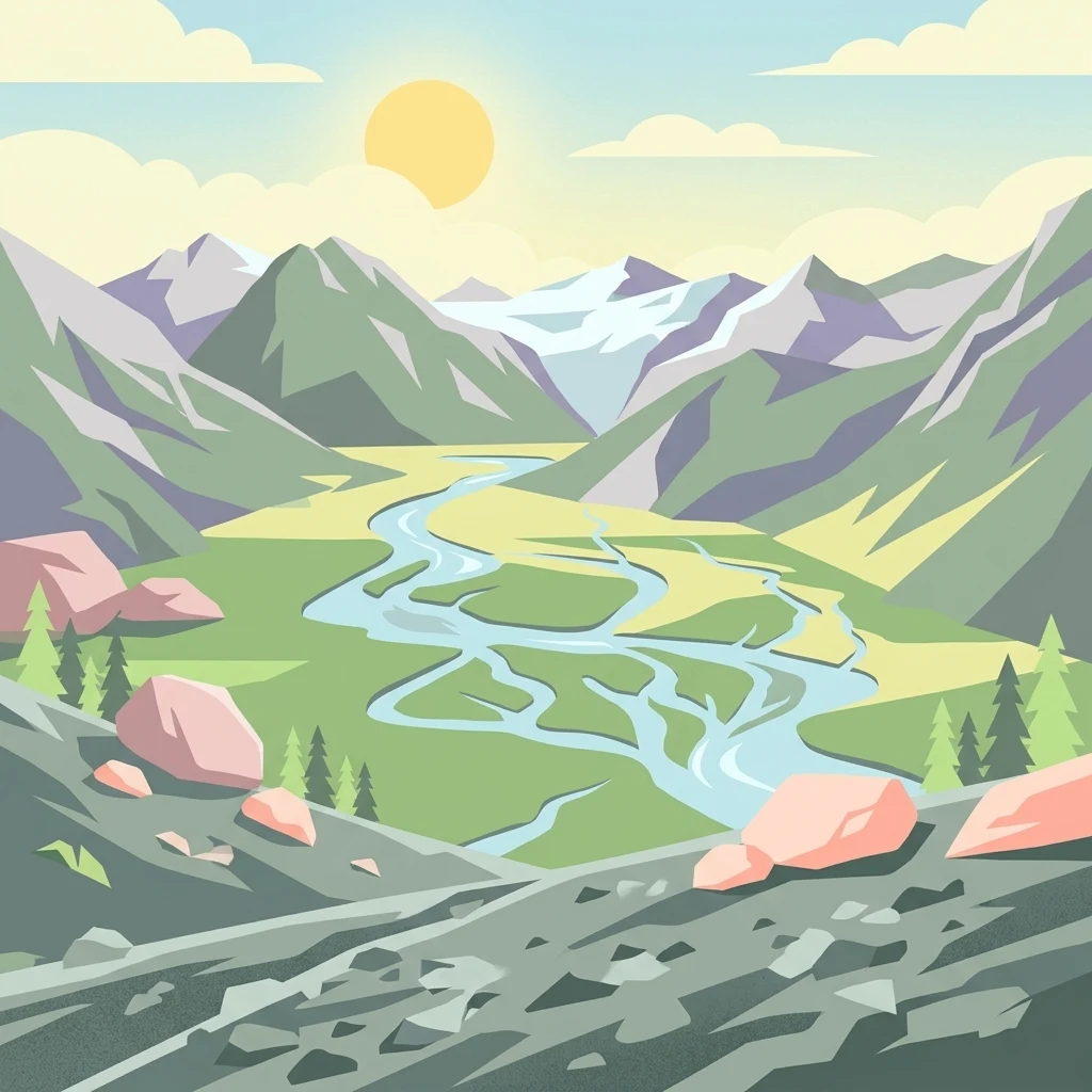
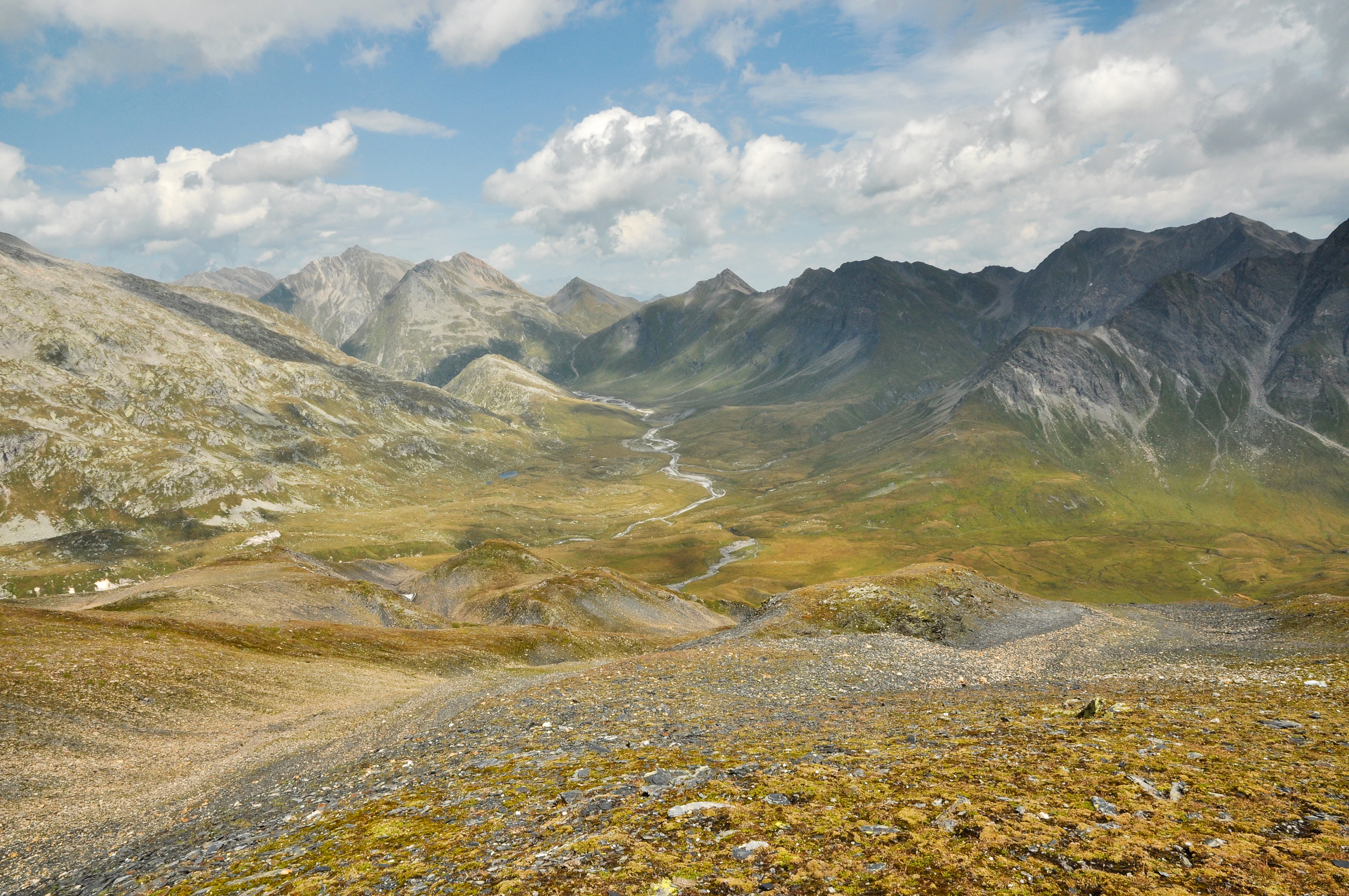
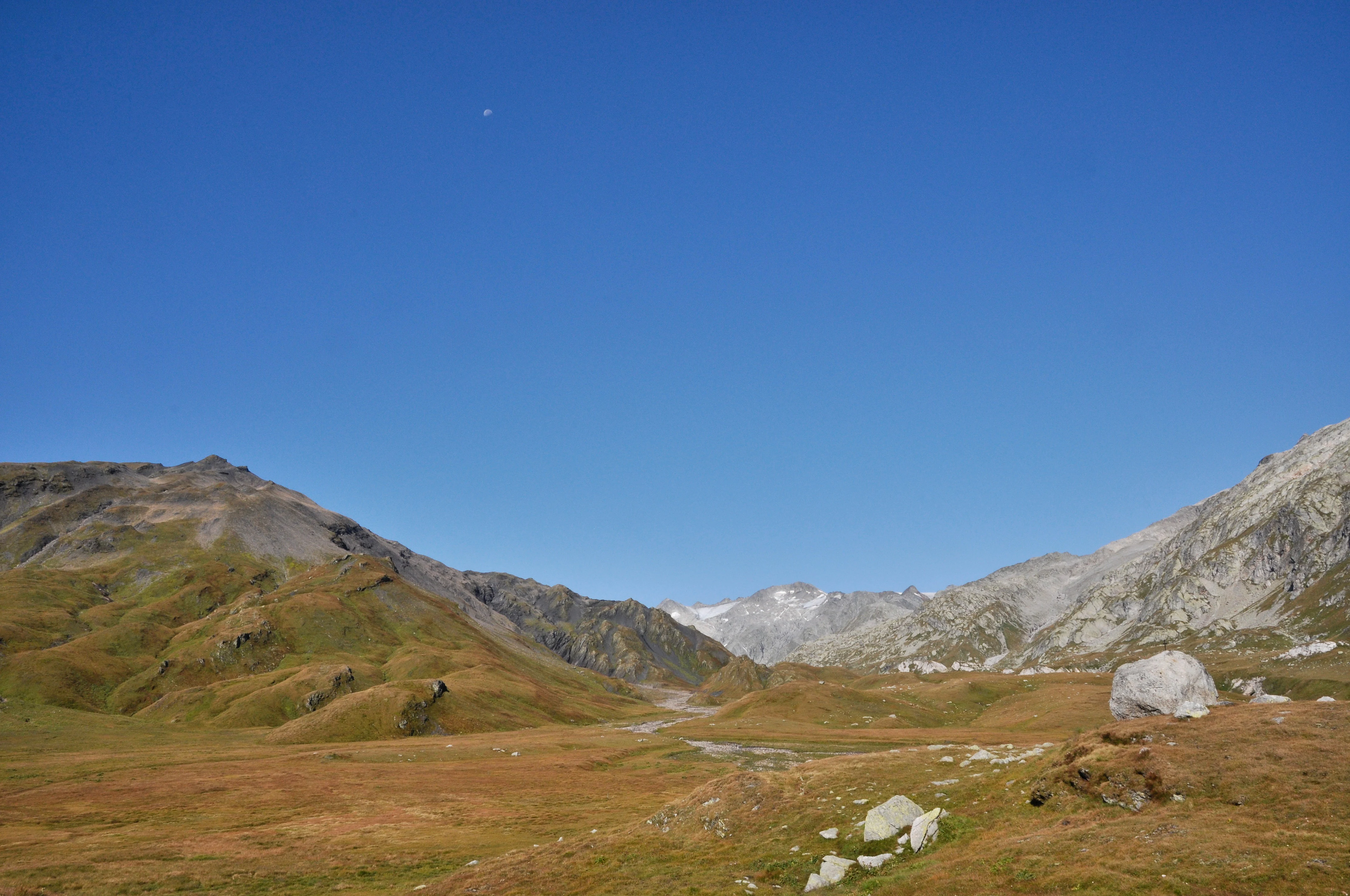
Plaun la Greina lies in the Surselva region within the municipality of Lumnezia, occupying a three-kilometer reach of the upper Rein da Sumvitg on a high plateau framed by three Adula mountain massifs. Although called a plateau, the terrain is more accurately a rolling upland of terraces, rocky ribs, moraine hummocks, and gentle elevations flanking a nearly flat floodplain that descends only about 15 meters across its length. Wetlands, ponds, and small fens punctuate the plain around the river.
To the northwest the landscape rises into the Piz Miezdi-Piz da Stiarls-Piz Greina-Piz Valdraus ridge and onward to Piz Medel, 3,210 meters, the highest peak near the reserve. To the east, the Piz Tgietschen-Piz Stgir-Piz Canal-Piz Terri chain separates the Greina from the valley of Vrin, with Piz Terri at 3,149 meters, while Pizzo Corói closes the valley to the southwest with rounded, debris-mantled slopes. The terrain near "Crap la Crusch" carries the remarkable erratic block of augen gneiss that was carried into the area by ancient glaciers and gives its name to a neighboring moor of national importance.
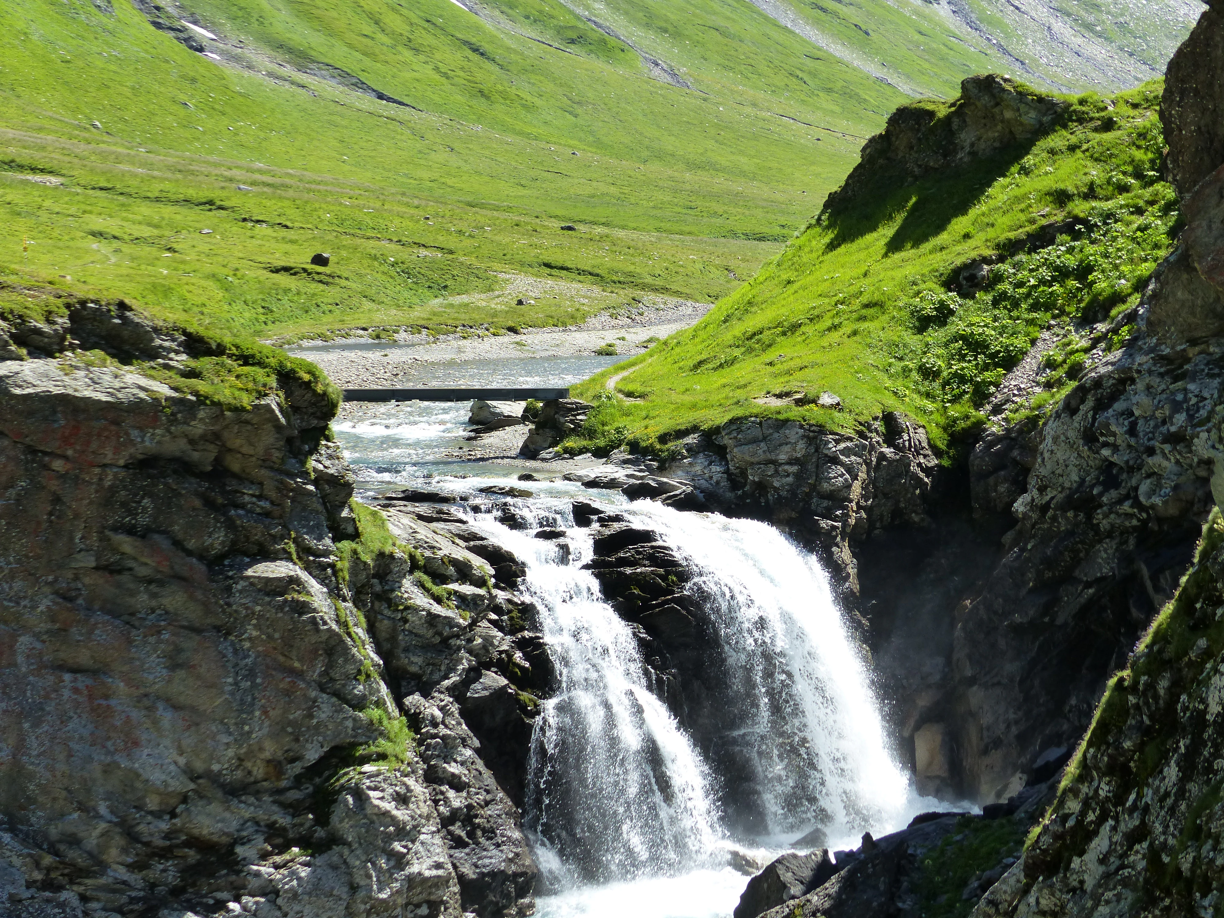
The hydrological setting of the plateau defines its character. Meltwater streams descend from remnant glaciers on Piz Medel, Piz Terri, and the Gaglianera, and numerous mountain torrents feed into the Somvixer Rhein as it braids across the plain. Near the Greina pass the river cuts through a gorge before reaching the floodplain, and at the downstream end it enters a second gorge at "La Camona" on its way to Val Sumvitg. The mountain crestline across the Greina also marks a portion of the great European watershed: water on one side flows to the Rhine and the North Sea, while water on the other side feeds the Brenno and ultimately the Po and the Mediterranean.
Aue Plaun la Greina ecosystems, habitats, and plant life
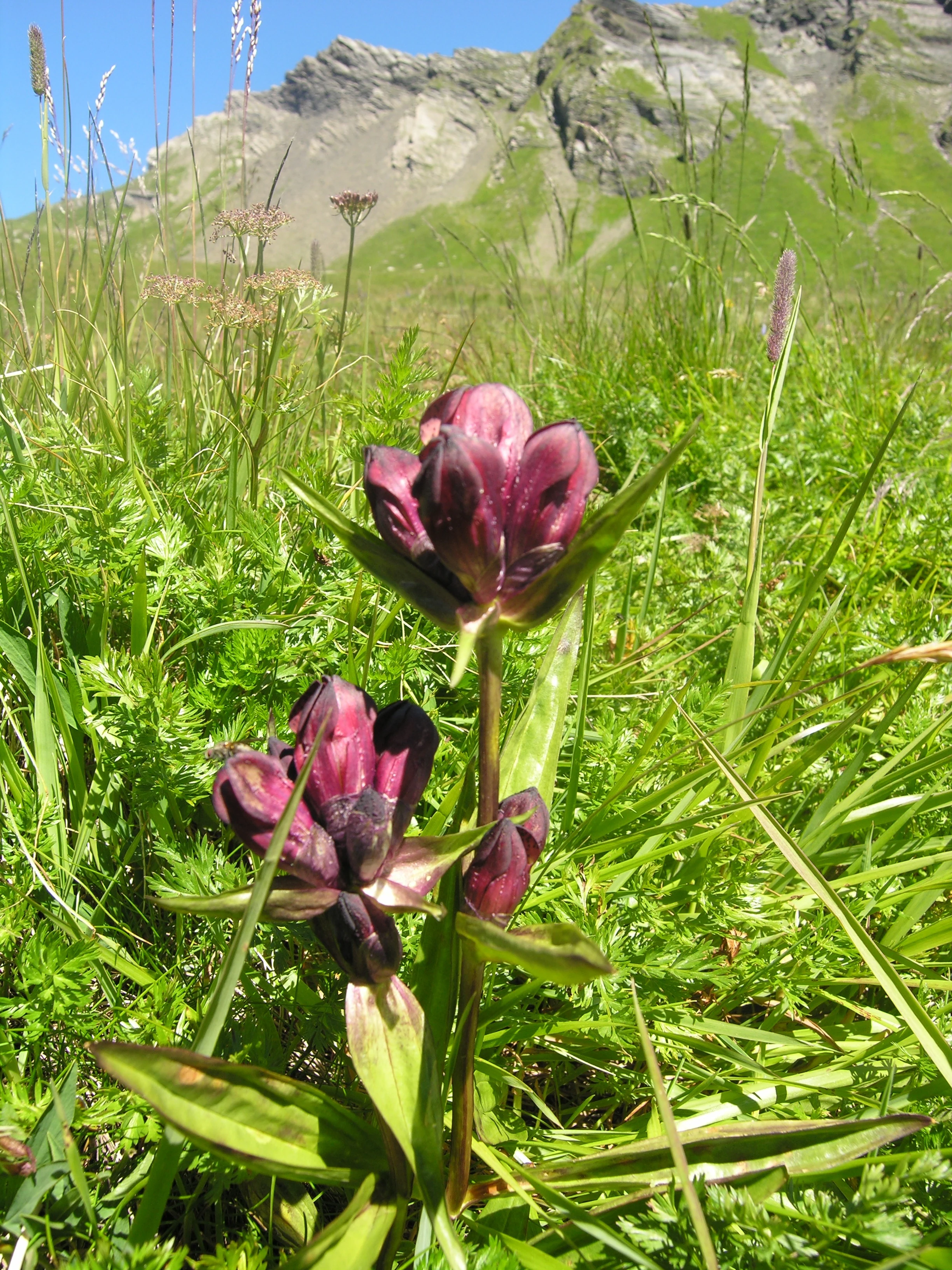
The Greina floodplain hosts an unusually rich mosaic of high-alpine habitats compressed into a small area. Within and around the reserve, five distinct biotope types occur along the riverbanks, on gravel islands, in the flat surroundings, on moraine hummocks, and on the adjacent mountain slopes, supporting a varied pioneer and grassland flora. The underlying geology alternates between calcareous and siliceous parent materials, which allows plant communities of contrasting ecological demands to coexist within a short distance.
Pioneer communities of river gravel and sand shift with the river's frequent reworking of the floodplain, while the flats near the river belong to the flat-mire alliance Caricion nigrae, with reed-creeping species, sedges, and mosses. On dry hummocks and terraces, krummsegge grasslands of the Caricetum curvulae association cover the slopes, and snow bed communities with characteristic species occupy shaded hollows. The combination of mires, springs, sedge fens, and small pools gives the area a mosaic more reminiscent of northern tundra than of typical closed Alpine forest belts.
The full altitudinal range of vegetation in the reserve is compressed because trees cannot survive at this elevation. Only isolated shrubs, such as alpine rose, are present, and the vegetation is largely undisturbed apart from limited grazing pressure. A 2006 cantonal report, however, noted localized trampling damage from cattle in the trampling-sensitive flat mires, particularly in the southwestern half of the floodplain, indicating that the site continues to require careful management to retain its character.
Aue Plaun la Greina wildlife and species highlights
Because the Greina lies above the tree line in an open, treeless landscape dominated by mats, gravels, and fens, the area supports only a limited but distinctive set of large animal species. Marmots inhabit the rocky outcrops and meadow edges, and the threatened adder (Kreuzotter) finds favorable conditions among the warm, stony slopes and terraces. Apart from these prominent species, the open meadows and the broader extensive pastureland support the typical invertebrate fauna of high-alpine environments.
The floodplain's broader significance for wildlife is less about species richness than about its function as a refuge within a human-shaped landscape. The braided river, gravel bars, fens, and floodplain meadows provide valuable habitat for alpine aquatic invertebrates and for ground-nesting or meadow-dependent birdlife typical of the high Alps. The reserve is also embedded within the federally decreed hunting ban area "Pez Vial/Greina," which strengthens its value as a protected wildlife habitat on a regional scale.
Aue Plaun la Greina conservation status and protection priorities
Aue Plaun la Greina is one of the most important nature conservation case studies in Switzerland. Designated in 1992 under the federal ordinance on alluvial areas of national importance, it represents the type "alpine floodplain" within the national inventory of floodplain sites. The surrounding landscape was added to the Federal Inventory of Landscapes and Natural Monuments in 1996 under the name "Greina-Piz Medel," and the federal hunting ban area "Pez Vial/Greina," decreed in 2004, overlays a portion of the territory.
The conservation goals defined for the site emphasize the preservation of the mountain landscape with its natural dynamics, of water bodies and riparian habitats in a near-natural state, of glacier forelands and flowing water dynamics, of geological exposures and geomorphological features, and of the characteristic and relict plant and animal species of the floodplain. The outcome of decades of negotiation successfully traded the loss of potential hydropower revenue for permanent legal protection of an intact alpine river landscape and provided a model of compensation-based conservation that has shaped Swiss practice since the 1990s.
Aue Plaun la Greina cultural meaning and human context
The Greina plateau sits at the meeting point of two historical language areas, Surselva Romansh in Graubünden and Alpine Lombard in Ticino, and its very name preserves this linguistic heritage. "Plaun" derives from Latin planum and means plain, while the origin of "Greina" remains debated but has been linked to a Romanish word meaning mountain or summit. Old transalpine routes, including the Greina pass and the nearby Crap la Crusch saddle, have carried travelers between the Vorderrhein valley and the Blenio valley for centuries; the Greina route was documented in the Habsburger Urbar of the early 14th century under the name "Agren."
Seasonal alpine pastoralism has shaped the landscape for centuries, with grazing rights shared across cantonal boundaries. Negotiation among communities, energy companies, and federal authorities over the future of the Greina became a defining episode of late 20th-century Swiss civic engagement and shaped how compensation-based conservation is discussed in the Alps.
Top sights and standout views in Aue Plaun la Greina
Aue Plaun la Greina combines ecological rarity with cultural and historical significance: a 39-hectare federally protected high-alpine floodplain at the heart of a major landscape protection area, preserved from a long-threatened hydroelectric reservoir through one of the most important conservation campaigns of 20th-century Switzerland.
The reserve is distinguished by its braided alpine river, diverse pioneer and mire vegetation, exposed glacial and tectonic geological features, and its position on the European watershed between the Rhine and the Po. It is also a landmark for transalpine cultural history, located at the meeting of two Alpine language regions and crossed by ancient routes that remain part of the regional hiking network today.
Best time to visit Aue Plaun la Greina
Summer and early autumn are the natural season for experiencing the Greina floodplain, when snow has melted from the plateau, the alpine meadows and fens are accessible, and the trail network across the high passes is open under typical high-alpine conditions. July and August generally bring the most stable weather and the fullest bloom of alpine flora across the dry meadows and moraine terraces.
Because access is exclusively on foot and the longer approaches from Vrin or the Blenio valley require two or more days of mountain walking, the area rewards visitors who plan for sustained daylight, stable weather windows, and cooler mountain temperatures. Outside the summer hiking season, heavy snow and high avalanche risk make the plateau inaccessible under normal conditions, reinforcing the seasonal character of any visit.