
Why Greina, Piz Medel stands out
Greina, Piz Medel is known for the broad, almost flat Greina high plateau and the surrounding ring of high peaks in the Adula Alps, which together create a strikingly open high-alpine landscape for an otherwise mountainous region. The area is also defined by its position on the European main watershed, its nationally significant floodplain and bog habitats on the plateau, and its cluster of three-thousand-meter peaks that frame the Greina valley.
Greina, Piz Medel history and protected-area timeline
Greina – Piz Medel has been formally recognized at the federal level as part of the Swiss Inventory of Landscapes and Natural Monuments of National Importance since 1996, giving it continuous protection as a landscape of national significance. Even before that designation, much of the area's territory had already been protected since 1992 as federal hunting reserve (Jagdbanngebiet) under the cantonal entries «Pez Vial/Greina» in Graubünden and «Greina» in Ticino. These protections built on a long pre-existing pattern of traditional Alpine land use, transhumance, and pastoral management across the high valleys.
The cultural significance of the Greina plateau and the surrounding passes goes back much further. The Greina pass and related routes over the Diesrut pass and via Crap la Crusch served as historic high-altitude connections between the Surselva valleys and the Blenio valley, used for seasonal livestock movement, local trade, and travel through the central Alps. The pastoral buildings, alpine dairies, and cableways that still operate in the valleys reflect this long continuity of human presence within a high-mountain setting that otherwise feels untouched.
Modern recognition of the area as a heritage landscape came through dedicated documentation and advocacy. The Swiss Greina Foundation helped draw national attention to the region in the early 1980s, and the area has since been described in national inventories and reference works on Switzerland's natural heritage. The current BLN object sheet for object 1913 «Greina – Piz Medel» defines the formal protection goals that govern the area today, building on decades of conservation practice in the region.
Greina, Piz Medel landscape and geographic character
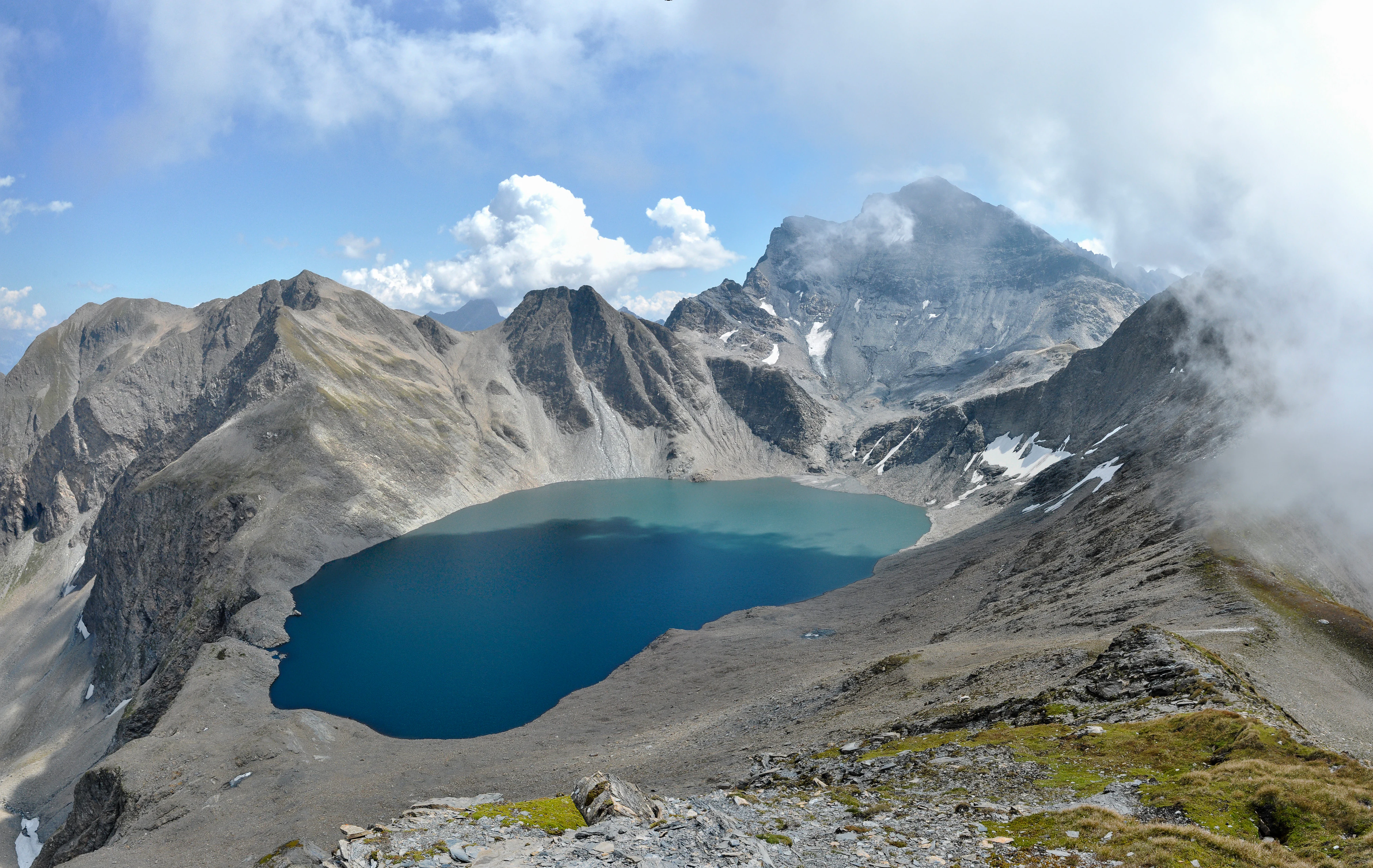
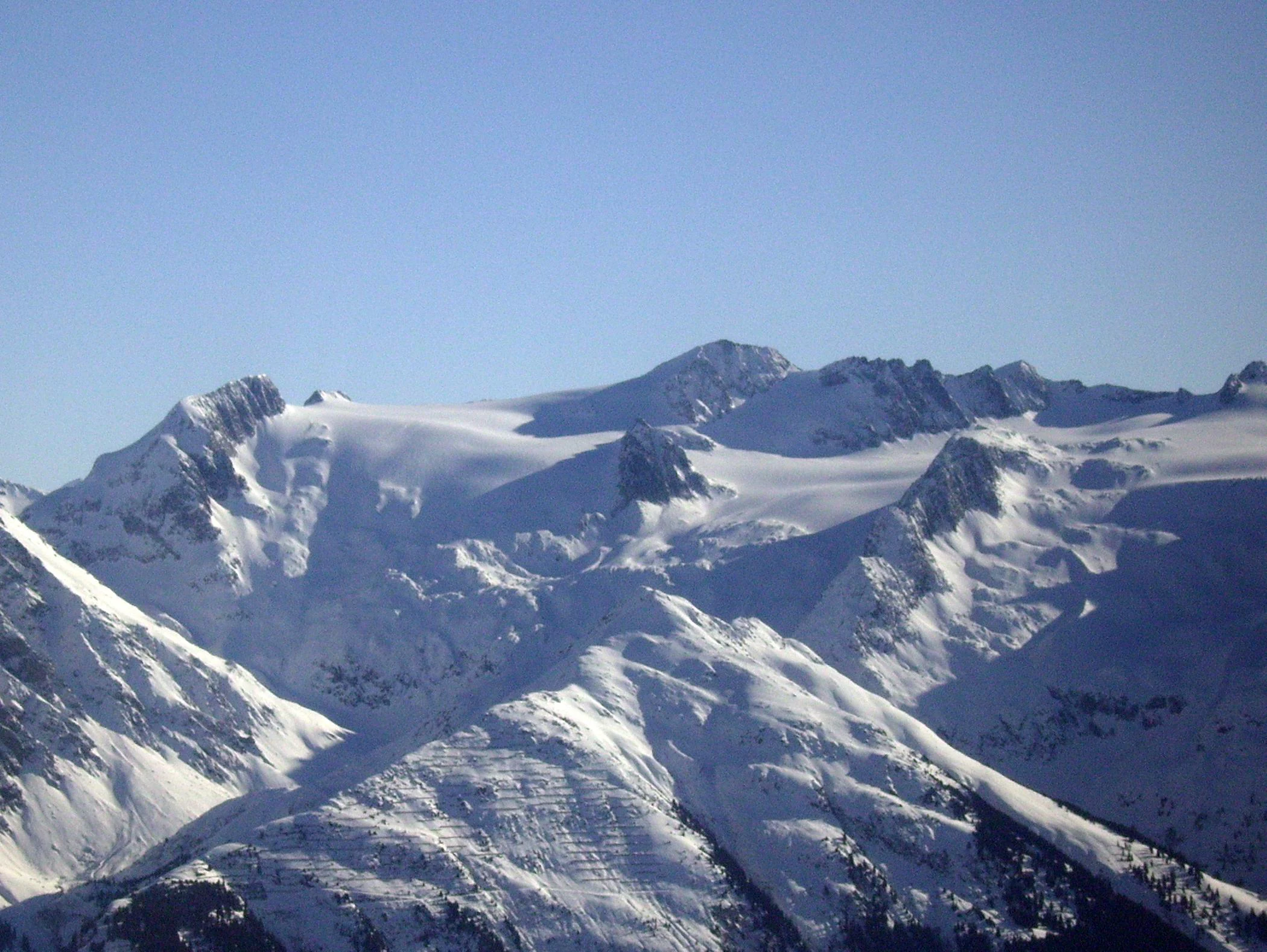
The landscape of Greina – Piz Medel is dominated by the contrast between the high ring of peaks of the Adula Alps and the broad, elevated Greina plateau that occupies the center of the protected area. The bordering massifs rise above three thousand meters in clusters rather than as a single continuous wall, producing a relatively open feel at high elevation. Piz Medel at 3210 meters marks the northwestern edge of the area, with the Medel group of summits forming an arc that includes Piz Cristallina, Piz Uffiern, Cima di Camadra, and Piz a Spescha, while the eastern chain is anchored by Piz Terri at 3149 meters.
The central Greina plateau, sitting at roughly 2300 meters, is the most unusual landscape feature of the BLN site. This wide valley floor holds the upper Rein da Sumvitg (Somvixer Rhein) and creates a flat, sweeping expanse framed by steep slopes, an unusual sight in a setting otherwise defined by rugged Alpine terrain. Around the plateau, deeply cut valleys descend almost two thousand meters to the surrounding lowlands, including the Camadra valley, where valley floors reach around 1275 meters, and the Somvix valley to the north at about 1280 meters.
The hydrological landscape is especially striking. On the plateau and along the rivers, peat bogs, small ponds, and braided channels form a richly varied wetland mosaic. Glacial influence is still visible in the high north, where the Medelser glacier and the Lavaz glacier occupy cirques and leave active glacier forelands marked by moraines and freshly exposed ground. The Laghet la Greina at 2585 meters sits in a hollow beneath Piz Terri, and a scatter of smaller lakes appear at the Cristallina and Uffiern passes and in former glacier basins of Val Lavaz, while the Lago di Luzzone reservoir lies just beyond the southern boundary.
Among the most characteristic features of the southern part of the area is the nationally important dry meadow «Andirö» on the south slope of Pizzo Pianca, covering nearly 23 hectares. Together these elements create a compact landscape mosaic in which alpine wetlands, dry meadows, glacier forelands, and three-thousand-meter peaks coexist within a single protected perimeter.
Greina, Piz Medel ecosystems, habitats, and plant life
The ecological character of Greina – Piz Medel reflects its position straddling both the Alpine main ridge and a sharp climatic gradient between the relatively dry, continental northern valleys and the more humid southern slopes of Ticino. The protected area holds a sequence of vegetation zones typical of the central Swiss Alps, from subalpine pasture and conifer forest in the lower valleys through larch and stone pine stands, up to alpine meadows, frost patterns, and barren periglacial terrain near the summits.
The most ecologically distinctive zone is the Greina high plateau, which contains nationally important floodplain habitats (the Auenlandschaft «Plaun la Greina») and the Crap la Crusch bog. These wetlands support a specialized flora adapted to braided river channels, gravel beds, and peat soils, and they shelter relict and characteristic plant communities that are closely tied to natural river dynamics. Because the rivers of the plateau shift and rework their beds freely, the area preserves processes rather than just static communities, an attribute emphasized in the BLN protection goals.
Glacier forelands in the northwest, including the forefields of the Medelser and Lavaz glaciers, add a further distinct habitat type. These young, still-colonizing surfaces are listed in the Federal Inventory of Alluvial Areas of National Importance and support pioneer plant communities as well as associated invertebrate and bird life. On the dry, sun-exposed slopes of the Ticino side, the «Andirö» dry meadow preserves a nationally valuable example of southern Alpine meadow habitat with its own characteristic species assemblage, completing the ecological gradient of the BLN site.
Greina, Piz Medel wildlife and species highlights
The wildlife value of Greina – Piz Medel is closely linked to the diversity of habitats packed into the area: glacial forelands, alpine plateau wetlands, dry meadows, mountain forests, and peaks, all within a short distance of one another. The BLN protection objectives explicitly call for preserving the diverse habitats that support wild mammals and birds, and the area has historically been recognized as an important federal hunting reserve (Jagdbanngebiet) in both cantons, with reserves «Pez Vial/Greina» in Graubünden and «Greina» in Ticino.
Among the species specifically highlighted in the protection objectives is the rock partridge (Steinhuhn), a characteristic bird of rocky, open alpine terrain that depends on the mosaic of cliffs, alpine pastures, and dry grasslands found across the area. The combination of braided floodplain channels, bogs, alpine meadows, and surrounding rock faces also makes the area attractive for typical high-alpine breeding birds, raptors, and species tied to dynamic riverine habitats.
The larger mammals of the central Swiss Alps, including ibex, chamois, and marmots, find suitable habitat in the cliffs, pastures, and boulder fields surrounding the plateau. The complex vertical structure of the area, from the valley floors near 1275 meters up to peaks above 3200 meters, means that animal life shifts with elevation, and the underprotected wildlife reserves layered on top of the BLN designation reinforce the area's importance for fauna at a national scale.
Greina, Piz Medel conservation status and protection priorities
Greina – Piz Medel is protected at the federal level as object 1913 of the Federal Inventory of Landscapes and Natural Monuments of National Importance (BLN), a designation it has held since 1996. Beyond the BLN layer, significant portions of the area have been federal hunting reserves (Jagdbanngebiete) since 1992, while specific habitats inside the area also appear in separate federal inventories, including the inventory of alluvial areas of national importance (which lists glacier forelands here) and the inventory of dry meadows and pastures of national importance in Ticino (through the «Andirö» site).
The BLN object description sets out an unusually broad set of conservation targets. They include preserving the Greina plateau in a natural and untouched state, protecting the dynamic processes of the mountain landscape and its waters, maintaining water bodies and their riparian habitats in a natural or near-natural condition, and safeguarding the dynamics of glacier forelands and flowing waters. The objectives also cover the geological exposures and geomorphological features of the area, the characteristic and relict species of the floodplain habitats, the quality and ecological function of dry meadows, and the habitats of wild mammals and birds, with an explicit reference to the rock partridge.
By embracing both ecological processes and cultural landscape elements, the conservation approach for Greina – Piz Medel treats the area as an integrated high-alpine system rather than a simple reserve. Traditional alpine use, including pastoralism, the maintenance of alpine huts, and the preservation of historic pass routes, is part of the protection goals, recognizing that the landscape's distinctive character depends on the interaction of natural dynamics and centuries of human adaptation.
Greina, Piz Medel cultural meaning and human context
Although Greina – Piz Medel is fundamentally a high-alpine natural landscape, it carries a strong cultural component shaped by long-standing pastoral and transhumant traditions. Historic pass routes across the Greina pass, the Diesrut pass, and via Crap la Crusch once linked the Surselva valleys in Graubünden with the Blenio valley in Ticino, and these corridors still anchor the geography of the area. Hiking the old passes today follows centuries-old lines of seasonal movement, transport, and exchange through the central Alps.
Inside the BLN perimeter, alpine pastures occupy wide sections of the high valleys, dotted with cattle sheds and small dairies that sustain summer grazing. The Camadra valley, the Cristallina valley, and the middle Somvix valley are accessible by vehicle road, while cableways once used for goods transport still link the upper Camadra valley with the Scaletta hut and link the Garzora valley with the Motterascio hut and the Alp Motterascio. Huts of the Swiss Alpine Club, including the Terri hut on the Somvixer Rhein and the Medelser hut, continue to serve as bases for walkers and alpinists exploring the area.
The region also sits at a linguistic and cantonal frontier, with Romansh-speaking communities to the north in Sumvitg, Medel, and Lumnezia, and Italian-speaking communities to the south in Blenio. In addition, water from several streams inside the protected area is captured above Ghirone for the Lac di Luzzone reservoir and the Olivone hydropower plant, a long-standing infrastructure link that illustrates how even remote high-alpine landscapes remain integrated with broader regional economies and energy systems. Recognition of the cultural value of the area has been supported in part by the Swiss Greina Foundation, which has long promoted awareness of the Greina high valley.
Top sights and standout views in Greina, Piz Medel
Greina – Piz Medel stands out for the unusual combination of an expansive high plateau framed by a ring of three-thousand-meter peaks. The Greina high plateau, with its nationally important floodplain and bog habitats, gives the area a scale and openness rare for the Swiss Alps. Eleven summits above 3000 meters, with Piz Medel as the highest at 3210 meters, create a striking border around the plateau, and the area crosses the European main watershed between the Rhine and Po basins, adding geographic significance to its scenic value.
Equally notable are the dynamic natural processes preserved here. Active glacier forelands of the Medelser and Lavaz glaciers, shifting braided river systems on the plateau, mountain lakes like the Laghet la Greina, and the «Andirö» dry meadow on the Ticino flank together illustrate an unusually intact gradient of high-alpine habitats. Layered federal protections, including BLN status since 1996 and hunting reserve status since 1992, reinforce both the ecological and the cultural value of the landscape, making Greina – Piz Medel a benchmark example of integrated high-alpine conservation in Switzerland.
Best time to visit Greina, Piz Medel
Greina – Piz Medel is a high-alpine landscape, and the practical season for exploring its rivers, bogs, and passes is fundamentally shaped by snow cover and weather. The Greina plateau itself sits at roughly 2300 meters, so even in the warmest part of the year the area retains an alpine character, with cool nights, rapidly changing weather, and lingering snow patches at higher elevations. In winter and early spring much of the plateau and the surrounding passes are snow-bound and are not realistically accessible to walkers without alpine skills and equipment.
The most rewarding time for most visitors falls in the heart of the alpine summer, when the Greina high plateau becomes accessible on foot from the Camadra and Somvix valleys, the flowering of alpine meadows is at its peak, and the contrast between green wetlands and rocky peaks is most pronounced. Late summer and early autumn can also be attractive, with more stable weather, clearer views across the surrounding massifs, and a quieter atmosphere after the main tourist season, while the dry southern slopes of Ticino remain warmer and more inviting than the northern side. At any time of year, conditions in a high-alpine setting like Greina – Piz Medel can shift quickly, and visitors should expect mountain weather rather than lowland conditions.