
Why Naturpark Calancatal stands out
The park is best known for protecting a complete, near-entire alpine side valley in the southern Swiss Alps, from high glacial headwaters down through a steep gorge landscape to a Mediterranean-influenced lower valley. Its identity is shaped by the long Calancasca valley, sharp surrounding ridges, traditional Walser-style alpine hamlets, and protected natural sites such as the Bedoleta forest reserve, the Trescolmen hunting reserve, and the nationally important floodplain and amphibian spawning area of Pian di Alne. It is also distinctive as Switzerland's first federally recognized nature park candidacy from the Italian-speaking south, and as a park whose territory was assembled community by community through local referendums in the small municipalities that make up the Calanca valley.
Naturpark Calancatal history and protected-area timeline
The origins of the Naturpark Calancatal are tied to the failed effort to establish a much larger Parc Adula national park. In 2016, when the local communities of Buseno, Calanca, and Rossa voted to join the prospective Parc Adula, the upper Calanca valley was recognized as an important element of a future national park landscape, but the broader project collapsed because other candidate areas withdrew support.
After a separate attempt to create a park covering the entire Moesa region also failed, attention turned to the smaller Calanca valley itself. In 2018, the municipalities of Buseno, Calanca, and Rossa decided to prepare a candidacy for a regional nature park under Article 23f of the Swiss federal law on the protection of nature and cultural heritage (NHG). A management plan for the establishment phase covering 2020 to 2024 was produced in 2019, and the cantonal authorities of Graubünden, the Moesa region, and the three founding municipalities set up the carrier organization Associazione Parco Val Calanca. On 15 February 2019, voters in Buseno, Calanca, and Rossa approved the candidacy in local plebiscites.
The Swiss Federal Office for the Environment (BAFU) had already accepted the candidacy in 2019 as the first nature park candidacy from Italian-speaking Switzerland and supported planning with federal subsidies. After further planning brought the park's foundations to maturity by 2022, Mesocco decided to join in December 2022, and in January 2023 the municipalities of Buseno, Calanca, Rossa, and Santa Maria in Calanca adopted the park's charter by referendum, with approval rates ranging from 76 percent to 100 percent. Following BAFU's review of the dossier, the Naturpark Calancatal received the federal label "Park of national significance" in 2023 for an initial ten-year operating period, and the park organization officially began operations at the beginning of 2024.
Naturpark Calancatal landscape and geographic character
The landscape of the Naturpark Calancatal is shaped by a long, narrow southern Alpine valley arranged along the Calancasca stream. The valley runs roughly 27 kilometers from the high ridges near the San Bernardino area in the north down to the entrance gorge near Roveredo in the south, dropping from peaks above 3,000 meters to a valley mouth near 505 meters elevation.
Steep mountain flanks close in on the valley on the west, east, and north, forming a near-continuous wall of ridges. From these ridges descend peaks such as the Puntone dei Fración (3,202 m), Zapporthorn (3,155 m), Cima Rossa (3,161 m), Pizzo de Stabi (3,136 m), Piz de Groven (2,693 m), and Torent Alto (2,956 m). Small glaciers persist beneath the Zapporthorn and Pizzo de Stabi, feeding the highest headwaters of the Calancasca.
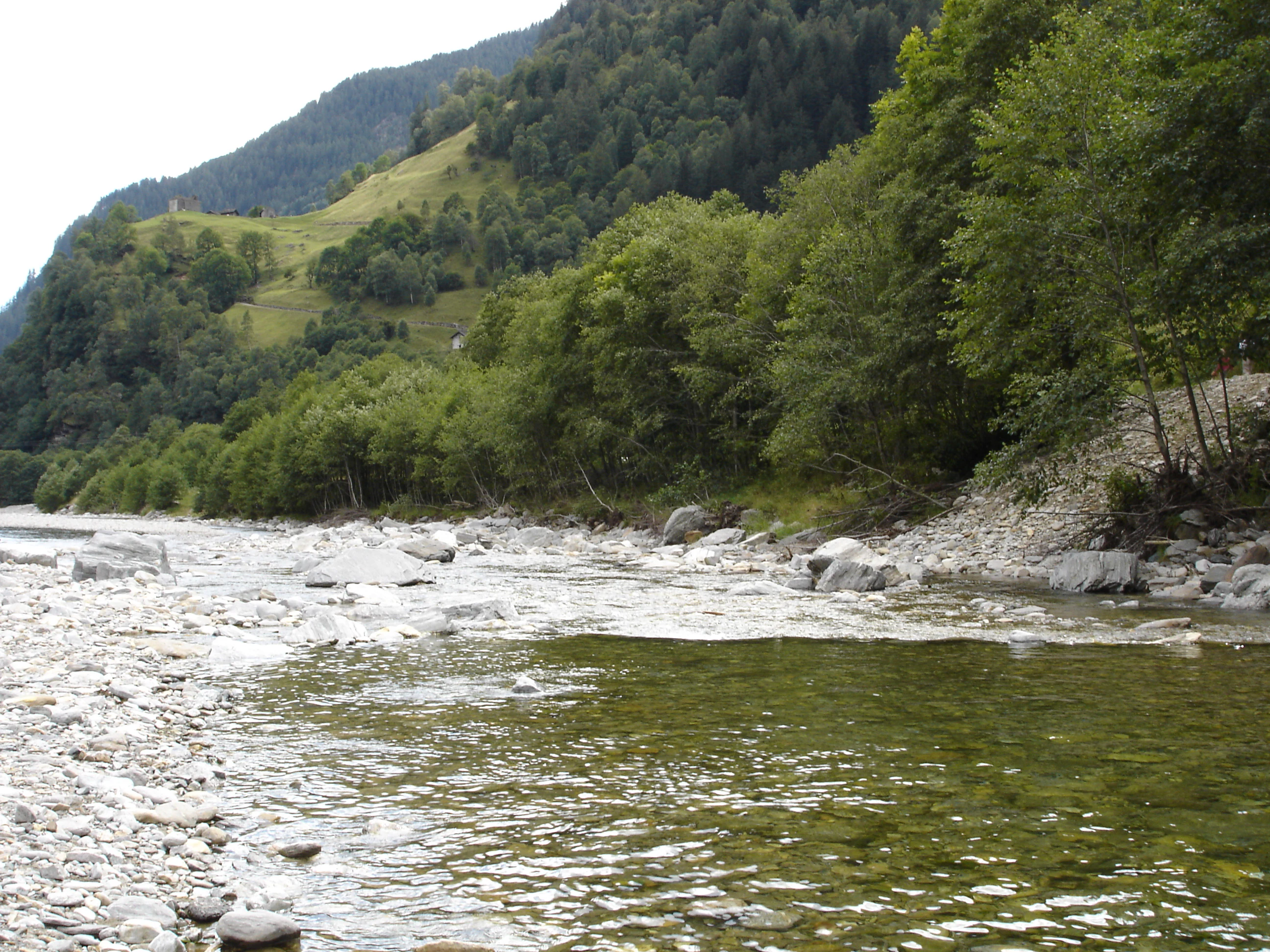
The valley floor is typically a tight gorge or narrow trough, with the Calancasca cutting through bedrock and, in some sections, passing through deep slot gorges; below Buseno the river leaves the park area. Above the river and gorge, the slopes are occupied by mixed forest, dry mountain meadows, and the stone villages and terraced fields typical of the Alpine Lombard cultural area, while the upper slopes give way to alpine pastures and high rocky basins, including the Stabi, Arbeola, and Trescolmen alp areas at the head of the valley.
Naturpark Calancatal ecosystems, habitats, and plant life
Ecologically, the Naturpark Calancatal spans a full vertical gradient of southern Alpine habitats within a relatively compact area. The lowest elevations around the valley entrance are influenced by the warmer Mesolcina climate and support dry meadows, chestnut and mixed broadleaf woodlands, and Mediterranean-flavoured flora, while progressively higher zones transition through montane and subalpine forest into alpine grassland above the tree line.
The protected natural areas within the park reflect this diversity. The Bedoleta forest reserve preserves a section of natural forest dynamics on the valley's slopes, while the Trescolmen area is designated as a hunting reserve that protects alpine fauna from disturbance. The floodplain and nationally important amphibian spawning area at Pian di Alne safeguards wet meadows and breeding habitat for amphibians along the Calancasca, and the high moors of Pian di Scignan and Alp de Mem-Bosch Moghé protect peat-forming vegetation in the upper valley. Several dry meadows scattered through the park are listed in Switzerland's federal inventory of dry meadows and pastures of national importance, conserving species-rich grassland communities shaped by traditional mountain haymaking and grazing.
Wetland, riverine, forest, dry grassland, and alpine habitats thus coexist across the park, linked by a continuous gradient that follows both elevation and exposure along the valley's flanks.
Naturpark Calancatal wildlife and species highlights
The wildlife of the Naturpark Calancatal is shaped by the same altitudinal gradient that defines the park's habitats. Lower slopes near the valley entrance support reptile, amphibian, and warm-climate invertebrate communities favored by the dry meadows and south-facing rock of the Mesolcina foothills. The nationally important amphibian spawning area of Pian di Alne is a key refuge for frogs, toads, and salamanders breeding in the wet floodplain of the Calancasca.
Higher up, the mixed and coniferous forests of the mid-valley, including the Bedoleta natural forest reserve, provide habitat for typical Alpine forest species such as red deer, chamois, and an array of woodland birds, while the Trescolmen area is explicitly protected as a hunting reserve, indicating its importance as refuge and range for ungulates and other game species that depend on undisturbed alpine terrain.
In the alpine zone above the tree line, the park's high ridges, alpine pastures, and residual glacier forelands host typical high-mountain species: ibex and chamois on rocky slopes and ledges, marmots in alpine meadows, and raptors such as golden eagles and bearded vultures soaring above the surrounding peaks. The unbroken continuity of forest, open pasture, and high rock that characterizes the park means that wildlife movements between lowland breeding habitats, mid-elevation forests, and alpine summer ranges remain largely unimpeded within the protected perimeter.
Naturpark Calancatal conservation status and protection priorities
From a conservation perspective, the Naturpark Calancatal matters because it safeguards an entire southern Alpine side valley rather than a single site or species. Its 13,900+ hectares encompass near-complete ecological gradients, from low-elevation dry meadows through montane forest to high alpine pasture and glacial headwaters, allowing landscape-scale processes such as hydrology, sediment transport, and ungulate movements to function within a single protected perimeter.
The park formalizes and connects several pre-existing protected areas: the Bedoleta natural forest reserve, the Trescolmen hunting reserve, the nationally important floodplain and amphibian area of Pian di Alne, the high moors of Pian di Scignan and Alp de Mem-Bosch Moghé, and numerous dry meadows listed in the federal inventory of dry meadows and pastures. By bringing these fragmented designations under one regional park framework, the Calancatal strengthens protection of forest dynamics, alpine wetlands, dry grassland biodiversity, and amphibian breeding habitat in a single coordinated management plan.
Receiving the federal "Park of national significance" label in 2023 for an initial ten-year operating period also secures long-term public funding and planning stability, while its community-based governance through the small Calanca valley municipalities gives the park an unusually strong local stake in maintaining traditional land uses, such as alpine grazing and hay meadow management, that underpin much of its ecological value.
Naturpark Calancatal cultural meaning and human context
Culturally, the Naturpark Calancatal lies within the Italian-speaking part of Switzerland and, more specifically, in the traditional area of Alpine Lombard, a Romance language area whose dialects have historically shaped local place names, architecture, and village life. The valley's stone hamlets, terraced fields, stone bridges, and chapels reflect a deeply rooted Alpine rural culture that has maintained close ties to seasonal pastoralism, forestry, and small-scale agriculture for centuries.
The valley's cultural significance was part of why it was included in early proposals for the Parc Adula national park, and it is now a central theme of the regional park, whose charter commits the municipalities to safeguarding both natural and cultural heritage. The Trägerverein Associazione Parco Val Calanca is itself a cultural artifact, representing an effort by very small communities to organize collectively around the preservation of their valley landscape. The neighboring valleys of the Mesolcina and Ticino, into which the Calanca flows, add layers of transhumance routes, religious architecture, and regional food and craft traditions that the park can interpret alongside its natural values.
Top sights and standout views in Naturpark Calancatal
Highlights of the Naturpark Calancatal include the dramatic 27-kilometer alpine valley of the Calancasca, the high surrounding peaks above 3,000 meters, the deep entrance gorge Tiieda near Roveredo, and the protected Bedoleta forest reserve, Trescolmen hunting reserve, and nationally important Pian di Alne floodplain and amphibian area.
Equally notable is the park's character as one of the youngest parks in the Swiss network, the first federally supported nature park candidacy from Italian-speaking Switzerland, and a community-driven project in which several small Alpine villages, including Buseno, Calanca, Rossa, Santa Maria in Calanca, and parts of Mesocco, voted themselves into the park by overwhelming majorities.
Best time to visit Naturpark Calancatal
The Naturpark Calancatal offers strongly contrasting experiences across the seasons typical of a southern Alpine valley. Late spring and early summer bring flowering alpine meadows, high water in the Calancasca from snowmelt, and the reopening of high pastures; mid- and late summer provide the most reliable conditions for hiking the high trails and visiting the alpine hamlets of the upper valley.
Autumn is traditionally a period of cultural activity in Alpine villages, with harvests, transhumance returns, and quieter trails, while winter transforms the valley into a quieter landscape of snow-covered ridges, frozen side streams, and small ski areas in the lower villages; access to the highest elevations becomes more difficult in deep winter. Because conditions vary by elevation, visitors benefit from timing excursions to the season and altitude they intend to reach, from valley-floor walks in the warmer months to high-alpine excursions in the stable midsummer period.