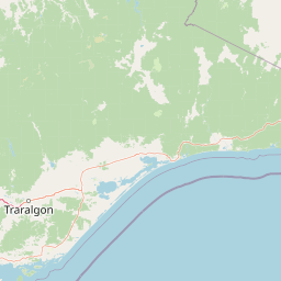
Peaks
Gable End
1,566 m

Detailed spatial analysis of terrain, mountain peaks, and river systems
Examine the physical characteristics and environmental layout of Avon Wilderness Park, a 395.58 square kilometer wildlife reserve located in Victoria. This geography profile traces the Great Dividing Range context, including its mountain terrain, ridges, and river systems spanning the alpine landscape.
Related tags
A remote mountain ash wilderness on the edge of the Victorian Alps.
Avon Wilderness Park is a protected wilderness area in the southern Victorian Alps, in southeastern Australia. It sits within the rugged high country of Gippsland, adjoining the southern boundary of the larger Alpine National Park and forming part of the broader Australian Alps National Parks and Reserves system. The park protects a substantial tract of mountain ash forest and sub-alpine woodland, landscapes shaped by Victoria's cool, wet mountain climate. The wilderness is managed by Parks Victoria under a strict wilderness classification, meaning road-building and mechanised access are not permitted. There are no marked tracks or vehicle routes inside the reserve, and hikers generally navigate with topographic maps. The nearest access point is the small settlement of Licola. Together with Big Desert Wilderness Park and Wabba Wilderness Park, Avon forms one of only three designated wilderness parks in the state of Victoria. The park is significant both for its ecological values and for its role in the continental network of Australian Alps reserves. It was added to the Australian National Heritage List in 2008 as part of a serial nomination of eleven areas that together represent the cultural and natural heritage of Australia's high country.
Recorded country memberships and regional administrative placement for Avon Wilderness Park
A mapped 395.58 km² extent defines Avon Wilderness Park
Mountain classification and recorded internal natural features
Peaks
1,566 m
Peaks
Streams
Rivers
Rivers
Streams
Alpine climate zones, montane forests, and mountain relief profiles
Mountains · Forest
Montane forest · Alpine meadow
Compare surrounding protected landscapes and neighboring Victorian alpine terrain
North

Mapping significant alpine, subalpine, and mountain wilderness landscapes.
Alpine National Park represents Victoria's largest protected area, safeguarding critical alpine and subalpine environments across the Great Dividing Range. This national park encompasses vast mountainous terrain, including Victoria's highest peaks like Mount Bogong, and the expansive Bogong High Plains known for their unique grassland and woodland ecosystems. The park's protected landscape offers rich opportunities for geographic discovery and understanding its place within Australia's significant mountain wilderness regions.
West
Discover Victoria's southernmost alpine wilderness.
Baw Baw National Park offers a rare glimpse into Australia's subalpine environment, characterized by striking granite boulder formations and iconic snow gum forests. As a protected national park, it safeguards unique ecosystems and habitats, including those for critically endangered species. This atlas entry details the park's distinctive landscape, its mapped boundaries, and its geographic significance as the southern edge of mainland alpine terrain.
East
A vital protected area within the Gippsland region of Australia
Located 320 kilometres east of Melbourne, Mitchell River National Park preserves a dramatic landscape of deep channels and high cliffs. This essential protected area serves as a sanctuary for unique warm-temperate rainforests, which survive within gorge environments sheltered from harsh regional winds and bushfires, representing a rare botanical occurrence in southeastern Australia.
West
Explore mapped boundaries and vital water catchment landscapes.
Yarra Ranges National Park in Victoria, Australia, represents a significant protected landscape within the Great Dividing Range. It is renowned for its exceptionally tall mountain ash forests, which are vital carbon stores and habitats, and its critical function as a water catchment area for Melbourne. This park offers a deep dive into a unique geographic setting defined by diverse mountain terrain, temperate rainforests, and subalpine environments, all preserved for their ecological and water security importance.
Northwest
Explore mapped terrain and diverse eucalypt forests.
Lake Eildon National Park in Victoria's Central Highlands offers a unique protected landscape shaped by ancient volcanic activity and the region's gold rush era. This national park, centered around the large Lake Eildon reservoir, provides critical habitat within its diverse eucalypt forests. Discover its geological significance, historical mining sites, and mapped boundaries, offering a comprehensive view of its protected-area identity and regional geographic context.
Southeast
Discover unique island habitats and mapped paperbark forests.
The Lakes National Park offers a unique exploration of coastal wetlands and their mapped geographic features. Situated within the Gippsland Lakes, this protected area showcases diverse island habitats and fringing paperbark forests. As a designated national park, its conservation legacy is evident in the preserved wetland systems and the ecological significance of areas like Rotamah Island, providing a distinct regional landscape for atlas discovery.
Southwest
Explore the mapped terrain and unique forest ecosystems.
Morwell National Park, an Australian national park in the Strzelecki Ranges, is celebrated for its extraordinary plant and animal diversity within a concentrated area. The park preserves critical wet sclerophyll forests and delicate temperate rainforest pockets within deep gullies, offering a distinct landscape character. Its establishment reflects a significant community-driven conservation effort, making it a valuable site for understanding regional protected-area geography and landscape richness.
South
Explore mapped fern gullies and temperate rainforest ecosystems.
Tarra-Bulga National Park is a protected national park in Victoria, Australia, renowned for its spectacular old-growth mountain ash forests and lush fern gullies. This significant fragment of temperate rainforest offers a unique window into the region's natural heritage and geographic past. Discover the mapped landscape character, including towering trees and vibrant undergrowth, making it a key destination for protected-area exploration.
Delve into the protected boundaries and natural terrain of Avon Wilderness Park using MoriAtlas mapping data. This wilderness reserve offers a clear look at the high-country ecology of the Victorian Alps and the scale of Australia's most significant roadless forest landscapes.