

Mori Atlas logo
Wildlife reserveBakhira Wildlife Sanctuary

Explore the seasonal dynamics and geographic boundaries of this critical Ramsar freshwater habitat.

Bakhira Wildlife Sanctuary: Mapping the Largest Natural Floodplain Wetland in Northern India

Bakhira Wildlife Sanctuary represents an expansive freshwater floodplain ecosystem situated in the Sant Kabir Nagar district of Uttar Pradesh. As the largest natural lake of its kind in India, this protected area is defined by its seasonal fluctuations, extensive reedbeds, and shallow margins that support resident and migratory bird populations from across the central Asian flyway. The landscape functions as a vital intersection where natural hydrological cycles meet traditional rural land use, creating a unique conservation model within the northern Indian plains.

floodplain wetlandfreshwater lakemigratory waterfowlRamsar sitebird sanctuarywetland conservation

Bakhira Wildlife Sanctuary

Wildlife reserve

Park overview

Structured park overview, official facts, and landscape profile for Bakhira Wildlife Sanctuary

Bakhira Wildlife Sanctuary park facts, protected area profile, and essential visitor context

Review the core facts for Bakhira Wildlife Sanctuary, including designation, size, terrain, visitor scale, habitats, and operating context in one park-focused overview.

About Bakhira Wildlife Sanctuary

Bakhira Wildlife Sanctuary represents one of the great natural floodplain wetlands of the Indo-Gangetic plain, occupying a broad low-lying basin in eastern Uttar Pradesh. The site's defining feature is Bakhira Lake itself, an expansive sheet of shallow freshwater that shifts in extent with the seasons but consistently remains large enough to be classified as the largest natural floodplain wetland in India. The surrounding landscape is a patchwork of wet grassland, agricultural fields, reed margins, and small settlements, with roughly 108 villages lying within about five kilometers of the lake shoreline.

Ecologically, the sanctuary is structured around seasonal flooding patterns. During the monsoon and post-monsoon months, the lake swells and connects with the broader Bakhira Canal network, while in drier periods it retains a core zone of open water that continues to support aquatic life. This hydrological rhythm is central to the site's productivity, sustaining fish populations, aquatic vegetation, and the invertebrates that underpin the food chain for fish, birds, and other wildlife.

The wetland's ornithological importance is one of its most widely recognized attributes. The lake draws large numbers of migratory waterfowl from Siberia, Tibet, China, and Europe, providing a wintering and staging habitat in a region that otherwise offers limited secure wetland habitat. At the same time, the lake supports a substantial community of resident breeding birds, whose populations fluctuate with water levels and the management of surrounding habitats.

Beyond its ecological profile, Bakhira is closely tied to the daily lives of local communities. Fishing in the lake, cultivation in the surrounding floodplain, and collection of fuelwood from accessible wetland margins have long sustained nearby villages, and the sanctuary's identity is shaped as much by these interactions as by its formal protected status. The interplay between conservation, hydrology, and rural livelihoods gives Bakhira a particular character among India's inland wetlands and has contributed to its elevation to Ramsar Wetland of International Importance.

Quick facts and research context for Bakhira Wildlife Sanctuary

Bakhira Wildlife Sanctuary lies in Sant Kabir Nagar district of eastern Uttar Pradesh, near the towns of Gorakhpur, Khalilabad, and Basti. The protected area centers on Bakhira Lake, a large natural floodplain wetland that forms the core of the site and supports an interconnected mosaic of open water, reedbeds, and surrounding agricultural land.

Established as a wildlife sanctuary in 1980 and later recognized as a Ramsar Site in 2021, the site is managed under IUCN Category IV, reflecting its role as a habitat and species management area. The lake functions simultaneously as a wintering ground for long-distance migratory waterfowl, a breeding ground for resident wetland birds, and a livelihood resource for nearby villages.

Protection and recognition

Documented terrestrial protection scope and Ramsar site recognition

Bakhira Wildlife Sanctuary Protection Status and International Recognition

Bakhira Wildlife Sanctuary holds a documented terrestrial protection scope supported by official Ramsar wetland recognition. Verified designation sources establish the conservation framework and international status governing this protected natural area.

International recognition

Protection details

Protection scope
Terrestrial
Transboundary protection
No
Park context

Deeper park guide and search-rich context for Bakhira Wildlife Sanctuary

Bakhira Wildlife Sanctuary history, landscape, wildlife, and travel context

Explore Bakhira Wildlife Sanctuary through its history, landscape character, ecosystems, wildlife, conservation priorities, cultural context, and seasonal travel timing in a structured park guide built for atlas discovery and search intent.

Why Bakhira Wildlife Sanctuary stands out

Bakhira is best known for being one of the most significant floodplain wetlands in northern India, especially for wintering populations of migratory waterfowl. Each year, Siberian and central Asian birds travel roughly 5,000 kilometers to reach the lake, using its open water and fringing habitats as a seasonal refuge. Equally distinctive is the sanctuary's identity as a working rural wetland, where fishing, agriculture, and traditional fuelwood collection by surrounding villages take place within and around the protected boundary. This blend of ecological importance and everyday human use gives Bakhira a layered character that distinguishes it from more strictly reserved inland sites.
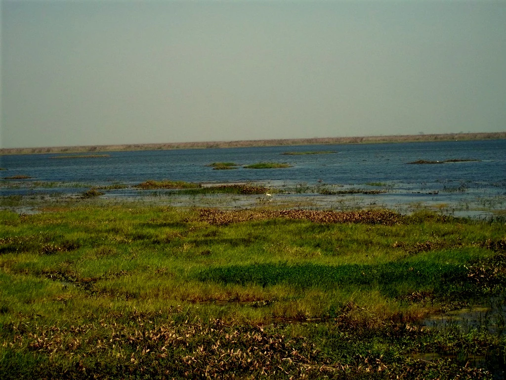
A wide view of a large, flat lake with marshy, grassy vegetation in the foreground and a distant shoreline under a clear sky.
A wide view of the Bakhira lake, a large natural floodplain wetland.

Bakhira Wildlife Sanctuary history and protected-area timeline

Bakhira Lake has functioned as a natural floodplain water body for centuries, with the surrounding villages historically dependent on its fish, agricultural fringe, and marginal vegetation. Formal recognition of the area as a wildlife sanctuary came in 1980, when the Government of India designated it as a protected area under the framework used for habitat and species management across the country.

For decades after its establishment, Bakhira remained a regionally important wetland but lacked the international profile of some larger Indian Ramsar sites. In 2021, on World Wetlands Day, this changed when the lake was designated as a Ramsar Wetland of International Importance, formally acknowledging its significance for migratory waterfowl, resident biodiversity, and the wider ecological functioning of the Indo-Gangetic floodplain system.

Bakhira Wildlife Sanctuary landscape and geographic character

The landscape of Bakhira Wildlife Sanctuary is dominated by a wide, flat floodplain basin characteristic of eastern Uttar Pradesh. The lake itself is broad, shallow, and seasonally variable, fringed by gently sloping margins that transition into wet grasslands, reedbeds, and cultivated fields. Because the terrain is low-lying and largely level, the scenery is defined less by dramatic relief and more by the interplay of open water, emergent vegetation, and surrounding farmland.

Seasonal flooding shapes almost every visible feature of the sanctuary. Monsoon inflows expand the lake considerably and recharge the surrounding floodplain, while drier months expose mudflats, reed islands, and shallow margins that are especially important for feeding waterfowl. The canal network connected to Bakhira acts as a hydraulic extension of the lake itself, allowing water to move through the surrounding landscape over distances of several kilometers.

Bakhira Wildlife Sanctuary ecosystems, habitats, and plant life

Bakhira's natural character is built around its freshwater floodplain ecosystem. Open water dominates the central lake, while the edges support stands of emergent aquatic vegetation, floating plants, and reedy margins that shelter invertebrates, fish fry, and amphibians. Beyond the immediate shoreline, the wider landscape includes seasonal wet grasslands, scrub, and cultivated land that together form a heterogeneous wetland mosaic.

Flooding cycles are central to the ecological rhythm of the site. They regulate nutrient cycling, control the distribution of aquatic vegetation, and refresh feeding areas for fish and waterbirds. The lake supports more than 30 recorded fish species, with commercially important taxa such as rohu and snakehead fish among the dominant catches, reflecting both the productivity of the wetland and its close integration with local livelihoods.

Bakhira Wildlife Sanctuary wildlife and species highlights

The wildlife profile of Bakhira is overwhelmingly shaped by its birdlife. The lake serves as a wintering and staging ground for migratory waterfowl traveling from Siberia, Tibet, China, and Europe, many of which cover distances on the order of 5,000 kilometers to reach the site. These seasonal visitors include a variety of ducks, geese, waders, and other waterbirds that depend on the lake's open water and shallow margins during the colder months.

Among resident species, the grey-headed swamphen, locally known as Kaima, is one of the sanctuary's most characteristic breeding birds, recognizable by its purplish-blue plumage, red legs, and bald red forehead. Beyond birds, the lake supports a rich fish fauna of more than 30 species, and the surrounding wetlands host reptiles, amphibians, and a range of aquatic invertebrates that sustain the broader food web of the floodplain.

Bakhira Wildlife Sanctuary conservation status and protection priorities

Bakhira Wildlife Sanctuary carries conservation significance on multiple levels. As an IUCN Category IV protected area, its formal status emphasizes habitat and species management rather than strict wilderness preservation, which fits its role as a working landscape where human activity and biodiversity values coexist.

The most significant conservation milestone in its recent history was designation as a Ramsar Wetland of International Importance in 2021, recognizing the lake's role in supporting migratory waterfowl across a vast flyway and preserving one of India's most important floodplain wetlands. Together, national sanctuary status and Ramsar recognition place Bakhira within a formal framework for monitoring hydrology, water quality, biodiversity, and community use. Continued conservation of the site depends on balancing the needs of migratory and resident wildlife with the fishing, agricultural, and fuelwood practices of the surrounding village communities.

Bakhira Wildlife Sanctuary cultural meaning and human context

The sanctuary is deeply interwoven with the cultural and economic life of the surrounding villages. Around 108 villages sit within about five kilometers of the lake, and residents have long relied on the wetland for fish, agricultural land on the floodplain margins, and fuelwood from accessible reedbeds and scrub. This pattern of use has shaped traditional knowledge of the lake's seasonal rhythms, including flood cycles, fish movements, and bird arrivals.

Local identity is also expressed through the names and folklore attached to the lake's wildlife. The grey-headed swamphen, for instance, is affectionately called Kaima in local usage and is considered a familiar resident bird, reflecting a long-standing familiarity between the rural community and the wetland's birdlife.

Top sights and standout views in Bakhira Wildlife Sanctuary

Bakhira stands out as India's largest natural floodplain wetland, an expansive freshwater lake whose scale and seasonality set it apart from many other protected inland waters. Its recognition as a Ramsar Wetland of International Importance highlights its central place in a wider flyway used by Siberian, central Asian, and European waterfowl.

The sanctuary is also notable for the way ecological function, rural livelihood, and conservation management coexist on the same landscape. Visitors and researchers value Bakhira not only for its winter bird arrivals and resident species such as the grey-headed swamphen, but also as a model of how a floodplain wetland can remain ecologically vibrant while continuing to support nearby farming and fishing communities.

Best time to visit Bakhira Wildlife Sanctuary

The most rewarding time to experience Bakhira Wildlife Sanctuary is during the winter months of November through January, when migratory waterfowl from Siberia, Tibet, China, and Europe arrive at the lake. During this period the open water and fringing habitats host large concentrations of ducks, geese, waders, and other waterbirds, and the surrounding landscape takes on a quieter, drier character that makes birdwatching easier along the shoreline.

Outside the winter peak, the sanctuary has its own seasonal rhythm tied to the monsoon and post-monsoon flooding of the floodplain. Visitors interested in wetland scenery, hydrology, and the broader landscape may find the post-monsoon period particularly atmospheric, though bird diversity and visibility tend to peak in the colder months.

Monthly climate preview

Long-term representative temperature and precipitation patterns across the year

Bakhira Wildlife Sanctuary Climate Normals and Measured Weather by Month

Historical data records monthly temperature and precipitation swings across the representative coordinate, establishing a baseline for regional environmental conditions. Reviewing the complete twelve-month profile clarifies how long-term averages shift through each seasonal cycle at Bakhira Wildlife Sanctuary.
Annual mean26 °C
15 °C35 °C
Jan15°
Feb19°
Mar25°
Apr31°
May35°
Jun35°
Jul31°
Aug29°
Sep28°
Oct25°
Nov21°
Dec16°
Warmest month
May

34.5 °C

Coolest month
January

15.1 °C

Wettest month
July

10.4 mm/day

Driest month
November

0.1 mm/day

Park location guide

Geography guide, regional context, and park location map for Bakhira Wildlife Sanctuary

Bakhira Wildlife Sanctuary park geography, regions, and map view in India

Understand where Bakhira Wildlife Sanctuary sits in India through a broader geographic reading of the surrounding landscape, nearby location context, and its mapped position within the national park landscape.

How Bakhira Wildlife Sanctuary fits into India

India is a South Asian country bordered by the Indian Ocean, Arabian Sea, and Bay of Bengal. It shares land borders with Pakistan, China, Nepal, Bhutan, Bangladesh, and Myanmar. The country has a population of over 1.4 billion people and operates as a federal parliamentary republic with its capital in New Delhi.

Wider geography shaping Bakhira Wildlife Sanctuary in India

India occupies the Indian subcontinent in South Asia, bordered by the Arabian Sea to the southwest, the Bay of Bengal to the southeast, and the Indian Ocean to the south. It shares land borders with Pakistan to the west, China, Nepal, and Bhutan to the north, and Bangladesh and Myanmar to the east. The territory also includes the Andaman and Nicobar Islands in the Indian Ocean.

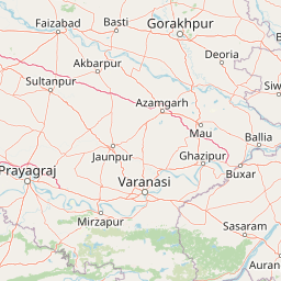
Map view of Bakhira Wildlife Sanctuary

Use this park location map to pinpoint Bakhira Wildlife Sanctuary in India, understand its exact geographic position, and read its mapped placement within the surrounding landscape more clearly.

Pigeon | © OpenStreetMap contributors

Location context for Bakhira Wildlife Sanctuary

Uttar Pradesh

Visual reference guide to floodplain habitats, open waters, and seasonal marsh terrain

Bakhira Wildlife Sanctuary Landscape Photos and Protected Wetland Scenery

Visual documentation reveals the expansive freshwater lake, seasonal reedbeds, and flat floodplain terrain defining Bakhira Wildlife Sanctuary. Examining protected area photography helps researchers understand how regional agriculture, seasonal water expansion, and migratory bird habitats shape the natural environment.

A wide view of a large, flat lake with marshy, grassy vegetation in the foreground and a distant shoreline under a clear sky.

Park atlas

Compare surrounding regional wetland geography and related conservation landscapes

Explore Protected Areas and Parks Near Bakhira Wildlife Sanctuary

Browse other national parks and protected areas sharing the wider floodplain geography of Bakhira Wildlife Sanctuary. Comparing these nearby wetland reserves provides valuable context for regional conservation patterns and inland water habitats.
Wildlife reserveUttar Pradesh
90 km away#1 closest

West

Parvati Arga Bird Sanctuary: Wetland Geography and Protected Area Atlas of Uttar Pradesh

Examining oxbow lakes and freshwater habitat boundaries

Located in northern India, Parvati Arga Bird Sanctuary encompasses a vital mosaic of freshwater oxbow lakes and surrounding deciduous woodland. The sanctuary serves as a key conservation area within Uttar Pradesh, protecting essential waterbird habitats and demonstrating the complex hydro-geography of the Gangetic plain through its crescent-shaped lakes and marshy margins.

Area
10.84 km²
Established
1990
IUCN
IV
Relief
Lowland
National parkNepal
96 km away#2 closest

Northeast

Chitwan National Park: Nepal's Designated National Park Landscape

Explore mapped boundaries and surrounding regional geography.

Chitwan National Park is a vital protected area offering critical insights into Nepal's natural geography. This entry provides detailed information on the park's specific landscape characteristics and its mapped boundaries, crucial for anyone interested in the atlas-level understanding of protected lands within South Asia. Discover the geographic context of this national park and its significance within the broader conservation framework of Nepal.

Area
952.63 km²
Established
1973
IUCN
II
Relief
Mixed relief
National parkWest Champaran District
About 110 km away#3 closest

Northeast

Valmiki National Park: A Vital National Park and Protected Landscape in Bihar

Explore unique Sivalik terrain and mapped protected area boundaries

Valmiki National Park, located in the West Champaran District of Bihar, is a significant protected area renowned for its unique geography. Situated at the interface of the Himalayas and the Gangetic plains, the park showcases a varied terrain including ridges, gorges, dense forests, and extensive wetlands. As Bihar's only national park and a designated tiger reserve, it offers rich insights into conservation landscapes and regional biodiversity for atlas exploration.

Area
898.45 km²
Established
1990
IUCN
II
Relief
Mixed relief
National parkNepal
About 131 km away#4 closest

Northeast

Parsa National Park: Mapped Protected Landscape Within Nepal's Geography

Explore its national park status and geographic setting.

Parsa National Park represents a significant protected area within the geographic framework of Nepal. This page provides critical atlas context, detailing the park's mapped boundaries and its role as a national park. It serves as an essential resource for understanding the specific landscape features and regional geographic positioning of Parsa National Park, contributing to a structured view of protected lands across South Asia.

Area
627.39 km²
Established
2017
IUCN
II
Relief
Lowland
National parkNepal
About 181 km away#5 closest

Northwest

Banke National Park: Nepal National Park with Distinct Protected Landscape Geography

Explore the mapped terrain and regional atlas context of Banke National Park.

Banke National Park represents a vital protected area within Nepal's diverse geography, offering a focused point for atlas and map-based discovery. As a national park, its designated status highlights its importance in conserving natural landscapes and understanding regional protected-area distribution across South Asia. This entry provides detailed geographic context, enabling users to explore the park's mapped boundaries and appreciate its role within Nepal's broader natural territory.

Area
550 km²
Established
2010
IUCN
II
Relief
Upland
Wildlife reserveUttar Pradesh
196 km away#6 closest

Southwest

Samaspur Bird Sanctuary: Geographic Overview of Uttar Pradesh Wetland Reserves

Freshwater marshland and migratory bird habitat in North India

Samaspur Bird Sanctuary preserves a series of freshwater jheels and marshes in the central Gangetic plain. This protected area supports an expansive ecosystem of migratory waterfowl and resident species, defining a distinct natural enclave within the agricultural landscape of Raebareli district.

Area
7.994 km²
Established
1987
IUCN
IV
Water
Water-dominated
National parkBardiya District
About 225 km away#7 closest

Northwest

Bardiya National Park: Nepal's Expansive Terai Protected Landscape and Atlas

Mapped geography, tiger habitat, and rhino conservation in Bardiya District.

Bardiya National Park represents a significant protected area within Nepal's Terai lowlands, providing an exceptional resource for geographic discovery. Its diverse terrain, including vast grasslands and dense forests bisected by major river systems like the Karnali and Babai, creates unique ecosystems. As the largest national park in Nepal, it is instrumental in mapping wildlife corridors and understanding regional landscape dynamics, particularly for endangered species such as Bengal tigers and Indian rhinoceroses. This park offers a profound glimpse into the mapped natural heritage of the Bardiya District.

Area
968 km²
Established
1988
IUCN
II
Relief
Mixed relief
National parkNepal
226 km away#8 closest

North

Shey Phoksundo National Park: Nepal's Largest Trans-Himalayan Protected Landscape with Phoksundo Lake

Explore alpine terrain and unique protected ecosystems.

Delve into the geographical distinctiveness of Shey Phoksundo National Park, Nepal's expansive protected area. This park is defined by its dramatic elevation changes and the striking Phoksundo Lake, a vivid turquoise alpine reservoir set against barren, mountainous terrain. Understanding its trans-Himalayan setting and protected landscape context reveals its importance within the broader atlas of global natural areas.

Area
3,555 km²
Established
1984
IUCN
II
Relief
Mountain

Common questions about visiting, size, designation, and location context for Bakhira Wildlife Sanctuary

Bakhira Wildlife Sanctuary FAQs for park facts, access, geography, and protected area context

Find quick answers about Bakhira Wildlife Sanctuary, including protected-area facts, park geography, trail and visitor context, and how the park fits into its surrounding country and regional landscape.
MoriAtlas Explorer

Continue Your Protected Areas Search Across the Global Atlas

Deepen your exploration by continuing the structured search for national parks and protected areas worldwide. Utilize the comprehensive filtering capabilities to compare different conservation landscapes and refine your understanding of global park geography. Discover more about the distribution and characteristics of protected natural areas.

Global natural geography