

Mori Atlas logo
National parkBeringia National Park

Exploring the diverse cluster ecosystems across the tundra and Bering Sea coastline

Beringia National Park: Mapping the Arctic Protected Landscapes of the Chukotka Peninsula

Beringia National Park spans millions of hectares across the Chukotka Autonomous Okrug, encompassing a complex network of coastal cliffs, river basins, and offshore islands. This protected area preserves critical Arctic biodiversity and ecological landscapes that define the western Bering Strait. The park serves as a foundational element of the regional atlas, featuring distinct tundra environments and island habitats that offer a window into the remote geography of the Russian Far East.

Arctic tundraBering StraitRussian Far EastChukotkaprotected island ecosystemsseabird colonies

Beringia National Park

National park

Park overview

Structured park overview, official facts, and landscape profile for Beringia National Park

Beringia National Park park facts, protected area profile, and essential visitor context

Review the core facts for Beringia National Park, including designation, size, terrain, visitor scale, habitats, and operating context in one park-focused overview.

About Beringia National Park

Beringia National Park occupies a remarkable stretch of the Russian Arctic, anchoring the western shore of the Bering Strait in the remote Chukotka Peninsula. Its territory spreads across three administrative districts of the Chukotka Autonomous Okrug and is organized into six cluster areas rather than a single contiguous block, reflecting the fragmented geography of the region's coastlines, islands, and inland tundra.

The park's landscapes range from low Arctic tundra and river valleys to rocky sea cliffs, headlands, and offshore islands in the Bering Sea. Cluster areas include the Chegitunsky, Dezhnevsky, and Mechigmensky mainland units, as well as the Kolyuchin cluster covering Kolyuchin Island to the north. The Providensky cluster incorporates small coastal sections near Cape Stoletia and Cape Chukotsky along with Nuneangan Island, while the Inchoun cluster corresponds to the basin of the Uttyveem River. Together these units give the park an unusual mix of coastal, marine-influenced, and inland Arctic environments.

Ecologically the park is important for Arctic and sub-Arctic species, particularly nesting seabirds, migratory waterfowl, and Arctic-adapted mammals. Because the Chukotka coast lies opposite Alaska across the Bering Strait, the park also has symbolic ecological importance as the Asian side of the broader Beringia concept, the natural and cultural corridor that once linked the two continents.

Quick facts and research context for Beringia National Park

Beringia National Park is located in Chukotka Autonomous Okrug, in the Russian Far East, on the western edge of the Bering Strait. It was established in its current national park form on January 17, 2013, replacing an earlier nature-ethnic park created in 1993. The park covers roughly 1.8 million hectares across six separate cluster areas and is IUCN Category II. The nearest major city is Anadyr.

Protection and recognition

Mixed protection scope and establishment records for a northern wilderness

Beringia National Park Protection Status and Designation History

Beringia National Park documents a mixed protection scope established in 2013 within the regional protected area framework. Official records compile formal designation details and management scope without imported international recognition sources.

Protection details

Protection scope
Mixed
Designated year
2013
Transboundary protection
No
Park context

Deeper park guide and search-rich context for Beringia National Park

Beringia National Park history, landscape, wildlife, and travel context

Explore Beringia National Park through its history, landscape character, ecosystems, wildlife, conservation priorities, cultural context, and seasonal travel timing in a structured park guide built for atlas discovery and search intent.

Why Beringia National Park stands out

Beringia National Park is best known for protecting the tundra, coastal, and island ecosystems of the Chukotka side of the Bering Strait. It preserves landscapes strongly associated with the ancient Beringia land-bridge region, including Arctic seabird colonies and migrating wildlife. The park's multi-cluster composition gives it a distinctive combination of mainland coastal tundra, offshore islands, and inland river basins.
Beringia National Park history and protected-area timeline

The origins of Beringia National Park lie in a Soviet-American agreement signed in June 1990 by Mikhail Gorbachev and George H. W. Bush, which envisioned an international protected area around the Bering Strait. The IUCN General Assembly, with representatives from more than 100 states, recognized the special status of the Bering Strait region, helping to catalyze the creation of a Russian protected area on the Chukotka side.

On January 27, 1993, a resolution of the head of the Chukotka Autonomous Okrug administration established the Nature-Ethnic Park Beringia (Russian part) in the Providensky and Chukotsky districts. Two decades later, the park was expanded and elevated in status. On January 17, 2013, Prime Minister Dmitry Medvedev signed a decree formally establishing the national park, transferring it to the jurisdiction of the Russian Ministry of Natural Resources and Ecology.

The park has since been managed by a dedicated federal state budgetary institution. Its founding charter was issued by Russian government decree on June 10, 2013, and the institution's statute was approved in August 2013, formalizing its mandate to protect natural complexes and culturally significant sites across the Chukotka portion of Beringia.

Beringia National Park landscape and geographic character

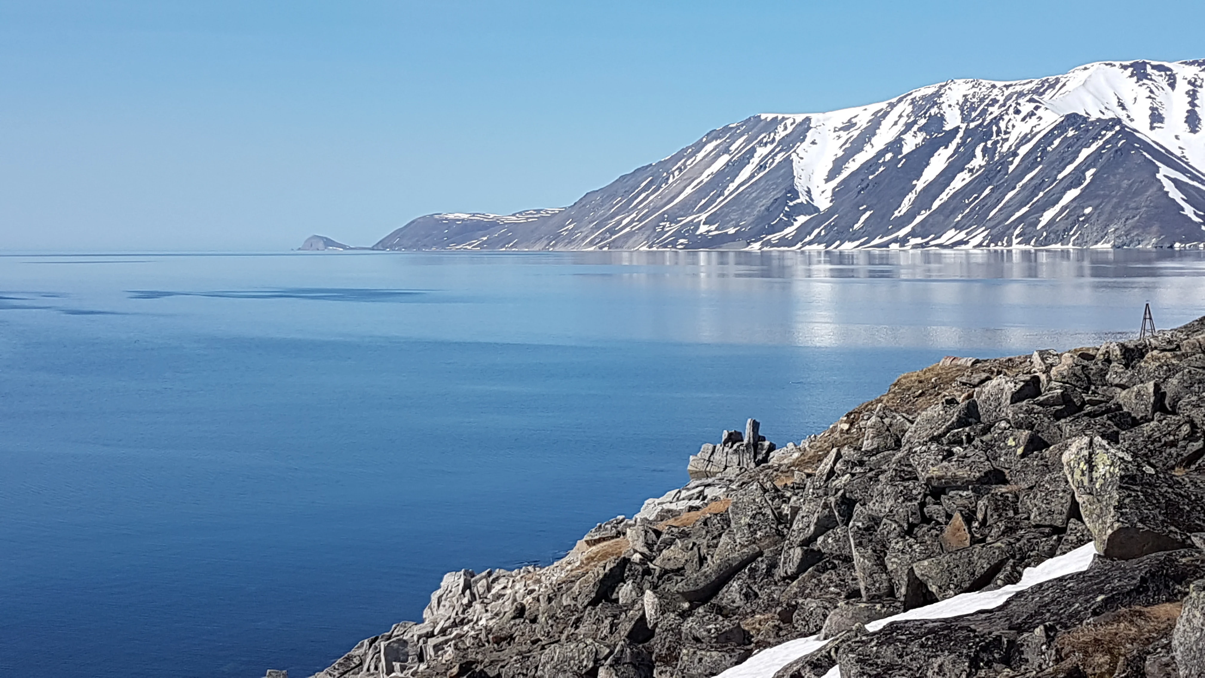
The landscape of Beringia National Park is defined by the meeting of Arctic tundra, rugged Bering Sea coastline, and scattered offshore islands. Mainland cluster areas feature open tundra plains, river valleys, and rocky headlands, while coastal sections near Cape Chukotsky and Cape Stoletia display the steep, exposed shoreline typical of the Chukotka Peninsula.

Offshore geography plays a major role in the park's character. Kolyuchin Island in the north and Nuneangan Island in the south contribute marine-influenced habitats and seabird nesting environments that differ ecologically from the inland tundra. Inland, the Inchoun cluster corresponds to the basin of the Uttyveem River, introducing broader lowland river-valley ecosystems into the park's structure.

Because the park is divided into six separate clusters, visitors and researchers move between strikingly different Arctic scenes, from tundra uplands and river systems to oceanic cliffs and remote island shores, all within one protected area.

Beringia National Park ecosystems, habitats, and plant life

Beringia National Park preserves a representative slice of Chukotka's Arctic and sub-Arctic ecosystems, combining coastal tundra, marine shoreline habitats, island vegetation, and inland river-basin environments. The ecological pattern is shaped by a harsh climate, short summers, and the interplay between continental Arctic conditions and the moderating influence of the Bering Sea.

Tundra dominates the mainland clusters, while coastal and island clusters support specialized habitats including seabird nesting areas and marine-influenced plant communities. The river basins, particularly around the Uttyveem, support wetland and riparian zones that act as important refuges for waterfowl and other migratory species. The diversity of habitats, from dry tundra uplands to brackish coastal flats, underpins the park's ecological value across its disconnected cluster areas.

Beringia National Park wildlife and species highlights

Wildlife in Beringia National Park reflects the richness of the Chukotka Arctic. The park supports around 47 mammal species, including Arctic fox, red fox, wolf, ermine, weasel, wolverine, brown bear, lynx, snowshoe hare, northern pika, moose, and reindeer. Fifteen of these mammal species are listed in the Russian Red Data Book.

The park's avifauna is particularly significant, with about 157 bird species recorded as nesting in the area, 23 of which are included in the Russian Red Data Book. Coastal cliffs and offshore islands provide nesting habitat for seabirds, while tundra and wetland areas support migratory waterfowl and waders. The combination of mainland tundra and island breeding grounds gives the park an important role in regional bird conservation, especially along the Bering Strait flyway.

Beringia National Park conservation status and protection priorities

From a conservation perspective, Beringia National Park is the cornerstone of Russia's contribution to protecting the ecosystems of the Bering Strait. It safeguards Arctic tundra, coastal habitats, and offshore island environments that are otherwise sparsely represented in the global network of protected areas. The large number of Red Data Book species, particularly among birds and mammals, signals its importance for the long-term survival of Arctic-adapted fauna.

The park's multi-cluster design is itself a conservation strategy, linking representative mainland ecosystems with key island and coastal sites rather than fencing off a single contiguous area. Its transboundary context, sitting opposite the U.S. Bering Land Bridge National Preserve in Alaska, also gives it international significance as part of the wider Beringian ecological corridor.

Beringia National Park cultural meaning and human context

The name Beringia carries deep cultural meaning, referencing the ancient land bridge that once connected Asia and North America and that gives the broader region its sense of shared natural and human heritage. The park's predecessor was specifically designated a nature-ethnic park, recognizing the importance of preserving the cultural landscape alongside the natural environment of the Chukotka coast.

This heritage is tied to the indigenous Chukchi people and other communities of the region, whose long-standing relationship with the tundra, coast, and sea is part of the human context of the protected area. The park's location on the western shore of the Bering Strait also gives it symbolic value across the Beringia Shared Heritage Program, a framework for cross-border cooperation between Russia and the United States.

Top sights and standout views in Beringia National Park

Beringia National Park stands out for the sheer scale of its protected Arctic landscapes and the diversity packed into its scattered cluster areas. The combination of mainland tundra, dramatic Bering Sea coastlines, and offshore island habitats makes it rare among Russian national parks.

Its ecological importance is reinforced by the presence of dozens of Red Data Book species, particularly nesting seabirds and Arctic mammals. The park also carries meaningful transboundary significance as the Russian counterpart in the shared Beringia conservation story.

Best time to visit Beringia National Park

The character of a visit to Beringia National Park is shaped by extreme seasonality. Short Arctic summers bring the most active wildlife, snow-free tundra, and accessible coastal and island environments, making this the most natural window for nature-focused visits and seabird viewing. Winters are long, harsh, and dominated by snow and ice, with very limited access and prolonged darkness at such a high latitude.
Monthly climate preview

Long-term temperature ranges and monthly precipitation averages for Chukotka Autonomous Okrug

Beringia National Park Climate Normals and Annual Weather Patterns

Long-term representative coordinate records outline measured monthly temperature variations and precipitation averages across Beringia National Park. Detailed twelve-month climate profiles provide comprehensive numerical insights into annual meteorological rhythms.
Annual mean-4 °C
-17 °C8 °C
Jan-17°
Feb-16°
Mar-14°
Apr-8°
May-2°
Jun
Jul
Aug
Sep
Oct-2°
Nov-7°
Dec-13°
Warmest month
July

8.3 °C

Coolest month
January

-16.6 °C

Wettest month
August

3.1 mm/day

Driest month
March

1.4 mm/day

Park location guide

Geography guide, regional context, and park location map for Beringia National Park

Beringia National Park park geography, regions, and map view in Russia

Understand where Beringia National Park sits in Russia through a broader geographic reading of the surrounding landscape, nearby location context, and its mapped position within the national park landscape.

How Beringia National Park fits into Russia

Russia is a transcontinental nation spanning eleven time zones, bordered by fourteen countries. It is the world's largest country by area, covering 17,098,246 km². Moscow is the capital and largest city, while Saint Petersburg is the second-largest and a major cultural centre.

Wider geography shaping Beringia National Park in Russia

Russia spans Eastern Europe and North Asia, covering 17,098,246 km². It shares land borders with fourteen countries, more than any other nation, and spans eleven time zones. The landscape includes vast plains, mountain ranges such as the Urals and Caucasus, and extensive coastlines along the Arctic Ocean, Pacific Ocean, Baltic Sea, Black Sea, and Caspian Sea.

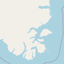
Map view of Beringia National Park

Use this park location map to pinpoint Beringia National Park in Russia, understand its exact geographic position, and read its mapped placement within the surrounding landscape more clearly.

Pigeon | © OpenStreetMap contributors

Location context for Beringia National Park

Chukotka Autonomous Okrug
Park atlas

Compare regional protected areas, tundra ecosystems, and adjacent wilderness zones.

Explore Other Parks Near Beringia National Park and Connected Arctic Landscapes

Browsing other parks near Beringia National Park reveals matching Arctic tundra, rugged coastal cliffs, and remote island habitats across the surrounding region. Extended comparison of these protected landscapes provides valuable geographic context for northern conservation zones.
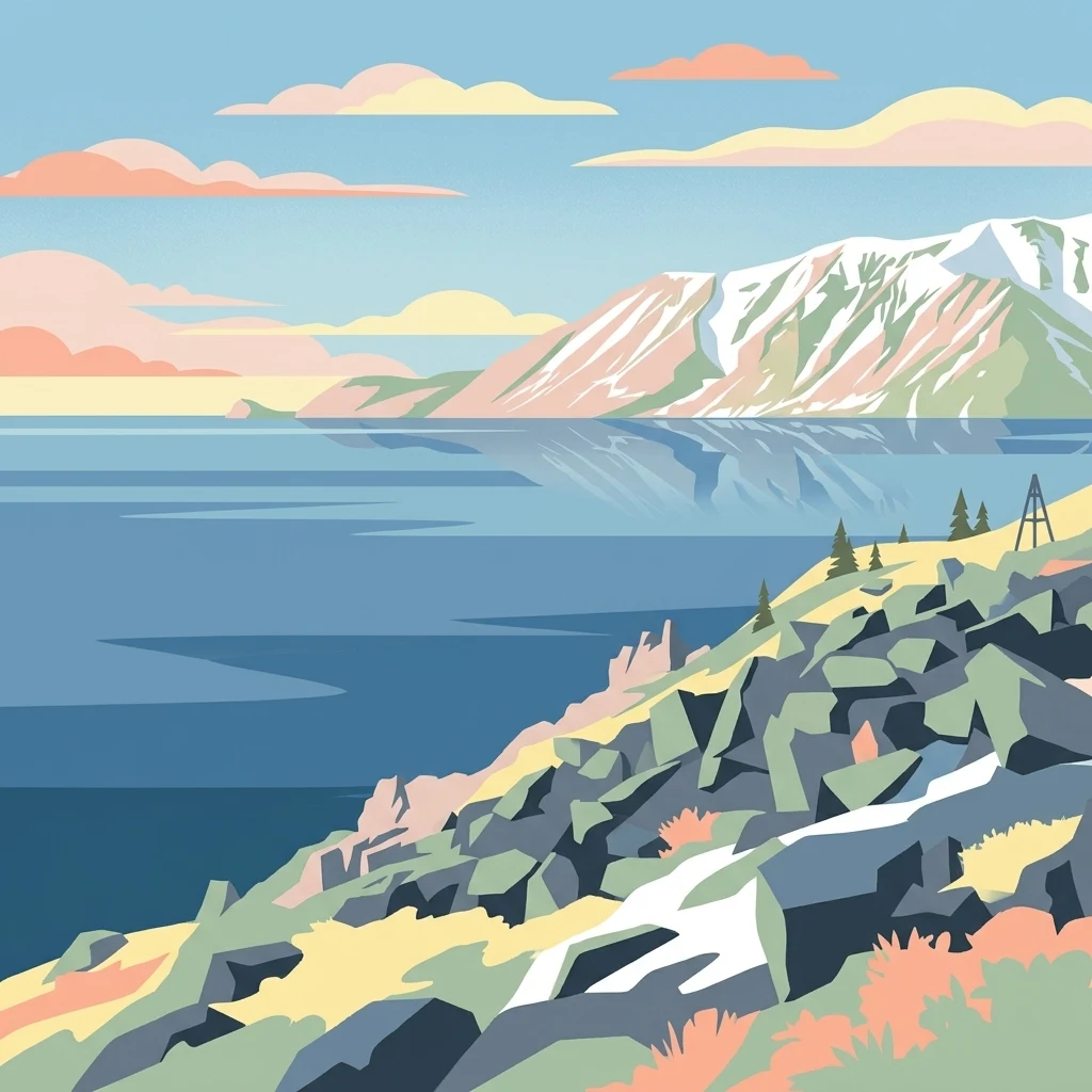
Stylized illustration of a mountainous coastline with rocky shore, calm water, and snow-capped peaks under a sky with clouds
National parkChukotka Autonomous Okrug
Mapped location lies within the park boundary#1 closest

West

Beringia National Park: Arctic Tundra and Mountain Landscape Discovery in Chukotka

Explore protected boundaries and subarctic geographic features

Beringia National Park offers an expansive look at the subarctic ecosystems of the Chukchi Peninsula. This protected area preserves a unique terrain characterized by low-lying tundra plains and dramatic mountain ridges. Its position along the Bering Strait provides significant geographic context for understanding northern land connections and the remnants of ice age migrations within the Russian Arctic wilderness.

Area
30,532 km²
Established
2013
IUCN
II
Relief
Mixed relief
National parkNorthwest Arctic Borough
About 676 km away#2 closest

Northeast

Kobuk Valley National Park: Protected National Park with Regional Geography Context

Explore mapped boundaries and natural terrain within Northwest Arctic Borough.

Kobuk Valley National Park serves as a primary protected landscape within the Northwest Arctic Borough, Alaska. This entry facilitates detailed atlas exploration of its specific geography, mapped protected boundaries, and the natural terrain that defines its character as a designated national park. Understand its place within the broader regional landscape for comprehensive geographic discovery.

Area
7,084.9 km²
Established
1980
IUCN
II
Visitors
17.6K annual
Wildlife reserveAlaska
About 752 km away#3 closest

East

Innoko Wilderness: Geographic Profile and Protected Landscape of Interior Alaska

Subarctic wilderness tracking wetlands and boreal transitions

Spanning over one million acres in the Alaskan interior, Innoko Wilderness offers a unique look at a sprawling subarctic ecosystem. Dominated by muskeg, interconnected lakes, and the floodplains of the Yukon and Innoko Rivers, this protected area functions as a critical transition zone between interior forests and western tundra landscapes.

Area
5,000 km²
Established
1980
IUCN
Ib
Relief
Lowland
National parkAlaska
About 977 km away#4 closest

Northeast

Gates of the Arctic National Park and Preserve: Alaska's Remote Protected Landscape

Explore mapped park boundaries and regional geographic context.

Delve into the protected landscape of Gates of the Arctic National Park and Preserve, a vast national park situated in Alaska. This entry offers a detailed perspective on its geographic setting, focusing on mapped boundaries and its significance as a protected area. Understand the scale and natural context of this remote wilderness for comprehensive atlas-based exploration.

Area
34,287 km²
Established
1978
IUCN
V
Visitors
11.9K annual
National parkAlaska
About 1,082 km away#5 closest

East

Lake Clark National Park and Preserve National Park: Alaska's Protected Landscape Discovery

Mapping the geographic context and protected park boundaries.

Lake Clark National Park and Preserve stands as a protected national park in Alaska, offering a distinct geographic identity for atlas exploration. Delve into its role as a protected landscape, examining its mapped presence within the Alaskan region. This resource provides structured insights into the park's protected area status and its contribution to the understanding of natural terrain and regional geography.

Area
16,308.9 km²
Established
1980
IUCN
V
Visitors
19.8K annual
National parkAlaska
About 1,086 km away#6 closest

Southeast

Katmai National Park and Preserve: Alaska National Park Atlas and Protected Landscape Exploration

Discover mapped boundaries and regional geographic context within Alaska.

Katmai National Park and Preserve represents a significant protected landscape within the state of Alaska, offering a unique point for atlas-based geographic inquiry. This detail page provides structured information focused on the park's mapped boundaries, its place within regional geography, and the characteristics of its natural terrain. Understand the core identity of Katmai National Park and Preserve as a protected national park entity for comprehensive map exploration.

Area
16,564.1 km²
Established
1980
IUCN
II
Visitors
34.5K annual
National parkAlaska
About 1,127 km away#7 closest

East

Denali National Park and Preserve: Detailed Protected Landscape and Map Exploration in Alaska

Explore its mapped boundaries and Alaskan regional geography.

Understand Denali National Park and Preserve as a distinct protected landscape within Alaska's vast geography. This park detail page offers insights into its mapped boundaries, natural terrain, and its contribution to the regional atlas of protected areas. Discover the geographic context that defines this significant national park, providing a foundation for detailed map-based exploration and understanding of its conservation significance.

Area
24,464 km²
Established
1917
IUCN
V
Visitors
427.6K annual
Nature reserveAlaska
About 1,258 km away#8 closest

East

Kachemak Bay National Estuarine Research Reserve: Alaska Protected Nature Reserve Atlas

Coastal and marine watershed geography on the Kenai Peninsula.

Kachemak Bay National Estuarine Research Reserve is a federally protected landscape on the western shore of the Kenai Peninsula. It encompasses diverse terrains including eelgrass meadows, tidal mudflats, and spruce forests. As the largest unit in the national estuarine system, it provides a unique window into the geographic connection between Gulf of Alaska marine zones and upland forest catchments.

Area
1,500 km²
Climate
Subpolar
Scope
Mixed
Water
Water-dominated

Common questions about visiting, size, designation, and location context for Beringia National Park

Beringia National Park FAQs for park facts, access, geography, and protected area context

Find quick answers about Beringia National Park, including protected-area facts, park geography, trail and visitor context, and how the park fits into its surrounding country and regional landscape.
MoriAtlas Explorer

Continue Your Protected Areas Search Across the Global Atlas

Deepen your exploration by continuing the structured search for national parks and protected areas worldwide. Utilize the comprehensive filtering capabilities to compare different conservation landscapes and refine your understanding of global park geography. Discover more about the distribution and characteristics of protected natural areas.

Global natural geography
