Mori Atlas logo
National parkBeringia National Park

Explore the mapped terrain and protected boundaries of Beringia National Park in Chukotka.

Beringia National Park: Protected Subarctic Tundra Landscape and Land Bridge Geography

Beringia National Park represents a monumental protected area situated at the easternmost edge of Russia, within the vast Chukotka Autonomous Okrug. Occupying a profound geographic position on the Asian side of the Bering Strait, this park preserves the historical land bridge territory that once connected continents and facilitated ancient migrations. MoriAtlas offers a window into this remote tundra wilderness, allowing for detailed exploration of its mapped landscapes, unique subarctic terrain, and the profound archaeological significance of its expansive protected boundaries.

Subarctic TundraArctic WildernessLand Bridge HistoryChukotkaRemote Protected AreaIUCN Category II
Stylized illustration of a mountainous coastline with rocky shore, calm water, and snow-capped peaks under a sky with clouds

Beringia National Park

National park

Park overview

Structured park overview, official facts, and landscape profile for Beringia National Park

Beringia National Park park facts, protected area profile, and essential visitor context
Review the core facts for Beringia National Park, including designation, size, terrain, visitor scale, habitats, and operating context in one park-focused overview.

About Beringia National Park

Beringia National Park occupies a unique place in Russia's protected area network as a vast subarctic wilderness at the geographical edge of the continent. The park's establishment in 2013 represented a significant milestone in Russian conservation, protecting an extensive territory that encompasses the maritime highland and tundra landscapes of the Chukchi Peninsula. The name Beringia carries profound geological meaning, referring to the now-submerged land bridge that existed during periods of lower sea levels, connecting what are now Siberia and Alaska into a single landmass that facilitated the great migration of species and human populations between the continents.

The park's territory spans two administrative districts, with Providensky District to the south and Chukotsky District to the north, reflecting the considerable geographic scope of this protected area. The landscape is characterized by mountain ridges of medium elevation averaging 900 meters, with Mount Iskhodnaya standing as the highest point at 1194 meters, while extensive tundra plains fill the intervening valleys and coastal zones. This topography creates a diverse terrain of ridges, valleys, and coastal areas that support distinct ecological communities adapted to the harsh subarctic conditions.

The Bering Strait itself remains one of the world's most geopolitically significant maritime boundaries, and Beringia National Park serves as the Russian counterpart to the Bering Land Bridge National Preserve on the Alaskan side. While formal international park arrangements have not yet been established, the two protected areas share a common heritage and complementary conservation goals, representing the shared natural history of the Bering region.

Quick facts and research context for Beringia National Park

Beringia National Park covers approximately 30,532 square kilometers in the Chukotka Autonomous Okrug, making it one of Russia's largest protected areas. The park was established in 2013 under the management of Russia's Ministry of Natural Resources and Environment, receiving IUCN category II designation as a national park. The territory lies within the Bering tundra ecoregion, characterized by Subarctic climate conditions with only one to three months annually experiencing temperatures above 10°C. Average January temperatures in the nearby Anadyr region reach approximately -22.6°C, while July averages around 11.6°C. The park's proximity to the Bering Strait places it directly across from Alaska's Bering Land Bridge National Preserve, with ongoing discussions about potential cross-border collaboration.

Park context

Deeper park guide and search-rich context for Beringia National Park

Beringia National Park history, landscape, wildlife, and travel context
Explore Beringia National Park through its history, landscape character, ecosystems, wildlife, conservation priorities, cultural context, and seasonal travel timing in a structured park guide built for atlas discovery and search intent.

Why Beringia National Park stands out

Beringia National Park is best known for its extraordinary position at the easternmost edge of Russia, directly facing Alaska across the Bering Strait and marking the historic gateway of the Bering land bridge that once connected Asia and North America. The park preserves a landscape of immense paleobiological significance, the area where mammoths, steppe bison, and early human populations moved between continents during the last Ice Age. Its tundra ecosystems represent some of the most well-preserved subarctic environments in the Northern Hemisphere, with extensive coastal plains and mountain terrain supporting specialized Arctic vegetation. The cultural significance extends to the indigenous Chukchi and Yupik communities who maintain traditional relationships with this landscape, making it both an ecological and ethnographic treasure.

Rocky shoreline with patches of snow overlooking a calm blue bay, snow-covered mountains in the distance under a clear sky
Providence Bay within Beringia National Park, showing rocky coastline and snow-capped mountains

Beringia National Park history and protected-area timeline

Beringia National Park was officially established in 2013 as part of Russia's expanding network of protected areas in the far north. The creation of the park reflected growing recognition of the Bering Strait region's ecological and historical significance, building upon decades of scientific study of the area's unique paleontological and archaeological resources. The region had previously lacked formal national park status despite its extraordinary natural and cultural values, with the land serving primarily as traditional territory for the indigenous Chukchi and Yupik peoples.

The concept of cross-border cooperation between Russian and American protected areas in the Bering region has been discussed since the park's establishment, mirroring similar international park arrangements in other frontier regions. The Bering Land Bridge National Preserve in Alaska, administered by the U.S. National Park Service, preserves the complementary eastern side of this historical land bridge. While no formal international park agreement has been finalized, the ongoing dialogue between Russian and American conservation authorities reflects the shared understanding that the Bering land bridge's heritage transcends national boundaries.

The park's governing body is the Ministry of Natural Resources and Environment of the Russian Federation, which manages protected area operations including ecological monitoring, boundary enforcement, and visitor management in this extremely remote territory. The establishment also acknowledged the importance of maintaining traditional livelihoods of indigenous communities within the park boundaries, recognizing that human cultural connections to this landscape extend far beyond modern conservation designations.

Beringia National Park landscape and geographic character

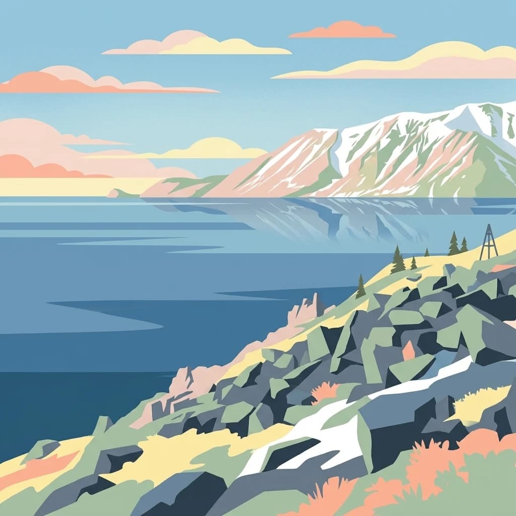
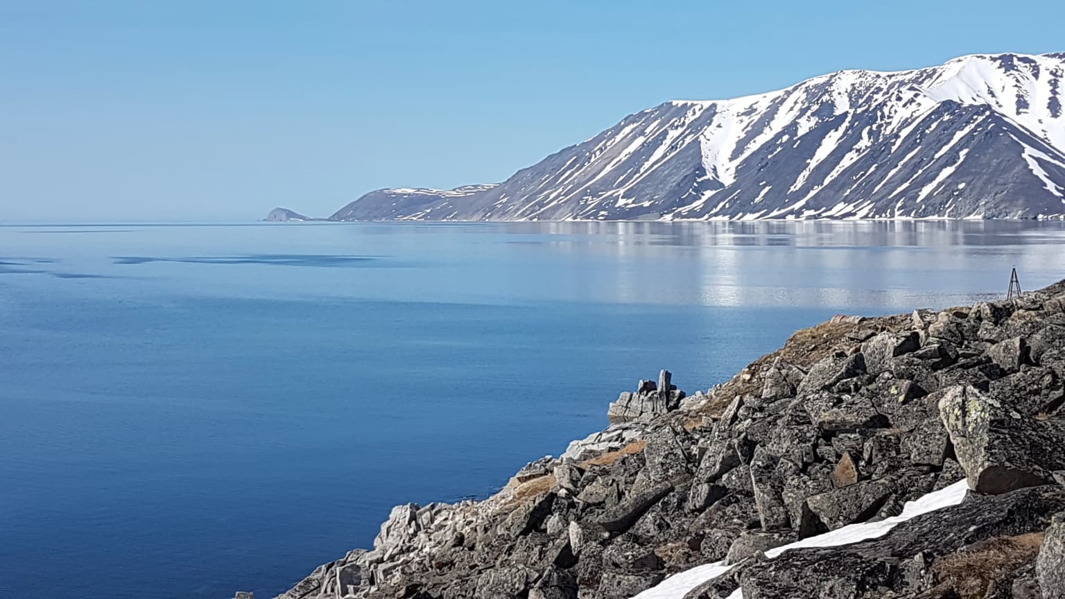
The landscape of Beringia National Park represents a quintessential Arctic tundra environment shaped by maritime influences from the Bering Strait and adjacent seas. The terrain consists primarily of mountain ridges and extensive tundra plains, with elevations ranging from sea level along the coast to the highest peaks approaching 1200 meters. The mountains are characterized by rounded, eroded profiles typical of ancient uplifted terrain, while the intervening valleys and coastal areas feature the flat, often waterlogged terrain that defines tundra ecosystems.

The maritime setting imposes itself on the landscape through fog, wind, and the moderate precipitation patterns typical of coastal Arctic regions. The terrain supports sparse vegetation dominated by mosses, lichens, and dwarf shrub species that carpet the ground in summer months, providing a vivid green-brown contrast against the rocky exposures and persistent snow patches. The absence of significant tree growth reflects both the harsh climate and the young geological history of the terrain, with permafrost limiting soil development and root penetration.

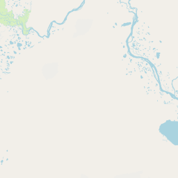
The Bering Strait itself forms the eastern boundary reference point, though the park's coastline faces multiple directions across the peninsula's irregular shape. The mountain backdrop and open tundra create vast panoramas characteristic of high-latitude wilderness, with the horizon often stretching unbroken across this treeless terrain. The landscape has remained essentially unmodified by industrial development, preserving the natural character that has defined this region for millennia.

Beringia National Park ecosystems, habitats, and plant life

Beringia National Park lies within the Bering tundra ecoregion, one of the distinctive subarctic biomes that ring the northern continents. The ecoregion is characterized by a continuous cover of low-growing vegetation adapted to short growing seasons, permafrost soils, and the extreme temperature variations between brief summers and long, cold winters. The maritime influence from the Bering Strait moderates some temperature extremes compared to continental interiors, but the region still experiences the profound seasonal changes typical of high-latitude environments.

The vegetation consists primarily of tundra plant communities including cottongrass, sedge, moss, and lichen associations that create the characteristic Arctic landscape. In summer, flowering plants including various Arctic species add color to the tundra, though the overall impression remains one of subtle, resilient life rather than lush growth. The soil conditions, dominated by permafrost and limited nutrient availability, prevent the development of the more diverse forest ecosystems found at lower latitudes.

The climate classification is Subarctic (Dfc according to the Köppen system), featuring cool summers with only one to three months above 10°C and cold winters with the coldest month averaging below -3°C. This climate regime produces the conditions that maintain the tundra ecosystem and its specialized adapted species, creating an environment fundamentally different from the temperate forests and grasslands that characterize most of the inhabited regions of the Northern Hemisphere.

Beringia National Park wildlife and species highlights

The wildlife of Beringia National Park reflects the Arctic tundra ecosystem, with species adapted to the harsh conditions and seasonal extremes of the far north. The tundra supports populations of reindeer, which have traditionally been important to the indigenous peoples of the region and continue to inhabit the park's vast territories. Arctic fox and snow sheep are among the notable mammalian species that have evolved to thrive in this environment, utilizing the rocky terrain and tundra vegetation for shelter and food.

The region's position along the Bering Strait also makes it significant for migratory bird populations that use the coastal areas as staging grounds during their seasonal movements between breeding grounds in the Arctic and wintering areas further south. Various seabird species utilize the coastline, while the tundra breeding grounds support populations of shorebirds and waterfowl during the brief summer season.

The marine environment of the Bering Strait itself supports species adapted to cold waters, with the strait's role as a migration corridor for Pacific species connecting Arctic and sub-Arctic marine ecosystems. While the park's primary focus is on terrestrial environments, the coastal position means marine resources have historically been important to local communities and contribute to the overall ecological value of the protected area.

Beringia National Park conservation status and protection priorities

Beringia National Park represents a significant addition to the global protected area network, preserving one of the most extensive remaining areas of unmodified subarctic tundra in Eurasia. The IUCN category II designation reflects the park's primary objectives of protecting natural ecosystems while allowing for sustainable visitor use and appreciation of the landscape's values. The establishment of the park in 2013 addressed a significant gap in the conservation coverage of Russia's far northeastern regions, which had previously lacked formal national park status for these unique environments.

The conservation significance extends beyond the park's borders through its relationship with the Bering Land Bridge National Preserve in Alaska, creating the potential for coordinated transcontinental conservation of the Bering region's shared natural heritage. The land bridge history adds a paleobiological dimension to the conservation value, as the territory contains evidence of the ecosystems and species that existed during the Pleistocene when the land connection allowed the great interchange of flora and fauna between continents.

The protection of this Arctic tundra ecosystem is particularly important given the vulnerability of subarctic environments to climate change impacts, including shifts in permafrost stability, vegetation changes, and altered migration patterns for both wildlife and indigenous communities who maintain traditional connections to the land. The park provides a reference area for understanding natural processes in these environments and serves as a baseline against which future environmental changes can be measured.

Beringia National Park cultural meaning and human context

Beringia National Park lies within the ancestral territories of the Chukchi and Yupik peoples, whose traditional relationships with this landscape extend back thousands of years. These indigenous communities have maintained continuous cultural connections to the Bering Strait region, developing adaptive strategies for survival in the harsh Arctic environment through reindeer herding, marine mammal hunting, and other traditional practices. The park's sparse population today remains predominantly indigenous, maintaining cultural traditions that link contemporary life to the historical use of this territory.

The region's cultural significance extends beyond living traditions to encompass the archaeological heritage left by earlier inhabitants and the historical narratives associated with the Bering land bridge. This area represents one of the key zones where human populations moved between Asia and North America, making it foundational to the peopling of the Americas. The cultural landscape thus carries layers of significance spanning from deep prehistory through the historic period of Russian exploration and settlement to contemporary indigenous community life.

The relationship between indigenous communities and the protected area requires ongoing attention to ensure that conservation designations support rather than undermine traditional livelihood practices and cultural continuity. The management framework acknowledges the importance of these connections while providing for the protection of natural values that are themselves intertwined with cultural meaning.

Top sights and standout views in Beringia National Park

Beringia National Park offers visitors access to one of Earth's most remote and historically significant landscapes—the eastern gateway to the Bering land bridge that once connected continents. The vast tundra wilderness provides an immersive Arctic experience far from typical tourism infrastructure, with the opportunity to walk through landscapes that have changed little since the last Ice Age. The park's position directly across from Alaska creates a unique geographic experience where on clear days the opposite continent is visible across the water, making the abstract concept of the land bridge remarkably tangible.

The cultural dimension adds depth to the natural landscape, with the presence of indigenous Chukchi and Yupik communities maintaining traditional connections to this territory. The park represents one of the few places where visitors can experience a subarctic environment that has escaped significant industrial development, preserving the wild character that defined this region for millennia. The combination of geological significance, ecological distinctiveness, and cultural depth makes Beringia a unique destination for those seeking to understand the broader story of Earth's northern latitudes and the connections between continents that have shaped both natural and human history.

Best time to visit Beringia National Park

The optimal time to visit Beringia National Park is during the brief Arctic summer, typically from June through August, when temperatures rise above freezing and the tundra transforms with vegetation growth and bird migrations. Summer offers the most accessible conditions for exploration, with the landscape displaying the green-brown tapestry of Arctic vegetation and extended daylight hours providing extended opportunities for outdoor activities. This is also the season when wildlife is most active, with reindeer populations visible across the tundra and migratory birds present in the coastal zones.

Winter visits are possible but present significant challenges, with extreme cold, limited daylight, and the practical difficulties of Arctic travel during the extended polar night period. The winter landscape has its own stark beauty, with snow-covered tundra and the possibility of observing northern lights, but the conditions require specialized equipment and preparation. The shoulder seasons of spring and autumn offer transitional conditions but may present access limitations due to weather and the practical challenges of transitioning between summer and winter travel patterns.

Park location guide

Geography guide, regional context, and park location map for Beringia National Park

Beringia National Park park geography, regions, and map view in Russia
Understand where Beringia National Park sits in Russia through a broader geographic reading of the surrounding landscape, nearby location context, and its mapped position within the national park landscape.

How Beringia National Park fits into Russia

Russia is a transcontinental nation spanning eleven time zones, bordered by fourteen countries. It is the world's largest country by area, covering 17,098,246 km². Moscow is the capital and largest city, while Saint Petersburg is the second-largest and a major cultural centre.

Wider geography shaping Beringia National Park in Russia

Russia spans Eastern Europe and North Asia, covering 17,098,246 km². It shares land borders with fourteen countries, more than any other nation, and spans eleven time zones. The landscape includes vast plains, mountain ranges such as the Urals and Caucasus, and extensive coastlines along the Arctic Ocean, Pacific Ocean, Baltic Sea, Black Sea, and Caspian Sea.

Map view of Beringia National Park

Use this park location map to pinpoint Beringia National Park in Russia, understand its exact geographic position, and read its mapped placement within the surrounding landscape more clearly.

Pigeon | © OpenStreetMap contributors

Location context for Beringia National Park

Chukotka Autonomous Okrug

Trace the distinctive features of this protected area's remote subarctic tundra, ancient land bridge geography, and coastal wilderness habitats.

Beringia National Park Photos: Explore Arctic Tundra Landscapes and Land Bridge Scenery
Browse comprehensive imagery of Beringia National Park to visually grasp its vast subarctic tundra, remote coastal plains, and historic land bridge terrain. Understanding these park landscapes through photography offers crucial insight into its ecological significance, ancient connections between continents, and unique protected-area environment.

Rocky shoreline with patches of snow overlooking a calm blue bay, snow-covered mountains in the distance under a clear sky

Park atlas

Trace the regional geography of conserved subarctic tundra and ancient land bridge landscapes

Explore Nearby National Parks and Protected Areas around Beringia National Park
Continue your atlas exploration from Beringia National Park by discovering other national parks and protected areas within Chukotka Autonomous Okrug and the broader Russian Far East. Compare diverse subarctic tundra ecosystems, examine their unique land bridge histories, and understand the regional distribution of conservation efforts across this vast Arctic territory.
Protected areaKamchatka Krai

Commander Islands Protected Area: Detailed Map and Regional Geographic Context

Explore protected landscapes in Kamchatka Krai.

Delve into the Commander Islands Protected Area, a significant protected landscape located within the vast geography of Kamchatka Krai. This detailed entry provides essential atlas-level context, focusing on the park's mapped boundaries and its position within the regional landscape. Understand the protected area's geographic identity and its role in the natural terrain of the Russian Far East through our structured exploration tools.

Area
1,846 km²
IUCN
Ia
Relief
Mixed relief
Climate
Subpolar
National parkNorthwest Arctic Borough

Kobuk Valley National Park: Protected National Park with Regional Geography Context

Explore mapped boundaries and natural terrain within Northwest Arctic Borough.

Kobuk Valley National Park serves as a primary protected landscape within the Northwest Arctic Borough, Alaska. This entry facilitates detailed atlas exploration of its specific geography, mapped protected boundaries, and the natural terrain that defines its character as a designated national park. Understand its place within the broader regional landscape for comprehensive geographic discovery.

Area
7,084.9 km²
Established
1980
IUCN
II
Visitors
17.6K annual
National parkSakha Republic

Kytalyk National Park: A Protected Landscape in Sakha Republic's Vast Geography

Explore mapped protected area boundaries and regional context.

Kytalyk National Park stands as a significant protected territory within the expansive Sakha Republic, a region notable for its sheer scale and Arctic geography. This national park offers a focal point for exploring mapped natural landscapes and understanding the distribution of protected areas across Siberia. Through MoriAtlas, users can access detailed geographic information, including the precise boundaries of Kytalyk National Park, facilitating a structured approach to regional geography and protected land discovery.

Area
18,856 km²
Established
2020
IUCN
II
Relief
Lowland
National parkAlaska

Gates of the Arctic National Park and Preserve: Alaska's Remote Protected Landscape

Explore mapped park boundaries and regional geographic context.

Delve into the protected landscape of Gates of the Arctic National Park and Preserve, a vast national park situated in Alaska. This entry offers a detailed perspective on its geographic setting, focusing on mapped boundaries and its significance as a protected area. Understand the scale and natural context of this remote wilderness for comprehensive atlas-based exploration.

Area
34,287 km²
Established
1978
IUCN
V
Visitors
11.9K annual
National parkAlaska

Lake Clark National Park and Preserve National Park: Alaska's Protected Landscape Discovery

Mapping the geographic context and protected park boundaries.

Lake Clark National Park and Preserve stands as a protected national park in Alaska, offering a distinct geographic identity for atlas exploration. Delve into its role as a protected landscape, examining its mapped presence within the Alaskan region. This resource provides structured insights into the park's protected area status and its contribution to the understanding of natural terrain and regional geography.

Area
16,308.9 km²
Established
1980
IUCN
V
Visitors
19.8K annual
National parkAlaska

Denali National Park and Preserve: Detailed Protected Landscape and Map Exploration in Alaska

Explore its mapped boundaries and Alaskan regional geography.

Understand Denali National Park and Preserve as a distinct protected landscape within Alaska's vast geography. This park detail page offers insights into its mapped boundaries, natural terrain, and its contribution to the regional atlas of protected areas. Discover the geographic context that defines this significant national park, providing a foundation for detailed map-based exploration and understanding of its conservation significance.

Area
24,464 km²
Established
1917
IUCN
V
Visitors
427.6K annual
National parkAlaska

Katmai National Park and Preserve: Alaska National Park Atlas and Protected Landscape Exploration

Discover mapped boundaries and regional geographic context within Alaska.

Katmai National Park and Preserve represents a significant protected landscape within the state of Alaska, offering a unique point for atlas-based geographic inquiry. This detail page provides structured information focused on the park's mapped boundaries, its place within regional geography, and the characteristics of its natural terrain. Understand the core identity of Katmai National Park and Preserve as a protected national park entity for comprehensive map exploration.

Area
16,564.1 km²
Established
1980
IUCN
II
Visitors
34.5K annual
National parkAlaska

Kenai Fjords National Park: Alaskan National Park & Protected Area Geographic Context

Mapped protected landscape and regional terrain discovery.

Kenai Fjords National Park serves as a key national park entity for understanding Alaska's protected lands. This destination focuses on the park's specific geographic identity and its role as a mapped protected landscape. Users can explore its protected area boundaries and gain insights into the regional geography it occupies, enriching an atlas-based view of natural terrains across Alaska.

Area
2,711.33 km²
Established
1980
IUCN
II
Visitors
425.4K annual

Common questions about visiting, size, designation, and location context for Beringia National Park

Beringia National Park FAQs for park facts, access, geography, and protected area context
Find quick answers about Beringia National Park, including protected-area facts, park geography, trail and visitor context, and how the park fits into its surrounding country and regional landscape.
MoriAtlas Explorer

Continue Your Protected Areas Search Across the Global Atlas

Deepen your exploration by continuing the structured search for national parks and protected areas worldwide. Utilize the comprehensive filtering capabilities to compare different conservation landscapes and refine your understanding of global park geography. Discover more about the distribution and characteristics of protected natural areas.

Global natural geography