Mori Atlas logo
National parkBetung Kerihun National Park

Discover the mapped boundaries and landscape context of this significant protected area.

Betung Kerihun National Park: A Protected National Park in West Kalimantan's Geography

(Taman Nasional Betung Kerihun)

Betung Kerihun National Park represents a key protected landscape within Indonesia's West Kalimantan province. As a designated national park, it offers critical insight into the region's natural geography and mapped protected areas. Explore its distinct identity within the atlas, focusing on its geographic setting and the mapped extent of this vital conservation area.

Montane RainforestBorneoTransboundary ConservationPrimatesOrangutan HabitatWorld Heritage Site Candidate

Betung Kerihun National Park

National park

Park overview

Structured park overview, official facts, and landscape profile for Betung Kerihun National Park

Betung Kerihun National Park park facts, protected area profile, and essential visitor context
Review the core facts for Betung Kerihun National Park, including designation, size, terrain, visitor scale, habitats, and operating context in one park-focused overview.

About Betung Kerihun National Park

Betung Kerihun National Park represents one of Indonesian Borneos most ecologically significant protected areas, preserving a substantial contiguous tract of tropical rainforest in a region where habitat loss from logging and agricultural expansion poses severe threats to biodiversity. The parks location in West Kalimantan places it at the heart of the islands montane forest zone, where the transition from lowland dipterocarp forests to oak-dominated montane vegetation creates remarkable ecological diversity within a relatively compact geographic area. This altitudinal gradient, spanning from 150 meters to nearly 1,800 meters, supports distinct vegetation communities that harbor unique species assemblages found nowhere else on Earth. The parks designation as a proposed World Heritage Site reflects its significance as a transboundary conservation landscape that transcends national borders and represents one of the last great intact rainforest complexes in Southeast Asia.

Quick facts and research context for Betung Kerihun National Park

Betung Kerihun National Park occupies roughly 5.5 percent of West Kalimantan Province and forms a critical transborder conservation complex with the adjacent Lanjak Entimau Wildlife Sanctuary in Malaysia. The park was originally designated as a 600,000-hectare nature reserve in 1982, expanded to 800,000 hectares in 1992, and elevated to national park status in 1995. It is managed by the Ministry of Forestry through the Betung Kerihun Park Management Unit, employing 57 staff members and 24 park rangers across four field posts. The park protects a unique convergence of Borneo montane rain forests covering approximately two-thirds of its area with Borneo lowland rain forests in the remaining territory.

Park context

Deeper park guide and search-rich context for Betung Kerihun National Park

Betung Kerihun National Park history, landscape, wildlife, and travel context
Explore Betung Kerihun National Park through its history, landscape character, ecosystems, wildlife, conservation priorities, cultural context, and seasonal travel timing in a structured park guide built for atlas discovery and search intent.

Why Betung Kerihun National Park stands out

Betung Kerihun is best known for its population of endangered Bornean orangutans, one of the parks most iconic and conservation-critical species. The park also protects seven additional primate species and supports extraordinary biodiversity including 300 bird species with 25 endemic to Borneo, at least 162 fish species, and 54 mammal species. The proposed Transborder Rainforest Heritage of Borneo World Heritage Site designation, jointly nominated with Malaysias Lanjak Entimau Wildlife Sanctuary, would recognize the parks outstanding universal value as a contiguous transboundary rainforest ecosystem.

Betung Kerihun National Park history and protected-area timeline

The conservation history of Betung Kerihun began in 1982 when the Indonesian Ministry of Agriculture declared the area a 600,000-hectare nature reserve, recognizing its ecological importance despite limited baseline survey data at that time. The reserve was expanded to 800,000 hectares in 1992, reflecting growing understanding of the areas biodiversity value and the need for larger protected landscapes to support viable populations of wide-ranging species like the orangutan. The formal establishment as a national park occurred in 1995, elevating the areas legal protection status and enabling more comprehensive management planning. The Betung Kerihun Park Management Unit was officially launched by the Minister of Forestry in 1997, providing the institutional framework for on-ground conservation activities. Development of the transboundary World Heritage nomination with Malaysia began in earnest during this period, recognizing that effective conservation of migratory species and contiguous ecosystems required cooperation across the border.

Betung Kerihun National Park landscape and geographic character

The topography of Betung Kerihun is dominated by steep, hilly terrain characteristic of Borneos interior mountain ranges, with more than half of the park area exhibiting slopes exceeding 45 degrees. This rugged landscape creates numerous microhabitats and ecological niches, contributing to the areas exceptional biodiversity. The highest peaks, Mount Kerihun and Mount Lawit, rise prominently above the surrounding terrain and are visible from considerable distances, serving as landmark features in the region. The park occupies a critical position at the headwaters of the Kapuas River, the major waterway draining much of western Borneo. This hydrological significance extends far beyond the parks boundaries, as the rivers flow patterns influence water availability, flood regimes, and ecosystem health across downstream West Kalimantan. The combination of high relief, complex terrain, and substantial elevational range creates a visually dramatic landscape of forested ridges, steep valleys, and cascading streams.

Betung Kerihun National Park ecosystems, habitats, and plant life

Betung Kerihun protects two primary ecoregions that together represent the full spectrum of Borneo rainforest types. Borneo montane rain forests dominate approximately two-thirds of the park, occurring at elevations above roughly 1,000 meters where temperature conditions and atmospheric moisture create distinct forest character. These montane forests feature oak species from the genera Lithocarpus and Castanopsis as dominant canopy trees, replacing the dipterocarp species that characterize lowland forests. Borneo lowland rain forests occupy the remaining portion of the park at lower elevations, where massive emergent dipterocarp trees rise above a dense canopy of tropical hardwoods. The botanical diversity is exceptional, with at least 97 orchid species and 49 palm species documented within the park boundaries. This floral richness provides the foundation for the parks extraordinary faunal diversity.

Betung Kerihun National Park wildlife and species highlights

The faunal community of Betung Kerihun ranks among the richest in Southeast Asia. The parks most famous resident is the endangered Bornean orangutan, whose populations in the park represent a critical component of species survival given severe range-wide declines from habitat loss and hunting. Beyond orangutans, the park supports at least seven additional primate species including Müllers Bornean gibbon, white-fronted surili, maroon leaf monkey, southern pig-tailed macaque, crab-eating macaque, Sunda slow loris, and Horsfields tarsier, creating one of the most diverse primate communities on Borneo. Bird diversity includes 300 species with 25 endemics restricted to the island, while at least 162 fish species and 54 mammal species have been recorded. This remarkable vertebrate diversity reflects the integrity of the parks forest habitats and the continuity of ecological processes across the large protected landscape.

Betung Kerihun National Park conservation status and protection priorities

Betung Kerihun faces significant conservation challenges despite its protected status. Illegal logging represents a major threat, with WWF data documenting approximately 31,000 trees illegally harvested from the park in 2002 alone, indicating the scale of pressure on this remote forest. Wildlife poaching, particularly of orangutans for the pet trade, poses an additional serious threat, with reports suggesting 10 to 15 orangutans were traded monthly from West and Central Kalimantan to supply demand in major Indonesian cities. The transboundary dimension of conservation is critical, as the parks ecological continuity with Lanjak Entimau Wildlife Sanctuary in Malaysia supports species that require large home ranges and facilitates genetic exchange between populations. The proposed World Heritage designation would elevate international recognition and potentially increase resources for protection.

Betung Kerihun National Park cultural meaning and human context

The park is home to several Dayak indigenous communities, including the Dayak Iban, Dayak Taman, and Dayak Bukat peoples, whose traditional territories and ancestral lands encompass portions of the protected area. Twelve villages exist in and around the park, with two settlements located within the official boundaries at Nanga Bungan and Tanjung Lokang, while six additional villages adjoin the park perimeter. These communities maintain traditional livelihoods based on hunting, collection of non-timber forest products, and subsistence farming using shifting cultivation practices. The presence of indigenous communities within the park presents both conservation challenges and opportunities, as traditional resource use patterns can both complement and conflict with strict preservation objectives. Meaningful engagement with Dayak communities is essential for effective long-term conservation.

Best time to visit Betung Kerihun National Park

The optimal period for visiting Betung Kerihun National Park generally falls during the dry season months from April to October, when reduced rainfall facilitates access to trails and fieldwork activities. The wet season from November through March brings heavy precipitation that can make backcountry travel difficult and roads impassable, though this period also offers the chance to experience the parks forests at their lushest and observe waterfall displays at their most impressive. Wildlife viewing opportunities remain relatively consistent year-round given the parks resident species, though orangutan sightings may be more reliable during fruiting seasons when these large primates concentrate around productive trees. Visitors should be prepared for humid tropical conditions regardless of season and should anticipate challenging terrain requiring reasonable fitness levels.

Park location guide

Geography guide, regional context, and park location map for Betung Kerihun National Park

Betung Kerihun National Park park geography, regions, and map view in Indonesia
Understand where Betung Kerihun National Park sits in Indonesia through a broader geographic reading of the surrounding landscape, nearby location context, and its mapped position within the national park landscape.

How Betung Kerihun National Park fits into Indonesia

Indonesia is a vast archipelagic nation in Southeast Asia and Oceania, spanning over 17,000 islands between the Indian and Pacific Oceans. As the world's fourth-most populous country with 288 million people, it features extraordinary cultural and biological diversity, withJavanese and Sundanese being the largest ethnic groups. The country gained independence from the Netherlands in 1945 and operates as a unitary presidential republic.

Wider geography shaping Betung Kerihun National Park in Indonesia

Indonesia is situated in Southeast Asia and Oceania, spanning the equatorial region between the Indian Ocean to the west and the Pacific Ocean to the east. The archipelago includes major islands such as Sumatra, Java, Sulawesi, and parts of Borneo and New Guinea. It borders Papua New Guinea, Timor-Leste, and Malaysia by land, with extensive maritime boundaries throughout the region.

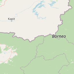
Map view of Betung Kerihun National Park

Use this park location map to pinpoint Betung Kerihun National Park in Indonesia, understand its exact geographic position, and read its mapped placement within the surrounding landscape more clearly.

Pigeon | © OpenStreetMap contributors

Location context for Betung Kerihun National Park

West Kalimantan
Park atlas

Trace the protected landscapes of Indonesian Borneo, extending from Betung Kerihun's montane rainforests.

Discover Nearby National Parks and Protected Areas Beyond Betung Kerihun in Borneo
Continue your exploration from Betung Kerihun National Park to discover other significant protected areas across Indonesian Borneo, tracing their unique montane and lowland rainforest ecosystems. This broader regional view allows for meaningful comparison of conservation efforts and diverse protected landscapes, revealing the interconnectedness of Borneo's natural heritage.
National parkSri Aman Division

Batang Ai National Park: National Park Landscape and Geographic Discovery

Explore the protected terrain and mapped boundaries of Sri Aman Division.

Batang Ai National Park serves as a distinct national park entity, vital for understanding the protected landscape and regional geography of Malaysia's Sri Aman Division. This resource offers detailed insights into the park's geographic scope, its mapped boundaries, and the natural terrain it encompasses, enabling structured exploration for atlas enthusiasts and geography researchers.

Area
24 km²
Established
1991
IUCN
II
Relief
Lowland
National parkCentral Kalimantan

Bukit Baka Bukit Raya National Park: Central Kalimantan's Protected Montane Rainforest Landscape

Explore the geographic core of Borneo's Schwaner mountain range.

Bukit Baka Bukit Raya National Park is a critical national park situated in Central Kalimantan, Indonesia, recognized for its extensive montane tropical rainforests and rugged topography. The park's landscape is dominated by the Schwaner mountain range, featuring prominent peaks like Bukit Raya, and functions as a vital watershed and biodiversity corridor. This protected area offers a rich subject for understanding regional geography, mapped landscapes, and the significance of Borneo's natural heritage within an atlas context.

Area
1,810 km²
Established
1992
IUCN
II
Relief
Mountain
National parkBintulu Division

Similajau National Park: A Protected Landscape within Bintulu Division's Geography

Explore mapped boundaries and regional natural landscape context.

Discover Similajau National Park, a designated national park in Malaysia’s Bintulu Division. This page focuses on the park's identity as a protected landscape, providing essential geographic context for atlas-based exploration. Users can learn about the park’s mapped boundaries and its role within the regional natural geography, offering a clear understanding of its significance as a conservation area.

Area
89.96 km²
Established
1976
IUCN
II
Relief
Upland
National parkBintulu Division

Bukit Tiban National Park: National Park Protected Area with Mapped Boundaries

Discover its geographic setting within Bintulu Division.

Bukit Tiban National Park stands as a significant protected natural area, offering a deep dive into its specific geography and mapped landscape. As a national park within Bintulu Division, it provides crucial atlas-level insight into regional protected lands. Explore the precise location and understand its context within Malaysia's network of natural conservation areas.

Area
96 km²
Established
2000
IUCN
II
Relief
Upland
National parkMiri Division

Usun Apau National Park: National Park with Regional Geographic Context in Miri Division

Explore protected boundaries and mapped landscape details.

Usun Apau National Park represents a distinct protected landscape within the Miri Division, identified as a national park. This entry focuses on its geographic attributes, including its mapped boundaries and its contribution to the regional protected area network. Users can explore Usun Apau National Park to understand its specific role in the geography of Miri Division and to gain context on Malaysia's conservation landscapes.

Area
471.22 km²
Established
2005
IUCN
II
Relief
Mountain
National parkSarawak

Rajang Mangroves National Park: Borneo's Premier Mangrove Protected Landscape

Explore the mapped geography and wetland conservation of this Sarawak national park.

Rajang Mangroves National Park is a significant protected area dedicated to preserving the intricate mangrove swamp ecosystems of Sarawak's Rajang River delta. Encompassing a vast expanse of tidal channels and riverine forests, this national park serves as a critical habitat for unique wildlife and plays a vital role in coastal ecological health. Its landscape is defined by the dynamic interface between riverine and marine environments, offering a prime example of wetland conservation within Borneo's broader natural geography and atlas context.

Area
107 km²
Established
2000
IUCN
II
Relief
Lowland
National parkMalaysia

Maludam National Park: Southeast Asian Protected Landscape and National Park Geography

Mapped boundaries and natural terrain in Malaysia.

Maludam National Park offers a focused exploration of protected landscape identity and geographic context within Malaysia. As a designated national park, it serves as a vital component for understanding the distribution of protected areas and their mapped terrain. This detailed entry allows for an appreciation of the park's specific environmental character and its contribution to the broader atlas of natural landscapes in Southeast Asia, facilitating structured discovery for researchers and explorers.

Area
432 km²
Established
2000
IUCN
II
Relief
Lowland
Watercolor illustration of a landscape with green hills, trees, and a valley
National parkSarawak

Niah National Park: Sarawak's Protected National Park Geography and Mapped Landscape

Explore protected area boundaries and regional context within Sarawak

Niah National Park represents a significant protected national park, offering a distinct geographic and landscape identity within Sarawak, Malaysia. This resource facilitates the exploration of its mapped boundaries and its place within the regional atlas of Borneo. Users can delve into the specific geography of this protected area, understanding its landscape characteristics and its contribution to the broader conservation mapping of the region.

Established
1974
Relief
Mountain
Access
Moderate access
Scope
Terrestrial

Common questions about visiting, size, designation, and location context for Betung Kerihun National Park

Betung Kerihun National Park FAQs for park facts, access, geography, and protected area context
Find quick answers about Betung Kerihun National Park, including protected-area facts, park geography, trail and visitor context, and how the park fits into its surrounding country and regional landscape.
MoriAtlas Explorer

Continue Your Protected Areas Search Across the Global Atlas

Deepen your exploration by continuing the structured search for national parks and protected areas worldwide. Utilize the comprehensive filtering capabilities to compare different conservation landscapes and refine your understanding of global park geography. Discover more about the distribution and characteristics of protected natural areas.

Global natural geography