Mori Atlas logo
National parkBotan Valley National Park

Discover the Mapped Boundaries and Rugged Terrain of this Southeastern Anatolian Valley

Botan Valley National Park: Turkey's Premier Protected Landscape and Biodiverse National Park

Botan Valley National Park represents a significant conservation initiative in southeastern Turkey, safeguarding one of the country's most biodiverse regions. Established in 2019, this national park preserves the dramatic geography of the Botan Valley in Siirt Province, characterized by its winding river and rugged, mountainous terrain. MoriAtlas provides a structured view of this protected landscape, enabling users to explore its mapped boundaries and understand its place within the regional geography.

national parkvalley landscaperiver ecosystemSoutheastern Turkeymountain terrainprotected area

Botan Valley National Park

National park

Park overview

Structured park overview, official facts, and landscape profile for Botan Valley National Park

Botan Valley National Park park facts, protected area profile, and essential visitor context
Review the core facts for Botan Valley National Park, including designation, size, terrain, visitor scale, habitats, and operating context in one park-focused overview.

About Botan Valley National Park

Botan Valley National Park represents a significant addition to Turkey's network of protected areas, established in 2019 to preserve one of the country's most ecologically important valley systems. Located in Siirt Province in southeastern Turkey, the park covers extensive terrain within the Botan Valley, a region that has long been recognized for both its natural beauty and historical importance. The park's designation as Turkey's largest national park underscores its scale and the substantial commitment to conservation that its establishment represents.

The park encompasses diverse landscapes within the valley system, including the river corridor of the Botan River, steep valley walls, and the surrounding terrain that forms part of the broader southeastern Anatolian mountain landscape. This varied topography creates multiple habitat types and supports ecological diversity that makes the area particularly valuable from a conservation perspective. The park provides protection for ecosystems that might otherwise face development pressures in a region experiencing ongoing economic and infrastructural change.

Beyond its conservation mandate, Botan Valley National Park offers facilities and opportunities for visitors to experience the valley's landscapes actively. With over 29 kilometers of established routes, the park supports hiking and exploration, while the topography and river conditions also enable adventure sports including paragliding and rafting. This combination of conservation protection and recreational opportunity reflects a contemporary approach to national park management that balances ecological preservation with sustainable visitor engagement.

Quick facts and research context for Botan Valley National Park

Botan Valley National Park is located in Siirt Province in southeastern Turkey, approximately 120 kilometers from the provincial capital of Siirt city. The park covers roughly 120,000 acres (approximately 48,500 hectares) and features over 29 kilometers of established walking and exploration routes. The area sits within a mountainous region characterized by deep valleys and the Botan River, which provides important ecological corridors within the protected landscape. The park was officially designated on August 15, 2019, making it one of Turkey's newest national parks. It falls under IUCN Category II classification for national parks and is managed by Turkey's Directorate-General of Nature Protection and National Parks.

Park context

Deeper park guide and search-rich context for Botan Valley National Park

Botan Valley National Park history, landscape, wildlife, and travel context
Explore Botan Valley National Park through its history, landscape character, ecosystems, wildlife, conservation priorities, cultural context, and seasonal travel timing in a structured park guide built for atlas discovery and search intent.

Why Botan Valley National Park stands out

Botan Valley National Park is most prominently known for being the largest national park in Turkey and the country's most biodiverse protected area. The park protects a significant valley ecosystem within the southeastern Anatolian region, characterized by its varied topography, river corridors, and the surrounding mountainous landscape. The area has historical significance alongside its ecological value, as the Botan Valley has been a notable geographical and cultural feature of the Siirt region for generations. The park also stands out for offering adventure sports opportunities, particularly paragliding and rafting, which utilize the valley's dramatic terrain and river systems.

Botan Valley National Park history and protected-area timeline

Botan Valley National Park was officially established on August 15, 2019, through a decision published in the Official Gazette of the Republic of Turkey. The establishment followed a formal process under the Turkish presidency, with Decision Number 1421 appearing in Official Gazette Number 30859. This relatively recent designation places Botan Valley among the newest of Turkey's national parks, representing a contemporary expansion of the country's protected area network.

The park's creation reflects growing recognition of the Botan Valley's ecological and historical significance within the broader Siirt Province landscape. The area had long been known locally as an important geographical feature, but formal protection as a national park elevates its status within Turkey's conservation framework. The establishment brought the valley under the management jurisdiction of the Directorate-General of Nature Protection and National Parks, ensuring coordinated oversight for both conservation and visitor management. The designation also aligned with broader national strategies for expanding protected areas and enhancing biodiversity conservation across Turkey's diverse ecological regions.

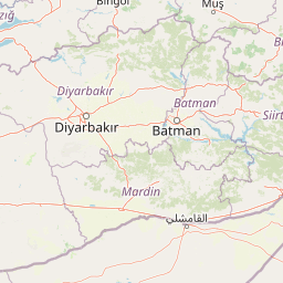
Botan Valley National Park landscape and geographic character

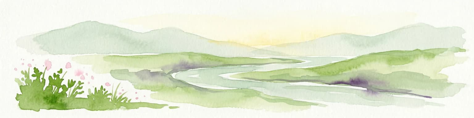
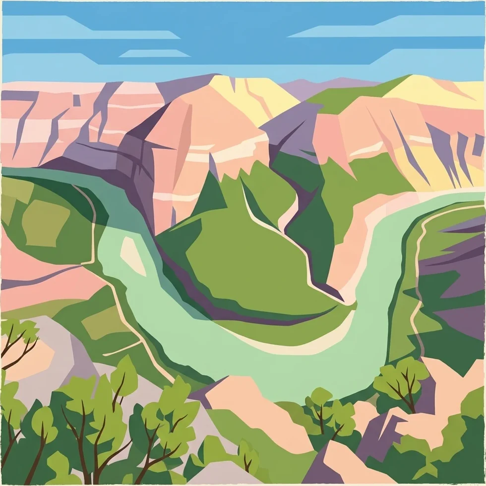
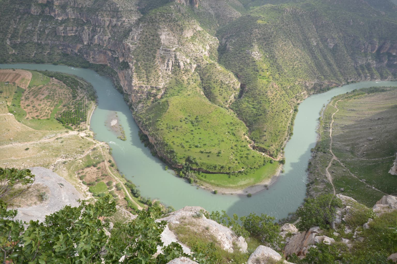
Botan Valley National Park is centered on the Botan Valley, a dramatic geological feature within southeastern Turkey's mountainous terrain. The valley is carved by the Botan River, which winds through the landscape creating a distinctive corridor of ecological importance. The surrounding terrain features steep valley walls and undulating hills that characterize the broader landscape of Siirt Province in this region.

The park encompasses approximately 120,000 acres of varied terrain, with the valley floor providing contrast to the higher elevation areas that rise along the valley's edges. The landscape supports a mosaic of vegetation communities adapted to the local climate and topography. The river system serves as a central ecological axis, providing water resources and habitat connectivity through the valley. The terrain's physical character, with its combination of valley floor and slopes, creates conditions that support both diverse ecosystems and recreational opportunities such as the paragliding that utilizes the valley's vertical relief.

Botan Valley National Park ecosystems, habitats, and plant life

The ecological significance of Botan Valley is underscored by its characterization as Turkey's most biodiverse national park, a distinction that highlights the area's rich natural heritage within the country's protected area network. The park encompasses the Botan Valley ecosystem, which supports multiple habitat types arising from the valley's varied topography, water resources, and position within the southeastern Anatolian ecological region. The Botan River corridor provides particular ecological importance, supporting riparian vegetation and associated wildlife communities through the valley system.

The vegetation within the park reflects the transitional nature of the southeastern Anatolian landscape, incorporating elements from different ecological zones. The park's biodiversity value stems from the combination of habitats present within its boundaries, including valley floor environments, slopes, and the riparian corridor created by the river. This ecological diversity underpins the park's significance within Turkey's conservation framework and justifies its designation as the country's largest national park based on biodiversity considerations.

Botan Valley National Park conservation status and protection priorities

Botan Valley National Park represents an important addition to Turkey's conservation estate, particularly given its designation as the country's largest and most biodiverse protected area. The park's establishment in 2019 formalized protection for a valley ecosystem that had previously lacked formal national park status, bringing coordinated management and regulatory frameworks to preserve its ecological integrity. The classification under IUCN Category II reflects the park's primary mandate of ecosystem conservation while also supporting visitor recreation and environmental education.

The protection of the Botan Valley provides conservation benefits beyond the immediate park boundaries, as the valley ecosystem connects with the broader landscape of southeastern Anatolia. The riparian corridor created by the Botan River supports wildlife movement and provides ecological corridors important for regional biodiversity. The park's management under the Directorate-General of Nature Protection and National Parks ensures that conservation objectives are balanced with sustainable visitor access and recreation opportunities. This management approach recognizes that effective conservation in national parks often involves both protecting natural processes and enabling people to experience and connect with protected landscapes.

Botan Valley National Park cultural meaning and human context

The Botan Valley has historical significance that extends beyond its ecological value, representing a long-established geographical feature within the Siirt Province landscape. The valley has been a notable feature of the region for generations, with local communities having historical connections to the area. The establishment of the national park in 2019 recognized both the ecological importance and the cultural significance of the valley, elevating protection for a landscape that holds meaning beyond its biological resources.

The park spans administrative boundaries across three districts within Siirt Province: central Siirt, Tillo, and Eruh. This geographic spread reflects the valley's substantial extent and its integration with the regional landscape. The historical recognition of the Botan Valley as a significant area within southeastern Turkey informed the decision to pursue national park designation, creating a framework that preserves both the natural environment and the cultural landscape character of the region.

Top sights and standout views in Botan Valley National Park

Botan Valley National Park stands as Turkey's premier protected area, offering the unique combination of being both the country's largest national park and its most biodiverse. The park protects a significant valley ecosystem in southeastern Anatolia, with the dramatic Botan River corridor providing the centerpiece of the landscape. Visitors can explore over 29 kilometers of established routes through the valley, experiencing landscapes that range from river valley floor to steeper terrain offering panoramic views. The park's adventure sports offerings, particularly paragliding and rafting, utilize the valley's natural features to provide distinctive recreational experiences. The relative newness of the park, established in 2019, means it represents a contemporary approach to conservation in Turkey, balancing ecosystem protection with visitor engagement and sustainable tourism potential.

Park location guide

Geography guide, regional context, and park location map for Botan Valley National Park

Botan Valley National Park park geography, regions, and map view in Turkey
Understand where Botan Valley National Park sits in Turkey through a broader geographic reading of the surrounding landscape, nearby location context, and its mapped position within the national park landscape.

How Botan Valley National Park fits into Turkey

Turkey, officially the Republic of Türkiye, is a transcontinental country located mainly in Anatolia (West Asia) with a smaller portion in East Thrace (Southeast Europe). It borders the Black Sea to the north, several countries to the east and south, and the Aegean Sea and European countries to the west. The country has a population of over 86 million and operates as a secular, Muslim-majority presidential republic with Ankara as capital and Istanbul as its largest city.

Wider geography shaping Botan Valley National Park in Turkey

Turkey is a transcontinental country with the majority of its territory (about 97%) located in Anatolia (West Asia) and a smaller portion called East Thrace in Southeast Europe. It borders the Black Sea to the north, Georgia, Armenia, Azerbaijan, and Iran to the east, Iraq and Syria to the south, and the Mediterranean Sea to the southwest. To the west, Turkey borders the Aegean Sea, Greece, and Bulgaria. The terrain includes mountains, plateaus, and coastal plains, with the Taurus Mountains running along the southern coast.

Map view of Botan Valley National Park

Use this park location map to pinpoint Botan Valley National Park in Turkey, understand its exact geographic position, and read its mapped placement within the surrounding landscape more clearly.

Pigeon | © OpenStreetMap contributors

Location context for Botan Valley National Park

Siirt Province
Park atlas

Compare diverse protected landscapes and regional park geography surrounding Turkey's largest national park in southeastern Anatolia.

Explore Other National Parks and Protected Areas Near Botan Valley National Park in Siirt Province
Browse additional national parks and protected areas located near Botan Valley National Park, extending your geographic exploration across southeastern Turkey's diverse landscapes. Compare varied park geography and conservation efforts, understanding the regional spread of protected sites adjacent to Turkey's largest and most biodiverse national park.
National parkHakkari Province

Hakkari Cilo-Sat Mountains National Park: Glacial Terrain and Regional Geography Atlas

Mapped protected boundaries in Hakkari Province's high alpine environment.

Delve into the geography and protected landscape of Hakkari Cilo-Sat Mountains National Park. This page provides a structured atlas view of its dramatic glacial valleys, alpine lakes, and high peaks within Hakkari Province. Understand the mapped extent and unique topographic features of this newly designated national park, ideal for exploring Turkey's remote mountain ecosystems.

Area
275 km²
Established
2020
Relief
Mountain
Climate
Temperate
National parkŞanlıurfa

Tek Tek Mountains National Park: Protected Area with Ancient Ruins in Şanlıurfa, Turkey

Mapped geography and historical landscapes within Turkey's southeastern steppe.

Tek Tek Mountains National Park represents a vital protected area in Şanlıurfa Province, southeastern Turkey. This national park safeguards a unique landscape defined by the Tek Tek mountain range, featuring rugged terrain, rocky outcrops, and semi-arid steppe ecosystems. Beyond its natural beauty, the park is renowned for its significant archaeological heritage, including ancient settlements and religious sites that offer a glimpse into the region's historical depth. MoriAtlas provides a structured atlas view of this protected landscape, detailing its geographic features and its place within the regional context.

Area
193.35 km²
Established
2007
Relief
Mixed relief
Climate
Arid
National parkBayburt Province

Mount Kop Defense National Historic Park: A Protected WWI Battlefield and Biodiversity Hotspot

Mapped protected area in Bayburt Province, Turkey.

Delve into Mount Kop Defense National Historic Park, a protected national park situated in the mountainous terrain of Bayburt Province, Turkey. This site is distinguished by its preserved World War I battlefield features and remarkable biodiversity, particularly its status as a critical habitat for numerous high-altitude butterfly species. Explore the mapped geography and unique conservation value of this significant protected landscape, understanding its distinct place within regional natural and historical atlases.

Area
6.335 km²
Established
2016
Relief
Mountain
Climate
Subpolar
National parkTurkey

Sarıkamış-Allahuekber Mountains National Park: High-Altitude Protected Forest and WWI Memorial Landscape in Turkey

Explore the distinct protected terrain and historical geography of Turkey's eastern highlands.

Sarıkamış-Allahuekber Mountains National Park offers a unique exploration of high-altitude protected lands in Turkey. This national park is characterized by its remarkable pure Caucasian pine forests that thrive at elevations typically above the tree line, showcasing a rare alpine ecosystem. The park's rugged mountain terrain, marked by significant historical sites from the Battle of Sarikamish, provides a profound connection between natural landscape and human history within its mapped boundaries. Discover the geographic setting and protected status of this distinctive area.

Area
225.19 km²
Established
2004
Relief
Mountain
Scope
Terrestrial
National parkTunceli Province

Munzur Valley National Park: Tunceli Province's Vast Protected Alpine Landscape

Discover Turkey's largest national park and its unique mountain geography.

Munzur Valley National Park stands as a monumental protected area within Tunceli Province, Turkey. Its expansive territory encompasses approximately 420 square kilometers of dramatic mountain ranges, deep river valleys, and high-altitude glacial lakes. The park's complex geological makeup, shaped by tectonic forces and glacial activity, contributes to its unique terrain. This atlas entry highlights the park's role as a major biodiversity hotspot and a significant feature within eastern Anatolia's regional geography, offering rich context for landscape exploration.

Area
420 km²
Established
1971
IUCN
II
Watercolor illustration of a winding river through green hills with pink flowers in the foreground
National parkArtvin Province

Hatila Valley National Park: Dramatic V-Shaped Valley and Volcanic Terrain in Artvin Province

Explore protected landscape, waterfalls, and botanical diversity.

Hatila Valley National Park represents a significant protected area within Artvin Province, Turkey, notable for its exceptionally steep, V-shaped river valley. This national park features a striking volcanic landscape characterized by deep gorges, numerous waterfalls, and unique geomorphological structures. Its rich botanical diversity, with 769 documented plant species including many endemics, positions it as a key site for understanding protected landscapes and regional flora. The park's geographic setting at the eastern end of the Kaçkar Mountains provides context for its Mediterranean climate and varied terrain.

Area
169 km²
Established
1994
Relief
Mountain
Climate
Mediterranean
Watercolor illustration showing a valley landscape with a lake, mountains, and grassy foreground
National parkTrabzon Province

Altındere Valley National Park: Discover its Dramatic Protected Landscape and Geography in Trabzon

Explore the unique cliff-side monastery and mountain terrain of this national park.

Altındere Valley National Park is a significant protected area within Turkey's Trabzon Province, renowned for its breathtaking geography. The park encompasses a dramatic valley in the Pontic Mountains, where the historic Sümela Monastery is famously situated on a sheer cliff face. Users can explore the mapped boundaries, distinct landscape features, and the regional context of this unique protected natural and cultural heritage site. This destination offers a compelling focus for understanding protected landscapes and their integration with the surrounding geography.

Area
44.68 km²
Established
1987
Relief
Mountain
Climate
Mediterranean
Watercolor painting showing mountains, trees, and a lake in soft green and blue tones
National parkArtvin Province

Karagöl-Sahara National Park: Mapped Highland Lake and Plateau Protected Area

Discover Artvin Province's unique landslide lake and alpine terrain.

Karagöl-Sahara National Park presents a compelling protected landscape in Artvin Province, Turkey, renowned for its dramatic landslide lake, Karagöl, and the expansive Sahara plateau. This national park provides a unique map of highland geography, featuring dense conifer forests that give way to alpine meadows at elevations around 1,800 meters. Examine the geological character, including active landslide zones and sedimentary formations, that shape this distinctive terrain and contribute to its protected ecological value within the Black Sea Region.

Area
32.51 km²
Established
1994
Relief
Mountain
Climate
Boreal

Common questions about visiting, size, designation, and location context for Botan Valley National Park

Botan Valley National Park FAQs for park facts, access, geography, and protected area context
Find quick answers about Botan Valley National Park, including protected-area facts, park geography, trail and visitor context, and how the park fits into its surrounding country and regional landscape.
MoriAtlas Explorer

Continue Your Protected Areas Search Across the Global Atlas

Deepen your exploration by continuing the structured search for national parks and protected areas worldwide. Utilize the comprehensive filtering capabilities to compare different conservation landscapes and refine your understanding of global park geography. Discover more about the distribution and characteristics of protected natural areas.

Global natural geography