Why Bribie Island National Park stands out
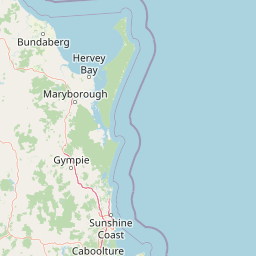
The park is best known for its accessible 4WD beach driving along Woorim Beach, diverse birdlife with over 190 species recorded including migratory waders, and the contrast between exposed ocean beaches and protected tidal wetland systems. The panoramic views of the Glass House Mountains from the eastern shoreline add a distinctive visual landmark to the park experience. The combination of self-contained island ecosystems with practical access from the mainland via a bridge makes Bribie Island uniquely approachable among Australian island national parks.
Bribie Island National Park history and protected-area timeline
Bribie Island was originally part of a larger tract of coastal land that underwent progressive reservation and protection during the late twentieth century. The national park was formally established in 1994, designating the island's eastern and central portions as a protected area under Queensland legislation. This followed earlier designations that recognised the island's ecological significance, particularly its bird habitats and coastal wetland systems. Prior to national park status, the land had been subject to various uses including forestry and grazing, and the transition to full protection reflected growing understanding of the island's conservation values. The establishment of the park coincided with broader recognition of Moreton Bay's environmental importance, leading to the creation of the Moreton Bay Marine Park in the early 1990s, which extends protection to the waters surrounding the island. Management of the park falls to the Queensland Parks and Wildlife Service, which operates visitor facilities, maintains tracks and camping areas, and implements conservation programs for the island's ecosystems.
Bribie Island National Park landscape and geographic character
The park's landscape is defined by its low-lying coastal island topography, where gentle dune ridges,起伏的海滩平原和广阔的潮汐湿地共同构成了一个相对平坦但生态多元的环境。东部海岸线直面太平洋,海浪持续塑造着沙滩和沙丘,而西部边缘则退入皮斯蒂斯通海峡的平静水域,形成红树林沼泽、泥滩和盐沼的复杂系统。岛上的沙丘系统在不同地点呈现出不同的成熟度,有些地方被海草和耐盐植物固定,而其他地方则暴露出明显的风吹沙丘特征。岛內地势极低,大部分区域海拔不超过10米,这种平坦的地形意味着景观视野开阔,尤其是在东部海滩可以远眺玻璃屋山脉的火山山峰,成为公园的标志性背景。公园的植被模式反映了这种多样化的水生和沿海环境,从暴露的海滩和沙丘到湿润的荒地灌丛、沿海草坪和淡水泻湖周围的植被带。
Bribie Island National Park ecosystems, habitats, and plant life
The park protects a remarkable diversity of coastal and wetland habitats within a relatively compact area. The eastern side features sandy beach and dune systems that grade into coastal heathland known as wallum, characterised by Banksia, wattles, and wildflowers that bloom prolifically in spring. The western side encompasses the tidal wetlands of Pumicestone Passage, where mangrove forests, saltmarsh, and mudflats create rich feeding and breeding grounds for marine and bird life. Freshwater lagoons and paperbark swamps occur in the island's interior, adding further habitat complexity. The interface between these environments creates productive ecological zones that support high biodiversity. Moreton Bay itself is recognised as a Ramsar-listed wetland of international importance, and the park contributes to this broader ecological significance by protecting terrestrial feeding and roosting areas for migratory shorebirds.
Bribie Island National Park wildlife and species highlights
The park supports a wide range of wildlife, with particular significance attached to its bird populations. Over 190 bird species have been recorded on the island, including numerous shorebirds that use the wetland areas during their annual migrations along the East Asian Australasian flyway. The tidal mudflats of Pumicestone Passage provide critical feeding habitat for these species. Among the mammals present, eastern grey kangaroos and wallabies are commonly seen, particularly at dawn and dusk when they move to more open areas to graze. Dingoes persist on the island as a top predator, maintaining a functional ecosystem role. Emus are another notable large mammal species that roam the island's interior areas. The marine environment supports sea turtles and various fish species, while the wetland systems provide habitat for reptiles, amphibians, and invertebrates. The combination of habitats ensures that wildlife observation is a consistent highlight for visitors throughout the year.
Bribie Island National Park conservation status and protection priorities
The park's conservation significance is closely tied to its role within the broader Moreton Bay ecosystem. The bay is listed as a Ramsar Convention wetland of international importance, and the park contributes to this designation by protecting the terrestrial and coastal habitats that support the bay's birdlife and marine biodiversity. The tidal wetlands and surrounding waters fall within the Moreton Bay Marine Park, creating layered protection for both land and sea environments. Key conservation priorities include maintaining water quality, protecting bird nesting and roosting sites, managing the impacts of visitor activities on sensitive dune systems, and controlling invasive species that threaten native vegetation communities. The flat, low-lying nature of the island also makes it vulnerable to sea-level rise and storm surge events, adding long-term management considerations.
Bribie Island National Park cultural meaning and human context
Bribie Island lies within the traditional Country of the Gubbi Gubbi people, who have lived in the region for thousands of years and maintain cultural connections to the coastal and marine environments of Moreton Bay. The island's name derives from the Yugara dialect, reflecting its long history as a place of indigenous significance. European settlement of the island began in the nineteenth century, with early development focused on timber cutting and later fishing and holiday settlements. The construction of a bridge connecting the island to the mainland in 1963 transformed Bribie Island from a relatively isolated coastal location into a rapidly developing residential and tourist area, making the national park designation particularly important for preserving the island's remaining natural character. The park's accessibility from Brisbane has made it an important site for environmental education and community engagement with nature.
Top sights and standout views in Bribie Island National Park
The park's standout features include the dramatic contrast between its surf beach on the Pacific coast and the sheltered, wetland-fringed shores of Pumicestone Passage on its western side. The 4WD beach drive along Woorim Beach offers a distinctive Australian coastal experience, while the inland walking tracks through wallum heathland provide access to more subtle natural environments. Birdwatching opportunities are exceptional, with both resident and migratory species present throughout the year. The views across the water to the Glass House Mountains form a memorable backdrop to any visit. The camping areas, particularly Ocean Beach with its 63 sites, allow visitors to experience the island's atmosphere beyond day-trip constraints.
Best time to visit Bribie Island National Park
The park can be visited throughout the year, though different seasons offer distinct experiences. Spring months from September to November bring wildflower displays across the wallum heathland and coincide with peak bird migration activity, making this an excellent time for wildlife observation. Summer months offer warm conditions ideal for beach activities and swimming, though visitors should be aware of stingers in the bay waters during this period. Autumn and winter provide milder temperatures comfortable for bushwalking and wildlife spotting, with the cooler months often producing clearer skies and more pleasant conditions for exploring the island. The park's low elevation means it remains accessible in most weather conditions, though summer thunderstorms can occur.