Mori Atlas logo
National parkFerntree Creek National Park

Mapping the protected boundaries and regional geography of Ferntree Creek National Park.

Ferntree Creek National Park: Queensland National Park Atlas and Protected Landscape

Ferntree Creek National Park represents a key protected area within Queensland's diverse geography. As a designated national park, its boundaries are mapped for atlas exploration, offering insight into the state's protected lands. This entry provides structured geographic context for Ferntree Creek National Park, enabling users to understand its position within Australia's northeastern region and its value for landscape discovery.

Wet sclerophyll forestBirdwatchingQueensland national parksAmphibian habitatEndangered speciesBrisbane Valley

Ferntree Creek National Park

National park

Park overview

Structured park overview, official facts, and landscape profile for Ferntree Creek National Park

Ferntree Creek National Park park facts, protected area profile, and essential visitor context
Review the core facts for Ferntree Creek National Park, including designation, size, terrain, visitor scale, habitats, and operating context in one park-focused overview.

About Ferntree Creek National Park

Ferntree Creek National Park occupies a small but ecologically significant area within the Brisbane Valley bioregion of southeastern Queensland. The park's protection dates to 1947, establishing it among Queensland's earlier national park designations. The reserve encompasses areas of wet sclerophyll forest, a vegetation type characterized by tall eucalyptus trees with a dense understory of ferns and shrubs. This forest type thrives in areas with higher rainfall and more fertile soils, making it a relatively restricted habitat within the broader Queensland landscape. The park's location north of Brisbane places it within a region that has experienced substantial land clearing for agriculture, forestry, and urban expansion. As a result, remaining patches of intact forest such as Ferntree Creek have become important islands of native biodiversity. The park is administered by the Queensland Parks and Wildlife Service, which manages it as part of Queensland's protected area network.

Quick facts and research context for Ferntree Creek National Park

Ferntree Creek National Park covers 0.72 square kilometers in southeastern Queensland, situated at approximately 57 meters average elevation. The park was established in 1947, making it one of Queensland's older protected areas. It lies within the Brisbane Valley region, an area characterized by undulating terrain and seasonal watercourses. The park's wet sclerophyll forest habitat provides a crucial refuge in a landscape otherwise fragmented by rural and residential development. Fifty bird species have been documented within the park boundaries, a notable density for such a small reserve.

Park context

Deeper park guide and search-rich context for Ferntree Creek National Park

Ferntree Creek National Park history, landscape, wildlife, and travel context
Explore Ferntree Creek National Park through its history, landscape character, ecosystems, wildlife, conservation priorities, cultural context, and seasonal travel timing in a structured park guide built for atlas discovery and search intent.

Why Ferntree Creek National Park stands out

Ferntree Creek National Park is particularly notable for its population of the tusked frog, an unusual amphibian species that represents a significant conservation priority. The park also provides critical habitat for the endangered gray goshawk, a raptorial bird species that depends on forested environments for nesting and hunting. The combination of wet sclerophyll forest, the presence of permanent watercourses, and the site's relatively undisturbed condition has allowed these species to persist in an area where suitable habitat has become increasingly scarce.

Ferntree Creek National Park history and protected-area timeline

Ferntree Creek National Park was established in 1947, representing an early addition to Queensland's national park system. The establishment of the park during this period reflected growing recognition in mid-twentieth-century Australia of the need to preserve representative samples of native vegetation and wildlife habitats. At the time of its declaration, the reservation of areas like Ferntree Creek served both conservation purposes and broader educational objectives, as Australian protected area management was still developing as a formal discipline. The park has remained under the management of what is now the Queensland Parks and Wildlife Service throughout its history, with its protected status providing continuous safeguard against development pressures that have transformed much of the surrounding Brisbane Valley.

Ferntree Creek National Park landscape and geographic character

The terrain of Ferntree Creek National Park consists of gently undulating hills typical of the Brisbane Valley region, with an average elevation around 57 meters above sea level. The landscape is characterized by valleys and drainage lines that carry seasonal water flows, with ferntree Creek itself providing a permanent water source through the landscape. The vegetation is dominated by wet sclerophyll forest, a plant community featuring tall eucalyptus species as the canopy layer, typically with a dense and diverse understory of ferns, shrubs, and small trees. The combination of water availability, relatively fertile soils, and protection from fire has allowed this forest type to develop a complex structure that supports diverse ecological communities.

Ferntree Creek National Park ecosystems, habitats, and plant life

The ecological character of Ferntree Creek National Park centers on its wet sclerophyll forest, which represents a vegetation type of high conservation significance in Queensland. This forest supports a complex ecological community with multiple layers, from the tall eucalyptus canopy through mid-story shrubs to the ground layer of ferns and grasses. The presence of permanent water in Ferntree Creek adds aquatic and riparian elements to the park's ecological profile. The documented presence of fifty bird species within this small reserve indicates high biodiversity value, with the forest structure providing nesting sites, feeding resources, and shelter for both resident and migratory bird species. The understory and ground layer support invertebrate populations and small mammals that form the base of the food web supporting larger species.

Ferntree Creek National Park wildlife and species highlights

The wildlife of Ferntree Creek National Park is distinguished by the presence of two particularly notable species. The gray goshawk, listed as endangered, utilizes the park's forested habitat for nesting and hunting, making the reserve an important site for the survival of this raptor species in the Brisbane region. The tusked frog, an unusual amphibian with distinctive morphology, finds refuge in the park's wet environments, representing a species of particular biological interest due to its limited distribution and specialized habitat requirements. Beyond these flagship species, the documented bird community of fifty species demonstrates the park's value as a biodiversity refuge, with the forest providing essential habitat for both cavity-nesting birds and species that feed on insects within the canopy and understory.

Ferntree Creek National Park conservation status and protection priorities

Ferntree Creek National Park serves as an important conservation refuge within a landscape that has been extensively modified by human activity. The park's protection of wet sclerophyll forest preserves a habitat type that has been significantly reduced across its former range in southeastern Queensland. The presence of endangered species including the gray goshawk elevates the conservation significance of the reserve beyond its modest area, as protected nesting and foraging habitat is critical for the viability of this species' population. The park also contributes to biodiversity conservation at a regional scale by maintaining connectivity within a fragmented landscape, allowing species to move between larger protected areas and providing refuges for species that cannot survive in cleared agricultural land.

Top sights and standout views in Ferntree Creek National Park

Ferntree Creek National Park's small area belies its ecological significance, with the park protecting one of the few remaining intact wet sclerophyll forest patches in the Brisbane Valley. The endangered gray goshawk and the unusual tusked frog represent the park's most notable wildlife, drawing attention from naturalists and conservation researchers. The combination of forested habitat, permanent water, and relatively undisturbed conditions creates a biodiversity hotspot within a heavily modified landscape. The park's establishment in 1947 marks it as one of Queensland's older national parks, reflecting early recognition of the need to preserve representative natural areas.

Best time to visit Ferntree Creek National Park

The optimal time to visit Ferntree Creek National Park aligns with Queensland's cooler, drier months from late autumn through winter and into early spring, typically May through September. During this period, lower temperatures make walking through the forest more comfortable, and reduced rainfall provides easier access to trails and viewing areas. Wildlife viewing can be particularly productive during these seasons as birds are more active around water sources and vegetation is less dense. The summer months bring higher temperatures and increased rainfall, which while contributing to the park's lush appearance, can make exploration less comfortable and trails potentially more difficult. The park can be visited year-round, but the cooler months generally offer more favorable conditions for observing wildlife and appreciating the forest environment.

Park location guide

Geography guide, regional context, and park location map for Ferntree Creek National Park

Ferntree Creek National Park park geography, regions, and map view in Australia
Understand where Ferntree Creek National Park sits in Australia through a broader geographic reading of the surrounding landscape, nearby location context, and its mapped position within the national park landscape.

How Ferntree Creek National Park fits into Australia

Australia is a constitutional monarchy and federal parliamentary democracy comprising six states and ten territories. With a population of nearly 28 million, it is one of the world's most urbanised countries, with most people concentrated on the eastern seaboard. The country has a high Human Development Index and is known for its cultural diversity, ancient Aboriginal heritage, and unique wildlife.

Wider geography shaping Ferntree Creek National Park in Australia

Australia occupies the entire Australian continent, the island of Tasmania, and numerous smaller islands. It is the world's flattest and driest inhabited continent, featuring vast deserts in the interior (the Outback), tropical rainforests along the eastern coast, and a coastline bordering the Indian and Pacific Oceans.

Map view of Ferntree Creek National Park

Use this park location map to pinpoint Ferntree Creek National Park in Australia, understand its exact geographic position, and read its mapped placement within the surrounding landscape more clearly.

Pigeon | © OpenStreetMap contributors

Location context for Ferntree Creek National Park

Queensland
Park atlas

Browse the surrounding Brisbane Valley region's diverse protected landscapes and compare nearby park geography.

Explore Other National Parks and Protected Areas Near Ferntree Creek National Park
After exploring Ferntree Creek National Park, continue discovering other protected areas and national parks throughout Queensland's Brisbane Valley. Trace the regional spread of diverse conservation landscapes and compare their unique features to understand the broader ecological context of southeastern Australia.
National parkQueensland

Triunia National Park: Mapped Protected Landscape within Queensland's Geography

Explore Queensland's natural terrain and park boundaries.

Triunia National Park stands as a protected landscape offering a distinct point for geographic exploration within Queensland, Australia. This page details the park's specific mapped boundaries and its contribution to the state's rich natural terrain, providing essential context for atlas-based discovery. Users can delve into the regional geography surrounding Triunia National Park, enhancing their understanding of Australia's protected areas and diverse ecosystems.

Area
0.18 km²
Established
1994
IUCN
II
Access
Access unknown
National parkQueensland

Eudlo Creek National Park: Queensland National Park Protected Landscape

Mapped geography and protected area context.

Eudlo Creek National Park is a designated national park situated within the vast geographical expanse of Queensland, Australia. This entry facilitates an atlas-style understanding of the park, highlighting its mapped boundaries and its significance as a protected natural landscape. Delve into the regional geography and landscape context to appreciate Eudlo Creek National Park's role within Australia's network of conservation areas.

Area
0.43 km²
Established
1951
IUCN
II
Climate
Subtropical
Watercolor painting showing a lake, mountains, trees, and flowers
National parkQueensland

Kondalilla National Park: Protected Waterfall Landscape and Bunya Pine Atlas

Explore Queensland's Blackall Range geography and mapped natural terrain.

Kondalilla National Park is a protected national park on the Blackall Range in Queensland, recognized for its significant remnant subtropical rainforest and spectacular waterfalls. This atlas entry provides detailed insight into its mapped boundaries, geographic setting, and the unique landscape character, including the easternmost bunya pine stands, making it a key destination for protected-area discovery.

Area
3.27 km²
Established
1945
IUCN
II
Relief
Mixed relief
National parkQueensland

Mapleton Falls National Park: National Park Geography and Protected Landscape Identity in Queensland

Explore mapped boundaries and regional natural terrain.

Mapleton Falls National Park is a protected natural area within Queensland, Australia, designated as a national park. This entry provides a focused atlas-style exploration of its geographic features, mapped protected boundaries, and its significance as part of Queensland's broader natural landscape. Discover the park's specific terrain and its place within the regional geography for detailed landscape context.

Area
0.26 km²
Established
1973
IUCN
II
Scope
Terrestrial
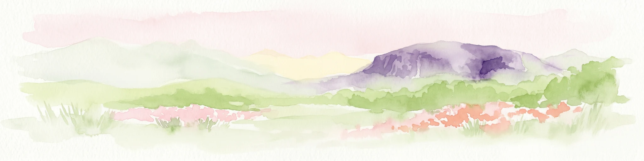
Watercolor depiction of Mount Coolum mountain with flowering fields in the foreground
National parkQueensland

Mount Coolum National Park: Mapped Boundaries and Geological Significance in Queensland

Explore Queensland's unique laccolith national park and its diverse botanical landscapes.

Mount Coolum National Park offers a concentrated study in unique geological formations and botanical richness within Queensland's protected lands. As a prominent laccolith, the park's dome-shaped mountain and rhyolite cliffs provide a striking natural landmark. Explore its mapped terrain, from forested slopes to rare heath communities, and grasp its significance as a protected area contributing to the regional landscape context. Understand the distinct natural character of this Sunshine Coast national park.

Area
0.69 km²
Established
1990
IUCN
II
Relief
Mixed relief
National parkQueensland

Dularcha National Park: Queensland National Park Landscape and Geographic Context

Explore mapped protected areas and natural terrain.

Delve into the specific protected landscape of Dularcha National Park, a national park situated in Queensland, Australia. This entry provides detailed information on its geographic features and mapped boundaries, contributing to a structured understanding of protected areas within the Australian atlas. Examine Dularcha National Park's unique natural environment and its place within the Sunshine State's diverse terrain.

Area
4.64 km²
Established
1921
IUCN
II
Climate
Subtropical
National parkQueensland

Tewantin National Park: Queensland National Park with Volcanic Peaks and Coastal Rainforest

Explore its unique ecosystems and protected landscape boundaries.

Tewantin National Park is a key protected area in Queensland, recognized for its distinct landscape blending coastal rainforest, vibrant Wallum Heath, and the ancient volcanic dome of Mount Tinbeerwah. This national park provides essential conservation for endangered species, particularly amphibians and the swamp stringybark tree, serving as an important natural enclave within the Sunshine Coast region. Its mapped geography offers insight into the ecological significance of this protected landscape, contributing a vital piece to Australia's atlas of natural heritage.

Area
13 km²
IUCN
II
Relief
Mixed relief
Climate
Subtropical
National parkQueensland

Glass House Mountains National Park: Explore its Protected Landscape and Queensland Geography

Mapped boundaries and regional natural terrain context.

Glass House Mountains National Park serves as a vital protected area, offering a specific geographic focus within Queensland, Australia. This page provides detailed context on its mapped boundaries and landscape character, contributing to a structured understanding of the national park's place in the Sunshine State's diverse geography. It highlights the park's role as a distinct protected territory within the broader Australian atlas.

Area
8.83 km²
Established
1994
IUCN
II
Relief
Mountain

Common questions about visiting, size, designation, and location context for Ferntree Creek National Park

Ferntree Creek National Park FAQs for park facts, access, geography, and protected area context
Find quick answers about Ferntree Creek National Park, including protected-area facts, park geography, trail and visitor context, and how the park fits into its surrounding country and regional landscape.
MoriAtlas Explorer

Continue Your Protected Areas Search Across the Global Atlas

Deepen your exploration by continuing the structured search for national parks and protected areas worldwide. Utilize the comprehensive filtering capabilities to compare different conservation landscapes and refine your understanding of global park geography. Discover more about the distribution and characteristics of protected natural areas.

Global natural geography