Why Burigi-Chato National Park stands out
Burigi-Chato is best known for its expansive Miombo woodland ecosystem, which represents one of Tanzania's less-protected woodland types, and for the dramatic Lake Burigi with its scattered islands and wetland inlets. The park's lakes support populations of the elusive sitatunga antelope and the iconic shoebill stork, a species that draws significant interest from birdwatchers. The combination of woodland savanna, lacustrine environments, and proximity to Uganda's Lake Mburo National Park and Rwanda's Akagera National Park positions the park as a component of a broader transboundary conservation landscape in the Lake Victoria basin.
Burigi-Chato National Park history and protected-area timeline
Burigi-Chato National Park was officially designated as a national park in 2019, representing Tanzania's commitment to expanding its protected area network to include under-represented ecosystems and regions. Prior to national park status, the area consisted of unprotected land and various local conservation designations. The establishment of the park formalized protection for a landscape that had not previously received formal national-level conservation status, despite its ecological significance within the Lake Victoria basin. The park is managed by the Tanzania National Parks Authority under the guidance of the Ministry of Natural Resources and Tourism, aligning it with the country's other national parks that are managed for conservation, tourism, and sustainable resource use.
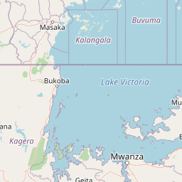
Burigi-Chato National Park landscape and geographic character
The landscape of Burigi-Chato National Park is characterized by its impressive spatial extent and topographic variety. The terrain includes long, rolling hills that create a gently undulating landscape across much of the park's interior. Rocky crags and steep escarpments provide more dramatic relief in certain areas, while deeply set valleys lined with forest create intimate, enclosed environments. The open plains and grasslands contrast sharply with the denser woodland areas, creating a mosaic of habitats that defines the park's character. Wetland systems, including swamps and flood plains, are scattered throughout, particularly associated with the lake systems and rivers that drain the landscape. The presence of Lake Burigi, a substantial freshwater body with islands, inlets, and bays, adds a significant lacustrine dimension to the park's geography.
Burigi-Chato National Park ecosystems, habitats, and plant life
The ecological character of Burigi-Chato is defined primarily by its extensive Miombo woodland, a woodland type widespread in southern Africa but underrepresented in Tanzania's protected area network. This woodland is dominated by species of the genera Combretum and Terminalia, creating a distinctive canopy structure across hundreds of square kilometers. The woodland supports a diverse understory of grasses and shrubs adapted to the seasonal rainfall patterns of the region. Beyond the woodland, the park encompasses a range of additional habitats including wetlands, flood plains, and the lacustrine environment of Lake Burigi. The lake and its associated wetlands provide critical habitat for water-dependent species and contribute to the biodiversity of the broader Lake Victoria basin.
Burigi-Chato National Park wildlife and species highlights
The wildlife of Burigi-Chato is adapted to the Miombo woodland and wetland habitats that characterize the park. The lakes and swamps of the park support the sitatunga antelope, a specialized wetland-dwelling antelope species that is relatively uncommon in Tanzania's protected areas. The marshes and papyrus stands surrounding the lakes provide habitat for the shoebill stork, a distinctive and sought-after species among birdwatchers. The woodland areas support populations of typical African savanna and forest-edge species. The park's position near the border with Uganda and its connection to the broader Lake Victoria ecosystem means it contributes to wildlife populations that move across national boundaries.
Burigi-Chato National Park conservation status and protection priorities
Burigi-Chato National Park addresses a significant gap in Tanzania's protected area network by providing formal conservation status to a large tract of Miombo woodland that had previously received limited protection. The park's establishment in 2019 expanded the country's national park estate by over 4,700 square kilometers and brought conservation attention to an ecosystem type that was under-represented in Tanzania's protected areas. The park's lakes, particularly Lake Burigi, serve important ecological functions within the Lake Victoria basin, providing water filtration, flood regulation, and habitat for aquatic and semi-aquatic species. The protection of this area also contributes to broader regional conservation efforts, as the park forms part of a network of protected areas extending into Uganda and Rwanda.
Burigi-Chato National Park cultural meaning and human context
Burigi-Chato National Park occupies a region of northwestern Tanzania that is rich in local cultural heritage. The park's name derives from Lake Burigi and Chato District, reflecting the importance of these geographic features in local identity. The area has historically been used by local communities for various livelihood activities including fishing, pastoralism, and small-scale agriculture. The establishment of the park in 2019 formalized protection over land that was previously largely uninhabited but remained under local use. The park is situated within a region that has historical connections to the broader Lake Victoria basin and the communities that have depended on its resources for generations.
Top sights and standout views in Burigi-Chato National Park
The defining highlights of Burigi-Chato National Park include its status as Tanzania's fourth-largest park, its extensive Miombo woodland protection, and the spectacular Lake Burigi with its islands, inlets, and bays. The opportunity to observe shoebill storks and sitatunga antelope in their wetland habitats represents a significant draw for wildlife enthusiasts. The park offers relatively undeveloped tourism opportunities including camping and canoeing, allowing visitors to experience a wilderness landscape that remains less visited than Tanzania's more established national parks. The park's position connecting Lake Victoria with the Rwandan border creates a transboundary conservation context that adds to its regional significance.
Best time to visit Burigi-Chato National Park
The best time to visit Burigi-Chato National Park is during the dry season, which typically runs from June through October, when wildlife viewing is more accessible as animals concentrate around remaining water sources. The dry season offers easier navigation through the park's woodland and grassland areas and provides optimal conditions for activities such as canoeing on Lake Burigi. The wet seasons, from November to May, bring heavier vegetation that can make wildlife observation more challenging but also bring lush scenery and increased bird activity. The park's relatively recent establishment means that visitor infrastructure is still developing, so travelers should be prepared for a more rustic experience compared to Tanzania's established tourism destinations.