

Mori Atlas logo
National parkRumanyika-Karagwe National Park

Discover the geographic contours and protected area identity of this Tanzanian national park.

Rumanyika-Karagwe National Park: Mapped Protected Landscape in Kagera Region, Tanzania

Rumanyika-Karagwe National Park stands as a significant protected area within Tanzania's northwestern Kagera Region. This page offers an atlas-style exploration, focusing on the park's mapped boundaries and its distinct place within the region's geography. Understand the landscape context and protected land features that define Rumanyika-Karagwe National Park, providing a grounded perspective for geographic discovery.

Savannah ecosystemWildlife conservationCultural heritage siteNorthwest TanzaniaKaragwe Kingdom historyTanzania national parks

Rumanyika-Karagwe National Park

National park

Park overview

Structured park overview, official facts, and landscape profile for Rumanyika-Karagwe National Park

Rumanyika-Karagwe National Park park facts, protected area profile, and essential visitor context

Review the core facts for Rumanyika-Karagwe National Park, including designation, size, terrain, visitor scale, habitats, and operating context in one park-focused overview.

About Rumanyika-Karagwe National Park

Rumanyika-Karagwe National Park represents an important addition to Tanzania's protected area network, created to preserve a distinctive savannah ecosystem in the country's northwestern corner. The park's location in the Kagera Region places it in an area of significant ecological and agricultural importance, where the savannah landscape supports both wildlife populations and human settlement. The park's creation in 2019 reflected Tanzania's ongoing commitment to expanding conservation coverage and protecting representative examples of its diverse ecosystems. The savannah environment features open grasslands interspersed with acacia woodlands and riparian zones along seasonal watercourses, creating varied habitat that supports diverse wildlife communities. Unlike the more intensively visited parks of the northern safari circuit, Rumanyika-Karagwe offers a more remote and less trafficked wilderness experience while still providing meaningful wildlife viewing opportunities. The park's management under the Tanzania National Parks Authority ensures standardized conservation protocols and visitor management appropriate for a protected savannah ecosystem.

Quick facts and research context for Rumanyika-Karagwe National Park

Located in the Kagera Region of northwestern Tanzania, Rumanyika-Karagwe National Park covers 247 square kilometers of savannah terrain across Kyerwa and Karagwe districts. The park is named after King Rumanyika I Orugundu, the 19th-century ruler of the Karagwe Kingdom. Established as a national park in 2019, it was previously known as the Rumanyika Orugundu Game Reserve. The park protects savannah wildlife including giraffes, buffalo, impala, waterbuck, leopards, zebras, bushbuck, and baboons. The nearest city is Bukoba, and the park is governed by the Tanzania National Parks Authority.

Protection and recognition

Documenting the terrestrial management scope and establishment framework since 2019.

Rumanyika-Karagwe National Park Protection Status and Conservation Profile

Browse the official protection profile of Rumanyika-Karagwe National Park, including its primary terrestrial scope and established boundaries designated in 2019. Exploring the verified designation details offers clear insights into the formal management history and regional framework governing the protected landscape.

Protection details

Protection scope
Terrestrial
Designated year
2019
Transboundary protection
No
Park context

Deeper park guide and search-rich context for Rumanyika-Karagwe National Park

Rumanyika-Karagwe National Park history, landscape, wildlife, and travel context

Explore Rumanyika-Karagwe National Park through its history, landscape character, ecosystems, wildlife, conservation priorities, cultural context, and seasonal travel timing in a structured park guide built for atlas discovery and search intent.

Why Rumanyika-Karagwe National Park stands out

Rumanyika-Karagwe National Park is best known for its savannah wildlife viewing opportunities, particularly for populations of giraffes, zebras, and diverse antelope species including impala and waterbuck. The park's significance is amplified by its historical and cultural connections to the Karagwe Kingdom, a powerful 19th-century African state that once dominated the region. The landscape of gently rolling savannah with scattered acacia trees and open grasslands provides a classic East African wilderness experience distinct from the more famous northern circuit parks. The park also offers accessibility from Bukoba, making it a practical destination for visitors to the Kagera Region.

Rumanyika-Karagwe National Park history and protected-area timeline

The land that now comprises Rumanyika-Karagwe National Park carries deep historical significance rooted in the legacy of the Karagwe Kingdom, a powerful pre-colonial African state that reached its zenith in the nineteenth century under the leadership of King Rumanyika I Orugundu. The king ruled from 1855 to 1882, a period during which the Karagwe Kingdom established itself as a major political and economic force in the Great Lakes region, renowned for its sophisticated political organization and extensive trade networks. The protected area was originally established as the Rumanyika Orugundu Game Reserve, explicitly honoring this historic ruler and connecting the modern conservation designation to the region's rich cultural heritage. In 2019, the area was upgraded to national park status, reflecting Tanzania's recognition of both its ecological value and its cultural significance. This transformation from game reserve to national park brought increased protection status and formal integration into the nation's park management system under the Tanzania National Parks Authority.

Rumanyika-Karagwe National Park landscape and geographic character

The park occupies a landscape of gently undulating savannah in the northwestern part of Tanzania's Kagera Region. The terrain consists of rolling plains and low hills covered in a mosaic of open grassland and scattered acacia woodland, typical of the eastern African savannah biome. The landscape features seasonal watercourses that carry flows during wet periods, creating riparian corridors with denser vegetation that provide important habitat variation. The elevation and positioning in the Kagera Region place the park in a transitional zone between more humid highland environments to the west and the drier savannah systems to the east. The open savannah character provides excellent wildlife viewing conditions, with good visibility across the grasslands and the ability to observe animals moving through the landscape. The combination of open plains, scattered trees, and seasonal water features creates a visually distinctive East African landscape that differs from the more rugged terrain found in some other Tanzanian protected areas.

Rumanyika-Karagwe National Park ecosystems, habitats, and plant life

Rumanyika-Karagwe National Park protects a representative example of the eastern African savannah ecosystem characteristic of northwestern Tanzania. The habitat consists primarily of grass-dominated savannah with varying densities of acacia trees, supporting a community of adapted wildlife species. The open grasslands support grazers such as zebras and various antelope species, while the scattered trees and thicker vegetation along watercourses provide cover for browsers and mixed feeders. The park contributes to the broader conservation of Tanzania's savannah systems, which represent some of the most extensive and ecologically significant grasslands in Africa. The protected status helps maintain ecological connectivity in a region where agricultural expansion has reduced natural habitat. The savannah ecosystem supports natural processes including seasonal patterns of vegetation growth, wildlife migration and movement, and predator-prey relationships that characterize healthy African wilderness areas.

Rumanyika-Karagwe National Park wildlife and species highlights

The park is home to a diverse assembly of savannah wildlife species typical of the region. Giraffes are among the most notable inhabitants, browsing on acacia and other trees throughout the park. Large herds of zebras move across the open grasslands, along with populations of impala and waterbuck representing the diverse antelope fauna. Buffalo herds are present in the area, often found near water sources. Predators including leopards maintain populations in the park, using the varied habitat for hunting and cover. Smaller mammals such as bushbuck and baboons round out the mammalian community. The combination of open savannah and woodland creates conditions suitable for both grazers and browsers, supporting a balanced ecosystem with multiple trophic levels. The wildlife community reflects the park's position in the eastern African savannah biome and provides the foundation for visitor wildlife viewing experiences.

Rumanyika-Karagwe National Park conservation status and protection priorities

Rumanyika-Karagwe National Park contributes to Tanzania's national conservation framework by protecting a savannah ecosystem that might otherwise face pressure from agricultural expansion and development. The Kagera Region is one of Tanzania's most densely populated rural areas, with intensive agricultural activity creating strong demand for land. National park designation provides formal legal protection for the area's wildlife and ecosystems, prohibiting activities that would degrade the natural environment. The park's creation in 2019 represented a strategic expansion of Tanzania's protected area network into a region that had previously lacked formal national park status. The park also serves a conservation purpose by preserving the historical and cultural landscape associated with the Karagwe Kingdom, linking natural and cultural heritage protection. Management by the Tanzania National Parks Authority brings professional conservation oversight and resource allocation appropriate for maintaining ecosystem integrity.

Rumanyika-Karagwe National Park cultural meaning and human context

The park is deeply connected to the cultural heritage of the Karagwe Kingdom, a significant pre-colonial African state that dominated the Kagera Region during the nineteenth century. King Rumanyika I Orugundu, who ruled from 1855 to 1882, led the kingdom through its period of greatest power and influence, establishing political and economic systems that shaped the region. The park's name honors this historic figure, and its earlier designation as the Rumanyika Orugundu Game Reserve explicitly recognized his legacy. The Karagwe Kingdom was renowned for its sophisticated political organization, its control of trade routes, and its agricultural productivity. The cultural connection between the park and the historic kingdom provides a distinctive identity that differentiates this protected area from others that lack such direct ties to major historical polities. This cultural context adds depth to the park's significance beyond its ecological value.

Top sights and standout views in Rumanyika-Karagwe National Park

Rumanyika-Karagwe National Park offers distinctive wildlife viewing in a relatively accessible northwestern Tanzania location near Bukoba. The park protects populations of giraffes, zebras, buffalo, impala, waterbuck, and leopards across its savannah landscapes. The historical connection to King Rumanyika I Orugundu and the Karagwe Kingdom provides cultural significance unique among Tanzanian parks. The park's relatively recent establishment in 2019 means it offers a fresh conservation designation and management framework. The combination of wildlife viewing, historical context, and accessibility from Bukoba makes the park a notable destination for visitors to the Kagera Region.

Best time to visit Rumanyika-Karagwe National Park

The park can be visited year-round, though the dry season from June through October typically offers optimal conditions for wildlife viewing as animals concentrate around remaining water sources and vegetation is less dense. The wet seasons from November to May bring greening of the landscape and can offer different aesthetic qualities, though some roads may become more difficult to navigate. The Kagera Region experiences a bimodal rainfall pattern with main rains in March through May and shorter rains in October through December. Visitors interested in combining wildlife viewing with cultural exploration may find the period around the dry season most favorable for comfortable outdoor activities. The park's proximity to Bukoba allows for day trips, though overnight stays enable more comprehensive exploration of the area.

Monthly climate preview

Deciphering the temperature rhythms and seasonal precipitation patterns in Kagera

Rumanyika-Karagwe National Park Climate Norms and Weather by Month

Long-term data at a representative elevation of 1414 meters reveals warm average temperatures between 19 and 22 degrees Celsius alongside distinct dry and wet precipitation cycles. Exploring the dedicated monthly profile clarifies how historical trends fluctuate from month to month with detailed minimum, maximum, and average metrics.
Annual mean21 °C
20 °C22 °C
Jan21°
Feb22°
Mar21°
Apr20°
May20°
Jun20°
Jul20°
Aug21°
Sep21°
Oct21°
Nov20°
Dec21°
Warmest month
February

21.8 °C

Coolest month
May

19.9 °C

Wettest month
November

4.3 mm/day

Driest month
July

1 mm/day

Park location guide

Geography guide, regional context, and park location map for Rumanyika-Karagwe National Park

Rumanyika-Karagwe National Park park geography, regions, and map view in Tanzania

Understand where Rumanyika-Karagwe National Park sits in Tanzania through a broader geographic reading of the surrounding landscape, nearby location context, and its mapped position within the national park landscape.

How Rumanyika-Karagwe National Park fits into Tanzania

Tanzania, officially the United Republic of Tanzania, is a presidential republic in East Africa within the African Great Lakes region. It was formed in 1964 through the unification of Tanganyika and Zanzibar. The country is known for its diverse wildlife, national parks including Serengeti and Ngorongoro, and significant archaeological sites with important hominid fossils.

Wider geography shaping Rumanyika-Karagwe National Park in Tanzania

Tanzania is located in East Africa within the African Great Lakes region. It is bordered by Uganda to the northwest, Kenya to the northeast, the Indian Ocean to the east, Mozambique and Malawi to the south, Zambia to the southwest, and Rwanda, Burundi, and the Democratic Republic of the Congo to the west. The country includes the mainland and the Zanzibar Archipelago.

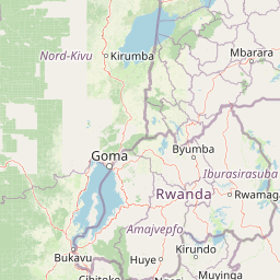
Map view of Rumanyika-Karagwe National Park

Use this park location map to pinpoint Rumanyika-Karagwe National Park in Tanzania, understand its exact geographic position, and read its mapped placement within the surrounding landscape more clearly.

Pigeon | © OpenStreetMap contributors

Location context for Rumanyika-Karagwe National Park

Kagera Region
Park atlas

Discover surrounding savannah landscapes and connected conservation regions in northwest Tanzania.

Explore National Parks and Protected Areas Near Rumanyika-Karagwe National Park

Continue exploration from Rumanyika-Karagwe National Park by browsing additional national parks and protected areas across Tanzania's Kagera Region. Compare diverse savannah ecosystems and significant conservation landscapes, tracing the geographic spread of protected territories on the regional atlas.
National parkKagera Region
About 23 km away#1 closest

West

Ibanda-Kyerwa National Park: Tanzania's Tri-Border Protected Landscape and Geographic Atlas

Savanna, riparian habitats, and vital regional geography exploration.

Delve into Ibanda-Kyerwa National Park, a recently established national park in Tanzania's Kagera Region. This protected area is distinguished by its critical location at the tri-border with Uganda and Rwanda, with the Kagera River system defining its unique savanna and riparian landscapes. Understanding its mapped boundaries and ecological context provides essential insight into protected land discovery in northwestern Tanzania and its role within the wider regional atlas.

Area
200 km²
Established
2019
IUCN
II
Relief
Highland
National parkEastern Province
About 49 km away#2 closest

South

Akagera National Park National Park: Protected Landscape Geography and Atlas Exploration

Understand the mapped terrain and regional context of Akagera National Park.

Akagera National Park, designated as a national park, represents a vital protected landscape within Rwanda's Eastern Province. This atlas-focused entry provides essential geographic context, highlighting the park's mapped boundaries and natural terrain. Explore Akagera National Park as a key element in regional geography and a focal point for understanding protected land distribution.

Area
1,122 km²
Established
1934
Visitors
34K annual
Relief
Mixed relief
National parkKiruhura District
About 66 km away#3 closest

North

Lake Mburo National Park: Uganda's National Park in Kiruhura District

Explore its mapped boundaries and regional geography.

Delve into the protected landscape of Lake Mburo National Park, situated in Uganda's Kiruhura District. This entry provides essential geographic context, mapping its boundaries and regional setting for users interested in detailed atlas exploration of protected areas and natural landscapes.

Area
260 km²
Established
1983
IUCN
II
Relief
Lowland
National parkKanungu District
About 105 km away#4 closest

West

Bwindi Impenetrable National Park: Uganda's National Park Geography and Mapped Terrain

Explore its protected landscape and regional context.

Delve into the protected landscape of Bwindi Impenetrable National Park, a protected area situated within Kanungu District, Uganda. This detail page offers a deep dive into its geographic setting, presenting mapped park boundaries and natural terrain features essential for understanding its role within the regional atlas. Discover the specific environmental context of this national park for robust map-based exploration.

Area
331 km²
Established
1991
IUCN
II
Relief
Mountain
National parkUganda
About 124 km away#5 closest

West

Mgahinga Gorilla National Park: Atlas of Protected Volcanic Landscapes in Uganda

Mapping the Virunga Mountains and high altitude conservation terrain.

Located in southwestern Uganda, Mgahinga Gorilla National Park protects a significant portion of the transboundary Virunga ecosystem. The park encompasses the peaks of Mount Muhabura, Mount Gahinga, and Mount Sabyinyo, providing a unique look at the vertical transition of habitats from bamboo forests to alpine zones. Access detailed geographic data and spatial context for one of the most ecologically important protected areas in the Albertine Rift.

Area
33.9 km²
Established
1991
IUCN
II
Relief
Mountain
National parkKisoro District
About 128 km away#6 closest

West

Mgahinga Gorilla National Park: A Geographic Study of Virunga Mountain Landscapes

Exploring protected boundaries and volcanic terrain in Kisoro District.

Mgahinga Gorilla National Park covers an essential range of montane forest and alpine zones across three dormant volcanoes in the Kisoro District of Uganda. This protected area functions as a key element of the broader Virunga mountain ecosystem, providing specialized habitats for endangered primate populations and endemic bird species. The dramatic vertical relief from bamboo forests to summit peaks defines this critical segment of the Albertine Rift conservation network.

Area
33.9 km²
Established
1991
IUCN
II
Relief
Mountain
National parkTanzania
About 131 km away#7 closest

South

Burigi-Chato National Park: Protected Landscape Atlas Entry for Tanzania

Explore the mapped geography and terrain of this Tanzanian national park.

Burigi-Chato National Park serves as a distinct protected area within Tanzania, detailed here for its geographic significance and atlas exploration value. Users can delve into the park's specific landscape characteristics, its protected boundaries, and its regional setting. This content is designed to support a deeper understanding of conservation lands and natural terrain within the East African context, offering a factual entry point for detailed geographic discovery.

Area
4,707 km²
Established
2019
IUCN
II
Relief
Mixed relief
Watercolor illustration of rolling hills, mountains, and a river or lake
National parkDemocratic Republic of the Congo
About 132 km away#8 closest

West

Virunga National Park: Democratic Republic of the Congo's Premier Protected Landscape

Mapped boundaries and diverse Albertine Rift endemic geography.

Virunga National Park represents a pivotal protected area within the Democratic Republic of the Congo, characterized by an exceptional range of geographic features and vital ecosystems. Its protected landscape includes active volcanoes like Nyiragongo with its lava lake, the towering Rwenzori Mountains, and diverse lowland savannas. This atlas-focused entry highlights the park's unique position in the Albertine Rift, crucial for numerous endemic species and offering significant insight into regional geography and protected land context.

Area
7,800 km²
Established
1925
IUCN
II
Relief
Mountain

Common questions about visiting, size, designation, and location context for Rumanyika-Karagwe National Park

Rumanyika-Karagwe National Park FAQs for park facts, access, geography, and protected area context

Find quick answers about Rumanyika-Karagwe National Park, including protected-area facts, park geography, trail and visitor context, and how the park fits into its surrounding country and regional landscape.
MoriAtlas Explorer

Continue Your Protected Areas Search Across the Global Atlas

Deepen your exploration by continuing the structured search for national parks and protected areas worldwide. Utilize the comprehensive filtering capabilities to compare different conservation landscapes and refine your understanding of global park geography. Discover more about the distribution and characteristics of protected natural areas.

Global natural geography


