Why Rumanyika-Karagwe National Park stands out
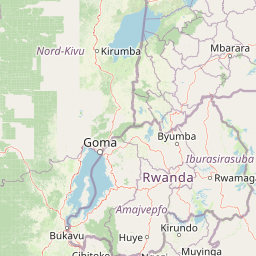
Rumanyika-Karagwe National Park is best known for its savannah wildlife viewing opportunities, particularly for populations of giraffes, zebras, and diverse antelope species including impala and waterbuck. The park's significance is amplified by its historical and cultural connections to the Karagwe Kingdom, a powerful 19th-century African state that once dominated the region. The landscape of gently rolling savannah with scattered acacia trees and open grasslands provides a classic East African wilderness experience distinct from the more famous northern circuit parks. The park also offers accessibility from Bukoba, making it a practical destination for visitors to the Kagera Region.
Rumanyika-Karagwe National Park history and protected-area timeline
The land that now comprises Rumanyika-Karagwe National Park carries deep historical significance rooted in the legacy of the Karagwe Kingdom, a powerful pre-colonial African state that reached its zenith in the nineteenth century under the leadership of King Rumanyika I Orugundu. The king ruled from 1855 to 1882, a period during which the Karagwe Kingdom established itself as a major political and economic force in the Great Lakes region, renowned for its sophisticated political organization and extensive trade networks. The protected area was originally established as the Rumanyika Orugundu Game Reserve, explicitly honoring this historic ruler and connecting the modern conservation designation to the region's rich cultural heritage. In 2019, the area was upgraded to national park status, reflecting Tanzania's recognition of both its ecological value and its cultural significance. This transformation from game reserve to national park brought increased protection status and formal integration into the nation's park management system under the Tanzania National Parks Authority.
Rumanyika-Karagwe National Park landscape and geographic character
The park occupies a landscape of gently undulating savannah in the northwestern part of Tanzania's Kagera Region. The terrain consists of rolling plains and low hills covered in a mosaic of open grassland and scattered acacia woodland, typical of the eastern African savannah biome. The landscape features seasonal watercourses that carry flows during wet periods, creating riparian corridors with denser vegetation that provide important habitat variation. The elevation and positioning in the Kagera Region place the park in a transitional zone between more humid highland environments to the west and the drier savannah systems to the east. The open savannah character provides excellent wildlife viewing conditions, with good visibility across the grasslands and the ability to observe animals moving through the landscape. The combination of open plains, scattered trees, and seasonal water features creates a visually distinctive East African landscape that differs from the more rugged terrain found in some other Tanzanian protected areas.
Rumanyika-Karagwe National Park ecosystems, habitats, and plant life
Rumanyika-Karagwe National Park protects a representative example of the eastern African savannah ecosystem characteristic of northwestern Tanzania. The habitat consists primarily of grass-dominated savannah with varying densities of acacia trees, supporting a community of adapted wildlife species. The open grasslands support grazers such as zebras and various antelope species, while the scattered trees and thicker vegetation along watercourses provide cover for browsers and mixed feeders. The park contributes to the broader conservation of Tanzania's savannah systems, which represent some of the most extensive and ecologically significant grasslands in Africa. The protected status helps maintain ecological connectivity in a region where agricultural expansion has reduced natural habitat. The savannah ecosystem supports natural processes including seasonal patterns of vegetation growth, wildlife migration and movement, and predator-prey relationships that characterize healthy African wilderness areas.
Rumanyika-Karagwe National Park wildlife and species highlights
The park is home to a diverse assembly of savannah wildlife species typical of the region. Giraffes are among the most notable inhabitants, browsing on acacia and other trees throughout the park. Large herds of zebras move across the open grasslands, along with populations of impala and waterbuck representing the diverse antelope fauna. Buffalo herds are present in the area, often found near water sources. Predators including leopards maintain populations in the park, using the varied habitat for hunting and cover. Smaller mammals such as bushbuck and baboons round out the mammalian community. The combination of open savannah and woodland creates conditions suitable for both grazers and browsers, supporting a balanced ecosystem with multiple trophic levels. The wildlife community reflects the park's position in the eastern African savannah biome and provides the foundation for visitor wildlife viewing experiences.
Rumanyika-Karagwe National Park conservation status and protection priorities
Rumanyika-Karagwe National Park contributes to Tanzania's national conservation framework by protecting a savannah ecosystem that might otherwise face pressure from agricultural expansion and development. The Kagera Region is one of Tanzania's most densely populated rural areas, with intensive agricultural activity creating strong demand for land. National park designation provides formal legal protection for the area's wildlife and ecosystems, prohibiting activities that would degrade the natural environment. The park's creation in 2019 represented a strategic expansion of Tanzania's protected area network into a region that had previously lacked formal national park status. The park also serves a conservation purpose by preserving the historical and cultural landscape associated with the Karagwe Kingdom, linking natural and cultural heritage protection. Management by the Tanzania National Parks Authority brings professional conservation oversight and resource allocation appropriate for maintaining ecosystem integrity.
Rumanyika-Karagwe National Park cultural meaning and human context
The park is deeply connected to the cultural heritage of the Karagwe Kingdom, a significant pre-colonial African state that dominated the Kagera Region during the nineteenth century. King Rumanyika I Orugundu, who ruled from 1855 to 1882, led the kingdom through its period of greatest power and influence, establishing political and economic systems that shaped the region. The park's name honors this historic figure, and its earlier designation as the Rumanyika Orugundu Game Reserve explicitly recognized his legacy. The Karagwe Kingdom was renowned for its sophisticated political organization, its control of trade routes, and its agricultural productivity. The cultural connection between the park and the historic kingdom provides a distinctive identity that differentiates this protected area from others that lack such direct ties to major historical polities. This cultural context adds depth to the park's significance beyond its ecological value.
Top sights and standout views in Rumanyika-Karagwe National Park
Rumanyika-Karagwe National Park offers distinctive wildlife viewing in a relatively accessible northwestern Tanzania location near Bukoba. The park protects populations of giraffes, zebras, buffalo, impala, waterbuck, and leopards across its savannah landscapes. The historical connection to King Rumanyika I Orugundu and the Karagwe Kingdom provides cultural significance unique among Tanzanian parks. The park's relatively recent establishment in 2019 means it offers a fresh conservation designation and management framework. The combination of wildlife viewing, historical context, and accessibility from Bukoba makes the park a notable destination for visitors to the Kagera Region.
Best time to visit Rumanyika-Karagwe National Park
The park can be visited year-round, though the dry season from June through October typically offers optimal conditions for wildlife viewing as animals concentrate around remaining water sources and vegetation is less dense. The wet seasons from November to May bring greening of the landscape and can offer different aesthetic qualities, though some roads may become more difficult to navigate. The Kagera Region experiences a bimodal rainfall pattern with main rains in March through May and shorter rains in October through December. Visitors interested in combining wildlife viewing with cultural exploration may find the period around the dry season most favorable for comfortable outdoor activities. The park's proximity to Bukoba allows for day trips, though overnight stays enable more comprehensive exploration of the area.