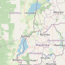
Why Queen Elizabeth National Park stands out
Queen Elizabeth National Park is best known for its population of tree-climbing lions in the Ishasha sector, where lions have adapted to ascending fig trees to rest and scan for prey. The male lions in this region are particularly distinctive for their black manes. The park is also famous for its dramatic volcanic landscape featuring craters and crater lakes, particularly the Katwe craters where salt has been extracted for generations. The Kazinga Channel provides one of the park's most iconic wildlife viewing experiences, with dense concentrations of hippos and crocodiles visible from boat trips. The park's status as a designated lion conservation unit shared with neighboring Virunga National Park underscores its importance for big cat conservation in Central Africa.
Queen Elizabeth National Park history and protected-area timeline
The modern history of Queen Elizabeth National Park is deeply intertwined with Uganda's colonial period and the complex relationship between conservation and local communities. In 1921, a rinderpest epidemic combined with sleeping sickness among the indigenous Songora people devastated the region, causing significant mortality and emigration. The colonial government subsequently evicted the remaining inhabitants from approximately 90 percent of their lands to establish game reserves, with homes torched and livestock slaughtered, forcing the Songora to seek refuge across the border in what is now the Democratic Republic of the Congo. The park was formally established in 1952 through the combination of the Lake George and Lake Edward Game Reserves, initially named Kazinga National Park. In 1954, the park was renamed to commemorate Queen Elizabeth II's visit, and the last remaining communal grazing rights of the Songora herders were rescinded, prompting further emigration. The late 20th and early 21st centuries brought new challenges, including conflicts with relocated communities such as the Basongora, who were forced to flee from the DRC in 2006 and settled in the park with their livestock. Predator attacks on livestock led to retaliatory poisoning that killed eleven lions in 2018, highlighting ongoing human-wildlife conflict issues. The park has also faced poaching threats, including the killing of six elephants in 2015.
Queen Elizabeth National Park landscape and geographic character
The physical landscape of Queen Elizabeth National Park is remarkably varied and dominated by the geological legacy of the East African Rift Valley. The park's terrain includes extensive savanna plains, swampy valleys, forest patches, and one of its most distinctive features: volcanic cones and craters scattered throughout the western portion of the park. These volcanic formations, many of which contain crater lakes, create a dramatic and photogenic landscape that is unique among East African protected areas. The Katwe craters represent the most significant of these volcanic depressions and have been used for salt extraction for generations, a traditional activity that continues to present day. The Kazinga Channel, a natural waterway connecting Lake Edward to Lake George, bisects the park and provides a permanent water source that draws wildlife throughout the year. The park also includes Kyambura Gorge, a steep forested ravine that provides a different habitat type and supports specialized species. The overall elevation ranges from around 900 meters to 1,300 meters above sea level, creating a relatively flat landscape punctuated by the volcanic features and the channel system.
Queen Elizabeth National Park ecosystems, habitats, and plant life
The ecological character of Queen Elizabeth National Park reflects its position in the transitional zone between the Central African rainforest ecosystem and the East African savanna system. This positioning, combined with the variety of habitats created by its volcanic landscape and water systems, results in exceptional biodiversity. The savanna grasslands support large populations of grazing and browsing animals, while the forest patches and the Kyambura Gorge provide habitat for forest-dependent species. The Kazinga Channel and associated wetlands create an aquatic environment that supports hippos, crocodiles, and waterfowl. The crater lakes, particularly those in the Katwe area, have unique chemical characteristics that influence their ecology. The park's position as part of a larger transboundary conservation network enhances its ecological significance by allowing species movement across international boundaries. The variety of habitats, from open grasslands to forested gorge environments, creates ecological niches that support the park's remarkable species diversity.
Queen Elizabeth National Park wildlife and species highlights
Queen Elizabeth National Park supports an impressive array of wildlife, with 95 mammal species and over 600 bird species recorded within its boundaries. The park is particularly known for its lion population, especially the tree-climbing lions of the Ishasha sector in Rukungiri District, where lions have developed the unusual behavior of ascending fig trees to rest and survey their territory. These lions are notable for the black-maned males that are characteristic of the population. Large mammals common in the park include African elephants, African buffalo, Uganda kob (the park's most abundant antelope), hippopotamus found in large numbers along the Kazinga Channel, topi, waterbuck, warthog, and the giant forest hog. Predators include leopards and spotted hyenas, while the park also supports populations of chimpanzees in the forested areas. The bird population is exceptionally diverse, with over 600 species representing both resident and migratory species. The Kazinga Channel and surrounding wetlands are particularly important for waterfowl and represents a critical habitat for many bird species.
Queen Elizabeth National Park conservation status and protection priorities
Queen Elizabeth National Park plays a crucial role in Uganda's conservation landscape and has been recognized internationally for its significance. In 2006, the park, together with adjacent Virunga National Park, was designated as a lion conservation unit by the International Union for Conservation of Nature, highlighting its importance for big cat conservation in Central Africa. The area is considered a potential lion stronghold if poaching is controlled and prey species are allowed to recover. The Uganda Carnivore Program, in partnership with the Uganda Wildlife Authority, actively monitors the resident lion population including hyenas and leopards through radio collars and other conservation initiatives. The park has faced significant conservation challenges, including poaching of elephants and conflicts between local communities and wildlife that have resulted in retaliatory killings of lions. Conservation efforts focus on anti-poaching patrols, community engagement to reduce human-wildlife conflict, and monitoring programs to track wildlife populations and movement patterns.
Queen Elizabeth National Park cultural meaning and human context
The cultural history of Queen Elizabeth National Park is marked by displacement and complex relationships between conservation initiatives and local communities. The Songora people, a pastoralist community indigenous to the region, were the original inhabitants of the area before the establishment of the park. Following disease outbreaks in 1921, the colonial government used the crisis as justification to evict the Songora from their lands to create game reserves, forcing many to relocate to what is now the Democratic Republic of the Congo. Additional relocations occurred when the park was formally established in 1952 and renamed in 1954, with the rescission of remaining grazing rights prompting further emigration. The Basongora community, originally from the park area, were forced to flee from the DRC in 2006 and returned to settle within the park boundaries, bringing their livestock and creating ongoing interactions with wildlife. The park maintains a twinning relationship with Queen Elizabeth Country Park in England, focusing on cultural exchange and community-based conservation support.
Top sights and standout views in Queen Elizabeth National Park
The tree-climbing lions of the Ishasha sector represent one of the most sought-after wildlife experiences in Uganda, with these lions regularly observed resting in the branches of fig trees. The Kazinga Channel boat cruise provides close encounters with concentrations of hippos and crocodiles along with abundant birdlife. The volcanic crater landscape, particularly around Katwe, offers dramatic scenery and the opportunity to observe traditional salt extraction. The Kyambura Gorge provides a contrasting forest environment and chimpanzee viewing opportunities. The park's position within a transboundary conservation complex with Virunga National Park creates one of Africa's most significant protected area networks. The variety of landscapes within a relatively compact area allows for diverse wildlife viewing experiences ranging from savanna grasslands to forested gorges.
Best time to visit Queen Elizabeth National Park
The best time to visit Queen Elizabeth National Park is during the dry seasons, which typically occur from December to February and from June to August. During these periods, wildlife congregates more readily around remaining water sources, making animal sightings more predictable. The dry conditions also make game viewing easier as vegetation is less dense and trails are more accessible. The wet seasons from March to May and September to November bring lush green landscapes and excellent birdwatching opportunities, though some roads may become difficult to navigate. The park can be visited year-round, but those seeking optimal wildlife viewing should plan for the dry seasons. The park remains open throughout the year, though certain areas may have restricted access during periods of heavy rainfall.