

Mori Atlas logo
National parkAkagera National Park

Discover the protected boundaries and natural terrain of Akagera National Park in Rwanda's Eastern Province.

Akagera National Park National Park: Mapped Protected Landscape and Regional Geography

Akagera National Park stands as a significant protected area within Rwanda's Eastern Province, offering a crucial anchor for geographic discovery. This page details the park's mapped boundaries, its role as a national park, and its contribution to the regional landscape context. Delve into the natural terrain and protected-land geography that defines Akagera National Park, providing foundational data for atlas-based exploration.

RwandaSavannaWetlandsBig FiveProtected WetlandWildlife Conservation

Akagera National Park

National park

Park overview

Structured park overview, official facts, and landscape profile for Akagera National Park

Akagera National Park park facts, protected area profile, and essential visitor context
Review the core facts for Akagera National Park, including designation, size, terrain, visitor scale, habitats, and operating context in one park-focused overview.

About Akagera National Park

Akagera National Park occupies the northeastern corner of Rwanda, extending along the border with Tanzania in a landscape that blends tropical savanna with freshwater wetlands. The parks location at the intersection of the Albertine Rift and the Great Rift Valley has created a unique ecological setting where species from East African savannas and Central African forests meet. The Kagera River, one of the principal sources of the Nile, forms the eastern boundary and sustains a chain of lakes including Lake Ihema, the largest within the park. The parks wetlands represent the largest protected freshwater system in East-Central Africa, supporting exceptional biodiversity despite the regions human population density. Following a period of significant wildlife depletion in the 1990s and early 2000s, intensive management and security improvements have enabled the recovery of key species populations. The park now operates as a sustainable tourism destination, generating significant revenue for conservation and local communities while serving as a model for public-private conservation partnerships in Africa.

Quick facts and research context for Akagera National Park

Akagera National Park spans 1,122 square kilometers in eastern Rwanda, sharing its eastern border with Tanzania. The park was established in 1934 during Belgian colonial rule and originally covered 2,500 square kilometers. It encompasses the Kagera River system, Lake Ihema, and extensive papyrus swamps that make up more than a third of the protected area. The park serves as Rwandas largest protected wetland and represents a critical conservation corridor in the Albertine Rift region. Following decades of wildlife decline, intensive conservation efforts since 2010 have rebuilt populations of elephants, buffalo, giraffes, and reintroduced apex predators including lions and rhinos.

Park context

Deeper park guide and search-rich context for Akagera National Park

Akagera National Park history, landscape, wildlife, and travel context
Explore Akagera National Park through its history, landscape character, ecosystems, wildlife, conservation priorities, cultural context, and seasonal travel timing in a structured park guide built for atlas discovery and search intent.

Why Akagera National Park stands out

Akagera is best known for its successful conservation story of restoring wildlife populations including the Big Five game species. The parks savanna landscapes support populations of African bush elephants, African buffalo, African leopards, and reintroduced eastern black rhinoceroses and lions. The extensive wetland system, fed by the Kagera River and dotted with lakes, provides critical habitat for hippos, crocodiles, and waterfowl. The parks transformation from a depleted reserve to a thriving ecosystem with over 13,500 large mammals makes it a notable example of African conservation success.

Akagera National Park history and protected-area timeline

Akagera National Park was established in 1934 by the Belgian colonial administration, covering approximately 2,500 square kilometers of savanna and wetland habitats. The park originally supported abundant wildlife including large populations of African wild dogs, known locally as Parc aux Lycaons, which were so numerous they were considered pests. Black rhinoceroses were introduced from Tanzania in 1957, and by the 1970s over 50 individuals inhabited the savanna habitats. Masai giraffes were translocated from Kenya in 1986. The park suffered severe wildlife declines during the 1990s following the 1994 Genocide against the Tutsi, when returning farmers settled within the park and killed the entire lion population. Poaching also decimated the rhino population, with the last confirmed black rhino sighting in 2007. In 2009, the Rwanda Development Board partnered with the African Parks Network under a 20-year agreement, and the Akagera Management Company was formed in 2010 to oversee restoration. A 10 million dollar investment funded a 120-kilometer western boundary fence, aerial surveillance, anti-poaching teams, and species reintroduction programs. Lions were reintroduced in 2015 from Tembe Elephant Park in South Africa, and eastern black rhinos returned in 2017. White rhinos were added in 2021 in the largest single rhinoceros translocation to Africa. Large mammal populations grew from 4,000 in 2010 to over 13,500 by 2018.

Akagera National Park landscape and geographic character

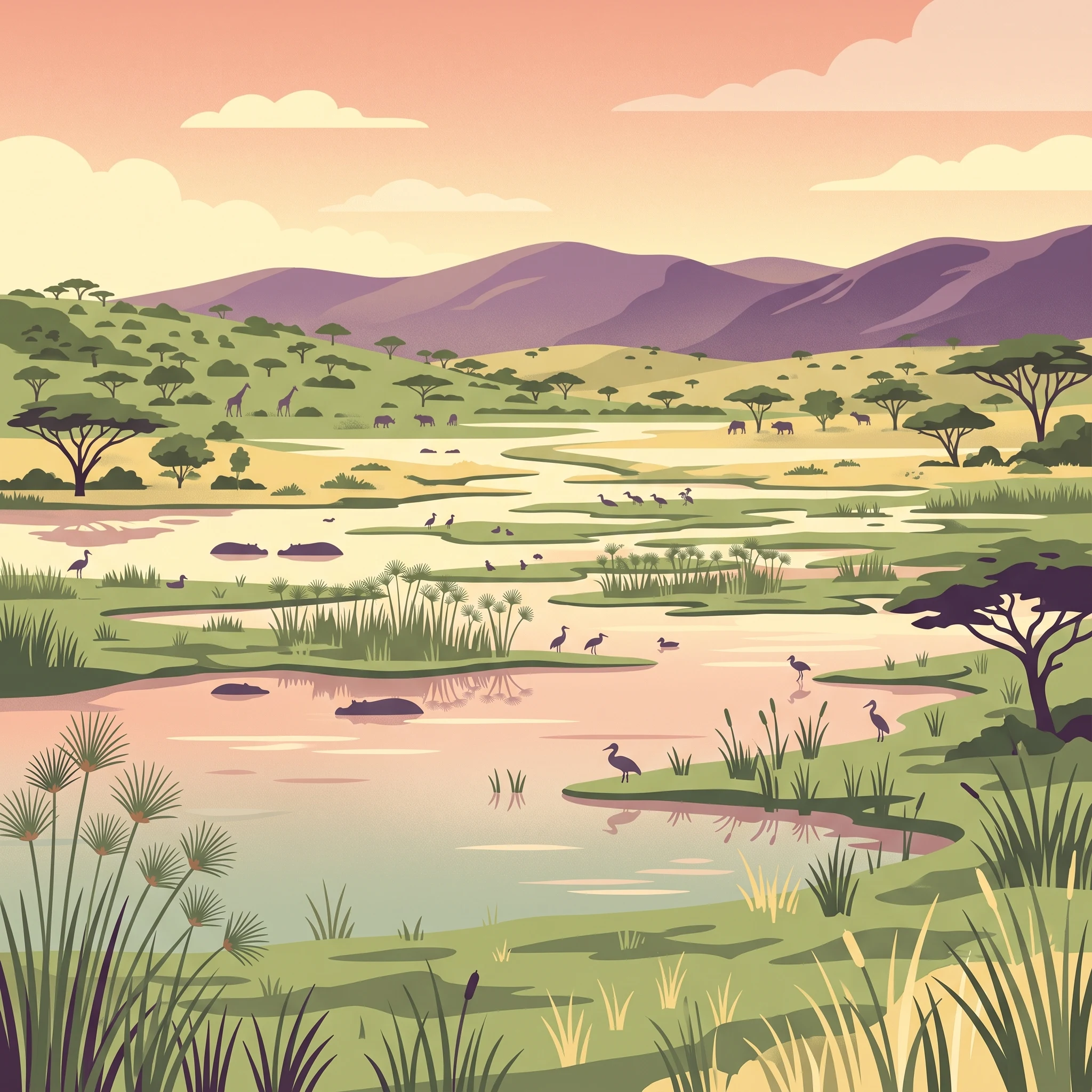
The landscape of Akagera National Park combines rolling savanna plains, acacia woodlands, and an extensive network of wetlands. The terrain is characterized by gentle slopes descending from Rwandas central highlands toward the Kagera River valley, creating a mosaic of grassland, woodland, and swamp habitats. The park contains a chain of lakes including Lake Ihema, Lake Rwanyakizinga, and smaller bodies fed by the Kagera River system. Papyrus swamps dominate the wetland areas, forming dense stands along lake margins and water channels that cover over a third of the parks area. The savanna habitats feature scattered acacia trees and tall grasses that turn golden during the dry season, creating classic East African scenery. The eastern boundary follows the Kagera River, which flows northward to join Lake Victoria and eventually the Nile. The combination of permanent water bodies, seasonal flooding, and terrestrial savanna creates a diverse landscape that supports both wetland-dependent species and savanna wildlife.

Akagera National Park ecosystems, habitats, and plant life

The ecological character of Akagera reflects its position as a transition zone between East African savanna ecosystems and Central African forest habitats. The parks savanna landscapes support characteristic grassland communities dominated by species such as star grass and red grass, interspersed with acacia woodlands that provide important dry-season browse for giraffes and elephants. The wetland system represents the largest protected freshwater habitat in the region, with papyrus swamps and open water bodies providing critical habitat for aquatic birds, hippos, and crocodiles. The Kagera River system serves as an important migratory corridor for fish species and supports one of the most productive freshwater fisheries in Rwanda. The parks diverse habitats also include montane forest patches in the western sections, adding to the ecological complexity. These varied environments create conditions for exceptional biodiversity, with the park supporting numerous mammal species, over 400 bird species, and significant populations of reptiles and amphibians.

Akagera National Park wildlife and species highlights

Akagera National Park supports diverse wildlife populations across its savanna and wetland habitats. The parks mammalian residents include African bush elephants, African buffalo, giraffes, zebras, and various antelope species including topi, impala, and waterbuck. Predators include African leopards and a growing population of lions reintroduced in 2015, now numbering over 50 individuals. The wetland areas support large populations of hippos and Nile crocodiles, with the lakes providing important habitat for waterfowl and wading birds. The parks birdlife includes herons, storks, egrets, and the iconic African fish eagle. Following the reintroduction of eastern black rhinoceroses from South Africa in 2017 and subsequent translocations, the park now hosts all of Africas Big Five: lion, leopard, elephant, rhino, and buffalo. White rhinoceroses were added in 2021, making Akagera one of the few parks with both black and white rhino populations.

Akagera National Park conservation status and protection priorities

Akagera National Park represents one of Africas most significant conservation success stories of the past two decades. The parks transformation from a depleted ecosystem to a thriving protected area demonstrates the potential of public-private partnerships in wildlife conservation. Management efforts have focused on habitat protection, anti-poaching enforcement, and species reintroduction programs that have restored biodiversity lost during the 1990s. The 120-kilometer boundary fence has reduced human-wildlife conflict and prevented cattle encroachment into core conservation areas. The reintroduction of lions and multiple rhino species has reestablished ecological processes dependent on apex predators. The parks revenue generation, reaching 4.8 million dollars in 2023, demonstrates that sustainable tourism can fund conservation operations with 92 percent of operating costs covered by park income. Akagera now serves as a model for conservation in Rwanda and the broader Great Lakes region, showing how investment in protection and species management can restore degraded protected areas.

Akagera National Park cultural meaning and human context

The Akagera region has historically been important for local communities who have utilized the lakes and wetlands for fishing and the savanna for livestock grazing. The Kagera River and associated wetlands hold cultural significance for communities along its banks, providing resources and transportation routes. The parks name derives from the Kagera River, known in local languages as the river that carries many boats. Following the 1994 genocide, population movements and resettlement in the park area created significant challenges for wildlife conservation, leading to the loss of several species. The current management model recognizes the importance of engaging local communities in conservation, with park revenues supporting surrounding villages and employment opportunities. The parks location along the Rwanda-Tanzania border also positions it within broader regional conservation efforts, connecting to Tanzanias Serengeti ecosystem.

Top sights and standout views in Akagera National Park

The restoration of Akagera National Park stands as a remarkable conservation achievement, with the parks Big Five populations representing successful species reintroductions. The extensive wetland system featuring Lake Ihema and papyrus swamps provides exceptional wildlife viewing opportunities, particularly for hippos, crocodiles, and waterbirds. Game drives across the savanna plains offer sightings of elephants, buffalo, giraffes, and an increasing lion population. The parks position as the largest protected wetland in East-Central Africa gives it regional significance for migratory birds and freshwater biodiversity. The Kagera River, one of the Niles major sources, flows along the parks boundary, adding to its geographic importance.

Best time to visit Akagera National Park

The best time to visit Akagera National Park is during the dry season from June to September, when wildlife congregates around water sources and vegetation is less dense, making animal spotting easier. The dry months offer prime conditions for game viewing as animals concentrate near the lakes and rivers. The wet season from October to May brings green landscapes and excellent birdwatching, with migratory species present. The parks accessibility and self-sustaining tourism model mean it can be visited year-round, though the dry season generally offers more reliable wildlife sightings.
Park location guide

Geography guide, regional context, and park location map for Akagera National Park

Akagera National Park park geography, regions, and map view in Rwanda
Understand where Akagera National Park sits in Rwanda through a broader geographic reading of the surrounding landscape, nearby location context, and its mapped position within the national park landscape.

How Akagera National Park fits into Rwanda

Rwanda is a landlocked East African nation bordered by Uganda, Tanzania, Burundi, and the Democratic Republic of the Congo. The country features mountains in the west, savanna in the southeast, and several volcanoes in the northwest forming part of the Virunga chain. It has a tropical highland climate with two rainy and two dry seasons annually.

Wider geography shaping Akagera National Park in Rwanda

Rwanda lies in the Great Rift Valley of East Africa, bordered by Uganda to the north, Tanzania to the east, Burundi to the south, and the Democratic Republic of the Congo to the west. The western region features mountains and lakes, while the southeast consists of savanna. Several volcanoes forming part of the Virunga Mountains are located in the northwest.

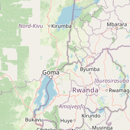
Map view of Akagera National Park

Use this park location map to pinpoint Akagera National Park in Rwanda, understand its exact geographic position, and read its mapped placement within the surrounding landscape more clearly.

Pigeon | © OpenStreetMap contributors

Location context for Akagera National Park

Eastern Province
Park atlas

Map the geographic spread of adjacent protected areas, comparing savanna and wetland conservation landscapes across East-Central Africa.

Browse Other National Parks and Protected Areas Around Akagera National Park and its Eastern African Geography
Browse national parks and protected areas located near Akagera National Park, tracing similar savanna and wetland ecosystems across the broader East-Central African region. Discover how these conservation landscapes connect geographically, allowing for in-depth comparison of their unique terrain, wildlife habitats, and protected status for comprehensive atlas-style browsing.
National parkKagera Region

Rumanyika-Karagwe National Park: Protected Landscape and Geographic Context in Kagera Region

Explore the mapped boundaries and regional setting of this national park.

Rumanyika-Karagwe National Park serves as a vital protected landscape within the Kagera Region of Tanzania. This entry facilitates a geographic discovery of the park, highlighting its mapped outlines and its role as a national park. Users can gain an understanding of its regional landscape context, providing a solid foundation for atlas-based exploration and appreciating the park's protected area status.

Area
247 km²
Established
2019
IUCN
II
Climate
Tropical
National parkKagera Region

Ibanda-Kyerwa National Park: Tanzania's Tri-Border Protected Landscape and Geographic Atlas

Savanna, riparian habitats, and vital regional geography exploration.

Delve into Ibanda-Kyerwa National Park, a recently established national park in Tanzania's Kagera Region. This protected area is distinguished by its critical location at the tri-border with Uganda and Rwanda, with the Kagera River system defining its unique savanna and riparian landscapes. Understanding its mapped boundaries and ecological context provides essential insight into protected land discovery in northwestern Tanzania and its role within the wider regional atlas.

Area
200 km²
Established
2019
IUCN
II
Relief
Highland
National parkTanzania

Burigi-Chato National Park: Protected Landscape Atlas Entry for Tanzania

Explore the mapped geography and terrain of this Tanzanian national park.

Burigi-Chato National Park serves as a distinct protected area within Tanzania, detailed here for its geographic significance and atlas exploration value. Users can delve into the park's specific landscape characteristics, its protected boundaries, and its regional setting. This content is designed to support a deeper understanding of conservation lands and natural terrain within the East African context, offering a factual entry point for detailed geographic discovery.

Area
4,707 km²
Established
2019
IUCN
II
Relief
Mixed relief
National parkGeita Region

Rubondo Island National Park: Tanzanian National Park Geography and Mapped Boundaries

Explore the protected landscape within Geita Region.

Delve into the protected landscape of Rubondo Island National Park, a designated national park situated in Tanzania's Geita Region. This page provides essential geographic context, detailing the park's mapped boundaries and its contribution to the regional atlas. Understanding Rubondo Island National Park involves exploring its specific terrain and its significance as a protected natural area within the broader landscape.

Area
456.8 km²
Established
1965
IUCN
II
Visitors
1.5K annual
National parkRwanda

Volcanoes National Park: Rwanda's Protected Volcanic Landscape and Regional Geography

Mapped park boundaries and East African geographic context.

Delve into Volcanoes National Park, a crucial protected area within Rwanda's northwest. This page offers detailed insight into its geography, highlighting the volcanic terrain and mapped boundaries that define this important national park. Understand its placement within the Virunga Mountains and its contribution to the natural landscape of East Africa, providing a foundation for atlas-based exploration of protected lands.

Area
160 km²
Established
1925
IUCN
II
Relief
Mountain
National parkWestern Province

Gishwati Forest National Park: Discover Rwanda's Protected Landscape Geography

Mapped protected area boundaries and regional natural landscape.

Gishwati Forest National Park offers a focused exploration of a significant protected natural landscape in Rwanda's Western Province. This resource provides detailed geographic context, highlighting the park's mapped boundaries and its role within the country's conservation areas. Understand its terrain and regional landscape importance through an atlas-centric view.

Area
32.02 km²
Established
2015
IUCN
IV
Relief
Mountain
National parkBurundi

Ruvubu National Park: A National Park in Burundi Focused on Protected Landscape Geography

Explore the mapped boundaries and regional context of Ruvubu.

Investigate Ruvubu National Park, a protected natural area in Burundi, and understand its geographic significance. This page serves as a detailed atlas entry, highlighting the park's mapped extent and its contribution to the regional landscape of East Africa. Explore the protected-area context and geographical features that define Ruvubu National Park for discovery and analysis.

Area
508 km²
Established
1980
IUCN
II
Relief
Mixed relief
National parkUganda

Queen Elizabeth National Park: Mapped Protected Landscape in Uganda's Geography

Explore Uganda's National Park map and terrain.

Queen Elizabeth National Park represents a significant protected landscape within Uganda, offering a rich context for geographic exploration. As a national park, its mapped boundaries define a unique area for understanding the region's natural terrain and landscape character. This destination provides structured data essential for atlas-based discovery, allowing users to analyze its geographic positioning and its role within Uganda's conservation areas.

Area
1,978 km²
Established
1952
IUCN
II
Relief
Mixed relief

Common questions about visiting, size, designation, and location context for Akagera National Park

Akagera National Park FAQs for park facts, access, geography, and protected area context
Find quick answers about Akagera National Park, including protected-area facts, park geography, trail and visitor context, and how the park fits into its surrounding country and regional landscape.
MoriAtlas Explorer

Continue Your Protected Areas Search Across the Global Atlas

Deepen your exploration by continuing the structured search for national parks and protected areas worldwide. Utilize the comprehensive filtering capabilities to compare different conservation landscapes and refine your understanding of global park geography. Discover more about the distribution and characteristics of protected natural areas.

Global natural geography



