
Why Cañón del Usumacinta stands out
The protected area is most recognized for the spectacular canyon of the Usumacinta River and the extensive tracts of high evergreen rainforest that line its slopes. It is also known for the San José and Desempeño rapids, which draw rafting activity, and for the karst features of the region, including the cenotes Ya Ax Ha and Aktun Ha and caves such as the Cueva del Tigre and Cueva de la Ventana with their stalactites and stalagmites. Its integration into the Mesoamerican Biological Corridor and its proximity to Maya archaeological sites, particularly Pomoná and San Claudio, also give it a strong profile as both a biodiversity and cultural landscape. The jaguar, the tapir, the manatee, and the ocellated turkey are among the species that help define the area's conservation identity.
Cañón del Usumacinta history and protected-area timeline
The protected area has a relatively short but layered administrative history. On 15 June 2005, the territory was first decreed as a state-level ecological reserve, recognizing the ecological importance of the Usumacinta canyon and its surrounding forests under Tabasco jurisdiction. Three years later, on 22 September 2008, the area was elevated to federal status as an Área de protección de flora y fauna, placing it under the oversight of Mexico's National Commission of Natural Protected Areas (CONANP).
The federal designation brought the area into the Mexican system of Areas de protección de flora y fauna, a category oriented toward safeguarding flora, fauna, and related ecosystems rather than prohibiting all human activity. It also formally linked the reserve to broader national and regional conservation frameworks, including the Mesoamerican Biological Corridor, which connects protected areas between southeastern Mexico and Central America.
Cañón del Usumacinta landscape and geographic character
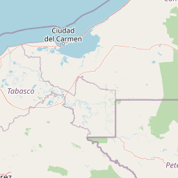
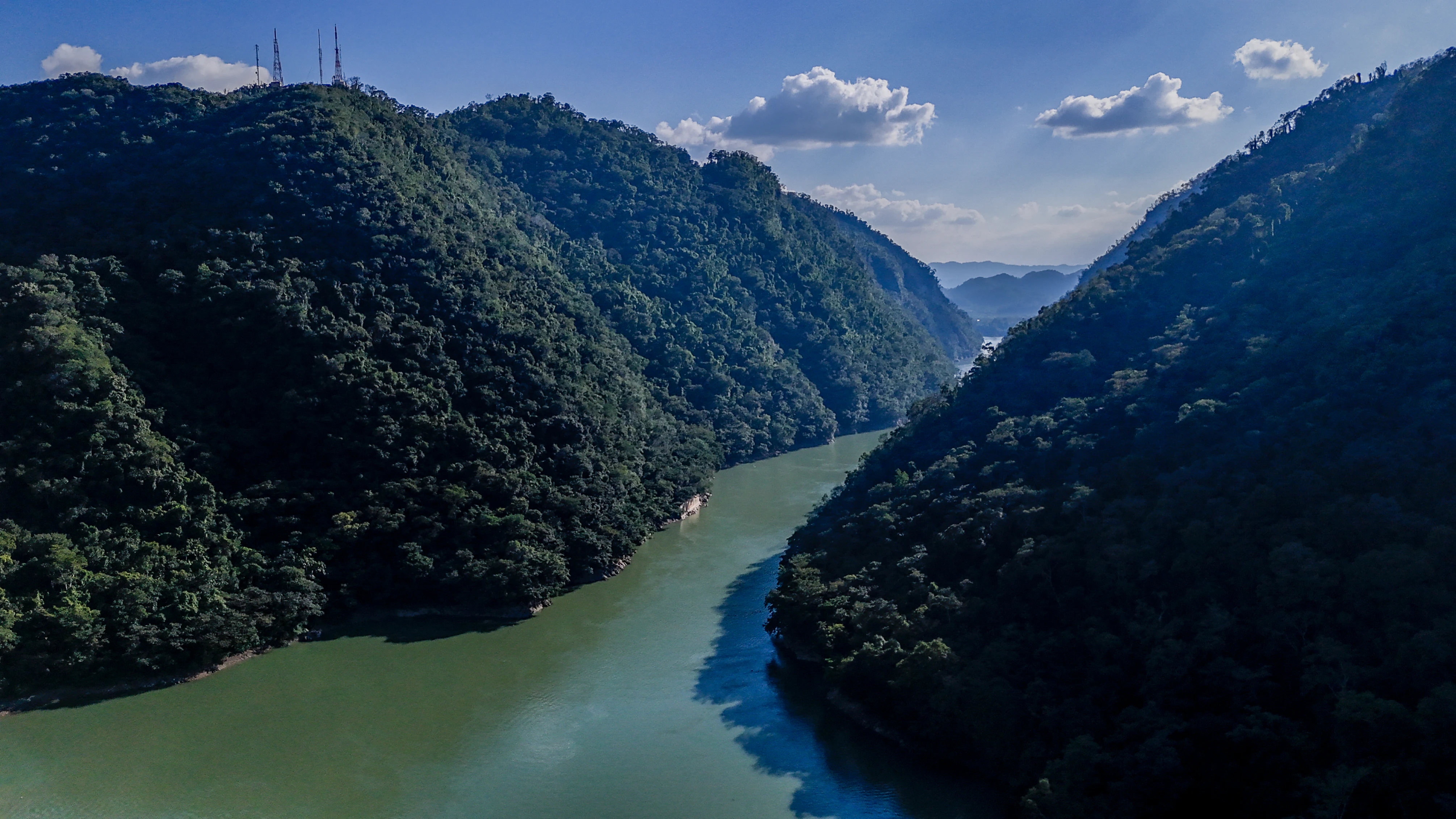
The landscape is built around the canyon of the Usumacinta River, one of the largest and most important rivers in Mesoamerica. The river here forms the boundary between Mexico and Guatemala, with the protected area lying along its Mexican bank. The canyon walls and surrounding terrain are cloaked in continuous high evergreen rainforest, giving the region a deeply forested, riverine character that contrasts strongly with the wetlands and coastal plains more commonly associated with Tabasco.
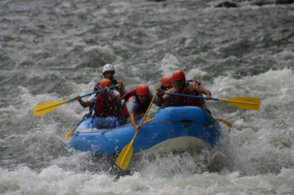
Within the canyon, the river generates notable rapids, including the San José and Desempeño rapids, which are focal points for adventure activity and scenic appreciation. The underlying geology supports a karst landscape marked by sinkholes, caves, and cenotes. The cenotes Ya Ax Ha ("Agua azul verde") and Aktun Ha ("Cenote de la cueva") near the ejido of Santo Tomás are emblematic of this subterranean and aquatic character, as are the Cueva del Tigre and Cueva de la Ventana, both known for their speleothems and their archaeological traces. Topographically, the area forms a transition between the forested lowlands of Tabasco and the rising terrain toward the Petén and the Guatemalan Maya Biosphere Reserve.
Cañón del Usumacinta ecosystems, habitats, and plant life
Ecologically, the reserve is dominated by high evergreen rainforest, locally known as selva alta perennifolia. This forest type forms a dense, multistory canopy, with an upper stratum dominated by large hardwood species such as chicozapote, zapote, ramón, guapaque, and canshán, some of whose emergent individuals reach roughly 45 meters. A middle canopy includes bojón, chacahuante, jobo, and molinillo, while the understory is often populated by clusters of guapaque, masamorro, barí, and shate palms, reflecting historical conditions that favored seedling establishment in specific zones.
The combination of canyon topography, river influence, and continuous forest cover creates a range of conditions that support a particularly diverse flora and fauna. The reserve lies within the Petén biogeographical province, one of the richest biological regions in Mesoamerica, and its plant communities share affinities with the forests of Chiapas and the Maya Biosphere Reserve across the border. This shared ecological foundation is precisely what makes the area function as a biological corridor, allowing species to move and maintain viable populations across the political boundary.
Cañón del Usumacinta wildlife and species highlights
The reserve is recognized as an important refuge and breeding habitat for both local and migratory fauna. Records compiled through CONABIO document more than 760 species of plants and animals across the area's biological inventory, of which approximately 90 species fall within some risk category under Mexico's NOM-059 standard, and a small number are considered exotic.
Among mammals, the area hosts around 38 species, including the tapir, jaguar, ocelot, puma, mantled howler monkey, white-tailed deer, paca, collared peccary, neotropical river otter, West Indian manatee, nine-banded armadillo, common raccoon, and various rodents and bats. Reptiles include the striped iguana, the tropical rattlesnake, and the common snapping turtle. Birdlife includes roughly 40 documented species, notably featuring threatened taxa such as the mealy parrot, the white-crowned parrot, and the ocellated turkey, the last of which is a particularly emblematic species of the Yucatán-Petén forest region. The presence of large cats, large ungulates, primates, parrots, and a freshwater sirenians like the manatee underscores the area's role in protecting both terrestrial and aquatic wildlife in southeastern Mexico.
Cañón del Usumacinta conservation status and protection priorities
The protected area's conservation significance derives from its position within the Mesoamerican Biological Corridor, a regional initiative linking protected areas from southeastern Mexico through Central America in order to maintain ecological connectivity and prevent the genetic and demographic isolation of species. By bridging lowland Tabasco forests with the Maya Biosphere Reserve in Guatemala and the forested landscapes of Chiapas across the Usumacinta River, the reserve helps ensure that forest-dependent species can maintain viable populations across the region.
Its status as a federal Área de protección de flora y fauna places it within Mexico's national system of protected natural areas, with management responsibility resting with CONANP. The area's combination of evergreen rainforest, canyon habitats, river ecosystems, and karst formations supports a notably high proportion of species flagged under Mexico's NOM-059 risk classification, highlighting its value for the protection of threatened flora and fauna. Preservation of these forests also contributes to watershed protection and ecological stability across a transboundary landscape that is central to the biological heritage of Mesoamerica.
Cañón del Usumacinta cultural meaning and human context
The reserve's cultural context is shaped by its position in a landscape long inhabited by Maya peoples and by the continuing traditions of the modern communities that live around it. The area contains recognized Maya archaeological sites, including San Claudio and Pomoná, and additional unreconstructed archaeological localities, while caves such as the Cueva del Tigre and Cueva de la Ventana hold vestiges of ancient Maya presence alongside their natural speleological value.
Outside the protected area itself, the surrounding municipality of Tenosique contributes a strong regional cultural identity. The annual Carnaval de Tenosique, sometimes described locally as one of the most unusual carnivals in the world, includes the traditional Danza del Pochó, a pre-Hispanic-rooted ceremony representing the struggle between good and evil. Local communities also participate in river-based ecotourism, offering boat excursions through the canyon, supporting the cultural and economic linkage between the reserve and the people of the Usumacinta region.
Top sights and standout views in Cañón del Usumacinta
A standout feature of the reserve is its riverine canyon landscape, where the Usumacinta River carves a continuous corridor of evergreen rainforest along the Guatemala-Mexico frontier. The San José and Desempeño rapids, the cenotes Ya Ax Ha and Aktun Ha, and the speleothem-rich Cueva del Tigre and Cueva de la Ventana together define a dramatic combination of river, karst, and forest scenery.
Equally distinguishing are its biological assets: a jaguar and tapir presence, a primate population including the mantled howler monkey, a freshwater manatee population tied to the river system, and threatened parrots and the emblematic ocellated turkey. Combined with its function as a node in the Mesoamerican Biological Corridor and its embedded Maya archaeological sites, these qualities make the protected area one of the most ecologically and culturally integrated natural reserves on Mexico's southern border.
Best time to visit Cañón del Usumacinta
The climate of the reserve is warm and humid year-round, with rains distributed through most of the year, an average annual temperature near 26.8 °C, and mean annual precipitation around 2,614 mm. This pattern means that conditions remain tropical at all times, with dense, always-green vegetation and typically high river levels.
Visit character therefore varies more in terms of river flow, trail conditions, and wildlife visibility than in terms of broad climatic seasons. Periods of slightly less intense rainfall tend to be more comfortable for activities such as boat excursions and visits to cenotes and archaeological sites, while rafting on the San José and Desempeño rapids depends heavily on current river conditions. Travelers interested in combining the natural reserve with the regional culture often time visits to coincide with the Carnaval de Tenosique in February, when the Danza del Pochó and other traditions bring additional cultural intensity to the broader Tenosique region.