Mori Atlas logo
Biosphere reserveMaya Biosphere Reserve

Mapping the karst terrain, tropical forest mosaics, and ancient archaeological density

Maya Biosphere Reserve: A Deep Dive into the Protected Geography of Northern Guatemala

(Reserva de la Biosfera Maya)

The Maya Biosphere Reserve encompasses a vast protected landscape within the Petén Department, safeguarding the largest continuous tract of tropical moist forest remaining north of the Amazon. This atlas entry details the reserve's unique zoning model, which integrates strict core conservation zones with multiple-use regions to protect diverse ecosystems ranging from limestone karst hills and cenotes to expansive wetland networks. Beyond its natural significance, the area serves as a critical repository for ancient Maya civilization, containing dense concentrations of archaeological sites beneath the dense forest canopy.

tropical forestbiosphere reserveUNESCOarchaeological sitesMaya civilizationwetlands
A stylized vector illustration of tiered Mayan pyramid structures rising above a dense green jungle landscape under a soft pastel sky.

Maya Biosphere Reserve

Biosphere reserve

Park overview

Structured park overview, official facts, and landscape profile for Maya Biosphere Reserve

Maya Biosphere Reserve park facts, protected area profile, and essential visitor context

Review the core facts for Maya Biosphere Reserve, including designation, size, terrain, visitor scale, habitats, and operating context in one park-focused overview.

About Maya Biosphere Reserve

The Maya Biosphere Reserve is Guatemala's flagship protected landscape, occupying a vast swath of the Petén region in the country's north. Created in 1990, it represents one of the most ambitious efforts in Central America to safeguard tropical forest, freshwater systems, and cultural heritage within a single coordinated governance framework. The reserve's identity is shaped by the interplay of dense rainforest, seasonal wetlands, karst terrain dotted with cenotes and lakes, and the forested hills where ancient Maya cities remain largely cloaked in jungle vegetation.

Administratively, the reserve is structured around multiple zones that reflect the UNESCO biosphere reserve model. Strictly protected core zones, including national parks such as Tikal, Sierra del Lacandón, Laguna del Tigre, and Mirador-Río Azul, host no human settlement, logging, or resource extraction. Surrounding multiple-use and buffer zones permit regulated activities, with community-based forest concessions for sustainable timber and non-timber products, alongside designated agricultural areas for rural communities. This zoning approach has made the reserve a widely studied case in conservation policy and integrated land management.

Ecologically, the reserve harbors a remarkable range of habitats, from tall tropical broadleaf forests to seasonally flooded wetlands and savanna patches, sustaining threatened species and a deep reservoir of native flora, including valuable hardwoods and palms. Culturally, it is the heartland of ancient Maya civilization, with hundreds of archaeological sites ranging from small settlements to complex urban centers. Major sites such as Tikal draw substantial visitation, while the Mirador Basin is the focus of long-term research into preclassic Maya urbanism. Together, these qualities give the Maya Biosphere Reserve an unusually multidimensional profile as a place of ecological, archaeological, and policy significance.

Quick facts and research context for Maya Biosphere Reserve

The Maya Biosphere Reserve lies in the El Petén department of northern Guatemala, spanning a wide range of tropical ecosystems from lowland rainforest to wetlands and karst terrain crisscrossed by rivers, lakes, and cenotes. It is administered by Guatemala's National Council of Protected Areas (CONAP) and was designated in 1990 as a UNESCO biosphere reserve, placing it within an international framework that seeks to combine conservation with sustainable development.

At roughly 21,600 square kilometers, it is by far the largest protected area in Guatemala and ranks among the most important tropical forest reserves in Central America. Protected species include Morelet's crocodile and the ocellated turkey, and its flora features commercially and ecologically significant trees such as big-leaf mahogany, cedar, breadnut, and logwood. The reserve also contains major Maya archaeological complexes, including Tikal and the preclassic sites of the Mirador Basin.

Protection and recognition

Documented terrestrial protection scope and official UNESCO Biosphere Reserve designation details.

Maya Biosphere Reserve Protection Status and International Recognition Data

Maya Biosphere Reserve protection status details compile verified terrestrial conservation frameworks and official UNESCO biosphere reserve designations into one reference. Structured preservation data provides clear insight into international recognition history without assumptions.

International recognition

Protection details

Protection scope
Terrestrial
Designated year
1990
Transboundary protection
No
Core area
7,670 km²
Buffer area
4,975 km²
Park context

Deeper park guide and search-rich context for Maya Biosphere Reserve

Maya Biosphere Reserve history, landscape, wildlife, and travel context

Explore Maya Biosphere Reserve through its history, landscape character, ecosystems, wildlife, conservation priorities, cultural context, and seasonal travel timing in a structured park guide built for atlas discovery and search intent.

Why Maya Biosphere Reserve stands out

Maya Biosphere Reserve is primarily known for protecting the largest remaining block of tropical moist forest north of the Amazon, a stronghold of wildlife and indigenous tree species in an otherwise heavily altered Central American landscape. It is equally renowned as one of the richest archaeological landscapes in the Maya world, with monumental sites such as Tikal and the lesser-known but vast cities of the Mirador Basin. The reserve is also recognized as a pioneering example of zoned conservation in Latin America, combining strictly protected core areas with multiple-use and buffer zones that support community forest concessions for sustainable harvesting of timber, chicle, xate palm, and allspice. This blend of ecological protection, sustainable forestry, and cultural heritage management distinguishes it from many other large tropical reserves.
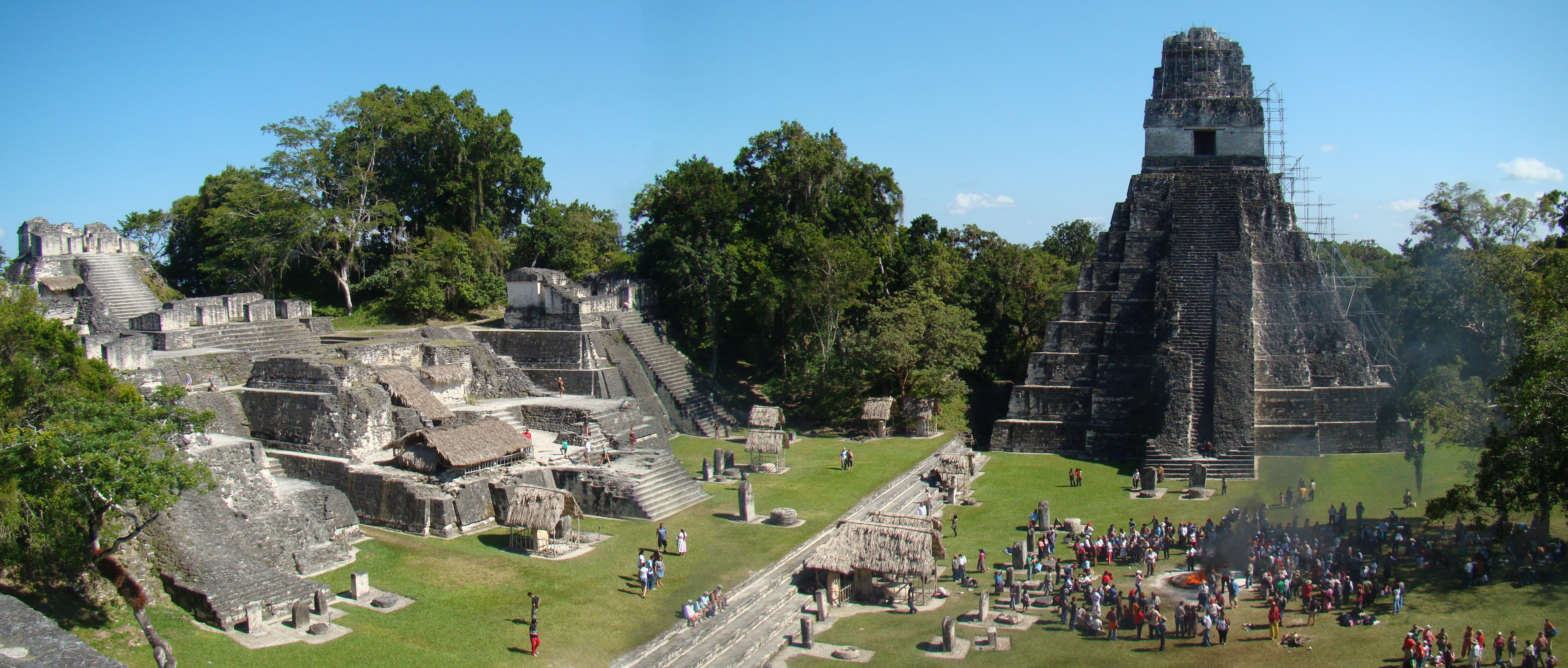
A panoramic wide shot of the Tikal Great Plaza, featuring a tall stone temple on the right, the North Acropolis ruins on the left, and a large crowd gathered in the central grassy plaza.
The Great Plaza and North Acropolis at Tikal, showcasing the ancient Maya architecture nestled within the tropical forest.

Maya Biosphere Reserve history and protected-area timeline

The Maya Biosphere Reserve was formally created in 1990, when Guatemala's government, with support from international partners, designated the Petén forests as a biosphere reserve under UNESCO's Man and the Biosphere Programme. The establishment came at a time when deforestation and agricultural expansion were accelerating across Central America, and the reserve was conceived as a framework for protecting the country's most extensive tropical forest block while still allowing regulated human activity in surrounding areas.

The reserve's management has been shaped by the UNESCO biosphere model, which divides the territory into strict core zones, a buffer zone, and multiple-use zones. Within the multiple-use areas, the government has granted long-term forest concessions to local communities, enabling them to practice sustainable forestry and to harvest traditional products such as chicle, xate palm, and allspice. International certification bodies, including the Forest Stewardship Council, have validated some of these concessions as sustainable, lending the reserve a global profile in community-based conservation.

In 2018, the application of airborne lidar technology near the reserve transformed understanding of the region's Maya archaeology, revealing tens of thousands of previously hidden structures and suggesting that ancient Maya population levels in the Petén Basin were far higher than earlier estimates. This discovery has renewed scholarly and public attention to the archaeological dimension of the reserve and underscored how its historical depth remains an active frontier of research.

Maya Biosphere Reserve landscape and geographic character

The physical landscape of the Maya Biosphere Reserve is defined by broad lowland terrain that rises gently into low mountain ranges and karst hills, much of it cloaked in dense tropical forest. The Petén lowlands are geologically a limestone platform that has weathered into a classic karst landscape, producing sinkholes, caves, and an extensive network of underground drainage that surfaces as cenotes, springs, and rivers.

Wetlands and aquatic features are a defining part of the scenery. The reserve holds lakes, slow-moving rivers, streams, and substantial marshy areas, particularly toward its western and northern edges. Seasonal flooding shapes large tracts of forest, and patches of savanna and palmetto scrub interrupt the otherwise continuous canopy in places, producing a mosaic of textures across the landscape.

In the south, the terrain gradually opens into more agricultural and modified landscapes that form part of the buffer zone, while the north retains remote tracts of unbroken rainforest enclosing the Mirador Basin and other elevated ridgelines. This combination of forest, wetland, karst, and subtle relief gives the reserve a landscape character that is both visually understated and ecologically rich.

Maya Biosphere Reserve ecosystems, habitats, and plant life

Ecologically, the Maya Biosphere Reserve is a stronghold of neotropical moist forest, holding one of the largest continuous tracts of tropical broadleaf forest left in Mesoamerica north of the Amazon basin. Its vegetation ranges from tall evergreen and semi-evergreen rainforests dominated by mahogany, cedar, and breadnut to seasonally inundated wetlands and palm-rich swamp forests along rivers and lakes.

The reserve's plant communities reflect transitions between broad forest types and localized microhabitats tied to soils and water availability. Native flora includes hardwoods, palms such as xate, and economically significant species like allspice. In some areas, mangrove elements and bloodwood, logwood, and black olive trees indicate the influence of both freshwater and brackish-water conditions.

Habitats within the reserve support a wide array of fauna, from aquatic species in rivers and wetlands to forest-dwelling birds, mammals, and reptiles, while the combination of closed canopy forest, open marsh, and aquatic environments sustains a complex food web. This ecological diversity, compressed into a single contiguous protected area, is one of the reserve's defining natural values.

Maya Biosphere Reserve wildlife and species highlights

The Maya Biosphere Reserve sustains a notably rich fauna for Central America, benefiting from its extensive forests and intact wetland systems. Among its signature species is Morelet's crocodile, which inhabits the reserve's lakes, rivers, and flooded areas, and the ocellated turkey, a striking bird endemic to the Yucatán Peninsula region and a focal species for birdwatchers and conservation efforts.

The broader wildlife community includes mammals such as ungulates, carnivores, and primates typical of the Petén forests, along with a diverse herpetofauna of snakes, lizards, and amphibians. Avian diversity is particularly high, with raptors, parrots, toucans, and waterbirds occupying different niches across forest, wetland, and edge habitats. Seasonal movements of migratory species add further variety to the reserve's birdlife.

Wildlife in the reserve faces ongoing pressures from habitat loss, illegal hunting, and fragmentation linked to encroachment, particularly outside the strictly protected core zones. The continued presence of wide-ranging species such as large cats and crocodilians is considered an important indicator of the reserve's relative ecological integrity compared to surrounding landscapes.

Maya Biosphere Reserve conservation status and protection priorities

Conservation significance is central to the Maya Biosphere Reserve: it protects the largest area of American tropical forest remaining north of the Amazon, making it a critical refuge for biodiversity in a region where forest cover has been heavily reduced. Its inclusion in UNESCO's Man and the Biosphere network reflects an internationally recognized effort to integrate biodiversity protection with sustainable land use.

The reserve's zoned structure is itself a conservation strategy, isolating the most ecologically and culturally sensitive areas as strictly protected cores while channeling economic activities into regulated buffers. Community forest concessions in the multiple-use zones, certified by organizations such as the Forest Stewardship Council, have positioned the reserve as a leading example of sustainable forestry linked to local livelihoods.

Despite these efforts, the reserve faces continuing pressure from illegal logging, cattle ranching, and small-scale agricultural expansion, with documented forest loss in parts of the Laguna del Tigre and Sierra del Lacandón areas. Conservation organizations, including the Rainforest Alliance, work in the region on community development and forest monitoring, while the National Council of Protected Areas (CONAP) oversees enforcement and concession management.

Maya Biosphere Reserve cultural meaning and human context

The Maya Biosphere Reserve is inseparable from the cultural heritage of the Maya civilization, whose cities, causeways, reservoirs, and ceremonial complexes lie scattered throughout its forests. Ancient settlements range from modest habitation sites to vast ceremonial centers, with Tikal standing as the most iconic and the Mirador Basin representing a dense cluster of interconnected preclassic cities.

Long before modern conservation designations, the Petén lowlands supported thriving indigenous societies whose descendants remain present in the region today. Communities within and around the reserve continue traditional practices such as the harvesting of chicle, xate, and allspice, and forest concessions have explicitly recognized these cultural and economic ties to the landscape.

The reserve also faces the challenge of cultural resource protection, with looting of Maya artifacts identified as one of the ongoing threats to the area. International archaeological collaborations, including long-term projects at El Mirador and other sites, have helped frame the reserve not only as a natural protected area but as a shared heritage landscape of global significance.

Top sights and standout views in Maya Biosphere Reserve

Among the reserve's standout features is the sheer scale of contiguous tropical forest protection, encompassing habitats from dense rainforest to wetland systems within a single integrated framework. The strict core zones, including Tikal, Sierra del Lacandón, Laguna del Tigre, and Mirador-Río Azul national parks, anchor the reserve's most ecologically intact areas, while buffer and multiple-use zones host some of the most extensive certified community forestry concessions in the region.

Equally distinctive is the archaeological density of the reserve. From the famous Maya metropolis of Tikal, which draws the largest share of visitors, to the remote preclassic cities of the Mirador Basin and other lesser-known sites, the reserve functions as an open-air archive of Maya civilization. The 2018 lidar discoveries further amplified this profile by revealing the true scale of past urban networks beneath the forest canopy.

Together, these natural and cultural highlights make the Maya Biosphere Reserve unusual in combining world-class biodiversity, an internationally influential conservation zoning model, and an extraordinary concentration of ancient Maya heritage within a single contiguous landscape.

Best time to visit Maya Biosphere Reserve

The dry season, generally running from roughly December through April, is widely associated with the most favorable conditions for visiting the Maya Biosphere Reserve. During these months, trails and archaeological sites are more accessible, forest mosquitoes and biting insects are less pervasive, and exposed Maya architecture stands out clearly against the surrounding vegetation, enhancing both wildlife viewing and sightseeing at sites such as Tikal.

By contrast, the wet season brings heavy rains, rising humidity, and swollen rivers and wetlands, which can make remote areas harder to reach but also intensify the lushness of the rainforest and the activity of many bird and amphibian species. Birdwatchers often favor transitional periods at the edges of the rainy season, when migrant and resident species are both active.

Travelers interested in the reserve's aquatic habitats should be aware that water levels rise substantially during the rains, while those focused on archaeological exploration typically prefer the cooler, drier months for greater comfort and visibility.
Monthly climate preview

Long-term representative point measurements tracking monthly temperature and precipitation rhythms

Maya Biosphere Reserve Climate Normals and Annual Weather Patterns

Representative coordinate records show measured monthly temperature variations alongside shifting precipitation rates across the landscape. Reviewing complete twelve-month normals provides detailed context for long-term meteorological patterns and regional environmental conditions.
Annual mean26 °C
23 °C30 °C
Jan23°
Feb24°
Mar27°
Apr30°
May30°
Jun27°
Jul26°
Aug27°
Sep26°
Oct25°
Nov23°
Dec23°
Warmest month
April

29.9 °C

Coolest month
January

22.5 °C

Wettest month
June

8.7 mm/day

Driest month
March

1.1 mm/day

Park location guide

Geography guide, regional context, and park location map for Maya Biosphere Reserve

Maya Biosphere Reserve park geography, regions, and map view in Guatemala

Understand where Maya Biosphere Reserve sits in Guatemala through a broader geographic reading of the surrounding landscape, nearby location context, and its mapped position within the national park landscape.

How Maya Biosphere Reserve fits into Guatemala

Guatemala is a presidential republic in Central America with a population of approximately 18.6 million, making it the most populous country in the region. The country was the heartland of the Maya civilization and gained independence from Spain in 1821. Guatemala has a diverse population including Maya, Ladino, Xinca, and Afro-Guatemalan communities, with Spanish as the official language.

Wider geography shaping Maya Biosphere Reserve in Guatemala

Guatemala is located in northern Central America, bordered by Mexico to the north and west, Belize to the northeast, Honduras to the east, El Salvador to the southeast, and the Pacific Ocean to the south. The terrain is predominantly mountainous with highlands, volcanic ranges, and coastal lowlands. The country includes the Petén region, a large lowland jungle area in the north.

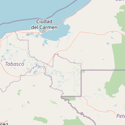
Map view of Maya Biosphere Reserve

Use this park location map to pinpoint Maya Biosphere Reserve in Guatemala, understand its exact geographic position, and read its mapped placement within the surrounding landscape more clearly.

Pigeon | © OpenStreetMap contributors

Location context for Maya Biosphere Reserve

Petén Department
Recorded earthquake history

Explore Historical Earthquake Records Associated With the Maya Biosphere Reserve

Access a structured collection of seismic data recorded in the vicinity of the Maya Biosphere Reserve. This catalogue allows for the investigation of historical tremor patterns in the Petén department through a clear, map-based interface that maintains geographic context.

Maya Biosphere Reserve Earthquake History

Catalogued events

37 events

Strongest magnitude

Magnitude 4.8

Most recent event

Aug 7, 2024

This history includes earthquakes recorded inside the park or within 50 km of its borders

Explore protected area views, tropical forest terrain, and ecological habitats across northern Guatemala.

Maya Biosphere Reserve Photos and Landscapes: Visual Guide to Scenery and Habitats

Visual documentation captures the dense rainforest canopy, wetland networks, and ancient archaeological architecture defining the Petén lowlands. Examining national park photography reveals the complex topography and zoned conservation character spanning this vast protected landscape.

A panoramic wide shot of the Tikal Great Plaza, featuring a tall stone temple on the right, the North Acropolis ruins on the left, and a large crowd gathered in the central grassy plaza.

A wide aerial view showing a dense green forest canopy with a large, tree-covered mound identified as the El Tigre pyramid in the center-right.

Park atlas

Compare regional geography and surrounding conservation areas in Mesoamerica

Explore Parks Near Maya Biosphere Reserve and Connected Protected Landscapes

Browse nearby national parks and protected areas sharing the broader ecological and archaeological footprint of Maya Biosphere Reserve. Continuing into these adjacent lowland forests and karst landscapes expands your understanding of regional conservation and Mesoamerican heritage.
Natural monumentChiapas
About 0.3 km away#1 closest

South

Yaxchilan Natural Monument: Geography and Protected Rainforest Boundaries in Chiapas

A mapped overview of river-cradled jungle terrain.

Yaxchilan encompasses a vital protected landscape within the Chiapas rainforest, centered on the dynamic Usumacinta River meander. This park record maps the intersection of tropical forest ecosystems and historical monument sites, offering a grounded look at the physical terrain, river-borne geography, and the natural corridors preserved within this distinct Mexican natural monument.

Relief
Lowland
Climate
Tropical
Access
Moderate access
Scope
Terrestrial
A soft watercolor painting of green rolling hills and lush vegetation, presented in a wide, panoramic style.
Protected areaBelize
About 0.9 km away#2 closest

East

El Pilar Archaeological Protected Area: Maya Monuments and Forested Landscapes in Belize

Binational heritage zone on the Belize and Guatemala border

El Pilar is a significant Maya archaeological site characterized by its vast collection of plazas and causeways that span the international frontier. The protected area features extensive tropical broadleaf forest that cloaks ancient stone monuments, showcasing an integrated approach to cultural heritage and ecological conservation within the Belize River valley escarpment.

Area
20 km²
Established
1998
Relief
Upland
Climate
Tropical
A soft watercolor illustration of a landscape with green trees, pink flowering bushes, and small plants against a pale, distant hilly background.
Wildlife reserveChiapas
About 6.5 km away#3 closest

South

Área de protección de flora y fauna Chan-Kin: Mapped Wildlife Reserve and Forest Landscape

Exploring protected tropical lowland ecosystems in eastern Chiapas

Área de protección de flora y fauna Chan-Kin represents a critical conservation node within the Selva Lacandona. This protected area maintains a continuous high-canopy forest structure, playing a decisive role in regional biodiversity and the persistence of wide-ranging tropical species across the Usumacinta basin.

Area
121.85 km²
Established
1992
Relief
Lowland
Climate
Tropical
National parkCayo District
About 9.7 km away#4 closest

East

Elijio Panti National Park: Protected Landscape and Regional Geography in Cayo District

Explore the mapped boundaries and geographic features of this national park.

Elijio Panti National Park offers a unique focus on protected landscape discovery within Belize. Situated in the Cayo District, this national park provides a specific geographic anchor for understanding natural terrain and mapped boundaries. The page details its identity as a protected area, contributing to a structured atlas of conservation lands and regional geography.

Area
52.645 km²
Established
2001
IUCN
II
Relief
Mountain
National parkCayo District
11 km away#5 closest

East

Chiquibul National Park: Detailed Protected Area and National Park Geography

Explore mapped boundaries within Belize's Cayo District.

Chiquibul National Park offers a critical lens through which to view Belize's protected natural areas. As a designated national park located in the Cayo District, it provides essential data for understanding the extent and geographic positioning of conservation landscapes. Users can engage with detailed map information to trace the park's borders and appreciate its role within the national atlas of protected territories.

Area
1,073 km²
Established
1995
IUCN
II
Relief
Mountain
A minimalist watercolor illustration showing layers of green hills and distant mountain ridgelines against a white background.
Protected areaMexico
About 20 km away#6 closest

South

Bonampak Protected Area: Geography and Landscape Context of the Lacandon Rainforest

An archaeological and natural monument in Chiapas, Mexico

Bonampak encompasses a rich protected area within the Lacandon rainforest, featuring low-lying jungle terrain and significant cultural heritage sites. This atlas entry examines the physical geography, including the site proximity to the Usumacinta River tributaries, and the preservation of continuous tropical canopy that defines the regional biodiversity and cultural landscape.

Relief
Lowland
Climate
Tropical
Scope
Terrestrial
Water
Minor water
A soft, minimalist watercolor painting showing a winding river flowing through rolling green hills against a white background.
Wildlife reserveTabasco
About 24 km away#7 closest

West

Cañón del Usumacinta Wildlife Reserve: Geography and Protected Area Mapping in Tabasco, Mexico

Tropical rainforest, karst cenotes, and riverine canyons

Cañón del Usumacinta represents an ecologically significant protected landscape in southeastern Mexico. This wildlife reserve features high evergreen rainforest, prominent river rapids, and karst geological features such as cenotes and caves. The reserve maintains critical biological continuity through its position in the Mesoamerican Biological Corridor, bridging remote riverine terrain with significant Maya archaeological sites.

Area
461.28 km²
Established
2005
Relief
Mixed relief
Climate
Tropical
Protected areaChiapas
About 26 km away#8 closest

Southwest

Área de protección de flora y fauna Nahá-Metzabok: A Protected Landscape in Chiapas

Mapping tropical rainforests, karst hydrology, and cultural heritage

The Área de protección de flora y fauna Nahá-Metzabok serves as a vital corridor in the Lacandon Jungle, protecting humid rainforests and rare montane cloud forest habitats. Its rugged karst terrain is characterized by prehistoric rock-art caves and critical aquatic systems that sustain regional river basins, offering a layered study of ecological and cultural significance in southern Mexico.

Area
8,617.49 km²
Established
1998

Common questions about visiting, size, designation, and location context for Maya Biosphere Reserve

Maya Biosphere Reserve FAQs for park facts, access, geography, and protected area context

Find quick answers about Maya Biosphere Reserve, including protected-area facts, park geography, trail and visitor context, and how the park fits into its surrounding country and regional landscape.
MoriAtlas Explorer

Continue Your Protected Areas Search Across the Global Atlas

Deepen your exploration by continuing the structured search for national parks and protected areas worldwide. Utilize the comprehensive filtering capabilities to compare different conservation landscapes and refine your understanding of global park geography. Discover more about the distribution and characteristics of protected natural areas.

Global natural geography