
Streams
Park geography
A structured profile of terrain, hydrology, and regional environmental context in Petén
Physical Geography, Mapped Boundaries, and Landscape Features of Maya Biosphere Reserve
The Maya Biosphere Reserve covers 21602.04 square kilometers within the Petén Department of Guatemala. This geography profile details the mapped boundaries and natural features including rivers, wetlands, forests, and lakes located throughout the reserve. Examine the terrain and landscape classification data that defines the environmental character of this significant protected area.
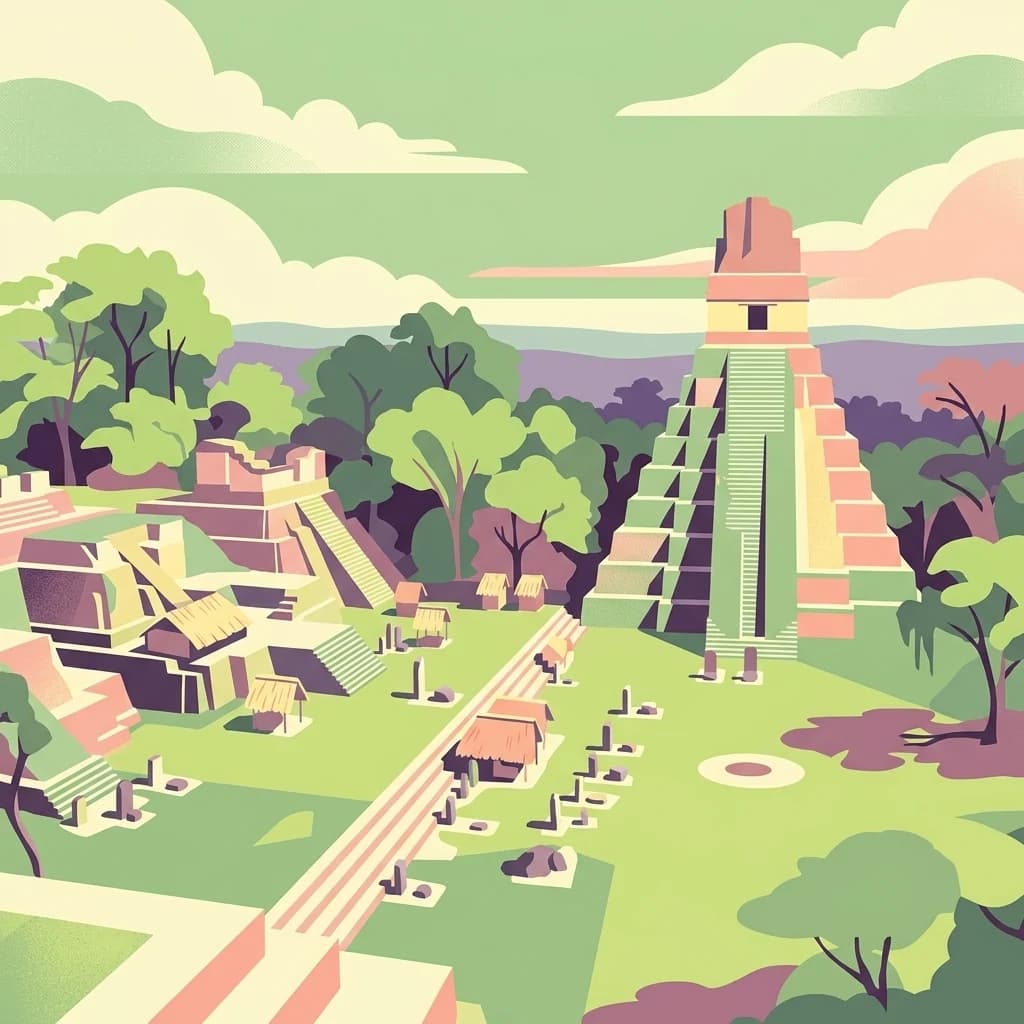
Guatemala's largest protected tropical forest and a cradle of ancient Maya civilization.
Maya Biosphere Reserve
The Maya Biosphere Reserve is a vast protected area located in the Petén region of northern Guatemala, covering roughly one-fifth of the country's land area. It safeguards the largest continuous tract of American tropical forest remaining north of the Amazon, stretching from wetlands and savannas to low mountain ranges and dense rainforest. Established in 1990 under the UNESCO Man and the Biosphere programme, the reserve is managed through a zoned system that balances strict core protection with regulated human use in surrounding buffer and multiple-use zones. It protects a rich mosaic of ecosystems, including tropical forests, wetlands, rivers, lakes, and cenotes, and harbors species such as Morelet's crocodile and the ocellated turkey. Beyond its ecological importance, the reserve contains one of the densest concentrations of ancient Maya archaeological sites anywhere, including the iconic city of Tikal and the interconnected Mirador Basin in the north. Its forests, archaeology, and biodiversity together make it one of the most significant protected landscapes in Mesoamerica.
- Location
- Guatemala
- Park type
- Biosphere reserve
- Established
- 1990
- Area
- 21,602 km²
Location overview
Guatemala and Peten Department regional positioning
Maya Biosphere Reserve Regional Geography and Location Index
Recorded location memberships place Maya Biosphere Reserve within Guatemala and Peten Department. Administrative records confirm the regional context for protected area exploration without marine or transboundary designations.
- Countries
- Guatemala
- Regions
- Petén Department
- Primary location
- Petén Department
- Geographic setting
- Inland
Boundary and coordinates
Interactive spatial geometry, area metrics, and coordinate limits
Maya Biosphere Reserve Boundary Map and Geographic Extent
Interactive spatial mapping outlines the protected perimeter and geographic context for this terrain. Derived measurement metrics detail total surface area, coordinate spans, and central positioning.
- Boundary area
- 20,783.7 km²
- Boundary perimeter
- 783.8 km
- Northernmost point
- 17.8166° N
- Southernmost point
- 16.676° N
- Easternmost point
- 89.1501° W
- Westernmost point
- 91.4396° W
- Geographic centre
- 17.3371° N, 90.1446° W
- North–south span
- 126.2 km
- East–west span
- 243.5 km
Terrain and natural features
Mixed relief classifications and recorded landscape features
Maya Biosphere Reserve Terrain and Natural Features
Explore mixed relief classifications across Maya Biosphere Reserve, featuring recorded natural landmarks within the protected area. Linked feature cards supply official names, types, and spatial relationships for each mapped element.
Selected named natural features
Streams
arroyo
Viewpoints
El Mirador de Chacalacas
Lagoons
Laguna El Repasto
Peaks
330
330 m
Viewpoints
Mirador Estación Biologica Las Guacamayas
Environmental setting
Tropical climate classifications and dominant forest cover settings
Maya Biosphere Reserve Environmental Classifications And Geography
Recorded landscape features, habitat types, and relief categories serve as complementary ways to read the physical setting of Maya Biosphere Reserve. Associated classification groups connect stored environmental attributes directly to related atlas destinations.
- Relief
- Mixed relief
- Climate
- Tropical
- Water
- Major water bodies
- Forest cover
- Dense forest cover
Landscape features
Hills · Forest · Wetland · Lakes · Rivers
Habitat types
Tropical forest · Wetland · Riverine habitat · Lacustrine habitat
Park atlas
Compare regional geography and surrounding conservation areas in Mesoamerica
Explore Parks Near Maya Biosphere Reserve and Connected Protected Landscapes
Browse nearby national parks and protected areas sharing the broader ecological and archaeological footprint of Maya Biosphere Reserve. Continuing into these adjacent lowland forests and karst landscapes expands your understanding of regional conservation and Mesoamerican heritage.
Natural monumentChiapas
About 0.3 km away#1 closest
South

Yaxchilan Natural Monument: Geography and Protected Rainforest Boundaries in Chiapas
A mapped overview of river-cradled jungle terrain.
Yaxchilan encompasses a vital protected landscape within the Chiapas rainforest, centered on the dynamic Usumacinta River meander. This park record maps the intersection of tropical forest ecosystems and historical monument sites, offering a grounded look at the physical terrain, river-borne geography, and the natural corridors preserved within this distinct Mexican natural monument.
- Relief
- Lowland
- Climate
- Tropical
- Access
- Moderate access
- Scope
- Terrestrial
Protected areaBelize
About 0.9 km away#2 closest
East

El Pilar Archaeological Protected Area: Maya Monuments and Forested Landscapes in Belize
Binational heritage zone on the Belize and Guatemala border
El Pilar is a significant Maya archaeological site characterized by its vast collection of plazas and causeways that span the international frontier. The protected area features extensive tropical broadleaf forest that cloaks ancient stone monuments, showcasing an integrated approach to cultural heritage and ecological conservation within the Belize River valley escarpment.
- Area
- 20 km²
- Established
- 1998
- Relief
- Upland
- Climate
- Tropical
Wildlife reserveChiapas
About 6.5 km away#3 closest
South
Área de protección de flora y fauna Chan-Kin: Mapped Wildlife Reserve and Forest Landscape
Exploring protected tropical lowland ecosystems in eastern Chiapas
Área de protección de flora y fauna Chan-Kin represents a critical conservation node within the Selva Lacandona. This protected area maintains a continuous high-canopy forest structure, playing a decisive role in regional biodiversity and the persistence of wide-ranging tropical species across the Usumacinta basin.
- Area
- 121.85 km²
- Established
- 1992
- Relief
- Lowland
- Climate
- Tropical
National parkCayo District
About 9.7 km away#4 closest
East
Elijio Panti National Park: Protected Landscape and Regional Geography in Cayo District
Explore the mapped boundaries and geographic features of this national park.
Elijio Panti National Park offers a unique focus on protected landscape discovery within Belize. Situated in the Cayo District, this national park provides a specific geographic anchor for understanding natural terrain and mapped boundaries. The page details its identity as a protected area, contributing to a structured atlas of conservation lands and regional geography.
- Area
- 52.645 km²
- Established
- 2001
- IUCN
- II
- Relief
- Mountain
National parkCayo District
11 km away#5 closest
East
Chiquibul National Park: Detailed Protected Area and National Park Geography
Explore mapped boundaries within Belize's Cayo District.
Chiquibul National Park offers a critical lens through which to view Belize's protected natural areas. As a designated national park located in the Cayo District, it provides essential data for understanding the extent and geographic positioning of conservation landscapes. Users can engage with detailed map information to trace the park's borders and appreciate its role within the national atlas of protected territories.
- Area
- 1,073 km²
- Established
- 1995
- IUCN
- II
- Relief
- Mountain
Protected areaMexico
About 20 km away#6 closest
South
Bonampak Protected Area: Geography and Landscape Context of the Lacandon Rainforest
An archaeological and natural monument in Chiapas, Mexico
Bonampak encompasses a rich protected area within the Lacandon rainforest, featuring low-lying jungle terrain and significant cultural heritage sites. This atlas entry examines the physical geography, including the site proximity to the Usumacinta River tributaries, and the preservation of continuous tropical canopy that defines the regional biodiversity and cultural landscape.
- Relief
- Lowland
- Climate
- Tropical
- Scope
- Terrestrial
- Water
- Minor water
Wildlife reserveTabasco
About 24 km away#7 closest
West
Cañón del Usumacinta Wildlife Reserve: Geography and Protected Area Mapping in Tabasco, Mexico
Tropical rainforest, karst cenotes, and riverine canyons
Cañón del Usumacinta represents an ecologically significant protected landscape in southeastern Mexico. This wildlife reserve features high evergreen rainforest, prominent river rapids, and karst geological features such as cenotes and caves. The reserve maintains critical biological continuity through its position in the Mesoamerican Biological Corridor, bridging remote riverine terrain with significant Maya archaeological sites.
- Area
- 461.28 km²
- Established
- 2005
- Relief
- Mixed relief
- Climate
- Tropical
Protected areaChiapas
About 26 km away#8 closest
Southwest
Área de protección de flora y fauna Nahá-Metzabok: A Protected Landscape in Chiapas
Mapping tropical rainforests, karst hydrology, and cultural heritage
The Área de protección de flora y fauna Nahá-Metzabok serves as a vital corridor in the Lacandon Jungle, protecting humid rainforests and rare montane cloud forest habitats. Its rugged karst terrain is characterized by prehistoric rock-art caves and critical aquatic systems that sustain regional river basins, offering a layered study of ecological and cultural significance in southern Mexico.
- Area
- 8,617.49 km²
- Established
- 1998
MoriAtlas Explorer
Trace the Protected Boundaries and Natural Geography of Maya Biosphere Reserve
Continue exploring the Maya Biosphere Reserve through this structured geographic analysis. Access detailed information on the reserve's forest-wetland mosaics, karst terrain, and integrated conservation zones, providing a clear window into one of the most significant protected landscapes managed within the MoriAtlas framework.
Browse next
Global natural geography
Explore related park routes
Explore MoriAtlas Global ParksBrowse All MoriAtlas ParksGlobal Park Map DiscoveryMoriAtlas: Browse All CountriesBrowse All MoriAtlas ContinentsNational Park Environment AtlasGrand Canyon National Park AtlasYellowstone National Park AtlasYosemite National Park Atlas and GeographySerengeti National Park AtlasGalápagos National Park Protected LandscapeBanff National Park Geography and AtlasKruger National Park Atlas EntryExplore Uluru-Kata Tjuta National Park GeographyPlitvice Lakes National Park AtlasFiordland National Park Protected LandscapeGreat Smoky Mountains National Park AtlasZion National Park Protected Landscape AtlasAfghanistan National Parks and Protected AreasAlbania National Parks and Protected AreasAlgeria National Parks and Protected AreasAmerican Samoa National Parks and Protected AreasAndorra National Parks and Protected AreasAngola National Parks and Protected AreasAntarctica National Parks and Protected AreasAntigua and Barbuda Park List