
Mori Atlas logo
Natural monumentYaxchilán

Mapping the riverine terrain and jungle ecosystems of a prominent Chiapas protected landscape.

Yaxchilan Natural Monument: An Atlas of Protected Tropical Forest and Maya Archaeological Geography

(Monumento Natural Yaxchilán)

Yaxchilan stands as a critical protected natural monument within the dense rainforest of the Lacandon jungle in Chiapas, Mexico. This atlas entry focuses on the unique horseshoe meander of the Usumacinta River that defines the park geography, tracing the spatial relationship between its monumental temple platforms and the surrounding tropical forest corridor. Researchers and geography enthusiasts can examine the rugged riverbank topography and the expansive, forested protected area that guards this significant cultural and natural site.

Maya archaeological siteClassic Maya civilizationUsumacinta RiverrainforestJacinto jungleChiapas
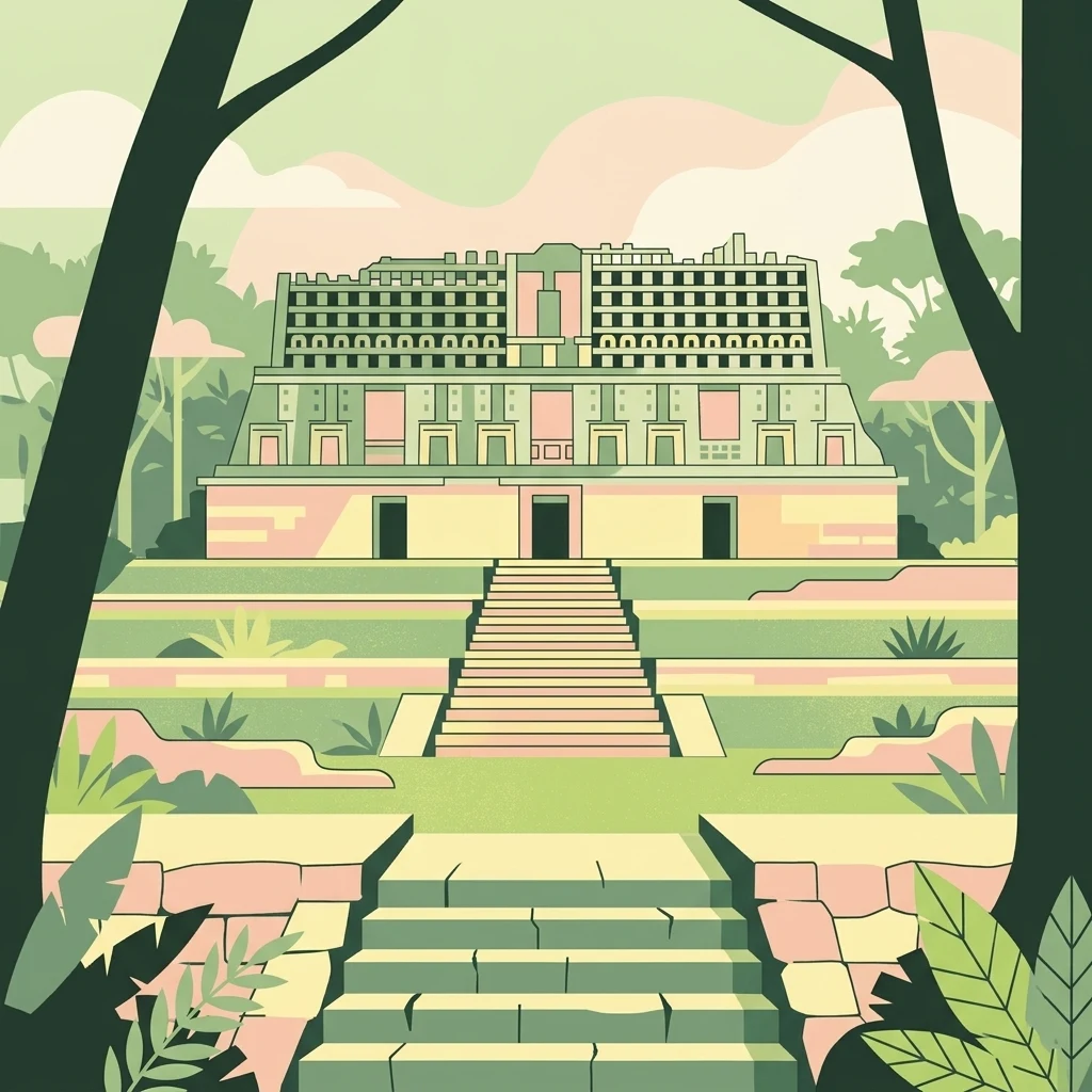
A flat vector-style illustration of a symmetric stone Mayan temple with a central staircase, framed by dark silhouettes of trees in the foreground.

Yaxchilán

Natural monument

Park overview

Structured park overview, official facts, and landscape profile for Yaxchilán

Yaxchilán park facts, protected area profile, and essential visitor context

Review the core facts for Yaxchilán, including designation, size, terrain, visitor scale, habitats, and operating context in one park-focused overview.

About Yaxchilán

Yaxchilán is one of the most important Maya cities of the Classic period and one of the most visually striking archaeological sites in the Maya lowlands. It stands on the south bank of the Usumacinta River in the Lacandon jungle of Chiapas, occupying a natural defensive position on a horseshoe bend of the river, with the only overland approach coming from the south. This riverside geography shaped both the city's commerce, tied to fluvial trade along the Usumacinta, and its military fortunes, since control of the river corridor was the key to regional power.

The city's core is organized into three connected architectural ensembles, the Great Plaza, the Great Acropolis, and the Small Acropolis, all of which are linked by stairways, ramps, and terraces. Around 50 of the roughly 120 known structures can be visited, including the towering Edificio 33, perched on a hill above the river, and the smaller but richly inscribed buildings of the Small Acropolis. Many buildings were aligned to the river rather than to the cardinal directions, and the two ballcourts at the site reflect this unusual orientation.

As a political center, Yaxchilán ruled a sizeable hinterland that included Bonampak and Lacanjá, and its rulers commissioned an extraordinary program of stelae, altars, and especially carved stone lintels that recount their wars, alliances, and ritual lives. These monuments make Yaxchilán one of the principal sources for reconstructing Classic Maya dynastic history and have supported key breakthroughs in deciphering Maya writing, most notably Tatiana Proskouriakoff's pioneering work in the 1960s. Today the archaeological core sits within the Monumento Natural Yaxchilán, a protected natural area that preserves both the ruins and their surrounding tropical forest setting along one of the most important rivers in Mesoamerica.

Quick facts and research context for Yaxchilán

Yaxchilán is a Classic Maya city-state in the Usumacinta basin, located in the municipality of Ocosingo, Chiapas, Mexico. It occupies a bend of the Usumacinta River and is administered as a Natural Monument by Mexico's National Institute of Anthropology and History (INAH). The site contains around 120 identified structures organized into three main architectural groups: the Great Plaza, the Great Acropolis, and the Small Acropolis.

Its occupation spans the Late Preclassic through the end of the Classic period, with monumental construction continuing into the early 9th century before the city was abandoned. The surrounding protected natural area is recorded as hosting more than 1,400 species of plants and animals, including over 150 listed under Mexican wildlife risk categories. Many of Yaxchilán's most important carved lintels now reside in the British Museum and Mexico's National Museum of Anthropology, the result of 19th-century removals.

Protection and recognition

Terrestrial protected area framework and designation records for Yaxchilán

Yaxchilán Protection Status and Documented Conservation Scope

Yaxchilán maintains a documented terrestrial protection scope within its regional landscape. Official conservation data compiles management parameters and recognized designation histories for analysis.

Protection details

Protection scope
Terrestrial
Transboundary protection
No
Park context

Deeper park guide and search-rich context for Yaxchilán

Yaxchilán history, landscape, wildlife, and travel context

Explore Yaxchilán through its history, landscape character, ecosystems, wildlife, conservation priorities, cultural context, and seasonal travel timing in a structured park guide built for atlas discovery and search intent.

Why Yaxchilán stands out

Yaxchilán is best known for its carved stone lintels, monumental hieroglyphic inscriptions, and the unusually detailed political and ritual history they preserve. The lintels of Structures 23, 33, 42, and 44 document royal accessions, war captives, and bloodletting rituals invoking the Vision Serpent, and they form one of the most important bodies of Maya narrative sculpture anywhere in the region. The site is equally known as a powerful Late Classic capital that dominated the middle Usumacinta and competed directly with Piedras Negras, Calakmul, Tikal, and Palenque. Its dramatic location on a horseshoe meander of the Usumacinta, combined with the dense rainforest setting in the modern Natural Monument, gives Yaxchilán a distinctive combination of political, artistic, and ecological significance.
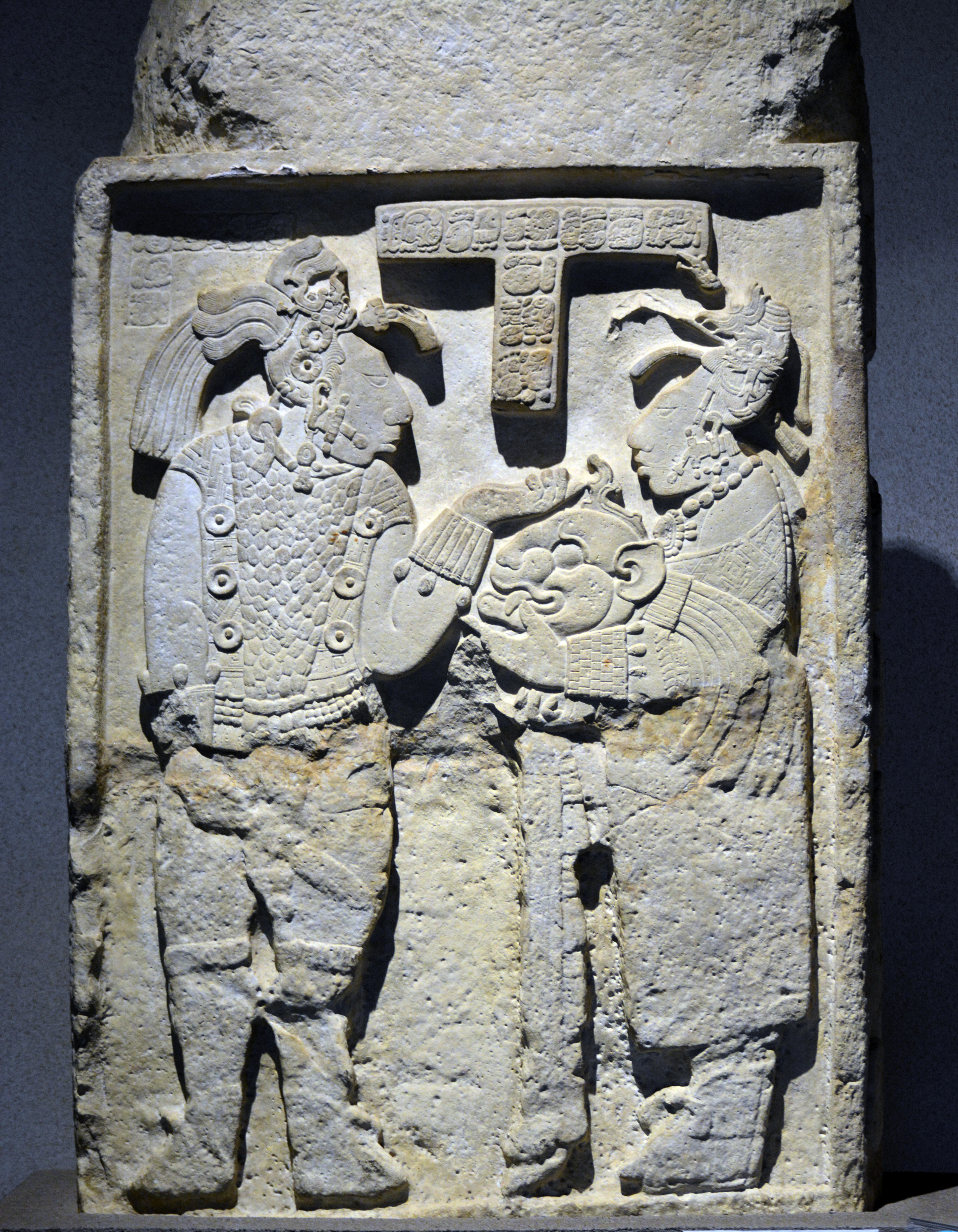
A vertically oriented rectangular limestone lintel featuring detailed relief carvings of two human figures in profile, including a ruler and consort, with Maya hieroglyphs at the top center.
A stone lintel from Yaxchilan, Mexico, featuring intricate Maya relief carvings of a ruler and consort.

Yaxchilán history and protected-area timeline

Yaxchilán's history reaches back into the Late Preclassic, but its rise to prominence came during the Classic period, when the city's rulers began to dominate the middle Usumacinta. The known dynastic sequence begins with Yopaat B'alam I, enthroned in 359, and continues through nearly twenty rulers over more than four centuries. Through warfare, marriage alliances, and control of river trade, Yaxchilán grew from a minor center into the leading power of its stretch of the Usumacinta, rivaling Piedras Negras across the river and asserting itself against Calakmul, Tikal, and Palenque.

The city's greatest era corresponds to the long reign of Itzamnaaj Kokaaj B'alam II (known in older literature as Escudo Jaguar II), who ruled from 681 to 742 and oversaw a major building program that reshaped the central precinct. After him, his sons Yopaat B'alam II and Yaxuun B'alam IV continued his policies, and Yaxuun B'alam IV in particular launched an intense campaign of monument-making that consolidated royal legitimacy. The last ruler with securely dated monuments, K'inich Tatb'u Jol III, reigned into the early 9th century. Archaeological evidence suggests the city was largely abandoned soon after the completion of Edificio 3, ending the dynastic rule of Yaxchilán.

In modern times, Yaxchilán was first reported by Juan Galindo in 1833 and was explored by Alfred Maudslay and Désiré Charnay in 1882, both of whom removed carved lintels for European collections. Teoberto Maler described the site in detail in the early 1900s, the Carnegie Institution mapped it in 1931, and from 1970 Ian Graham systematically recorded its inscriptions. The Mexican Instituto Nacional de Antropología e Historia conducted extended excavations and conservation work here from 1973 to 1990, and the University of Mexico's Pre-Hispanic Mural Painting Project has documented the surviving wall paintings. The site was designated a Natural Monument (Monumento Natural Yaxchilán) and remains administered by INAH, with Lacandon Maya communities continuing traditional pilgrimages to the ancient city.

Yaxchilán landscape and geographic character

The landscape of Yaxchilán is defined by the Usumacinta River, the largest river system in Mesoamerica, and by the Lacandon jungle that still envelops the ruins. The site occupies the inside curve of a horseshoe meander, so that water wraps around the city on three sides and only a narrow neck of land connects the urban core to the southern hinterland. This natural geography gave Yaxchilán a strong defensive advantage and gave the city direct, year-round access to river-borne trade.

Within the archaeological zone, the terrain rises from the riverbank terrace up to the Small Acropolis, producing a stair-stepped topography of plazas, platforms, and acropolises. The Great Plaza stretches along the central terrace, the Great Acropolis climbs above it, and the Small Acropolis crowns the highest ground, commanding views over the river and the surrounding forest. Edificio 33, the most prominent monument of the Great Acropolis, sits on a rise roughly 40 meters above the plaza, with a monumental stairway sweeping up toward it. Outside the urban core, dense tropical forest and seasonal wetlands extend in every direction, framing the ruins in a setting that has changed little since the city was abandoned.
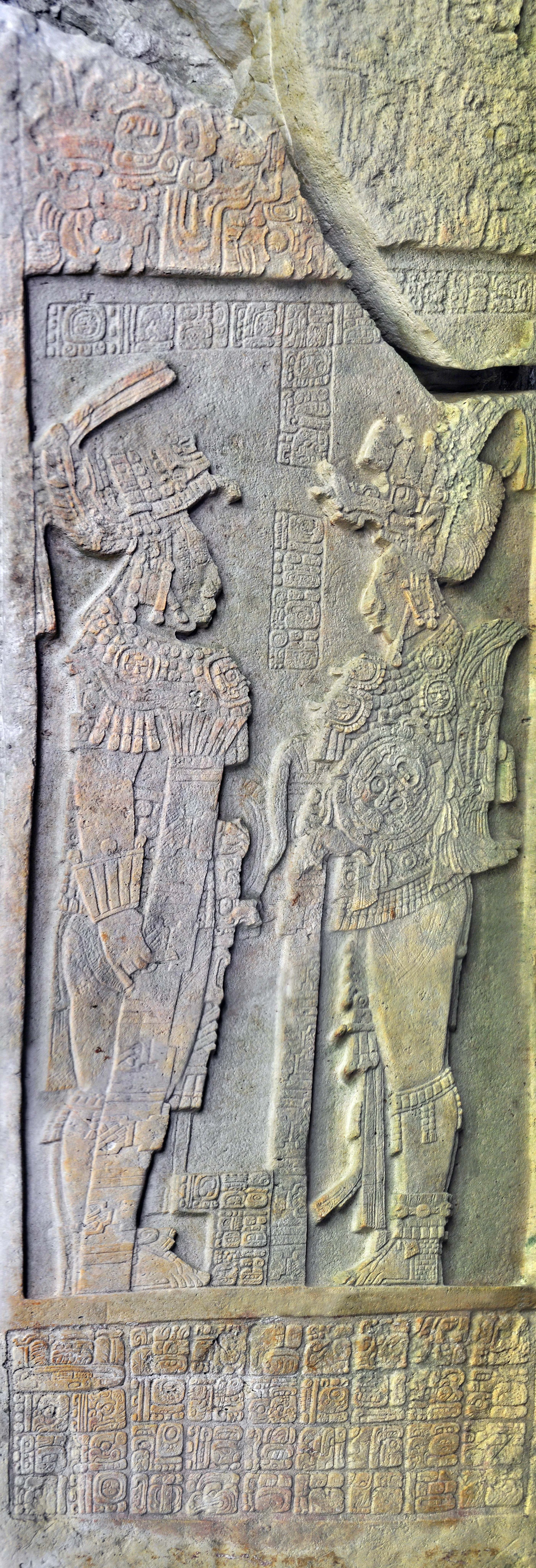
Ancient stone stela with intricate Mayan carvings of two figures in ceremonial attire surrounded by hieroglyphic inscriptions.
A detailed view of the carved stone relief on Stela 11 at Yaxchilan, depicting figures and Mayan glyphs.

Yaxchilán ecosystems, habitats, and plant life

The Monumento Natural Yaxchilán protects a substantial corridor of tropical forest along the Usumacinta, including both upland rainforest and riverine vegetation. Mexican biodiversity inventories associated with the protected area record more than 1,400 species of plants and animals, a figure that reflects the riverbank-edge ecology of the Usumacinta as well as the surrounding Lacandon jungle. Of these species, over 150 fall within risk categories under Mexico's NOM-059 wildlife protection standard, and a small number are recorded as exotic or invasive.

The mosaic of habitats around the ruins supports typical lowland Maya forest communities, with tall evergreen trees, seasonal inundation zones along the river, and patches of secondary growth created by the long-abandoned agricultural terraces and platforms of the ancient city. Seasonal flooding of the Usumacinta regularly covers the lower terraces, and the interplay between river and forest is a defining ecological feature of the area.
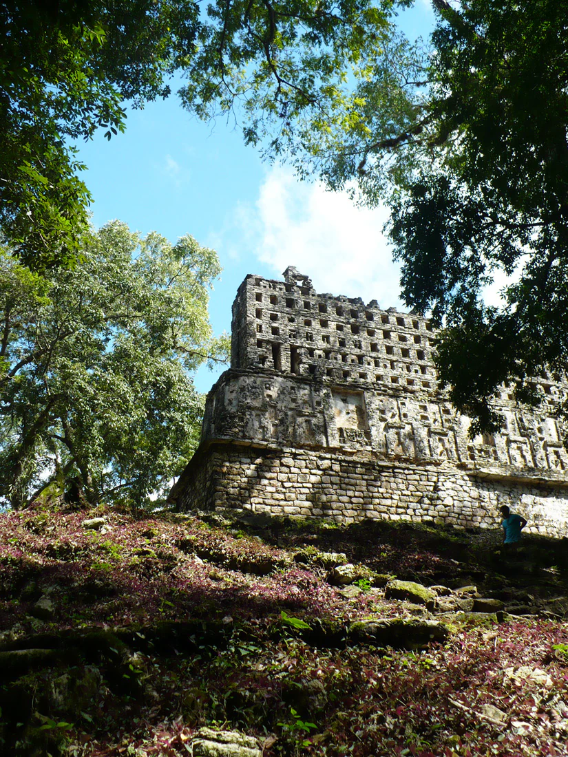
An ancient stone temple structure with a lattice roof comb, seen from below through the surrounding jungle canopy.
The temple structure at Yaxchilan, nestled within the dense jungle canopy.

Yaxchilán wildlife and species highlights

Wildlife information in the available sources is limited to overall biodiversity figures rather than detailed species lists, so a richer species-focused section cannot be reliably written. The protected natural area is documented as supporting over 1,400 species of plants and animals, with more than 150 of those in conservation risk categories, indicating that the Usumacinta corridor around Yaxchilán is a region of significant ecological value rather than an area known primarily for charismatic or emblematic species.
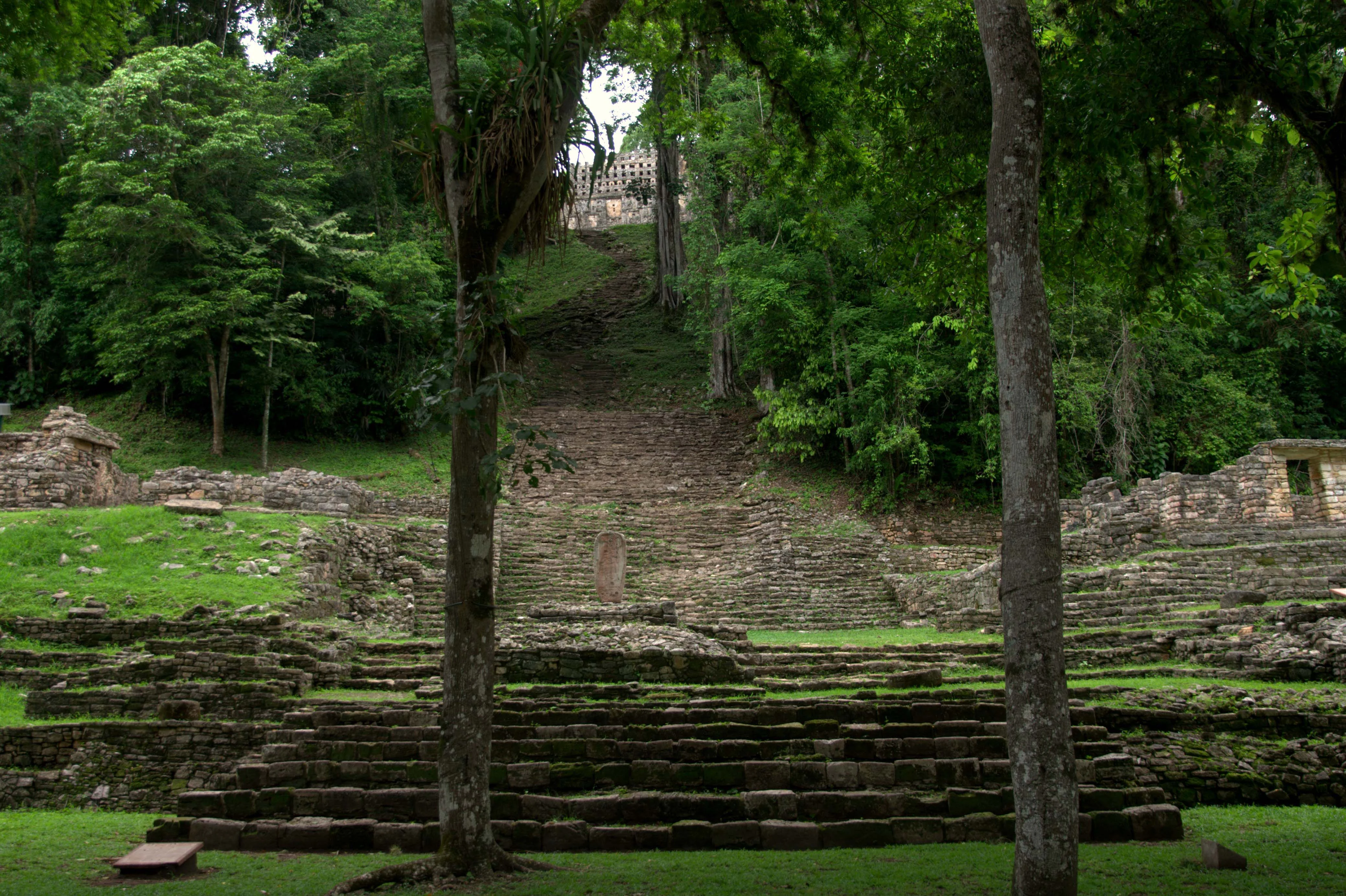
A wide stone stairway ascends a steep hill toward an ancient Maya building nestled in a dense tropical forest, with stepped ruins in the foreground.
A stone staircase leading up to Building 33 at the archaeological site of Yaxchilán, surrounded by lush jungle vegetation.

Yaxchilán conservation status and protection priorities

Conservation at Yaxchilán operates on two intersecting registers, archaeological and ecological. As an archaeological site, the city is protected under Mexican federal heritage law and has been the focus of long-running conservation programs led by the Instituto Nacional de Antropología e Historia, including Roberto García Moll's multi-season project from 1973 to 1985 and continuing work by Daniel Juárez Cossío and Mario Pérez Campa. These efforts stabilized structures, re-erected broken stelae, and reburied fragile inscriptions such as Hieroglyphic Stairway 5 to slow their deterioration.

Ecologically, the surrounding forest is preserved as the Monumento Natural Yaxchilán, a category of Mexican protected area that safeguards both the archaeological core and the tropical forest around it. The combination of Maya ruins, riverine habitat, and dense rainforest gives the protected area an unusual dual significance: it preserves one of the most important Classic Maya cities in situ while also maintaining a large block of biodiverse Usumacinta forest, including a substantial number of species protected under Mexican wildlife law. The site has also been the focus of international concern about the export of carved monuments, several of which were removed to the British Museum, the Berlin Ethnological Museum, and Mexico's National Museum of Anthropology in the 19th and 20th centuries.

Yaxchilán cultural meaning and human context

Yaxchilán sits at the heart of Maya cultural history, both as a Classic period capital and as a continuing focus of Maya religious life. The settlement belongs to the broad Usumacinta tradition of Maya architecture, art, and inscription, and its dynastic records have been central to the modern decipherment of Maya writing, most notably through Tatiana Proskouriakoff's pioneering studies of the site.

In the present day the site is within or near Lacandon Maya territory, and Lacandon communities continue to make pilgrimages to Yaxchilán to perform rituals in honor of traditional Maya deities. The site's later modern history, including the extraction of lintels and stelae by 19th-century explorers for European and Mexican museums, is itself an important part of its cultural profile, shaping ongoing debates about the repatriation of Maya cultural heritage.
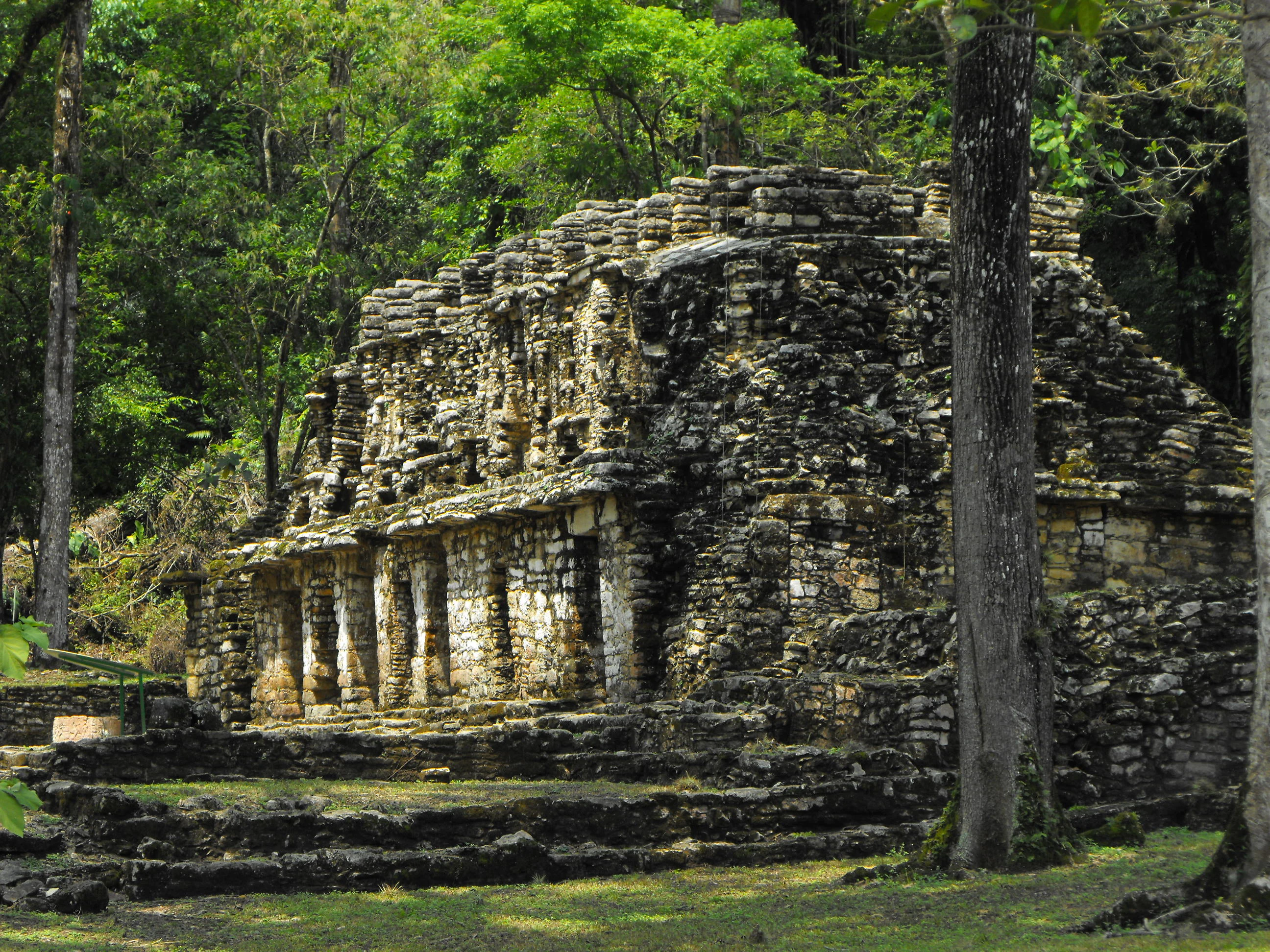
A weathered, multi-level ancient stone Mayan structure with pillars and stepped architecture, surrounded by dense green forest trees.
A stone structure at the Yaxchilan archaeological site, partially shaded by the surrounding jungle.

Top sights and standout views in Yaxchilán

A horseshoe meander of the Usumacinta River cradles the city on three sides, while the Small Acropolis, the Great Acropolis, and the Great Plaza rise in a stepped sequence of plazas, stairways, and roof-crowned temples. Edificio 33, dedicated in 756 by Pájaro Jaguar IV, rises on a hill high above the river and contains some of the best preserved carved lintels in the Maya world.

Highlight monuments also include the lintels of Edificio 23, which depict royal bloodletting and the emergence of the Vision Serpent; the inscribed stairways of Edificios 33 and 44; and stelae such as Estela 1, which still stands in dialogue with Edificio 33 in the Great Plaza. These monuments, combined with the surrounding Lacandon jungle and the riverside setting of the Natural Monument, make Yaxchilán one of the most complete syntheses of Maya political, artistic, and natural heritage in the Usumacinta basin.
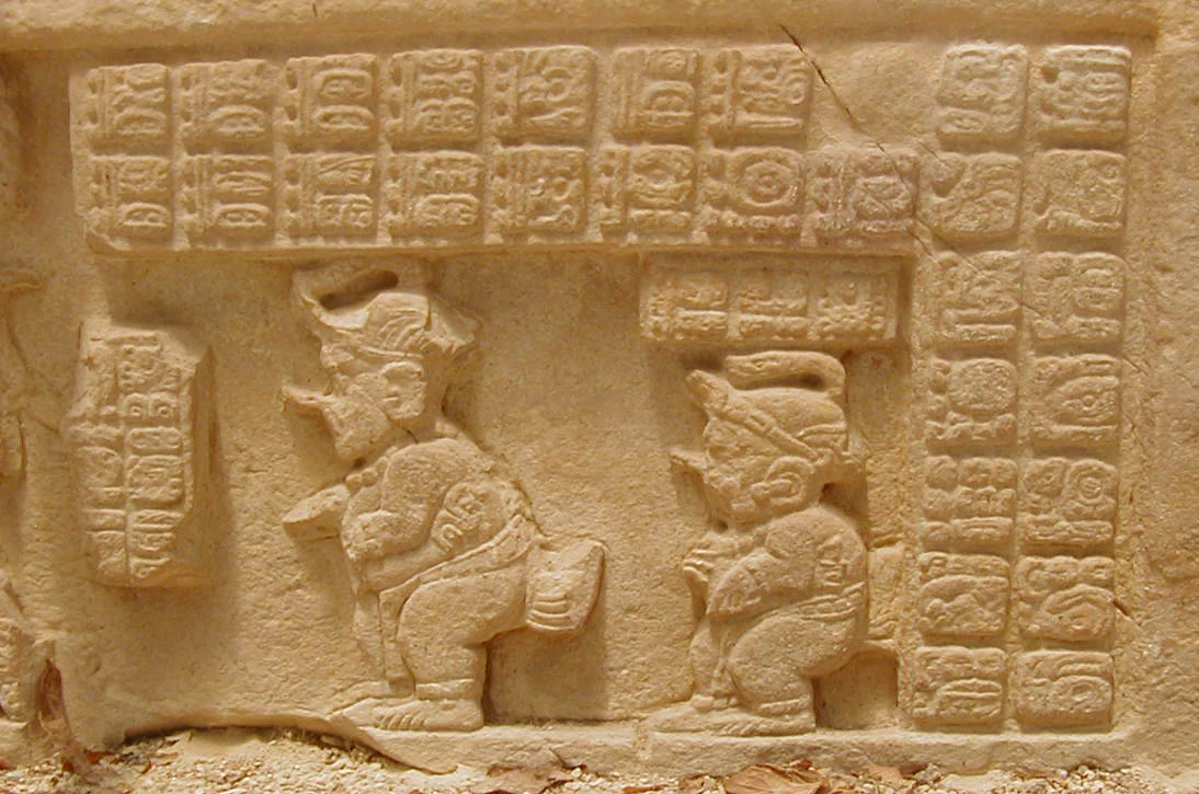
A close up view of an ancient stone lintel carving at Yaxchilan showing two small figures, possibly dwarfs, depicted in profile alongside blocks of carved Maya hieroglyphs.
A stone lintel at Yaxchilan featuring intricate relief carvings of figures and Maya glyphs.

Best time to visit Yaxchilán

Because the surrounding climate is hot and humid tropical forest with significant rainfall, the most comfortable visiting conditions generally occur in the drier months of the year, when river levels are lower and forest trails and ruins are easier to access. The rainy season brings higher water on the Usumacinta, which can affect boat access to the site and changes the experience of the surrounding jungle.

Seasonal flooding is also a defining characteristic of the landscape itself, since the river regularly inundates the lower terraces of the site, and visiting during different phases of the hydrological cycle gives a different sense of how the city was integrated with the river. Travelers should treat seasonal guidance as general, since exact access conditions vary with river levels, weather, and local logistics.

Monthly climate preview

Measured monthly averages and historical climate patterns for Yaxchilán

Yaxchilán Climate Normals, Long Term Temperature and Precipitation Rhythm

Historical data records mean monthly temperatures ranging from 20.43 degrees Celsius to 27.25 degrees Celsius alongside distinct precipitation fluctuations across the year. Reviewing the complete twelve-month record provides deeper insight into measured temperature ranges and monthly rainfall normals at this coordinate.
Annual mean24 °C
20 °C27 °C
Jan20°
Feb22°
Mar24°
Apr27°
May27°
Jun25°
Jul25°
Aug25°
Sep24°
Oct23°
Nov22°
Dec21°
Warmest month
May

27.3 °C

Coolest month
January

20.4 °C

Wettest month
September

10.7 mm/day

Driest month
March

1.2 mm/day

Park location guide

Geography guide, regional context, and park location map for Yaxchilán

Yaxchilán park geography, regions, and map view in Mexico

Understand where Yaxchilán sits in Mexico through a broader geographic reading of the surrounding landscape, nearby location context, and its mapped position within the national park landscape.

How Yaxchilán fits into Mexico

Mexico, officially the United Mexican States, is a country in North America spanning the Sierra Madre mountain ranges, coastal plains, and tropical regions. It borders the United States to the north, Guatemala and Belize to the southeast, and has coastlines along the Pacific Ocean, Gulf of Mexico, and Caribbean Sea. With a population exceeding 130 million, Mexico is home to one of the world's most significant concentrations of Indigenous languages alongside Spanish.

Wider geography shaping Yaxchilán in Mexico

Mexico occupies a land area of 1,972,550 km2, making it the thirteenth-largest country in the world. The terrain is highly diverse, featuring the Sierra Madre Occidental and Sierra Madre Oriental mountain ranges, the Mexican Plateau, coastal lowlands along the Pacific and Gulf/Caribbean margins, and the Yucatan Peninsula. The country spans multiple climate zones from desert in the north to tropical rainforest in the south.

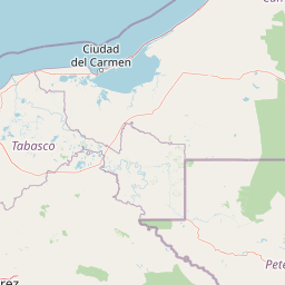
Map view of Yaxchilán

Use this park location map to pinpoint Yaxchilán in Mexico, understand its exact geographic position, and read its mapped placement within the surrounding landscape more clearly.

Pigeon | © OpenStreetMap contributors

Location context for Yaxchilán

Chiapas

Visual reference guide to the river meander, jungle terrain, and temple architecture

Yaxchilán Photos and Landscape Scenery in the Protected Rainforest

Visual records capture the dense tropical forest, the horseshoe river meander, and the tiered stone plazas defining the protected reserve. Examining these detailed images reveals how the surrounding jungle terrain and monumental architecture shape the character of the ancient sanctuary.

A vertically oriented rectangular limestone lintel featuring detailed relief carvings of two human figures in profile, including a ruler and consort, with Maya hieroglyphs at the top center.

A side-by-side view of three separate rectangular stone lintels with detailed Maya relief carvings of human figures and hieroglyphic inscriptions.

Ancient stone stela with intricate Mayan carvings of two figures in ceremonial attire surrounded by hieroglyphic inscriptions.

An ancient stone temple structure with a lattice roof comb, seen from below through the surrounding jungle canopy.

A wide stone stairway ascends a steep hill toward an ancient Maya building nestled in a dense tropical forest, with stepped ruins in the foreground.

Front view of the stone Maya Structure 33 building with an ornate roof comb, set against a jungle background.

A weathered, multi-level ancient stone Mayan structure with pillars and stepped architecture, surrounded by dense green forest trees.

A close up view of an ancient stone lintel carving at Yaxchilan showing two small figures, possibly dwarfs, depicted in profile alongside blocks of carved Maya hieroglyphs.

High-angle view looking down into a small grassy plaza surrounded by ancient stone ruins and thick tropical forest.

A path winds between ancient stone Maya ruins with a dark arched entryway visible in the distance at Yaxchilán.

A low-angle view of weathered stone ruins featuring a terraced pyramid base and arched stone doorways, surrounded by trees under a blue sky.

A high-angle view of ancient Maya stone ruins and tiered grass terraces surrounded by dense green forest foliage.

An elevated view of ancient stone archaeological ruins surrounded by a lush green forest at Yaxchilán.

Close up view of an ancient Maya limestone relief carving depicting human figures and hieroglyphs on a weathered, tan colored stone surface.

A weathered stone Maya structure with multiple doorways partially shaded by dense green jungle canopy, with a person standing on the right side.

A weathered, dark stone Maya temple building with tiered walls and doorways, nestled within a lush, green tropical forest.

Park atlas

Compare adjacent rainforest reserves and regional Maya basin conservation areas.

Parks Near Yaxchilán and Surrounding Protected Landscapes

Continue exploring regional protected areas and tropical river basins connected to the Usumacinta corridor. Compare nearby national parks and forest reserves to understand the broader ecological geography surrounding Yaxchilán.
A stylized vector illustration of tiered Mayan pyramid structures rising above a dense green jungle landscape under a soft pastel sky.
Biosphere reservePetén Department
About 0.3 km away#1 closest

North

Maya Biosphere Reserve: Geographic Overview and Protected Landscapes in Petén

Tropical forest ecosystems and ancient archaeological mapping

Covering roughly one-fifth of Guatemala, the Maya Biosphere Reserve represents a pioneering model of zoned conservation. The landscape features a complex mosaic of lowland rainforests, savanna patches, and seasonal wetlands formed over a weathered limestone platform. This atlas summary examines the reserve's ecological boundaries, its vital role in protecting Mesoamerican biodiversity, and the concentration of pre-Columbian cities located across the Petén Department.

Area
21,602 km²
Established
1990
Relief
Mixed relief
Climate
Tropical
A minimalist watercolor illustration showing layers of green hills and distant mountain ridgelines against a white background.
Protected areaMexico
About 24 km away#2 closest

Southwest

Bonampak Protected Area: Geography and Landscape Context of the Lacandon Rainforest

An archaeological and natural monument in Chiapas, Mexico

Bonampak encompasses a rich protected area within the Lacandon rainforest, featuring low-lying jungle terrain and significant cultural heritage sites. This atlas entry examines the physical geography, including the site proximity to the Usumacinta River tributaries, and the preservation of continuous tropical canopy that defines the regional biodiversity and cultural landscape.

Relief
Lowland
Climate
Tropical
Scope
Terrestrial
Water
Minor water
A soft watercolor illustration of a landscape with green trees, pink flowering bushes, and small plants against a pale, distant hilly background.
Wildlife reserveChiapas
About 28 km away#3 closest

Southeast

Área de protección de flora y fauna Chan-Kin: Mapped Wildlife Reserve and Forest Landscape

Exploring protected tropical lowland ecosystems in eastern Chiapas

Área de protección de flora y fauna Chan-Kin represents a critical conservation node within the Selva Lacandona. This protected area maintains a continuous high-canopy forest structure, playing a decisive role in regional biodiversity and the persistence of wide-ranging tropical species across the Usumacinta basin.

Area
121.85 km²
Established
1992
Relief
Lowland
Climate
Tropical
Protected areaChiapas
About 69 km away#4 closest

West

Área de protección de flora y fauna Nahá-Metzabok: A Protected Landscape in Chiapas

Mapping tropical rainforests, karst hydrology, and cultural heritage

The Área de protección de flora y fauna Nahá-Metzabok serves as a vital corridor in the Lacandon Jungle, protecting humid rainforests and rare montane cloud forest habitats. Its rugged karst terrain is characterized by prehistoric rock-art caves and critical aquatic systems that sustain regional river basins, offering a layered study of ecological and cultural significance in southern Mexico.

Area
8,617.49 km²
Established
1998
A soft, minimalist watercolor painting showing a winding river flowing through rolling green hills against a white background.
Wildlife reserveTabasco
About 84 km away#5 closest

Northwest

Cañón del Usumacinta Wildlife Reserve: Geography and Protected Area Mapping in Tabasco, Mexico

Tropical rainforest, karst cenotes, and riverine canyons

Cañón del Usumacinta represents an ecologically significant protected landscape in southeastern Mexico. This wildlife reserve features high evergreen rainforest, prominent river rapids, and karst geological features such as cenotes and caves. The reserve maintains critical biological continuity through its position in the Mesoamerican Biological Corridor, bridging remote riverine terrain with significant Maya archaeological sites.

Area
461.28 km²
Established
2005
Relief
Mixed relief
Climate
Tropical
National parkPetén
About 95 km away#6 closest

Southeast

El Rosario National Park: Protected National Park & Mapped Landscape Explorer

Geographic context and protected area boundaries within Petén.

Delve into the protected landscape of El Rosario National Park, identified as a national park within Guatemala's Petén region. This page provides an atlas-centric view, highlighting its mapped park boundaries and its significance in the regional geography. Understand the park as a distinct protected area contributing to the natural landscape context, ideal for geographic exploration and detailed mapping.

Area
11.05 km²
Established
1980
IUCN
II
Relief
Lowland
National parkChiapas
About 117 km away#7 closest

Southwest

Lagunas de Montebello National Park: Chiapas Protected Landscape Geography & Mapped Boundaries

Explore this national park's unique landscape context within Chiapas.

Lagunas de Montebello National Park offers a detailed view of protected landscape features and regional geographic context within Chiapas, Mexico. As a designated national park, its mapped boundaries are essential for understanding the distribution of protected areas and the natural terrain. This entity provides critical data for exploring the atlas of Mexican natural reserves and their specific environmental settings.

Area
64.11 km²
Established
1959
IUCN
II
Relief
Highland
A soft watercolor painting of a series of cascading waterfalls surrounded by light green foliage and rolling hills in the background.
Protected areaChiapas
About 129 km away#8 closest

West

Cascadas de Agua Azul: A Geological and Hydrological Survey of the Chiapas Protected Area

Limestone canyons, rainforest biodiversity, and river hydrology

Cascadas de Agua Azul offers a unique perspective on the karst terrain of Chiapas, Mexico. The site features shallow canyons carved by the Otulún and Tulijá rivers, sustained by a humid microclimate that supports dense mountain rainforest. This protected area acts as a crucial link in the regional conservation network, safeguarding limestone-rich soil environments and diverse habitats for migratory and endemic bird species.

Relief
Upland
Climate
Tropical
Access
Moderate access
Scope
Terrestrial

Common questions about visiting, size, designation, and location context for Yaxchilán

Yaxchilán FAQs for park facts, access, geography, and protected area context

Find quick answers about Yaxchilán, including protected-area facts, park geography, trail and visitor context, and how the park fits into its surrounding country and regional landscape.
MoriAtlas Explorer

Continue Your Protected Areas Search Across the Global Atlas

Deepen your exploration by continuing the structured search for national parks and protected areas worldwide. Utilize the comprehensive filtering capabilities to compare different conservation landscapes and refine your understanding of global park geography. Discover more about the distribution and characteristics of protected natural areas.

Global natural geography