
Mori Atlas logo
Wildlife reserveÁrea de protección de flora y fauna Chan-Kin

Understanding the mapped boundaries and ecological continuity of this vital lowland rainforest protected area.

Área de protección de flora y fauna Chan-Kin: Geographic Atlas of a Chiapas Tropical Forest Reserve

Located in the eastern reaches of Chiapas, Área de protección de flora y fauna Chan-Kin functions as a crucial lowland tropical forest reserve. This protected landscape extends the connectivity of the Lacandon rainforest, linking regional biosphere reserves and serving as a permanent sanctuary for habitat-dependent species such as the jaguar, harpy eagle, and scarlet macaw. The terrain consists of flat, alluvial lowlands beneath 200 meters, characterized by an exceptionally tall, evergreen canopy that persists as a major element of the wider Maya Forest.

Lacandon rainforesttropical forestbiosphere reserve networkflora and fauna protection areawildlife corridorMayan Forest
A stylized digital illustration of a lush tropical jungle valley with a waterfall flowing into a river under a soft sunset sky.

Área de protección de flora y fauna Chan-Kin

Wildlife reserve

Park overview

Structured park overview, official facts, and landscape profile for Chan-Kin Flora and Fauna Protection Area

Chan-Kin Flora and Fauna Protection Area park facts, protected area profile, and essential visitor context

Review the core facts for Chan-Kin Flora and Fauna Protection Area, including designation, size, terrain, visitor scale, habitats, and operating context in one park-focused overview.

About Chan-Kin Flora and Fauna Protection Area

Chan-Kin is a federal flora and fauna protection area covering approximately 12,185 hectares of lowland tropical forest in the Lacandon rainforest region of Chiapas, Mexico. It is located in the municipality of Ocosingo, near the Guatemalan border, and forms a vital extension of the Montes Azules Biosphere Reserve, one of the most biodiverse protected areas in the country.

The reserve lies at elevations below 200 meters, giving it a hot, humid climate with winter rainfall. Together with Montes Azules, Lacan-Tun, the Calakmul Biosphere Reserve in Campeche, and the forests of El Petén in Guatemala and Belize, Chan-Kin contributes to the great ecological region called El Gran Petén. This region is important not only for biological diversity but also for its potential influence on regional climate regulation.

Chan-Kin shares research and management facilities with Montes Azules, including the Chajul Tropical Biology Station, an INAH hostel near the archaeological site of Bonampak, and a network of ranger posts distributed across the area. There is no direct road access to the reserve; visitors and staff reach it only along unpaved tracks and trails, with the nearest settlements being Frontera Corozal and Benemérito de las Américas.

Ecologically, the area is dominated by tall evergreen rainforest, with some emergent trees reaching up to 60 meters, alongside medium-stature evergreen forest and palm-rich areas. Chan-Kin is home to a notable concentration of endangered wildlife, including several large cats, the Central American tapir, and a remarkable variety of tropical birds, and it plays an important role in connecting habitats across the Mexico-Guatemala border.

Quick facts and research context for Chan-Kin Flora and Fauna Protection Area

Chan-Kin is a Mexican federal flora and fauna protection area of roughly 12,000 hectares in the Lacandon rainforest of eastern Chiapas. It lies within Ocosingo municipality, near the Guatemalan border, and forms a complement to the Montes Azules and Lacan-Tun biosphere reserves.

The reserve was decreed on 21 August 1992 and shares research infrastructure, including the Chajul Tropical Biology Station, with its neighboring reserves. Although classified as a category-4 protection area in Mexico's protected-area system, it functions ecologically as an expansion of the larger Montes Azules Biosphere Reserve.

Protection and recognition

Documented terrestrial protection scope, designation framework, and conservation governance records

Área de protección de flora y fauna Chan-Kin Protection Status and International Recognition

Terrestrial protection status records outline the administrative classification for Área de protección de flora y fauna Chan-Kin across conserved landscapes. Official documentation compiles verified designation parameters and management scope metrics without external recognition sources.

Protection details

Protection scope
Terrestrial
Transboundary protection
No
Park context

Deeper park guide and search-rich context for Chan-Kin Flora and Fauna Protection Area

Chan-Kin Flora and Fauna Protection Area history, landscape, wildlife, and travel context

Explore Chan-Kin Flora and Fauna Protection Area through its history, landscape character, ecosystems, wildlife, conservation priorities, cultural context, and seasonal travel timing in a structured park guide built for atlas discovery and search intent.

Chan-Kin Flora and Fauna Protection Area history and protected-area timeline

Chan-Kin was established as a protected area on 21 August 1992 under Mexico's federal system of flora and fauna protection areas. Its creation came in response to a request from the Mexican scientific community, which argued that the Montes Azules Biosphere Reserve, the largest core of protected rainforest in the region, needed additional buffer zones to ensure the long-term integrity of the Lacandon rainforest.

The reserve was conceived from the start as a complement to Montes Azules, and together with the adjacent Lacan-Tun Biosphere Reserve it forms a southern expansion of the larger reserve. This grouping also links Montes Azules with Bonampak and, across the Usumacinta basin, with the tropical forests of El Petén in Guatemala and the Calakmul Biosphere Reserve in Campeche.

In the second half of the twentieth century, the Lacandon rainforest suffered heavy deforestation driven by migration into Chiapas, agricultural expansion, the opening of a border road, and petroleum exploration and exploitation. The declaration of Chan-Kin was therefore not only an ecological measure but also an attempt to safeguard a remaining corridor of connected tropical forest in one of Mesoamerica's most threatened landscapes.

Chan-Kin Flora and Fauna Protection Area landscape and geographic character

The landscape of Chan-Kin is defined by lowland tropical forest under 200 meters in elevation, with an extremely warm and humid climate and rainfall concentrated in the winter months. The terrain is part of the great alluvial and karstic lowlands of the Usumacinta basin, and it blends continuously with neighboring reserves and across the border into the Petén lowlands of Guatemala.

The dominant vegetation is high evergreen rainforest, where emergent trees reach heights of up to 60 meters, creating a continuous canopy that is broken only along rivers, streams, and small clearings. Common tree species include cansan (Terminalia amazonia), big-leaf mahogany (Swietenia macrophylla), Spanish cedar (Cedrela odorata), guanacaste (Schizolobium parahyba), palo de aro (Lonchocarpus sp.), and the ramón or breadnut tree (Brosimum alicastrum). In areas of medium-stature evergreen forest, the understory includes species such as canacoite (Bravaisia integerrima).

Although the reserve itself is essentially flat lowland forest, it sits within a broader Chiapas mosaic of humid tropical forest, conifer and oak forests, montane cloud forests, and cultivated grasslands. The park's value lies less in dramatic scenery and more in its continuity with these surrounding ecosystems, forming a vast forested landscape that has persisted despite significant regional deforestation.

Chan-Kin Flora and Fauna Protection Area ecosystems, habitats, and plant life

Chan-Kin protects one of the most intact sections of tall evergreen rainforest in the Lacandon region, part of a continuous humid tropical forest complex that extends from Chiapas into Guatemala and Belize. Its vegetation is classified as high evergreen rainforest (selva alta perennifolia), with a multi-layered structure of emergents, canopy, subcanopy, and understory that supports extraordinarily high biodiversity.

According to data from Mexico's National Biodiversity Information System (CONABIO), the area harbors more than 210 species of plants and animals, of which 52 fall under some category of risk in the Official Mexican Standard NOM-059, and three are considered exotic. Beyond its domestic plants, Chan-Kin also shelters endemic species such as Lacandonia schismatica, a rare plant of considerable scientific interest.

The reserve's ecological significance goes beyond its own borders. By maintaining unbroken forest cover, it functions as a biological corridor linking Montes Azules, Lacan-Tun, Bonampak, the Calakmul Biosphere Reserve, and the forests of El Petén, allowing species that require large territories to move across national boundaries and to maintain viable populations within the broader Mesoamerican tropical forest landscape.

Chan-Kin Flora and Fauna Protection Area wildlife and species highlights

Chan-Kin shares most of its fauna with the adjacent Montes Azules Biosphere Reserve and, more broadly, with the great Maya Forest complex that stretches into Guatemala and Belize. The area is particularly important for tropical forest raptors and large vertebrates that require extensive tracts of undisturbed forest.

Large mammals present in and around the reserve include the jaguar (Panthera onca), the ocelot (Leopardus pardalis), and Baird's tapir (Tapirus bairdii). These wide-ranging species benefit directly from Chan-Kin's role in extending the protected habitat available within Montes Azules and connecting the Mexican forests to those of El Petén.

Chan-Kin's bird life is equally significant. The reserve forms part of a network that supports more than 160 bird species that depend on continuous humid tropical forest, including the ornate hawk-eagle, harpy eagle, black hawk-eagle, black-and-white hawk-eagle, king vulture, orange-breasted falcon, scarlet macaw, and keel-billed toucan. The presence of these large, charismatic birds is often used as an indicator of the reserve's overall ecological health.

Chan-Kin Flora and Fauna Protection Area conservation status and protection priorities

Chan-Kin was created specifically to strengthen the conservation of the Lacandon rainforest, the largest contiguous block of tropical forest remaining in Mexico, and to act as an ecological extension of the Montes Azules Biosphere Reserve. Its establishment was driven by scientific concerns that Montes Azules alone could not ensure the long-term survival of the region's ecosystems, particularly those species that require very large, connected tracts of forest.

The reserve's conservation value lies both in its own biodiversity and in its role as a biological corridor. Together with Lacan-Tun and Bonampak, Chan-Kin links Montes Azules with the humid tropical forests of El Petén in Guatemala and the Calakmul Biosphere Reserve in Campeche. This connectivity is vital for species such as the jaguar and the harpy eagle, which need extensive ranges, and for migratory and wide-ranging tropical birds that cannot survive in fragmented landscapes.

Despite its protected status, Chan-Kin faces serious conservation challenges. More than 200 informal human settlements exist within and around the reserve, with a mix of indigenous communities, ejido and communal landholders, smallholders, and various government and non-government organizations involved in land and resource management. The lack of an integrated, broadly accepted management plan has led to conflicts over land tenure and recurrent pressure from agriculture, livestock, and logging. These pressures make the protection of Chan-Kin not just a local issue but a significant test of Mexico's broader strategy for conserving the Maya Forest.

Chan-Kin Flora and Fauna Protection Area cultural meaning and human context

Chan-Kin lies at the heart of the Lacandon rainforest, a region of deep cultural as well as ecological significance. The nearby archaeological site of Bonampak, with its famous Maya murals, is one of the most important pre-Columbian sites in the area, and an INAH hostel there (shared with the neighboring Montes Azules reserve) reflects the region's heritage value.

The modern cultural landscape is complex and contested. The reserve's surroundings include Lacandón Maya communities as well as waves of migrants from the northern highlands of Chiapas and other Mexican states who arrived during the latter half of the twentieth century. These settlements, together with varying forms of land tenure from ejidos and communal lands to small private properties, have created overlapping claims and tensions that continue to shape management of the forest.

This cultural complexity is intimately linked to the reserve's conservation challenges. Land tenure disputes, indigenous rights, and rural livelihoods are at the center of any long-term strategy for protecting the forest, making Chan-Kin a place where biodiversity conservation and human history are deeply intertwined.

Top sights and standout views in Chan-Kin Flora and Fauna Protection Area

Chan-Kin stands out as one of the southern anchors of the Lacandon rainforest protected-area system, effectively functioning as an extension of the much larger Montes Azules Biosphere Reserve. Its 12,000-plus hectares of lowland rainforest, with emergent trees reaching 60 meters, represent some of the tallest and most continuous tropical forest remaining in the region.

The reserve is a key node in a transboundary ecological network that links Mexican biosphere reserves with El Petén in Guatemala and Calakmul in Campeche. This role makes it especially important for wide-ranging species such as the jaguar, the harpy eagle, the scarlet macaw, and Central America's tapir, all of which require large, connected forest landscapes.

Chan-Kin is also notable for the stark contrast it embodies: a heavily protected forest surrounded by decades of deforestation, immigration-driven agricultural expansion, and more than 200 informal settlements. The reserve's existence is both a conservation achievement and a continuing challenge, making it a touchstone case in debates over how to maintain Mexico's remaining Maya Forest.

Best time to visit Chan-Kin Flora and Fauna Protection Area

Chan-Kin's tropical climate features warm temperatures year-round and rainfall concentrated in the winter months. As in much of the Lacandon rainforest, the driest and most accessible period tends to be the spring and early summer, when unpaved tracks are usually in better condition and wildlife viewing along forest edges can be easier.

The winter rainy season, by contrast, brings higher humidity and more challenging road conditions, but it also coincides with the active growth period of the forest, when vegetation is at its greenest and bird activity remains high. Because the reserve has no direct paved access, any visit depends on weather and on the conditions of forest tracks, and travelers should expect conditions oriented around the rhythms of the rainforest rather than conventional tourist seasons.

Monthly climate preview

Long-term representative temperature and precipitation patterns across the conservation landscape

Área de protección de flora y fauna Chan-Kin Climate Normals and Weather by Month

Representative coordinate records show measured monthly temperature variations and shifting precipitation levels across the protected area. Examining the complete twelve-month climate profile provides detailed long-term averages for scientific and geographic analysis.
Annual mean25 °C
22 °C29 °C
Jan22°
Feb24°
Mar27°
Apr29°
May29°
Jun26°
Jul26°
Aug26°
Sep25°
Oct25°
Nov23°
Dec22°
Warmest month
April

29.2 °C

Coolest month
January

22.2 °C

Wettest month
September

11.4 mm/day

Driest month
March

1.1 mm/day

Park location guide

Geography guide, regional context, and park location map for Chan-Kin Flora and Fauna Protection Area

Chan-Kin Flora and Fauna Protection Area park geography, regions, and map view in Mexico

Understand where Chan-Kin Flora and Fauna Protection Area sits in Mexico through a broader geographic reading of the surrounding landscape, nearby location context, and its mapped position within the national park landscape.

How Chan-Kin Flora and Fauna Protection Area fits into Mexico

Mexico, officially the United Mexican States, is a country in North America spanning the Sierra Madre mountain ranges, coastal plains, and tropical regions. It borders the United States to the north, Guatemala and Belize to the southeast, and has coastlines along the Pacific Ocean, Gulf of Mexico, and Caribbean Sea. With a population exceeding 130 million, Mexico is home to one of the world's most significant concentrations of Indigenous languages alongside Spanish.

Wider geography shaping Chan-Kin Flora and Fauna Protection Area in Mexico

Mexico occupies a land area of 1,972,550 km2, making it the thirteenth-largest country in the world. The terrain is highly diverse, featuring the Sierra Madre Occidental and Sierra Madre Oriental mountain ranges, the Mexican Plateau, coastal lowlands along the Pacific and Gulf/Caribbean margins, and the Yucatan Peninsula. The country spans multiple climate zones from desert in the north to tropical rainforest in the south.

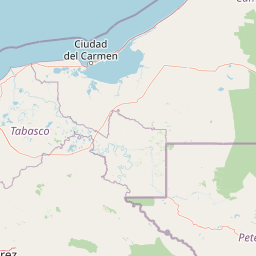
Map view of Chan-Kin Flora and Fauna Protection Area

Use this park location map to pinpoint Chan-Kin Flora and Fauna Protection Area in Mexico, understand its exact geographic position, and read its mapped placement within the surrounding landscape more clearly.

Pigeon | © OpenStreetMap contributors

Location context for Chan-Kin Flora and Fauna Protection Area

Chiapas

Visual reference of lowland rainforest habitats and tropical forest scenery

Área de protección de flora y fauna Chan-Kin Photos and Landscapes

Visual documentation of Área de protección de flora y fauna Chan-Kin reveals the dense canopy and humid lowland terrain of the Lacandon rainforest. Photographic records provide clear insight into the protected habitats and continuous forest corridors supporting regional wildlife.

A wide, hazy landscape view of a vast, forested canopy in the Lacandon Jungle under an overcast sky.

Park atlas

Compare adjacent lowland rainforest corridors and regional protected landscapes

Parks Near Área de Protección de Flora y Fauna Chan-Kin and Connected Reserves

Browsing other parks near Área de protección de flora y fauna Chan-Kin reveals the broader continuity of the Lacandon rainforest conservation network. Comparing these adjacent protected areas provides essential geographic context for understanding regional tropical forest corridors.
A stylized vector illustration of tiered Mayan pyramid structures rising above a dense green jungle landscape under a soft pastel sky.
Biosphere reservePetén Department
About 6.5 km away#1 closest

North

Maya Biosphere Reserve: Geographic Overview and Protected Landscapes in Petén

Tropical forest ecosystems and ancient archaeological mapping

Covering roughly one-fifth of Guatemala, the Maya Biosphere Reserve represents a pioneering model of zoned conservation. The landscape features a complex mosaic of lowland rainforests, savanna patches, and seasonal wetlands formed over a weathered limestone platform. This atlas summary examines the reserve's ecological boundaries, its vital role in protecting Mesoamerican biodiversity, and the concentration of pre-Columbian cities located across the Petén Department.

Area
21,602 km²
Established
1990
Relief
Mixed relief
Climate
Tropical
Natural monumentChiapas
About 28 km away#2 closest

Northwest

Yaxchilan Natural Monument: Geography and Protected Rainforest Boundaries in Chiapas

A mapped overview of river-cradled jungle terrain.

Yaxchilan encompasses a vital protected landscape within the Chiapas rainforest, centered on the dynamic Usumacinta River meander. This park record maps the intersection of tropical forest ecosystems and historical monument sites, offering a grounded look at the physical terrain, river-borne geography, and the natural corridors preserved within this distinct Mexican natural monument.

Relief
Lowland
Climate
Tropical
Access
Moderate access
Scope
Terrestrial
A minimalist watercolor illustration showing layers of green hills and distant mountain ridgelines against a white background.
Protected areaMexico
About 29 km away#3 closest

West

Bonampak Protected Area: Geography and Landscape Context of the Lacandon Rainforest

An archaeological and natural monument in Chiapas, Mexico

Bonampak encompasses a rich protected area within the Lacandon rainforest, featuring low-lying jungle terrain and significant cultural heritage sites. This atlas entry examines the physical geography, including the site proximity to the Usumacinta River tributaries, and the preservation of continuous tropical canopy that defines the regional biodiversity and cultural landscape.

Relief
Lowland
Climate
Tropical
Scope
Terrestrial
Water
Minor water
National parkPetén
About 70 km away#4 closest

East

El Rosario National Park: Protected National Park & Mapped Landscape Explorer

Geographic context and protected area boundaries within Petén.

Delve into the protected landscape of El Rosario National Park, identified as a national park within Guatemala's Petén region. This page provides an atlas-centric view, highlighting its mapped park boundaries and its significance in the regional geography. Understand the park as a distinct protected area contributing to the natural landscape context, ideal for geographic exploration and detailed mapping.

Area
11.05 km²
Established
1980
IUCN
II
Relief
Lowland
Protected areaChiapas
About 94 km away#5 closest

Northwest

Área de protección de flora y fauna Nahá-Metzabok: A Protected Landscape in Chiapas

Mapping tropical rainforests, karst hydrology, and cultural heritage

The Área de protección de flora y fauna Nahá-Metzabok serves as a vital corridor in the Lacandon Jungle, protecting humid rainforests and rare montane cloud forest habitats. Its rugged karst terrain is characterized by prehistoric rock-art caves and critical aquatic systems that sustain regional river basins, offering a layered study of ecological and cultural significance in southern Mexico.

Area
8,617.49 km²
Established
1998
A soft, minimalist watercolor painting showing a winding river flowing through rolling green hills against a white background.
Wildlife reserveTabasco
About 113 km away#6 closest

Northwest

Cañón del Usumacinta Wildlife Reserve: Geography and Protected Area Mapping in Tabasco, Mexico

Tropical rainforest, karst cenotes, and riverine canyons

Cañón del Usumacinta represents an ecologically significant protected landscape in southeastern Mexico. This wildlife reserve features high evergreen rainforest, prominent river rapids, and karst geological features such as cenotes and caves. The reserve maintains critical biological continuity through its position in the Mesoamerican Biological Corridor, bridging remote riverine terrain with significant Maya archaeological sites.

Area
461.28 km²
Established
2005
Relief
Mixed relief
Climate
Tropical
National parkChiapas
About 117 km away#7 closest

Southwest

Lagunas de Montebello National Park: Chiapas Protected Landscape Geography & Mapped Boundaries

Explore this national park's unique landscape context within Chiapas.

Lagunas de Montebello National Park offers a detailed view of protected landscape features and regional geographic context within Chiapas, Mexico. As a designated national park, its mapped boundaries are essential for understanding the distribution of protected areas and the natural terrain. This entity provides critical data for exploring the atlas of Mexican natural reserves and their specific environmental settings.

Area
64.11 km²
Established
1959
IUCN
II
Relief
Highland
A soft watercolor painting of a series of cascading waterfalls surrounded by light green foliage and rolling hills in the background.
Protected areaChiapas
About 153 km away#8 closest

Northwest

Cascadas de Agua Azul: A Geological and Hydrological Survey of the Chiapas Protected Area

Limestone canyons, rainforest biodiversity, and river hydrology

Cascadas de Agua Azul offers a unique perspective on the karst terrain of Chiapas, Mexico. The site features shallow canyons carved by the Otulún and Tulijá rivers, sustained by a humid microclimate that supports dense mountain rainforest. This protected area acts as a crucial link in the regional conservation network, safeguarding limestone-rich soil environments and diverse habitats for migratory and endemic bird species.

Relief
Upland
Climate
Tropical
Access
Moderate access
Scope
Terrestrial

Common questions about visiting, size, designation, and location context for Chan-Kin Flora and Fauna Protection Area

Chan-Kin Flora and Fauna Protection Area FAQs for park facts, access, geography, and protected area context

Find quick answers about Chan-Kin Flora and Fauna Protection Area, including protected-area facts, park geography, trail and visitor context, and how the park fits into its surrounding country and regional landscape.
MoriAtlas Explorer

Continue Your Protected Areas Search Across the Global Atlas

Deepen your exploration by continuing the structured search for national parks and protected areas worldwide. Utilize the comprehensive filtering capabilities to compare different conservation landscapes and refine your understanding of global park geography. Discover more about the distribution and characteristics of protected natural areas.

Global natural geography