

Mori Atlas logo
Protected areaEl Pilar

A binational archaeological landscape situated on the wooded escarpment of the Belize River valley.

El Pilar Archaeological Reserve: Mapped Maya Landscapes and Forested Protected Area in Belize

(El Pilar Archeological Reserve for Maya Flora and Fauna)

El Pilar spans 5,000 acres of monumental Maya architecture and tropical broadleaf forest across the Belize and Guatemala border. The site preserves over two dozen plazas and complex causeway systems hidden beneath a continuous forest canopy. This protected area serves as a primary hub for transboundary archaeological research and traditional forest garden management, grounding ancient history within its original geological escarpment environment.

Maya archaeologyancient Maya citytransboundary reservebinational peace parkBelize River valleyforest canopy conservation
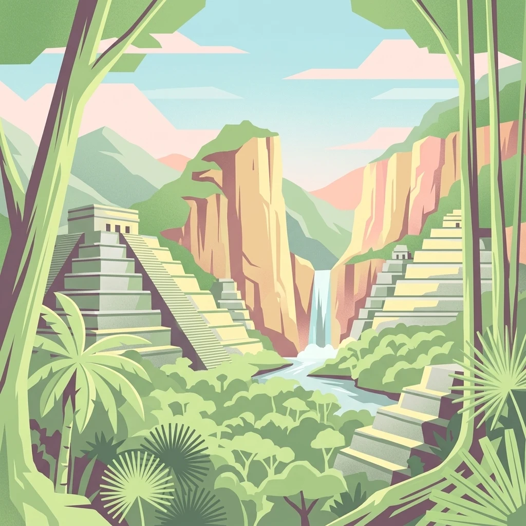
An artistic flat-style illustration of ancient Maya pyramids surrounded by tropical palm trees and jungle vegetation, with a waterfall and cliffs in the background.

El Pilar

Protected area

Park overview

Structured park overview, official facts, and landscape profile for El Pilar

El Pilar park facts, protected area profile, and essential visitor context

Review the core facts for El Pilar, including designation, size, terrain, visitor scale, habitats, and operating context in one park-focused overview.

About El Pilar

El Pilar is an ancient Maya city located on the natural boundary between Belize and Guatemala, just north of the Belize River and within easy reach of the town of San Ignacio. The name, meaning "watering basin" in Spanish, reflects the unusual abundance of streams converging below the escarpment on which the city was built, a rare hydrological feature within the broader Maya lowlands. The site's position on a high ridge placed it at the head of long causeways that connected it to neighboring centers, including Tikal more than 40 kilometers to the south.

The monumental core of El Pilar encompasses an estimated 120 acres of plazas, temples, palaces, and connecting causeways, with more than 25 major plazas and hundreds of substantial buildings. Archaeological mapping began in 1983 under the Belize River Archaeological Settlement Survey project led by Anabel Ford, and systematic excavation of access ways, stairs, and doorways has been ongoing since 1993. More recent work has used LiDAR imaging to extend the documented footprint well beyond the original surveys, much of it lying beneath intact forest cover.

What sets El Pilar apart from better-known Maya cities such as Tikal or Caracol is its deliberate preservation under canopy. Rather than clearing the forest to expose monuments, the El Pilar conservation philosophy treats the surrounding tropical forest as an essential protective shell for the architectural remains. As a result, the encounter with El Pilar is one of entering a living forest in which ancient plazas and temple platforms emerge gradually through the trees, a setting that also supports the continuation of traditional Maya forest gardening around the residential zone of Tzunu'un.

Quick facts and research context for El Pilar

El Pilar is a Maya archaeological site straddling the Belize-Guatemala border, situated on the upland escarpment about 12 kilometers north of San Ignacio, Belize. The site covers roughly 120 acres of monumental architecture and includes more than 25 plazas, making it the largest known Maya center in the Belize River area. A 5,000-acre buffer declared in 1998 as the El Pilar Archeological Reserve for Maya Flora and Fauna protects both the ancient structures and the surrounding forest.

The city has a documented occupation spanning roughly two thousand years, beginning in the Middle Preclassic period around 800 BC and reaching its peak before 1000 AD. Its core monuments, causeways, and forest gardens are jointly managed across two modern nations, and the site was placed on the World Monuments Fund's 100 Most Endangered Sites list in 1996.

Protection and recognition

Examine terrestrial protection scope and international recognition data for El Pilar.

El Pilar Protection Status and Transboundary Park Designation Records

El Pilar maintains a recorded terrestrial protection scope alongside established transboundary status within the global conservation network. Structured park data compiles documented protection metrics and designation frameworks for systematic geographic analysis.

Protection details

Protection scope
Terrestrial
Transboundary protection
Yes
Park context

Deeper park guide and search-rich context for El Pilar

El Pilar history, landscape, wildlife, and travel context

Explore El Pilar through its history, landscape character, ecosystems, wildlife, conservation priorities, cultural context, and seasonal travel timing in a structured park guide built for atlas discovery and search intent.

Why El Pilar stands out

El Pilar is best known as one of the largest Maya cities ever documented in the Belize River drainage, and as a flagship example of in-situ conservation of Maya monuments under their original forest canopy. The site's bridges, causeways, and plazas physically cross the modern Belize-Guatemala border, making it the focus of a pioneering effort to create the world's first archaeological peace park. Equally distinctive is its forest garden network, where contemporary Maya farmers maintain traditional agroforestry plots that echo the land-use patterns identified by archaeologists around the ancient residence of Tzunu'un. This fusion of living cultural practice, monumental archaeology, and tropical forest protection defines the site's global identity.
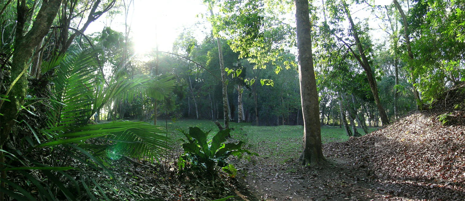
A wide, sun-drenched clearing surrounded by dense tropical forest, known as Plaza Copal at El Pilar.
The wooded clearing of Plaza Copal at the El Pilar Archaeological Reserve.

El Pilar history and protected-area timeline

Archaeologist Anabel Ford first mapped El Pilar in 1983 as part of the Belize River Archaeological Settlement Survey, identifying it as one of the most extensive concentrations of ancient Maya farmland on the edge of the major upland escarpment. Early survey work established that the site commanded a hierarchy of smaller settlements and farmsteads whose layout directly mirrored agricultural patterns in the surrounding landscape.

Intensive investigation of the monumental architecture began in 1993, when Ford and her team produced detailed engineering maps of the major plazas and began targeted excavation of stairs, doorways, and causeway connections. Tunnels cut into principal temples revealed a construction history spanning approximately two millennia, while surface mapping confirmed that the causeway system continued uninterrupted across what is today the international border between Belize and Guatemala.

In 1998 the surrounding 5,000 acres were formally designated as the El Pilar Archeological Reserve for Maya Flora and Fauna, declaring the site a protected cultural monument in both countries. Earlier, in 1996, El Pilar had been placed on the World Monuments Fund's list of 100 Most Endangered Sites, an event that helped catalyze ongoing work by Ford's team and local Maya farmers to integrate archaeological conservation with traditional forest management. Current research continues to expand the documented footprint of the site through LiDAR surveys and to develop the reserve as a model for binational heritage protection.

El Pilar landscape and geographic character

El Pilar sits atop a wooded upland escarpment that defines the geological frontier between the lowlands of the Belize River valley and the elevated interior of the Petén. The escarpment drops sharply on its southern face, giving the site commanding views over the river basin and concentrating the streams that inspired the city's Spanish name. Surrounding terrain is dominated by tropical broadleaf forest that cloaks both the monumental core and the residential zones, so that temple platforms and causeways are typically encountered as stone shapes emerging from dense green understory.

Karst features typical of the Yucatán platform are present in the wider landscape, and the elevation of the escarpment places El Pilar within a transitional zone between lowland rainforest and more seasonal interior woodland. The site's 120 acres of monumental architecture are woven into this forest rather than imposed upon it, with plazas, terraces, and stairways following the natural contours of the ridge.

El Pilar ecosystems, habitats, and plant life

The protected reserve surrounding El Pilar preserves a broad belt of mature tropical forest that includes both old-growth canopy and actively managed forest gardens. The trees and understory that have overgrown the monuments during the past millennium are now treated as a structural part of the cultural heritage, providing shade, soil stability, and microclimate buffering that protects the underlying limestone architecture.

Around the residential area of Tzunu'un, the forest has been shaped into traditional Maya forest gardens, polycultural plots that combine timber trees, fruit trees, root crops, medicinal plants, and managed understory layers. Forest gardeners from local Maya communities continue to maintain these plots as part of the El Pilar Forest Garden Network, providing a living example of the agroforestry systems that supported the original inhabitants of the city and a working model of indigenous land stewardship.

El Pilar wildlife and species highlights

The forest canopy that shelters El Pilar also supports a rich community of Neotropical wildlife characteristic of the Maya lowlands. Resident and migratory birdlife is present throughout the reserve, and the combination of old-growth forest, edge habitats along the escarpment, and actively cultivated forest gardens creates diverse feeding and nesting conditions. Mammals typical of the region, including howler and spider monkeys, deer, and various small carnivores, range across the protected area, while amphibians, reptiles, and insects thrive in the shaded limestone conditions and perennial streams of the escarpment base.

El Pilar conservation status and protection priorities

Conservation at El Pilar rests on an unusually close integration of cultural and natural heritage. Designated a protected cultural monument in both Belize and Guatemala in 1998 and placed on the World Monuments Fund's 100 Most Endangered Sites list in 1996, the site is now managed as a 5,000-acre buffer linking archaeological preservation with forest protection. The defining doctrine, developed by Anabel Ford under the banner Archaeology Under the Canopy, is that ancient Maya monuments are best preserved in the shade of the forest that has reclaimed them, rather than cleared and exposed in the open.

Park rangers are active on both sides of the border, addressing persistent threats from looting, but the broader conservation model relies on partnership with Maya land stewards. The El Pilar Forest Garden Network engages local farmers in maintaining traditional forest gardens around the ancient residential zone, demonstrating that active human cultivation and archaeological preservation can be complementary rather than conflicting land uses. The site has also been proposed as a model for transboundary heritage protection, with an ongoing initiative to designate El Pilar as the world's first archaeological peace park.

El Pilar cultural meaning and human context

El Pilar is, in equal measure, an archaeological site, a modern conservation landscape, and a living cultural landscape for Maya communities on both sides of the border. The ancient residential complex of Tzunu'un, excavated and consolidated under Ford's direction, is the only Maya house open to the public at the site, and it is integrated into a working forest garden cultivated by Maya farmers.

The site's binational character is central to its cultural meaning. The causeways and plazas identified by archaeologists physically cross the modern Belize-Guatemala frontier, and contemporary Maya people in both countries share ancestral ties to the city. The peace park vision explicitly encompasses this shared heritage, presenting El Pilar as a place where indigenous stewardship, ecological knowledge, and archaeological research converge across national boundaries.

Top sights and standout views in El Pilar

El Pilar combines the scale of a major Maya capital with a conservation philosophy that treats forest and monuments as a single heritage. Highlights include more than 25 plazas across a 120-acre monumental core, a causeway system that crosses the Belize-Guatemala border, and the only publicly accessible ancient Maya house at Tzunu'un, surrounded by actively managed forest gardens maintained by Maya farmers.

Equally notable is the site's role as a pioneering effort in transboundary heritage protection, with a formal proposal to recognize El Pilar as the world's first archaeological peace park and an ongoing LiDAR research program that continues to reveal the true footprint of the ancient city hidden beneath the canopy.

Best time to visit El Pilar

El Pilar is an outdoor archaeological and forest site in the Maya lowlands, where the climate is warm year-round and the forest remains verdent in every season. Visits during the drier months, generally running from roughly late November through April, are often more comfortable for walking the trails that link the plazas, causeways, and Tzunu'un residence, and for observing forest wildlife along the escarpment.

The wetter months, from May through October, bring heavier rain and lusher vegetation, which can make trails more difficult but also brings the forest canopy and the streams below the escarpment to full vigor. Because El Pilar's defining feature is its setting under forest cover, visitors in any season encounter the monuments embedded in green landscape rather than exposed ruins.

Monthly climate preview

Long-term representative coordinate records detailing annual temperature variations and precipitation distribution

El Pilar Climate Normals and Measured Monthly Temperature and Precipitation Rhythms

Representative coordinates record measured monthly averages spanning minimum temperatures of 13.23 degrees Celsius and maximum peaks of 39.63 degrees Celsius alongside variable precipitation rates. Analyzing complete twelve-month climatology records provides deep insight into long-term environmental patterns across the protected landscape.
Annual mean25 °C
22 °C28 °C
Jan22°
Feb24°
Mar26°
Apr28°
May28°
Jun26°
Jul26°
Aug26°
Sep26°
Oct25°
Nov23°
Dec22°
Warmest month
May

28.2 °C

Coolest month
January

22.1 °C

Wettest month
October

7.4 mm/day

Driest month
March

1.2 mm/day

Park location guide

Geography guide, regional context, and park location map for El Pilar

El Pilar park geography, regions, and map view in Belize

Understand where El Pilar sits in Belize through a broader geographic reading of the surrounding landscape, nearby location context, and its mapped position within the national park landscape.

How El Pilar fits into Belize

Belize is a Caribbean and Central American nation located on the Yucatán Peninsula's eastern coast. It gained independence from Britain in 1981 and remains a Commonwealth realm with Charles III as monarch. The country features diverse cultures, multiple spoken languages including Belizean Creole, Spanish, and Mayan languages, and is recognized for its rich marine biodiversity including the Mesoamerican Barrier Reef.

Wider geography shaping El Pilar in Belize

Belize occupies the eastern coast of the Yucatán Peninsula, stretching approximately 290 kilometres long and 110 kilometres wide. It is bordered by Mexico to the north and west, Guatemala to the south and west, and the Caribbean Sea to the east. The country also shares a maritime boundary with Honduras. The landscape includes coastal plains, swamps, and the Maya Mountains in the interior.

Map view of El Pilar

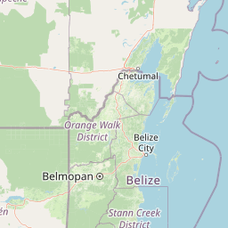
Use this park location map to pinpoint El Pilar in Belize, understand its exact geographic position, and read its mapped placement within the surrounding landscape more clearly.

Pigeon | © OpenStreetMap contributors

Visual exploration of ancient Maya architecture and tropical forest canopy

El Pilar Photos and Landscape Scenery in the Protected Forest Reserve

Photographic records reveal the forested escarpment, stone plazas, and monumental architecture of El Pilar. Visual research highlights the dense broadleaf canopy and transboundary protected terrain that define the ancient Maya city.

A wide, sun-drenched clearing surrounded by dense tropical forest, known as Plaza Copal at El Pilar.

Ancient stone steps and remnants of a Maya structure partially overgrown by vegetation in a forest setting at El Pilar.

Park atlas

Compare adjacent forest reserves and transboundary conservation zones across the regional escarpment.

Explore Other Parks Near El Pilar and Surrounding Protected Landscapes

Browse nearby national parks and protected areas sharing the tropical forest canopy and archaeological heritage of El Pilar. Expanding your view across the surrounding region reveals connected ecological corridors and diverse regional park geography.
A stylized vector illustration of tiered Mayan pyramid structures rising above a dense green jungle landscape under a soft pastel sky.
Biosphere reservePetén Department
About 0.9 km away#1 closest

West

Maya Biosphere Reserve: Geographic Overview and Protected Landscapes in Petén

Tropical forest ecosystems and ancient archaeological mapping

Covering roughly one-fifth of Guatemala, the Maya Biosphere Reserve represents a pioneering model of zoned conservation. The landscape features a complex mosaic of lowland rainforests, savanna patches, and seasonal wetlands formed over a weathered limestone platform. This atlas summary examines the reserve's ecological boundaries, its vital role in protecting Mesoamerican biodiversity, and the concentration of pre-Columbian cities located across the Petén Department.

Area
21,602 km²
Established
1990
Relief
Mixed relief
Climate
Tropical
National parkCayo District
About 28 km away#2 closest

South

Elijio Panti National Park: Protected Landscape and Regional Geography in Cayo District

Explore the mapped boundaries and geographic features of this national park.

Elijio Panti National Park offers a unique focus on protected landscape discovery within Belize. Situated in the Cayo District, this national park provides a specific geographic anchor for understanding natural terrain and mapped boundaries. The page details its identity as a protected area, contributing to a structured atlas of conservation lands and regional geography.

Area
52.645 km²
Established
2001
IUCN
II
Relief
Mountain
National parkCayo District
About 39 km away#3 closest

East

Guanacaste National Park National Park: Explore its Protected Landscape and Geographic Setting

Mapped natural terrain and regional context within Cayo District.

Delve into the specifics of Guanacaste National Park, a protected national park located in the Cayo District of Belize. This detail page is designed for atlas exploration, offering insights into the park's geographic boundaries and its significance as a defined natural landscape. Understand how this protected area fits into the regional geography and contributes to the mapped natural heritage of Belize.

Area
0.2 km²
Established
1973
IUCN
II
Climate
Tropical
National parkCayo District
About 43 km away#4 closest

South

Chiquibul National Park: Detailed Protected Area and National Park Geography

Explore mapped boundaries within Belize's Cayo District.

Chiquibul National Park offers a critical lens through which to view Belize's protected natural areas. As a designated national park located in the Cayo District, it provides essential data for understanding the extent and geographic positioning of conservation landscapes. Users can engage with detailed map information to trace the park's borders and appreciate its role within the national atlas of protected territories.

Area
1,073 km²
Established
1995
IUCN
II
Relief
Mountain
National parkCayo District
About 51 km away#5 closest

East

St. Herman's Blue Hole National Park: National Park Protected Landscape and Geographic Setting

Mapped Boundaries and Regional Landscape Context in Cayo District

St. Herman's Blue Hole National Park is an integral protected landscape within Belize, situated in the Cayo District. This national park offers specific geographic features and mapped boundaries essential for understanding its place within regional conservation. MoriAtlas provides detailed context for exploring the park's protected terrain and its contribution to the broader geographic atlas, focusing on landscape identity and mapped outlines for analytical discovery.

Area
2 km²
Established
1986
Climate
Tropical
Access
Easy access
Biosphere reserveEl Petén
About 81 km away#6 closest

South

Montañas Mayas Chiquibul Biosphere Reserve: Mapping the Maya Mountain Forest Landscapes

Exploring karst topography and protected forest corridors in El Petén

The Montañas Mayas Chiquibul biosphere reserve spans a vast, forested tract across the municipalities of San Luis and Poptún. As a cornerstone of the regional protected area network, it encompasses ridges, sinkholes, and river systems that define the transition from lowland plains to the Maya Mountain foothills. This area remains essential for understanding the natural heritage and geological complexity of northern Guatemala.

Area
1,236 km²
Relief
Highland
Water
Minor water
National parkStann-Creek District
About 85 km away#7 closest

Southeast

Mayflower Bocawina National Park: Tropical Forest, Waterfalls & Maya Sites Atlas

Explore the mapped protected landscape and geographic context of this Belizean park.

Mayflower Bocawina National Park presents a rich tapestry of dense tropical forest, dramatic waterfalls, and significant Maya archaeological sites within Belize's Stann-Creek District. As a protected national park, it offers unique opportunities for exploring its mapped terrain, natural biodiversity, and the historical landscape of ancient civilizations. Its conservation status highlights the importance of understanding such protected areas within a broader regional geography and atlas framework.

Area
28.33 km²
Established
2001
IUCN
II
Relief
Lowland
National parkToledo District
About 110 km away#8 closest

Southeast

Payne's Creek National Park: National Park Protected Landscape and Geographic Atlas

Explore mapped boundaries and regional geography in Toledo District.

Payne's Creek National Park serves as a vital protected area within Belize, recognized as a national park. This entry details its specific location within the Toledo District, emphasizing the mapped extent of its protected boundaries. It provides a foundation for understanding the park's geographic character and its role within regional conservation landscapes, ideal for atlas-based discovery.

Area
152 km²
IUCN
II
Relief
Lowland
Climate
Tropical

Common questions about visiting, size, designation, and location context for El Pilar

El Pilar FAQs for park facts, access, geography, and protected area context

Find quick answers about El Pilar, including protected-area facts, park geography, trail and visitor context, and how the park fits into its surrounding country and regional landscape.
MoriAtlas Explorer

Continue Your Protected Areas Search Across the Global Atlas

Deepen your exploration by continuing the structured search for national parks and protected areas worldwide. Utilize the comprehensive filtering capabilities to compare different conservation landscapes and refine your understanding of global park geography. Discover more about the distribution and characteristics of protected natural areas.

Global natural geography
