
Mori Atlas logo
Biosphere reserveCarsismo e grotte evaporitiche dell'Appennino settentrionale

Mapping the extensive gypsum cave systems and evaporite geological terrain in northern Italy.

Carsismo e grotte evaporitiche dell'Appennino settentrionale: Protected Karst Landscapes

The Carsismo e grotte evaporitiche dell'Appennino settentrionale preserves an extraordinary gypsum landscape across nine distinct areas in the Emilia-Romagna region. This serial protected area contains over 900 catalogued caves, representing a world-class laboratory for studying evaporite karst geomorphology and epigenetic evolution. Visitors can explore the geographic distribution of deep subterranean cavities and surface terrain features that have been scientifically documented for centuries.

karstgypsum cavesevaporite karstUNESCO World Heritagegeological heritageNorthern Apennines
A minimalist graphic illustration depicting a valley surrounded by steep cliffs, a waterfall cascading down a rock face, a flowing river in the foreground, and coniferous trees under a soft-toned sky.

Carsismo e grotte evaporitiche dell'Appennino settentrionale

Biosphere reserve

Park overview

Structured park overview, official facts, and landscape profile for Evaporitic Karst and Caves of the Northern Apennines

Evaporitic Karst and Caves of the Northern Apennines park facts, protected area profile, and essential visitor context

Review the core facts for Evaporitic Karst and Caves of the Northern Apennines, including designation, size, terrain, visitor scale, habitats, and operating context in one park-focused overview.

About Evaporitic Karst and Caves of the Northern Apennines

The Evaporitic Karst and Caves of the Northern Apennines is a serial World Heritage property that links together nine protected areas in the Apennine foothills and adjacent valleys of Emilia-Romagna. Rather than a single contiguous park, it is a curated set of representative sites that together illustrate the geological story of one of the planet's most unusual karst regions. The selection reflects a deliberate effort to showcase the diversity of gypsum formations found in the northern Apennines, from Triassic-age outcrops in the upper Secchia Valley to Miocene formations along the famous Vena del Gesso Romagnola ridge.

Geologically, the property protects an epigenetic gypsum karst terrain of international significance. Gypsum is a relatively soluble evaporite mineral, so its dissolution over millions of years produces distinctive landforms: sinkholes, dolines, blind valleys, cave systems, karren fields, and disappearing streams. At this site, these features are unusually well preserved and unusually densely packed, giving scientists an almost continuous record of how evaporite landscapes evolve. The more than 900 catalogued caves include some of the deepest gypsum caves anywhere on Earth, descending to depths on the order of 265 meters, a record depth for this rock type.

The protected areas that compose the serial property are individually significant as well. The Alta Valle Secchia encompasses the Triassic-age gypsum of the upper Secchia Valley, partly within the Appennino Tosco-Emiliano National Park. The Bassa collina reggiana and Gessi di Zola Predosa represent collinar gypsum outcrops closer to the plains. The Gessi Bolognesi form a regional park near Bologna, while the three Vena del Gesso Romagnola sectors cover one of the most celebrated gypsum formations in Italy, a long ridge that extends across the provinces of Ravenna and Rimini. The Evaporiti di San Leo contribute a striking geological-cliff landscape in the Rimini Apennines, and the Onferno Oriented Nature Reserve guards an important cave system and forested gypsum landscape on the Adriatic slope.

Although protection is distributed across multiple regional parks, nature reserves, SCI sites, and a national park, the World Heritage inscription stitches them into a single coherent narrative about evaporite karst. The result is both a geological museum and a research platform, recognized since 2023 as a property of outstanding universal value under UNESCO criterion (viii).

Quick facts and research context for Evaporitic Karst and Caves of the Northern Apennines

The site is a serial UNESCO World Heritage property inscribed in 2023 under criterion (viii), the geological criterion, with UNESCO reference number 1692 and a status of 'not in danger'.

It is located entirely within Emilia-Romagna, covering nine component areas across four provinces: Reggio Emilia, Bologna, Ravenna (including the Vena del Gesso Romagnola), and Rimini. The constituent areas include the Alta Valle Secchia within the Gessi Triassici and the Appennino Tosco-Emiliano National Park, the Bassa collina reggiana, the Gessi di Zola Predosa, the Gessi Bolognesi Regional Park, three sectors of the Vena del Gesso Romagnola Regional Park (Monte Penzola, Monte Casino, and Monte Mauro), the Evaporiti di San Leo, and the Onferno Oriented Nature Reserve.

The property is distinctive for its gypsum karst: a globally rare terrain type containing over 900 catalogued caves, a combined explored length of more than 100 kilometers, and caves reaching approximately 265 meters in depth, the deepest gypsum caves known on Earth.

Protection and recognition

Documented terrestrial protection scope, designation history, and international recognition records

Carsismo e grotte evaporitiche dell'Appennino settentrionale Protection Status and UNESCO Recognition

Terrestrial protection status for Carsismo e grotte evaporitiche dell'Appennino settentrionale spans designated management frameworks established in 2023. International recognition features documented UNESCO World Heritage status under the Evaporitic Karst and Caves of Northern Apennines listing.

International recognition

Protection details

Protection scope
Terrestrial
Designated year
2023
Transboundary protection
No
Park context

Deeper park guide and search-rich context for Evaporitic Karst and Caves of the Northern Apennines

Evaporitic Karst and Caves of the Northern Apennines history, landscape, wildlife, and travel context

Explore Evaporitic Karst and Caves of the Northern Apennines through its history, landscape character, ecosystems, wildlife, conservation priorities, cultural context, and seasonal travel timing in a structured park guide built for atlas discovery and search intent.

Why Evaporitic Karst and Caves of the Northern Apennines stands out

The property is best known for hosting the most studied and one of the most extensive evaporite karst systems in the world, with a remarkable concentration of gypsum caves spread across a relatively compact stretch of the northern Apennines. Its scientific fame rests on the unusual completeness of its epigenetic gypsum karst terrain, the extreme density of caves within a small area, and the existence of caves so deep that they hold records among gypsum cavities globally. This combination of density, depth, preservation, and centuries of continuous study has established the site as the international reference for evaporite karst research and for understanding how soluble evaporite rocks sculpt landscapes over geological time.
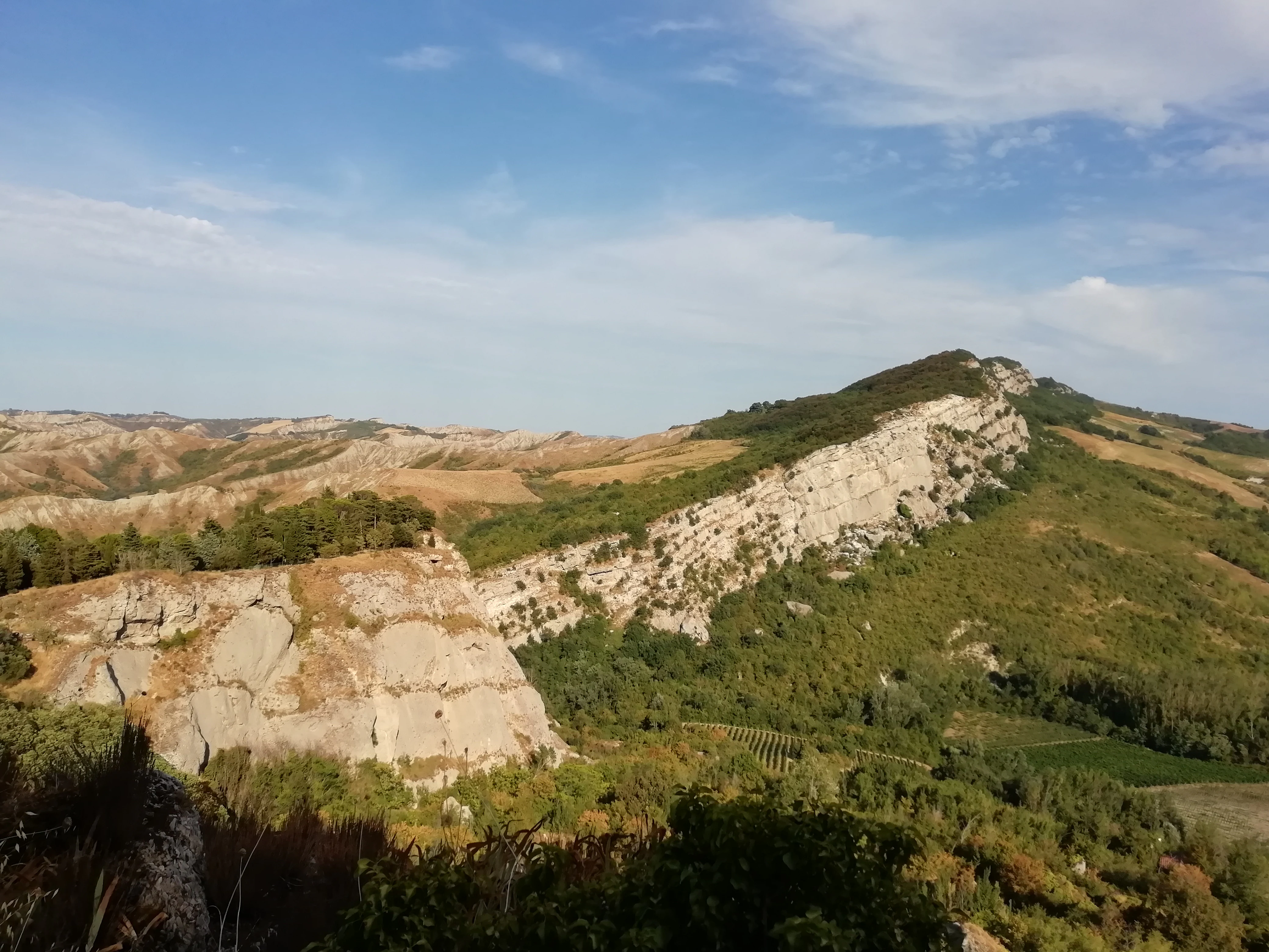
A landscape view of light-colored, exposed gypsum rock formations and rugged hills in the Italian Appennine region under a clear sky.
A wide view of the Riva di San Biagio and Tramosasso gorge in the Vena del Gesso Romagnola landscape.

Evaporitic Karst and Caves of the Northern Apennines history and protected-area timeline

Scientific interest in the gypsum caves and karst features of the northern Apennines stretches back to the sixteenth century, making this the longest continuously studied evaporite karst region in the world. Early naturalists documented cave formations and unusual landscape features long before modern geology provided the conceptual framework to interpret them, and the area has continued to attract researchers through every subsequent phase of karst science.

Modern protection of the landscape developed gradually through the late twentieth and early twenty-first centuries, as several of the component areas gained status as regional parks, nature reserves, sites of community importance under the European Natura 2000 network, or sectors of the Appennino Tosco-Emiliano National Park. By the early 2020s, this patchwork of protections already encompassed the most important gypsum outcrops in Emilia-Romagna.

The pivotal moment came in 2023, when UNESCO inscribed the Evaporitic Karst and Caves of the Northern Apennines on the World Heritage List under criterion (viii). As Italy's 59th World Heritage entry, the inscription recognized the property's outstanding universal value for geology and geomorphology, formally linking nine separate areas into a single serial site that tells the unified story of evaporite karst evolution.

Evaporitic Karst and Caves of the Northern Apennines landscape and geographic character

The landscape of the property is shaped almost entirely by the dissolution of gypsum and other evaporite rocks, producing a karst terrain of unusual richness and character. Where gypsum beds outcrop at the surface, the ground is sculpted into rounded dolines, blind valleys, swallow holes, karren fields, and abrupt scarps. Streams often vanish into the bedrock only to reappear kilometers downstream, and the result is a patchwork of bare rock outcrops, grassy hollows, and forested pockets that alternates over short distances.

The northern component areas capture the older, Triassic-age gypsum of the upper Secchia Valley, where massive white rock cliffs rise above the river. Toward Bologna and the Reggio Emilia low hills, gypsum outcrops form gentler, rolling terrain with quiet dolines and small cave entrances tucked into wooded slopes. The Vena del Gesso Romagnola, the most spectacular sector, is a continuous ridge of Miocene gypsum stretching across the provinces of Ravenna and Rimini, presenting long white cliff faces, deep gorges, and an extraordinary concentration of caves within its flanks.

Further south and east, the Evaporiti di San Leo introduce a dramatic cliff-and-fortress scenery, while the Onferno reserve protects a wooded karst landscape laced with caves close to the Adriatic slope. Across all nine areas, the interplay of pale gypsum, green forest, and reddish clay soils gives the property a distinctive visual identity that is rare in Europe.
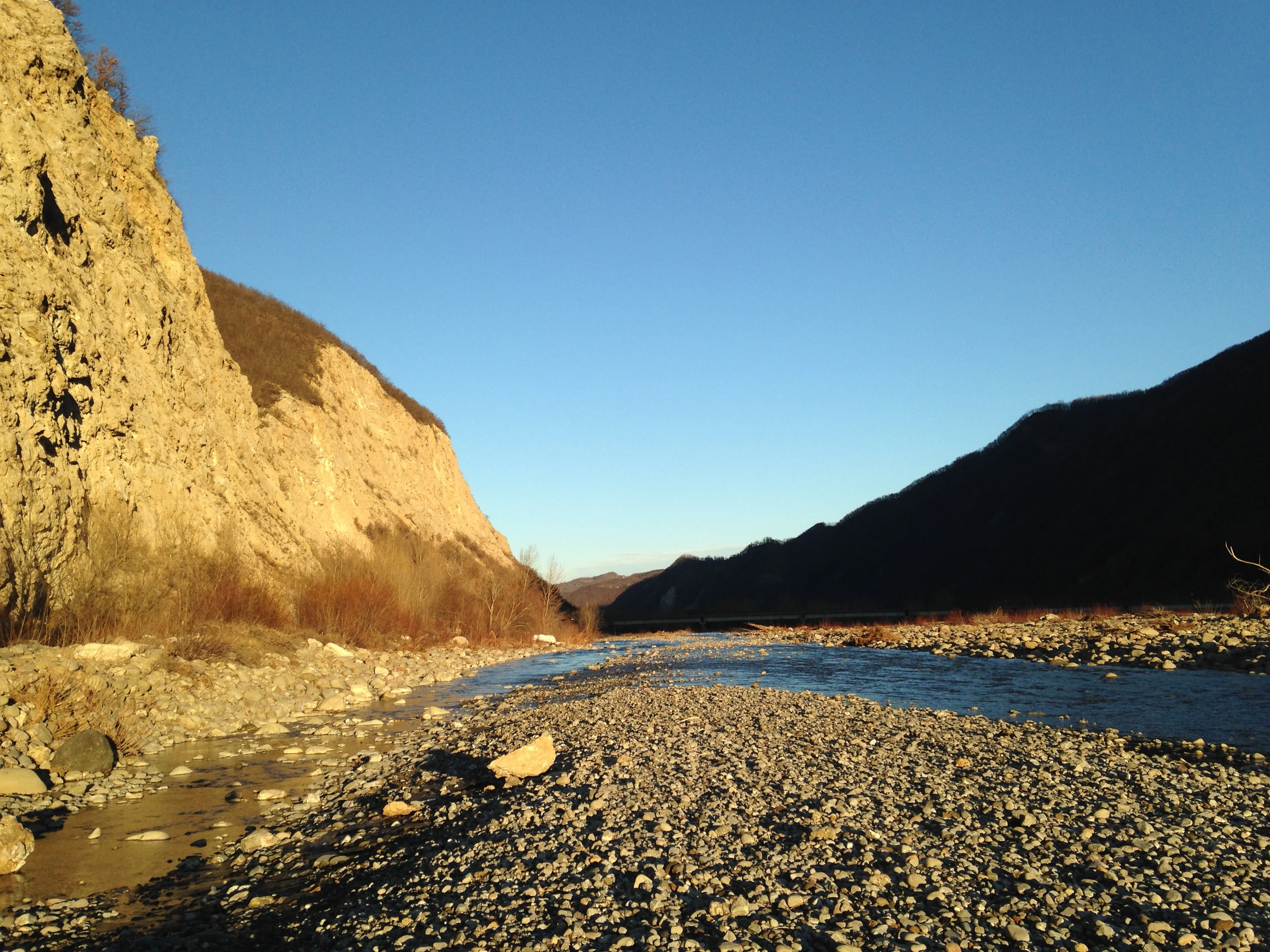
A wide angle view of the Secchia River flowing between steep, sunlit gypsum cliffs and rocky embankments under a clear blue sky.
Sunset over the Secchia River and the gypsum cliffs of the Apennines.

Evaporitic Karst and Caves of the Northern Apennines ecosystems, habitats, and plant life

The ecological character of the property is closely tied to its geology. Gypsum karst landscapes support specialized plant communities adapted to calcium-rich, often dry and rocky substrates. The vegetation alternates between exposed bare rock, xerophilous grasslands, garrigue-like scrub, and patches of forest that have colonized older, more stable surfaces. The bare white outcrops of the Vena del Gesso Romagnola and the Triassic gessi host some of the most distinctive of these plant assemblages, including gypsum-endemic species that find refuge in the Apennine foothills precisely because the rock chemistry excludes more competitive plants.

Cave ecosystems form another important ecological dimension of the site. Beyond the obvious geological interest, the more than 900 caves provide habitat for cave-dwelling invertebrates and bats, and the constant temperature, humidity, and isolation of gypsum cavities create refuges that complement the surface landscape. Forested karst valleys, like those around Onferno, support richer woodland communities that bridge between the bare geological outcrops and the broader Apennine forest biota, giving the serial property a layered ecological mosaic rather than a single uniform habitat type.
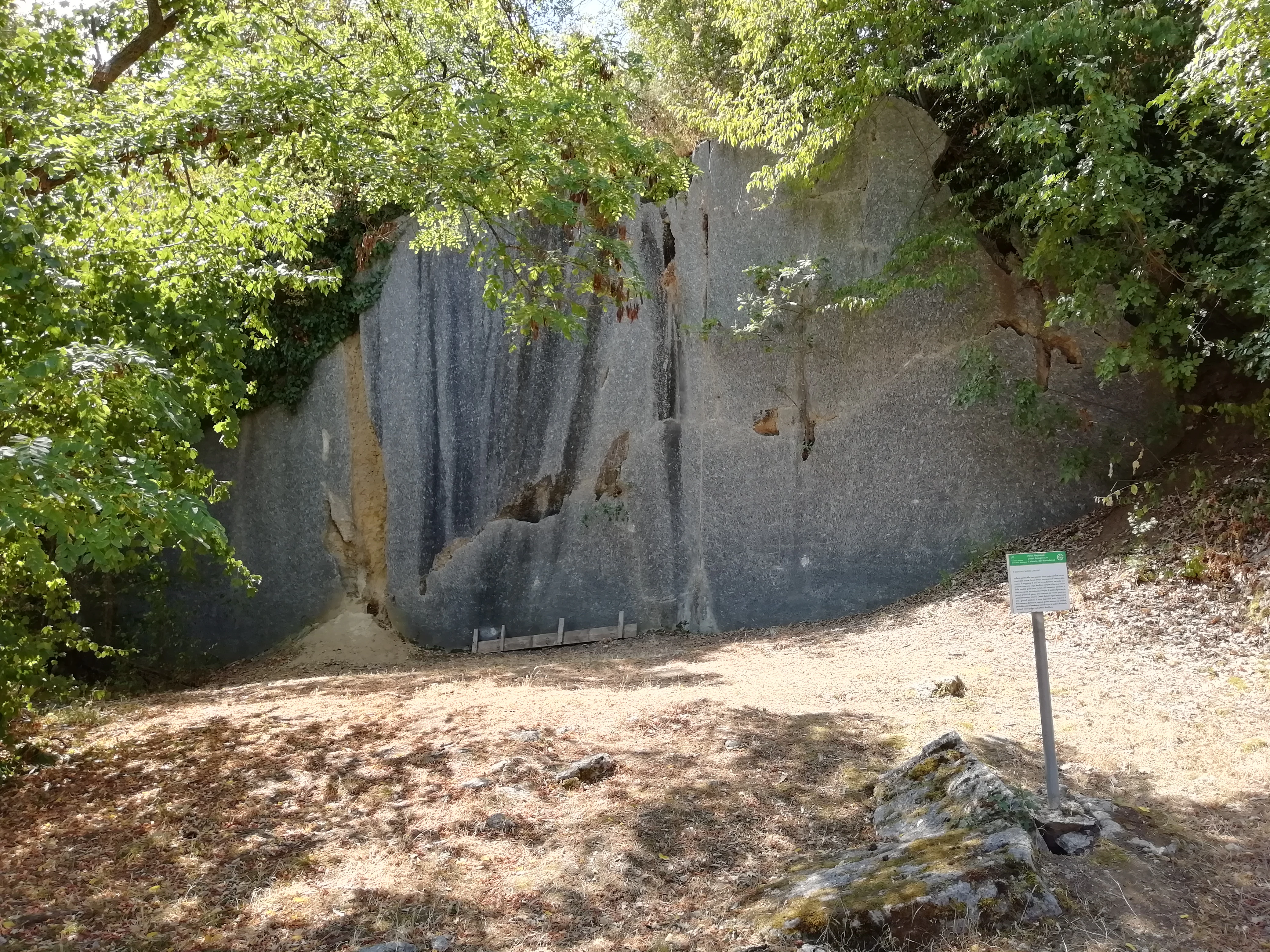
A rock face in a quarry showing vertical gouges and voids from ancient water erosion, surrounded by trees, with an interpretive sign in the foreground.
The Cava Filo quarry displays a cross-section of paleo-karst conduits carved into the gypsum rock.

Evaporitic Karst and Caves of the Northern Apennines wildlife and species highlights

Gypsum karst areas such as these are not known for charismatic large mammals in the way that alpine or woodland parks might be, but they shelter a distinctive and ecologically significant fauna shaped by caves, cliffs, and patchy forest.

Bats are among the most important animal inhabitants, using the extensive cave systems for roosting and hibernation. The numerous deep cavities across all nine component areas provide a network of bat habitat that is unusually rich for an Italian low-mountain context. Cave-dwelling invertebrates, including species restricted to gypsum environments, are also an important focus of biological study.

The fragmented forest patches, scrub-covered dolines, and cliff faces that characterize the property support typical Apennine fauna in adapted form: owls and other raptors hunt the open rocky areas, small mammals move through woodland edges, and reptiles and insects take advantage of the warm, exposed gypsum surfaces. The Onferno reserve, in particular, is noted for its well-preserved woodland fauna alongside its cave fauna, and the broader property contributes meaningfully to regional biodiversity despite the rocky dominance of the terrain.
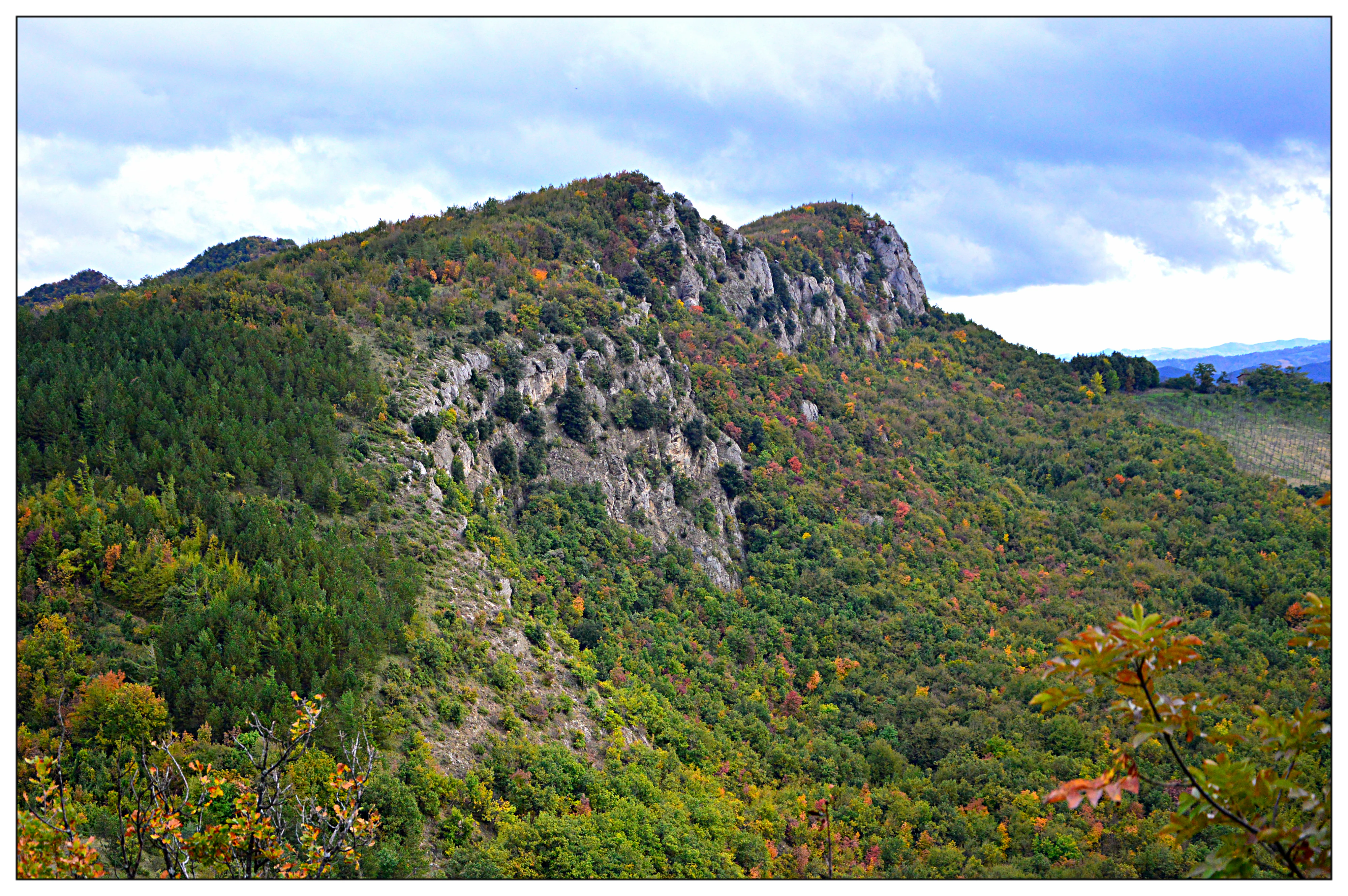
A landscape view of a hilly, forested ridge showing exposed rocky gypsum cliffs under a cloudy sky.
Panoramic view of the gypsum outcrops at Monte Mauro.

Evaporitic Karst and Caves of the Northern Apennines conservation status and protection priorities

The serial property has conservation significance that goes well beyond the usual framing of a protected natural area. Its inscription under UNESCO criterion (viii) formally recognizes that the gypsum karst terrain of the northern Apennines represents an outstanding universal record of geological and geomorphological processes, the kind of site whose scientific and educational value is of importance to all humanity.

From a regional perspective, the property consolidates protection across a network of already-designated conservation instruments, including regional parks (Gessi Bolognesi, Vena del Gesso Romagnola), a national park sector (Appennino Tosco-Emiliano), an oriented nature reserve (Onferno), and several Natura 2000 sites. This mosaic of designations ensures that the most representative gypsum outcrops are legally shielded from quarrying, uncontrolled development, and habitat degradation, while also allowing each area to be managed in a way tailored to its specific ecological conditions.

The site's standing as the first and most thoroughly studied evaporite karst region in the world also gives it a special role in conservation science. Decades, in some cases centuries, of continuous research mean that it functions as a baseline against which other gypsum karst regions can be measured, and as a training ground for the next generation of karst scientists. The World Heritage inscription reinforces this role by making the site an international reference point for evaporite karst conservation.

Evaporitic Karst and Caves of the Northern Apennines cultural meaning and human context

Human interaction with these landscapes is long-standing. The dramatic cliffs and ridges of gypsum karst, particularly along the Vena del Gesso Romagnola and around San Leo, have hosted settlements, fortifications, and places of spiritual significance for centuries. Medieval and Renaissance communities made use of gypsum as a building material, and the ridge-top villages of the Apennine foothills developed in close dialogue with the underlying geology.

The cave systems themselves have a lesser but real place in regional folklore and local knowledge, with several of the larger caves historically associated with legends, water sources, or hermit refuges. Modern cultural life in the surrounding valleys continues to be shaped by the gypsum landscape, from traditional agricultural use of karst pastures to the contemporary identity of protected areas as places of recreation, education, and environmental stewardship.
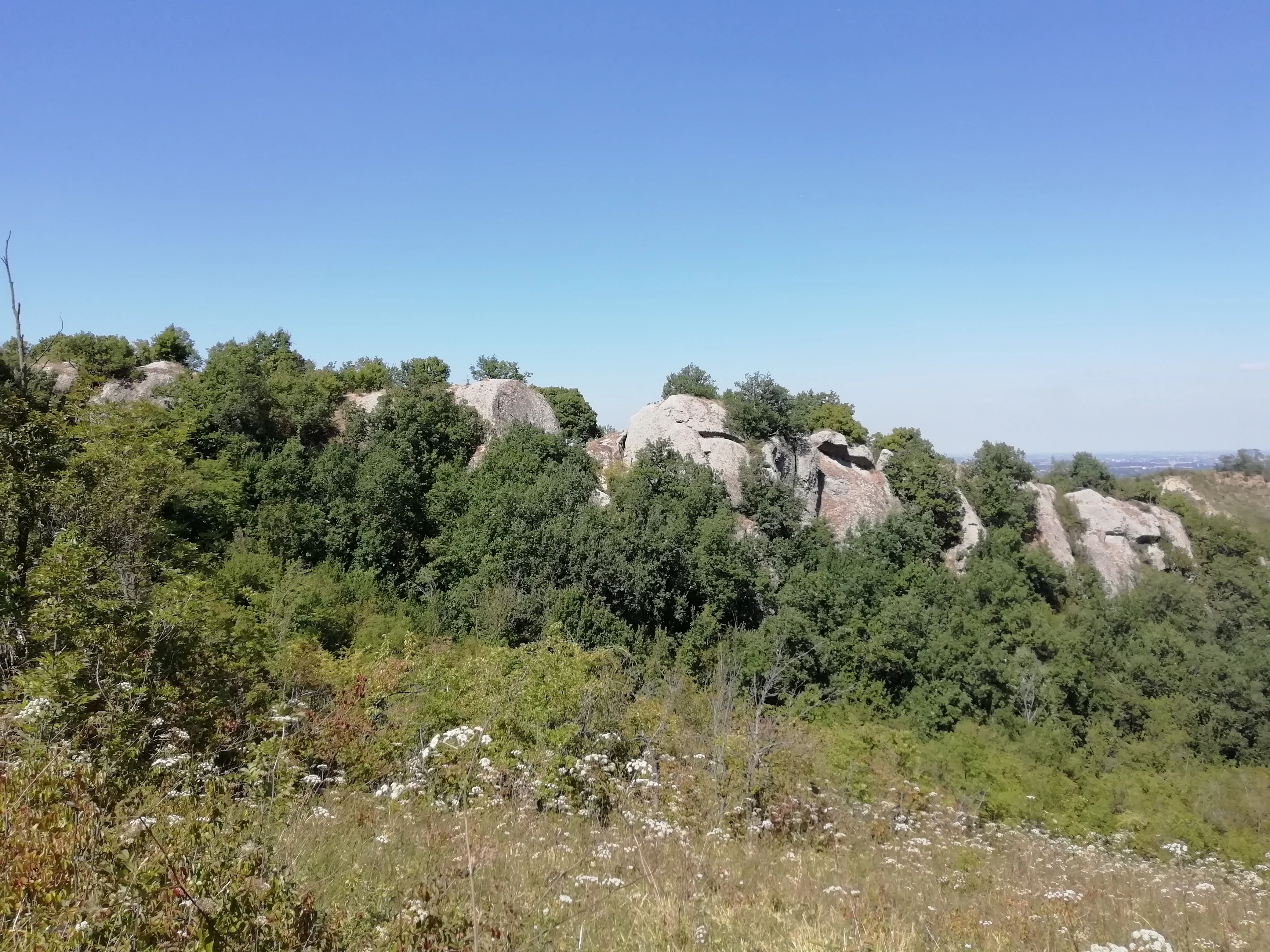
A sunny, eye-level view of a hillside covered in Mediterranean scrub and large, grey, weathered gypsum rock outcrops under a clear blue sky.
The gypsum rock formations of Monte Castello in the northern Apennines.

Top sights and standout views in Evaporitic Karst and Caves of the Northern Apennines

Among the most compelling features of the property is the sheer concentration of caves: more than 900 catalogued cavities spread across nine component areas, with a combined explored length beyond 100 kilometers. Within this cave network lie some of the deepest gypsum caves on Earth, reaching approximately 265 meters below the surface, a record depth for caves formed in soluble evaporite rock.

The property also stands out for the diversity of gypsum ages and formations it protects. From the ancient Triassic gypsum of the upper Secchia Valley to the Miocene formations of the Vena del Gesso Romagnola, the serial site captures multiple chapters of evaporite karst evolution in a single region. Coupled with centuries of continuous scientific study, this makes the property an unmatched natural laboratory for understanding how soluble rocks shape terrain.
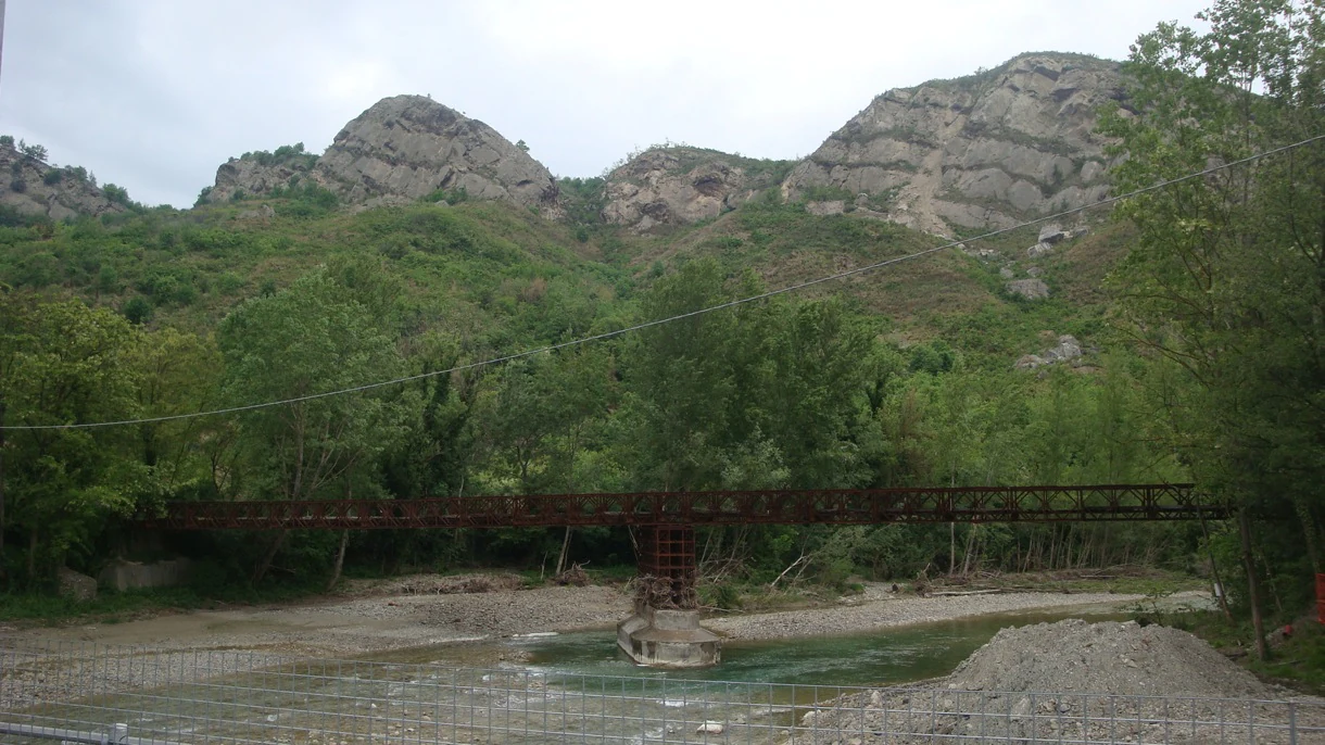
A metal truss bridge crossing a shallow, rocky river with green hills and exposed geological cliffs in the background.
A Bailey bridge spanning the Santerno river near Borgo Tossignano.

Best time to visit Evaporitic Karst and Caves of the Northern Apennines

The northern Apennine foothills enjoy a climate that varies substantially with elevation and exposure, with warmer conditions along the lower hills closer to the Po Plain and cooler, snowier winters in the higher Triassic gypsum areas. Spring and early autumn are broadly the most rewarding seasons for exploring the surface landscape, when mild temperatures bring out wildflowers on the gypsum grasslands and comfortable conditions make the karst ridges and dolines pleasant to walk.

Caves maintain a near-constant cool temperature year-round, which means underground visits are largely indifferent to the season but can feel particularly striking in summer, when the contrast with hot surface conditions is greatest. Winter can bring snow to the higher component areas, transforming the white gypsum outcrops into striking landscapes, though some paths may become more demanding. Travellers interested primarily in bat colonies and cave wildlife should be aware that bat activity follows its own seasonal cycle, with summer roosts and winter hibernation periods in the caves.
Monthly climate preview

Long-term monthly temperature and precipitation patterns across the representative park coordinate

Carsismo e grotte evaporitiche dell'Appennino settentrionale climate normals and annual temperature rhythm

Representative coordinates record distinct annual temperature ranges alongside measured monthly precipitation averages from 1991 to 2020. Examining the complete twelve-month climate profile reveals comprehensive statistical variations across the protected terrain.
Annual mean13 °C
3 °C24 °C
Jan
Feb
Mar
Apr11°
May16°
Jun21°
Jul24°
Aug24°
Sep19°
Oct13°
Nov
Dec
Warmest month
July

24.4 °C

Coolest month
January

2.6 °C

Wettest month
November

3.1 mm/day

Driest month
July

1.2 mm/day

Park location guide

Geography guide, regional context, and park location map for Evaporitic Karst and Caves of the Northern Apennines

Evaporitic Karst and Caves of the Northern Apennines park geography, regions, and map view in Italy

Understand where Evaporitic Karst and Caves of the Northern Apennines sits in Italy through a broader geographic reading of the surrounding landscape, nearby location context, and its mapped position within the national park landscape.

How Evaporitic Karst and Caves of the Northern Apennines fits into Italy

Italy is a unitary parliamentary republic in Southern and Western Europe, located on the Italian Peninsula with the Alps to the north. It borders France, Switzerland, Austria, Slovenia, Vatican City, and San Marino, and shares maritime boundaries with several Mediterranean countries. The country has approximately 59 million residents and uses the Euro as its currency.

Wider geography shaping Evaporitic Karst and Caves of the Northern Apennines in Italy

Italy occupies a boot-shaped peninsula in southern Europe, bordered by the Alps to the north. It shares land borders with France, Switzerland, Austria, Slovenia, Vatican City, and San Marino. The country includes the Mediterranean islands of Sicily and Sardinia, along with approximately 800 smaller islands.

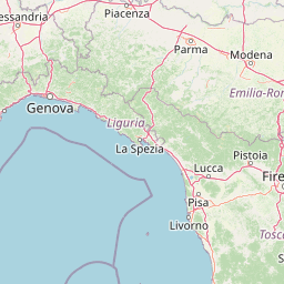
Map view of Evaporitic Karst and Caves of the Northern Apennines

Use this park location map to pinpoint Evaporitic Karst and Caves of the Northern Apennines in Italy, understand its exact geographic position, and read its mapped placement within the surrounding landscape more clearly.

Pigeon | © OpenStreetMap contributors

Location context for Evaporitic Karst and Caves of the Northern Apennines

Emilia-Romagna

Visual reference collection showcasing gypsum karst terrain, white cliffs, and cave environments across the Northern Apennines.

Carsismo e grotte evaporitiche dell'Appennino settentrionale Landscape and Scenery Photography

Visual documentation of Carsismo e grotte evaporitiche dell'Appennino settentrionale reveals the striking surface morphology of epigenetic gypsum karst, from white limestone scarps to forested dolines. Examining these protected landscape photographs helps researchers and visitors understand the geological formations and surface topography characteristic of the region.

A landscape view of light-colored, exposed gypsum rock formations and rugged hills in the Italian Appennine region under a clear sky.

A wide angle landscape shot of the Vena del Gesso Romagnola ridge in autumn, showing rocky outcrops, vibrant orange and yellow forest foliage, and a valley filled with low mist.

A wide angle view of the Secchia River flowing between steep, sunlit gypsum cliffs and rocky embankments under a clear blue sky.

A rock face in a quarry showing vertical gouges and voids from ancient water erosion, surrounded by trees, with an interpretive sign in the foreground.

A landscape view of a hilly, forested ridge showing exposed rocky gypsum cliffs under a cloudy sky.

A steep, wooded slope featuring moss-covered limestone or gypsum rocks, dirt paths, and dense green tree canopy filtering sunlight.

A sunny, eye-level view of a hillside covered in Mediterranean scrub and large, grey, weathered gypsum rock outcrops under a clear blue sky.

A metal truss bridge crossing a shallow, rocky river with green hills and exposed geological cliffs in the background.

Park atlas

Compare surrounding regional parks and protected landscapes across northern Italy

Parks Near Carsismo e Grotte Evaporitiche Dell'Appennino Settentrionale

Browsing other protected areas near Carsismo e grotte evaporitiche dell'Appennino settentrionale reveals broader geological formations and regional park geography. Examining adjacent terrain helps place notable gypsum cave systems into a wider natural conservation context.
Watercolor painting of rolling green hills under a sunset sky with soft color transitions
National parkEmilia-Romagna
About 0.5 km away#1 closest

Southwest

Appennino Tosco-Emiliano National Park: Explore Its National Park Boundaries and Geography

Discover the mapped landscape and regional context of this protected area.

Appennino Tosco-Emiliano National Park is a designated national park offering a rich area for geographic exploration. This MoriAtlas entry details the park's protected landscape, providing insights into its mapped boundaries and its contribution to the natural terrain of the Emilia-Romagna region. Understand its significance within the broader atlas of Italian protected areas, focusing on its unique geographic identity and landscape context.

Area
227.92 km²
Established
2001
IUCN
II
Relief
Mountain
Watercolor illustration of stylized rolling green mountains and a treeline in shades of green, pink, and soft yellow.
Nature reserveEmilia-Romagna
About 36 km away#2 closest

Northwest

Monte Prinzera Nature Reserve: Emilia-Romagna Protected Ophiolite and Geological Atlas

Ancient oceanic crust and rare ecological habitats

Monte Prinzera represents a singular geological anomaly in the Apennine foothills, characterized by its deep rust-red color and specialized dry Mediterranean vegetation. As the only protected ophiolite site in Emilia-Romagna, the reserve offers essential insight into ultramafic ecology, hosting a mosaic of mixed deciduous woodlands and xerophilous grasslands that support unique populations of birds, bats, and mammals.

Established
1990
Relief
Mountain
Scope
Terrestrial
Water
Minor water
Marine protected areaFrance
About 47 km away#3 closest

Southwest

Sanctuaire Pelagos Marine Protected Area: Mediterranean Geography and Seascape

A transboundary conservation zone spanning 87,500 square kilometers.

Sanctuaire Pelagos represents a unique collaborative effort in marine conservation across the Mediterranean. Spanning the waters between France, Italy, and Monaco, this protected maritime area is defined by its deep-sea canyons and nutrient-rich currents that sustain diverse cetacean populations. Its immense scale and international governance make it a focal point for understanding Mediterranean marine biodiversity and environmental policy.

Area
87,500 km²
Established
1999
IUCN
IV
Relief
Lowland
Nature reserveEmilia-Romagna
About 61 km away#4 closest

North

Riserva naturale di Torrile e Trecasali: Protected Wetland Geography in Emilia-Romagna

A regional nature reserve and migratory bird sanctuary

Located in the lowlands of the Po Valley, Riserva naturale di Torrile e Trecasali protects a concentrated variety of freshwater habitats. From reed-fringed canals to seasonal flood meadows, this site provides essential mapping context for understanding lowland riparian corridors and their role in regional biodiversity within northern Italy.

Area
1.09 km²
Established
2010
IUCN
IV
Watercolor illustration of a mountainous coastal landscape with green vegetation and a body of water
National parkLiguria
About 65 km away#5 closest

Southwest

Cinque Terre National Park: Protected Area Geography and Mapped Landscape

Explore its regional context in Liguria, Italy.

Examine Cinque Terre National Park as a key protected area within the rugged geography of Italy's Liguria region. This dedicated atlas entry provides essential geographic context, detailing the park's mapped boundaries and its significance as a national park. Understand how this protected landscape fits within the broader regional terrain, offering a structured view for geographic discovery and map-based exploration of Italy's protected areas.

Area
22 km²
Established
1999
IUCN
V
Relief
Mountain
Watercolor painting of a landscape with rolling hills, green fields, and a body of water under a pink sky
National parkForlì-Cesena Province
About 107 km away#6 closest

Southeast

Foreste Casentinesi, Monte Falterona, Campigna National Park: A Mapped Protected Landscape in Italy

National Park within Forlì-Cesena Province, Emilia-Romagna

Foreste Casentinesi, Monte Falterona, Campigna National Park is an important protected natural area situated in Forlì-Cesena Province, northeastern Italy. As a designated national park, it serves as a key landmark for exploring mapped protected land boundaries and understanding its specific contribution to the regional geography. This page provides an atlas-centric view, highlighting the park's geographic context and its identity as a significant protected landscape for discovery and reference.

Area
368 km²
Established
1993
IUCN
II
Relief
Mountain
National parkTuscany
About 107 km away#7 closest

South

Arcipelago Toscano National Park: Protected Islands and Mediterranean Landscape Atlas

Explore Tuscany's unique archipelago geography and protected natural terrain.

Arcipelago Toscano National Park offers a unique perspective on Mediterranean island ecosystems through its comprehensive atlas and mapped landscape context. Covering seven main islands and surrounding marine areas off the coast of Tuscany, this park protects dramatic granite cliffs, endemic flora, and vital habitats for marine and avian life. Understand its geographic scope, protected boundaries, and the distinctive natural terrain that defines this significant Italian conservation landscape.

Area
746.63 km²
Established
1996
IUCN
II
Relief
Mixed relief
Nature reserveLombardia
About 133 km away#8 closest

Northwest

Riserva naturale garzaia di Porta Chiossa: Protected Woodland and Heronry in Lombardia

Historic lowland forest and bird sanctuary geography

Located in the heart of the Po Plain, this nature reserve maintains an essential mosaic of wet woodland and riverine trees. Explore the boundaries of this ecological sanctuary, which remains one of the few surviving sections of the ancient Visconti hunting grounds, offering a unique window into the natural history of the Lombardy region.

Area
0.8 km²
Established
1984
IUCN
IV

Common questions about visiting, size, designation, and location context for Evaporitic Karst and Caves of the Northern Apennines

Evaporitic Karst and Caves of the Northern Apennines FAQs for park facts, access, geography, and protected area context

Find quick answers about Evaporitic Karst and Caves of the Northern Apennines, including protected-area facts, park geography, trail and visitor context, and how the park fits into its surrounding country and regional landscape.
MoriAtlas Explorer

Continue Your Protected Areas Search Across the Global Atlas

Deepen your exploration by continuing the structured search for national parks and protected areas worldwide. Utilize the comprehensive filtering capabilities to compare different conservation landscapes and refine your understanding of global park geography. Discover more about the distribution and characteristics of protected natural areas.

Global natural geography