


Mori Atlas logo
Wildlife reserveChikangawa Forest Reserve

Understanding the intersection of commercial pine plantations and native montane ecosystems in northern Malawi

Chikangawa Forest Reserve: An Atlas of the Viphya Mountains Protected Wildlife Landscapes

Chikangawa Forest Reserve spans the undulating ridges and plateaus of the Viphya Mountains in northern Malawi. This extensive protected area serves as a vital upland watershed, balancing large scale exotic pine plantations with pockets of indigenous evergreen montane forest. Detailed mapping reveals a complex terrain of steep slopes and sheltered valleys that provide essential habitat for forest-dependent species while regulating natural hydrology across the region.

forest reservepine plantationmountainsmontane forestwatershedNorthern Region Malawi
A flat vector-style illustration of a lush mountain valley featuring coniferous trees, rugged cliffs, and a small waterfall flowing into a stream, rendered in a warm, pastel color palette.

Chikangawa Forest Reserve

Wildlife reserve

Park overview

Structured park overview, official facts, and landscape profile for Chikangawa Forest Reserve

Chikangawa Forest Reserve park facts, protected area profile, and essential visitor context

Review the core facts for Chikangawa Forest Reserve, including designation, size, terrain, visitor scale, habitats, and operating context in one park-focused overview.

About Chikangawa Forest Reserve

Chikangawa Forest Reserve dominates the central section of the Viphya Mountains in northern Malawi, sweeping along the main road route between Mzuzu and Nkhata Bay. The reserve was set aside in 1948 to conserve the natural forests and water sources of the Viphya range, a relatively isolated highland block that rises between Lake Malawi to the east and the lower plains to the west. Decades later, it also became the setting for one of the most ambitious industrial afforestation programs in the region.

At the heart of Chikangawa lies the Viphya Plantation, a vast man-made forest of exotic pine trees established from 1964 originally with the aim of producing construction timber. While that industrial ambition proved difficult to realize at full scale, the plantations matured into one of Africa's most extensive tropical pine forests, fundamentally altering the visual and ecological character of the central Viphya range. Around and above the plantation belt, patches of native evergreen montane forest persist, harboring the indigenous flora the reserve was originally created to protect.

Chikangawa's significance is not only ecological. The reserve helps safeguard the upland catchments that feed rivers flowing down toward Lake Malawi and into the agricultural lowlands of northern Malawi, contributing to regional water security, soil stability, and microclimate moderation. It is managed by the Department of Forestry within the national system of forest reserves, with a stated mission of conserving forest resources sustainably while supporting local livelihoods and national development. Today, Chikangawa combines active timber production, biodiversity conservation, watershed protection, and an increasing role in ecotourism and research, making it a multi-use landscape rather than a strictly preserved wilderness.

Quick facts and research context for Chikangawa Forest Reserve

Chikangawa Forest Reserve lies in the Northern Region of Malawi, on the Viphya Mountains west of the shore of Lake Malawi. It is a state-managed forest reserve administered by the Department of Forestry and was formally established in 1948. The reserve covers on the order of 1,150 square kilometers, making it one of the largest contiguous forest blocks in the country.

Its character is unusual for tropical Africa: a large plantation of exotic pine trees overlays the central area, while surviving stands of native evergreen montane forest persist in pockets across the mountains. The reserve's principal roles are timber production, watershed protection, biodiversity conservation, and support for nearby communities. The road from Mzuzu toward Nkhata Bay crosses the heart of the reserve and is the most common way visitors experience the landscape.

Protection and recognition

Documented terrestrial protection scope and conservation status records

Chikangawa Forest Reserve Protection Status and Recognition Data

Chikangawa Forest Reserve maintains a documented terrestrial protection scope without external international recognition listings on file. Structured conservation records provide clear reference data regarding management parameters and administrative boundaries.

Protection details

Protection scope
Terrestrial
Transboundary protection
No
Park context

Deeper park guide and search-rich context for Chikangawa Forest Reserve

Chikangawa Forest Reserve history, landscape, wildlife, and travel context

Explore Chikangawa Forest Reserve through its history, landscape character, ecosystems, wildlife, conservation priorities, cultural context, and seasonal travel timing in a structured park guide built for atlas discovery and search intent.

Why Chikangawa Forest Reserve stands out

Chikangawa is best known for the vast pine plantation created on the Viphya Plateau in the second half of the twentieth century, together with the surviving indigenous montane forests it was designed to protect. The reserve stands out as one of southern Africa's most prominent examples of an African man-made pine forest established in a tropical setting. It is also recognized for the scenic Chikangawa road that climbs through the Viphya Mountains, offering long-distance views over Lake Malawi and the surrounding highlands. Ecologically, the reserve is notable for mixing commercial plantation forestry with native evergreen forest, providing habitat for rare Malawian species such as Mulanje cedar specimens and primates including the red colobus monkey.
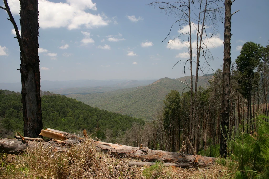
A wide view of a forested mountainous landscape under a partly cloudy sky, with pine trees in the foreground and a large fallen log.
A view overlooking the rolling terrain of the Viphya Mountains, characterized by pine forest and hillside slopes.

Chikangawa Forest Reserve history and protected-area timeline

Chikangawa Forest Reserve was formally established in 1948 as a protected forest area in the Northern Region of Malawi. Its creation responded to growing recognition of the ecological and hydrological importance of the Viphya Mountains, whose indigenous forests helped sustain water sources for downstream communities and farmland. By placing the range under formal protection, the colonial-era administration sought to safeguard native forests, stabilize soils, and regulate forest use in the highlands.

The reserve remained primarily a conservation and watershed-protection zone through the mid-twentieth century. A major shift came in 1964 with the establishment of the Viphya Plantation within the reserve, a large-scale afforestation project aimed at producing construction timber. The plantation expanded rapidly across the central Viphya and converted much of the original landscape into the exotic pine stands that define Chikangawa today, even as the broader industrial goal of large-scale timber supply was not fully realized.

In the years that followed, the reserve's role evolved from a purely protective designation toward a multi-use landscape managed by Malawi's Department of Forestry. Sustainable timber harvesting from the plantations became a core activity, alongside biodiversity conservation, watershed management, and support for local communities. The reserve has since been recognized as a key site for conservation and sustainable forest management in Malawi, even as it continues to balance the legacy of plantation forestry with efforts to protect remaining indigenous forest patches and broader ecosystem services.

Chikangawa Forest Reserve landscape and geographic character

The landscape of Chikangawa is defined by the long ridgelines and undulating plateau of the Viphya Mountains, with elevations that support a distinctly cooler and wetter microclimate than the surrounding lowlands. The reserve spans the central spine of this range, creating a vast expanse of forested slopes, broad ridges, and sheltered valleys that descend toward Lake Malawi in the east.

The visual identity of Chikangawa owes much to its pine plantations. Across the middle elevations, vast stands of tall exotic pine form a continuous canopy, broken by plantation compartments of different ages and by clearings used for roads and settlements. Above and between these plantations, patches of native evergreen montane forest survive, with denser undergrowth, mixed broadleaf trees, and more structurally varied vegetation. The contrast between plantation pine and natural forest is one of the defining visual signatures of a visit to the reserve.

The driving experience is a major part of the reserve's landscape character. The Chikangawa road climbs and descends through the mountains, with steep banks of pine on either side, sharp curves, and open viewpoints where the forest opens onto sweeping vistas. On clear days, travelers can see across the hills toward Lake Malawi and, in the other direction, across the plateau to the rolling terrain of northern Malawi.

Chikangawa Forest Reserve ecosystems, habitats, and plant life

Ecologically, Chikangawa occupies a transitional position between tropical lowland vegetation and the cooler montane flora of southern East Africa. The reserve is dominated in extent by its plantation pine forests, but the original ecological justification for the reserve was the protection of native evergreen montane forest, which still occupies significant swaths of the Viphya range above and around the plantation belt.

These native forests form a complex mosaic of evergreen canopy, secondary scrub, montane grassland, and slope-dependent vegetation patterns driven by altitude, exposure, and rainfall. The plantation, while biologically simplified, nonetheless contributes a substantial forest cover that moderates local climate, reduces soil erosion on steep slopes, and supports bird and insect communities that have adapted to plantation environments. Together, the two forest types create a layered habitat landscape unusual in the African context.

The reserve's upland forests and plantations act as important watershed systems. They capture rainfall and slowly release water into streams that drain toward Lake Malawi and surrounding lowlands, contributing to the hydrological stability of a large part of northern Malawi. This watershed role is as important to the reserve's ecological identity as its plant communities.

Chikangawa Forest Reserve wildlife and species highlights

Chikangawa's wildlife reflects its character as a forested highland rather than a savanna reserve. The dense canopy of both plantation pine and native evergreen forest provides habitat for forest-dependent bird species and mammals that thrive in continuous tree cover. The reserve is recognized in particular as a refuge for arboreal primates, including the red colobus monkey, which is among Malawi's most threatened primate species and depends on large blocks of undisturbed forest.

In addition to primates, the reserve supports smaller forest mammals, a rich bird community tied to both montane and plantation habitats, and a variety of reptiles and insects associated with the Viphya forests. Native forest patches, particularly those that have not been converted to plantation, support richer assemblages of mammals, birds, and endemic plant species than the more uniform pine stands. Conservation attention within the reserve focuses particularly on protecting these indigenous forest remnants, which carry a disproportionate share of the area's biodiversity value.

The reserve also contains notable plant species, including rare African trees such as the Mulanje cedar. Protecting such individual species and their associated forest communities is part of the broader wildlife and biodiversity mandate of the reserve, complementing its timber and watershed functions.

Chikangawa Forest Reserve conservation status and protection priorities

Chikangawa is one of the larger forest reserves in Malawi and forms a critical conservation block on the Viphya Mountains. Its original purpose was to protect indigenous forests and the water sources that communities, agriculture, and Lake Malawi depend on, and that conservation role remains central to the reserve's identity. By maintaining a continuous forest cover across the central Viphya, the reserve helps stabilize soils, regulate stream flow, and shelter native biodiversity.

The reserve is also an important example of balanced forest management in a tropical African setting. Its combination of exotic plantation and native forest demonstrates how commercial forestry and conservation can coexist on the same land base. Managed by the Department of Forestry, the reserve aims to conserve biodiversity, sustain timber production, and support community development, taking a multi-use approach rather than a strict preservation model.

Beyond its direct habitat protection, Chikangawa contributes to landscape-scale conservation in northern Malawi by linking forested mountains to lake shore ecosystems through maintained watershed functions. As one of Malawi's prominent state-managed forest reserves, it remains a reference point for national forest policy, sustainable timber practices, and efforts to safeguard the country's remaining indigenous highland forests.

Chikangawa Forest Reserve cultural meaning and human context

Chikangawa Forest Reserve sits on land long used and valued by communities in northern Malawi. The Viphya Mountains have historically supported small-scale agriculture, hunting, and gathering, and the original proclamation of the reserve in 1948 transformed long-inhabited terrain into formally protected state forest. The relationship between local communities and the reserve has continued since, with the Department of Forestry's stated mission explicitly recognizing the role of community development and local benefits alongside conservation.

The reserve also holds a particular place in modern Malawian public consciousness. Its dramatic forested slopes became part of national conversation following the 2024 crash of a Malawian Defence Force aircraft carrying the Vice-President and several senior officials. The accident, the deadliest in Malawi's aviation history, occurred within the reserve near Mzuzu, embedding Chikangawa into the country's recent political and social memory alongside its longstanding environmental significance.

Top sights and standout views in Chikangawa Forest Reserve

Viphya Mountains pine plantation stretching across one of the largest man-made pine forests in tropical Africa.

Surviving patches of native evergreen montane forest that the reserve was originally created to protect.

The scenic Chikangawa road between Mzuzu and Nkhata Bay, climbing through pine-clad ridges with views toward Lake Malawi.

Habitat value for forest-dependent wildlife, including red colobus monkeys and rare tree species such as Mulanje cedar.

A significant upland watershed system that contributes to the hydrology of northern Malawi and Lake Malawi.

Best time to visit Chikangawa Forest Reserve

The Chikangawa landscape is shaped by Malawi's tropical highland climate, with a clear cool-dry season and a warmer wet season. The cooler, drier months typically offer the most comfortable conditions for traveling the Chikangawa road, with reduced rainfall, fewer mist-shrouded afternoons, and clearer long-distance views across the Viphya Mountains toward Lake Malawi. Visibility from scenic viewpoints is generally at its best during this period.

The wet season transforms the reserve into a lusher, greener setting, with heavier rainfall swelling streams, intensifying the forest atmosphere, and making some forest roads more difficult to traverse. Bird activity and flowering in native forest patches can be more pronounced during these months, while the pine plantations remain accessible in clearer weather windows. Travelers aiming to experience the reserve as a working forest landscape rather than a vibrant green ecosystem often favor the drier, cooler season for its ease of access and panoramic views.

Monthly climate preview

Long-term representative monthly temperature and precipitation rhythms

Chikangawa Forest Reserve Climate Normals and Annual Weather Patterns

Chikangawa Forest Reserve exhibits a measured annual cycle of shifting monthly temperatures and precipitation rates based on historical coordinate data. Examining the complete twelve-month profile reveals detailed long-term averages for temperature bounds and rainfall distribution across the reserve.
Annual mean20 °C
15 °C23 °C
Jan21°
Feb21°
Mar21°
Apr20°
May18°
Jun16°
Jul15°
Aug17°
Sep20°
Oct22°
Nov23°
Dec22°
Warmest month
November

23.2 °C

Coolest month
July

15.4 °C

Wettest month
January

9.3 mm/day

Driest month
August

0.1 mm/day

Park location guide

Geography guide, regional context, and park location map for Chikangawa Forest Reserve

Chikangawa Forest Reserve park geography, regions, and map view in Malawi

Understand where Chikangawa Forest Reserve sits in Malawi through a broader geographic reading of the surrounding landscape, nearby location context, and its mapped position within the national park landscape.

How Chikangawa Forest Reserve fits into Malawi

Malawi is a landlocked country in Southeastern Africa. Formerly known as Nyasaland under British colonial rule, it gained independence in 1964 and became a multi-party democracy in 1994. The country is known for Lake Malawi, which comprises about one-fifth of its territory, and is governed as a unitary presidential republic with Lilongwe as its capital.

Wider geography shaping Chikangawa Forest Reserve in Malawi

Malawi is located in Southeastern Africa within the Great Rift Valley. It is bordered by Zambia to the west, Tanzania to the north and northeast, and Mozambique to the east, south, and southwest. The country features highlands and plateaus in the northern and central areas, with the Great Rift Valley system running through the territory.

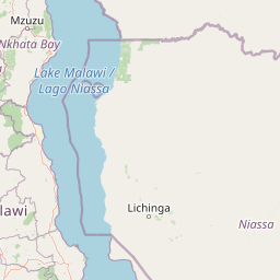
Map view of Chikangawa Forest Reserve

Use this park location map to pinpoint Chikangawa Forest Reserve in Malawi, understand its exact geographic position, and read its mapped placement within the surrounding landscape more clearly.

Pigeon | © OpenStreetMap contributors

Location context for Chikangawa Forest Reserve

Northern Region

Visual reference for plantation pine forests, montane habitats, and mountain terrain

Chikangawa Forest Reserve Photos and Landscapes: Viphya Mountains Scenery

Photographs capture the vast pine plantations, steep mountain ridges, and surviving native evergreen forests defining the Viphya range. Visual records help researchers analyze regional land cover, watershed conservation zones, and habitat structures across northern Malawi.

A wide view of a forested mountainous landscape under a partly cloudy sky, with pine trees in the foreground and a large fallen log.

A paved road stretching into the distance, flanked by tall pine trees on both sides.

Park atlas

Compare adjacent highland forests, montane reserves, and regional protected landscapes

Parks Near Chikangawa Forest Reserve and Protected Areas in the Surrounding Region

Browse other protected areas and mountain reserves located near Chikangawa Forest Reserve to compare regional forest ecosystems. Continuing the geographical comparison reveals broader patterns across northern highland habitats and surrounding watershed terrain.
Watercolor illustration showing a soft-focus landscape with scattered trees, low scrub, and distant rolling hills in pale green and yellow tones.
Wildlife reserveMalawi
About 27 km away#1 closest

Southeast

Nkhotakota Wildlife Reserve: Protected Geography and Rift Valley Landscapes

A vast, recovering miombo woodland sanctuary in central Malawi.

Nkhotakota Wildlife Reserve represents a massive conservation effort within the Great Rift Valley, protecting 1,800 square kilometres of steep ridges, riverine gorges, and dense woodland patches. This atlas entry details the reserve's unique topography, ranging from high-altitude escarpments down toward Lake Malawi, and its role as a pivotal site for large mammal restoration and bird diversity in Southeastern Africa.

Area
1,800 km²
IUCN
IV
Relief
Mixed relief
Climate
Tropical
Wildlife reserveMalawi
About 85 km away#2 closest

North

Vwaza Marsh Wildlife Reserve: Geographic Atlas and Protected Landscape Overview

A lowland wilderness reserve in northern Malawi

Spanning roughly 1,000 square kilometers, Vwaza Marsh Wildlife Reserve provides a unique contrast to the surrounding highlands through its flat topography, seasonal wetlands, and dense mopane forests. This destination serves as a vital corridor for large mammals moving across the border, offering a window into the complex interplay of water-focused ecology and savanna-woodland habitats in Southeastern Africa.

Area
1,000 km²
IUCN
IV
National parkMalawi
About 97 km away#3 closest

North

Nyika National Park: Malawi National Park Atlas Exploration and Protected Landscape

Discover geographic context and mapped boundaries of this protected area.

Nyika National Park serves as a core entry for understanding Malawi's protected areas and natural landscapes through an atlas lens. Explore the park's designation as a national park, its geographic positioning within Malawi, and the mapped context that defines its protected status. This detail page provides a foundational view for appreciating the park's landscape and its contribution to the regional protected lands overview.

Area
3,134 km²
Established
1966
IUCN
II
Relief
Highland
National parkZambia
About 129 km away#4 closest

North

Nyika National Park: A Zambian National Park for Mapped Landscape Discovery

Explore its protected area boundaries and regional geographic context.

Nyika National Park in Zambia is a critical protected landscape offering valuable insights for geographic exploration. As a national park, its mapped terrain and regional context provide a distinct point of study within the country's atlas. Users can investigate the park's specific geographic features and its contribution to Zambia's conservation landscapes, enriching their understanding of protected areas.

Relief
Highland
Climate
Subtropical
Access
Moderate access
Scope
Terrestrial
National parkMuchinga Province
About 137 km away#5 closest

West

North Luangwa National Park: National Park Protected Landscape and Regional Geography

Mapped boundaries and geographic context within Muchinga Province.

North Luangwa National Park is a designated national park offering critical insights into Zambia's protected landscapes. This page provides an atlas-driven view of its geographic scope, emphasizing its mapped boundaries and its position within Muchinga Province. Explore the fundamental geography and protected area context that defines North Luangwa National Park for structured landscape discovery.

Area
4,636 km²
Established
1972
IUCN
II
Relief
Mixed relief
National parkZambia
About 138 km away#6 closest

Southwest

Lukusuzi National Park: Zambia's Protected National Park Geographic Context

Mapped protected area and regional landscape identity for Lukusuzi.

Gain detailed insights into Lukusuzi National Park, a key protected area in Zambia, through its geographic setting and mapped boundaries. This page provides essential context for understanding the park's landscape character and its significance within the national park atlas. Explore the fundamental protected-area geography of this distinct Zambian natural landscape.

IUCN
II
Access
Access unknown
Scope
Terrestrial
National parkMalawi
About 151 km away#7 closest

Southwest

Kasungu National Park: Protected Landscape and Geographic Atlas of Central Malawi

Explore Miombo woodlands and dambo grasslands across its mapped terrain.

Kasungu National Park is a key protected area in Malawi, offering insights into the geography of Central Malawi's savanna landscapes. This national park, covering over 2,300 square kilometres, is defined by its characteristic Miombo woodland interspersed with dambo grasslands and riverine habitats. Its location near the Zambian border provides a critical conservation corridor, making it an important entity for understanding regional protected land distribution and landscape ecology within the atlas.

Area
2,316 km²
Established
1970
IUCN
II
Relief
Mixed relief
Nature reserveCentral Region
About 172 km away#8 closest

South

Ntchisi Mountain Forest Reserve: Geographic Overview and Protected Landscape Analysis

Nature reserve featuring isolated montane rainforest and high-elevation grassland in Malawi

Ntchisi Mountain Forest Reserve stands as a compact highland landmark within Malawi's Central Region, hosting a rare enclave of montane rainforest. This protected area offers an essential study in landscape zonation, where rift-influenced moisture supports diverse forest patches amidst a broader expanse of miombo woodland and montane grasses.

Area
97.12 km²
Established
1924
Relief
Mountain
Climate
Tropical

Common questions about visiting, size, designation, and location context for Chikangawa Forest Reserve

Chikangawa Forest Reserve FAQs for park facts, access, geography, and protected area context

Find quick answers about Chikangawa Forest Reserve, including protected-area facts, park geography, trail and visitor context, and how the park fits into its surrounding country and regional landscape.
MoriAtlas Explorer

Continue Your Protected Areas Search Across the Global Atlas

Deepen your exploration by continuing the structured search for national parks and protected areas worldwide. Utilize the comprehensive filtering capabilities to compare different conservation landscapes and refine your understanding of global park geography. Discover more about the distribution and characteristics of protected natural areas.

Global natural geography
