

Mori Atlas logo
Wildlife reserveRefuge d'oiseaux de la baie Est

A critical migratory bird refuge defined by coastal tidal flats and expansive tundra landscapes.

Refuge d'oiseaux de la baie Est: Mapping Protected Arctic Wildlife Habitats in Nunavut Canada

(East Bay Migratory Bird Sanctuary)

Refuge d'oiseaux de la baie Est sits on the southeastern shore of Southampton Island within the Hudson Strait region of Nunavut. This protected area preserves a mosaic of intertidal habitats and low Arctic tundra that provides essential breeding and staging grounds for migratory bird populations. Through its coastal geography and remote northern setting, the wildlife reserve maintains a crucial corridor for waterfowl and shorebirds traveling through the eastern Canadian Arctic.

migratory bird sanctuaryArctic tundracoastal habitattidal flatsbirdwatchinglow Arctic

Refuge d'oiseaux de la baie Est

Wildlife reserve

Park overview

Structured park overview, official facts, and landscape profile for East Bay Migratory Bird Sanctuary

East Bay Migratory Bird Sanctuary park facts, protected area profile, and essential visitor context

Review the core facts for East Bay Migratory Bird Sanctuary, including designation, size, terrain, visitor scale, habitats, and operating context in one park-focused overview.

About East Bay Migratory Bird Sanctuary

East Bay Migratory Bird Sanctuary is a federally protected coastal sanctuary in Nunavut, Canada, that exists to conserve migratory bird habitat along one of the most important subarctic-to-Arctic transition zones in the country. The sanctuary sits on the southeastern coast of Southampton Island, an environment characterized by broad tidal flats, shallow bays, and low tundra plains that border the cold waters of Hudson Strait. Because remote Arctic coastal sites of this kind are rare in the global network of protected areas, East Bay holds a distinctive place in Canada's Migratory Bird Sanctuary system.

The sanctuary's identity is shaped by the interplay between land and sea. The shoreline opens into shallow, nutrient-rich waters where tidal movement exposes extensive intertidal flats. These flats serve as feeding grounds for migratory waterfowl and shorebirds, while adjacent areas of coastal tundra provide nesting cover for ground-nesting species. The setting creates a productivity gradient in which marine influence supports dense seasonal concentrations of birds during the short but biologically intense Arctic summer.

Administratively, East Bay is part of the Canadian Wildlife Service's network of Migratory Bird Sanctuaries, a category of protected area designed specifically around the protection of migratory bird populations and their habitats. Its jurisdiction places it within the Kivalliq region of Nunavut, with the nearest permanent community being Coral Harbour on the western side of Southampton Island. The sanctuary covers a substantial coastal footprint along East Bay and is treated as a wilderness-class protected area under IUCN Category Ib guidelines, recognizing the minimal level of habitat disturbance maintained within its boundaries.

Beyond its conservation role, East Bay contributes to broad international recognition of the area's importance for birds. The sanctuary lies entirely within the East Bay/Native Bay Important Bird Area, a site recognized for its ornithological significance at the continental level. That dual designation, as a federally protected migratory bird sanctuary and as a portion of a recognized Important Bird Area, reinforces the sanctuary's profile as a key node in Arctic migratory bird conservation.

Quick facts and research context for East Bay Migratory Bird Sanctuary

East Bay Migratory Bird Sanctuary is located in Nunavut, Canada, on the southeastern part of Southampton Island, near the community of Coral Harbour in the Kivalliq region. It is a federally administered Migratory Bird Sanctuary under the Canadian Wildlife Service, governed by Canada's Migratory Bird Sanctuary program.

The sanctuary was established in 1959 and is recorded in international protected-area datasets as an IUCN Category Ib protected area, reflecting a wilderness-oriented status with limited human interference. The site is entirely encompassed by the East Bay/Native Bay Important Bird Area, a designation that recognizes the area's outstanding value for migratory and breeding birds in the eastern Arctic. The official Government of Canada page for the sanctuary lists it among the country's northernmost bird-focused protected sites.

Protection and recognition

Documented conservation status, management scope, and protected area designation history.

Refuge d'oiseaux de la baie Est Protection Status and WDPA Records

Protected area records for Refuge d'oiseaux de la baie Est assemble verified global database identifiers and conservation status details. Structured registry data outlines formal administrative recognition without assuming management outcomes or external program affiliations.

Protection details

WDPA ID
13400
Park context

Deeper park guide and search-rich context for East Bay Migratory Bird Sanctuary

East Bay Migratory Bird Sanctuary history, landscape, wildlife, and travel context

Explore East Bay Migratory Bird Sanctuary through its history, landscape character, ecosystems, wildlife, conservation priorities, cultural context, and seasonal travel timing in a structured park guide built for atlas discovery and search intent.

Why East Bay Migratory Bird Sanctuary stands out

East Bay Migratory Bird Sanctuary is best known for protecting intertidal flats, coastal tundra, and shallow bay habitat on southeastern Southampton Island, an environment that supports migratory bird populations at the edge of the eastern Arctic. The sanctuary exists primarily to safeguard seasonal habitat for waterfowl, shorebirds, and seabirds that use East Bay and the surrounding coastline during breeding and migration periods. Its inclusion within the East Bay/Native Bay Important Bird Area underscores the sanctuary's significance for long-range migratory species, including waterfowl that travel between the lower Arctic and breeding grounds further north. The combination of tidal flats, marine shallows, and adjacent low tundra gives the protected area its ecological identity and makes it a recognized focal point for bird conservation in the Hudson Strait region.

East Bay Migratory Bird Sanctuary history and protected-area timeline

East Bay Migratory Bird Sanctuary was formally established in 1959 as part of Canada's program of Migratory Bird Sanctuaries, a federal designation developed to protect habitat for migratory bird populations against habitat loss and disturbance. The sanctuary's creation reflects early post-war recognition of the need to safeguard Arctic and subarctic breeding and staging habitat, particularly in regions where migratory pathways cross remote and otherwise sparsely governed coastlines.

Its establishment predates the creation of Nunavut as a separate Canadian territory, and the sanctuary has been carried forward under successive administrative arrangements as the region transitioned from the Northwest Territories to the Nunavut territory. Throughout this evolution, the sanctuary has remained under the authority of the Canadian Wildlife Service and has retained its original protection purpose. Later, the broader East Bay/Native Bay area was independently recognized as an Important Bird Area, confirming the long-term significance of the habitat that the sanctuary was created to protect.

Because the site is remote and difficult to access, the sanctuary's modern history is shaped less by tourism infrastructure and more by ongoing monitoring and conservation management associated with its Important Bird Area and Migratory Bird Sanctuary status.

East Bay Migratory Bird Sanctuary landscape and geographic character

The landscape of East Bay Migratory Bird Sanctuary is defined by the meeting of land and sea along the southeastern coast of Southampton Island. Extensive tidal flats fringe East Bay, and these intertidal zones dominate the sanctuary's shoreline character. At low tide, broad expanses of soft substrate and shallow pools are exposed, while rising tides reconnect the flats with the deeper, cold waters of Hudson Strait.

Behind the intertidal zone, the terrain rises gently into low Arctic tundra. This coastal tundra forms a relatively flat mosaic of sedges, mosses, lichens, and dwarf vegetation typical of low-lying Arctic terrain. There are no high mountain ranges or deeply incised valleys; instead, the topography is shaped by subtle elevation changes that influence drainage patterns, snowmelt timing, and the distribution of wet and dry tundra habitats.

Small streams, coastal ponds, and wetland depressions are scattered across the landscape, fed largely by snowmelt and summer precipitation. These freshwater features dot the tundra and contribute to the mosaic of habitats that surround the bay. The combination of marine flats, coastal tundra, and inland wetlands gives the sanctuary its overall physiographic character and underpins the seasonal productivity that supports bird life during the breeding season.

East Bay Migratory Bird Sanctuary ecosystems, habitats, and plant life

Ecologically, East Bay Migratory Bird Sanctuary sits at the interface of marine and terrestrial Arctic ecosystems. The shallow, tidally influenced waters of East Bay carry nutrients that support invertebrates and small marine organisms, which in turn form the base of the food web for many migratory bird species. As tides rise and fall across expansive flats, feeding conditions fluctuate daily, concentrating bird activity along the edges of the flats and in adjacent shallow water.

The terrestrial component is dominated by low Arctic tundra, with characteristic plant communities of sedges, grasses, mosses, and lichens. Wet depressions and small ponds add patches of aquatic habitat that breeding waterfowl and shorebirds use during the summer. The vegetation cover is low and open, leaving the landscape visibly shaped by ice, water, and wind.

This combination of intertidal marine habitat and coastal tundra creates ecological conditions that recur across much of the eastern Canadian Arctic, but the specific configuration around East Bay supports particularly notable seasonal concentrations of birds. The sanctuary's nature is therefore best understood as a seasonal habitat mosaic rather than a single dominant ecosystem.

East Bay Migratory Bird Sanctuary wildlife and species highlights

Wildlife in East Bay Migratory Bird Sanctuary is shaped strongly by its function as a migratory bird area. The sanctuary supports seasonal populations of waterfowl, shorebirds, and seabirds that use the tidal flats and adjacent tundra for feeding and nesting during the Arctic summer. The protected area's shoreline and bay habitats provide feeding grounds rich in intertidal invertebrates, while the surrounding low tundra offers nesting cover for ground-nesting species.

Beyond birds, the broader Southampton Island ecosystem supports typical low-Arctic terrestrial fauna. The tundra and coastal margins host mammal species associated with the Hudson Strait ecosystem, including Arctic fox, while marine waters nearby support seals and other marine mammals typical of the region. These broader wildlife patterns complement, rather than define, the sanctuary's bird-focused conservation role.

Seasonal abundance is uneven: the short Arctic summer drives a strong pulse of biological activity, and bird numbers reach their highest levels during the nesting and post-breeding staging phases. Outside the summer season, the landscape becomes largely unoccupied by migratory species, with overwintering wildlife limited to those adapted to persistent Arctic conditions.

East Bay Migratory Bird Sanctuary conservation status and protection priorities

East Bay Migratory Bird Sanctuary exists primarily to protect migratory bird habitat along an Arctic coastal environment of recognized national and international significance. Its designation as a Migratory Bird Sanctuary places it within one of Canada's oldest and most strictly enforced habitat-protection frameworks, designed to shield birds, their nests, and their feeding habitat from disturbance and habitat loss.

The sanctuary is categorized as an IUCN Category Ib protected area, which positions it within the wilderness-protection class. This category reflects both the remote character of the site and the low level of direct human activity within its boundaries, allowing natural ecological processes to dominate. Its overlap with the East Bay/Native Bay Important Bird Area reinforces the conservation picture, layering international ornithological recognition on top of federal habitat protection.

At a regional scale, the sanctuary contributes to the conservation of migratory bird populations that connect the eastern Canadian Arctic to temperate and subarctic wintering grounds further south. By protecting a key node of Arctic breeding habitat, the sanctuary helps maintain the ecological integrity of migration routes that cross multiple jurisdictions and ecological zones.

East Bay Migratory Bird Sanctuary cultural meaning and human context

The cultural context of East Bay Migratory Bird Sanctuary is closely tied to Inuit homelands in the Kivalliq region. Southampton Island, on which the sanctuary lies, is part of the traditional territory of Inuit communities, and Coral Harbour, the nearest community to the sanctuary, is an Inuit hamlet whose residents continue to maintain close ties to the surrounding land and sea. The coastline and its seasonal wildlife are significant in traditional land-use practices, including hunting, fishing, and travel along the coast.

The sanctuary's protected status coexists with this ongoing human relationship to the land. As a federal designation focused on migratory bird habitat, the sanctuary is intended to limit disruptive activity around bird habitat rather than to exclude all forms of traditional land use. This balance reflects Canada's broader approach to protected-area management in Nunavut, where conservation and Indigenous land relationships are increasingly governed alongside one another.

Top sights and standout views in East Bay Migratory Bird Sanctuary

East Bay Migratory Bird Sanctuary stands out as a federally protected Migratory Bird Sanctuary located on the southeastern coast of Southampton Island, one of the larger islands at the northern edge of Hudson Bay. Its position at the meeting point of tidal flats and low Arctic tundra gives it a clear ecological identity built around seasonal bird use. The sanctuary is also notable for being entirely covered by the East Bay/Native Bay Important Bird Area, indicating that its conservation value extends beyond national recognition to international ornithological frameworks.

The site's combination of remote Arctic setting, substantial intertidal habitat, and wilderness-level protection makes it a distinctive element of Canada's northern protected-area network. Its long-standing status, established in 1959 and continuing under Nunavut administration, reinforces its identity as a stable, long-term refuge for migratory birds in a region where habitat protection is otherwise sparse.

Best time to visit East Bay Migratory Bird Sanctuary

The timing of any visit to East Bay Migratory Bird Sanctuary is dictated by the Arctic seasonal cycle. The brief summer, broadly from late June through August, is when migratory bird presence peaks and when coastal habitat is most biologically active. During this window, tidal flats and adjacent tundra support nesting and feeding activity, daylight is extended, and the landscape is largely free of snow. This is also the period in which the sanctuary's habitats are most accessible by conventional means.

Outside the summer months, conditions become far more restrictive. Sea ice, persistent snow cover, extreme cold, and reduced daylight characterize the broader Arctic winter, making travel to and within the sanctuary impractical for almost any visitor. Spring and autumn are transitional, with low biological activity and challenging travel conditions. As a result, any presence in the area is effectively a summer phenomenon, and even then logistics are dependent on remote-access travel from Coral Harbour.
Monthly climate preview

Long-term representative point measurements tracking annual temperature and precipitation rhythm

Refuge d'oiseaux de la baie Est Climate Profile and Weather by Month Normals

Historical climatology data captures the measured monthly temperature range and precipitation rates recorded at a representative coordinate within Refuge d'oiseaux de la baie Est. Examining the complete twelve-month profile reveals detailed baseline variations across the conservation landscape.
Annual mean-9 °C
-25 °C8 °C
Jan-25°
Feb-25°
Mar-21°
Apr-13°
May-5°
Jun
Jul
Aug
Sep
Oct-4°
Nov-12°
Dec-20°
Warmest month
July

7.5 °C

Coolest month
January

-25.3 °C

Wettest month
August

2.5 mm/day

Driest month
January

0.6 mm/day

Park location guide

Geography guide, regional context, and park location map for East Bay Migratory Bird Sanctuary

East Bay Migratory Bird Sanctuary park geography, regions, and map view in Canada

Understand where East Bay Migratory Bird Sanctuary sits in Canada through a broader geographic reading of the surrounding landscape, nearby location context, and its mapped position within the national park landscape.

How East Bay Migratory Bird Sanctuary fits into Canada

Canada is a federal parliamentary constitutional monarchy spanning North America from the Atlantic to the Pacific and Arctic Oceans. With a population of over 41 million, it is officially bilingual in English and French at the federal level. The country gained independence from the United Kingdom through a gradual process culminating in 1982.

Wider geography shaping East Bay Migratory Bird Sanctuary in Canada

Canada occupies the northern portion of North America, sharing its longest international border with the United States. The country extends from the Atlantic Ocean to the Pacific Ocean and northward into the Arctic Ocean, giving it the longest coastline of any nation.

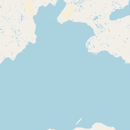
Map view of East Bay Migratory Bird Sanctuary

Use this park location map to pinpoint East Bay Migratory Bird Sanctuary in Canada, understand its exact geographic position, and read its mapped placement within the surrounding landscape more clearly.

Pigeon | © OpenStreetMap contributors

Location context for East Bay Migratory Bird Sanctuary

Nunavut
Park atlas

Compare regional protected areas and coastal tundra landscapes across the Hudson Strait

Explore Parks Near Refuge d'oiseaux de la baie Est and Surrounding Arctic Habitats

Browsing other protected areas near Refuge d'oiseaux de la baie Est reveals connected coastal habitats, tidal flats, and northern wildlife reserves. Expanding park comparison across the surrounding region provides deeper context for Arctic conservation networks and northern migration corridors.
National parkNunavut
243 km away#1 closest

Northwest

Ukkusiksalik National Park: Nunavut Protected Area Geography and Map Context

Explore the protected landscape and mapped terrain of this Canadian National Park.

Ukkusiksalik National Park serves as a protected national park within Nunavut, offering a distinct geographic identity. This entry provides structured insights into the park's mapped boundaries and its surrounding regional landscape, facilitating a deeper understanding of its place within the broader atlas of protected areas. Examine the geographic context and discover the unique attributes of Ukkusiksalik National Park's protected territory.

Area
20,885 km²
Established
2003
IUCN
II
Relief
Mixed relief
National parkNunavut
719 km away#2 closest

Northeast

Auyuittuq National Park: Nunavut National Park and Protected Landscape Atlas

Explore Arctic protected area geography and mapped boundaries.

Auyuittuq National Park is a key protected area within Nunavut, Canada, serving as a vital component of the national park system. This entry provides the essential geographic and atlas context for understanding Auyuittuq National Park, highlighting its status as a mapped protected landscape. Examine its role within the regional geography of Nunavut and its contribution to the broader atlas of Canadian conservation lands.

Area
21,470 km²
Established
1972
IUCN
II
Visitors
256 annual
National parkManitoba
815 km away#3 closest

Southwest

Wapusk National Park: Manitoba National Park Protected Landscape & Geographic Exploration

Mapped park boundaries and regional landscape context in Manitoba.

Delve into Wapusk National Park, a federally protected area in Manitoba designed for geographic exploration and atlas-based discovery. Understand its specific role as a national park, examining its mapped boundaries and the unique natural landscape it preserves within the broader regional geography of Manitoba. This park serves as a key data point for comprehending Canada's network of protected lands and their geographical significance.

Area
11,475 km²
Established
1996
IUCN
II
Visitors
82 annual
Wildlife reserveNunavut
824 km away#4 closest

Northeast

Ninginganiq National Wildlife Area: Geographic Overview and Protected Landscape Mapping

A vital Arctic wildlife reserve on Baffin Island, Nunavut.

Ninginganiq National Wildlife Area stands as a cornerstone of Arctic conservation, encompassing the fog-defined shores of Isabella Bay. This protected area on Baffin Island serves as a critical seasonal feeding ground for bowhead whales and protects a vast expanse of tundra, marine inlets, and coastal ecosystems. Its establishment reflects a cooperative stewardship model between the federal government and Inuit communities, grounding this reserve in both ecological importance and cultural history.

Area
3,362 km²
Established
2010
IUCN
Ib
Relief
Lowland
Wildlife reserveQikiqtaaluk
917 km away#5 closest

Northeast

Qaqulluit National Wildlife Area: Protected Marine Geography and Arctic Cliff Landscapes

A remote wildlife reserve along the eastern Arctic coastline.

Qaqulluit National Wildlife Area is a strictly protected reserve in Nunavut, recognized for its concentration of seabird nesting cliffs at Cape Nuvuttiq. The geography is defined by the sharp transition between towering rock walls and cold marine waters, creating a unique coastal environment that supports significant Arctic breeding colonies and marine mammals.

Area
398.21 km²
Established
2010
IUCN
Ib
National parkNewfoundland and Labrador
952 km away#6 closest

East

Torngat Mountains National Park: National Park Atlas and Protected Landscape Exploration

Explore the mapped geography and protected status of this Canadian national park.

Gain a structured understanding of Torngat Mountains National Park, a protected national park in Newfoundland and Labrador. This destination focuses on its geographic identity, mapped boundaries, and place within the broader regional landscape of the Canadian Arctic. Discover the park's terrain and conservation context, essential for anyone exploring Canada's protected areas and natural geography.

Area
9,700 km²
Established
2008
IUCN
II
Visitors
599 annual
National parkNunavut
About 987 km away#7 closest

North

Sirmilik National Park: Nunavut National Park Atlas and Protected Landscape Map

Explore the geographic boundaries and regional context of Sirmilik National Park.

This entry provides detailed insights into Sirmilik National Park, a designated national park situated in Nunavut, Canada. It serves as a focal point for understanding the park's specific geography, its mapped protected landscape, and its role within the regional atlas. Users can explore the park's defined boundaries and its contribution to the broader landscape context of Nunavut, making it an essential destination for detailed geographic discovery.

Area
22,200 km²
Established
2001
IUCN
II
Visitors
6 annual
National parkNorthwest Territories
About 1,305 km away#8 closest

West

Thaidene Nëné National Park Reserve: Northwest Territories National Park Atlas Overview

Mapped geography and protected landscape context.

Investigate Thaidene Nëné National Park Reserve, a key national park within the Northwest Territories. This detailed entry focuses on its protected area status, mapped geographic boundaries, and regional landscape context, crucial for understanding its role in the broader atlas of conservation lands.

Area
14,070 km²
Established
2019
IUCN
II
Relief
Highland

Common questions about visiting, size, designation, and location context for East Bay Migratory Bird Sanctuary

East Bay Migratory Bird Sanctuary FAQs for park facts, access, geography, and protected area context

Find quick answers about East Bay Migratory Bird Sanctuary, including protected-area facts, park geography, trail and visitor context, and how the park fits into its surrounding country and regional landscape.
MoriAtlas Explorer

Continue Your Protected Areas Search Across the Global Atlas

Deepen your exploration by continuing the structured search for national parks and protected areas worldwide. Utilize the comprehensive filtering capabilities to compare different conservation landscapes and refine your understanding of global park geography. Discover more about the distribution and characteristics of protected natural areas.

Global natural geography