

Mori Atlas logo
Wildlife reserveQaqulluit National Wildlife Area

Examining the vertical coastal geography and marine protected status of this Nunavut reserve.

Qaqulluit National Wildlife Area: A Protected Arctic Seabird Colony and Sea Cliff Landmark

Qaqulluit National Wildlife Area represents a critical node in the Canadian Arctic protected landscape, centered on the dramatic verticality of Cape Nuvuttiq. This wildlife reserve features sea cliffs that rise several hundred metres above the waters of the eastern Arctic, providing essential nesting habitat for large colonies of northern fulmar. The protected area encompasses both these sheer rock faces and the surrounding marine environment of Baffin Bay and Davis Strait, which support diverse Arctic marine life.

Arcticseabird cliffsImportant Bird AreaNunavutmarine protected areanational wildlife area

Qaqulluit National Wildlife Area

Wildlife reserve

Park overview

Structured park overview, official facts, and landscape profile for Qaqulluit National Wildlife Area

Qaqulluit National Wildlife Area park facts, protected area profile, and essential visitor context

Review the core facts for Qaqulluit National Wildlife Area, including designation, size, terrain, visitor scale, habitats, and operating context in one park-focused overview.

About Qaqulluit National Wildlife Area

Qaqulluit National Wildlife Area is a Canadian federal wildlife reserve that protects a single but ecologically intense landscape: the high Arctic sea cliffs at the northern end of Qaqulluit Island. Its identity as a protected area is built almost entirely around these cliffs and the birds that breed on them, rather than around a broad terrestrial park or visitor landscape. Located in the Qikiqtaaluk region of Nunavut, the reserve lies along the eastern edge of the Canadian Arctic Archipelago, where land, sea ice, and open ocean interact to shape one of the most demanding ecosystems on the continent.

The terrestrial portion of the reserve is small and tightly focused on the headland known as Cape Nuvuttiq, an area of steep cliffs that tower above the sea and offer the kind of vertical, predator-resistant nesting habitat that Arctic seabirds rely on. Surrounding the cliffs, the reserve extends across a much larger marine zone whose cold, productive waters sustain both breeding seabirds and visiting marine mammals. Together, the cliffs and their associated ocean zone form a tightly linked ecological system that has been recognized as an Important Bird Area and designated as a National Wildlife Area to keep that system intact.

Beyond its ecological role, Qaqulluit reflects the layered nature of conservation in Nunavut: a federal designation that protects a specific breeding ground, applied on Inuit-governed land in a region where wildlife stewardship has both contemporary ecological and deep cultural dimensions. The reserve is remote, with no permanent settlement within it, and its character is defined as much by physical inaccessibility as by its cliffs and birds, making it primarily a research and conservation landscape rather than a destination for casual visitors.

Quick facts and research context for Qaqulluit National Wildlife Area

Qaqulluit National Wildlife Area is a protected area of roughly 398 square kilometres, of which only a small fraction is land. Almost the entire reserve extends over surrounding Arctic ocean, while the terrestrial portion is concentrated at Cape Nuvuttiq on the northern end of Qaqulluit Island. The reserve is located within the Qikiqtaaluk region of Nunavut, the closest inhabited community being Qikiqtarjuaq about 100 kilometres to the northwest. Administered by the Canadian Wildlife Service, it is one of only a handful of National Wildlife Areas in Nunavut and was formally designated on 3 June 2010.

Protection and recognition

Examine documented protection records and international designation frameworks

Qaqulluit National Wildlife Area Protection Status and Regional Recognition Data

Protected area records for Qaqulluit National Wildlife Area compile official conservation status and formal recognition data. Structured geographic databases provide complete administrative facts without supplemental management assumptions.

Protection details

WDPA ID
555516429
Park context

Deeper park guide and search-rich context for Qaqulluit National Wildlife Area

Qaqulluit National Wildlife Area history, landscape, wildlife, and travel context

Explore Qaqulluit National Wildlife Area through its history, landscape character, ecosystems, wildlife, conservation priorities, cultural context, and seasonal travel timing in a structured park guide built for atlas discovery and search intent.

Why Qaqulluit National Wildlife Area stands out

Qaqulluit is best known for hosting one of the most important northern fulmar colonies in Canada, an estimated 100,000 breeding pairs concentrated on steep Arctic sea cliffs that have been formally recognized as an Important Bird Area. The reserve's cliffs at Cape Nuvuttiq rise sharply out of the ocean, creating nesting habitat that is rare along the eastern Arctic and that supports the colony's disproportionate contribution to Canada's overall fulmar population. Few protected areas in the country concentrate such a large share of a single seabird species within such a small, sharply defined cliff environment.

Qaqulluit National Wildlife Area history and protected-area timeline

Qaqulluit National Wildlife Area was formally established on 3 June 2010 under the management of the Canadian Wildlife Service, becoming one of a small number of National Wildlife Areas located in the territory of Nunavut. Its designation came after the cliffs at Cape Nuvuttiq had been recognized as an Important Bird Area for their exceptional concentration of nesting northern fulmars, a recognition that highlighted the national significance of what had previously been a largely unmonitored stretch of Arctic coastline.

The headland itself carries an older toponymic layer: Cape Nuvuttiq was previously known as Cape Seale, reflecting earlier European-era naming conventions used in this part of Baffin Island. The contemporary name Qaqulluit, drawn from Inuktitut and meaning roughly "the place of fulmars" or "fulmars," reflects the indigenous linguistic and ecological framing of the landscape and the dominant bird of the cliffs. The 2010 federal designation thus aligned formal protection with the place's longstanding local identity as a seabird landscape.

Since its establishment, the reserve has continued to be administered primarily as a conservation and monitoring area rather than as an access-oriented park. Management emphasis has been placed on maintaining the integrity of the cliff-nesting colony and on tracking the population of northern fulmars and other seabirds using this stretch of coast, while keeping the surrounding marine environment protected from activities that could disrupt breeding or foraging conditions.

Qaqulluit National Wildlife Area landscape and geographic character

The landscape of Qaqulluit National Wildlife Area is dominated by the towering sea cliffs of Cape Nuvuttiq on the northern end of Qaqulluit Island, where rock walls rise dramatically from the Arctic Ocean. These cliffs reach heights of several hundred metres and form a near-vertical interface between land and sea, an unusual feature along this stretch of the eastern Arctic coastline and the defining physical element of the entire reserve. The combination of high, exposed rock faces meeting cold ocean waters below shapes both the visual character of the area and its ecological function.

Beyond the cliffs themselves, the terrestrial portion of the reserve is small, reflecting the fact that Qaqulluit is fundamentally a coastal and marine protected area. The surrounding landscape consists of the open waters of Baffin Bay and Davis Strait, where sea ice, cold currents, and seasonal open water delimit the productive marine zone that the reserve is designed to keep intact. From a distance, the cliffs appear as a sheer wall at the edge of an otherwise low Arctic island, capped by the kind of weather-beaten rock tundra typical of the region.

The dramatic vertical relief of Cape Nuvuttiq is central to the reserve's identity. Few protected areas in Nunavut showcase such a concentrated and visually striking cliff-to-sea transition, and it is this feature, more than any inland terrain, that gives Qaqulluit its character. The cliffs also create microhabitats across their ledges and faces that are largely absent from the surrounding lowlands, which is precisely why seabirds have concentrated here in such numbers.

Qaqulluit National Wildlife Area ecosystems, habitats, and plant life

Ecologically, Qaqulluit is a tightly focused reserve built around two linked habitats: the high Arctic sea cliffs that support dense breeding seabird colonies, and the cold marine waters that supply food for those birds and host seasonal marine mammals. The cliff habitat is narrow in extent but extremely productive in biological terms, offering predator-free nesting ledges, exposure to sunlight, and shelter from wind where seabirds can raise their young. Below the cliffs, the marine environment of the surrounding ocean provides the planktonic and fish-based food web on which the colony depends.

Away from the cliffs, the terrestrial ecosystem is minimal: a small portion of high Arctic tundra at the northern tip of Qaqulluit Island, with the typical sparse vegetation of the region. The terrestrial surface protected by the reserve is small enough that most of the biological interest, and most of the conservation value, lies at the boundary between land and sea. This boundary zone, combining rock, cliff vegetation, guano-enriched soils, and marine productivity, is essentially what the reserve exists to protect.

At a regional scale, Qaqulluit fits into a broader pattern of Arctic protected areas where small but ecologically intense pockets of habitat, such as seabird cliffs, polynyas, or key marine zones, are singled out for protection rather than large continuous landscapes. The reserve's importance rests less on its total size and more on the concentration of breeding seabirds and the ecological processes concentrated along these particular cliffs and the waters immediately offshore.

Qaqulluit National Wildlife Area wildlife and species highlights

The wildlife profile of Qaqulluit National Wildlife Area is dominated by its seabird colony, and in particular by the northern fulmar, for which the reserve is best known. With an estimated 100,000 breeding pairs, the colony represents roughly one-third of the Canadian population of this species, making Qaqulluit one of the most important fulmar sites in the country. Fulmars nest on the ledges of Cape Nuvuttiq's high cliffs, where they are largely inaccessible to terrestrial predators and where the combination of updrafts and open ocean below creates ideal feeding conditions.

In addition to the fulmars, the cliffs and rocky shores also support smaller breeding populations of glaucous gull and black guillemot, both of which use the cliffs and nearby waters as part of their breeding cycle. These species contribute to the broader seabird community and reinforce the importance of the site as a multi-species nesting area, even though fulmars overwhelmingly define the colony's identity. The surrounding ocean further supplies foraging habitat not only for these breeding birds but also for non-breeding and migrant seabirds moving through the eastern Arctic.

The marine waters within and around the reserve are also used by several Arctic marine mammals. Harp seals, walruses, and polar bears are known to use the area seasonally, taking advantage of sea ice, open water, and shoreline features that concentrate prey or haul-out opportunities. While the terrestrial core of the reserve is small, this marine mammal presence extends the wildlife significance of Qaqulluit well beyond its cliffs, marking it as a place of importance for both nesting seabirds and the broader Arctic marine food web.

Qaqulluit National Wildlife Area conservation status and protection priorities

Qaqulluit's conservation significance lies primarily in its role as a national stronghold for the northern fulmar. By safeguarding roughly one-third of Canada's entire breeding population within a single protected cliff site, the reserve plays an outsized role in maintaining the country's overall fulmar numbers and the genetic and demographic health of the species in this part of the Arctic. The concentration of so many pairs in one location means that any disturbance to this specific stretch of cliff could have proportionally large consequences at a national scale, which is precisely why formal protection has been applied.

The site's designation as an Important Bird Area and its subsequent elevation to a National Wildlife Area reflect a layered conservation strategy that began with international recognition of its ornithological value and was then translated into binding federal protection. Administered by the Canadian Wildlife Service, the reserve is subject to restrictions designed to limit activities that could disrupt nesting behavior, degrade cliff habitat, or affect the surrounding marine environment on which the seabirds depend. This combination of protection instruments: Important Bird Area recognition, National Wildlife Area designation, and federal wildlife service management, gives Qaqulluit a relatively high level of formal safeguard for such a remote and ecologically narrow site.

At a broader level, Qaqulluit contributes to the network of protected places in Nunavut that together ensure that key Arctic breeding and feeding habitats remain intact, even as climate change, shipping, and resource development pressures increase across the region. While the reserve itself is small and tightly focused, its conservation value is amplified by the simple fact that high Arctic seabird cliffs of this quality are rare, and protecting the most important of them helps maintain the long-term viability of species whose breeding options across the Canadian Arctic are already limited.

Qaqulluit National Wildlife Area cultural meaning and human context

The cultural context of Qaqulluit is rooted in Inuktitut language and Inuit place-naming along the Baffin Island coast. The name Qaqulluit, from which both the island and the wildlife area take their modern names, comes from Inuktitut and refers to the fulmars themselves, meaning roughly "the fulmars" or "place of fulmars." This naming reflects long-standing Inuit knowledge of the cliffs as one of the most important seabird sites on this part of the coast, a relationship that predates European exploration and modern conservation designations.

The reserve is also defined by an older layer of European-era toponymy. Cape Nuvuttiq was previously known as Cape Seale, a name that reflects the history of exploration and mapping on eastern Baffin Island rather than the local Inuktitut tradition. The shift back to the Inuktitut-based name for both the headland and the federal protected area mirrors a broader move in Nunavut toward recognizing indigenous names for prominent landscape features, and it repositions the place within its original Inuit cultural geography.

Because the reserve is uninhabited, contains no settlements, and is administered by a federal wildlife agency rather than a land claims organization, its contemporary cultural role is primarily symbolic and linguistic rather than demographic. There are no resident communities within Qaqulluit, and the importance of the area for local Inuit is more connected to traditional ecological knowledge of seabirds and marine mammals along this coast than to any specific settlement or land use within the reserve itself.

Top sights and standout views in Qaqulluit National Wildlife Area

Qaqulluit's most distinctive feature is the sheer Arctic sea cliff at Cape Nuvuttiq, rising several hundred metres above the ocean and supporting the most significant northern fulmar colony in Canada. The reserve also stands out for the extreme concentration of its ecological value within a small footprint: nearly all of the terrestrial area is cliff habitat, and all of the marine area supports the food web beneath that colony. The reserve's recognition as an Important Bird Area and its position as one of only a handful of National Wildlife Areas in Nunavut further mark it as a nationally significant site, while its remoteness ensures a level of naturalness that is increasingly rare in protected areas elsewhere in Canada.

Best time to visit Qaqulluit National Wildlife Area

Because Qaqulluit National Wildlife Area is a strictly protected, uninhabited, and logistically remote site dominated by breeding seabirds and Arctic marine wildlife, any meaningful visitation would focus on the open-water season of late spring through early autumn, when sea ice has retreated enough to allow ship-based access along the cliffs. Late spring and summer are also when the fulmar colony, glaucous gulls, and black guillemots are actively nesting on the cliffs, making this the period of greatest biological activity. Winter conditions, with polar darkness, extreme cold, and heavy sea ice, effectively preclude ordinary visits and shift any activity into specialized research contexts. As a wildlife area rather than a visitor park, access is generally restricted, and any seasonal timing should be considered in that light.
Monthly climate preview

Long-term monthly temperature and precipitation data for Qikiqtaaluk

Qaqulluit National Wildlife Area Climate Normals and Temperature Patterns

Representative coordinate records show wide annual temperature swings alongside measured precipitation rates across twelve distinct intervals. Detailed monthly comparisons provide deeper analytical insight into long-term climate patterns recorded at this location.
Annual mean-10 °C
-25 °C5 °C
Jan-24°
Feb-25°
Mar-22°
Apr-14°
May-6°
Jun
Jul
Aug
Sep
Oct-6°
Nov-13°
Dec-20°
Warmest month
July

4.6 °C

Coolest month
February

-25 °C

Wettest month
August

2.4 mm/day

Driest month
February

0.7 mm/day

Park location guide

Geography guide, regional context, and park location map for Qaqulluit National Wildlife Area

Qaqulluit National Wildlife Area park geography, regions, and map view in Canada

Understand where Qaqulluit National Wildlife Area sits in Canada through a broader geographic reading of the surrounding landscape, nearby location context, and its mapped position within the national park landscape.

How Qaqulluit National Wildlife Area fits into Canada

Canada is a federal parliamentary constitutional monarchy spanning North America from the Atlantic to the Pacific and Arctic Oceans. With a population of over 41 million, it is officially bilingual in English and French at the federal level. The country gained independence from the United Kingdom through a gradual process culminating in 1982.

Wider geography shaping Qaqulluit National Wildlife Area in Canada

Canada occupies the northern portion of North America, sharing its longest international border with the United States. The country extends from the Atlantic Ocean to the Pacific Ocean and northward into the Arctic Ocean, giving it the longest coastline of any nation.

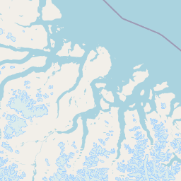
Map view of Qaqulluit National Wildlife Area

Use this park location map to pinpoint Qaqulluit National Wildlife Area in Canada, understand its exact geographic position, and read its mapped placement within the surrounding landscape more clearly.

Pigeon | © OpenStreetMap contributors

Location context for Qaqulluit National Wildlife Area

Qikiqtaaluk
Park atlas

Compare adjacent Arctic reserves and coastal wildlife habitats across the surrounding region

Explore Other Parks Near Qaqulluit National Wildlife Area and Regional Protected Areas

Browse related national parks and protected areas connected to the broader geography of Qaqulluit National Wildlife Area. Continuing into these neighboring coastal reserves helps place northern seabird habitats within a wider regional conservation network.
National parkNunavut
47 km away#1 closest

Northwest

Auyuittuq National Park: Nunavut National Park and Protected Landscape Atlas

Explore Arctic protected area geography and mapped boundaries.

Auyuittuq National Park is a key protected area within Nunavut, Canada, serving as a vital component of the national park system. This entry provides the essential geographic and atlas context for understanding Auyuittuq National Park, highlighting its status as a mapped protected landscape. Examine its role within the regional geography of Nunavut and its contribution to the broader atlas of Canadian conservation lands.

Area
21,470 km²
Established
1972
IUCN
II
Visitors
256 annual
Wildlife reserveNunavut
260 km away#2 closest

Northwest

Ninginganiq National Wildlife Area: Geographic Overview and Protected Landscape Mapping

A vital Arctic wildlife reserve on Baffin Island, Nunavut.

Ninginganiq National Wildlife Area stands as a cornerstone of Arctic conservation, encompassing the fog-defined shores of Isabella Bay. This protected area on Baffin Island serves as a critical seasonal feeding ground for bowhead whales and protects a vast expanse of tundra, marine inlets, and coastal ecosystems. Its establishment reflects a cooperative stewardship model between the federal government and Inuit communities, grounding this reserve in both ecological importance and cultural history.

Area
3,362 km²
Established
2010
IUCN
Ib
Relief
Lowland
National parkNewfoundland and Labrador
762 km away#3 closest

South

Torngat Mountains National Park: National Park Atlas and Protected Landscape Exploration

Explore the mapped geography and protected status of this Canadian national park.

Gain a structured understanding of Torngat Mountains National Park, a protected national park in Newfoundland and Labrador. This destination focuses on its geographic identity, mapped boundaries, and place within the broader regional landscape of the Canadian Arctic. Discover the park's terrain and conservation context, essential for anyone exploring Canada's protected areas and natural geography.

Area
9,700 km²
Established
2008
IUCN
II
Visitors
599 annual
Watercolor illustration of green rolling hills and a body of water under a pale sky
National parkGreenland
827 km away#4 closest

Northeast

Northeast Greenland National Park: Arctic Wilderness and Protected Landscape Atlas

Explore the world's largest national park and its mapped terrain.

Northeast Greenland National Park represents an extraordinary expanse of Arctic wilderness, renowned as the largest protected area globally. This national park protects a diverse landscape, from the interior Greenland Ice Sheet to dramatic glacial fjords and ice-free polar desert regions. Discover its extensive mapped boundaries and its significance as a sanctuary for vital Arctic megafauna, offering a profound case study in large-scale protected landscape geography.

Area
972,000 km²
Established
1974
IUCN
II
Relief
Mixed relief
Wildlife reserveNunavut
917 km away#5 closest

West

Refuge d'oiseaux de la baie Est: Protected Coastal Landscapes on Southampton Island

Wildlife reserve in the Nunavut territory of Canada

Refuge d'oiseaux de la baie Est functions as a federally protected sanctuary within the Hudson Strait ecosystem. The terrain is characterized by broad intertidal flats, coastal saltmarshes, and low-lying tundra that supports migratory birds at the edge of their Arctic breeding range. This site maps as a cornerstone of conservation in the Kivalliq region, safeguarding seasonal habitats from the coast to the inland wetlands.

Area
1,128.11 km²
Established
1959
IUCN
Ib
Relief
Lowland
National parkNunavut
About 936 km away#6 closest

Northwest

Sirmilik National Park: Nunavut National Park Atlas and Protected Landscape Map

Explore the geographic boundaries and regional context of Sirmilik National Park.

This entry provides detailed insights into Sirmilik National Park, a designated national park situated in Nunavut, Canada. It serves as a focal point for understanding the park's specific geography, its mapped protected landscape, and its role within the regional atlas. Users can explore the park's defined boundaries and its contribution to the broader landscape context of Nunavut, making it an essential destination for detailed geographic discovery.

Area
22,200 km²
Established
2001
IUCN
II
Visitors
6 annual
National parkNunavut
1,098 km away#7 closest

West

Ukkusiksalik National Park: Nunavut Protected Area Geography and Map Context

Explore the protected landscape and mapped terrain of this Canadian National Park.

Ukkusiksalik National Park serves as a protected national park within Nunavut, offering a distinct geographic identity. This entry provides structured insights into the park's mapped boundaries and its surrounding regional landscape, facilitating a deeper understanding of its place within the broader atlas of protected areas. Examine the geographic context and discover the unique attributes of Ukkusiksalik National Park's protected territory.

Area
20,885 km²
Established
2003
IUCN
II
Relief
Mixed relief
National parkNewfoundland and Labrador
1,456 km away#8 closest

South

Mealy Mountains National Park Reserve: National Park Protected Landscape and Map Boundaries

Explore the geography and natural terrain of Newfoundland and Labrador.

Mealy Mountains National Park Reserve represents a key protected landscape within Newfoundland and Labrador, offering detailed insights for atlas-based discovery. This national park's geographic scope and mapped boundaries are crucial for understanding its regional context and natural terrain. Explore the structured facts and landscape characteristics that define this significant protected area, providing a clear view of its protected-land identity.

Area
10,700 km²
Established
2015
IUCN
II
Relief
Mountain

Common questions about visiting, size, designation, and location context for Qaqulluit National Wildlife Area

Qaqulluit National Wildlife Area FAQs for park facts, access, geography, and protected area context

Find quick answers about Qaqulluit National Wildlife Area, including protected-area facts, park geography, trail and visitor context, and how the park fits into its surrounding country and regional landscape.
MoriAtlas Explorer

Continue Your Protected Areas Search Across the Global Atlas

Deepen your exploration by continuing the structured search for national parks and protected areas worldwide. Utilize the comprehensive filtering capabilities to compare different conservation landscapes and refine your understanding of global park geography. Discover more about the distribution and characteristics of protected natural areas.

Global natural geography
