
Islands
Park geography
Coastal terrain, island geography, and protected area dimensions in South Australia
Geographic Profile and Mapped Boundaries of Eba Island Conservation Park
Eba Island Conservation Park encompasses 1.34 square kilometers of protected coastal landscape within South Australia. This geographic profile details the park boundaries, island terrain features, and Mediterranean climate habitat zones across the reserve.
Related tags
island conservation parkstrict nature reserveseabird breeding habitatcalcarenite geologylimestone coast
A small South Australian island reserve protecting seabird breeding habitat and calcarenite coastal landforms.
Eba Island Conservation Park
Eba Island Conservation Park is a small protected island reserve located off the west coast of Eyre Peninsula in South Australia, near the township of Streaky Bay. It shelters seabird breeding colonies and an unusual inshore island habitat within the sheltered waters of Streaky Bay, a short distance south of Perlubie Hill. The island is entirely composed of calcarenite, often capped with harder limestone, and its shape reflects the contrasting energy of the surrounding sea. On its exposed southwestern flanks, wave action has carved blowholes, jagged ridges, and scalloped rock, while the more sheltered northern side has gentler sandy coves and small headlands.
- Location
- Australia
- Park type
- Nature reserve
- Established
- 1966
- Area
- 1.3 km²
Location overview
National park administrative relationships and coastal island status
Geographic Overview of Eba Island Conservation Park in South Australia
Eba Island Conservation Park sits within Australia and the regional jurisdiction of South Australia. Protected area records confirm its distinct coastal and island geography without marine classifications.
- Countries
- Australia
- Regions
- South Australia
- Primary location
- South Australia
- Geographic setting
- Coastal · Island
Boundary and coordinates
Mapped perimeter geometry and derived area metrics for protected terrain
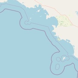
Eba Island Conservation Park Boundary Map and Spatial Extent
Interactive boundary mapping defines the spatial extent and geographic layout of the protected terrain. Derived area measurements provide supplementary context for the recorded territorial limits.
- Boundary area
- 1.2 km²
- Boundary perimeter
- 5.3 km
- Northernmost point
- 32.674° S
- Southernmost point
- 32.6827° S
- Easternmost point
- 134.2806° E
- Westernmost point
- 134.2596° E
- Geographic centre
- 32.6783° S, 134.2704° E
- North–south span
- 1 km
- East–west span
- 2 km
Terrain and natural features
Protected landscape terrain classifications and linked geographic features
Eba Island Conservation Park Terrain and Named Natural Features
Recorded lowland relief classifications define the primary terrain characteristics across Eba Island Conservation Park. Linked feature cards supply names, types, measurements, and spatial relationships for Eba Island and the Great Australian Bight.
Selected named natural features
Bays
Great Australian Bight
Environmental setting
Mediterranean climate zones, coastal habitats, and low relief terrain classifications
Eba Island Conservation Park Environmental Setting and Landscape Classifications
Recorded landscape features and habitat classifications outline the physical geography of Eba Island Conservation Park across coastal and lowland terrain. Stored environmental categories connect directly to related protected area destinations throughout the atlas network.
- Relief
- Lowland
- Climate
- Mediterranean
- Water
- Minor water
- Forest cover
- Sparse forest
- Seasonality
- Year-round
Landscape features
Islands · Coast · Beach · Cliffs
Habitat types
Coastal habitat · Grassland
Park atlas
Compare regional coastal reserves and nearby island sanctuaries across South Australia
Explore Protected Areas and Other Parks Near Eba Island Conservation Park
Browsing other protected areas near Eba Island Conservation Park reveals connected coastal habitats and similar island reserves along the western edge of Eyre Peninsula. Expanding the geographic comparison helps trace regional conservation patterns and sheltered marine ecosystems across the surrounding limestone coast.
Nature reserveSouth Australia
About 35 km away#1 closest
South

Calpatanna Waterhole Conservation Park: Protected Geography and Coastal Reserve Mapping
Nature reserve landscape within the South Australian Eyre Peninsula
Calpatanna Waterhole Conservation Park represents a specialized protected environment within South Australia. Centred on its namesake waterhole, the area preserves a distinctive mosaic of seasonal saline lagoons and hardy mallee eucalyptus scrub. This reserve highlights the ecological and geographic character of the Eyre Peninsula, where low undulating terrain supports unique, salt-adapted vegetation communities.
- Area
- 36.44 km²
- Established
- 1974
- IUCN
- Ia
- Relief
- Lowland
Protected areaSouth Australia
38 km away#2 closest
South
Cape Blanche Conservation Park: Eyre Peninsula Coastal Protected Landscape Map
Regional geography and conservation coastal terrain
Located on the remote western coast of the Eyre Peninsula, Cape Blanche Conservation Park serves as a dedicated sanctuary for coastal raptors and migratory birds. This protected area features a rugged intersection of limestone cliffs, sandy bays, and native coastal flora, providing an essential ecological corridor within the South Australian reserve system.
- Area
- 810 km²
- Established
- 2012
- IUCN
- III
- Scope
- Terrestrial
Wildlife reserveSouth Australia
66 km away#3 closest
East
Gawler Ranges Conservation Park: Mallee Landscapes and Regional Protected Areas
Semi-arid habitat and rocky terrain of South Australia
Gawler Ranges Conservation Park protects a core area of tree mallee woodland and rocky rises near the southern fringe of the Gawler Ranges. This wildlife reserve serves as an essential anchor for regional biodiversity on the Eyre Peninsula, offering a look at the arid-adapted vegetation and weathered geological structures that define this remote section of South Australia.
- Area
- 154.8 km²
- Established
- 1993
- IUCN
- VI
- Relief
- Upland
National parkSouth Australia
83 km away#4 closest
East
Gawler Ranges National Park: South Australia's Mapped Protected National Landscape
Explore the geography and protected area context of this national park.
Gawler Ranges National Park stands as a significant protected area within the geographic expanse of South Australia. Designated as a national park, it offers valuable insights into Australia's conservation landscapes and regional geography. Users can explore its mapped boundaries and understand its unique role within the national park system, making it a key point for structured geographic study and atlas-based discovery of protected lands.
- Area
- 1,628.75 km²
- Established
- 2002
- IUCN
- VI
- Relief
- Mountain
Wildlife reserveSouth Australia
About 113 km away#5 closest
Southeast
Cocata Conservation Park: Eyre Peninsula Protected Wildlife Reserve and Landscape Map
Geographic overview of South Australian conservation lands.
Cocata Conservation Park encompasses a vast semi-arid expanse on the Eyre Peninsula, characterized by gently undulating plains, calcrete-capped terrain, and open salt flats. Gain insights into the physical geography and habitat distribution of this important South Australian wildlife reserve through detailed regional mapping.
- Area
- 167.62 km²
- Established
- 1993
- IUCN
- VI
- Scope
- Terrestrial
National parkSouth Australia
126 km away#6 closest
Northeast
Lake Gairdner National Park: National Park with Unique South Australian Geography and Mapped Boundaries
South Australian protected area with distinct landscape characteristics.
Lake Gairdner National Park serves as a key protected area within the geographic expanse of South Australia. This national park offers a unique focus for atlas exploration, highlighting its specific landscape features and mapped boundaries. Users can delve into the park's protected status and its contribution to the regional geography, providing valuable context for understanding Australia's diverse natural protected lands and their cartographic representation.
- Area
- 5,531.77 km²
- Established
- 1991
- IUCN
- VI
- Relief
- Lowland
Wildlife reserveSouth Australia
About 127 km away#7 closest
Southeast
Dakalanta Sanctuary: A Private Wildlife Reserve on the Northern Eyre Peninsula
Mapped regional geography and conservation habitat profiles
Dakalanta Sanctuary provides a significant example of private land conservation in South Australia. Covering 130 square kilometres of low hills and stabilized dunes, this reserve focuses on restoring native vegetation after past pastoral use. The area is vital for safeguarding semi-arid habitats like mallee woodlands, playing an active role in regional biodiversity protection and habitat connectivity.
- Area
- 130 km²
- Established
- 2002
- Relief
- Upland
- Access
- Access unknown
Nature reserveSouth Australia
137 km away#8 closest
Northwest
Chadinga Conservation Park: Coastal Dunes and Salt Lake Geography in South Australia
Remote protected dune systems and arid saline landscapes
Chadinga Conservation Park protects a significant stretch of coastal dune country west of Lake MacDonnell. This arid landscape, defined by salt lakes and mallee scrub, serves as a crucial habitat for rare species, offering a raw and undisturbed look at the coastal geography of the South Australian coastline.
- Area
- 118.54 km²
- Established
- 1993
- IUCN
- VI
- Relief
- Lowland
MoriAtlas Explorer
Continue Exploring Eba Island Conservation Park and Its Coastal Geography
Deepen your understanding of this protected nature reserve in South Australia by examining its geological characteristics and unique offshore setting. MoriAtlas provides detailed context on the landscape features, coastal boundaries, and ecological role of this distinct island environment.
Browse next
Global natural geography
Explore related park routes
Explore MoriAtlas Global ParksBrowse All MoriAtlas ParksGlobal Park Map DiscoveryMoriAtlas: Browse All CountriesBrowse All MoriAtlas ContinentsNational Park Environment AtlasGrand Canyon National Park AtlasYellowstone National Park AtlasYosemite National Park Atlas and GeographySerengeti National Park AtlasGalápagos National Park Protected LandscapeBanff National Park Geography and AtlasKruger National Park Atlas EntryUluṟu-Kata Tjuṯa National Park AtlasExplore Uluru-Kata Tjuta National Park GeographyPlitvice Lakes National Park AtlasFiordland National Park Protected LandscapeGreat Smoky Mountains National Park AtlasAfghanistan National Parks and Protected AreasAlbania National Parks and Protected AreasAlgeria National Parks and Protected AreasAmerican Samoa National Parks and Protected AreasAndorra National Parks and Protected AreasAngola National Parks and Protected AreasAntarctica National Parks and Protected AreasAntigua and Barbuda Park List