Mori Atlas logo
Protected landscapeFir of Drenovë-Sinicë Protected Landscape

Mapping the Silver fir ecosystems, geological monuments, and karst landscapes of Korçë County

Fir of Drenovë-Sinicë Protected Landscape: A Geographic Analysis of Southeastern Albania Forest Terrain

Fir of Drenovë-Sinicë Protected Landscape represents a significant ecological mosaic in southeastern Albania where Illyrian deciduous and Dinaric Alpine forests converge. This protected area features a dense canopy of mature Silver fir alongside prominent geological landmarks including the Stone of Capi and the Cave of Tren. The mapped territory reveals a complex intersection of tectonic relief, deep valleys, and groundwater-fed mountain lakes that define its natural identity.

silver fir foresttemperate broadleaf forestIllyrian deciduous forestsDinaric Alpine mixed forestskarst landscapenatural monuments

Fir of Drenovë-Sinicë Protected Landscape

Protected landscape

Park overview

Structured park overview, official facts, and landscape profile for Fir of Drenovë-Sinicë Protected Landscape

Fir of Drenovë-Sinicë Protected Landscape park facts, protected area profile, and essential visitor context

Review the core facts for Fir of Drenovë-Sinicë Protected Landscape, including designation, size, terrain, visitor scale, habitats, and operating context in one park-focused overview.

About Fir of Drenovë-Sinicë Protected Landscape

Fir of Drenovë-Sinicë Protected Landscape occupies a place at the heart of Albania's southeastern mountain forests, southeast of the regional capital Korçë. Set within Korçë County, the reserve sits in terrain shaped by long-term interaction between mountain uplift, water erosion, and forest cover. Its roughly 10 square kilometers capture a representative slice of the Illyrian-Dinaric forest transition, an ecological frontier that runs through much of the western Balkans.

The reserve's defining identity is its Silver fir woodland. Silver fir dominates the canopy and gives the area its name, while other broadleaf and conifer species, including beech, oak, and pine, fill out a layered forest mosaic. The result is a temperate broadleaf and mixed forest structure typical of mid-elevation Balkan mountains, with clear seasonal variation in color, light penetration, and biodiversity activity. Ecologically, the reserve functions as a continuous extension of regional forest systems, allowing species movement and ecological processes that rely on large, undisturbed forest tracts.

What makes the protected landscape especially distinctive, however, is the layering of geological heritage on top of its forest values. Within the same small area where Silver fir stands thrive, visitors and researchers encounter an array of named rocky monuments, karst cavities, mountain lakes, and other natural features that the Government of Albania has formally designated as natural monuments. This combination gives the reserve both a strong ecological function, as a refugium for temperate forest biodiversity, and a strong geo-conservation function, as a record of the geological forces that have shaped Albania's southeast.

Managed by the National Agency of Protected Areas and protected under Albania's national framework for natural monuments and protected landscapes, Fir of Drenovë-Sinicë stands as a compact but content-rich example of the country's natural heritage. Its forests, rocks, caves, and lakes together present a coherent picture of how living ecosystems and long-term geological processes can coexist within a single protected area.

Quick facts and research context for Fir of Drenovë-Sinicë Protected Landscape

Fir of Drenovë-Sinicë Protected Landscape is situated in Korçë County in southeastern Albania, lying within the temperate broadleaf and mixed forest belt that stretches across the central Balkans. Its territory falls inside the Illyrian deciduous forests and Dinaric Alpine mixed forests terrestrial ecoregion, both belonging to the Palearctic realm.

The reserve covers approximately 10.3 square kilometers and was formally established on 21 November 1966. It is classified under IUCN Category V as a protected landscape/seascape and is administered by Albania's National Agency of Protected Areas. Silver fir is the dominant tree species, and the area also preserves a notable cluster of rock formations, karst cavities, and mountain lakes designated as natural monuments.

Protection and recognition

Examine documented terrestrial boundaries, management scope, and conservation recognition details.

Fir of Drenovë-Sinicë Protected Landscape Protection Status and Records

Terrestrial protection status records for Fir of Drenovë-Sinicë Protected Landscape outline documented management scope and official boundaries. Conservation framework details provide structured insight into administrative designation history.

Protection details

Protection scope
Terrestrial
Transboundary protection
No
Park context

Deeper park guide and search-rich context for Fir of Drenovë-Sinicë Protected Landscape

Fir of Drenovë-Sinicë Protected Landscape history, landscape, wildlife, and travel context

Explore Fir of Drenovë-Sinicë Protected Landscape through its history, landscape character, ecosystems, wildlife, conservation priorities, cultural context, and seasonal travel timing in a structured park guide built for atlas discovery and search intent.

Why Fir of Drenovë-Sinicë Protected Landscape stands out

The protected landscape is best known for its mature Silver fir forests, which form one of the most characteristic Silver fir stands in southeastern Albania. The dominance of Abies alba gives the reserve a distinctive dark-green canopy that persists through the seasons and defines the visual identity of the area. Beyond the forest itself, the park is recognized for its concentration of geological and hydrological landmarks. Named rock features such as the Stone of Capi, the Cut Stone, the Zhombrit Pyramid, and the Cave of Tren, together with the Lenies Lakes and karst cavities, collectively give the relatively compact reserve an unusually varied natural-monument profile. The combination of dense Silver fir woodland and concentrated geological monuments is what sets Fir of Drenovë-Sinicë apart from many other forest reserves in the country.
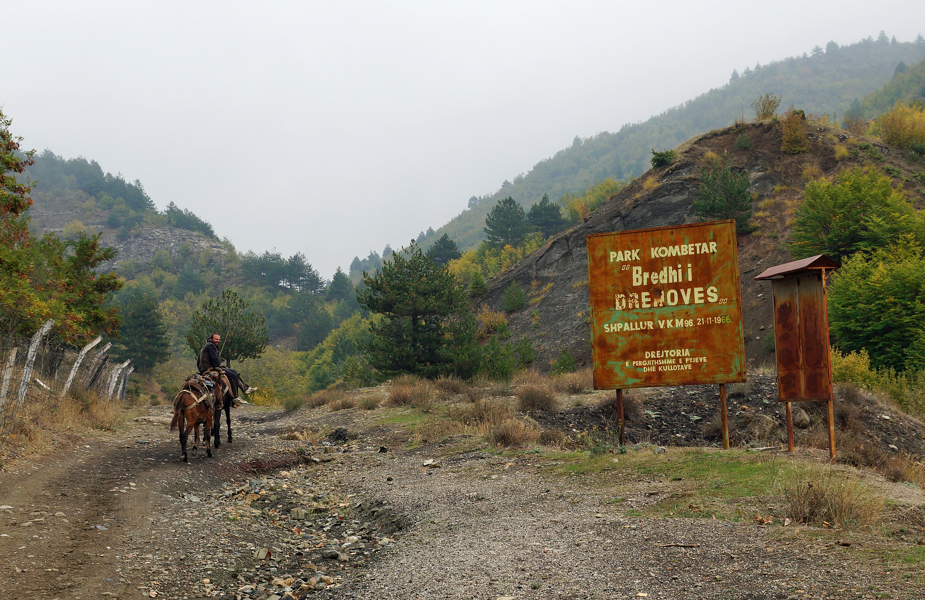
A weathered, rusted metal sign marking the Fir of Drenovë national park stands on a dirt road in a mountainous, forested landscape, with a person on horseback approaching from the left.
A weathered entrance sign for the Fir of Drenovë Protected Landscape, with a person riding a horse nearby.

Fir of Drenovë-Sinicë Protected Landscape history and protected-area timeline

Fir of Drenovë-Sinicë was formally established as a protected landscape on 21 November 1966, making it one of the older formally designated natural protected areas in Albania. Its establishment reflected an early recognition that the Silver fir forests south of Korçë, together with the surrounding rock formations, karst features, and mountain lakes, constituted a natural heritage worth long-term legal protection.

Since its original designation, the protected landscape has been administered within Albania's evolving system of protected-area governance. Today it falls under the responsibility of the National Agency of Protected Areas, the national body charged with managing Albania's network of protected natural areas. Its classification under IUCN Category V, as a protected landscape/seascape, reflects both its scenic and ecological character and the intention to maintain the interaction between natural systems and the surrounding cultural landscape.

In addition to the overarching landscape protection, individual features within the reserve, including the Stone of Capi, the Cut Stone, the Zhombrit Pyramid, the Cave of Tren, the Lenies Lakes, and associated karst cavities, have been separately declared as natural monuments by the Government of Albania. This layered protection history has reinforced both the natural-monument status and the broader recognition of the area as a representative example of southeastern Albania's temperate mountain heritage.

Fir of Drenovë-Sinicë Protected Landscape landscape and geographic character

The landscape of Fir of Drenovë-Sinicë is shaped by the tectonic and erosional history of the southeastern Albanian mountains. Relief inside the reserve is uneven, with pronounced changes in elevation that produce deep valleys, rugged slopes, and exposed rocky outcrops. The terrain alternates between densely forested ridges and more open sections where rock formations emerge above or alongside the tree cover, giving the protected landscape a continuously varied visual character.

Karst processes have left a strong imprint on the area's surface and subsurface geology. Dissolution of soluble rock has produced cavities, sinkholes, and the broader karstic cavities that are recorded as separate natural monuments within the reserve. These features interact with the hydrological system, supporting seeps, springs, and the small mountain lake systems, such as the Lenies Lakes, that punctuate the higher parts of the catchment.

Among the most visually distinctive landscape elements are the named rock formations. The Stone of Capi, the Cut Stone, and the Zhombrit Pyramid rise as isolated monoliths and prominent rocky masses within the forested terrain, while the Cave of Tren illustrates the area's subterranean geomorphology. Combined, these landforms create a landscape in which forest cover and exposed geology alternate closely, producing a tapestry of slopes, cliffs, valleys, and water features that defines the protected area's geographic identity.

Fir of Drenovë-Sinicë Protected Landscape ecosystems, habitats, and plant life

Ecologically, Fir of Drenovë-Sinicë sits inside the overlap between two Palearctic temperate forest ecoregions: the Illyrian deciduous forests and the Dinaric Alpine mixed forests. This overlap gives the area a particularly rich forest composition, with species from both ecoregions coexisting across the landscape and creating structurally complex woodland.

Silver fir (Abies alba) is the dominant tree species and the principal ecological anchor of the reserve. Around it, beech, oak, and pine contribute to a multi-layered canopy that shifts in composition with elevation, slope exposure, and soil conditions. Together these species produce a continuous closed forest cover across most of the reserve, with seasonal changes in foliage color, understory development, and light penetration that mark the rhythm of the year.

The diversity of morphological, climatic, and hydrological conditions within the protected landscape supports a corresponding variety of microhabitats. Forested slopes, rocky outcrops, karst cavities, mountain lakes, and seepage zones each host different ecological communities, allowing the reserve to function as a compact but ecologically layered refuge within Albania's broader temperate forest network.

Fir of Drenovë-Sinicë Protected Landscape wildlife and species highlights

The protected landscape's wildlife reflects the species pools typical of southeastern Albania's Illyrian-Dinaric temperate forests. The continuous Silver fir and mixed broadleaf forest provides habitat for forest-dwelling birds, mammals, and invertebrates adapted to mid-elevation Balkan woodland conditions. Closed canopy, mature trees, and the presence of standing and fallen deadwood create structural diversity that supports cavity-nesting species, understory birds, and small forest mammals.

Rock formations, cliffs, and the Cave of Tren offer contrasting habitat conditions for species that depend on bare rock, crevices, or subterranean environments. Raptors and other cliff-associated birds can use the exposed rocky monuments, while cave environments host specialized invertebrate and bat communities. The Lenies Lakes and surrounding wet microhabitats contribute freshwater and shoreline elements to the reserve's overall fauna, supporting amphibians, aquatic invertebrates, and species that use mountain water bodies as part of their seasonal range.

The combined forest, rock, karst, and freshwater habitats give Fir of Drenovë-Sinicë a balanced wildlife profile in which forest species, rock-associated fauna, and freshwater-dependent species can all find sustained habitat within a relatively compact area.

Fir of Drenovë-Sinicë Protected Landscape conservation status and protection priorities

From a conservation perspective, Fir of Drenovë-Sinicë represents a critical reference site for the protection of Silver fir forests in southeastern Albania. Its status as the dominant species and the area's long-standing formal protection since 1966 make it an important benchmark for monitoring the health of Abies alba populations in the region, especially in the context of broader Balkan concerns about temperate forest regeneration, climate sensitivity, and land-use change.

The reserve's designation under IUCN Category V as a protected landscape/seascape reflects its dual significance. It functions both as an ecological reserve, maintaining forest cover, habitat connectivity, and biodiversity, and as a landscape-level conservation unit, preserving the visual and structural relationship between forests, rocky landforms, and hydrological features. Inclusion in the Illyrian deciduous forests and Dinaric Alpine mixed forests ecoregions further grounds the area's conservation value within internationally recognized frameworks for temperate forest protection.

Equally important is the layered natural-monument protection applied to individual features inside the reserve. Rock formations such as the Stone of Capi, the Cut Stone, and the Zhombrit Pyramid, along with the Cave of Tren, the Lenies Lakes, and the karst cavities, have all been separately declared natural monuments by the Government of Albania. This combination of landscape-level and feature-level protection gives the area unusually strong legal conservation standing and reinforces its role as a multi-objective conservation site combining forest, geological, and hydrological values.

Fir of Drenovë-Sinicë Protected Landscape cultural meaning and human context

Although Fir of Drenovë-Sinicë is primarily valued for its ecological and geological heritage, the surrounding landscape carries a long history of local human presence. The region southeast of Korçë, including villages such as Dardhë, has been shaped by traditional mountain livelihoods, including forestry, small-scale agriculture, and pastoralism, that have coexisted with the forest over generations.

The named rock formations and caves within the reserve are also part of local cultural memory. Features such as the Stone of Capi, the Cut Stone, the Zhombrit Pyramid, and the Cave of Tren are linked in popular tradition with local legends and place-name folklore, giving the protected landscape a cultural dimension beyond its strictly ecological role. This blend of natural monument, living forest, and cultural reference makes the area meaningful both as a protected natural environment and as part of the regional identity of southeastern Albania.

Top sights and standout views in Fir of Drenovë-Sinicë Protected Landscape

Fir of Drenovë-Sinicë stands out for the tight overlap of forest, geology, and hydrology within a compact territory. Its Silver fir woodland gives it a clearly defined ecological identity, while its cluster of designated natural monuments, including the Stone of Capi, the Cut Stone, the Zhombrit Pyramid, the Cave of Tren, the Lenies Lakes, and the karst cavities, raises its profile as a multi-feature conservation site rather than a simple forest reserve.

Equally distinctive is its position at the boundary between the Illyrian deciduous forests and the Dinaric Alpine mixed forests, two of the most ecologically significant temperate forest ecoregions in the Balkans. Together with its long-standing protection history since 1966 and its formal IUCN Category V status, this combination of ecological, geological, and institutional factors makes Fir of Drenovë-Sinicë one of the more representative and content-rich protected landscapes in southeastern Albania.

Best time to visit Fir of Drenovë-Sinicë Protected Landscape

Because the reserve is a mountain forest landscape, the character of a visit shifts meaningfully with the seasons. Late spring and early summer typically bring the freshest green tones to the mixed broadleaf component of the forest, with active understory growth and more visible wildlife movement against the darker Silver fir canopy. Summer offers the most comfortable conditions for exploring the rocky monuments and higher trails, when longer days allow extended time in the field.

Autumn is often particularly striking visually, as beech, oak, and other broadleaf species shift through yellow, orange, and red hues that contrast with the persistent dark green of the Silver fir. Winter brings a quieter atmosphere, with snow siting on conifer branches and clearer visibility of the rocky outcrops and structural features of the landscape, though accessibility conditions in mountain terrain can vary. Wildlife viewing and forest atmosphere are strongest in the cooler halves of the year, when animal activity is more concentrated and forest light is softer and more directional.
Monthly climate preview

Long-term representative monthly temperature and precipitation cycles across the protected terrain

Climate Normals and Annual Weather Patterns for Fir of Drenovë-Sinicë Protected Landscape

Representative coordinates record distinct annual temperature swings alongside measured monthly precipitation variations for Fir of Drenovë-Sinicë Protected Landscape. Comprehensive twelve-month meteorological profiles provide deeper analytical context for long-term regional climate trends.
Annual mean10 °C
0 °C21 °C
Jan
Feb
Mar
Apr
May12°
Jun17°
Jul21°
Aug21°
Sep16°
Oct11°
Nov
Dec
Warmest month
August

21.2 °C

Coolest month
January

-0.4 °C

Wettest month
November

3.6 mm/day

Driest month
July

0.9 mm/day

Park location guide

Geography guide, regional context, and park location map for Fir of Drenovë-Sinicë Protected Landscape

Fir of Drenovë-Sinicë Protected Landscape park geography, regions, and map view in Albania

Understand where Fir of Drenovë-Sinicë Protected Landscape sits in Albania through a broader geographic reading of the surrounding landscape, nearby location context, and its mapped position within the national park landscape.

How Fir of Drenovë-Sinicë Protected Landscape fits into Albania

Albania is a unitary parliamentary republic in Southeast Europe, situated on the Balkan Peninsula along the Adriatic and Ionian coastal regions. With a population of approximately 2.4 million people, it borders Montenegro, Kosovo, North Macedonia, and Greece. The country features varied landscapes ranging from the Albanian Alps to fertile coastal plains, with Tirana as its capital and largest city.

Wider geography shaping Fir of Drenovë-Sinicë Protected Landscape in Albania

Albania occupies the western part of the Balkan Peninsula in Southeast Europe. The country features a varied terrain with rugged mountain ranges including the Albanian Alps (Accursed Mountains), Korab, Skanderbeg Mountains, Pindus, and Ceraunian Mountains. Fertile lowland plains extend along the Adriatic and Ionian coastal regions. The country borders Montenegro to the northwest, Kosovo to the northeast, North Macedonia to the east, and Greece to the south.

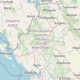
Map view of Fir of Drenovë-Sinicë Protected Landscape

Use this park location map to pinpoint Fir of Drenovë-Sinicë Protected Landscape in Albania, understand its exact geographic position, and read its mapped placement within the surrounding landscape more clearly.

Pigeon | © OpenStreetMap contributors

Location context for Fir of Drenovë-Sinicë Protected Landscape

Korçë County

Visual exploration of Silver fir forests, rocky terrain, and natural monuments

Fir of Drenovë-Sinicë Protected Landscape Photos and Scenery

Visual documentation captures the dense Silver fir canopy, rugged limestone formations, and diverse habitats across the protected terrain. Detailed photography reveals the unique ecological character and geological monuments defining the southeastern Albanian landscape.

A weathered, rusted metal sign marking the Fir of Drenovë national park stands on a dirt road in a mountainous, forested landscape, with a person on horseback approaching from the left.

Park atlas

Compare regional mountain terrain, forest reserves, and connected protected landscapes.

Parks Near Fir of Drenovë-Sinicë Protected Landscape and Surrounding Protected Areas

Browsing other protected areas near Fir of Drenovë-Sinicë Protected Landscape reveals the broader ecological patterns of the southeastern Albanian mountains. Regional park comparison highlights shared temperate forest ecoregions, rugged karst relief, and adjacent conservation landscapes.
Watercolor painting of a river flowing through a valley with mountains and greenery
National parkKorçë County
About 17 km away#1 closest

North

Prespa National Park: Protected Landscape and High-Altitude Lakes in Korçë County, Albania

Explore the geography and mapped boundaries of this vital national park.

Prespa National Park, located in Korçë County, Albania, is a protected area characterized by its significant high-altitude tectonic lakes, dramatic mountain landscapes, and vital wetland habitats. This entry provides a structured atlas-style overview of the park's geographic identity, its protected landscape features, and its ecological importance, serving as a key point of reference for understanding this unique Balkan region.

Area
276.131 km²
Established
1999
IUCN
II
Relief
Mountain
A watercolor illustration of a landscape with soft green hills and a pinkish water area, set against a plain white background.
National parkWestern Macedonia
About 22 km away#2 closest

Northeast

Prespa National Park: Mapping the Biodiversity and Lake Landscapes of Western Macedonia

A Ramsar wetland reserve and transboundary protected area

Prespa National Park encompasses 32,700 hectares of diverse habitats, from the shallow waters of Small Prespa Lake to the surrounding forested uplands. This protected area acts as a vital sanctuary for migratory bird species and endemic plants, offering a rich look at the ecological interplay between water, floodplains, and mountain terrain in northern Greece.

Area
327 km²
Established
2009
IUCN
VI
Relief
Mixed relief
A soft watercolor painting of a lake landscape with rolling green hills, distant mountains, and gentle reflections in pale greens, pinks, and yellows.
Nature reserveNorth Macedonia
About 38 km away#3 closest

North

Lake Ohrid Nature Reserve: Mapped Geographic Boundaries and Ancient Balkan Lake Ecosystems

A tectonic mountain lake system in North Macedonia

Lake Ohrid represents a monumental protected landscape within the mountainous southwestern Balkans. As one of the oldest and deepest lakes in Europe, it serves as a critical refuge for unique endemic species that exist in its clear, oligotrophic waters. This area showcases the complex interplay between tectonic geological history, high-mountain terrain, and the sustained conservation of a globally significant natural basin.

Area
358 km²
Relief
Mixed relief
Climate
Mediterranean
Access
Easy access
A soft watercolor painting of layered rolling hills and mountains fading into the distance with small clusters of stylized trees in the foreground.
Protected landscapeAlbania
About 41 km away#4 closest

Northwest

Guri i Nikës-Lenie-Valamarë Protected Landscape: Albania Mountain and Forest Geography

A protected mosaic of Mediterranean woodlands and Pindus foothills

Spanning roughly 22 square kilometers near Pogradec, the Guri i Nikës-Lenie-Valamarë Protected Landscape protects a diverse array of forested slopes and freshwater habitats. This essential Balkan biological corridor provides a detailed look at the transition between dense woodland and scrub communities within the Pindus mountain system, highlighting its role as a key habitat for large carnivore populations.

Area
22 km²
Established
1996
IUCN
VI
Relief
Mountain
Watercolor painting showing mountains, a river, and vegetation
National parkAlbania
About 46 km away#5 closest

West

Tomorr Mountain National Park: Sacred Peak & Karst Protected Landscape in Albania

Explore Albania's dramatic mountain geography and protected areas.

Tomorr Mountain National Park offers a unique exploration of southern Albania's dramatic limestone anticline. Dominated by the sacred Mount Tomorr and featuring the spectacular Osum Canyon, this national park provides insight into karst terrain, old-growth forests, and significant biodiversity. Discover its mapped boundaries and regional geographic context within the Pindus Mountains for structured atlas exploration.

Area
271.855 km²
Established
1956
IUCN
II
Relief
Mountain
Watercolor painting of a landscape with green fields, scattered trees, and rolling hills under a light sky
National parkGjirokastër County
About 46 km away#6 closest

Southwest

Fir of Hotovë-Dangëlli National Park: Ancient Forests & Mountain Wilderness Atlas

Explore a premier protected landscape in Gjirokastër County, Albania.

Fir of Hotovë-Dangëlli National Park stands as a monumental protected area, celebrated for its exceptional old-growth Hotova Fir forests, which are a rare Mediterranean plant relic. This national park in Gjirokastër County offers a detailed look at a vast mountainous terrain, featuring dramatic canyons like Lengarica Canyon, and serving as a critical habitat for diverse wildlife. MoriAtlas provides structured geographic context for this significant landscape, highlighting its mapped boundaries and role as a key component of regional protected area networks.

Area
360.038 km²
Established
2008
IUCN
II
Relief
Mountain
Watercolor painting of a landscape with green trees, rolling hills, and distant mountains under a light sky
National parkMunicipality of Bitola
About 47 km away#7 closest

Northeast

Pelister National Park: North Macedonia's Oldest National Park and Alpine Protected Landscape

Explore unique glacial features and endemic forests within Municipality of Bitola.

Pelister National Park, a pioneering protected area in North Macedonia, offers a rich tapestry of alpine geography and unique geological formations. This page provides detailed information on the park's landscape, including its dramatic mountain massif within Municipality of Bitola, the rare Macedonian pine forests, the striking 'stone rivers' formed by ancient glacial processes, and the serene Pelister Eyes glacial lakes. Discover the park's mapped boundaries and its significance as a conservation heritage site within the Balkan Peninsula.

Area
171.5 km²
Established
1948
IUCN
II
Visitors
30K annual
A pale, soft-hued watercolor illustration of a natural landscape featuring rolling hills, a small waterfall, and sparse trees on a white background.
Protected areaAlbania
About 59 km away#8 closest

West

Bogovë Nature Park: Protected Limestone Hills and Waterfall Geography in Southern Albania

Regional protected area within the Balkan forest ecoregion

Bogovë Nature Park protects 330 hectares of diverse Mediterranean forest and dramatic limestone ravines. Central to its identity are the cascading waterfalls and karst topography that characterize this portion of the Pindus Mountains mixed forests ecoregion in southern Albania, providing a significant example of Balkan woodland preservation.

Area
3.3 km²
Established
1977
IUCN
IV
Relief
Mountain

Common questions about visiting, size, designation, and location context for Fir of Drenovë-Sinicë Protected Landscape

Fir of Drenovë-Sinicë Protected Landscape FAQs for park facts, access, geography, and protected area context

Find quick answers about Fir of Drenovë-Sinicë Protected Landscape, including protected-area facts, park geography, trail and visitor context, and how the park fits into its surrounding country and regional landscape.
MoriAtlas Explorer

Continue Your Protected Areas Search Across the Global Atlas

Deepen your exploration by continuing the structured search for national parks and protected areas worldwide. Utilize the comprehensive filtering capabilities to compare different conservation landscapes and refine your understanding of global park geography. Discover more about the distribution and characteristics of protected natural areas.

Global natural geography