

Mori Atlas logo
National parkGambela National Park

Discover the mapped boundaries and regional context of this protected area in East Africa.

Gambela National Park: Ethiopia's National Park Geography and Protected Landscape

Gambela National Park stands as a significant national park within Ethiopia, offering a focal point for understanding the country's protected lands and natural geography. This page serves as an atlas entry to Gambela National Park, detailing its mapped landscape and its position within the regional geography of Ethiopia and the broader Horn of Africa. Explore the protected area's boundaries and its role in the conservation landscape of East Africa.

national parkEthiopiaprotected areaAfrican park

Gambela National Park

National park

Park overview

Structured park overview, official facts, and landscape profile for Gambella National Park

Gambella National Park park facts, protected area profile, and essential visitor context

Review the core facts for Gambella National Park, including designation, size, terrain, visitor scale, habitats, and operating context in one park-focused overview.
Monthly climate preview

Long-term representative records for monthly temperature and precipitation rhythm

Gambela National Park Climate Normals and Annual Temperature Patterns

Gambela National Park exhibits measured monthly temperature variations alongside a distinct annual precipitation cycle recorded at a representative elevation point. Reviewing the complete twelve-month climate profile provides detailed historical baseline data for temperature and rainfall patterns across the area.
Annual mean28 °C
25 °C33 °C
Jan30°
Feb32°
Mar33°
Apr31°
May28°
Jun26°
Jul25°
Aug26°
Sep26°
Oct27°
Nov27°
Dec29°
Warmest month
March

32.7 °C

Coolest month
July

25.4 °C

Wettest month
October

4.7 mm/day

Driest month
February

0.2 mm/day

Park location guide

Geography guide, regional context, and park location map for Gambella National Park

Gambella National Park park geography, regions, and map view in Ethiopia

Understand where Gambella National Park sits in Ethiopia through a broader geographic reading of the surrounding landscape, nearby location context, and its mapped position within the national park landscape.

How Gambella National Park fits into Ethiopia

Ethiopia is a landlocked federal parliamentary republic located in the Horn of Africa. With a population of approximately 135 million people, it is the 14th-most populous country in the world and the most populous landlocked country. The country is known for its ancient history, diverse ethnic groups, and the capital Addis Ababa, which lies near the East African Rift.

Wider geography shaping Gambella National Park in Ethiopia

Ethiopia is located in the Horn of Africa, bordered by Eritrea to the north, Djibouti to the northeast, Somalia to the east, Kenya to the south, South Sudan to the west, and Sudan to the northwest. The country sits on the African and Somali tectonic plates, with the East African Rift running through it. The terrain includes highlands, valleys, and lowlands.

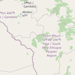
Map view of Gambella National Park

Use this park location map to pinpoint Gambella National Park in Ethiopia, understand its exact geographic position, and read its mapped placement within the surrounding landscape more clearly.

Pigeon | © OpenStreetMap contributors
Park atlas

Explore Ethiopia's Protected Landscapes and Regional Park Geography Beyond Gambela National Park

Discover Other National Parks and Protected Areas Near Gambela National Park

Explore other national parks and protected areas located near Gambela National Park in Ethiopia, tracing their geographic distribution and environmental settings. Continue your park discovery journey by comparing these diverse African protected landscapes, understanding their place within the broader regional conservation atlas.
National parkSouth Sudan
About 153 km away#1 closest

South

Boma National Park: Protected Landscape in South Sudan's East African Geography

Explore mapped boundaries and regional terrain context.

Boma National Park represents a vital protected landscape within South Sudan. As a national park, it contributes significantly to the geographic understanding of conservation areas in East Africa. Its distinct location and mapped outlines provide essential context for those exploring the regional atlas, highlighting its importance in understanding South Sudan's natural terrain and protected area network.

Area
22,800 km²
Established
1977
IUCN
II
Relief
Lowland
National parkEthiopia
About 265 km away#2 closest

Southeast

Omo National Park: Ethiopia's Remote Protected Landscape with Rich Wildlife Spectacles

Mapped boundaries, savannah plains, and Maji Mountains terrain.

Omo National Park is a remote protected area in Ethiopia renowned for its expansive savannah, riverine woodlands, and remarkable wildlife concentrations. Covering over 4,000 square kilometers, this national park presents a landscape of sweeping plains, the vital Omo River corridor, and the dramatic Maji Mountains. The park's protected status safeguards exceptional populations of large mammals, offering a glimpse into an untamed African wilderness. Explore the mapped geography and the unique ecological zones that contribute to its significant conservation value.

Area
4,068 km²
Established
1980
IUCN
II
Relief
Mixed relief
National parkEthiopia
About 296 km away#3 closest

East

Didessa National Park: Protected River Valley Landscape in Ethiopia's Western Highlands

Discover dramatic escarpments, forested terrain, and waterfalls.

Explore Didessa National Park, a protected area in western Ethiopia notable for its dramatic topographical features. This national park showcases a striking landscape of steep escarpments flanking the Didessa River valley, supporting lush forest ecosystems. Key features include numerous waterfalls that contribute to the park's distinctive terrain and ecological significance. Understanding Didessa National Park offers insight into Ethiopia's protected lands and their unique geographic attributes.

Area
1,300 km²
Established
2017
IUCN
II
Relief
Lowland
National parkSouth West Ethiopia Peoples' Region
About 314 km away#4 closest

East

Chebera Churchura National Park: Ethiopia's National Park Protected Landscape Explorer

Mapping the protected area and regional geography of Chebera Churchura.

Chebera Churchura National Park is a key protected landscape in the South West Ethiopia Peoples' Region, designated as a national park. This page provides detailed geographic context and atlas-level information about the park's boundaries and its place within the regional terrain. Engage with the structured data that defines Chebera Churchura National Park's identity as a significant natural area for map-based discovery.

Area
1,250 km²
Established
2006
IUCN
II
Climate
Tropical
National parkSouth Sudan
About 330 km away#5 closest

Southwest

Bandingilo National Park: South Sudan's Protected National Park Identity

Explore its mapped boundaries and East African landscape.

Bandingilo National Park stands as a distinct protected area within South Sudan, contributing to the nation's catalog of national parks. This entry offers a focused atlas perspective, detailing the park's geographic setting and its mapped features. Understand the landscape context and its relation to the surrounding regional geography of East Africa, providing a foundation for structured discovery of protected lands.

Area
10,000 km²
Established
1992
IUCN
II
Relief
Lowland
National parkSouth Sudan
About 333 km away#6 closest

West

Shambe National Park: South Sudan's Protected Savanna and White Nile Landscape

Mapped park boundaries and regional geography in Jonglei State.

Shambe National Park, established in 1985, serves as a protected area within South Sudan, covering approximately 620 square kilometers of savanna and riverine terrain. Its geographic position on the western bank of the White Nile floodplain in Jonglei State is key to understanding its ecological significance. The park's landscape is defined by extensive wetlands, seasonal grasslands, and woodland patches, supporting a notable diversity of large mammal species and providing essential context for regional conservation efforts.

Area
620 km²
Established
1985
IUCN
II
Relief
Lowland
National parkSouth Ethiopia Regional State
About 341 km away#7 closest

Southeast

Mago National Park: Protected Savanna and Riverine Ecosystems in South Ethiopia

Discover the unique landscapes and wildlife habitats mapped within this national park.

Mago National Park stands as a critical protected landscape within the South Ethiopia Regional State, characterized by its significant riverine forests, acacia savanna, and wetland environments along the Mago and Omo rivers. This national park is integral for understanding the distribution of wildlife and the geographic context of Ethiopia's natural heritage. Its mapped terrain offers insights into a landscape that supports both diverse ecosystems and unique cultural traditions, making it a vital component of the country's conservation network.

Area
2,220 km²
Established
1979
IUCN
II
Relief
Mixed relief
National parkEthiopia
About 391 km away#8 closest

Southeast

Maze National Park: Ethiopia's Essential National Park for Swayne's Hartebeest and Geothermal Wonders

Discover mapped savanna ecosystems and unique montane geography within this protected Ethiopian landscape.

Maze National Park represents a significant protected area within Ethiopia, vital for the conservation of the endangered Swayne's hartebeest. Its diverse terrain includes savanna grasslands and unique geothermal features such as active geysers, all set against a distinctive montane backdrop. This national park offers a deep dive into Ethiopia's natural heritage, providing a clear geographic identity and valuable context for landscape exploration.

Area
210 km²
Established
2005
IUCN
II
Relief
Mixed relief

Common questions about visiting, size, designation, and location context for Gambella National Park

Gambella National Park FAQs for park facts, access, geography, and protected area context

Find quick answers about Gambella National Park, including protected-area facts, park geography, trail and visitor context, and how the park fits into its surrounding country and regional landscape.
MoriAtlas Explorer

Continue Your Protected Areas Search Across the Global Atlas

Deepen your exploration by continuing the structured search for national parks and protected areas worldwide. Utilize the comprehensive filtering capabilities to compare different conservation landscapes and refine your understanding of global park geography. Discover more about the distribution and characteristics of protected natural areas.

Global natural geography