

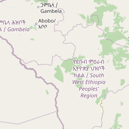
Discover the mapped boundaries and regional context of this protected area in East Africa.
Gambela National Park stands as a significant national park within Ethiopia, offering a focal point for understanding the country's protected lands and natural geography. This page serves as an atlas entry to Gambela National Park, detailing its mapped landscape and its position within the regional geography of Ethiopia and the broader Horn of Africa. Explore the protected area's boundaries and its role in the conservation landscape of East Africa.
Gambela National Park
National park
Structured park overview, official facts, and landscape profile for Gambella National Park
Geography guide, regional context, and park location map for Gambella National Park
Ethiopia is a landlocked federal parliamentary republic located in the Horn of Africa. With a population of approximately 135 million people, it is the 14th-most populous country in the world and the most populous landlocked country. The country is known for its ancient history, diverse ethnic groups, and the capital Addis Ababa, which lies near the East African Rift.
Ethiopia is located in the Horn of Africa, bordered by Eritrea to the north, Djibouti to the northeast, Somalia to the east, Kenya to the south, South Sudan to the west, and Sudan to the northwest. The country sits on the African and Somali tectonic plates, with the East African Rift running through it. The terrain includes highlands, valleys, and lowlands.
Common questions about visiting, size, designation, and location context for Gambella National Park
Deepen your exploration by continuing the structured search for national parks and protected areas worldwide. Utilize the comprehensive filtering capabilities to compare different conservation landscapes and refine your understanding of global park geography. Discover more about the distribution and characteristics of protected natural areas.
