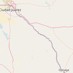
Peaks
Guadalupe Peak
2,657 m

A technical overview of boundary dimensions, peak elevations, and desert landscape features
This geographic profile details the physical characteristics of Guadalupe Mountains National Park in Culberson County. It covers the mapped 349.51 square kilometer boundary, elevations reaching 2667 meters, and a diverse range of terrain including canyons, limestone cliffs, and arid dune systems. The data provides a structured reference for the regional geography and natural features contained within this protected area.
Related tags
Texas tallest peak and Permian reef wilderness in the Chihuahuan Desert
Guadalupe Mountains National Park is a United States national park located in the Guadalupe Mountains of West Texas, east of El Paso. The park preserves a dramatic mountain island rising from the Chihuahuan Desert, containing Guadalupe Peak, the highest point in Texas at 8,751 feet. The range represents the ancient Capitan Reef, formed at the margins of a shallow sea during the Permian Period approximately 272 to 260 million years ago. The park encompasses 86,367 acres of diverse terrain including desert, canyon, and alpine ecosystems, protecting one of the most geologically significant and ecologically varied landscapes in the American Southwest.
Map placement within Texas, Culberson County, and Hudspeth County
Analyzing 349.51 square kilometers of protected land area and spatial limits
Mountain relief metrics and recorded natural features
Peaks
2,657 m
Streams
Streams
Natural springs
Rivers
Peaks
2,026 m
Arid climate profiles, mountain relief, and recorded landscape features
Mountains · Canyon · Cliffs · Forest · Grassland · Rivers · Dunes · Cave · Valleys · Desert
Explore a wider selection of national parks and protected landscapes across West Texas and the adjacent Chihuahuan Desert terrain for comparison.
Northwest

Geography of the Sacramento, Capitan, and Guadalupe Mountains
Lincoln National Forest encompasses a remarkable vertical transition across three ranger districts in New Mexico. The area protects complex mountain landscapes including the east-west Capitan range and the ancient reef geology of the Guadalupe Mountains, serving as a critical example of ecological diversity within a single federal unit.
Northeast
View mapped terrain and geographic context for this Eddy County national park.
Gain a deep understanding of Carlsbad Caverns National Park through its specific geographic features and protected landscape identity. This entry provides foundational atlas-level information on the park's mapped boundaries and its role as a designated national park within the broader regional geography of Eddy County. It is designed to offer precise context for users focused on understanding the specific natural terrain and conservation geography of this important protected area, facilitating structured discovery.
Northwest
Explore its protected boundaries and desert geography.
White Sands National Park is a protected national park renowned for its stunning gypsum dunes, offering a unique landscape within New Mexico's geography. This page provides detailed information on its mapped protected area, serving as a valuable resource for understanding the park's specific geographic context and its identity as a significant protected natural landscape.
Southwest

A dynamic desert wildlife reserve and arid natural ecosystem
Located in northern Chihuahua, Médanos de Samalayuca is a protected wildlife reserve centered on a massive, shifting field of fine white silica sand. This desert landscape offers a stark contrast to the surrounding scrublands, providing an essential look at the geological forces and climatic extremes that shape the arid environments of the Chihuahuan Desert.

Northwest
Mapped terrain, forest boundaries, and regional wilderness character
Gila National Forest stands as a critical protected landscape in New Mexico, encompassing immense mountain ranges, narrow river gorges, and extensive backcountry basins. This atlas entry details the forest's topographic transition from high-altitude ponderosa stands to desert lowlands, highlighting its status as the foundational site for the global wilderness movement and a stronghold for regional ecological diversity.
Southeast
Explore Brewster County's protected natural terrain.
Big Bend National Park is a prominent national park defined by its protected landscape and geographic features within Brewster County. This destination provides users with detailed atlas-style information, focusing on the park's mapped boundaries and its contribution to the understanding of regional natural geography. Delve into the specific context of this protected area to enhance your geographic discovery.

Northwest
Mapped terrain, alpine peaks, and diverse forest ecosystems within the American Southwest
The Gila Wilderness stands as a primary case study in landscape conservation, protecting a massive network of unroaded river canyons and forest-covered mountains in New Mexico. This region serves as a bridge between temperate montane zones and arid desert environments, creating a unique ecological atlas defined by significant altitudinal gradients, volcanic features, and extensive watershed networks across the Mogollon range.
South
Chihuahuan Desert conservation area in Chihuahua, Mexico
This wildlife reserve protects a vast expanse of the Chihuahuan Desert along the Mexico-United States border. The landscape is defined by deep river-cut canyons, volcanic uplifts, and broad valleys. Discover the geological structure and ecological boundaries of this protected area, which mirrors the conservation efforts of neighboring regions to maintain a vital desert ecosystem.
Delve deeper into the specifics of Guadalupe Mountains National Park's protected landscape and its integral role in the regional geography of Culberson County. Understanding the mapped terrain and conservation context helps build a richer atlas of natural areas, offering continuous discovery of its unique geographic features and protected status for those interested in West Texas's natural heritage.