
Natural springs
Park geography
Detailed analysis of boundary spans, elevation data, and natural mountain landforms
Sierra de Guadarrama National Park: A Comprehensive Geographic and Terrain Profile
Examine the physical structure of Sierra de Guadarrama National Park, encompassing 339.6 square kilometers across the regions of Madrid and Castile and León. This profile documents the expansive mountainous terrain, including elevations up to 2428 meters, alongside documented peaks, springs, and waterfall locations distributed across the interior landscape.
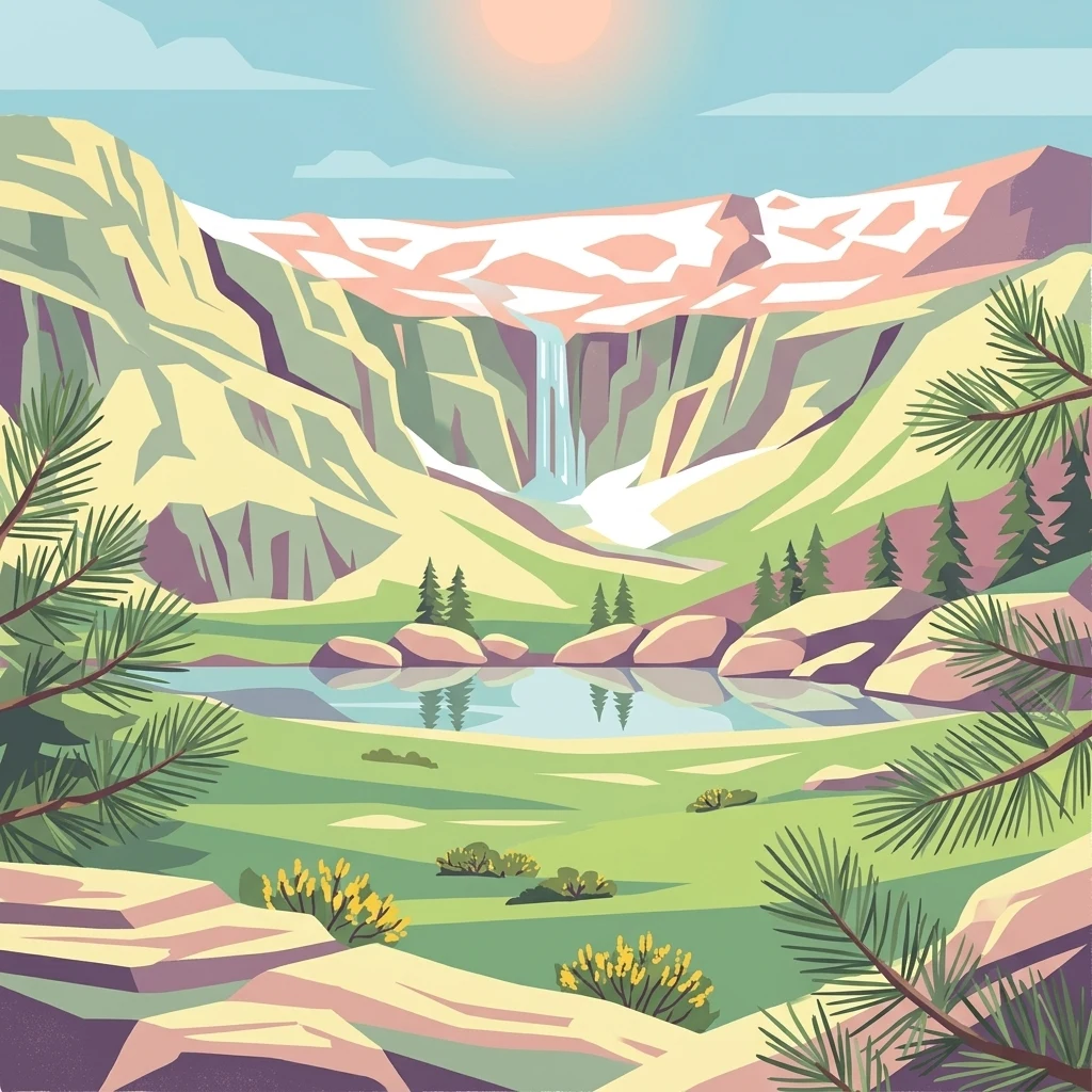
Spain's Alpine Heartland: Mountain Peaks, Ancient Pine Forests, and Glacial Lagoons
Sierra de Guadarrama National Park
Sierra de Guadarrama National Park is a recently established protected area in central Spain, declared in June 2013 and now representing the fifth-largest national park in the country. The park encompasses the granite peaks and forested slopes of the Sierra de Guadarrama, a mountain range forming part of the Sistema Central that divides the northern and southern mesetas of the Iberian Peninsula. The protected area spans approximately 34,000 hectares across the Community of Madrid and the provinces of Segovia and Ávila in Castile and León, protecting a remarkable diversity of eleven distinct ecosystems that include the only Iberian examples of high Mediterranean mountain environments. The range serves as a critical watershed, feeding rivers that flow to both the Tagus and Duero basins. Peñalara, at 2,428 meters, stands as the park's highest summit, while the landscape features dramatic glacial cirques, pristine lagoons, and some of Spain's finest natural pine forests.
- Location
- Spain
- Park type
- National park
- Established
- 2013
- Area
- 339.6 km²
- Highest point
- 2,428 m
Location overview
Regional placement across Castile and León and the Community of Madrid
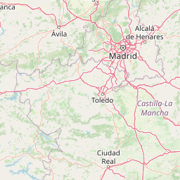
Geographic Context of Sierra de Guadarrama National Park in Spain
Sierra de Guadarrama National Park spans the Community of Madrid and Castile and León in Spain. The inland sanctuary contains no transboundary, coastal, island, or marine territories.
- Countries
- Spain
- Regions
- Castile and León, Community of Madrid
- Primary location
- Spain
- Geographic setting
- Inland
Boundary and coordinates
Spanning 339.6 square kilometers of protected geographic terrain
Mapped Boundaries of Sierra de Guadarrama National Park
Detailed boundary geometry outlines the physical footprint of Sierra de Guadarrama National Park. Accompanying geographic facts supply estimated area metrics, coordinate limits, and spatial center points.
- Boundary area
- 355.3 km²
- Boundary perimeter
- 282.2 km
- Northernmost point
- 41.0379° N
- Southernmost point
- 40.7378° N
- Easternmost point
- 3.7301° W
- Westernmost point
- 4.1394° W
- Geographic centre
- 40.8583° N, 3.9218° W
- North–south span
- 33.3 km
- East–west span
- 34.5 km
Elevation and terrain
Mountain relief statistics and recorded natural features
Sierra de Guadarrama National Park Terrain and Elevation Range
Recorded elevation ranges span from 900 meters to a maximum high point of 2428 meters across the terrain. Linked feature cards provide names, types, and spatial relationships for recorded natural formations.
- Minimum elevation
- 900 m
- Maximum elevation
- 2,428 m
- Highest point
- 2,428 m
Selected named natural features
Streams
Arroyo de las Caseras
Streams
Arroyo Santa Ana
Streams
Arroyo de Aguas Buenas
Mountain saddles
Collado de las Loberas
1,565 m
Peaks
Peña del Yelmo
1,718 m
Environmental setting
Analysis of Mediterranean climate zones, forest cover, and mountain relief types
Sierra de Guadarrama National Park Environmental Settings and Landscape Classifications
Recorded landscape features, habitat types, and water presence categories frame the physical setting of Sierra de Guadarrama National Park. Mapped classifications connect specific environmental metrics to corresponding atlas destinations.
- Relief
- Mountain
- Climate
- Mediterranean
- Water
- Major water bodies
- Forest cover
- Mostly forested
- Seasonality
- Year-round
Landscape features
Mountains · Valleys · Forest · Rivers · Lakes · Waterfalls · Cliffs
Habitat types
Temperate coniferous forest · Temperate broadleaf forest · Montane forest · Alpine meadow · Grassland · Wetland · Riverine habitat
Park atlas
Explore the geographic spread of protected areas surrounding Sierra de Guadarrama National Park, comparing mountain landscapes and diverse Iberian ecosystems.
Compare National Parks Near Sierra de Guadarrama, Discovering Central Spain's Protected Landscapes
After viewing Sierra de Guadarrama National Park, explore other protected areas in central Spain, discovering comparable mountain ranges, diverse pine forests, and unique high Mediterranean ecosystems. Compare these conservation landscapes to understand the regional spread of protected geography and its significance within the Iberian Peninsula.
Biosphere reserveMadrid
12 km away#1 closest
Northeast

Sierra del Rincón Biosphere Reserve: Mountain Geography and Protected Landscape Analysis
Transitional mountain terrain in the Sierra Norte region of Madrid
Sierra del Rincón provides a unique study of ecological compression, where Atlantic-flavored beech groves meet Mediterranean oak and highland shrublands. This protected mountain territory in Madrid integrates rich forest habitats with traditional agro-silvopastoral village life, making it a critical reference for understanding the transitional geography of the Iberian Central System.
- Area
- 152.31 km²
- Established
- 2005
- Relief
- Mountain
- Climate
- Alpine
Protected landscapeCastilla y León
97 km away#2 closest
North
Sabinares del Arlanza-La Yecla: A Detailed Protected Landscape and Map of Burgos
Ancient juniper woodlands and deep limestone ravines in Castilla y León.
This protected area centers on the remarkable juniper forests and the narrow, vertical walls of the La Yecla gorge. The landscape serves as an essential habitat for cliff-nesting raptors while bridging the terrain between the Sierra de la Demanda foothills and the Arlanza River basin. The map captures the geological diversity of these limestone structures and the expansive botanical value found within this significant Spanish natural entity.
- Area
- 391.74 km²
- Established
- 2020
- IUCN
- V
- Relief
- Upland
National parkToledo Province
137 km away#3 closest
South
Cabañeros National Park: Spain's Premier Iberian Oak Woodland Protected Landscape
Mapped Geography of Montes de Toledo Protected Area
Cabañeros National Park is celebrated as the most extensive and well-conserved example of Iberian Mediterranean forest in Spain. Situated within the Montes de Toledo, the park features a remarkable dichotomy between its unique raña flatlands and mountainous sierras, harboring ancient oak woodlands and significant biodiversity. This national park serves as a crucial component of the region's geographic context and a prime destination for atlas-based discovery of protected landscapes.
- Area
- 409 km²
- Established
- 1995
- IUCN
- II
- Visitors
- 104.6K annual
Biosphere reserveLa Rioja
156 km away#4 closest
Northeast
Valles del Jubera, Leza, Cidacos y Alhama: Protected Landscapes in La Rioja, Spain
A biosphere reserve featuring limestone gorges and dinosaur fossil sites
Valles del Jubera, Leza, Cidacos y Alhama forms a distinct mid-mountain region in northern Spain where four river valleys have carved deep passages into the earth. The area serves as a vital protected landscape containing rich paleontological history, thermal springs, and traditional Mediterranean forests. This atlas entry details the natural boundaries and geographic character of one of Spain's significant biosphere reserves.
- Area
- 1,196.69 km²
- Established
- 2003
National parkSpain
173 km away#5 closest
South
Tablas de Daimiel National Park: Spain's Inland Wetland National Park and Protected Area
Explore mapped boundaries and regional geographic context.
Tablas de Daimiel National Park represents one of the last remaining examples of floodplain wetland systems in Spain's interior. Located in Castilla-La Mancha, this protected area showcases a unique confluence of fresh and brackish waters, supporting a rich mosaic of emergent vegetation and serving as a critical habitat for migratory birds. Use MoriAtlas to explore its precise geographic setting, mapped terrain, and its role as a vital conservation landscape within the Iberian Peninsula.
- Area
- 30.3 km²
- Established
- 1973
- IUCN
- II
- Relief
- Lowland
National parkExtremadura
178 km away#6 closest
Southwest
Monfragüe National Park: Dramatic Cliffs, Raptor Haven, and Extremadura's Protected Landscape
Discover its mapped terrain and unique geography in Spain.
Monfragüe National Park, situated in Extremadura, Spain, offers a compelling study in protected landscape geography. The park's identity is shaped by its formidable cliffs and river valleys carved by the Tagus, providing critical nesting grounds for European raptors. This MoriAtlas entry details the park's mapped boundaries and its significance as a vital protected area within the region. Users can explore the specific natural terrain and regional context that establish Monfragüe as a unique protected territory.
- Area
- 179 km²
- Established
- 2007
- IUCN
- II
- Visitors
- 331.8K annual
National parkSpain
About 192 km away#7 closest
Southwest
Monfragüe National Park: Protected Landscape Atlas of Spanish Raptor Colonies
Explore mapped terrain and regional geography within this Spanish National Park.
As a national park in Spain's Extremadura region, Monfragüe National Park offers a distinct protected landscape shaped by the Tagus River and dramatic limestone cliffs. It is globally recognized for its exceptional birdlife, especially its large griffon vulture colonies and populations of Spanish imperial eagles, making it a significant site for ecological study and atlas-based exploration of protected areas. The park's landscape, characterized by Mediterranean woodlands and rugged terrain, provides crucial habitat and a unique geographic context for understanding Iberian Peninsula conservation.
- IUCN
- II
- Scope
- Terrestrial
Biosphere reserveExtremadura
About 195 km away#8 closest
Southwest
La Siberia Biosphere Reserve: Mapped Geography and Protected Lands of Extremadura
A study of reservoir coastlines and Mediterranean serranías
La Siberia Biosphere Reserve offers a deep look into the rural landscape of Extremadura, Spain. Characterized by five major reservoirs and vast Mediterranean oak dehesas, the area provides essential habitat for raptors and preserves significant prehistoric rock art within its complex serranía topography. Explore the geographic boundaries and water-dominated landscape of this distinct inland region.
- Area
- 2,836.7 km²
- Established
- 2019
- Relief
- Mountain
- Climate
- Mediterranean
MoriAtlas Explorer
Continue Exploring Sierra de Guadarrama National Park's Protected Landscape and Geography
Deepen your understanding of Sierra de Guadarrama National Park by exploring its specific mapped boundaries and regional geographic context within the Iberian Peninsula. Discover the unique protected landscape features, diverse ecosystems, and detailed terrain that define this significant national park. MoriAtlas provides the structured data to navigate and comprehend such vital natural areas.
Browse next
Global natural geography
Explore related park routes
Explore MoriAtlas Global ParksBrowse All MoriAtlas ParksGlobal Park Map DiscoveryMoriAtlas: Browse All CountriesBrowse All MoriAtlas ContinentsNational Park Environment AtlasGrand Canyon National Park AtlasYellowstone National Park AtlasYosemite National Park Atlas and GeographySerengeti National Park AtlasGalápagos National Park Protected LandscapeBanff National Park Geography and AtlasKruger National Park Atlas EntryUluṟu-Kata Tjuṯa National Park AtlasExplore Uluru-Kata Tjuta National Park GeographyPlitvice Lakes National Park AtlasFiordland National Park Protected LandscapeGreat Smoky Mountains National Park AtlasAfghanistan National Parks and Protected AreasAlbania National Parks and Protected AreasAlgeria National Parks and Protected AreasAmerican Samoa National Parks and Protected AreasAndorra National Parks and Protected AreasAngola National Parks and Protected AreasAntarctica National Parks and Protected AreasAntigua and Barbuda Park List